Download Free Middle East Regional Maps
<-- Free Map Downloads
<-- Free World Country Map Downloads
Sponsors
Note that maps may not appear on the webpage in their full size and resolution. To save the maps to your computer, right-click on the link.
Abu Musa and the Tunbs [Strait of Hormuz] (Political) 1980 (149K)
Arabian Peninsula and Vicinity (Shaded Relief) 1984 (380K)
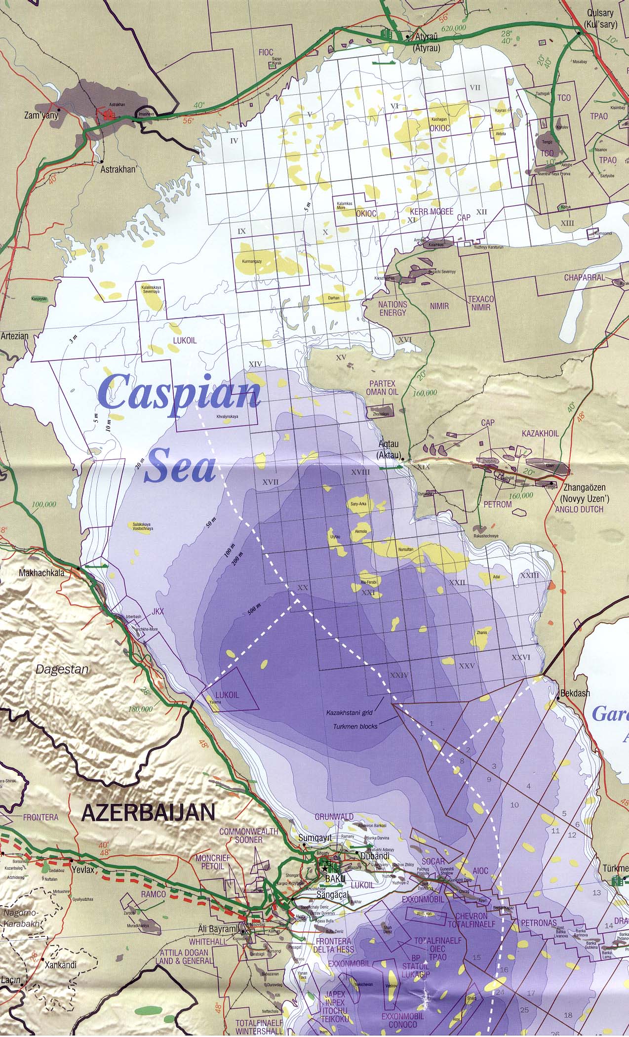
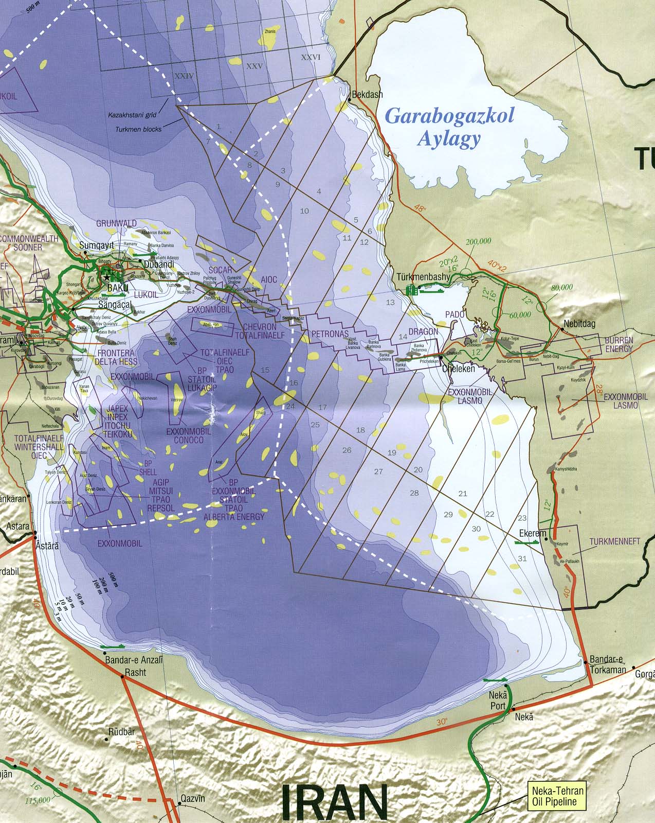
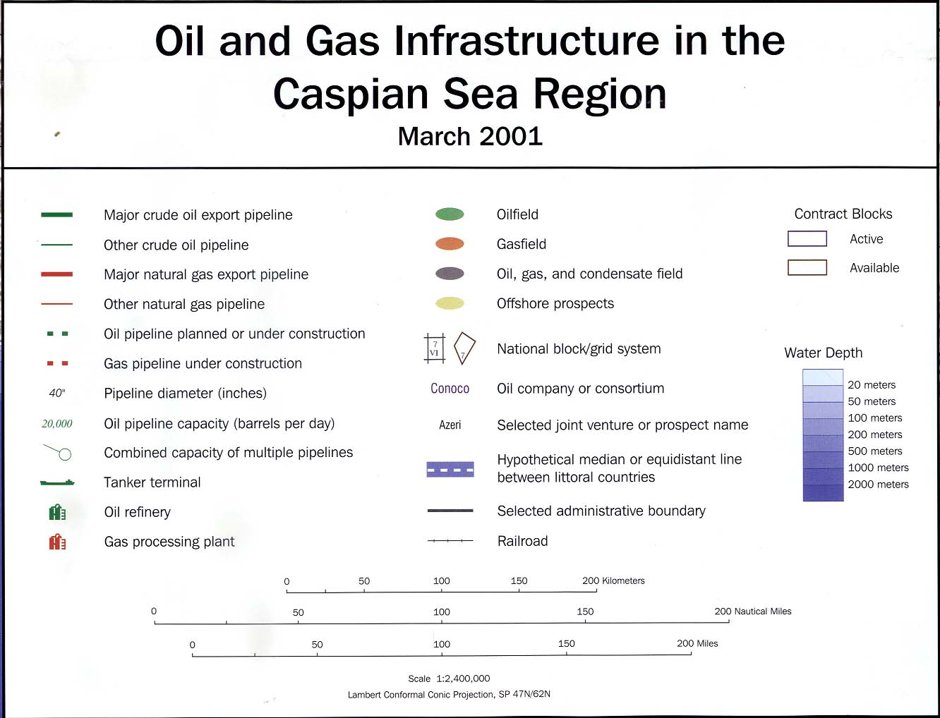
[Caspian Region] Oil and Gas Infrastructure in the Caspian Sea Region 2001 (2.5 MB)
Portions of the map above:
Caspian Region North (497K)
Caspian Region South (359K)
Map Legend (138K)
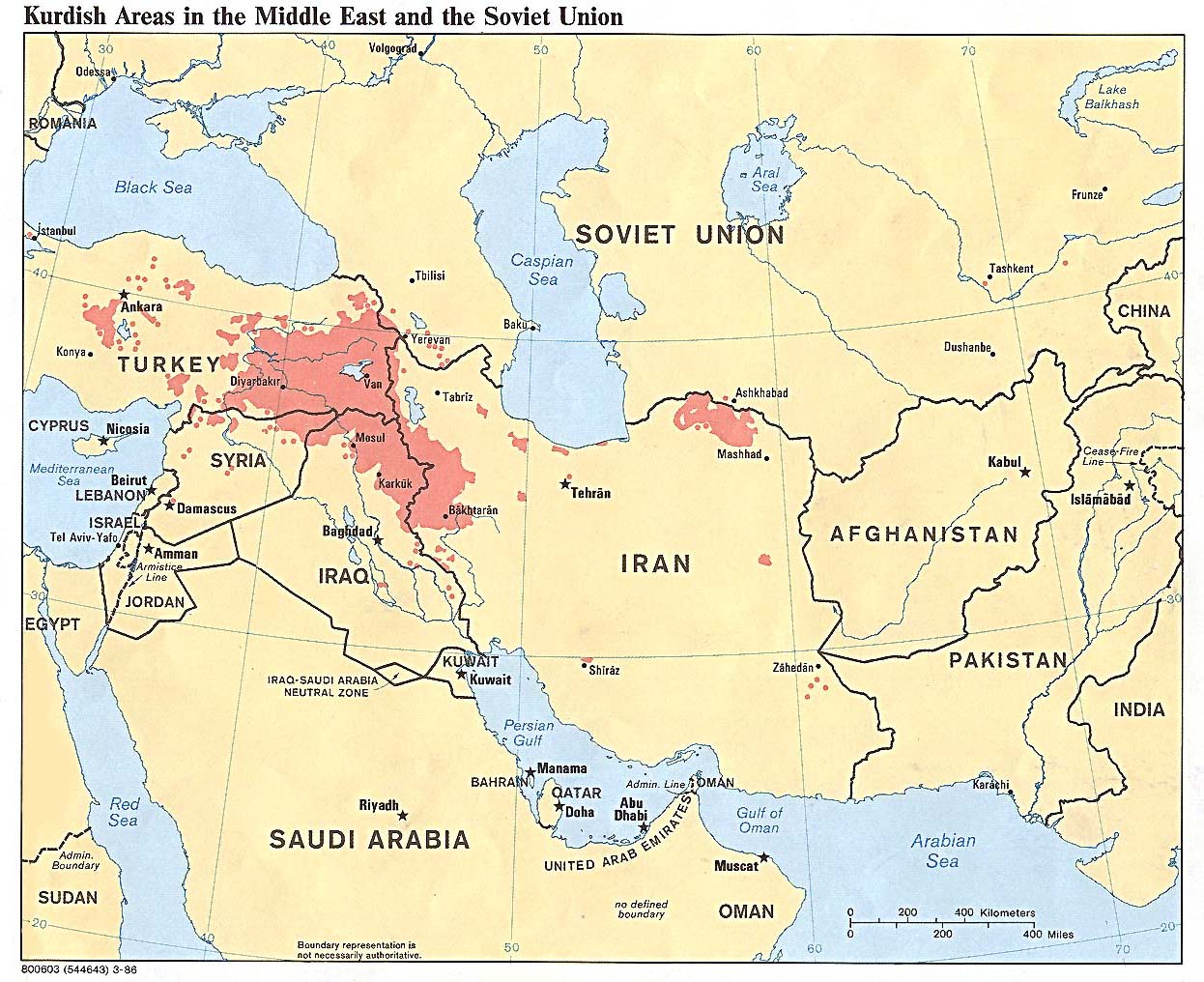
Kurdish Areas in the Middle East and the Soviet Union 1986 (254K)
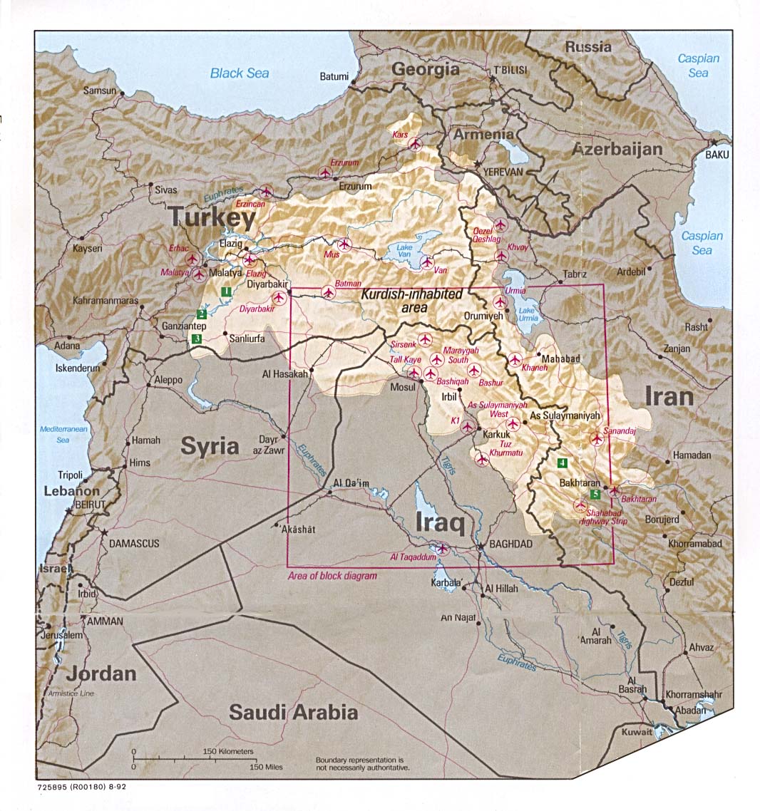
Kurdish Lands (location map) 1992 (235K)
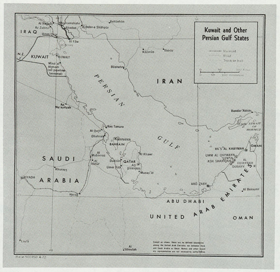
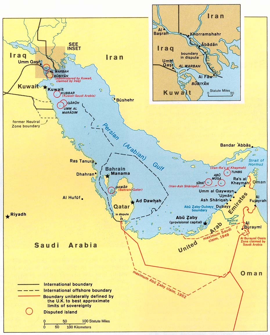
Kuwait and Other Persian Gulf States (Political) 1972 (680K)
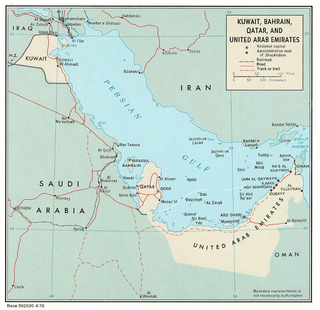
Kuwait, Bahrain, Qatar, and United Arab Emirates (Political) 1976 (324K)
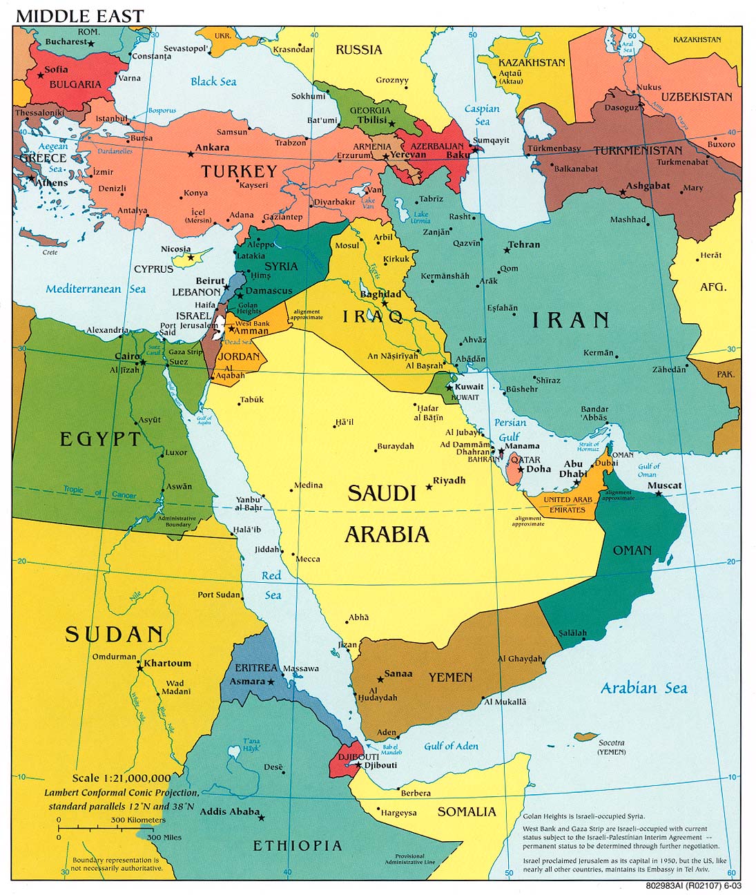
Middle East (Political) 2003 (334K) [jpeg format]
Middle East (Political) 2003 (254K) [pdf format]
Middle East (Political) 2001 (157K) [jpeg format]
Middle East (Political) 2001 (206K) [pdf format]
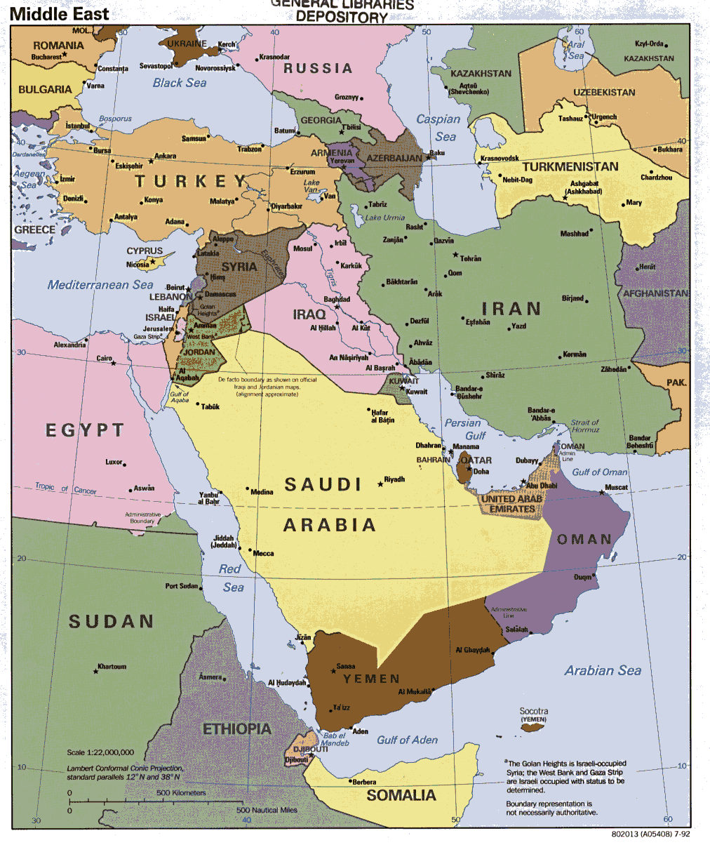
Middle East (Political) 1998 (323K) [jpeg format]
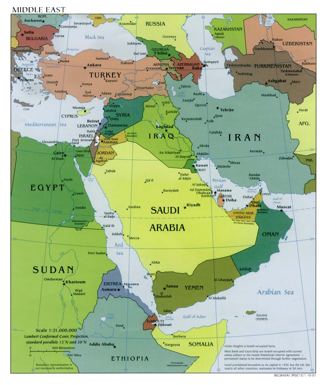
Middle East (Political) 1997 (315K) [jpeg format]
Middle East (Political) 1997 (1MB) [pdf format]
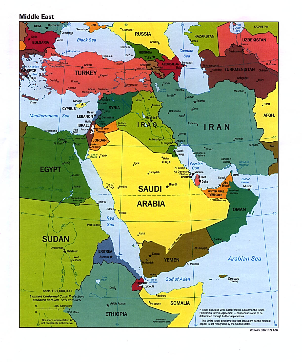
Middle East (Political) 1995 (433K) [jpeg format]
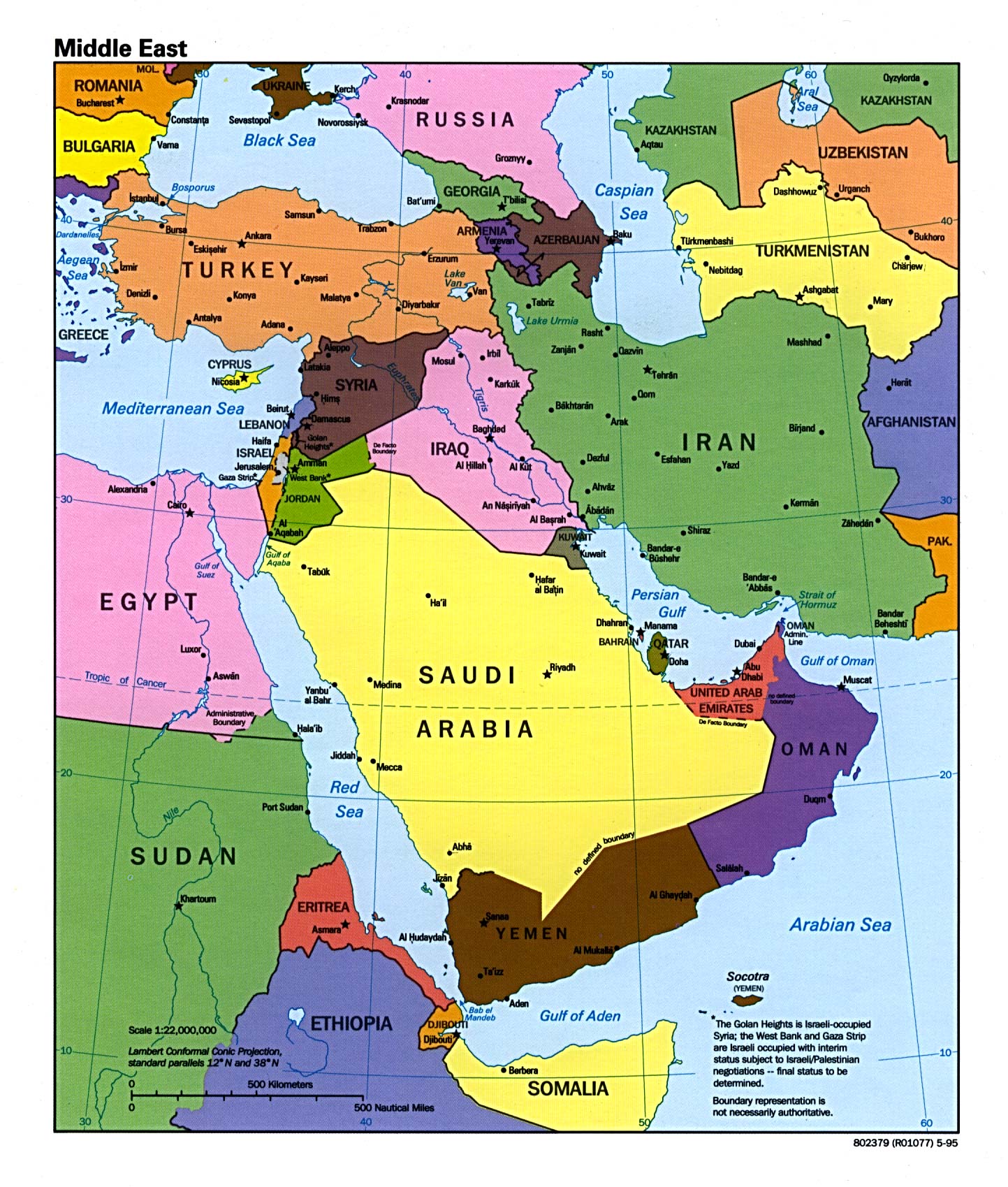
Middle East (Political) 1992 (175K) [jpeg format]
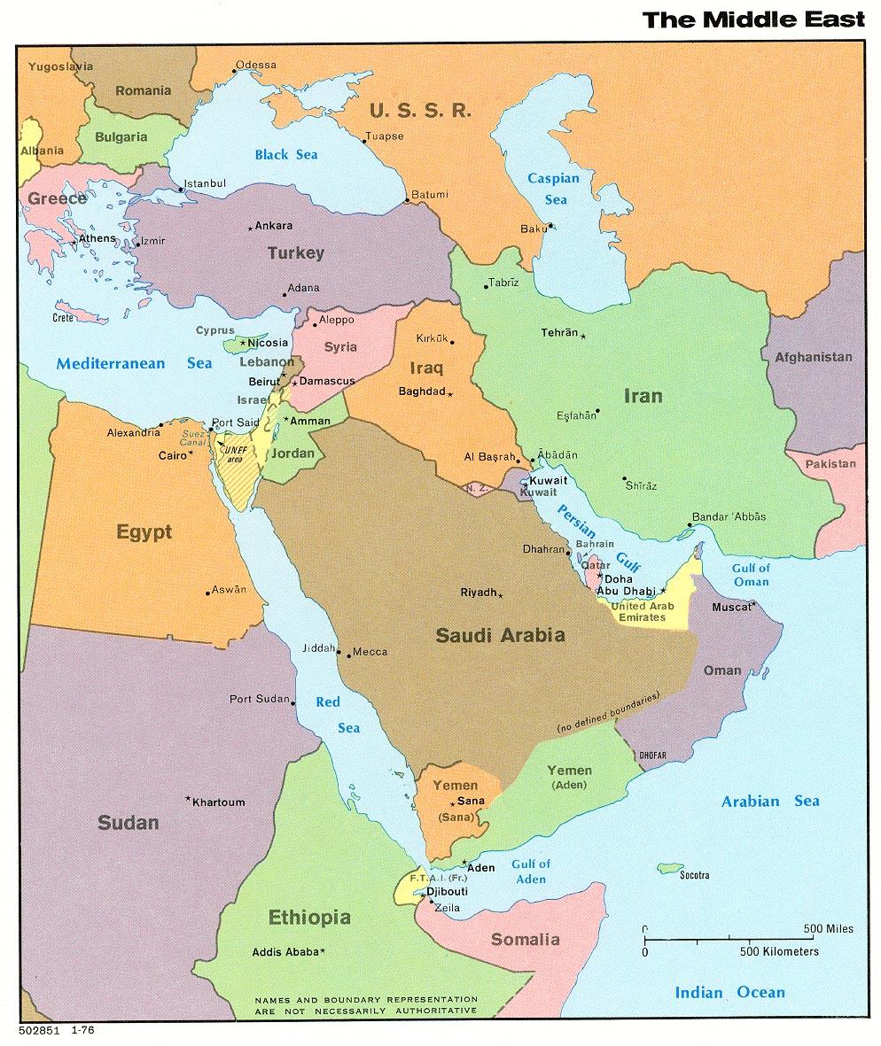
Middle East (Political) 1976 (368K) [jpeg format]
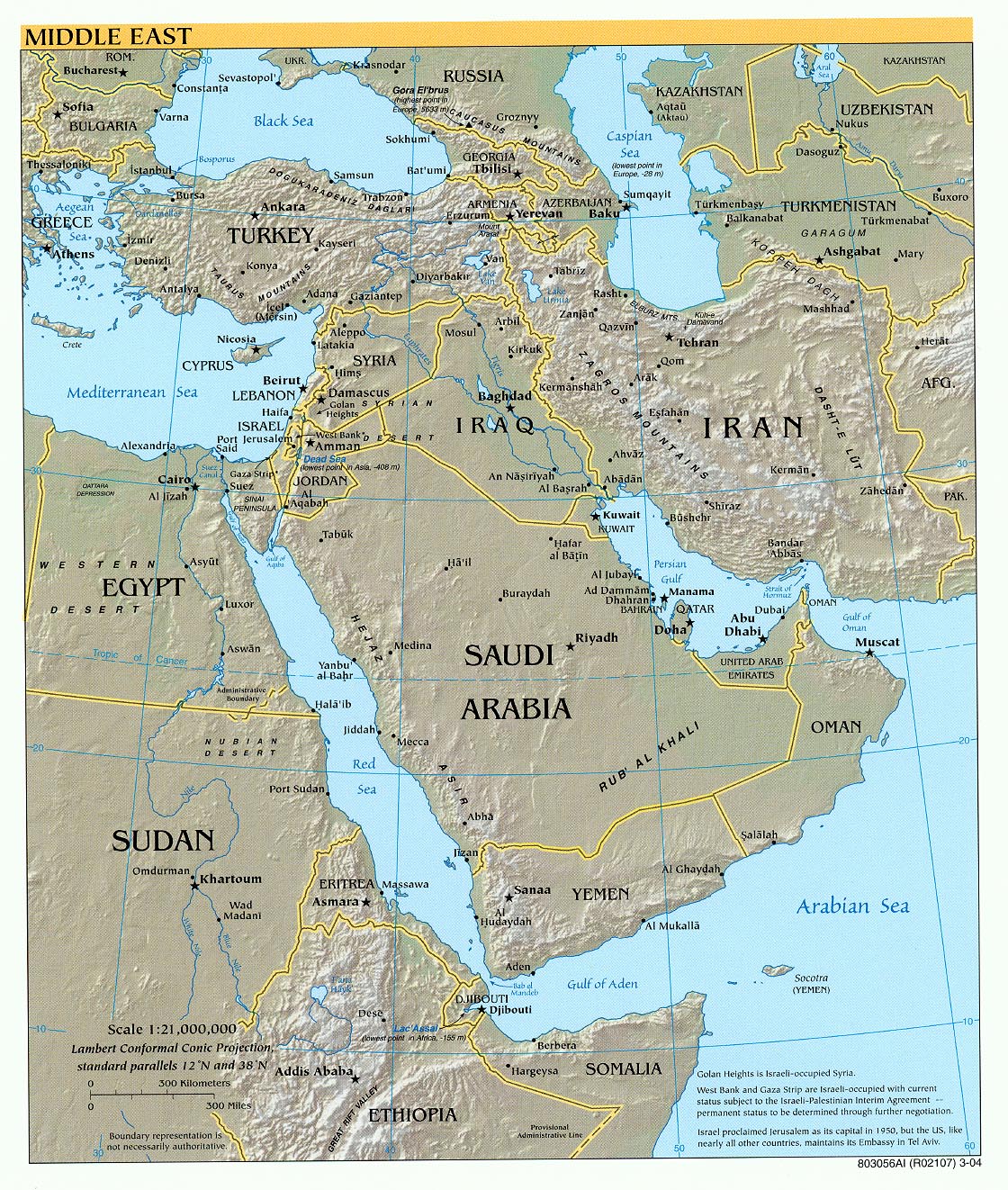
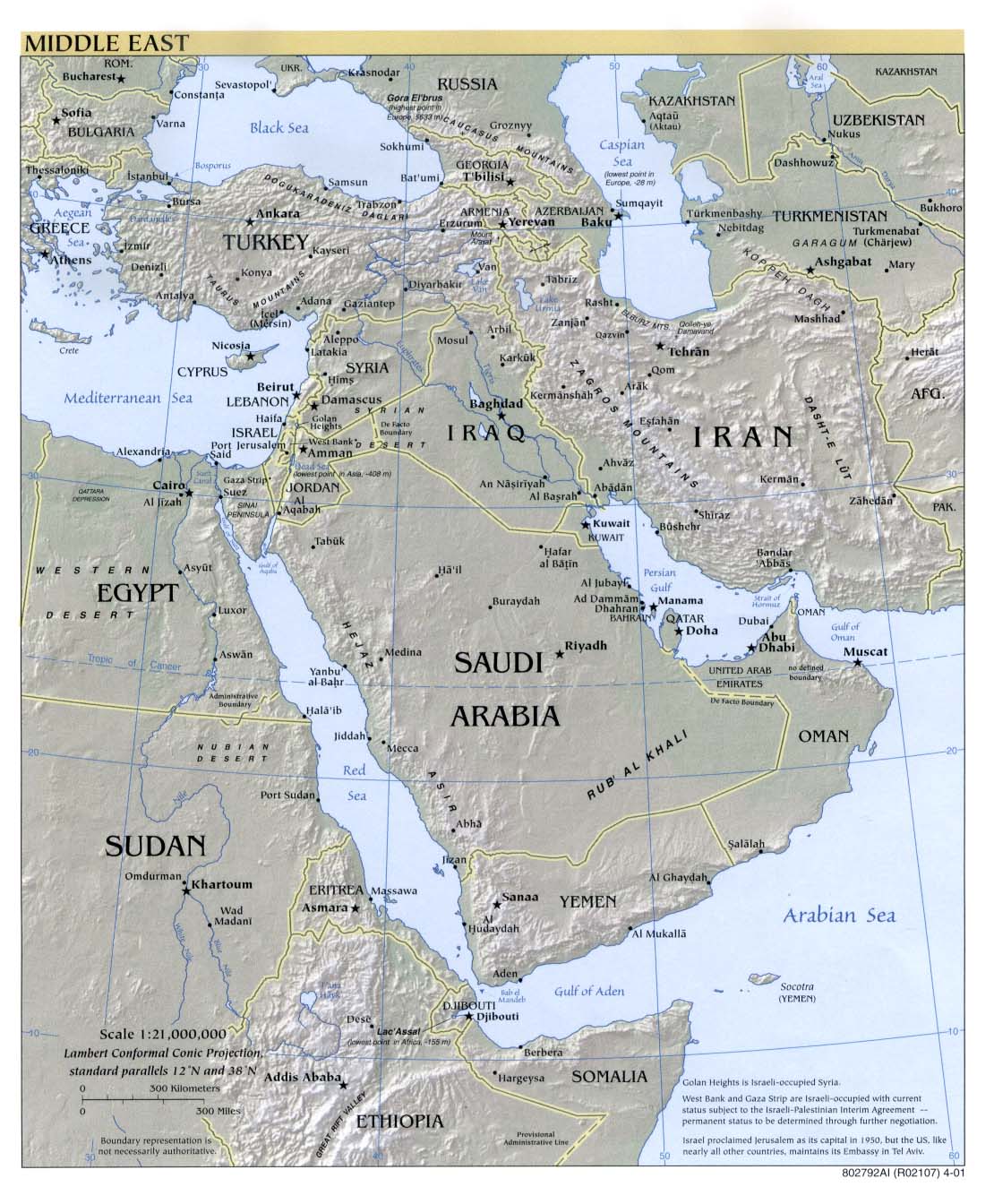
Middle East (Reference Map) 2004 (553K) [jpeg format]
Middle East (Reference Map) 2004 (486K) [pdf format]
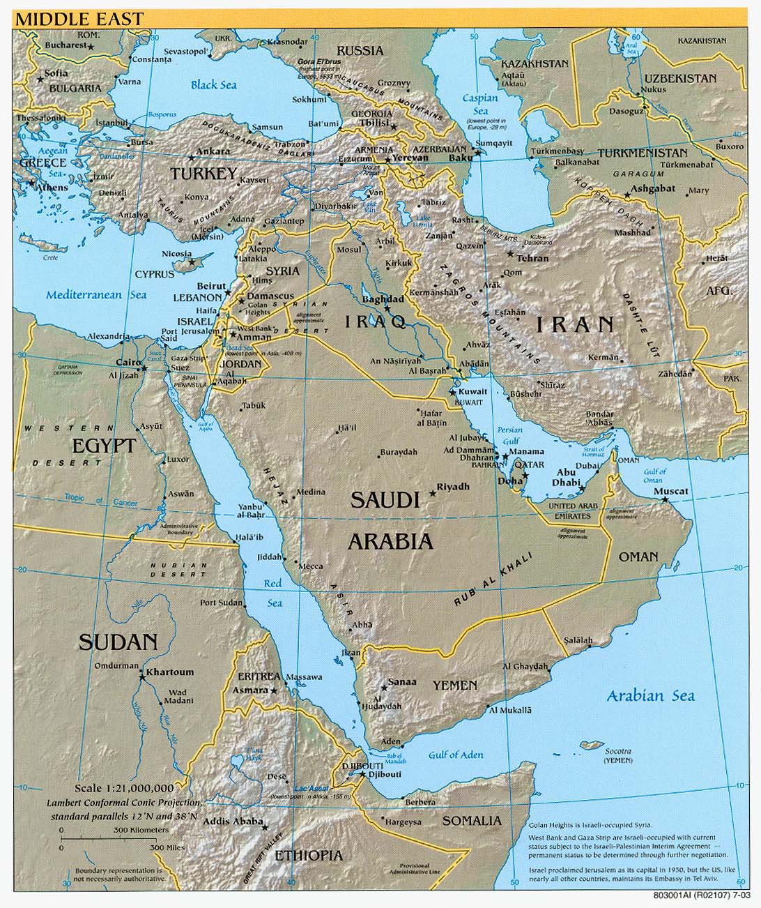
Middle East (Reference Map) 2003 (333K) [jpeg format]
Middle East (Reference Map) 2003 (335K) [pdf format]
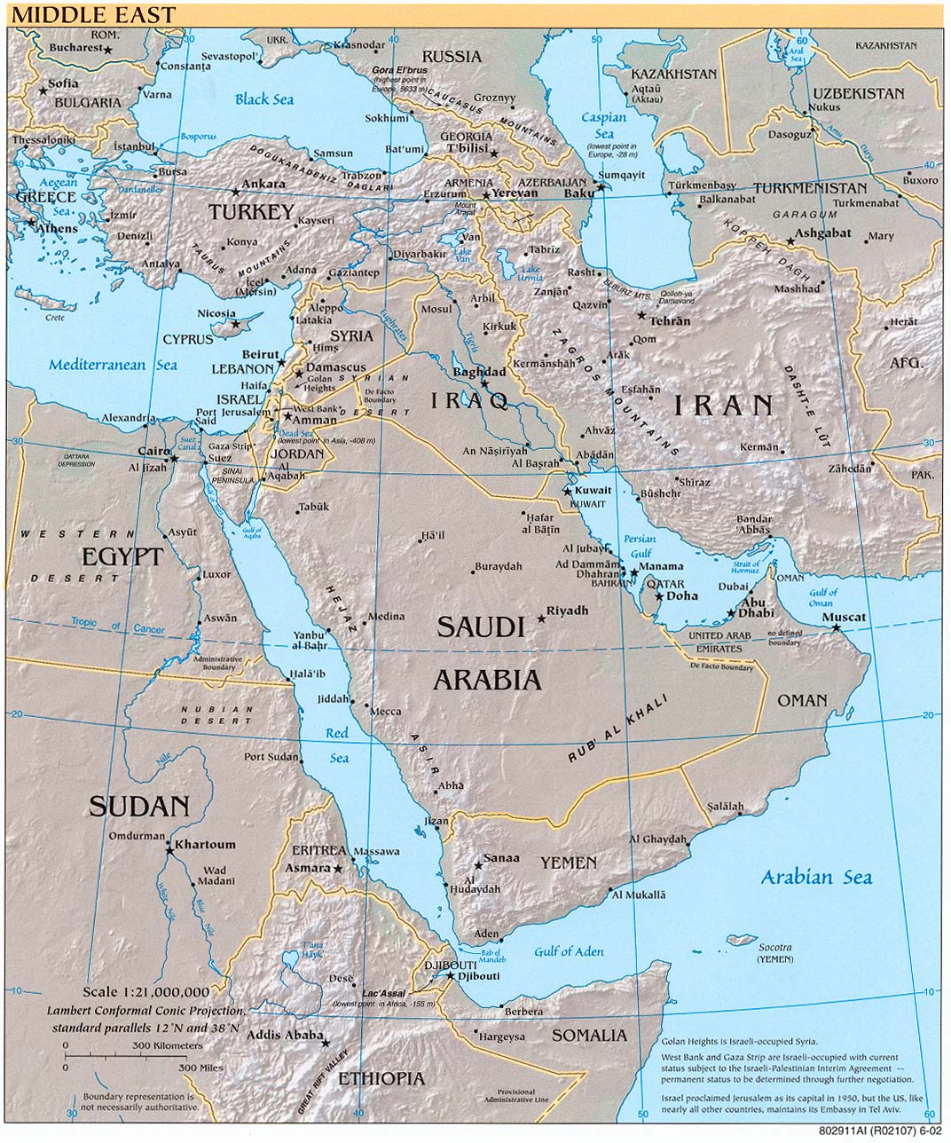
Middle East (Reference Map) 2002 (347K) [jpeg format]
Middle East (Reference Map) 2002 (230K) [pdf format]
Middle East (Reference Map) 2001 (226K) [jpeg format]
Middle East (Reference Map) 2001 (1.2MB) [pdf format]
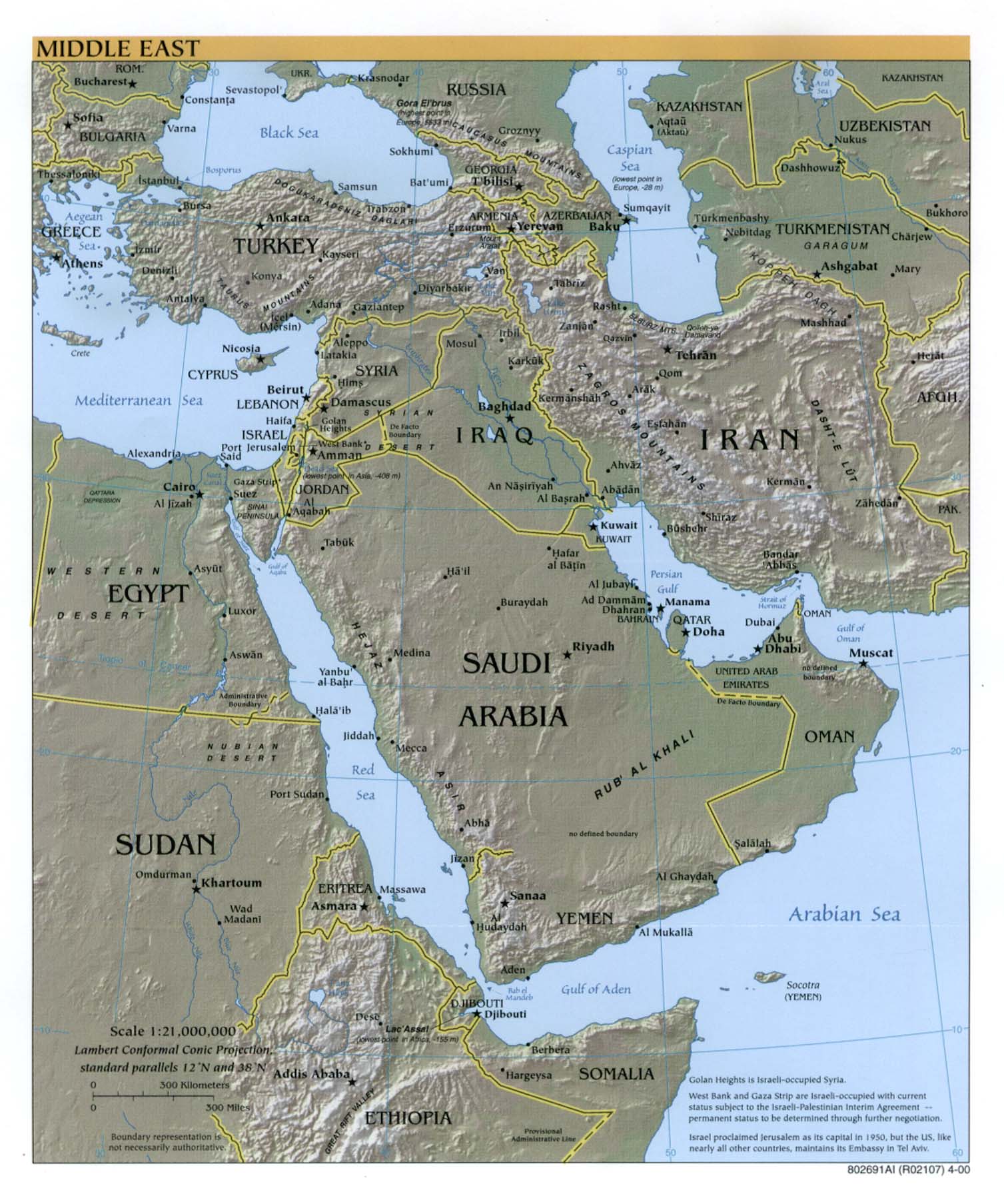
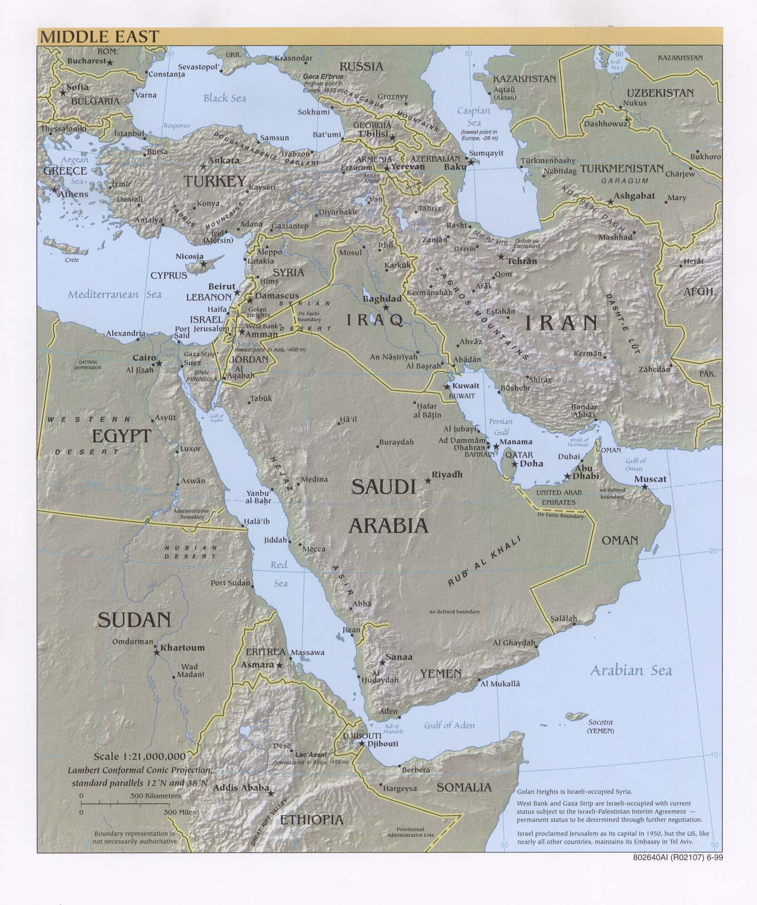
Middle East (Reference Map) 2000 (306K) [jpeg format]
Middle East (Reference Map) 2000 (774K) [pdf format]
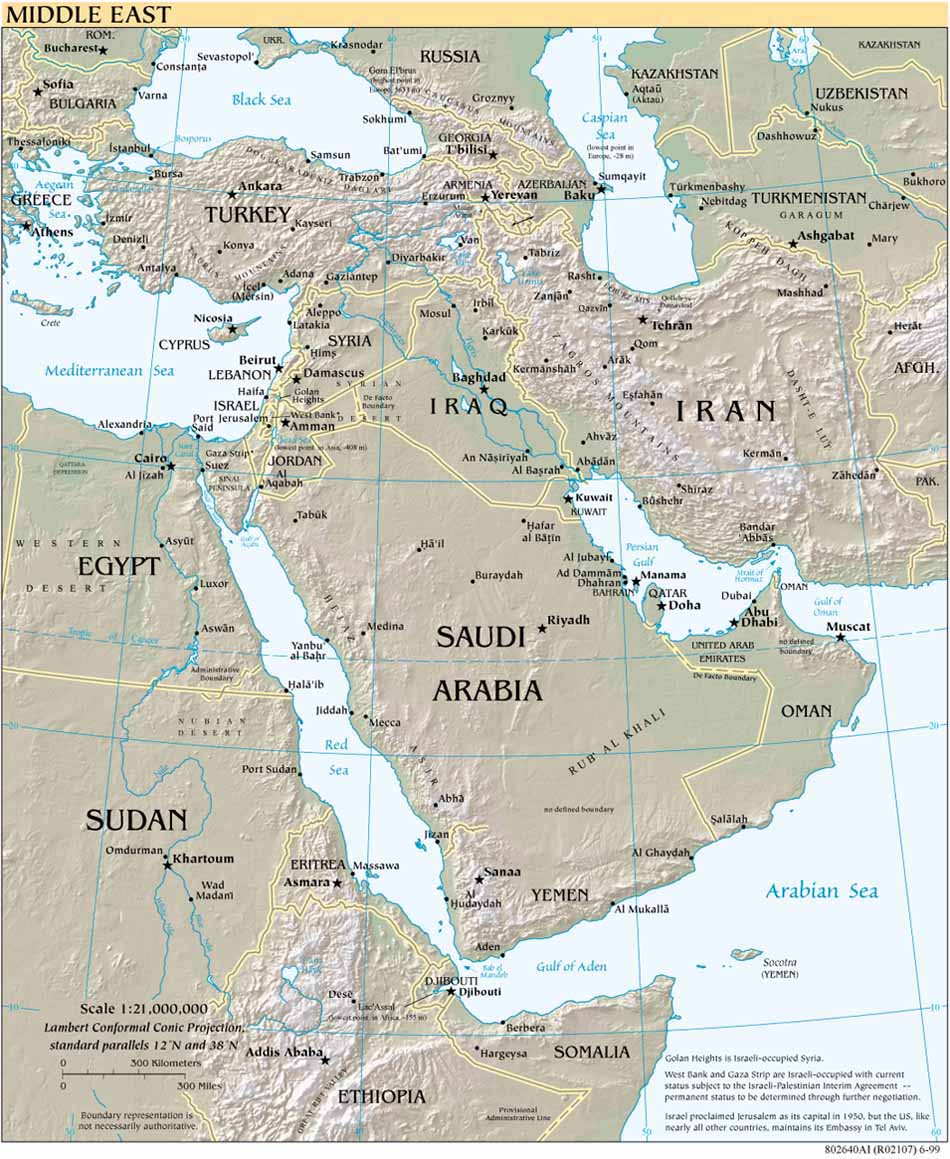
Middle East (Reference Map) 1999 (184K) [jpeg format]
Middle East (Reference Map) 1999 (339K) [larger jpeg]
Middle East (Reference Map) 1999 (547K) [pdf format]
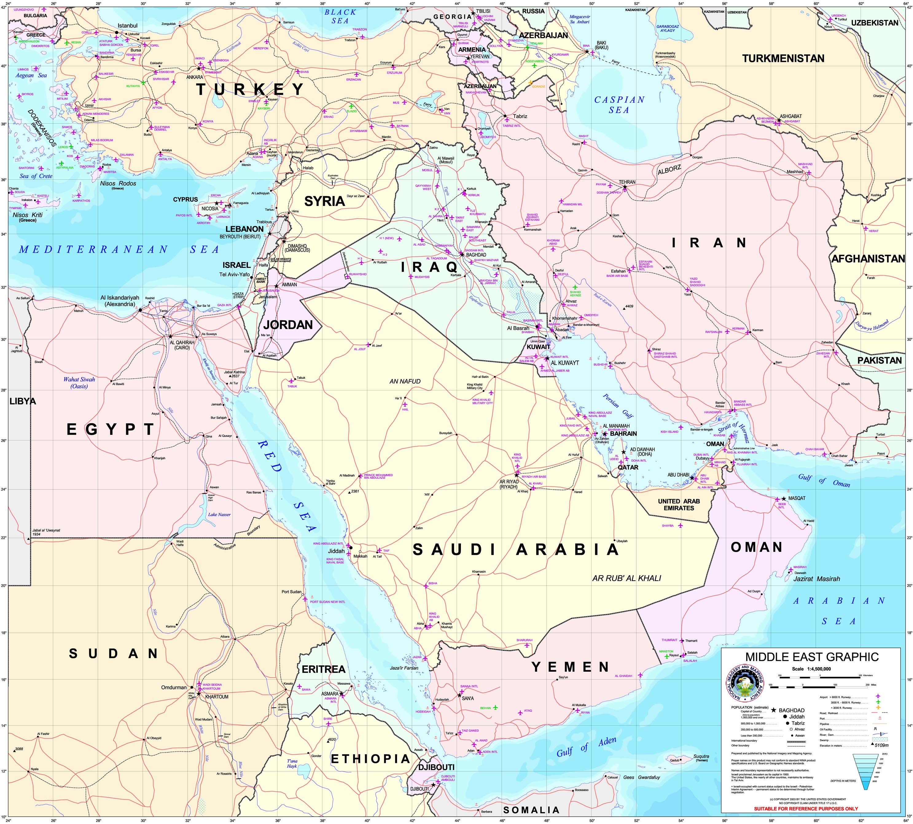
Middle East (Special Reference Graphic) NIMA 2003 (1MB)
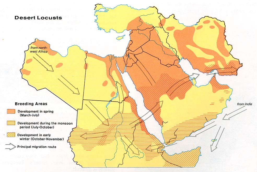
Middle East - Desert Locusts From Issues in the Middle East, Atlas, 1973 (124K)
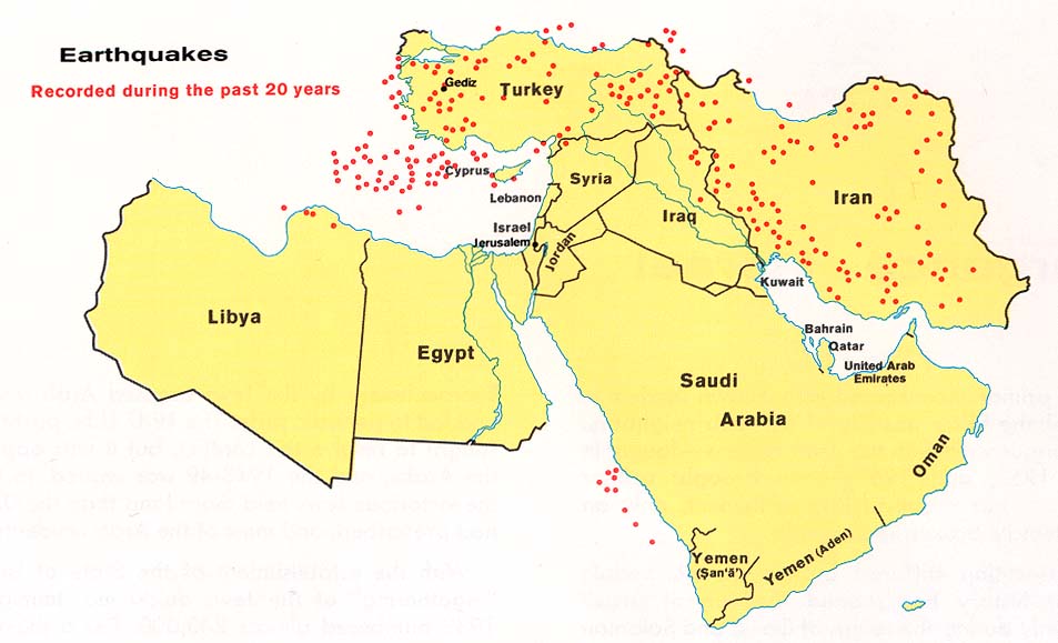
Middle East - Earthquakes From Issues in the Middle East, Atlas, 1973 (86K)
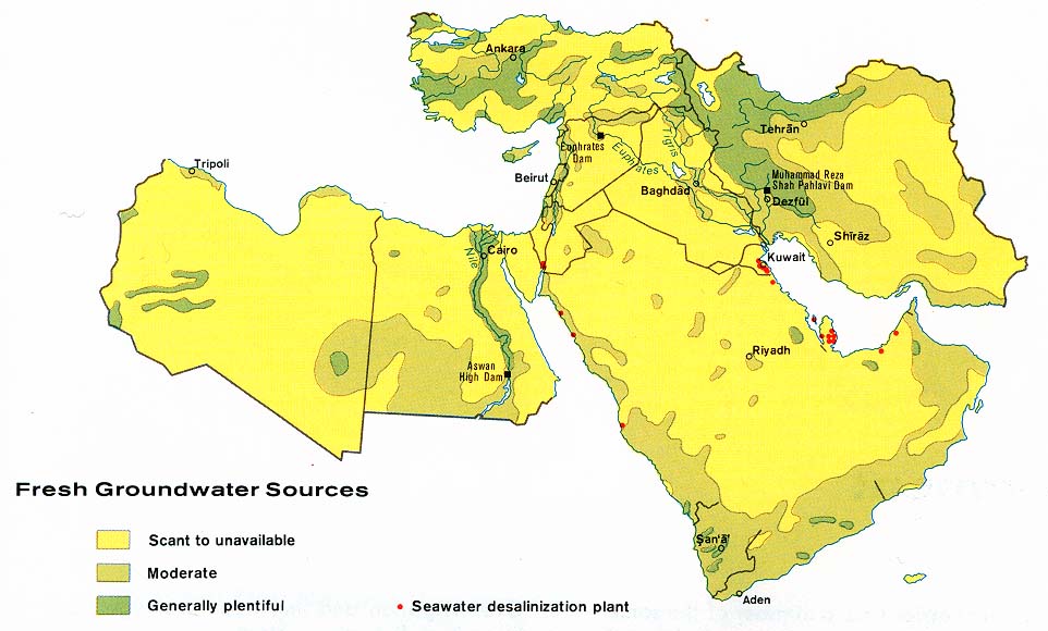
Middle East - Fresh Groundwater Sources From Issues in the Middle East, Atlas, 1973 (105K)
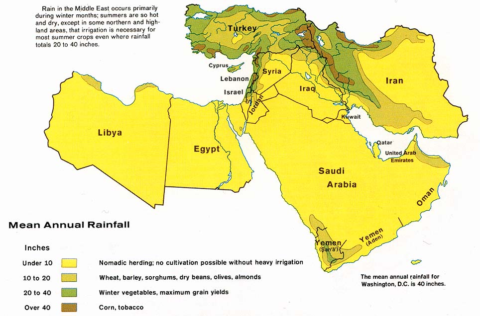
Middle East - Mean Annual Rainfall From Issues in the Middle East, Atlas, 1973 (120K)
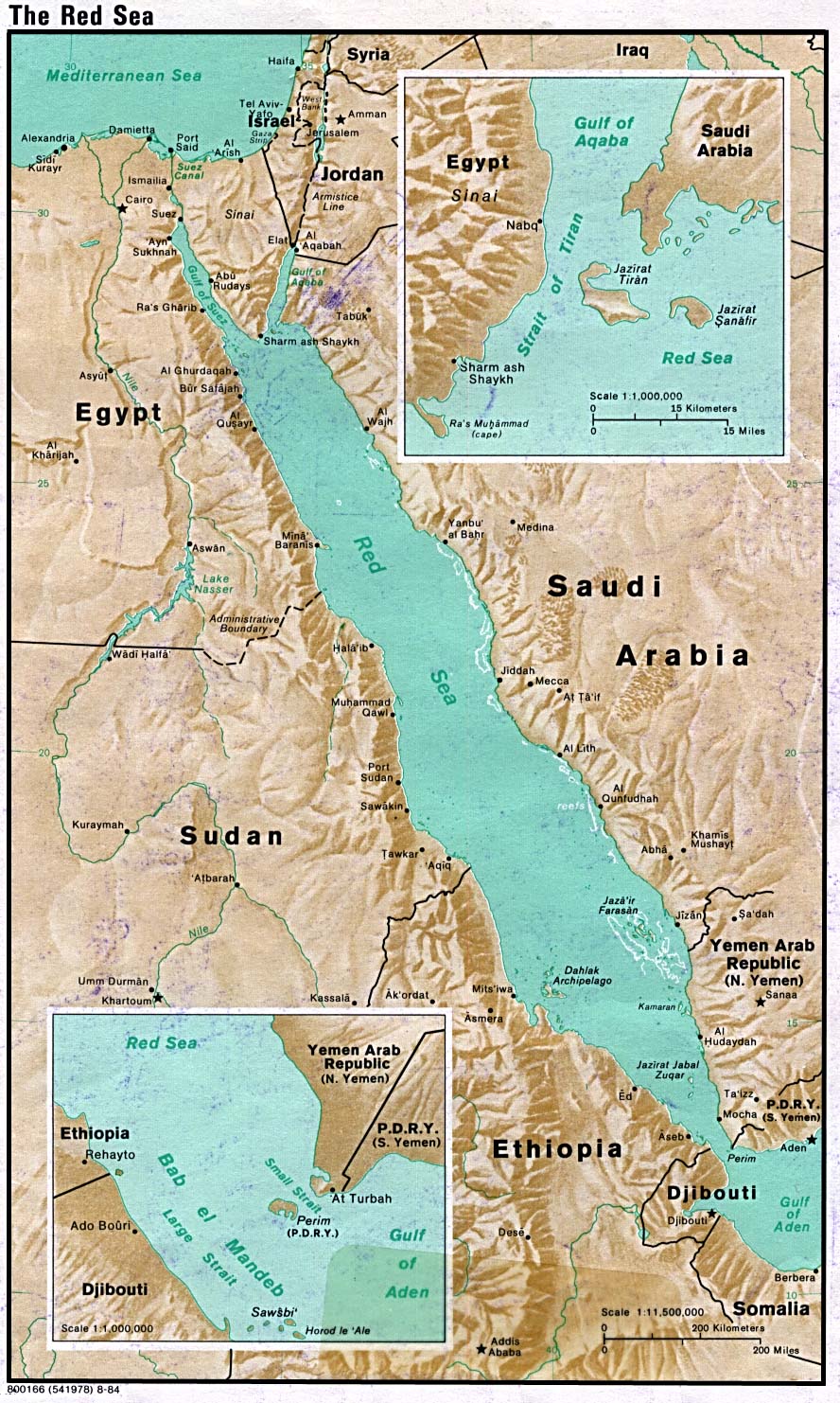
Middle East/Red Sea Portion of World Map, Sheet 6, Series 1150, U.S. Defense Mapping Agency 1987 (1990 Printing) (311K)
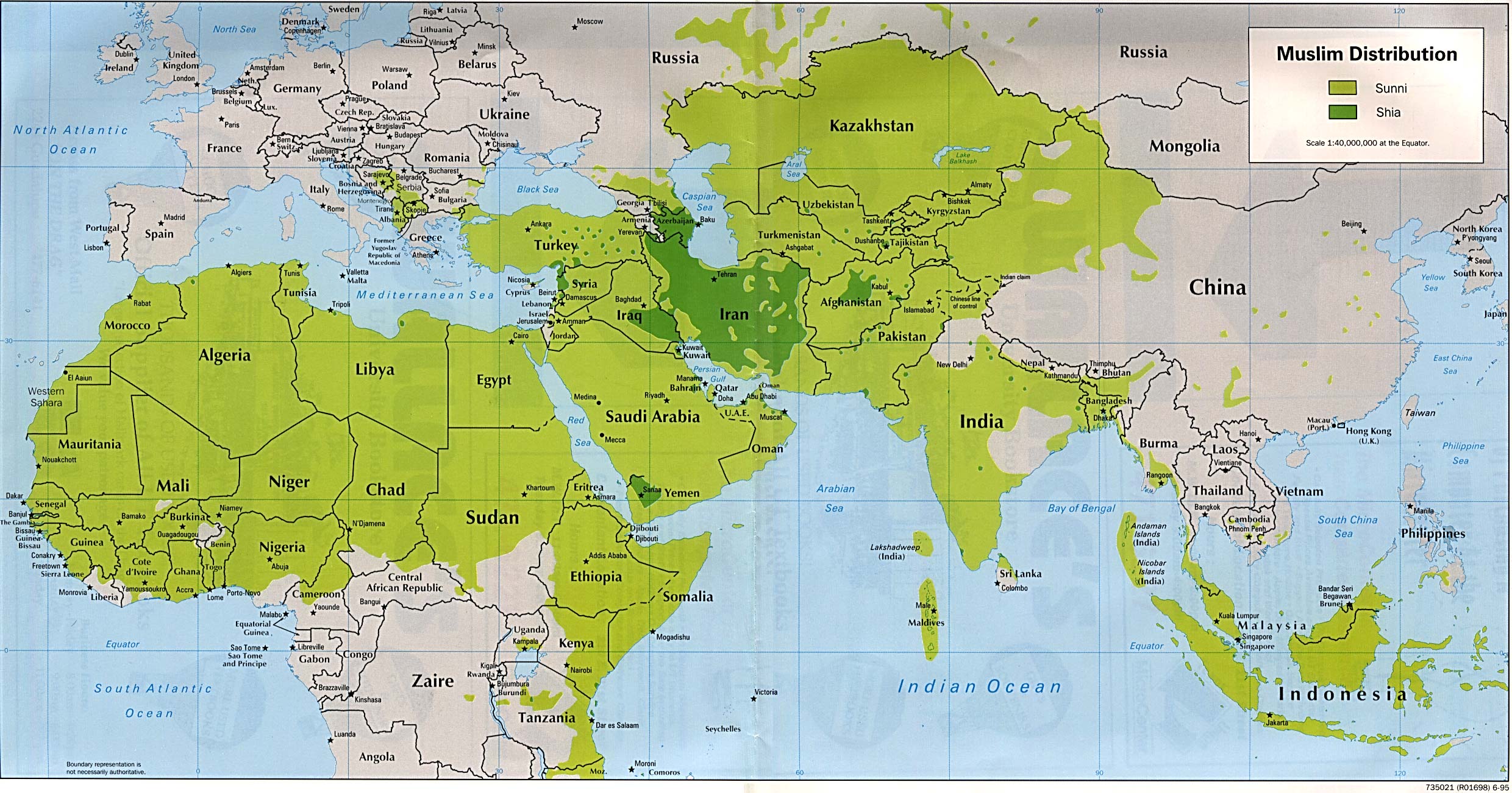
Muslim Distribution 1995 (570K)
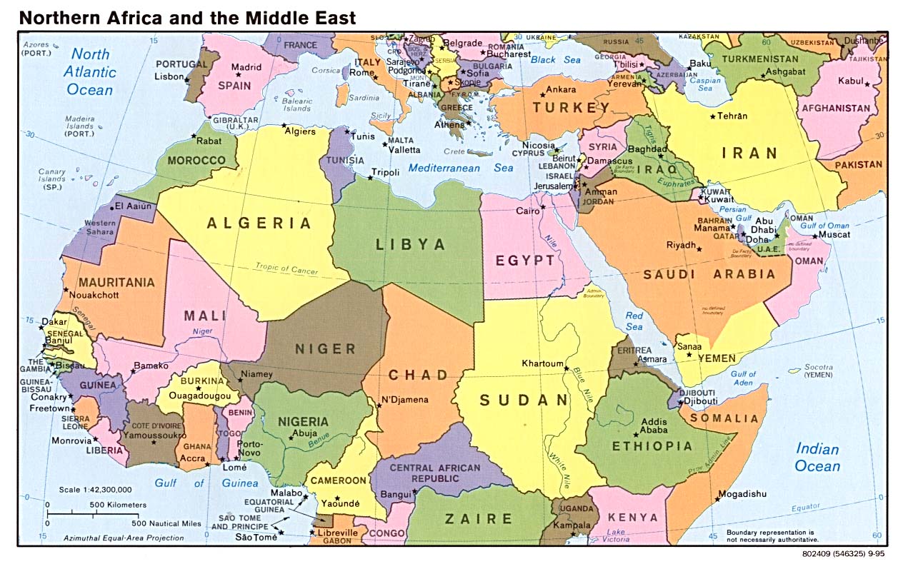
Northern Africa and the Middle East (Political) 1995 (207K)
Persian Gulf [shows international boundaries, offshore boundaries] From Issues in the Middle East, Atlas, 1973 (195K)
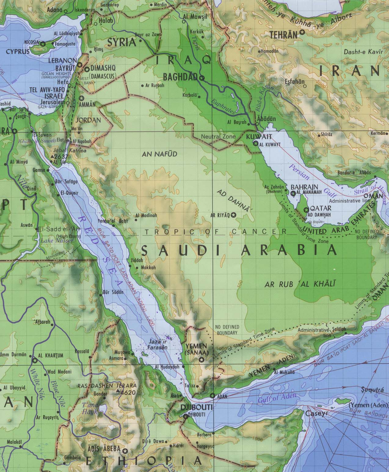
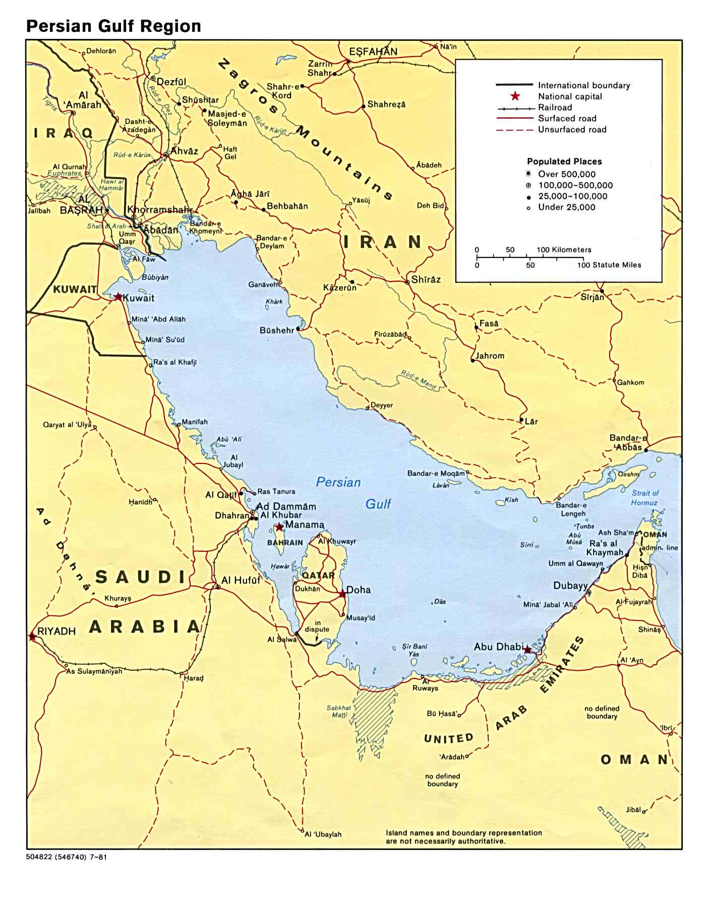
Persian Gulf Region (Political) 1981 (187K)
Red Sea (Shaded Relief) 1984 (318K)
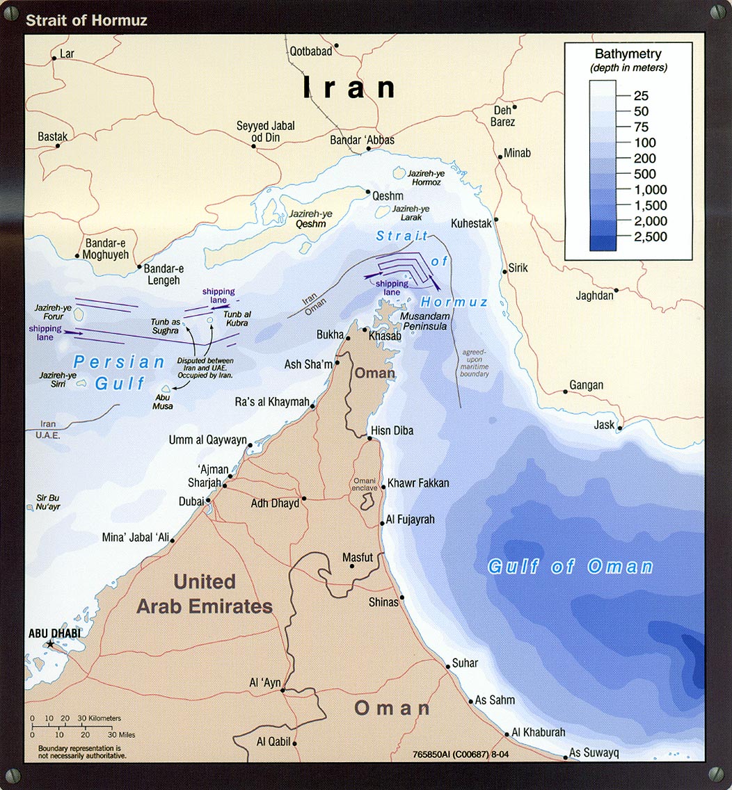
Strait of Hormuz (Political) 1980 (149K)
Strait of Hormuz portion of Iran Country Profile 2004 (311K)
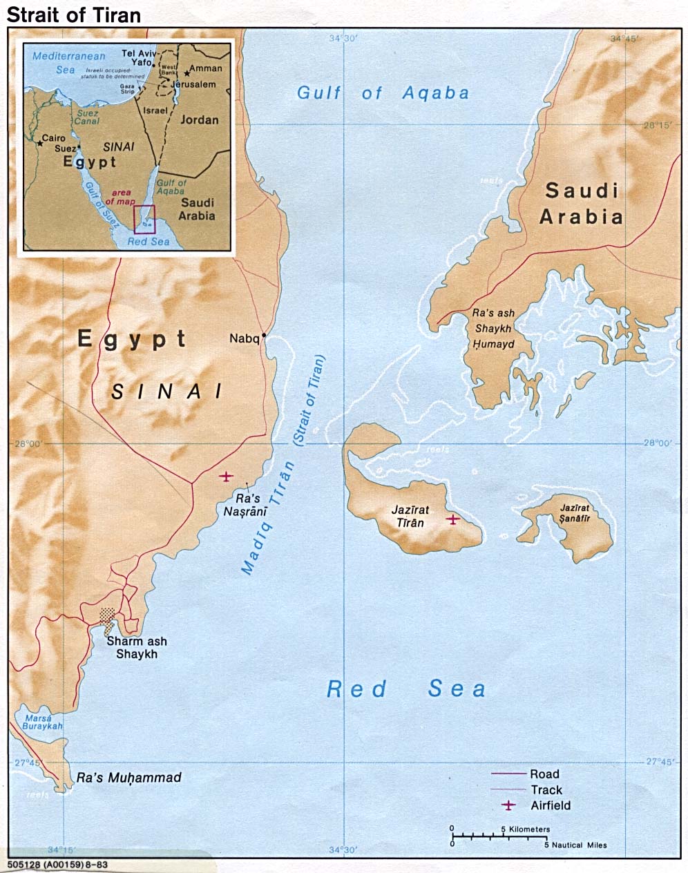
Strait of Tiran 1983 (203K)
Sources: These maps were provided by the University of Texas Library and/or
the U.S. Central Intelligence Agency (CIA) unless otherwise noted.
Sponsors
Maps on other websites
Middle East (JohoMaps)
Middle East (United Nations)
Middle East (SMPP)
Middle East (World Sites Atlas)
Middle East - Atlas of the Orient
Middle East - Economic and Social Commission for Western Asia (United Nations) [PDF]
Middle East - Forest Type and Protected Area Distribution (WCMC)
Middle East - Physical Map (National Geographic)
Middle East Countries
Afghanistan
Arab World
Armenia
Azerbaijan
Bahrain
Cyprus
Dagestan
Egypt
Gaza
Georgia
Iran
Iraq
Israel
Jordan
Kazakhstan
Kuwait
Kyrgyzstan
Lebanon
Oman
Qatar
Saudi Arabia
Syria
Turkey
Turkmenistan
United Arab Emirates
Uzbekistan
West Bank
Yemen
<-- Free Map Downloads
<-- Free World Country Map Downloads
Didn't find what you are looking for? We've been online since 1996 and have created 1000's of pages. Search below and you may find just what you are looking for.
Michael R. Meuser
Data Research & GIS Specialist
MapCruzin.com is an independent firm
specializing in GIS project development and data research.
We created the first U.S. based
interactive toxic chemical facility
maps on the internet in 1996 and we
have been online ever since. Learn more about us and our services.
Have a project in mind? If you have data, GIS project or custom shapefile needs contact Mike.
Contact Us
Report Broken Links
Subscribe for Updates


![Abu Musa and the Tunbs [Strait of Hormuz]](/free-maps-middle-east/hormuz_80.jpg)
![[Caspian Region] Oil and Gas Infrastructure in the Caspian Sea Region](/free-maps-middle-east/caspian_sea_oil_gas-2001.jpg)