Download Free Kuwait Maps
<-- Free Map Downloads
<-- Free World Country Map Downloads
Sponsors
Note that maps may not appear on the webpage in their full size and resolution. To save the maps to your computer, right-click on the link.
Kuwait (Political) 2006 (428K) and
pdf format (531K)
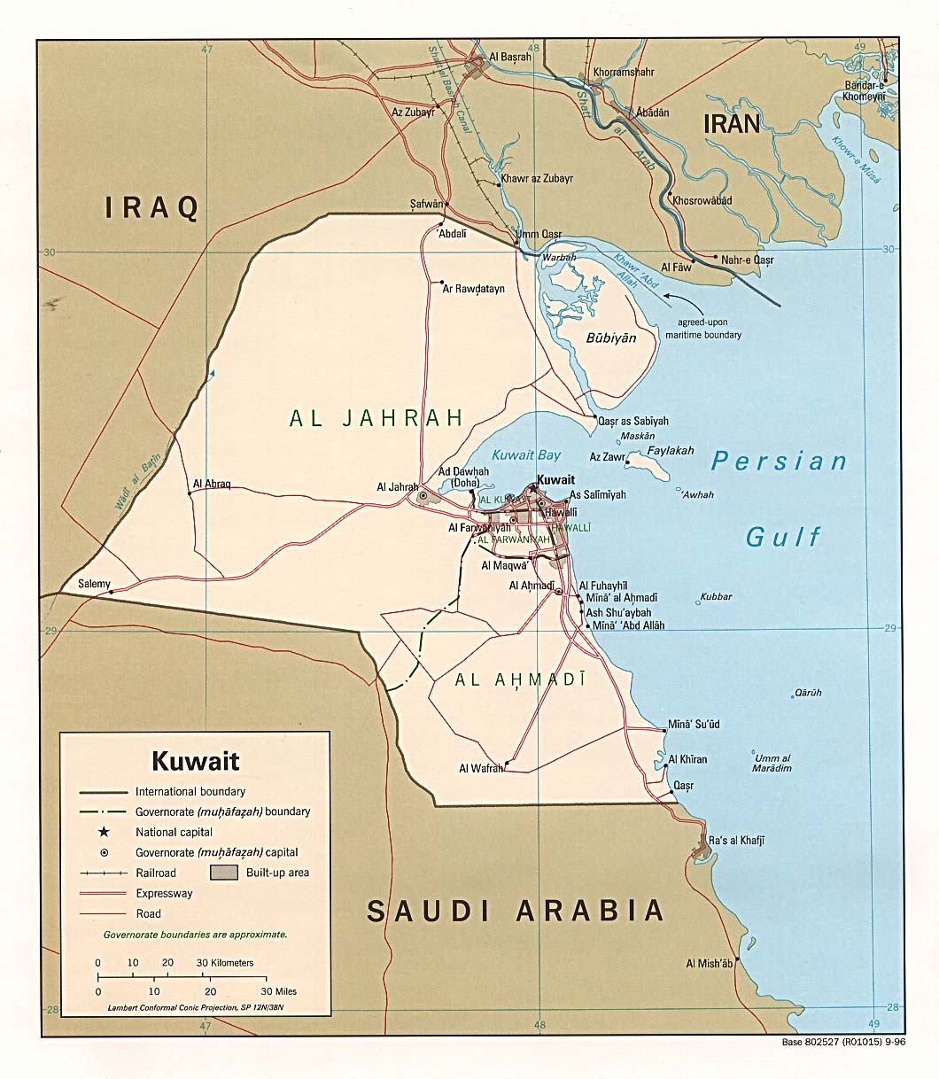
Kuwait (Political) 1996 (234K) and pdf format (237K)
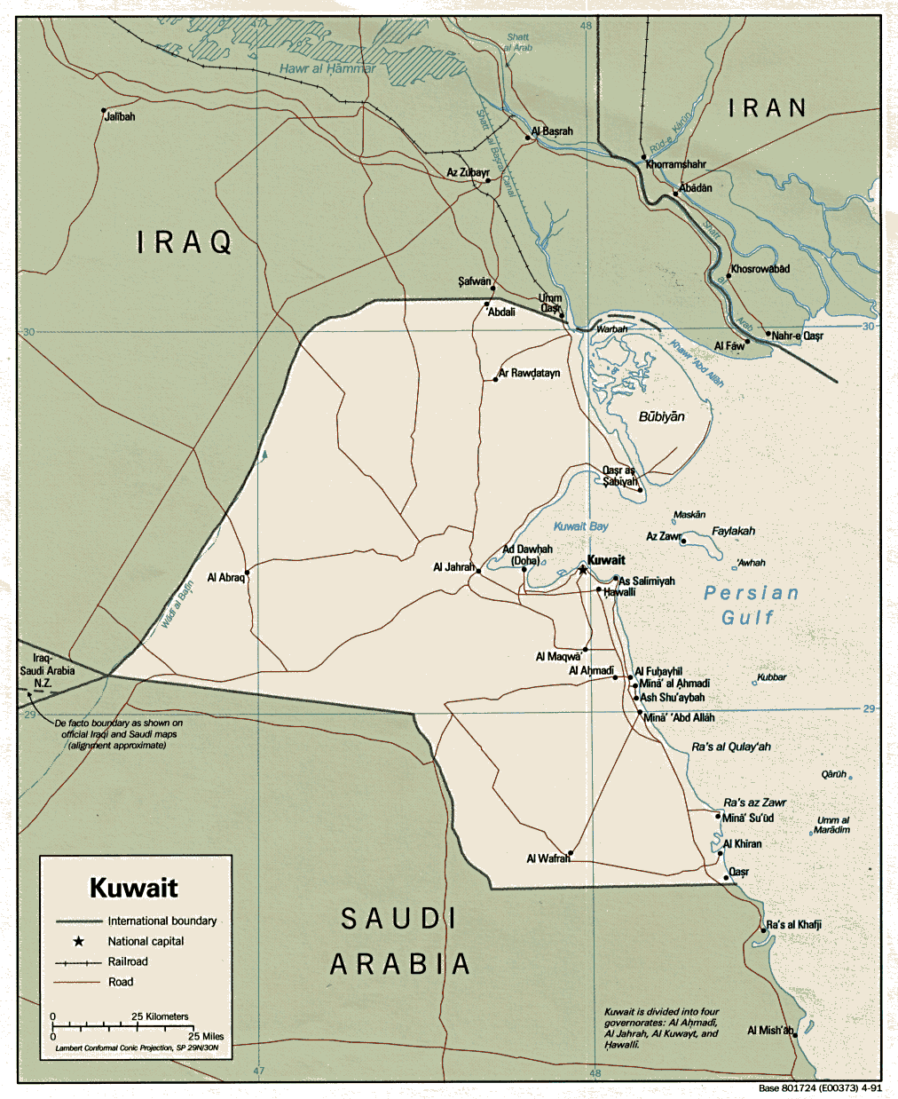
Kuwait (Political) 1991 (229K) and
pdf format (254K)
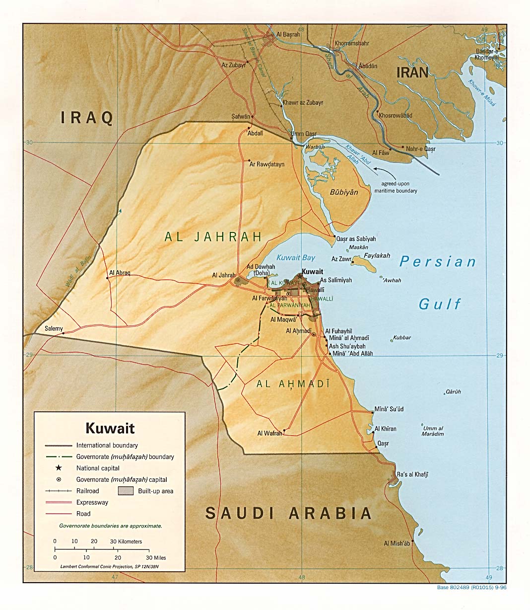
Kuwait (Shaded Relief) 1996 (234K) and pdf format (251K)
Kuwait (Small Map) 2008 (12K)
Al Basrah Region [Iraq] Including Northern Kuwait original scale 1:670,000 From Iraq-Iran: Central and Southern Border Areas CIA 1980 (400K)
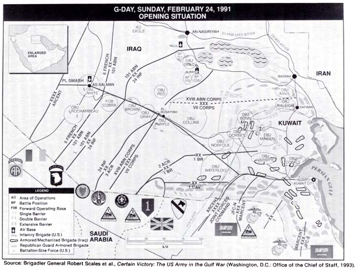
G-Day, Sunday, February 24, 1991 Opening Situation (86K) From "Lucky War": Third Army in Desert Storm by Richard M. Swain. U.S. Army Command and General Staff College Press, Fort Leavenworth, Kansas, 1997.
Iraq Invasion of Kuwait August 1990 (102K) From U.S. Marines in the Persian Gulf, 1990-1991: With Marine Forces Afloat in Desert Shield and Desert Storm by Ronald J. Brown. U.S. Marine Corps, History and Museums Division, Washington, D.C. 1998.
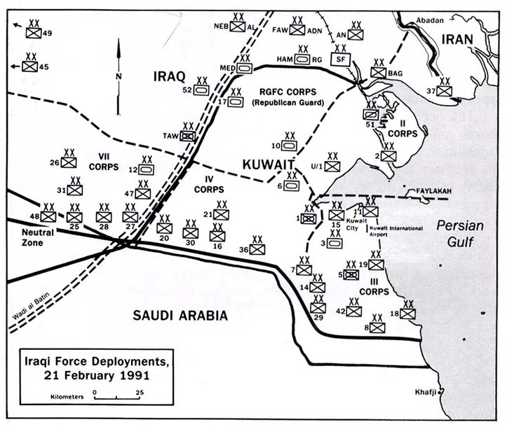
Iraqi Force Deployments, 21 February 1991 (88K) From U.S. Marines in the Persian Gulf, 1990-1991: With the 2nd Marine Division in Desert Shield and Desert Storm by Dennis P. Mroczkowski. U.S. Marine Corps, History and Museums Division, Washington, D.C. 1993.
KTO: Comparison to Eastern United States (82K) From "Lucky War": Third Army in Desert Storm by Richard M. Swain. U.S. Army Command and General Staff College Press, Fort Leavenworth, Kansas, 1997.
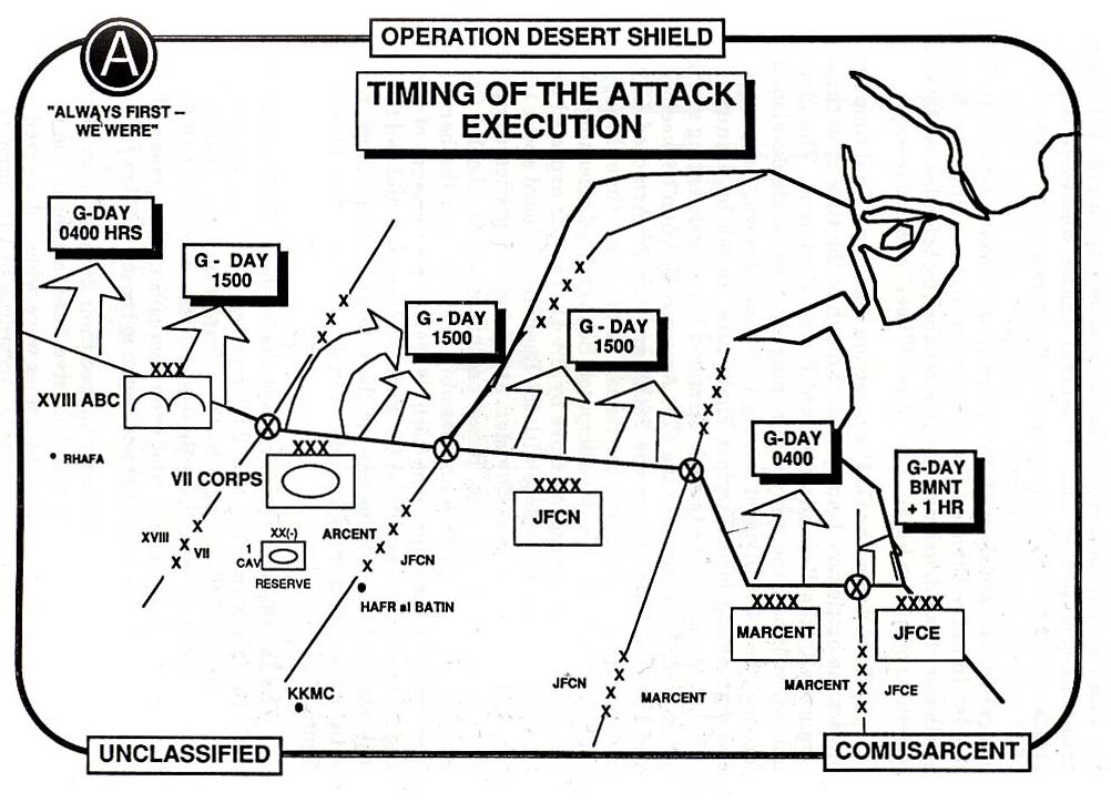
Operation Desert Shield Timing of Attack Execution (112K) From U.S. Marines in the Persian Gulf, 1990-1991: With the 2nd Marine Division in Desert Shield and Desert Storm by Dennis P. Mroczkowski. U.S. Marine Corps, History and Museums Division, Washington, D.C. 1993.
The Persian Gulf and U.S. Earnest Will Surveillance Operations, 1987-1988 (61K) From On Course to Desert Storm: The United States Navy and the Persian Gulf by Michael A. Palmer. Naval Historical Center, Washington, D.C. 1992.
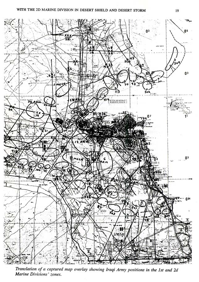
Translation of a Captured Map Overlay Showing Iraqi Army Positions in The 1st and 2nd Marine Divisions' Zones (234K) From U.S. Marines in the Persian Gulf, 1990-1991: With the 2nd Marine Division in Desert Shield and Desert Storm by Dennis P. Mroczkowski. U.S. Marine Corps, History and Museums Division, Washington, D.C. 1993.
Sources: These maps were provided by the University of Texas Library and/or
the U.S. Central Intelligence Agency (CIA) unless otherwise noted.
Maps on other websites
Kuwait (Lonely Planet)
Kuwait (UniMaps)
Kuwait (United Nations) [PDF]
Kuwait - Oil Fields (MERIP)
<-- Free Map Downloads
<-- Free World Country Map Downloads
Didn't find what you are looking for? We've been online since 1996 and have created 1000's of pages. Search below and you may find just what you are looking for.
Michael R. Meuser
Data Research & GIS Specialist
MapCruzin.com is an independent firm
specializing in GIS project development and data research.
We created the first U.S. based
interactive toxic chemical facility
maps on the internet in 1996 and we
have been online ever since. Learn more about us and our services.
Have a project in mind? If you have data, GIS project or custom shapefile needs contact Mike.
Contact Us
Report Broken Links
Subscribe for Updates
Sponsors


![Al Basrah Region [Iraq] Including Northern Kuwait](/free-maps-kuwait/al_basrah_iraq_80.jpg)