Download Free Iraq Maps
<-- Free Map Downloads
<-- Free World Country Map Downloads
Sponsors
Note that maps may not appear on the webpage in their full size and resolution. To save the maps to your computer, right-click on the link.
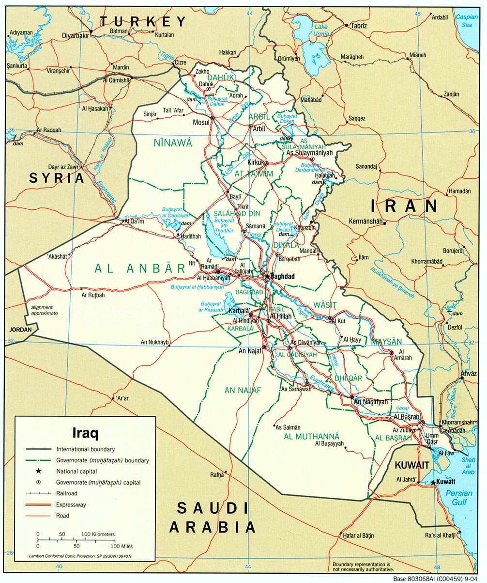
Iraq (Political) 2004 (351K) and
pdf format (399K)
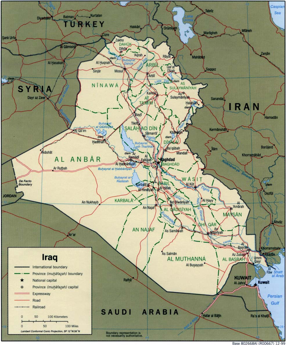
Iraq (Political) 1999 (323K) and pdf format (199K)
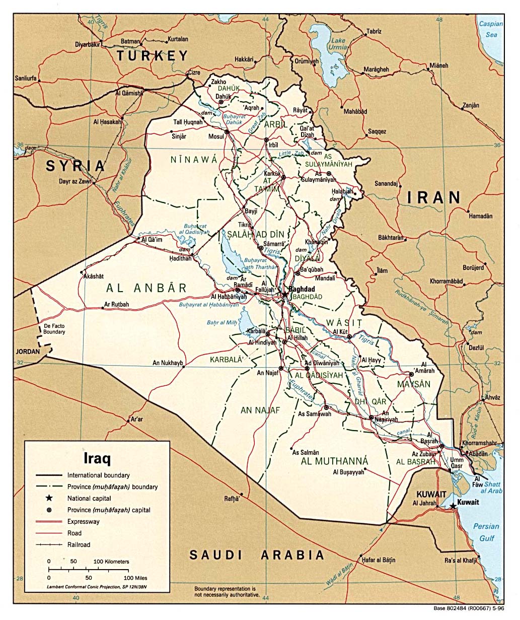
Iraq (Political) 1996 (295K) and pdf format (299K)
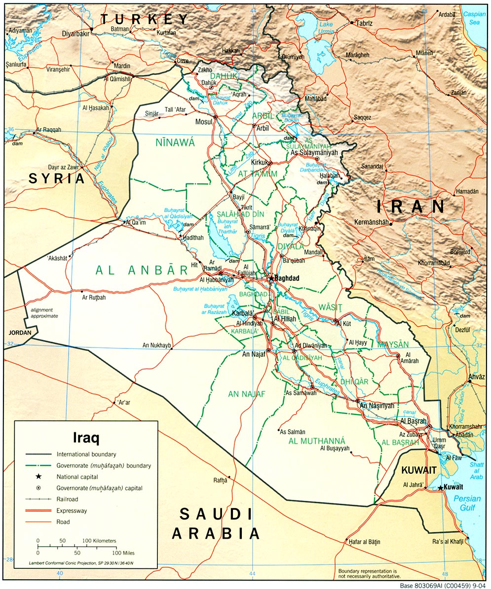
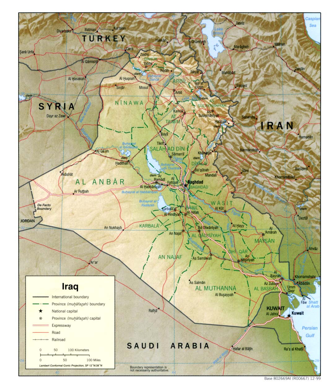
Iraq (Shaded Relief) 2004 (374K) and
pdf format (423K)
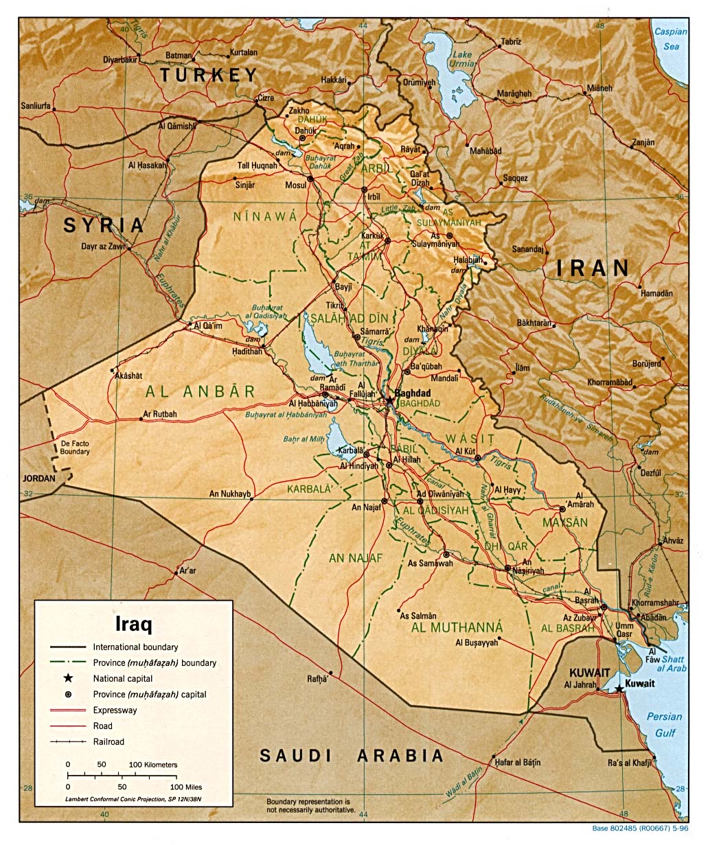
Iraq (Shaded Relief) 1999 (323K) and pdf format (221K)
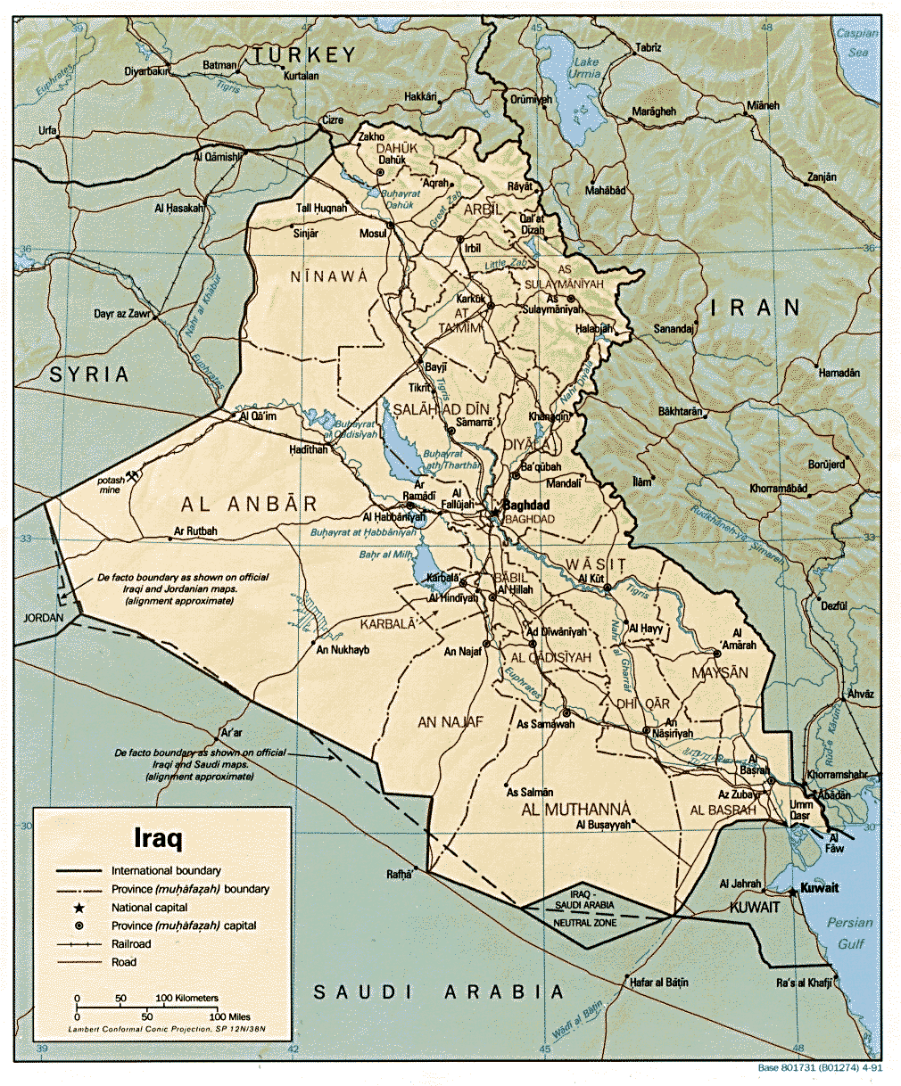
Iraq (Shaded Relief) 1996 (307K) and pdf format (311K)
Iraq (Shaded Relief) From the CIA Atlas of the Middle East, 1993 (580k)
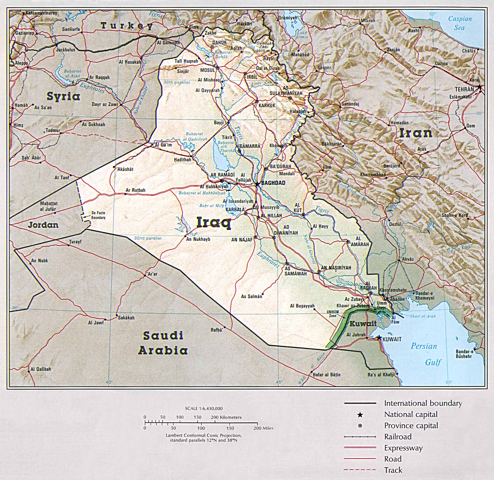
Iraq (Shaded Relief) 1991 (377K) and pdf format (392K)
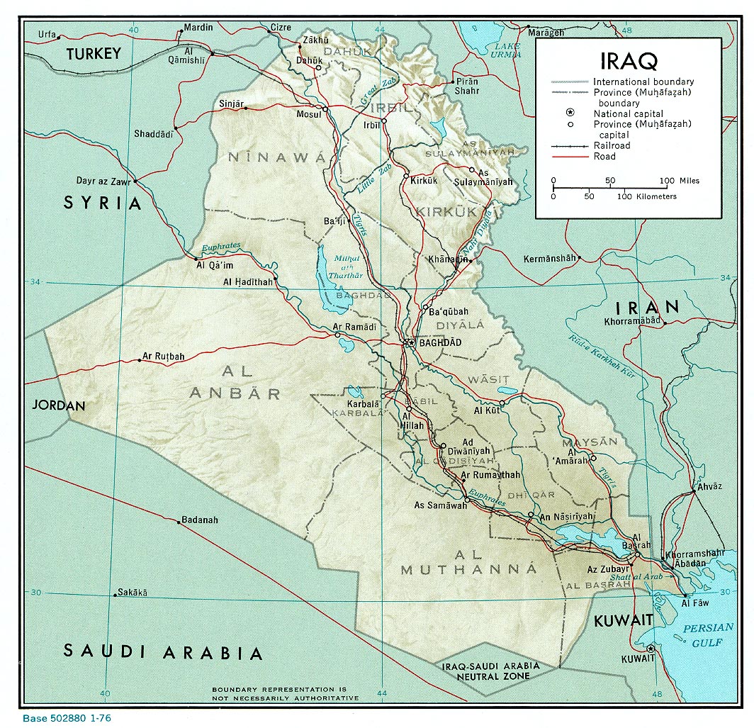
Iraq (Shaded Relief) 1976 (405K) and pdf format (407K)
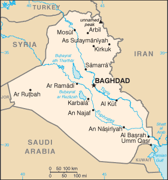
Iraq (Small Map) 2008 (13K)
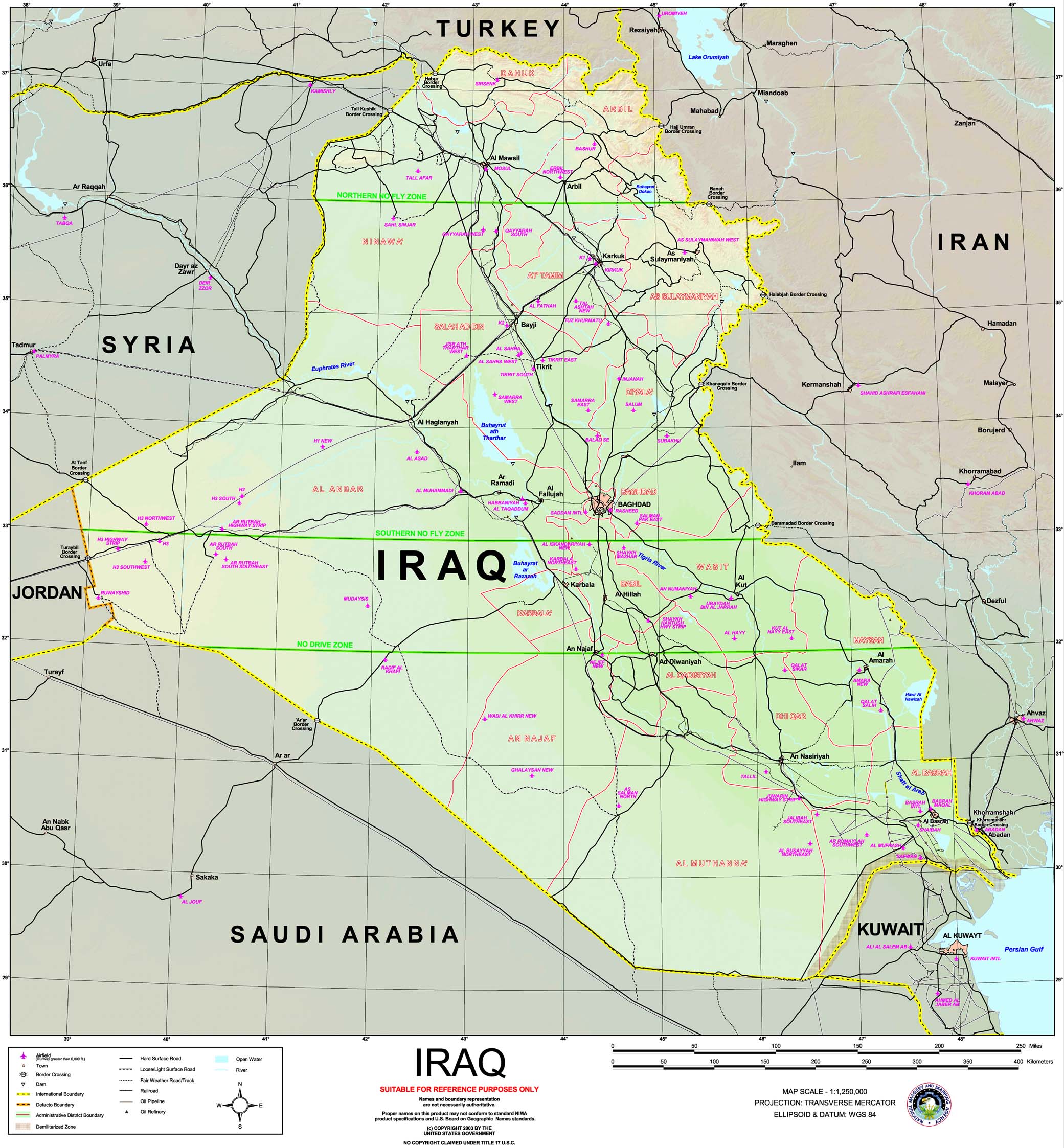
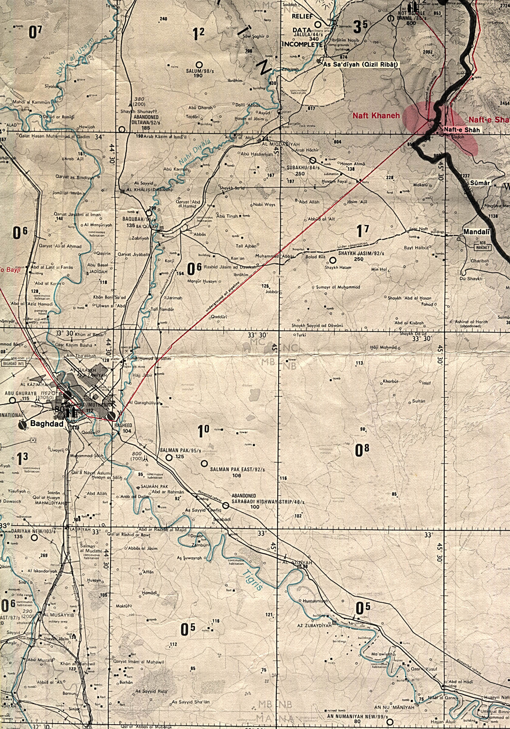
Iraq (Special Reference Graphic) NIMA 2003 (608K)
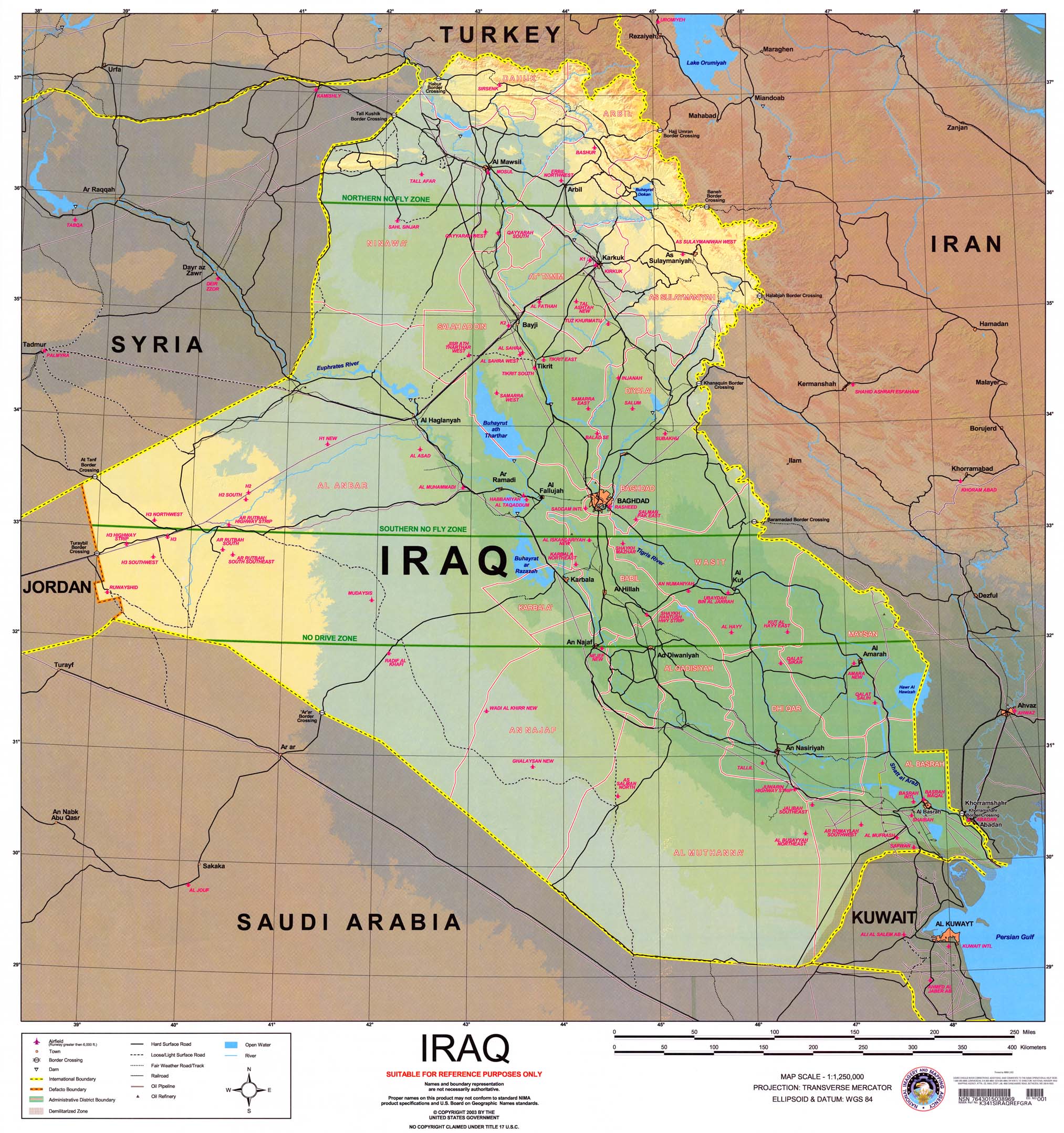
Iraq (Special Reference Graphic) NIMA 2003 (608K) with gradient tints
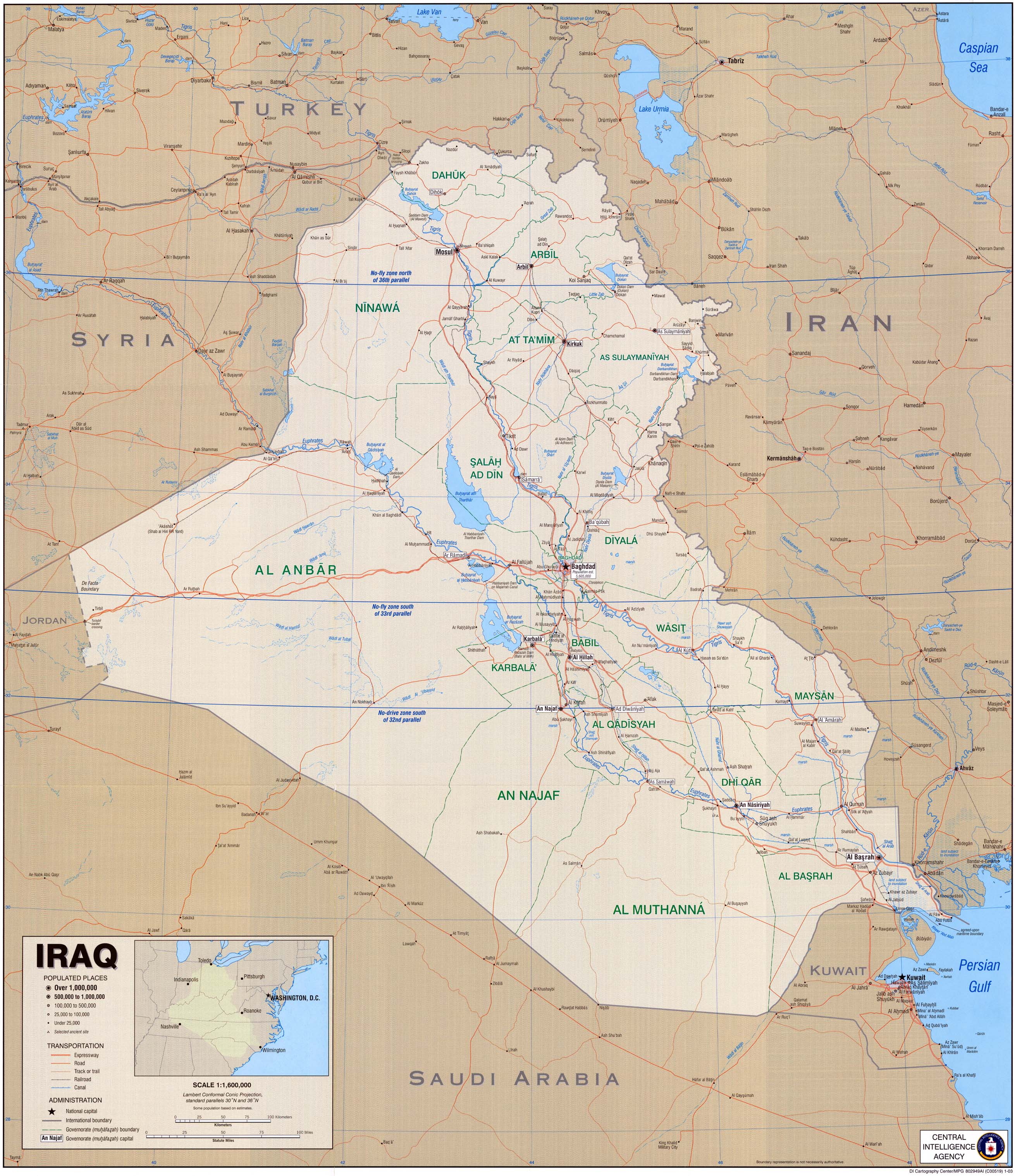
Iraq (1,290K) CIA 2003
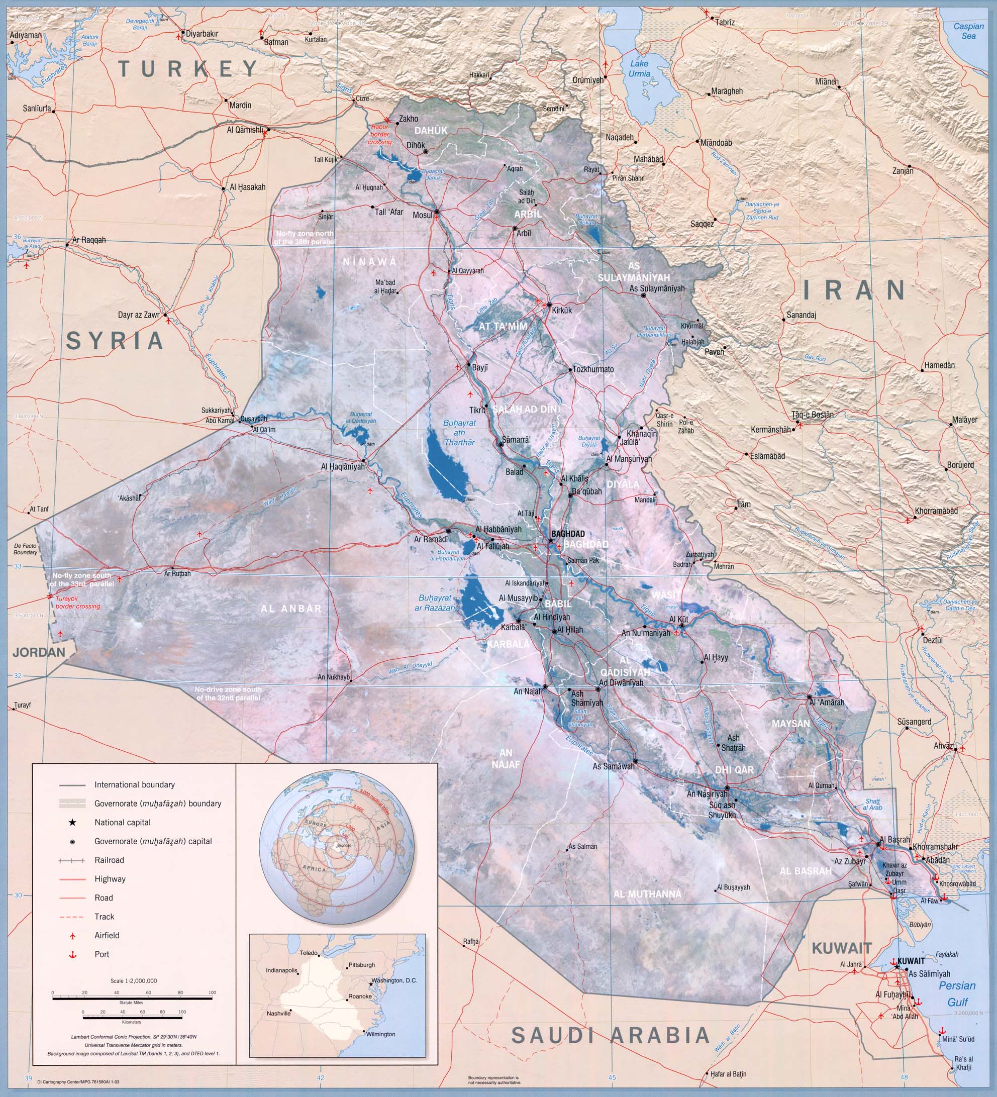
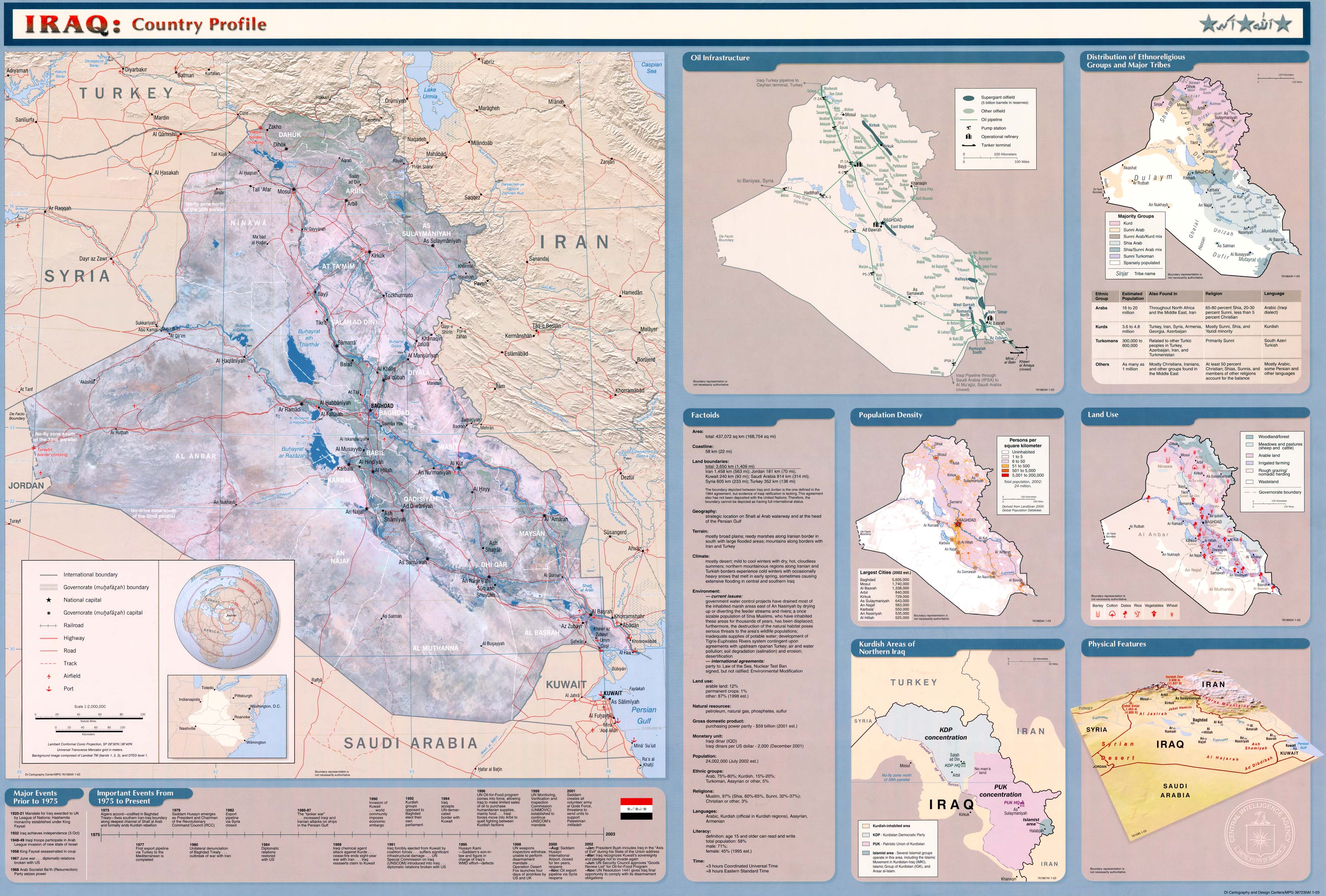
Iraq (632K) From Iraq: Country Profile, 2003 and
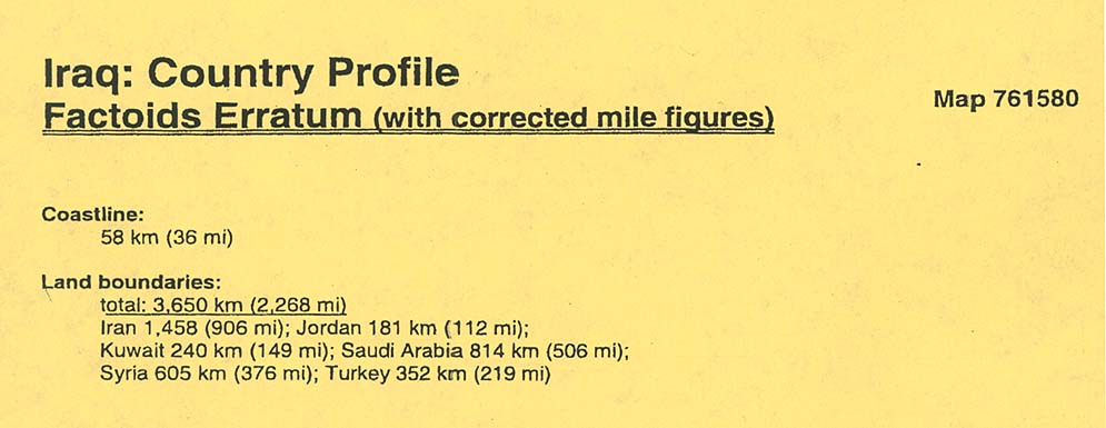
Entire Map with insets (1.2MB) and Factoids Erratum
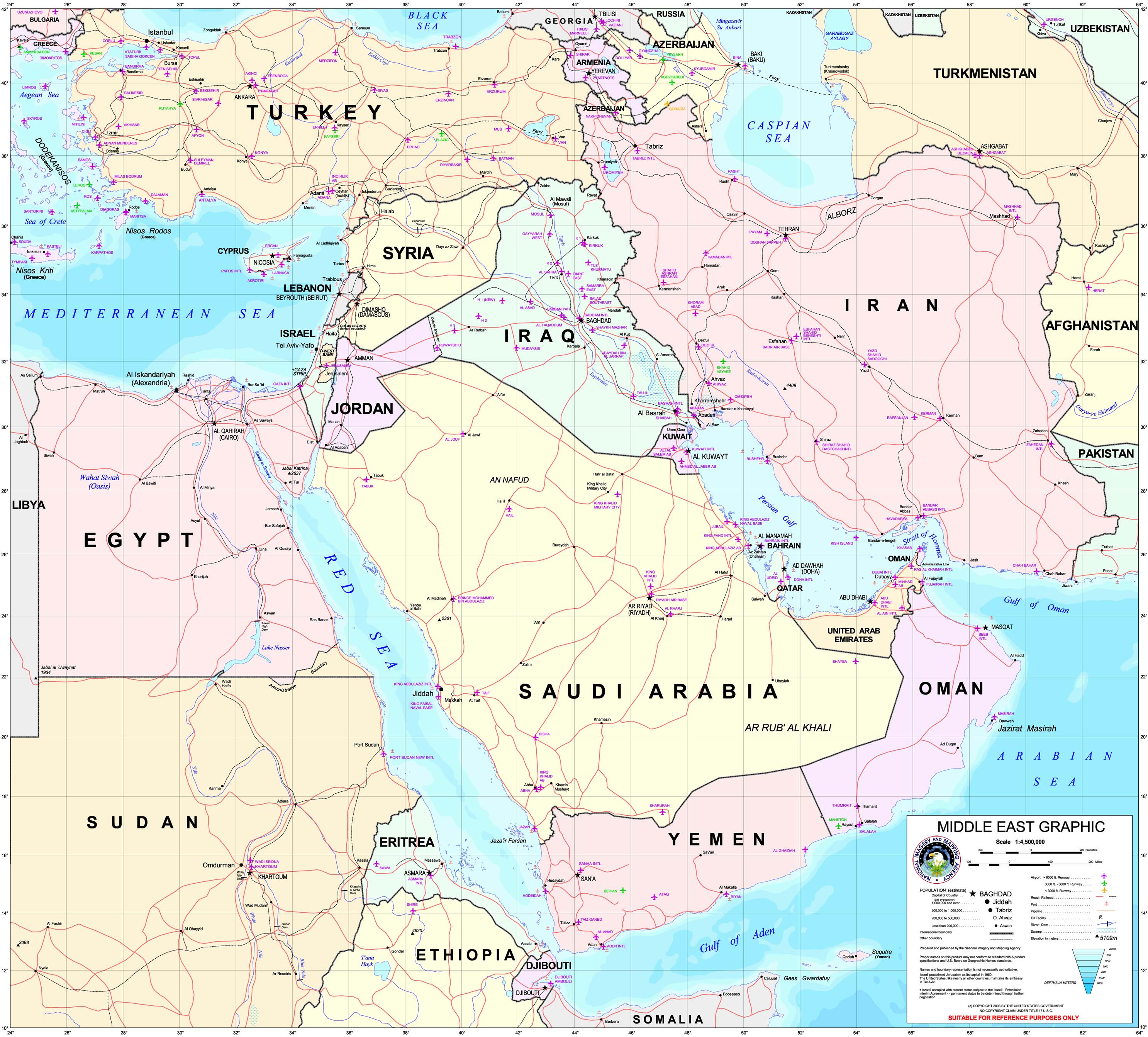
Middle East Graphic (Special Reference Graphic) NIMA 2003 (1MB)
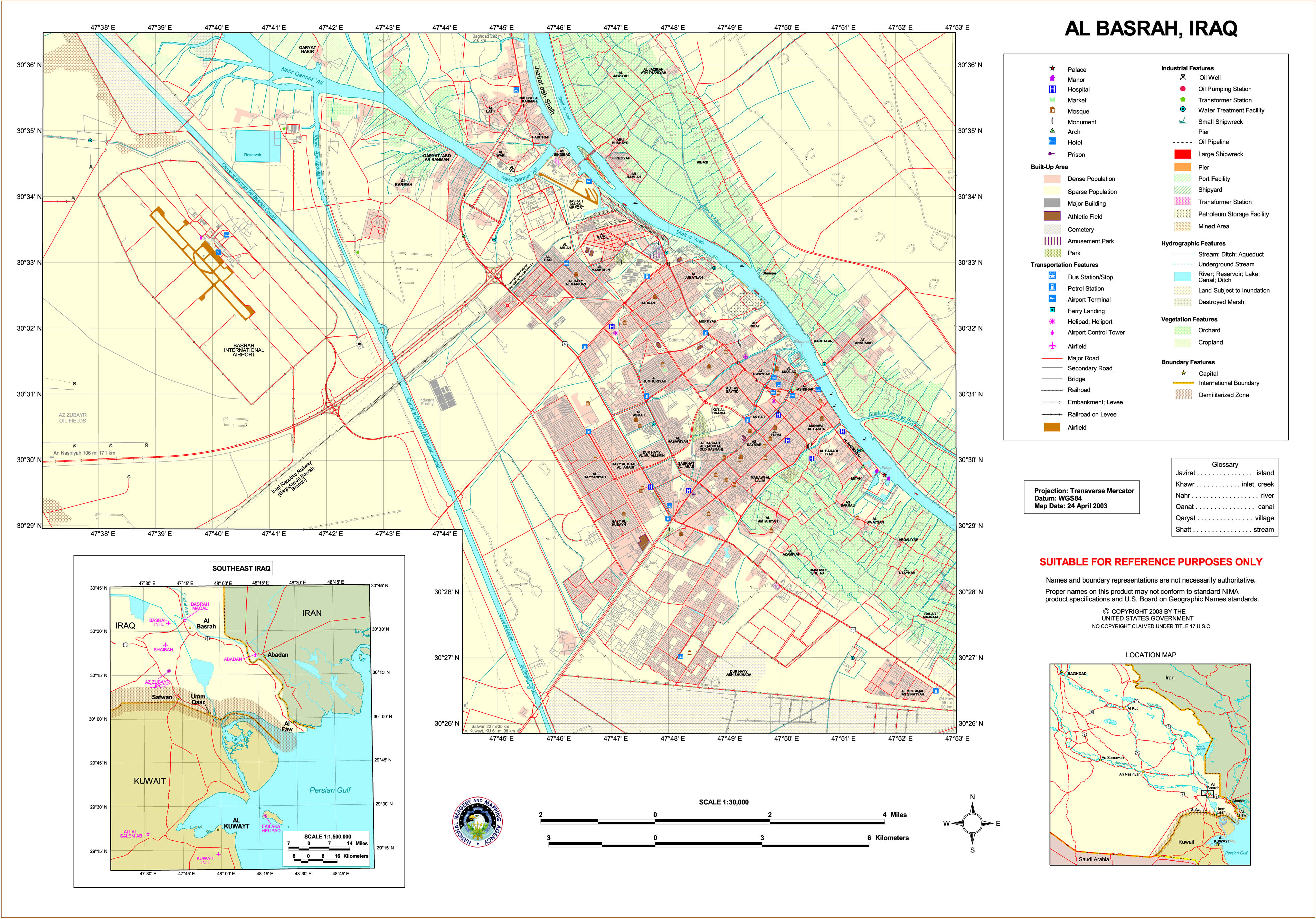
Al Basrah (Special Reference Graphic) NIMA 2003 (2MB)
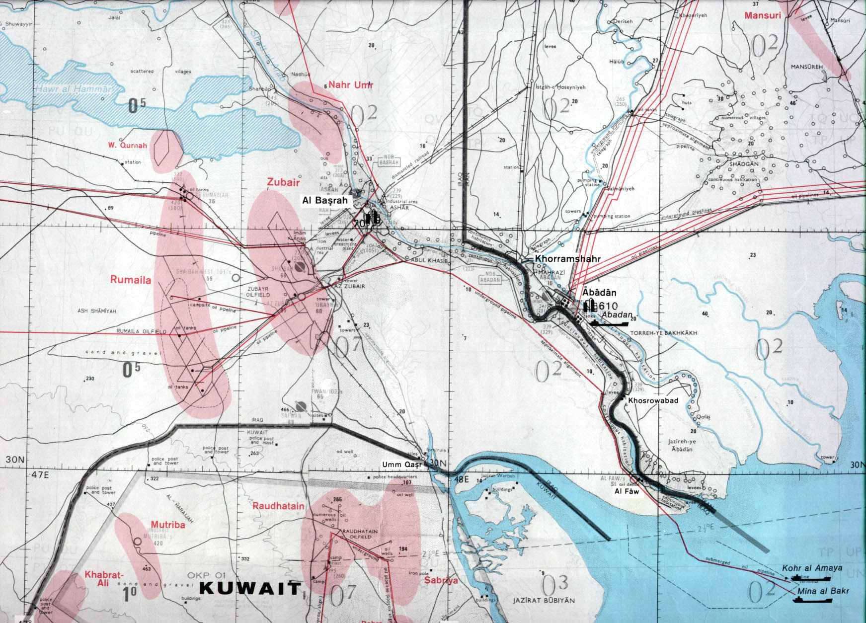
[Al Basrah] Basra (topographic map in Russian) original scale 1:200,000 Portion of Soviet General Staff map H-38-XVIII 1990 (540K)
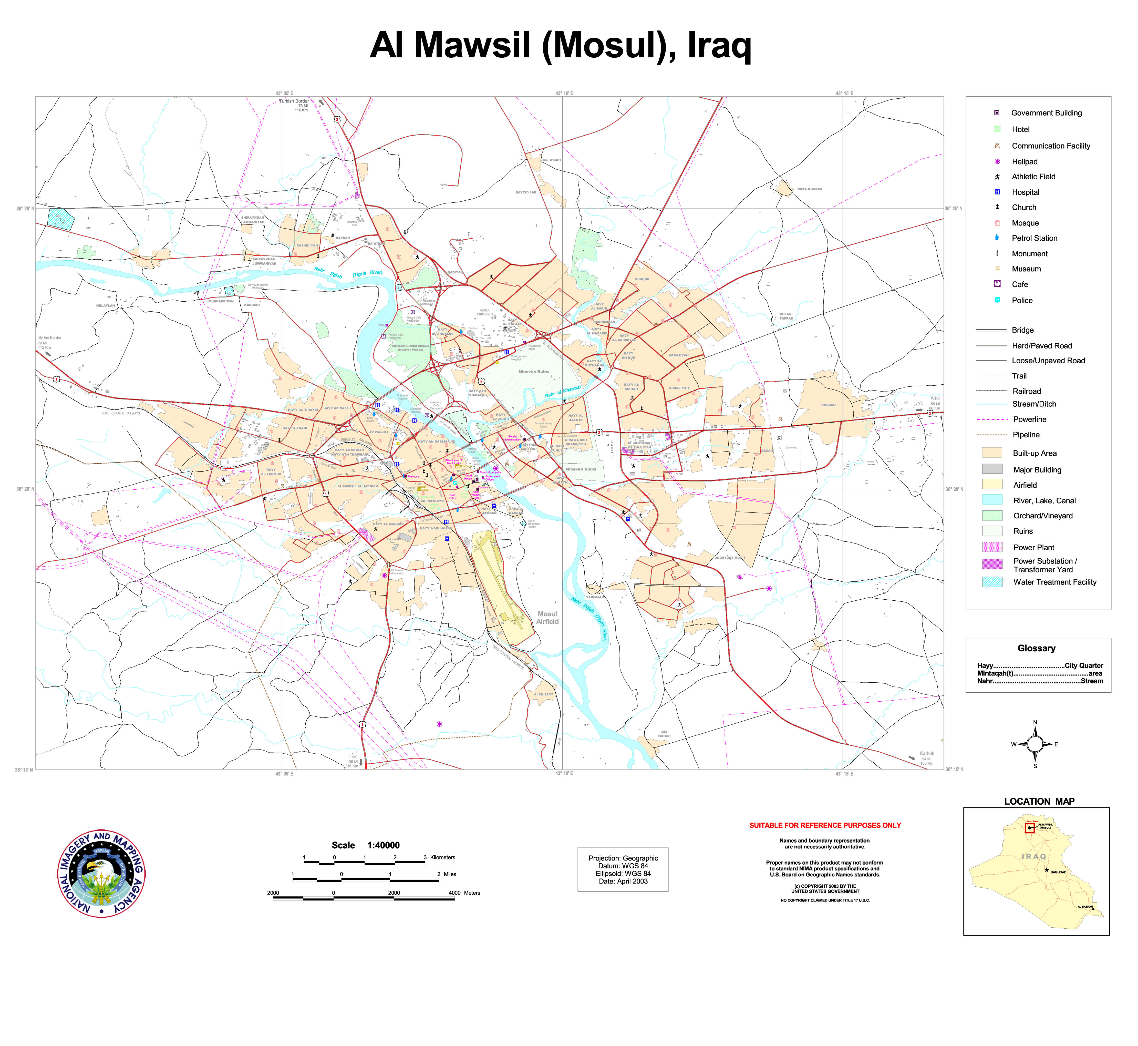
Al Mawsil (Mosul) (Special Reference Graphic) NIMA 2003 (1.8MB)
Baghdad From Central and Southern Iraq [map], CIA, February 2003 (250K)
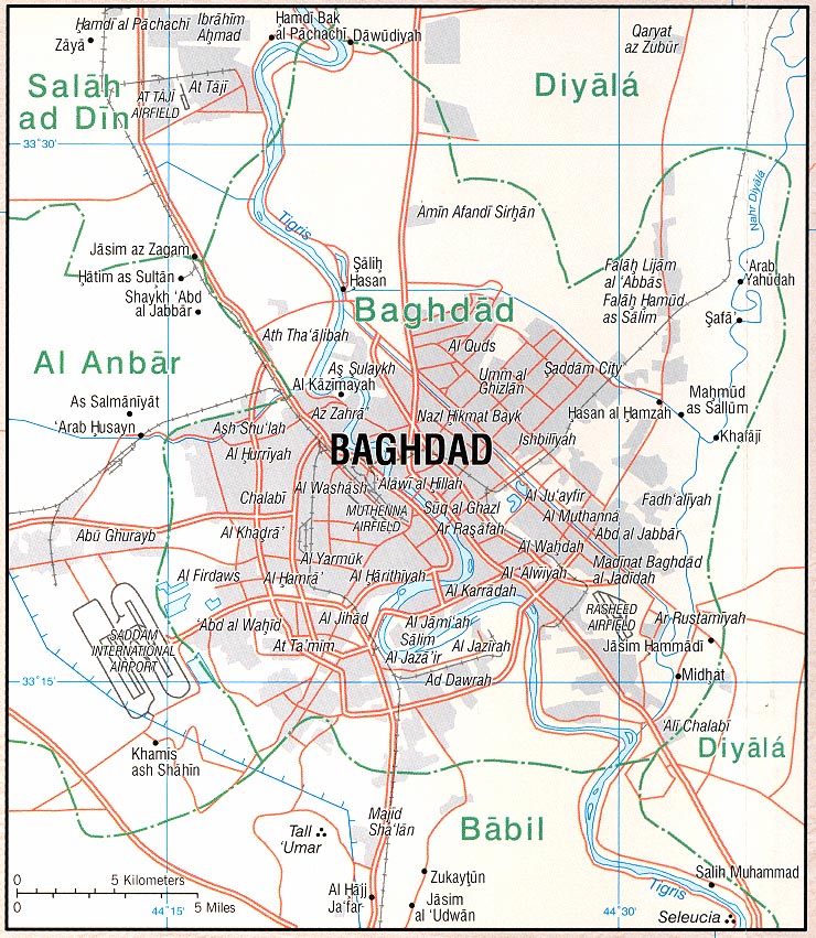
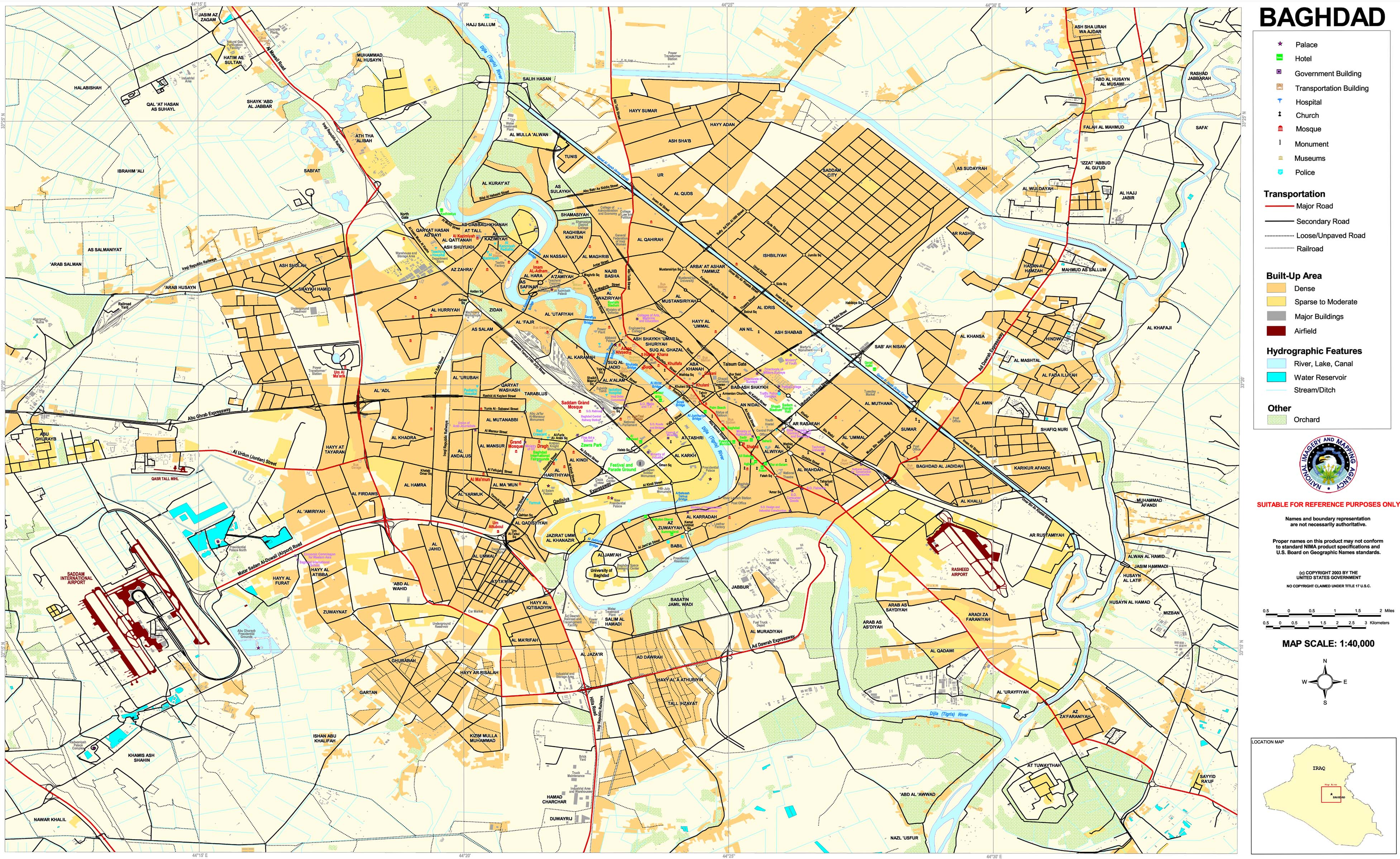
Baghdad (Special Reference Graphic) NIMA 2003 (1.5M)
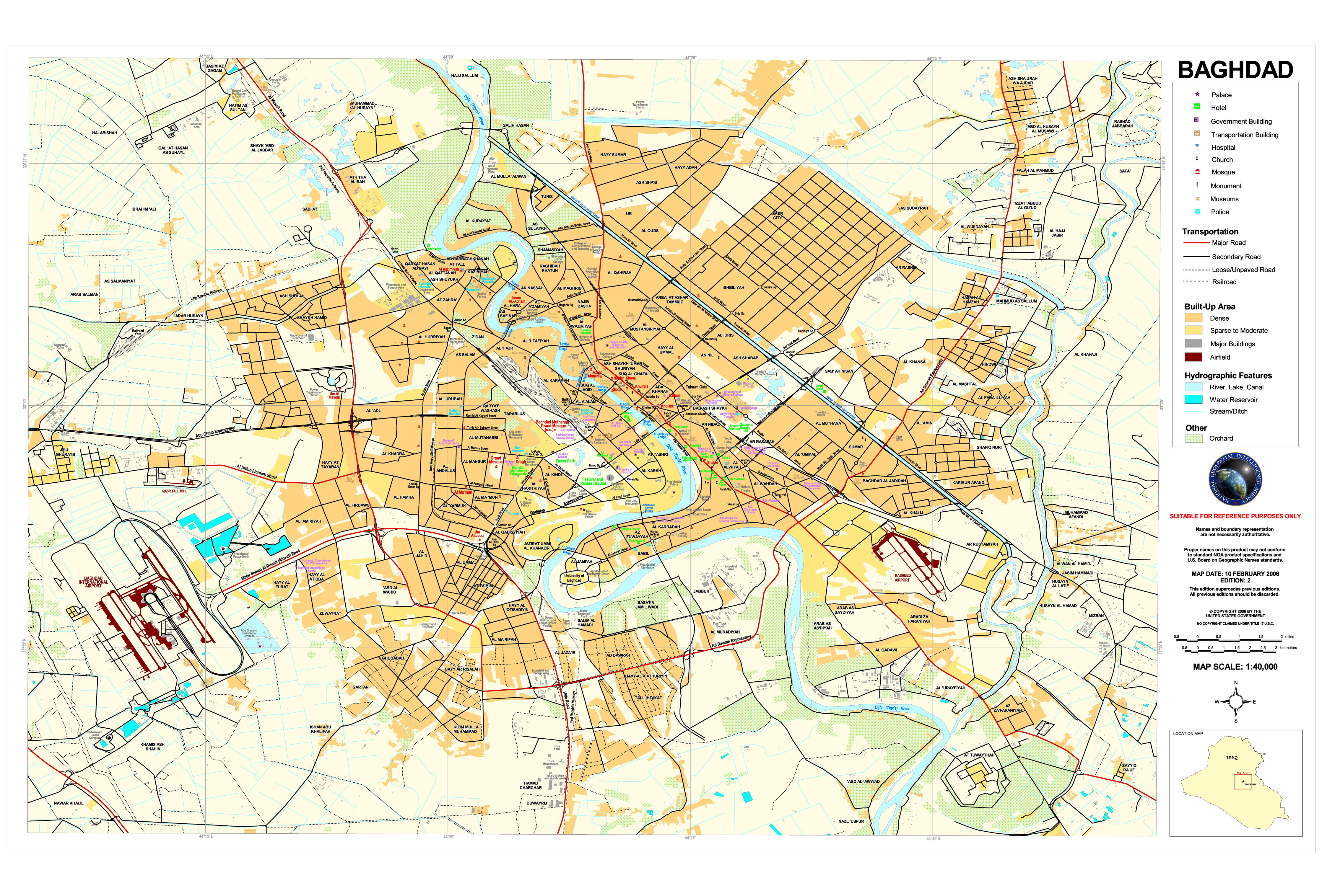
Baghdad National Geospatial-Intelligence Agency 2006 (3.3 MB)
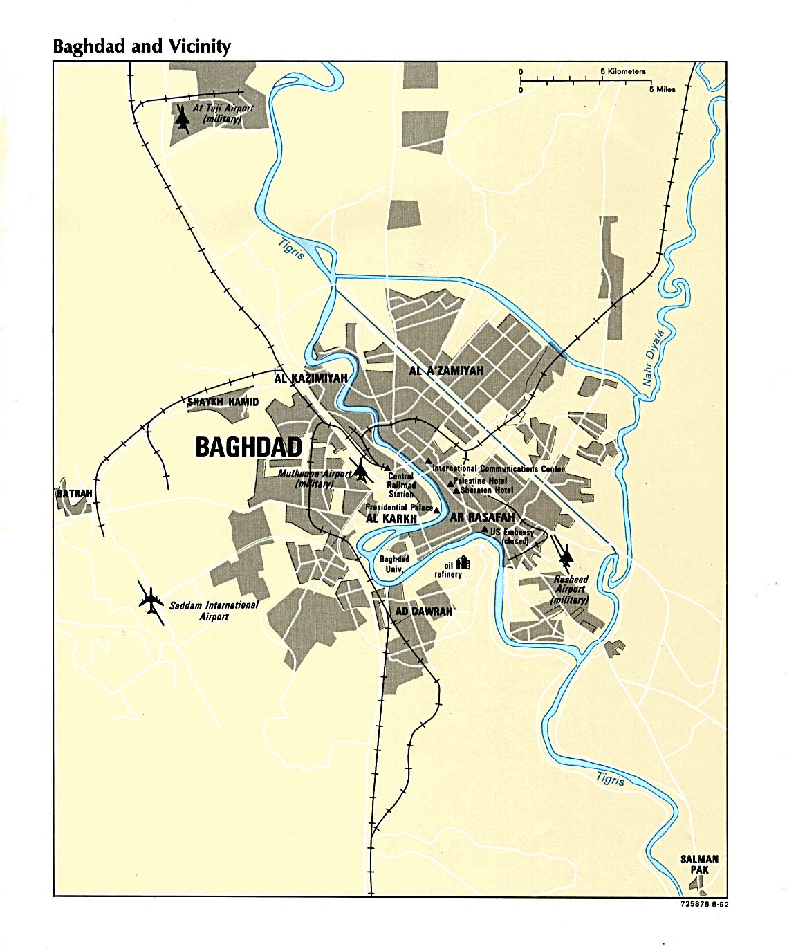
Baghdad CIA 1992 (206K)
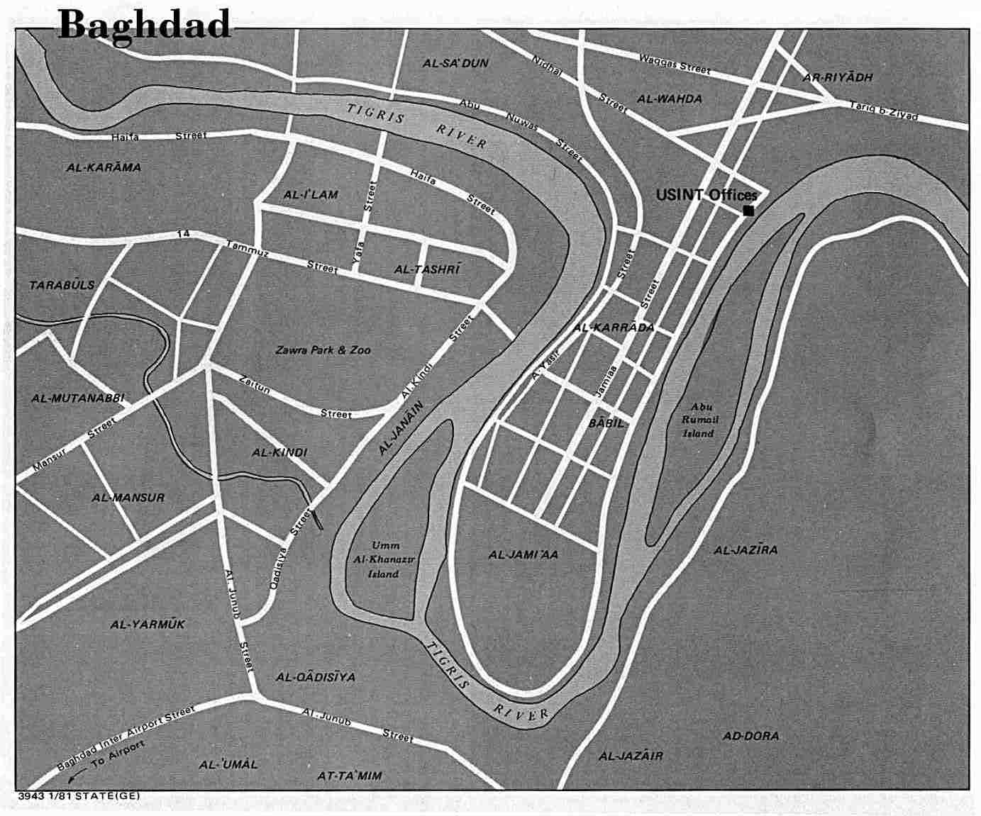
Baghdad U.S. Dept. of State 1981 (98K)
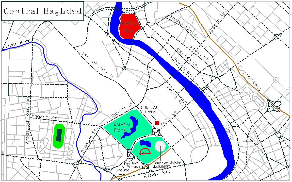
Central Baghdad 1998 (428K) Kenny Hopper, University of Texas
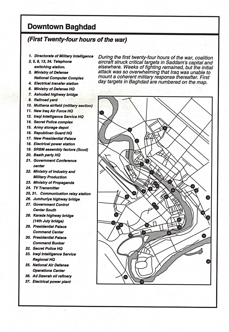
Downtown Baghdad: Initial Targets Jan. 1991 From Decisive Force by Richard G. Davis, U.S. Air Force, 1996 (201K)
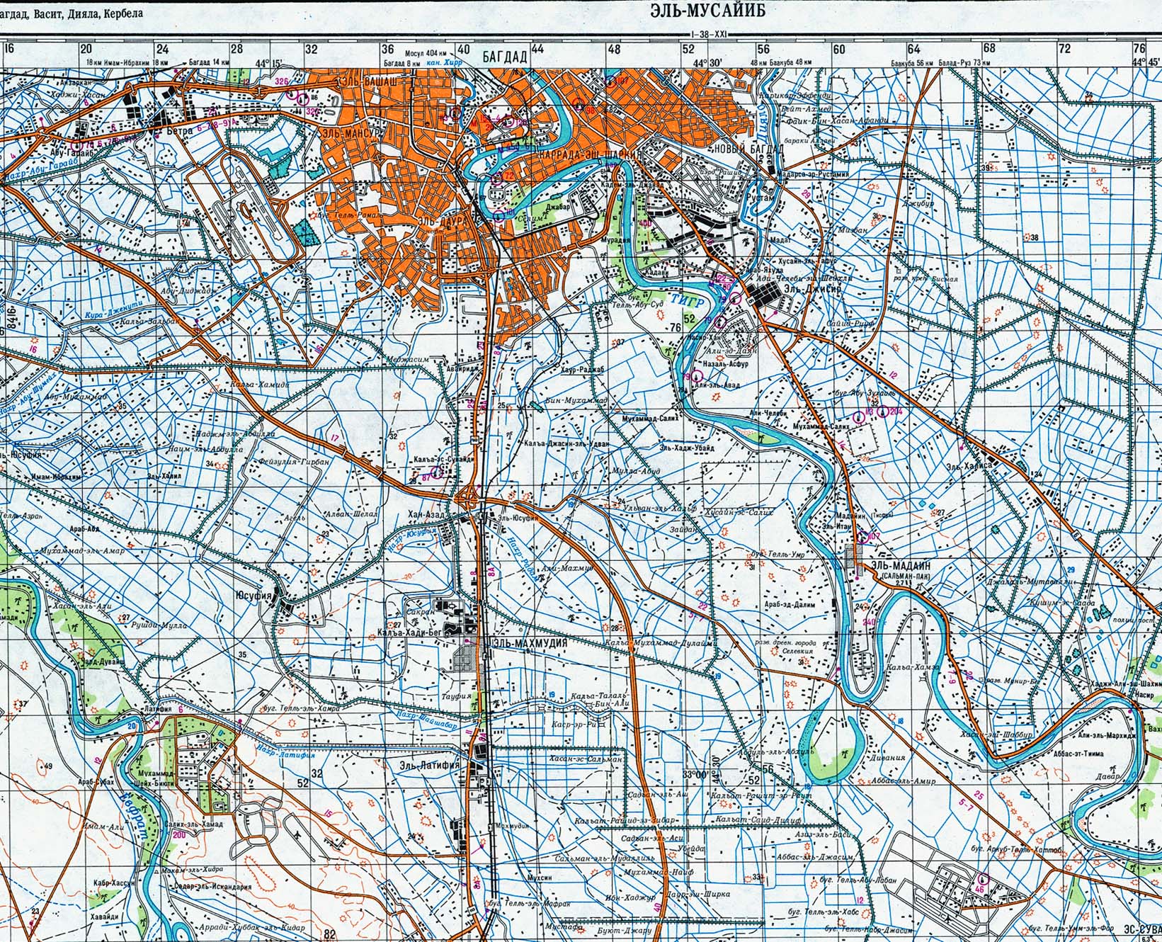
Baghdad - North (topographic map in Russian) original scale 1:200,000 Portion of Soviet General Staff map I-38-XXI 1991 (843K)
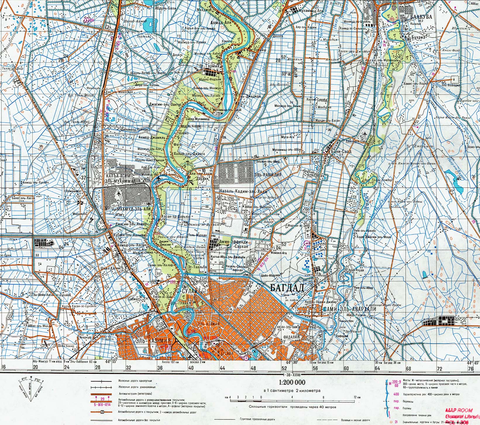
Baghdad - South (topographic map in Russian) original scale 1:200,000 Portion of Soviet General Staff map I-38-XXVII 1991 (833K)
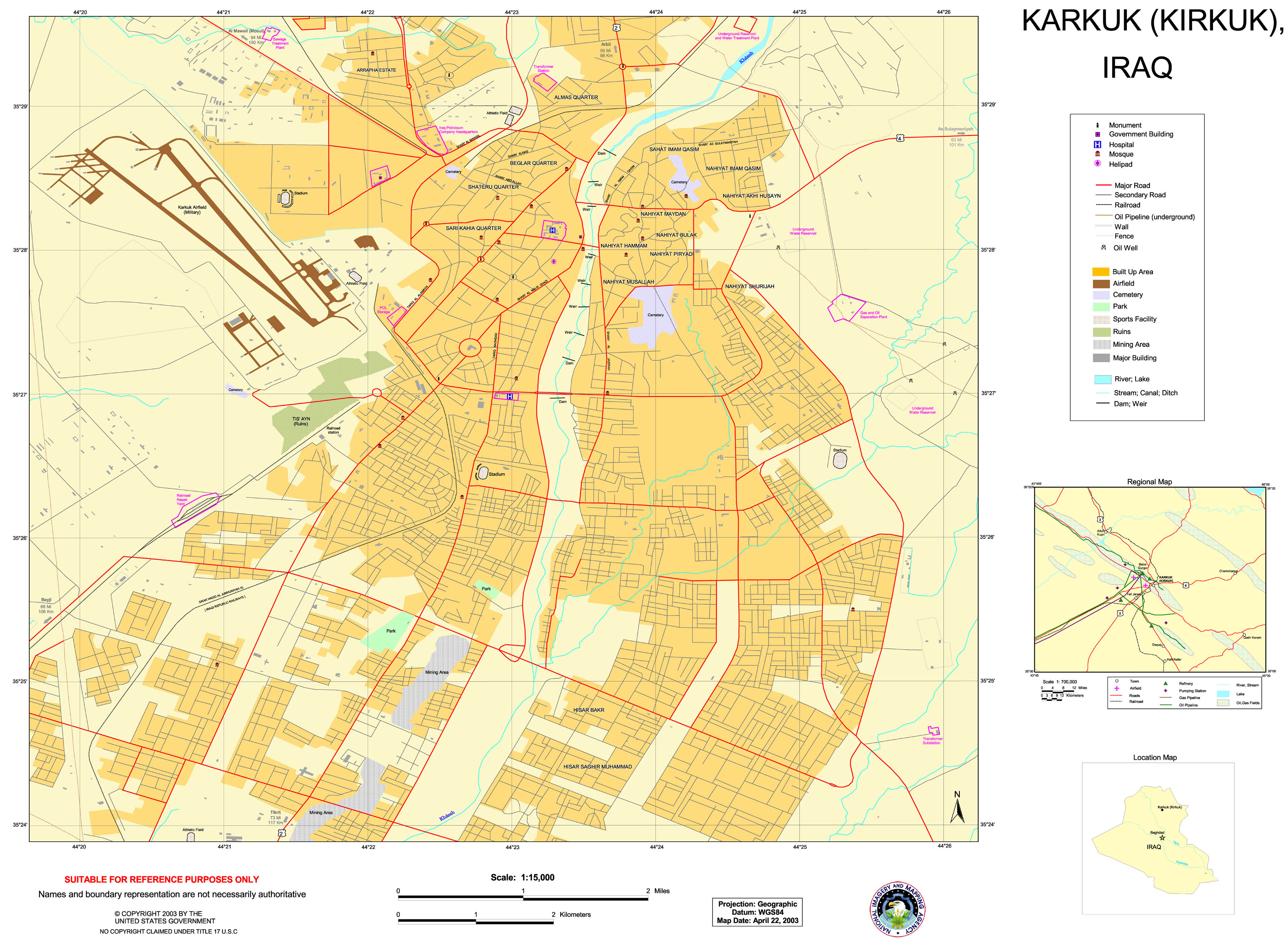
Karkuk (Kirkuk) (Special Reference Graphic) NIMA 2003 (1.3MB)
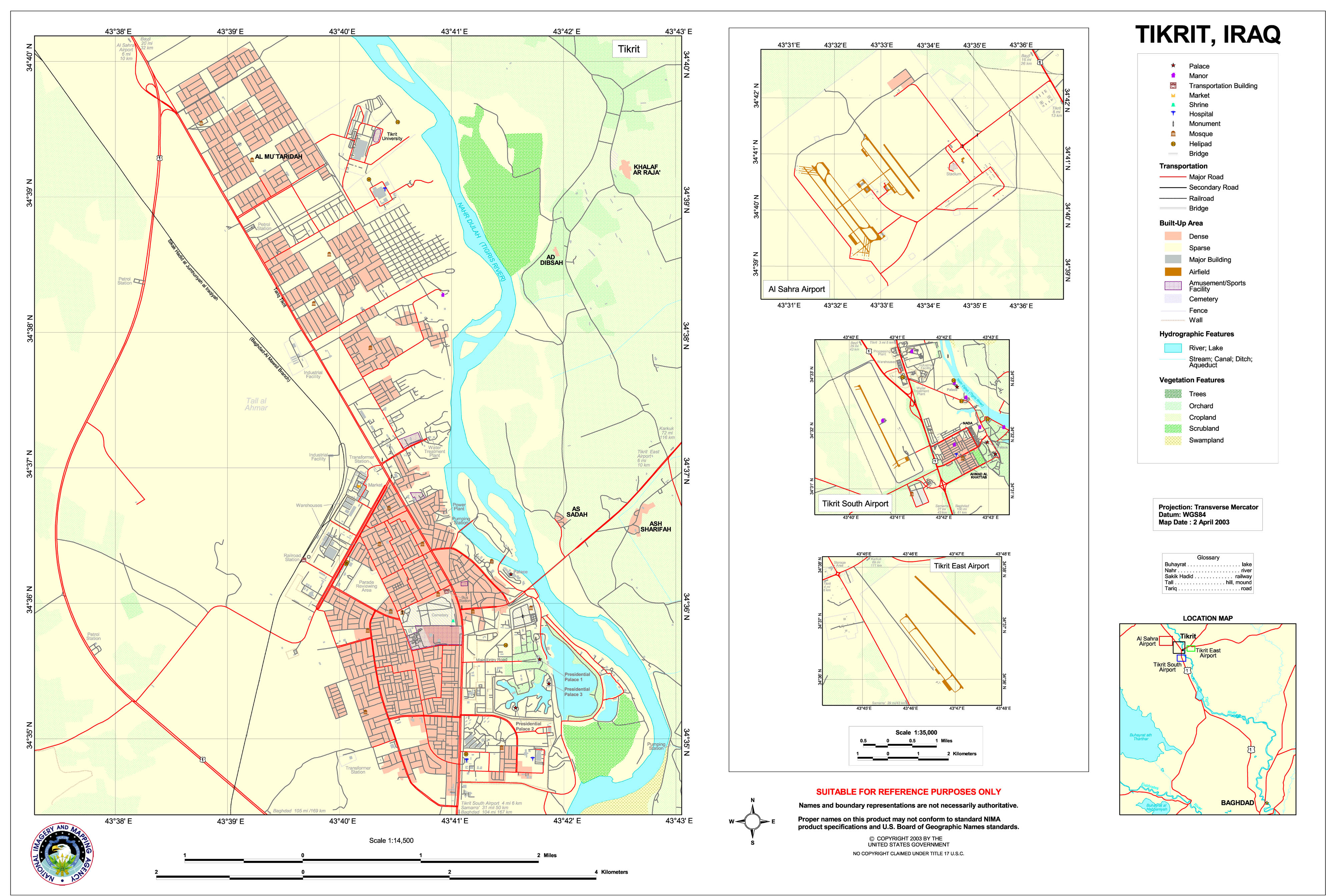
Tikrit (Special Reference Graphic) NIMA 2003 (1.4MB)
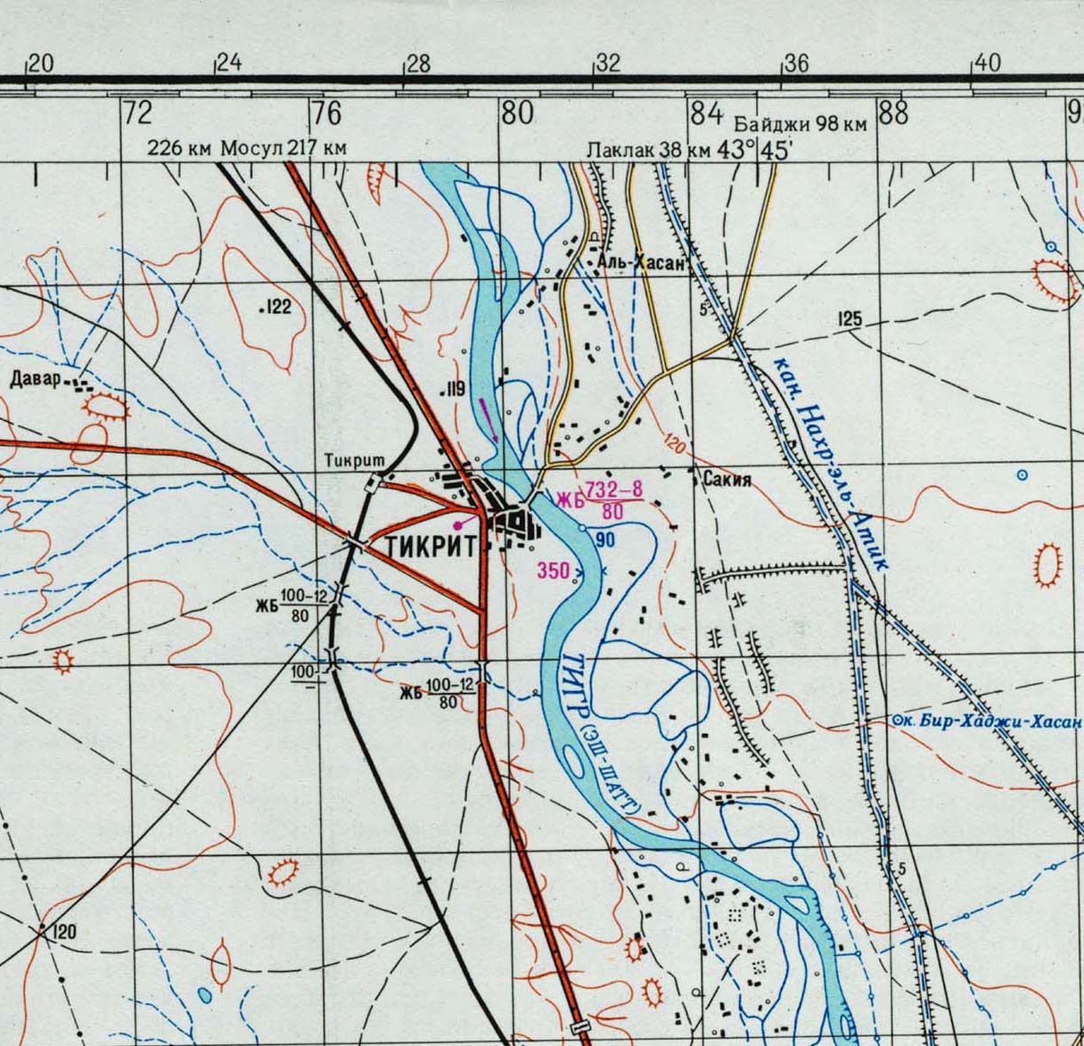
Tikrit (topographic map in Russian) original scale 1:200,000 Portion of Soviet General Staff map I-38-XIV 1972 (263K)
Al Basrah Region - Oil and Gas Fields original scale 1:670,000 From Iraq-Iran: Central and Southern Border Areas CIA 1980 (400K)
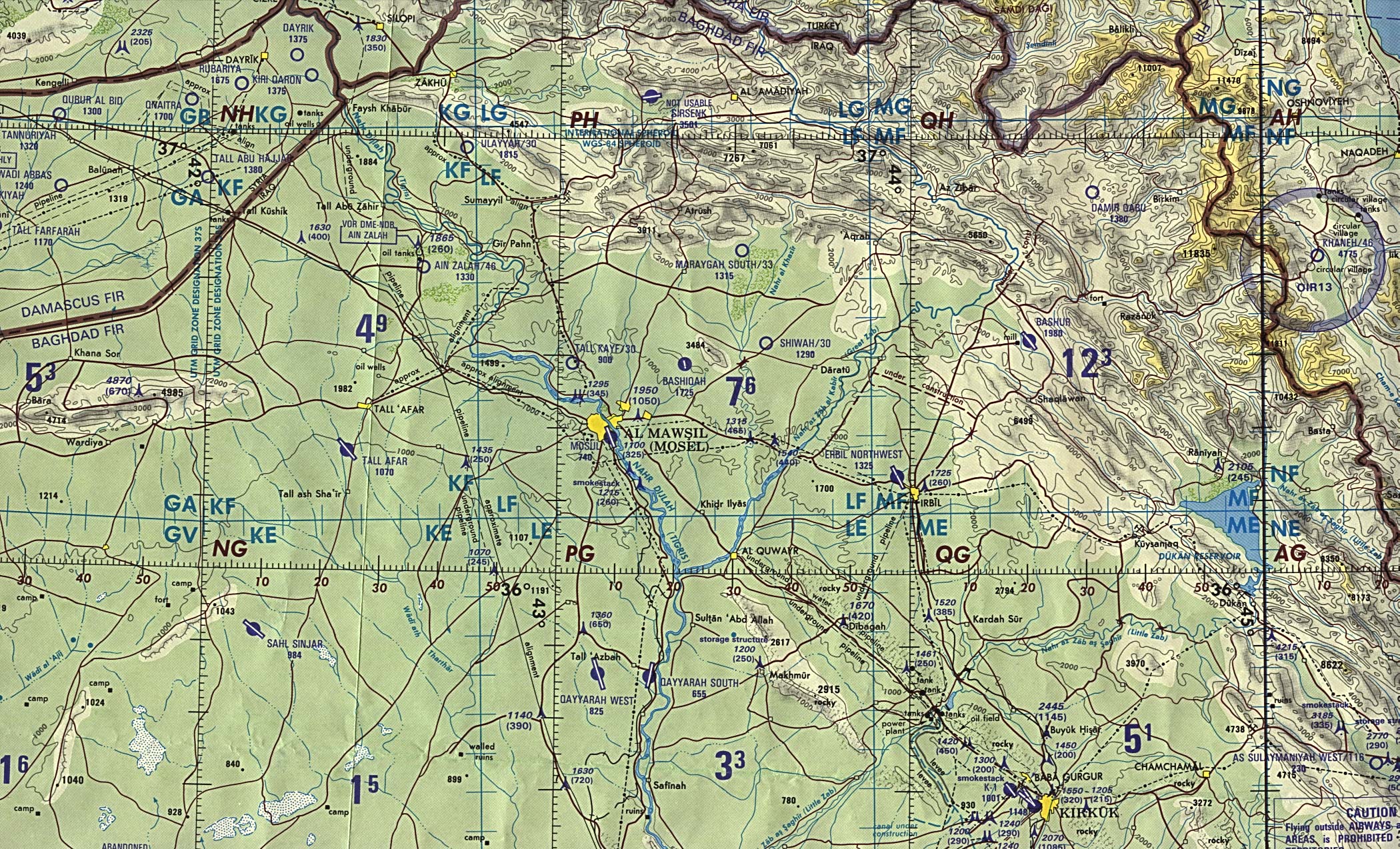
Al Mawsil [Mosul]-Arbil [Irbil] Region, Northern Iraq (tactical pilotage chart) original scale 1:500,000 Portion of Defense Mapping Agency TPC G-4B 1989 (927K) Not for navigational use
Baghdad Region original scale 1:670,000 From Iraq-Iran: Central and Southern Border Areas CIA 1980 (1136K)
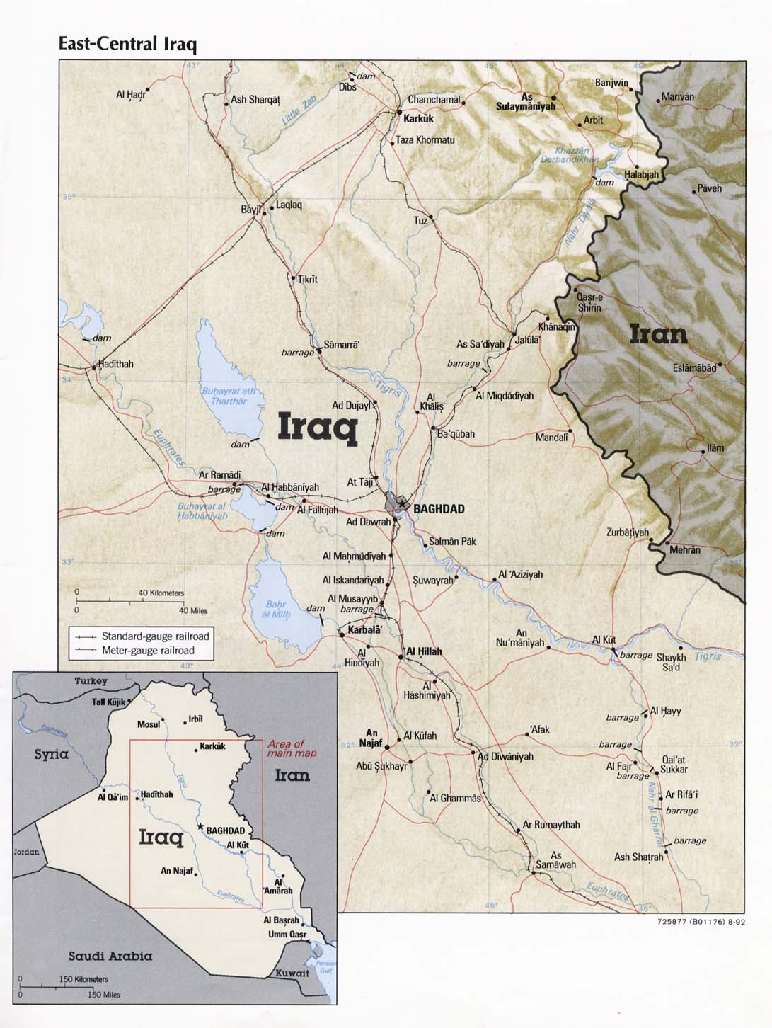
East-Central Iraq From Iraq a Map Folio CIA 1992 (181K)
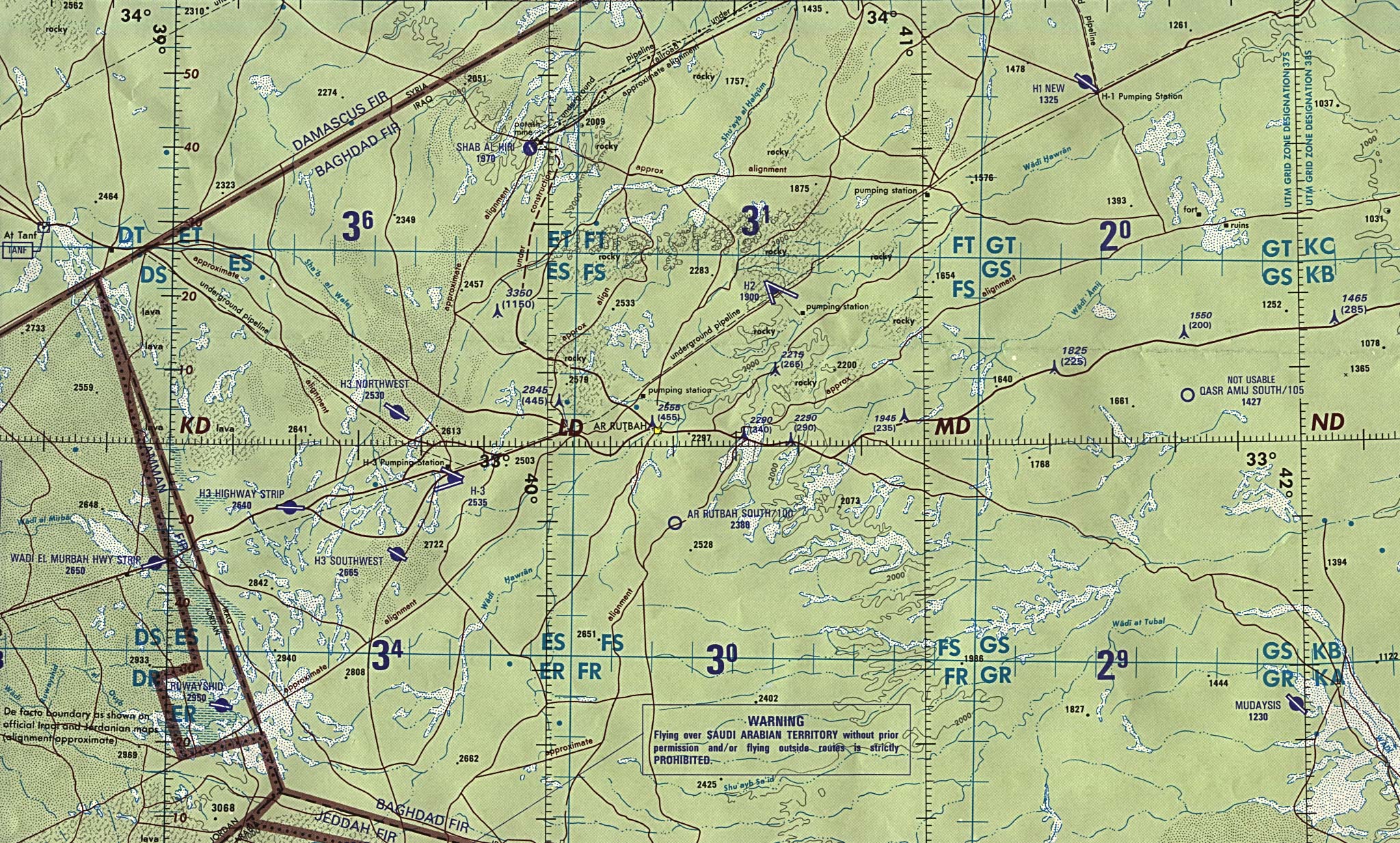
Iraq/Jordan Border (operational navigation chart) original scale 1:1,000,000 Portion of Defense Mapping Agency ONC G-4 1990 (833K) Not for navigational use
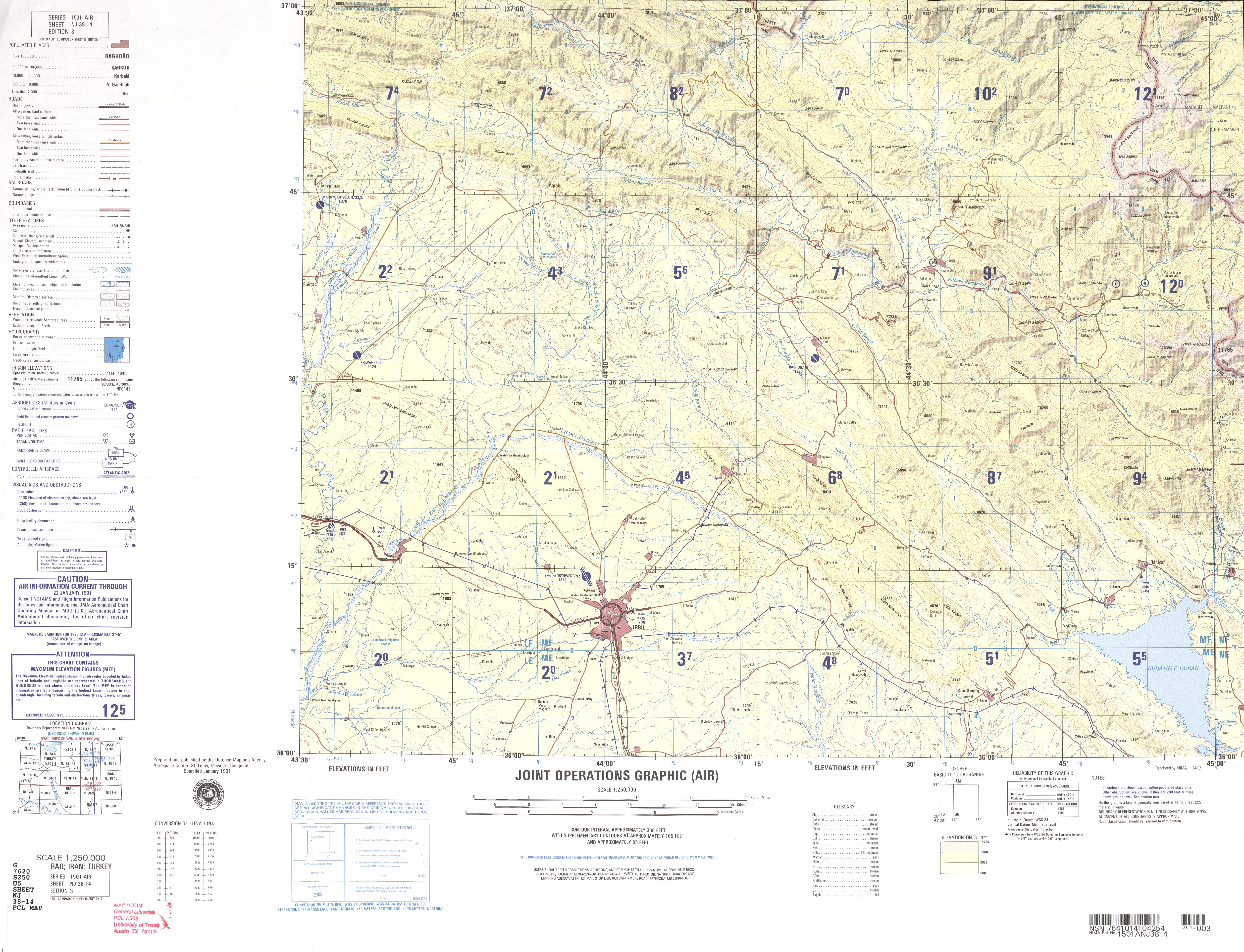
Irbil Region (joint operations graphic) original scale 1:250,000 Defense Mapping Agency Series 1501, Sheet NJ 38-14, Edition 3, 1991 reprinted 2002 (3.9 MB) Not for navigational use
Northern Iraq (operational navigation chart) original scale 1:1,000,000 Portion of Defense Mapping Agency ONC G-4 1990 (1MB) Not for navigational use
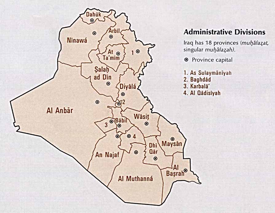
Iraq: Administrative Divisions From Atlas of the Middle East, CIA, 1993 (69K)
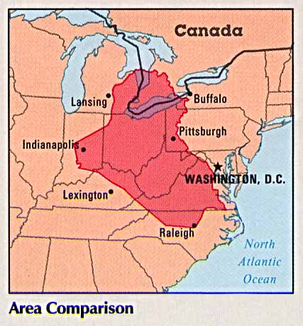
Iraq: Area Comparison From Atlas of the Middle East, CIA, 1993 (38K)
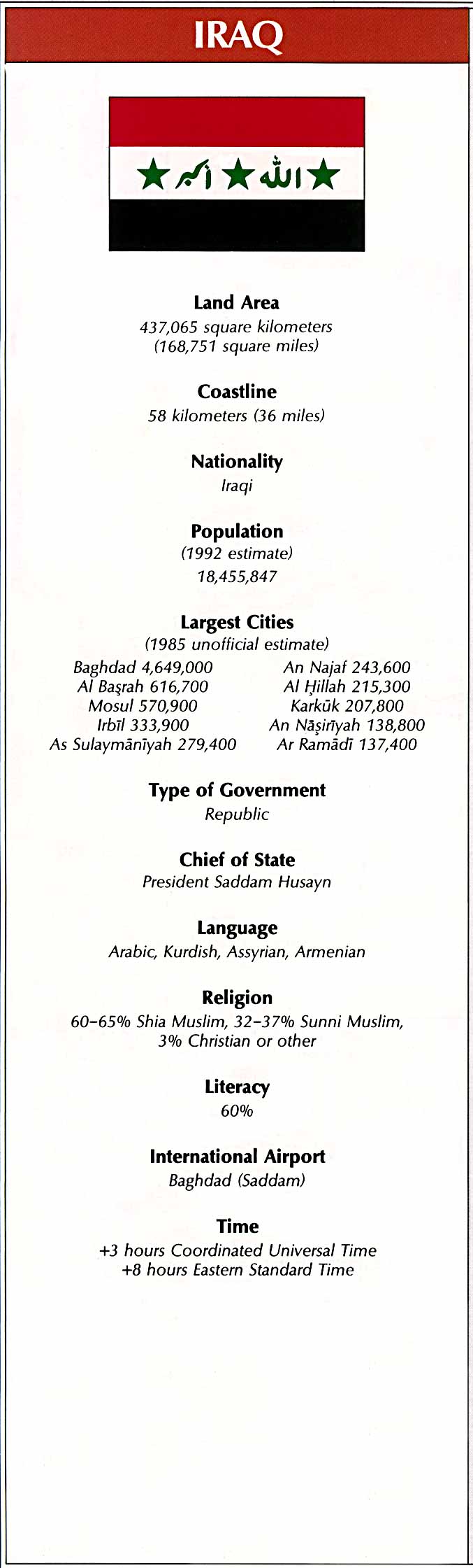
Iraq: Country Information From Atlas of the Middle East, CIA, 1993 (128K) Flag and statistics, not a map
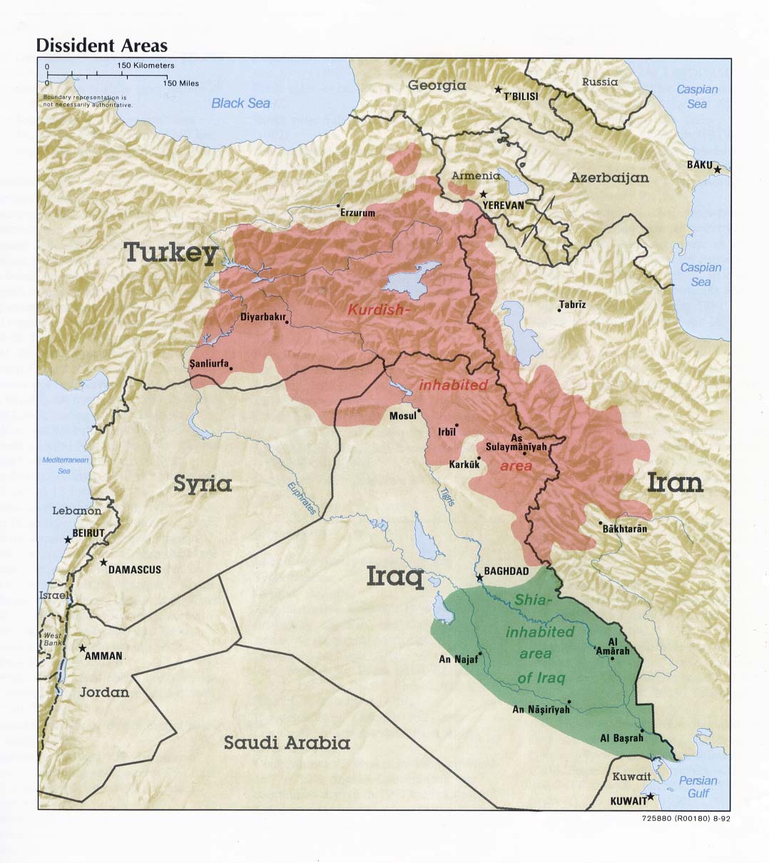
Iraq: Dissident Areas From Iraq a Map Folio, CIA, 1992 (170K)
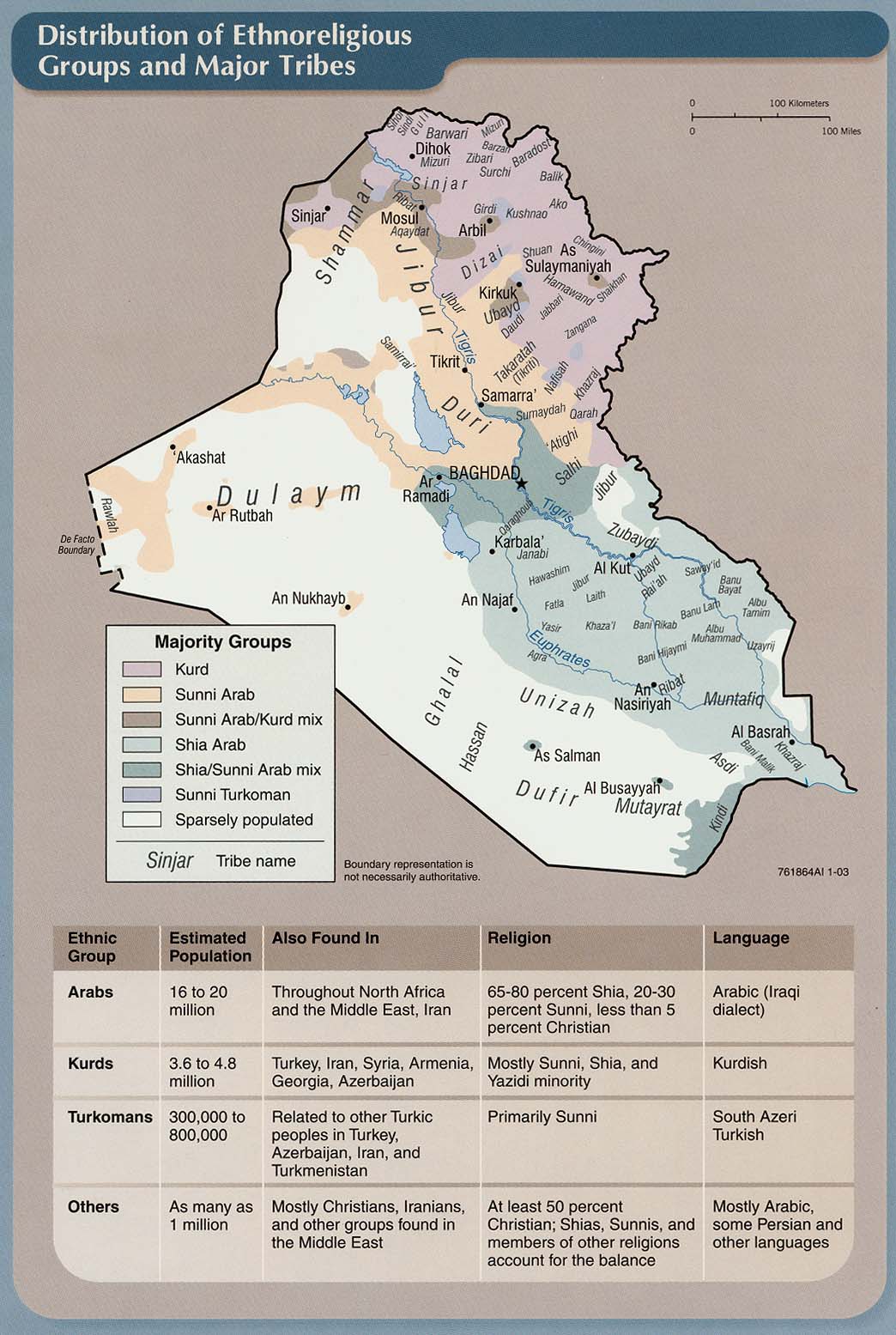
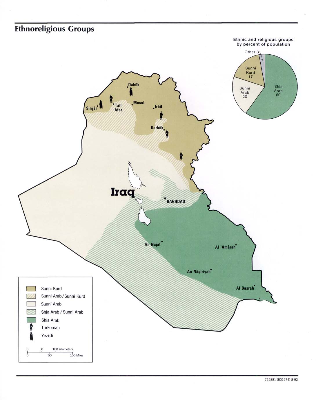
Iraq: Distribution of Ethnoreligious Groups and Major Tribes From Iraq: Country Profile [map], CIA, January 2003 (215K) and
pdf format (216K)
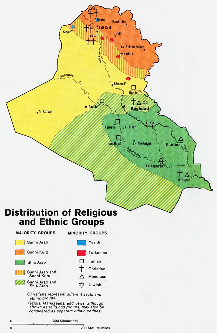
Iraq: Distribution of Religious Groups and Ethnic Groups from Map No. 503930 1978 (163K)
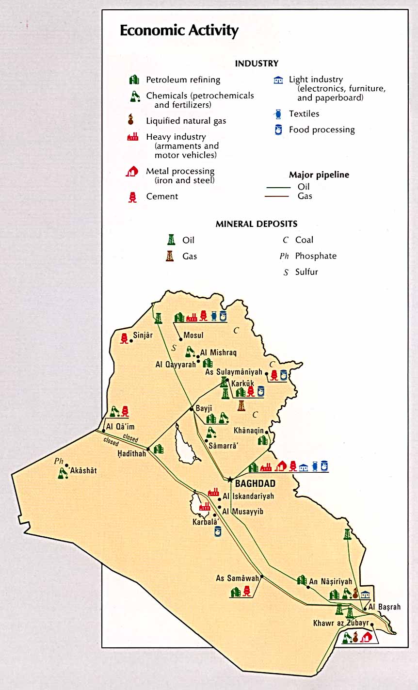
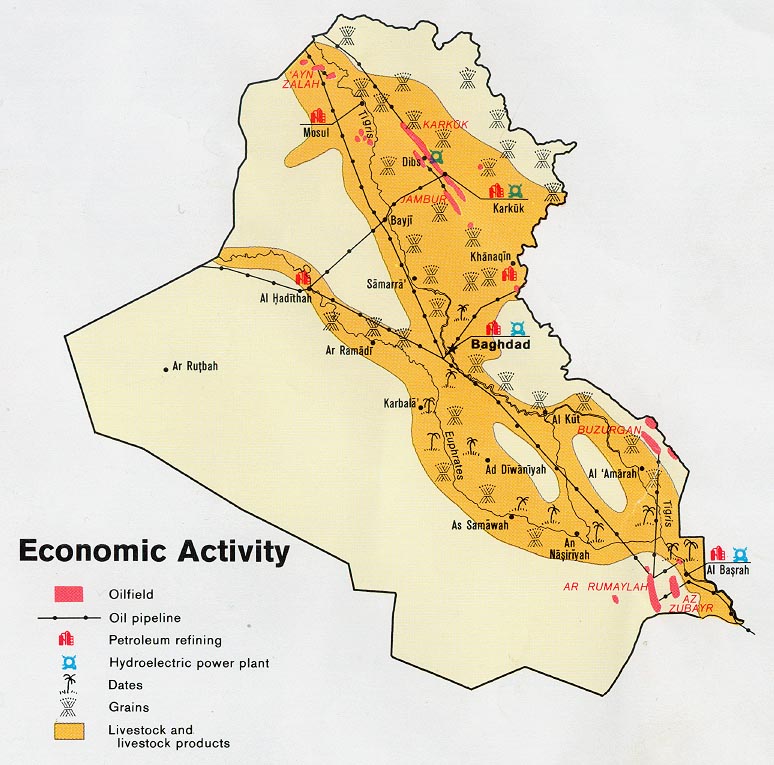
Iraq: Economic Activity From Atlas of the Middle East, CIA, 1993 (115K)
Iraq: Economic Activity from Map No. 503930 1978 (134K)
Iraq: Ethnoreligious Groups From Iraq a Map Folio, CIA, 1992 (112K)
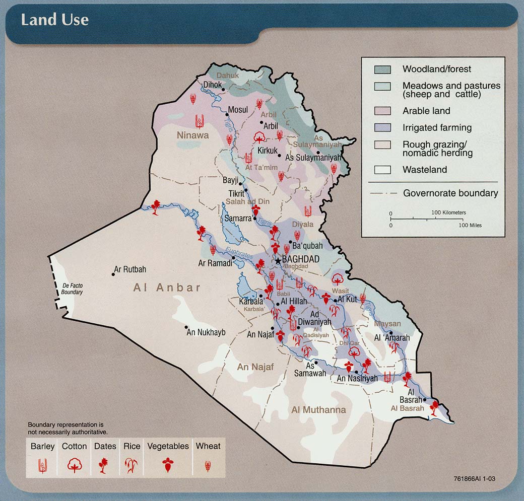
Iraq: Land Use From Iraq: Country Profile [map], CIA, January 2003 (213K) and
pdf format (211K)
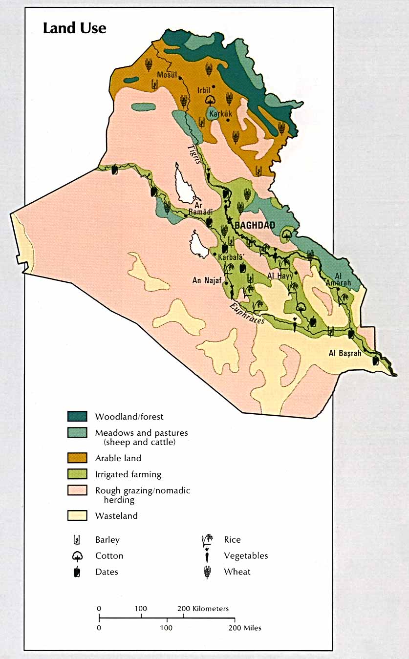
Iraq: Land Use From Atlas of the Middle East, CIA, 1993 (111K)
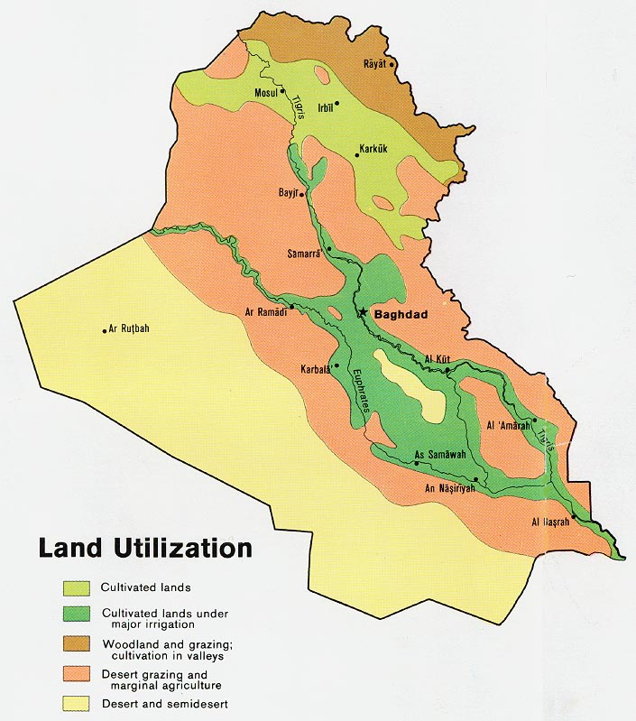
Iraq: Land Utilization from Map No. 503930 1978 (127K)
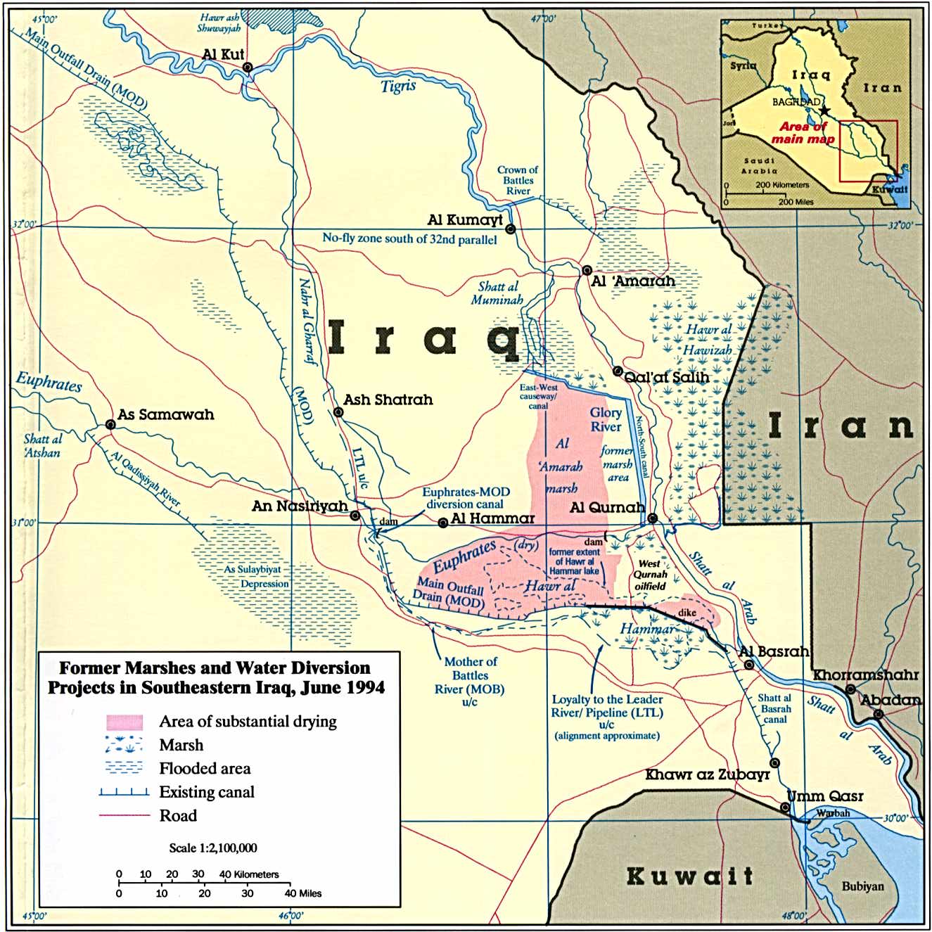
Iraq - Marshes - Former Marshes and Water Diversion Projects in Southeastern Iraq From The Destruction of Iraq's Southern Marshes, CIA Publication IA 94-10020, 1994 (243K)
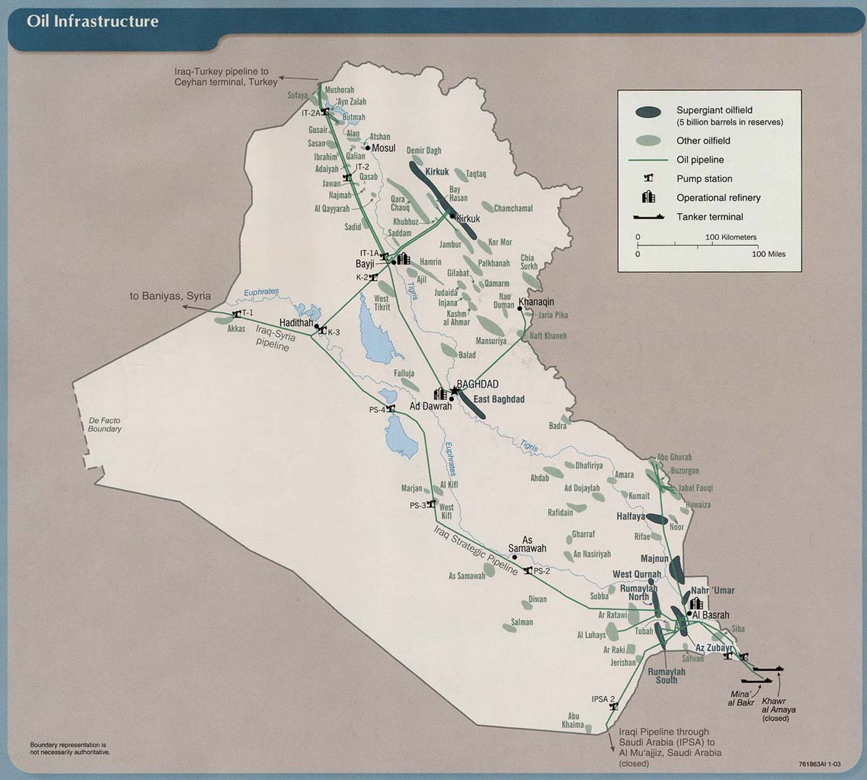
Iraq: Oil Infrastructure From Iraq: Country Profile [map], CIA, January 2003 (157K) and
pdf format (160K)
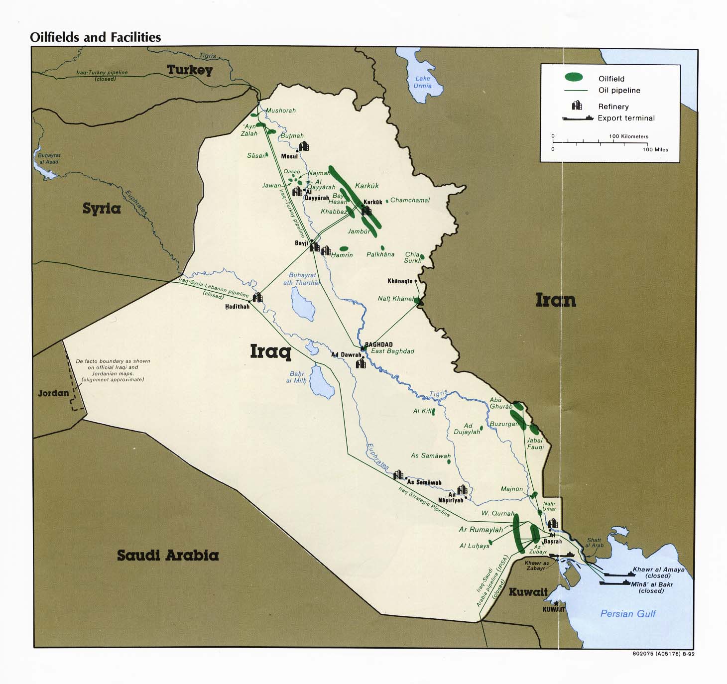
Iraq: Oilfields and Facilities From Iraq a Map Folio, CIA, 1992 (182K)
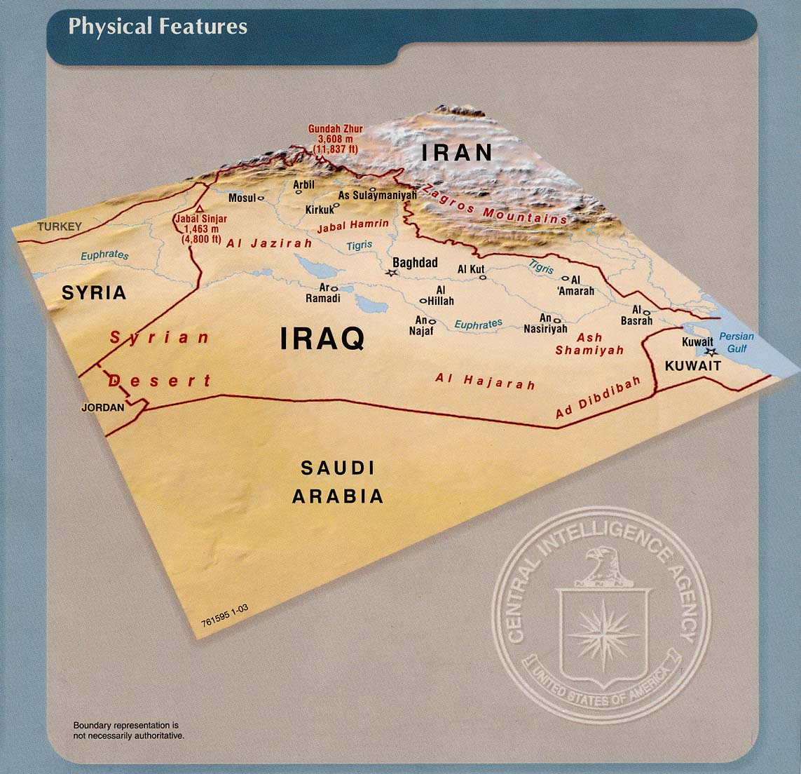
Iraq: Physical Features From Iraq: Country Profile [map], CIA, January 2003 (226K) and
pdf format (221K)
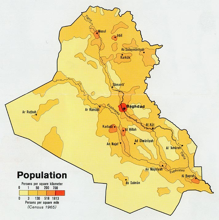
Iraq: Population from Map No. 503930 1978 (124K)
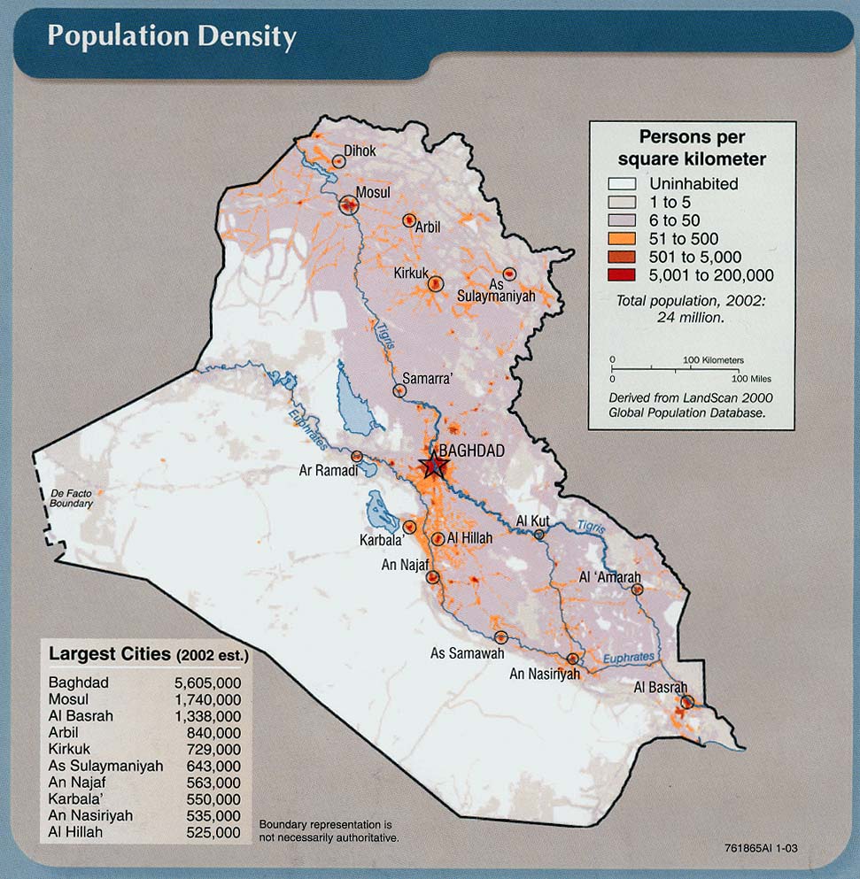
Iraq: Population Density From Iraq: Country Profile [map], CIA, January 2003 (213K) and
pdf format (183K)
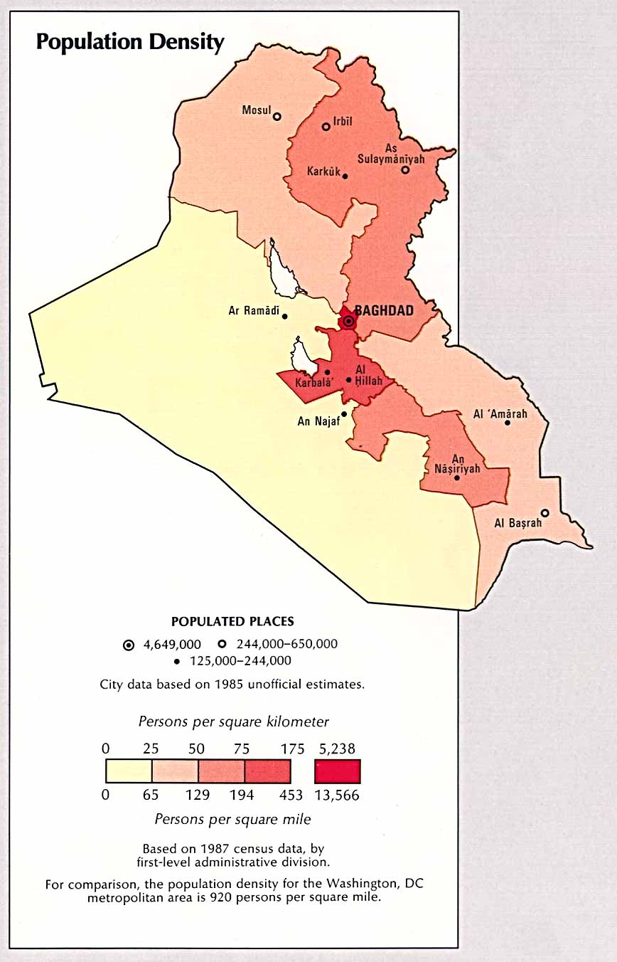
Iraq: Population Density From Atlas of the Middle East, CIA, 1993 (185K)
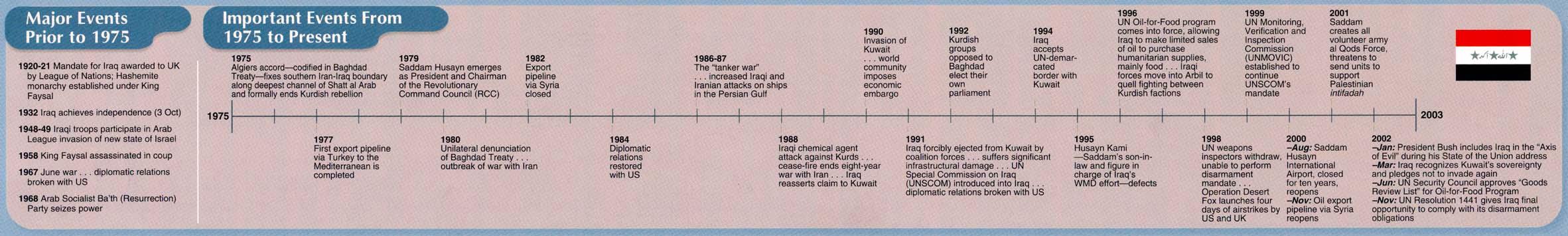
Iraq: Time Line "Major Events Prior to 1975, Important Events from 1975 to Present" From Iraq: Country Profile [map], CIA, January 2003 (151K) Chart
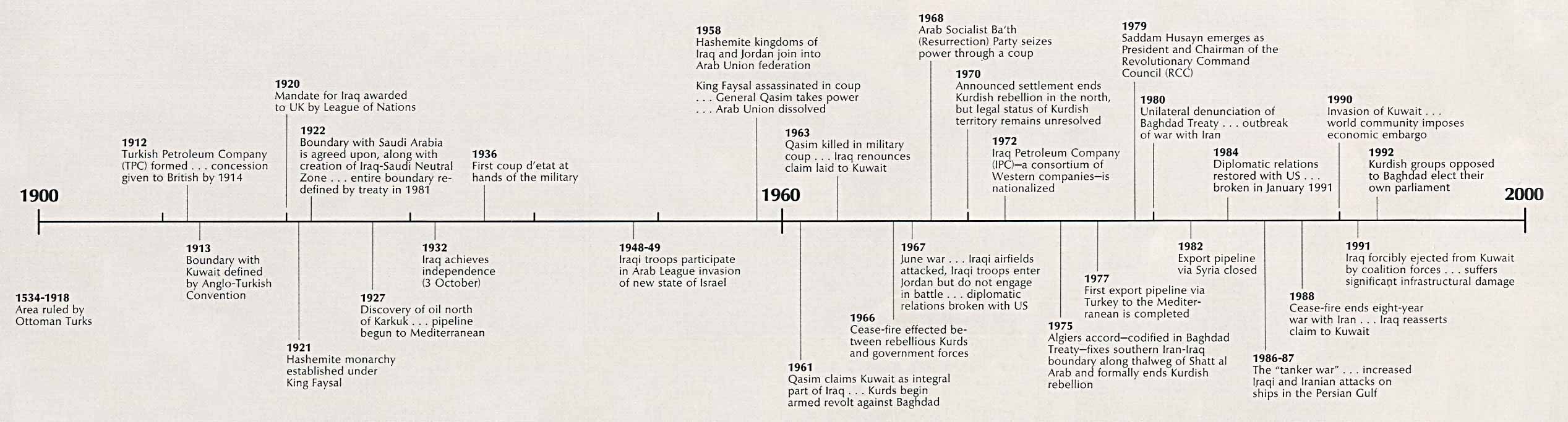
Iraq: Time Line From Atlas of the Middle East, CIA, 1993 (210K) Chart
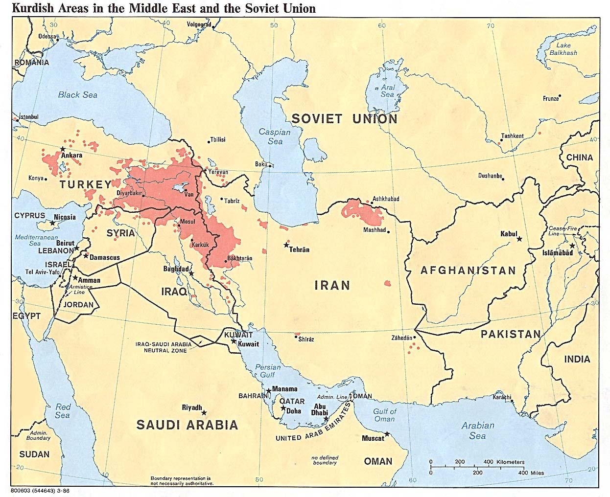
Kurdish Areas in the Middle East and the Soviet Union 1986 (254K)
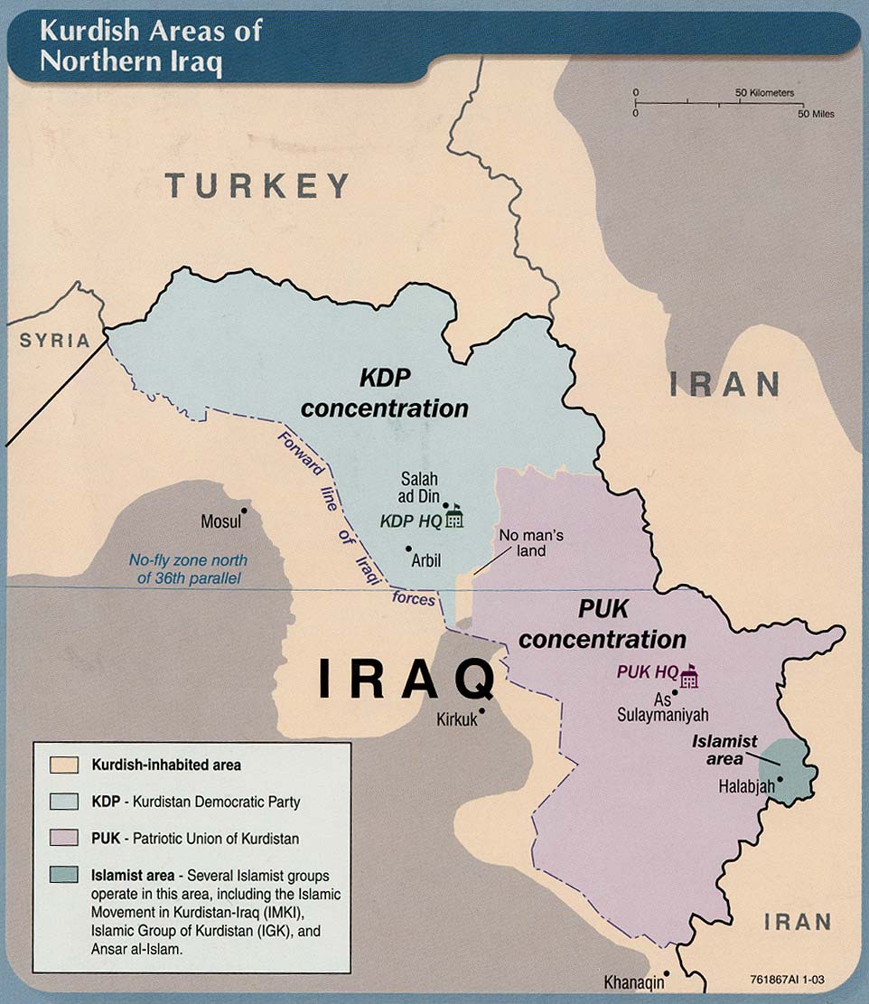
Kurdish Areas of Northern Iraq From Iraq: Country Profile [map], CIA, January 2003 (165K) and
pdf format (164K)
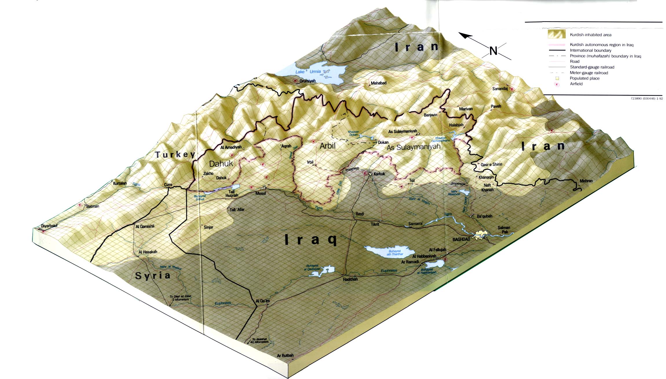
Kurdish Lands From Iraq: A Map Folio, CIA, 1992 (319K)
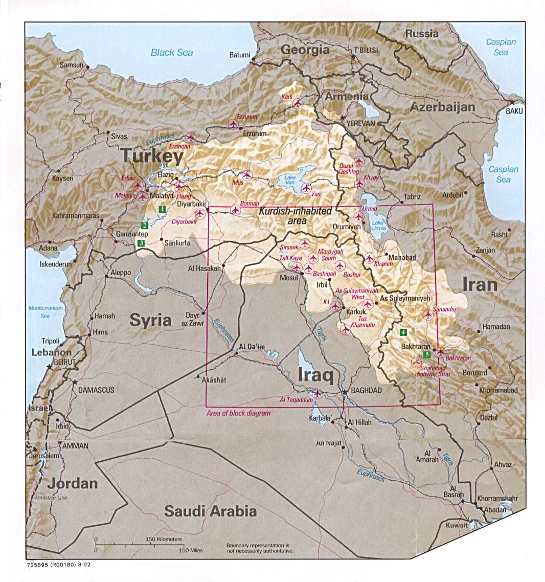
Kurdish Lands (location map) From Iraq: A Map Folio, CIA, 1992 (235K)
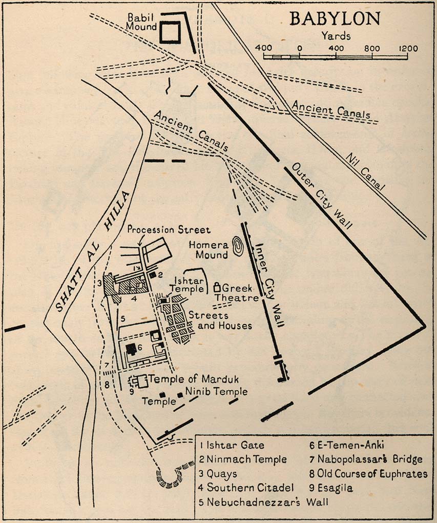
Babylon From Iraq and the Persian Gulf. Great Britain. Naval Intelligence Division, 1944 (173K)
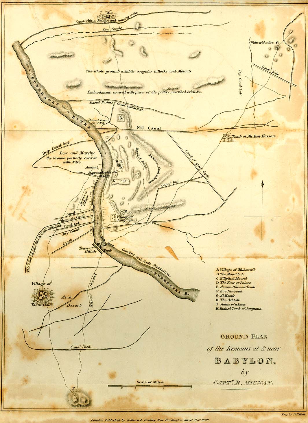
Babylon 1829 (229K)
From Travels in Chaldaea, including a journey from Bussorah to Bagdad, Hillah, and Babylon,
performed on foot in 1827, published by Henry Colburn and Richard Bentley, London, 1829.
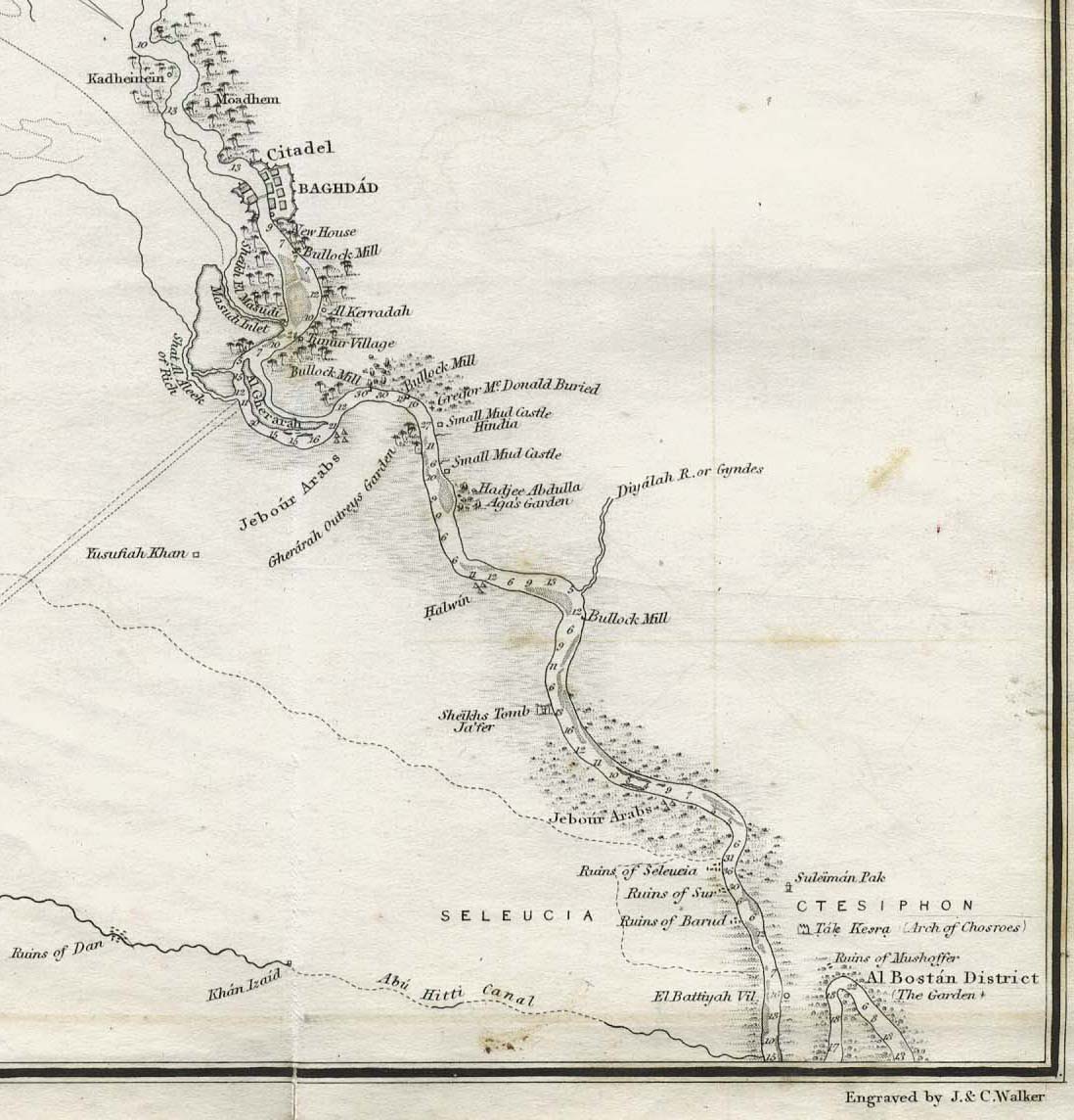
Baghdad 1849 (176K)
Part of "The River Euphrates From Hit to the Kuthah River and The River Tigris from Sammara to the Abu Hitti Canal..."
from Maps volume, sheet VII of The Expedition for the Survey of the Rivers Euphrates and Tigris, Carried on by Order of the British Government in the years 1835, 1836, and 1837...
by Francis Rawdon Chesney. London, Longman, Brown, Green, and Longmans, 1850.
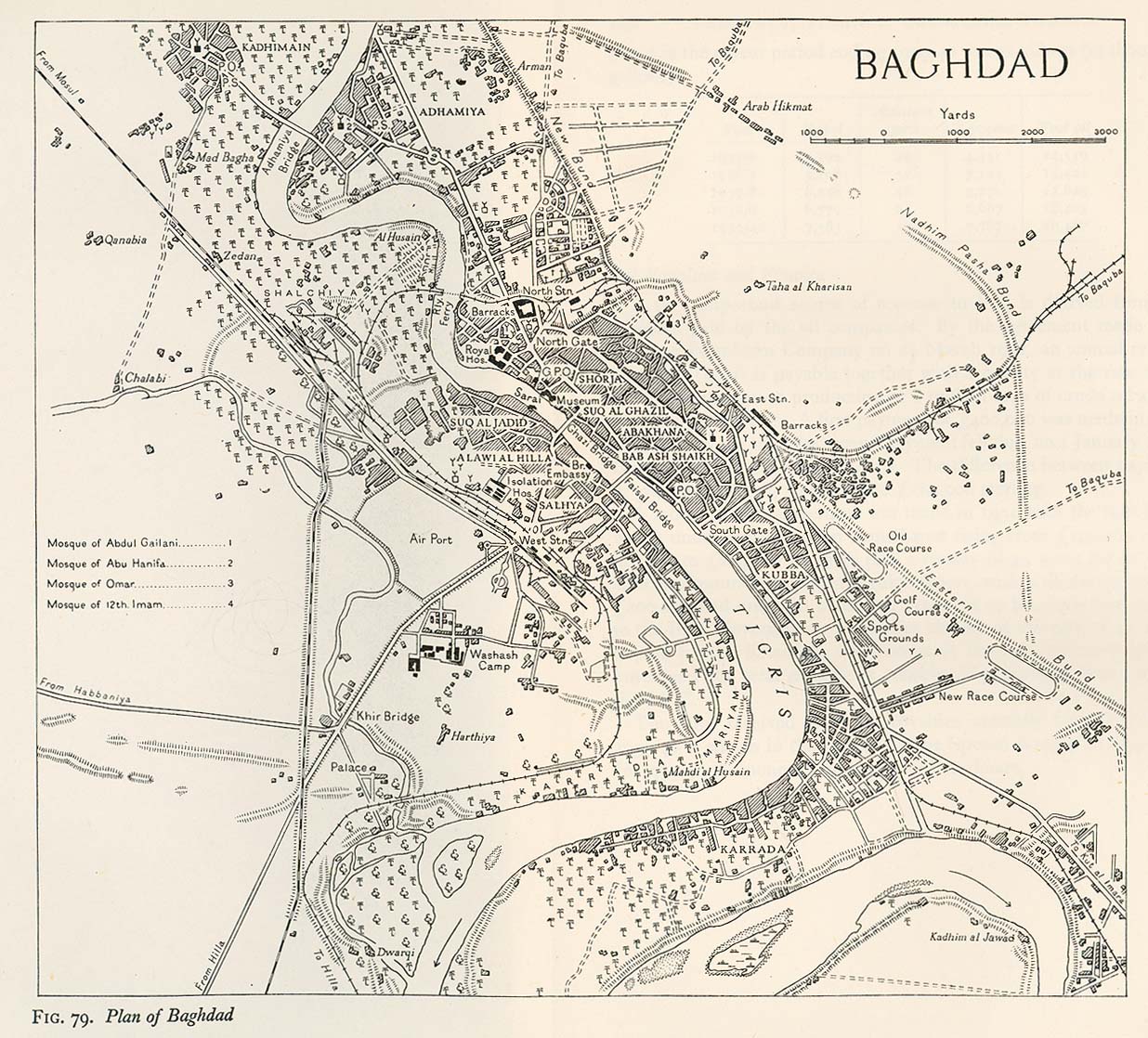
Baghdad 1944 From Iraq and the Persian Gulf. Great Britain. Naval Intelligence Division, 1944 (346K)
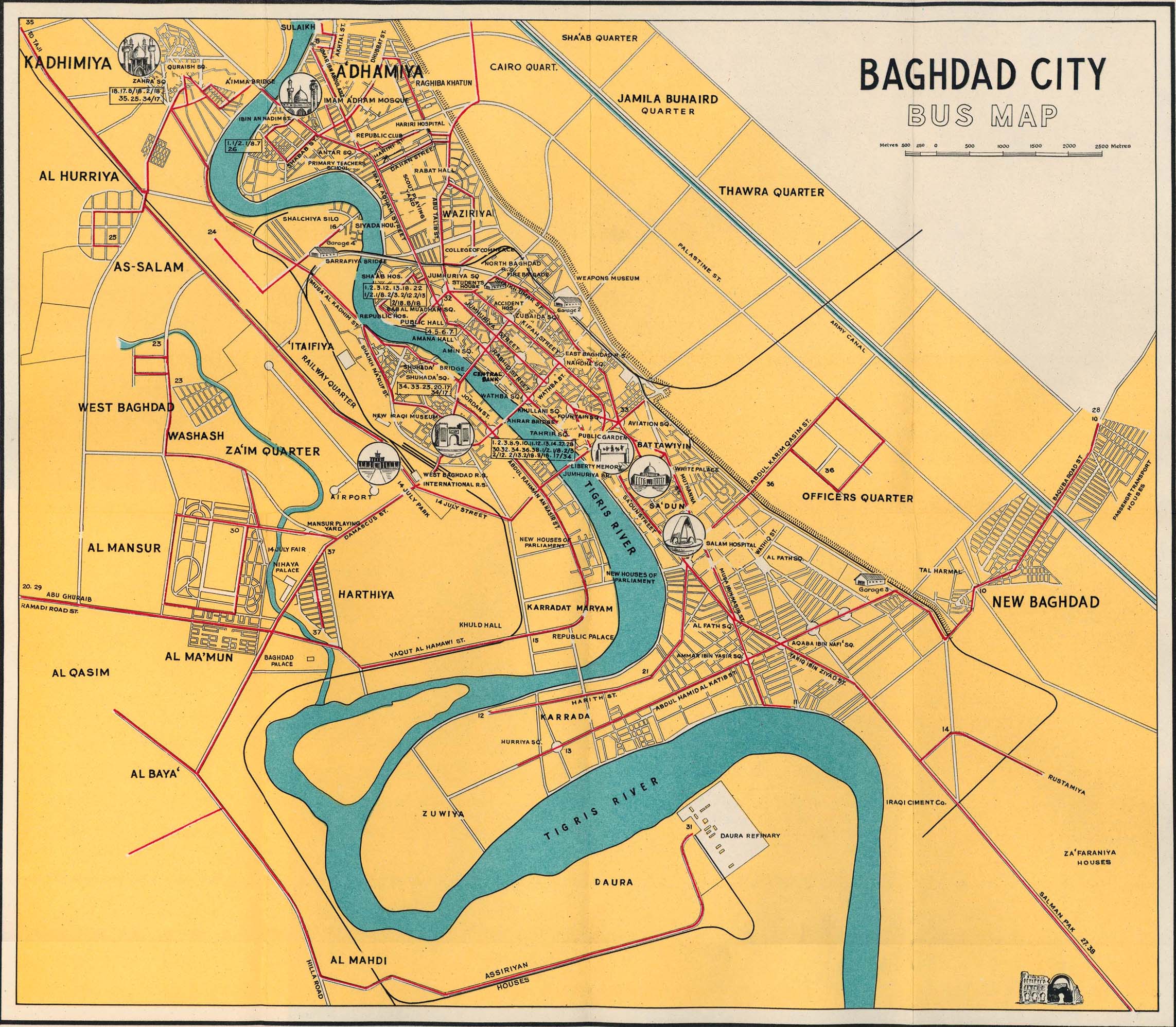
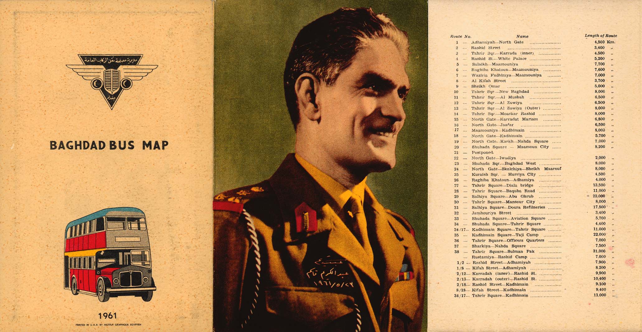
Baghdad 1961 Baghdad Bus Map (708K) and map cover and route information (291K)
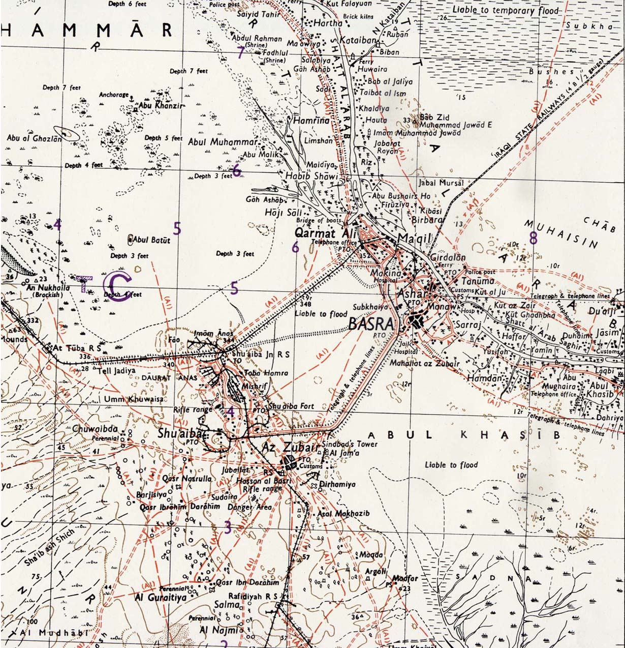
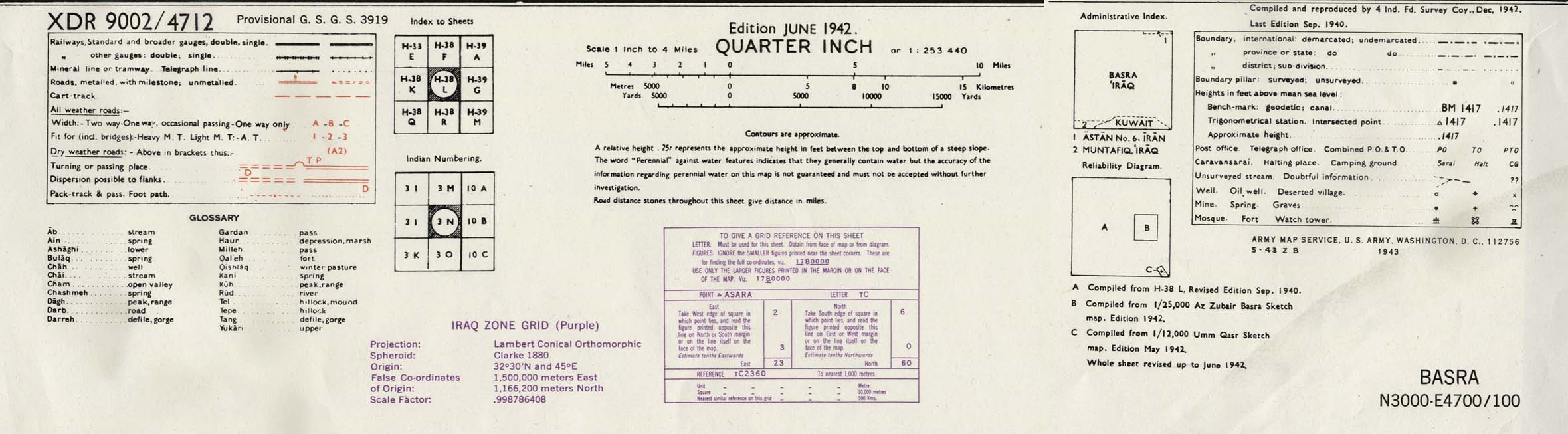
Basra Area 1942 (423K) map key and scale (185K)
Part of sheet H-38 L Basra. Edition June 1942. Original scale 1:253,440 Compiled and Reproduced by India Field Survey Company, December 1942. Published by the U.S. Army Map Service, May 1943.
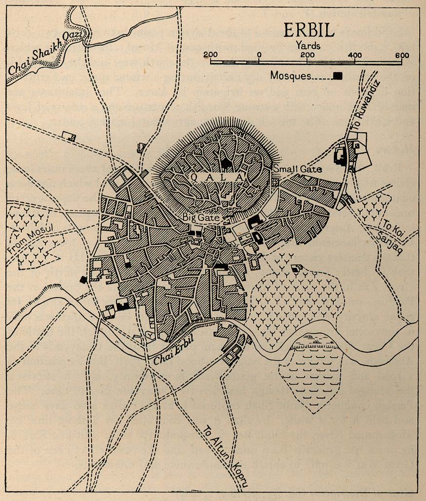
Erbil 1944 From Iraq and the Persian Gulf. Great Britain. Naval Intelligence Division, 1944 (238K)
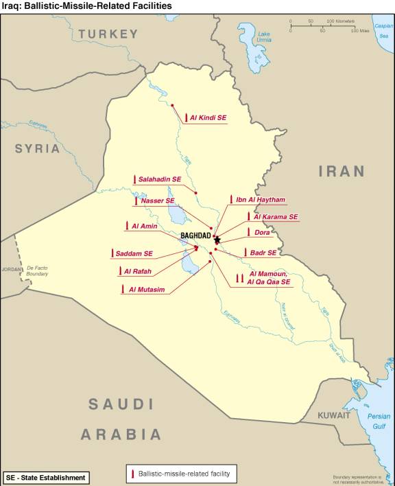
Iraq: Ballistic-Missile-Related Facilities From Iraq's Weapons of Mass Destruction Programs, U.S. Director of Central Intelligence, October 2002 (37K)
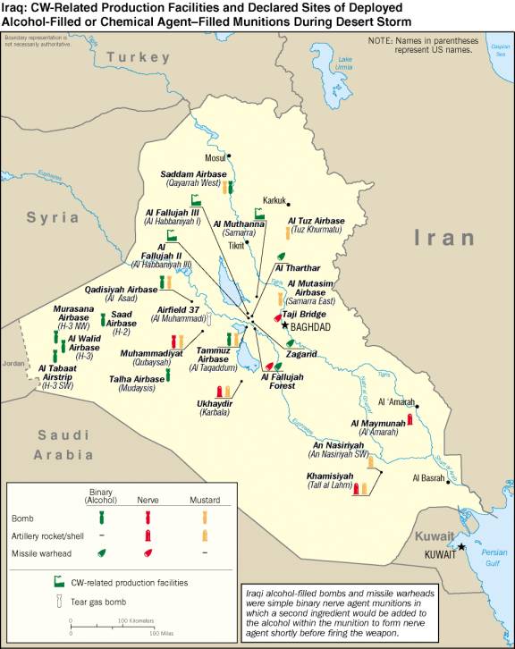
Iraq: CW-Related Production and Declared Sites of Deployed Alcohol-Filled or Chemical Agent-Filled Munitions During Desert Storm From Iraq's Weapons of Mass Destruction Programs, U.S. Director of Central Intelligence, October 2002 (62K)
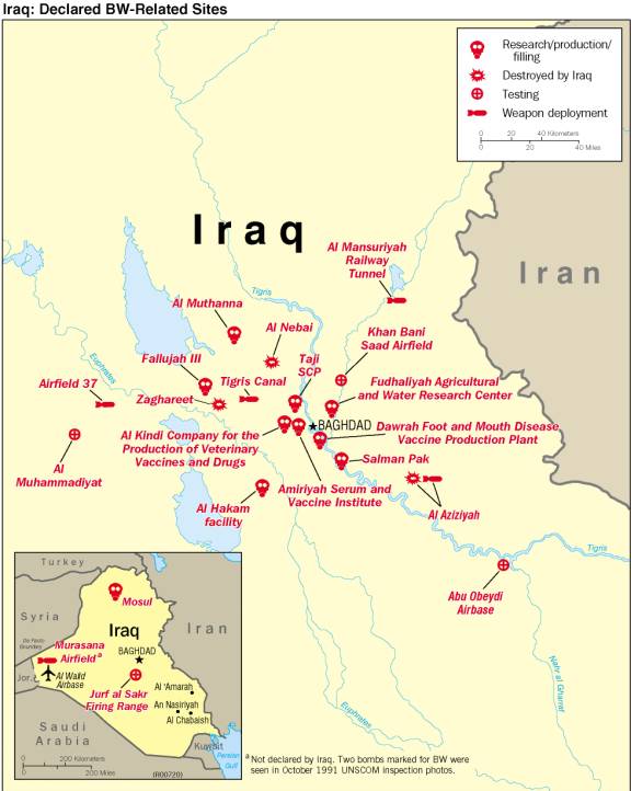
Iraq: Declared BW-Related Sites From Iraq's Weapons of Mass Destruction Programs, U.S. Director of Central Intelligence, October 2002 (52K)
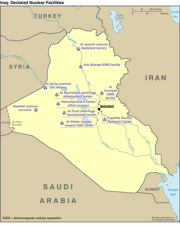
Iraq: Declared Nuclear Facilities From Iraq's Weapons of Mass Destruction Programs, U.S. Director of Central Intelligence, October 2002 (39K)
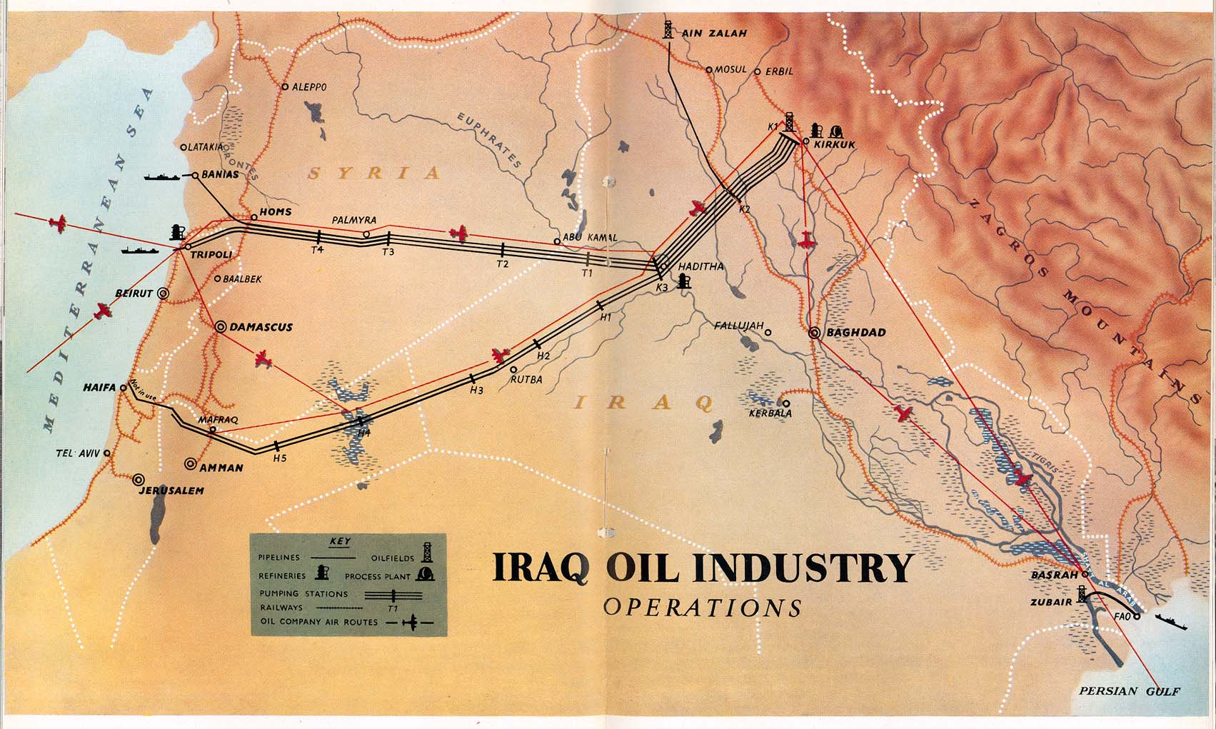
Iraq Oil Industry Operations 1953 From Iraq Today. Directorate-General of Propaganda, Baghdad, 1953
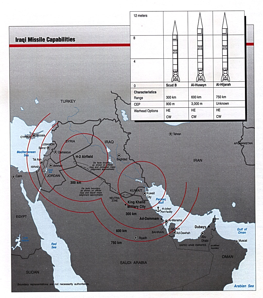
Iraqi Missile Capabilities From Conduct of the Persian Gulf War: Final Report to Congress, U.S. Dept. of Defense, April 1992 (338K)
Iraq Tourist Map - North,
Iraq Tourist Map - South and map legend from Iraq Tourist Map. Iraq Tourism Administration, ca. 1970 (935K)
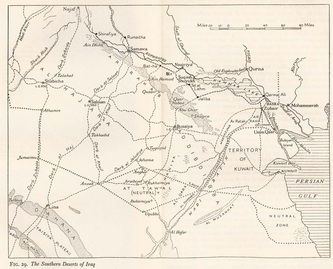
Iraq - Southern Deserts of Iraq From Iraq and the Persian Gulf. Great Britain. Naval Intelligence Division, 1944 (177K)
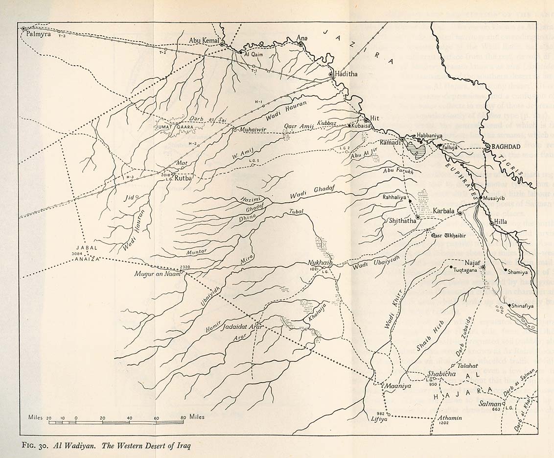
Iraq - Western Desert of Iraq From Iraq and the Persian Gulf. Great Britain. Naval Intelligence Division, 1944 (211K)
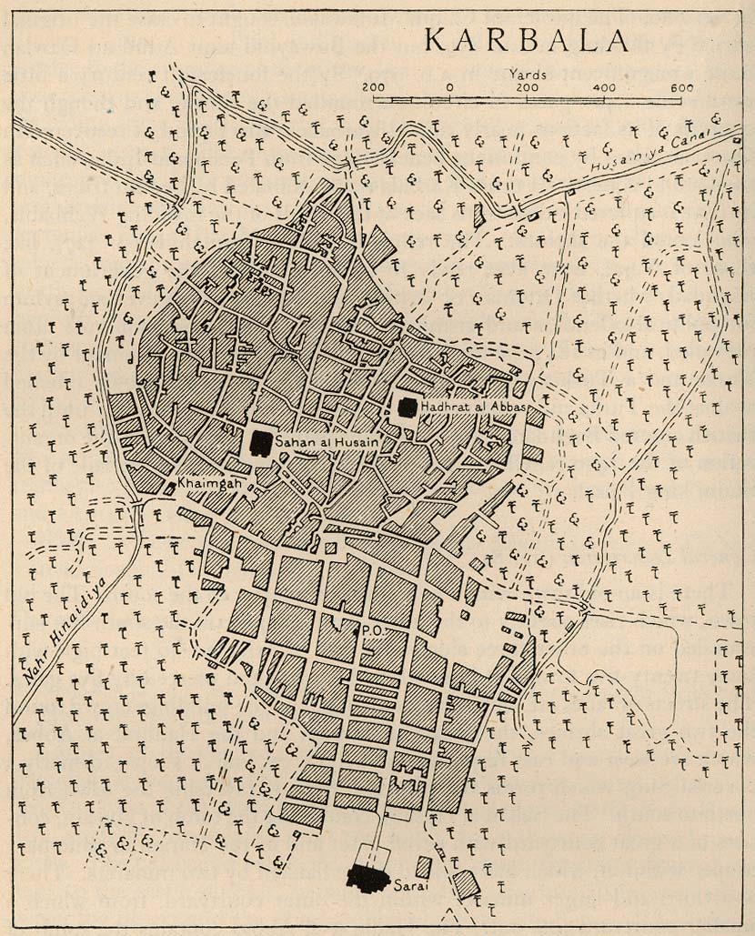
Karbala 1918 "Sketch-plan of Karbala in 1918" from Iraq and the Persian Gulf. Great Britain. Naval Intelligence Division, 1944 (243K)
Mosul 1944 From Iraq and the Persian Gulf. Great Britain. Naval Intelligence Division, 1944 (317K)
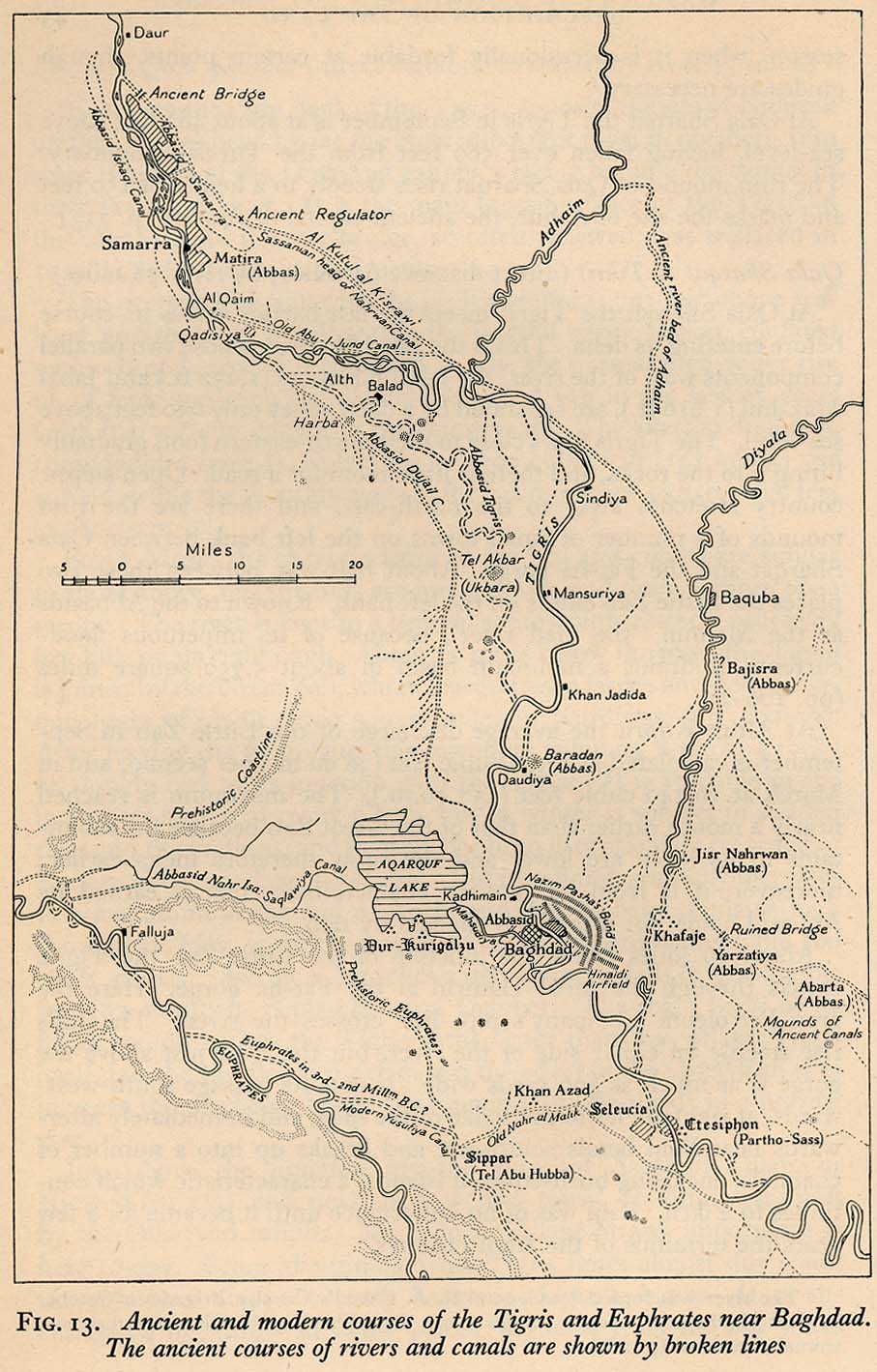
Tigris and Euphrates Near Baghdad, Ancient and Modern Courses From Iraq and the Persian Gulf. Great Britain. Naval Intelligence Division, 1944 (209K)
Sponsors
Sources: These maps were provided by the University of Texas Library and/or
the U.S. Central Intelligence Agency (CIA) unless otherwise noted.
Maps on other websites
Iraq (Guardian Unlimited)
Iraq (hot-maps.de)
Iraq (UniMaps)
Iraq (United Nations) [PDF]
<-- Free Map Downloads
<-- Free World Country Map Downloads
Didn't find what you are looking for? We've been online since 1996 and have created 1000's of pages. Search below and you may find just what you are looking for.
Michael R. Meuser
Data Research & GIS Specialist
MapCruzin.com is an independent firm
specializing in GIS project development and data research.
We created the first U.S. based
interactive toxic chemical facility
maps on the internet in 1996 and we
have been online ever since. Learn more about us and our services.
Have a project in mind? If you have data, GIS project or custom shapefile needs contact Mike.
Contact Us
Report Broken Links
Subscribe for Updates


![[Al Basrah] Basra](/free-maps-iraq/basra_1990.jpg)
![Al Mawsil [Mosul]-Arbil [Irbil] Region, Northern Iraq (tactical pilotage chart)](/free-maps-iraq/iraq_north_g4b_89.jpg)