Immediate Download
 Shapefiles on this page: Alberta,
British Columbia,
Manitoba,
Newfoundland Labrador,
New Brunswick,
Ontario,
Quebec,
Saskatchewan,
Group 1 (Yukon Territory - Northwest Territories - Nunavut),
Group 2 (Prince Edward Island - Nova Scotia)
All
Shapefiles on this page: Alberta,
British Columbia,
Manitoba,
Newfoundland Labrador,
New Brunswick,
Ontario,
Quebec,
Saskatchewan,
Group 1 (Yukon Territory - Northwest Territories - Nunavut),
Group 2 (Prince Edward Island - Nova Scotia)
All
Click next to the shapefile you wish and you will have immediate access to it using our secure merchant account provider, ClickBank/Keynetics or PayPal, whichever you prefer. Note that a few of the smaller shapefiles are grouped into single sets.
If you with to purchase more than one FSA shapefile, consider purchasing the Western Canada and/or Eastern Canada shapefile sets at a considerable discount.
Alberta FSA Shapefile Download Now
British Columbia FSA Shapefile Download Now
Manitoba FSA Shapefile Download Now
Newfoundland Labrador FSA Shapefile Download Now
New Brunswick FSA Shapefile Download Now
Ontario FSA Shapefile Download Now
Quebec FSA Shapefile Download Now
Saskatchewan FSA Shapefile Download Now
(Group1) Yukon Territory, Northwest Territories and Nunavut FSA Shapefiles Download Now
(Group2) Prince Edward Island and Nova Scotia FSA Shapefiles Download Now
Download All - Each set is $397
Western Canada: British Columbia, Alberta, Saskatchewan, Manitoba, Group 1 (Yukon Territory, Northwest Territories, and Nunavut) Download Now
Eastern Canada: Ontario, Quebec, Newfoundland Labrador, New Brunswick, Group 2 (Prince Edward Island and Nova Scotia) Download Now
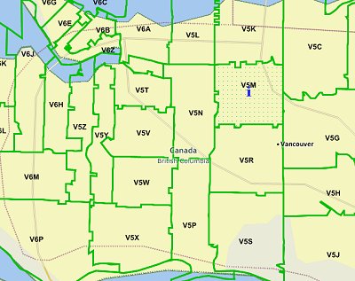
A Note About How Your GIS Maps Will Look
The image on this page is an example of how these shapefiles may look when loaded into a GIS program. Your GIS maps may not look exactly like this. Each GIS program is different. Shapefiles themselves are a collection of points, lines or polygons. They have no attributes. It is up to you, the user, to define colors, line width, symbols and other attributes within the limits and capabilities of the GIS programs you are using.
Copyright and Use of Shapefiles
The shapefiles on this page are copyrighted as follows. Copyright © 2017 Michael R. Meuser, All Rights Reserved. You may use these shapefiles in any GIS project or to make maps. You may not create copies of the shapefiles for the use of others whether for personal or commercial use. You may not resell the shapefiles. If you require multiple copies of the same shapefile, please contact Mike at [email protected]. Thank You.
About Quality, Accuracy and Suitability
Generally, the geodata and shapefiles found at MapCruzin.com may come from a variety of
government, non-governmental and self-reporting private
sources. While we try to assure the accuracy of
this material, we cannot promise that it is
absolutely accurate. We do promise that using the
map layer will be fun, entertaining or educational - possibly even frustrating.
Beyond this, we make no guarantee as to its
suitability for any purpose. We assume no liability
or responsibility for errors or inaccuracies. Please
understand that you download and use these map layers and data at your own
risk.
<-- Return to Do It Yourself GIS Maps
Didn't find what you are looking for? We've been online since 1996 and have created 1000's of pages. Search below and you may find just what you are looking for.
Michael R. Meuser
Data Research & GIS Specialist
MapCruzin.com is an independent firm
specializing in GIS project development and data research.
We created the first U.S. based
interactive toxic chemical facility
maps on the internet in 1996 and we
have been online ever since. Learn more about us and our services.
Have a project in mind? If you have data, GIS project or custom shapefile needs contact Mike.
Contact Us
Report Broken Links
Subscribe for Updates