|
SARS - Severe Acute Respiratory Syndrome
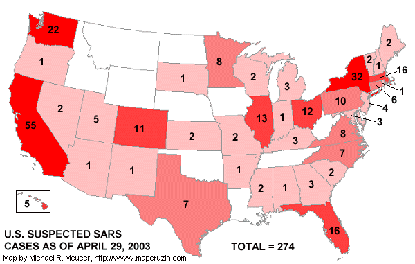
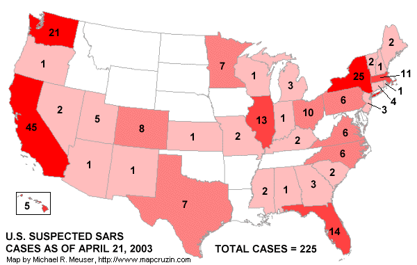
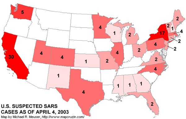
Right-click on this map image to save on your computer.
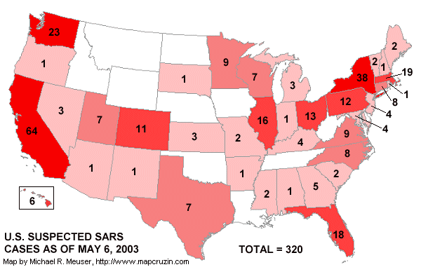
Right-click on this map image to save on your computer. Visit the CDC SARS Website for latest information about U.S. and world SARS cases. Maps on this page were created with Maptitude GIS.
Perspective: As the SARS story unfolds it is worth considering that, according to the CDC, 36,000 individuals die of flu-related diseases in the United States each year. As of May 6, 2003 there have been NO SARS related deaths in the U.S. Click here for more information.
| 


