Download Free United States Maps
Sponsors
<-- Free Map Downloads
<-- Free World Country Map Downloads
Note that maps may not appear on the webpage in their full size and resolution. To save the maps to your computer, right-click on the link.
Indian and Federal Lands Maps of the U.S. states in GIF and PDF formats.
Precipitation Maps of conterminous U.S. states in GIF and PDF formats.
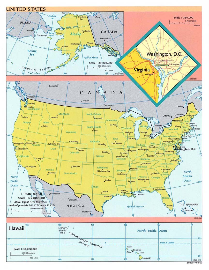
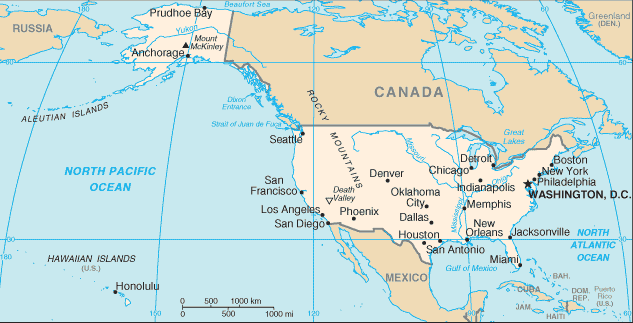
United States CIA 2002 (200K) and PDF format (201K)
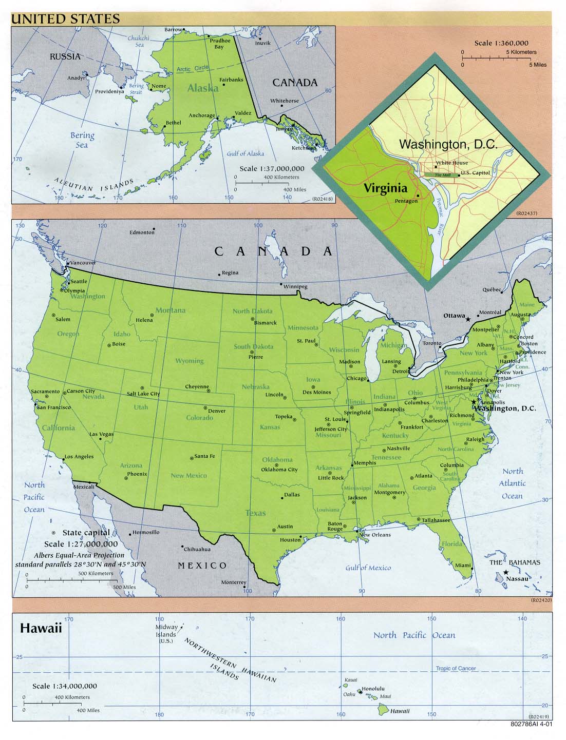
United States CIA 2001 (226K)
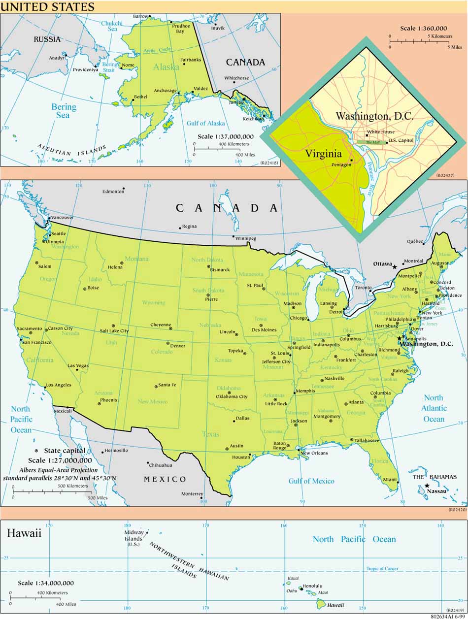
United States CIA 1999 (159K)
United States CIA 1997 (527K)
United States CIA 2001 (PDF format) 2001 (750K)
United States CIA 1999 (PDF format) 1999 (645K)
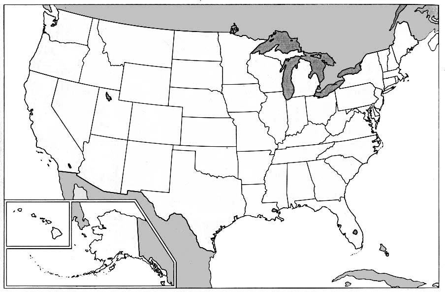
United States (Outline Map) or United States (Outline Map for Printing) 1998 (85K)
United States including Alaska and Hawaii (Outline Map) 1992 (291K) U.S. Bureau of the Census, 1990 Census of Population (1990 CP-1-1)
United States (Small Map) CIA 2008 (26K)
United States - Federal Lands and Indian Reservations PDF format (2.3MB) The National Atlas of the United States of America, U.S. Geological Survey, 2003
United States [complete map with Alaska, Hawaii and Puerto Rico insets] (Wall Map) Shaded relief map with state boundaries, forest cover, place names, major highways. Portion of "The National Atlas of the United States of America General Reference [Map]", U.S. Geological Survey 2001, Printed 2002 (4.5MB)
United States [lower 48 states with Hawaii and Puerto Rico insets] (Wall Map) Shaded relief map with state boundaries, forest cover, place names, major highways. Portion of "The National Atlas of the United States of America General Reference [Map]", U.S. Geological Survey 2001, Printed 2002 (2.8MB)
United States [Alaska] (Wall Map) Shaded relief map with state boundaries, forest cover, place names, major highways. Portion of "The National Atlas of the United States of America General Reference [Map]", U.S. Geological Survey 2001, Printed 2002 (1.2MB)
United States Population Change by State 1990 to 2000 U.S. Bureau of the Census 2000 (PDF Format)
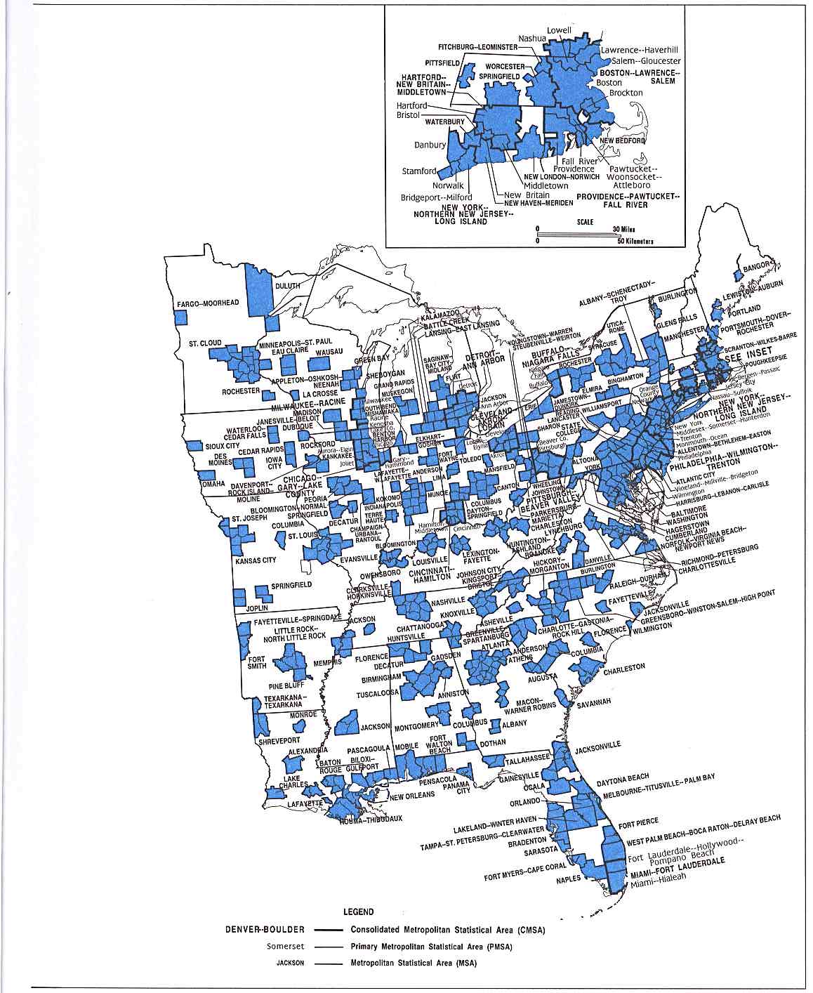
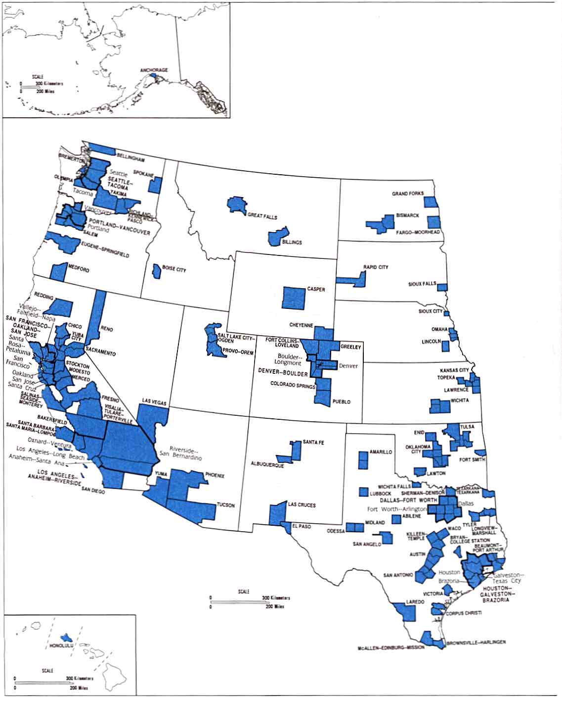
Metropolitan Areas Map 1999 U.S. Bureau of the Census June 30, 1999 (426K) [PDF Format]
Metropolitan Areas Map with separate Northeast Inset 1999 U.S. Bureau of the Census June 30, 1999 (427K) [PDF Format]
Metropolitan Areas Maps in Eastern and Western Sections 1999 U.S. Bureau of the Census June 30, 1999 (424K) [PDF Format]
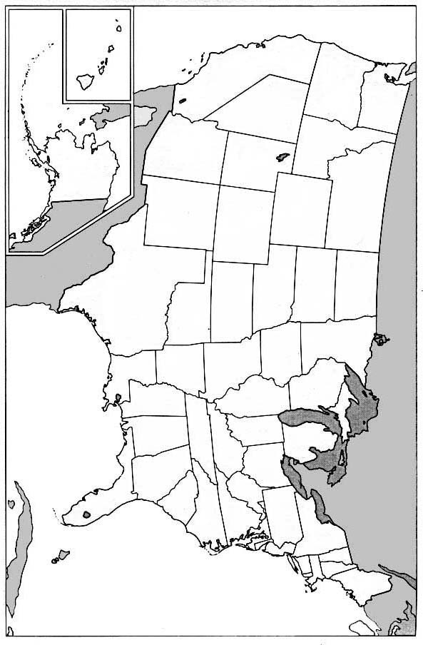
Metropolitan Areas of the Eastern United States, 1992 U.S. Bureau of the Census, 1990 Census of Population (1990 CP-1-1)(186K)
Metropolitan Areas of the Western United States, 1992 U.S. Bureau of the Census, 1990 Census of Population (1990 CP-1-1)(95K)
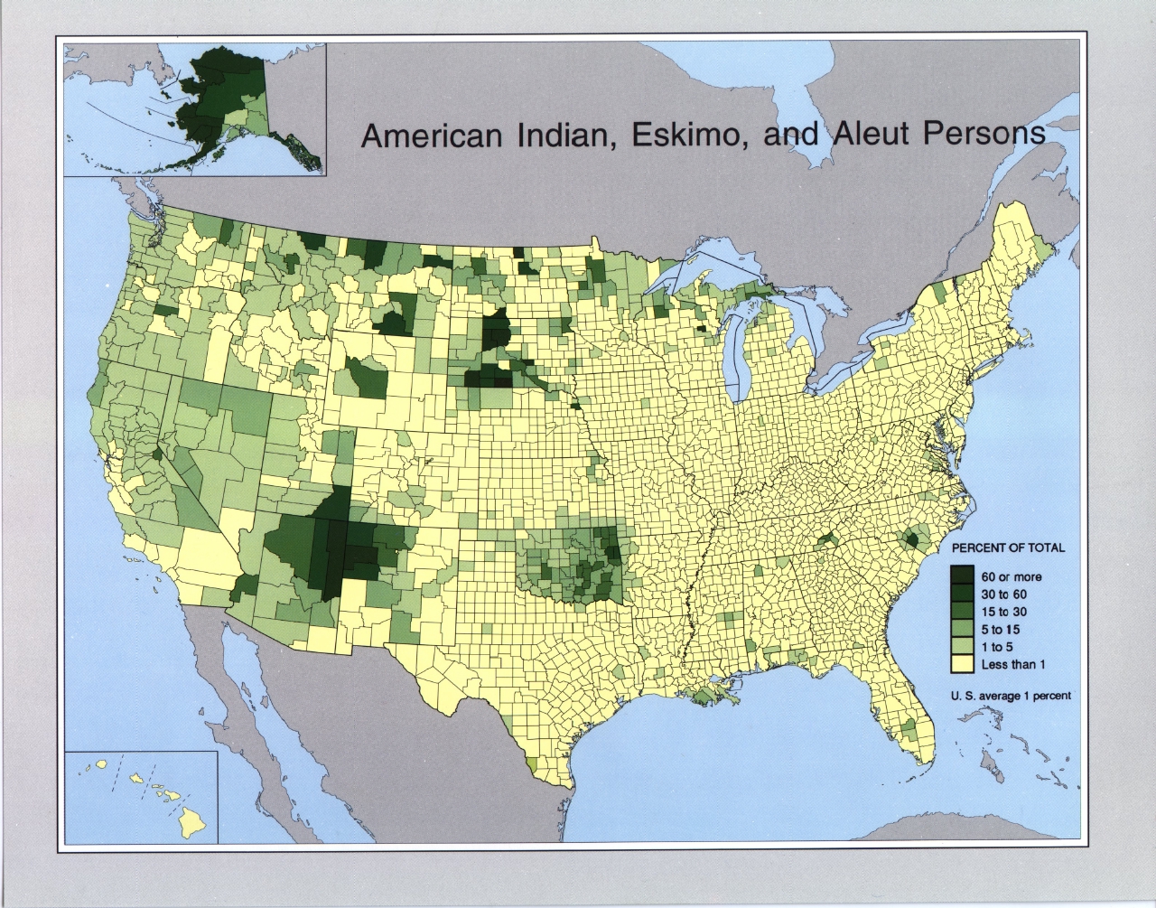
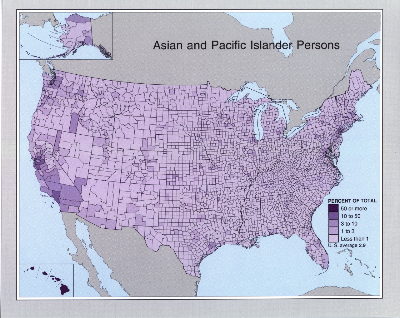
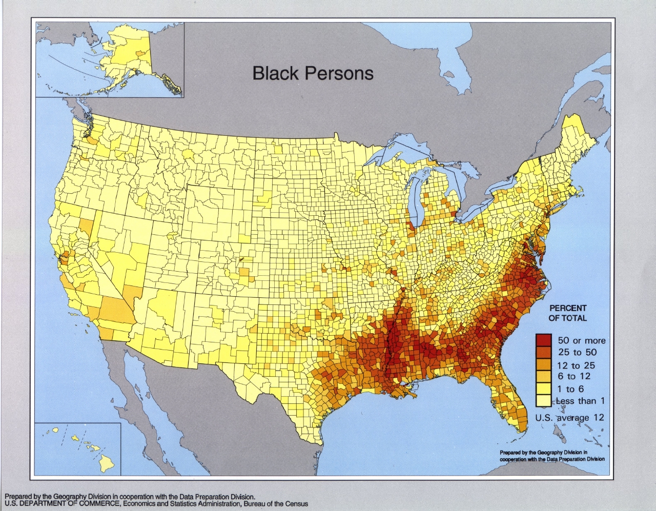
The following maps are from Race and Hispanic Origin Population Density of the United States: 1990,
Census Bureau GE-90 map series (GE-90 No. 6). The maps represent population by County as a Percentage of Total Population:
American Indian, Eskimo and Aleut Persons 1990 (1.17MB)
Asian and Pacific Islander Persons 1990 (1.21MB)
Black Persons 1990 (1.18MB)
Hispanic Origin Persons 1990 (1.24MB)
Standard Time Zones [United States] 2004 nationalatlas.gov 2004 (PDF Format)
Sources: These maps were provided by the University of Texas Library and/or
the U.S. Central Intelligence Agency (CIA) unless otherwise noted.
Maps on other websites
United States - African-American Population (CensusScope)
United States - Agricultural Atlas [Interactive], 2002 (USDA)
United States - Agricultural Atlas, 1997 (USDA)
United States - Agriculture - Crop Maps, 2006 (USDA)
United States - Airline Flight Maps (FlightAware)
United States - Ancestry Maps, 1990 (Digital Atlas of the United States)
United States - Ancestry, Top Cities by Ethnic Group (Epodunk)
United States - Area Code Maps (Areacode-info.com)
United States - Area Code Maps (NANPA)
United States - Atlas of United States Mortality (NCHS)
United States - Biomass Maps (NREL)
United States - Border Patrol Sector Map (Honorfirst)
United States - Census Maps (American Factfinder)
United States - Climate Map (NOAA)
United States - Climate Maps (Printable-Maps)
United States - Department of Homeland Security Facilities (Monthly Review)
United States - Disaster Relief Maps (American Red Cross)
United States - 2004 Election Map (BBC News)
United States - 2004 Election Map (CNN)
United States - 2004 Election Map (Electoral-Vote.com)
United States - 2004 Election Map (Jeff Culver, BoingBoing.net)
United States - 2004 Election Maps (New York Times)
United States - 2004 Election Map - Popular Vote by County (Cox Newspapers) [PDF]
United States - 2004 Election Map - Popular Vote by County (ESRI)
United States - 2004 Election Map - Popular Vote by County (Robert Vanderbei, Princeton University)
United States - 2004 Elections - U.S. Senate Map (CNN)
United States - 2004 Elections - U.S. House of Representatives Map (CNN)
United States - 2006 Election Results Maps (Congressional Quarterly Politics)
United States - 2006 Election Maps - Senate,
House,
Governors (CNN)
United States - 2006 Election Results Maps (New York Times)
United States - 2008 Election Maps - President,
Senate, House, and Governors (CNN)
United States - 2008 Election Map (New York Times)
United States - 2008 Election Map (Fox)
United States - 2008 Election Map (MSNBC)
United States - 2008 Election Map (ABC, Australia)
United States - 2008 Elections - Electoral Shifts (New York Times)
United States - 2008 Elections - Presidential Election: Winners by County (Washington Post)
United States - Electric Grid, Existing and Proposed (National Public Radio)
United States - Electronic Map Library (California State University, Northridge)
United States - Energy - Renewable Energy Atlas of the West (Energy Foundation)
United States - Energy - Solar Energy Maps (NREL)
United States - EnviroMapper (EPA)
United States - Environmental Geographic Assessment Tool (EPA)
United States - Environmental Health Maps [ToxMap] (NLM)
United States - Federal Courts Map (USCourts.gov)
United States - Flood Maps (FEMA)
United States - HIV/AIDS Maps (Frontline/PBS)
United States - Gasoline Price Map (Gasbuddy.com)
United States - Geologic Map Database (USGS)
United States - Graphical Locator (Montana State University)
United States - Ground Water Atlas (USGS)
United States - Hispanic Population 2000 (CensusScope)
United States - Hispanic Population Growth (Rural) 1990-2000 (USDA)
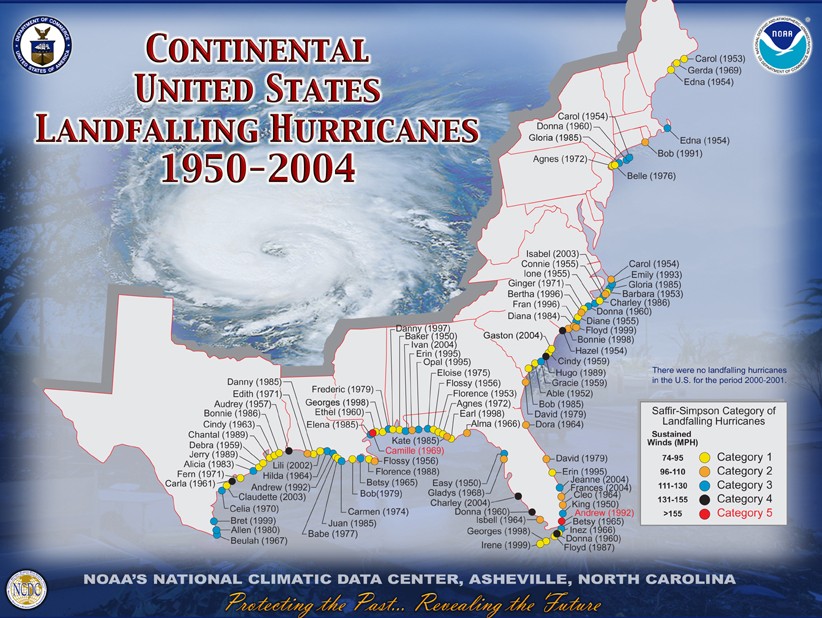
United States - Hurricane Landfalls 1950-2004 (NOAA)
United States - Immigration Explorer - Interactive Map (New York Times)
United States - Income Maps, 1990 (Digital Atlas of the United States)
United States - Influenza Map, Weekly (U.S. Centers for Disease Control)
United States - Landforms - Color Landform Atlas of the U.S. (Ray Sterner)
United States - Language Map (Modern Language Association)
United States - Language Spoken at Home Maps (Valparaiso University)
United States-Mexico Border Fence Map (Christian Science Monitor)
United States-Mexico Border Fence Map (John Jorsett)
United States-Mexico Border Fence, Arizona (San Diego Union)
United States - Military Bases in U.S., Clickable Map (Military.com)
United States - Military Bases Overseas, Clickable Map (Military.com)
United States - Monarch Butterfly Migration
United States - Mortality (Atlas of United States Mortality)
United States - National Atlas
United States - National Park Maps (National Park Service)
United States - Pesticide Maps (USGS)
United States - Physical Map (National Geographic)
United States - Pig Population (AP/Daylife)
United States - Plague Cases 1980-2002 (EOM)
United States - Plant Hardiness Zone Maps (U.S. National Arboretum)
United States - Political Campaign Contribution Maps (Fundrace.org)
United States - Political Maps (Politicalmaps.org)
United States - Pollution Map (Sierra Club)
United States - Population Maps, 1990 (Digital Atlas of the United States)
United States - Population Maps, 2000 (Fedstats)
United States - Poverty Maps, 1990 (Digital Atlas of the United States)
United States - Primary Elections 2004 (Scholastic.com)
United States - Race and Ethnic Origin Maps, 1990 (Digital Atlas of the United States)
United States - Recreation Maps Interactive Atlas (Recreationmaps.gov)
United States - Relief Maps (3-D shaded relief) (Andrew Birrell)
United States - Same-Sex Marriage Map (National Public Radio)
United States - Same-Sex Marriage Map (Wikipedia)
United States - School District Map Viewer (NCES)
United States - Segregation Maps (CensusScope)
United States - Solar Energy Maps (NREL)
United States - Telephone Area Code Maps - By State (NANPA)
United States - Time Zones (Time.gov)
United States - Topographic Maps (ACME Mapper)
United States - Topographic Maps (MyTopo.com)
United States - Topographic Maps (Terra Server)
Sponsors
United States - Vegetation and Plant Distribution Maps (Claire Englander and Philip Hoehn)
United States - Voting Maps 1840-2008 (University of Richmond)
United States - Walkable Neighborhoods (Walk Score)
United States - Water Use Maps (U.S. Geological Survey)
United States - Wildland Fires - Clickable Map (USDA National Interagency Fire Center)
United States - Wind Energy Resource Atlas (RREDC)
United States - Wind Maps (NREL)
United States - Zip Code Mapper [for individual Zip Codes] (John Coryat Systems)
<-- Free Map Downloads
<-- Free World Country Map Downloads
Didn't find what you are looking for? We've been online since 1996 and have created 1000's of pages. Search below and you may find just what you are looking for.
Michael R. Meuser
Data Research & GIS Specialist
MapCruzin.com is an independent firm
specializing in GIS project development and data research.
We created the first U.S. based
interactive toxic chemical facility
maps on the internet in 1996 and we
have been online ever since. Learn more about us and our services.
Have a project in mind? If you have data, GIS project or custom shapefile needs contact Mike.
Contact Us
Report Broken Links
Subscribe for Updates


![United States [complete map with Alaska, Hawaii and Puerto Rico insets]](/free-maps-united-states/united_states_wall_2002.jpg)
![United States [lower 48 states with Hawaii and Puerto Rico insets]](/free-maps-united-states/united_states_wall_2002_us.jpg)
![United States [Alaska]](/free-maps-united-states/united_states_wall_2002_ak.jpg)