Download Free Oregon Maps
<-- Free Maps
<-- Free U.S. State Maps
<-- Free World Country Maps
See Also:
Topographic Maps
ArcGIS Shapefile Map Layers
Download or link to these maps for your reports, websites, research, projects, presentations...
Note that maps may not appear on the webpage in their full size and resolution. To save the maps to your computer, right-click on the link.
State Map
Oregon (base map) JPEG format (536K) County boundaries and names, county seats, rivers. Original scale 1:2,500,000 U.S. Geological Survey, 1972 limited update 1990
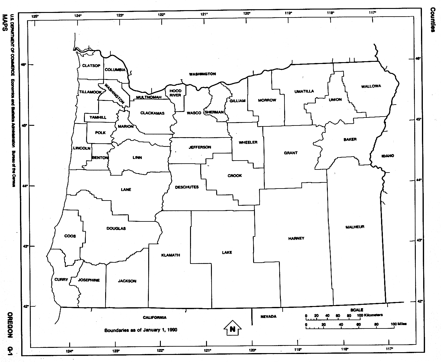
Oregon (outline map) JPEG format (114K) County boundaries and names. U.S. Bureau of the Census, 1990
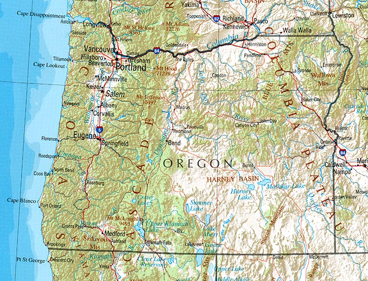
Oregon (reference map) JPEG format (236K) Shaded relief map with state boundaries, forest cover, place names, major highways. Portion of "The National Atlas of the United /free-state-maps/states/oregon/ of America. General Reference", compiled by U.S. Geological Survey 2001, printed 2002
Oregon (reference map) PDF format (239K) Shaded relief map with state boundaries, forest cover, place names, major highways. Portion of "The National Atlas of the United /free-state-maps/states/oregon/ of America. General Reference", compiled by U.S. Geological Survey 2001, printed 2002
Oregon - Federal Lands and Indian Reservations PDF format (1.38MB) The National Atlas of the United /free-state-maps/states/oregon/ of America, U.S. Geological Survey, 2003
Public Lands in Oregon and Washington Compiled by the U.S. Forest Service and Bureau of Land Management 1996 (545K)
City Maps
Baker City (topographic) original scale 1:24,000 U.S.G.S. 1994 (499K)
Canby (topographic) original scale 1:24,000 U.S.G.S. 1961, photorevised 1985 (295K)
La Grande (topographic) original scale 1:24,000 U.S.G.S. 1994 (471K)
Historical City Maps
Albany 1917 Automobile Blue Book (323K)
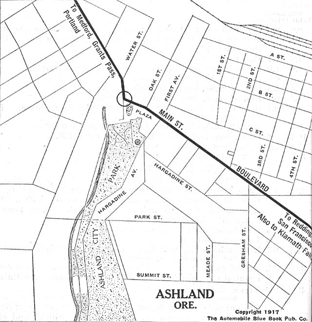
Ashland 1917 Automobile Blue Book 1917 Vol. 8, Section 2 (117K)
Crater Lake National Park 1917 Automobile Blue Book 1917 Vol. 8, Section 2 (240K)
Eugene 1917 Automobile Blue Book 1917 Vol. 8, Section 2 (91K)
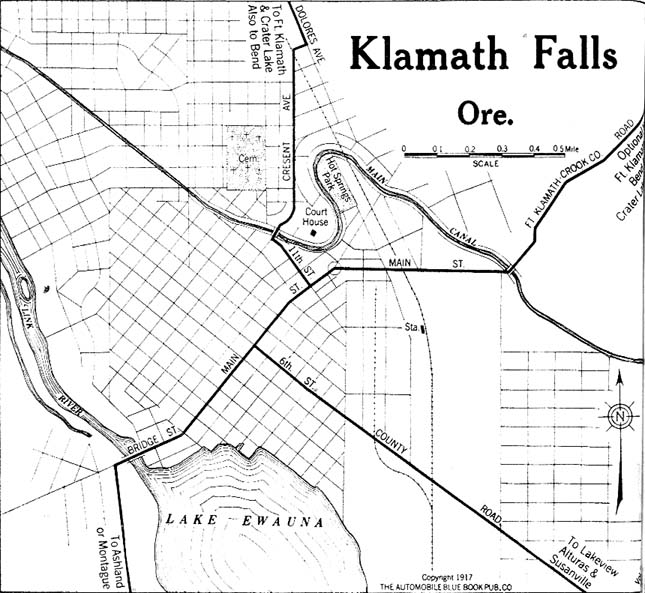
Klamath Falls 1917 Automobile Blue Book 1917 Vol. 8, Section 2 (122K)
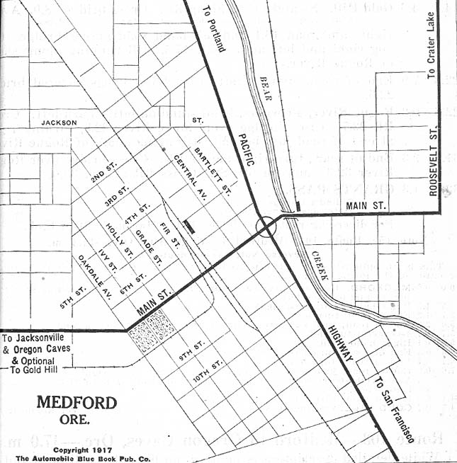
Medford 1917 Automobile Blue Book 1917 Vol. 8, Section 2 (116K)
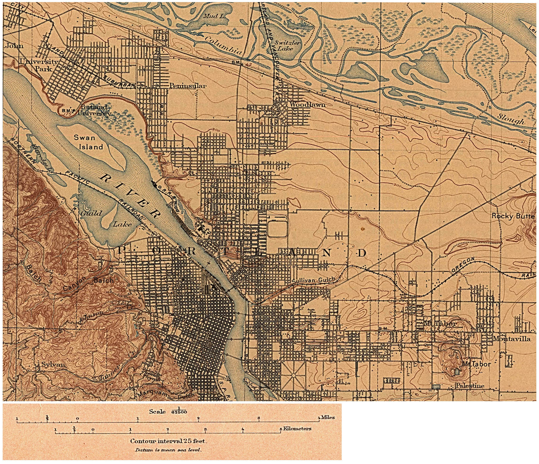
Portland 1897 (Topographic) original scale 1:62,500 U.S. Geological Survey 1897 (910K)
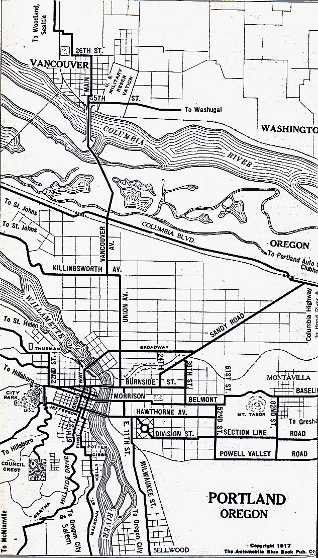
Portland 1917 Automobile Blue Book (264K)
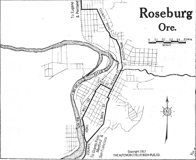
Roseburg 1917 Automobile Blue Book 1917 Vol. 8, Section 2 (79K)
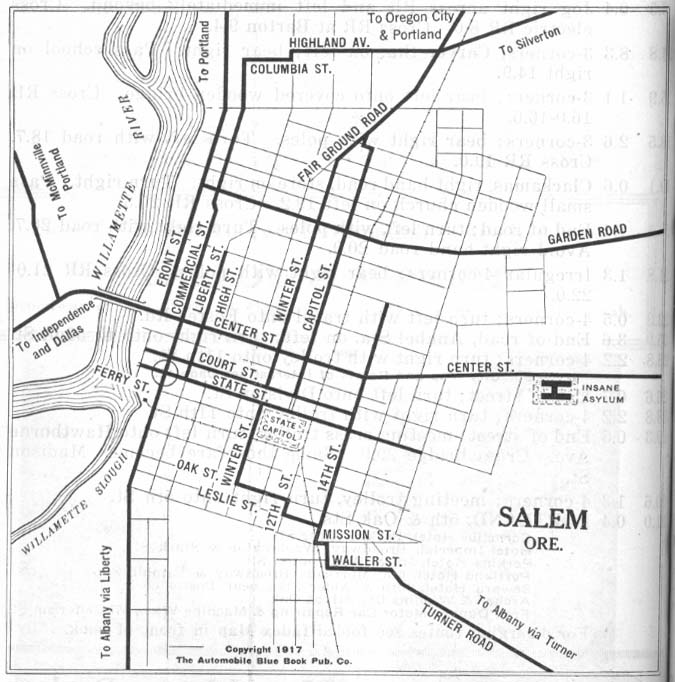
Salem 1917 Automobile Blue Book 1917 Vol. 8, Section 2 (112K)
Maps of National Parks, Monuments, and Historic Sites
The following maps were produced by the U.S. National Park Service unless otherwise noted.
Crater Lake National Park (Area Map) (27K)
Crater Lake National Park (topographic) scale 1:62,500 U.S.G.S. 1988 (944K)
Crater Lake National Park (Shaded Relief Map) 1:62,500 U.S.G.S. 1984 (357K)
John Day Fossil Beds National Monument (Area Maps) 1999 (65K) (PDF Format)
John Day Fossil Beds National Monument - Clarno Unit (Park Map) 1999 (65K) (PDF Format)
John Day Fossil Beds National Monument - Painted Hills Unit (Park Map) 1999 (65K) (PDF Format)
John Day Fossil Beds National Monument - Sheep Rock Unit (Park Map) 1999 (65K) (PDF Format)
Nez Perce National Historical Park [Idaho / Montana / Oregon / Washington] (All Sites Map) 1997 (65K) (PDF Format)
See Also:
Topographic Maps
ArcGIS Shapefile Map Layers
<-- Free Maps
<-- Free U.S. State Maps
<-- Free World Country Maps
Didn't find what you are looking for? We've been online since 1996 and have created 1000's of pages. Search below and you may find just what you are looking for.
Michael R. Meuser
Data Research & GIS Specialist
MapCruzin.com is an independent firm
specializing in GIS project development and data research.
We created the first U.S. based
interactive toxic chemical facility
maps on the internet in 1996 and we
have been online ever since. Learn more about us and our services.
Have a project in mind? If you have data, GIS project or custom shapefile needs contact Mike.
Contact Us
Report Broken Links
Subscribe for Updates


