Download Free Missouri Maps
<-- Free Maps
<-- Free U.S. State Maps
<-- Free World Country Maps
See Also:
Topographic Maps
ArcGIS Shapefile Map Layers
Download or link to these maps for your reports, websites, research, projects, presentations...
Note that maps may not appear on the webpage in their full size and resolution. To save the maps to your computer, right-click on the link.
State Maps
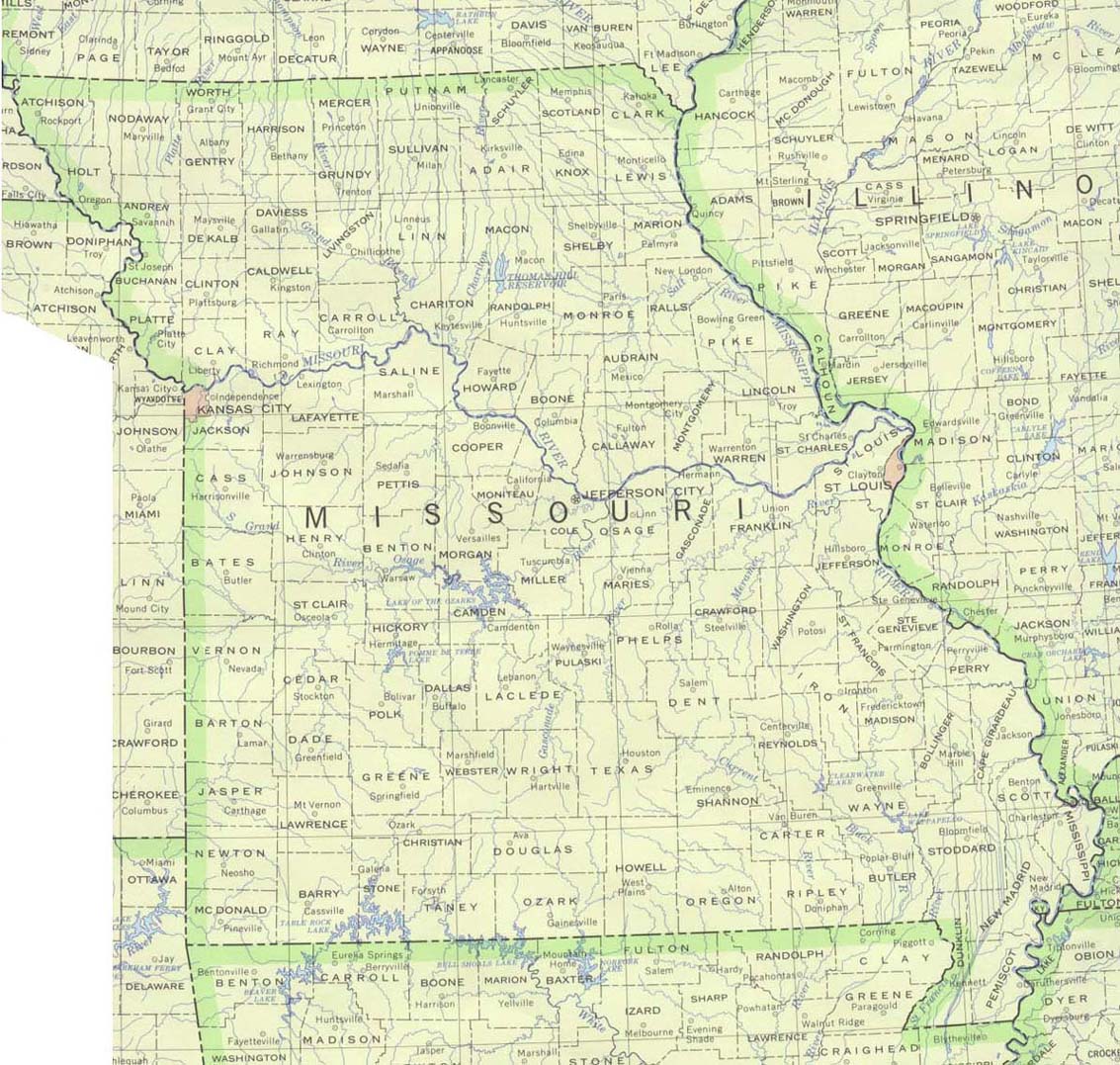
Missouri (base map) JPEG format (276K) County boundaries and names, county seats, rivers. Original scale 1:2,500,000 U.S. Geological Survey, 1972 limited update 1990
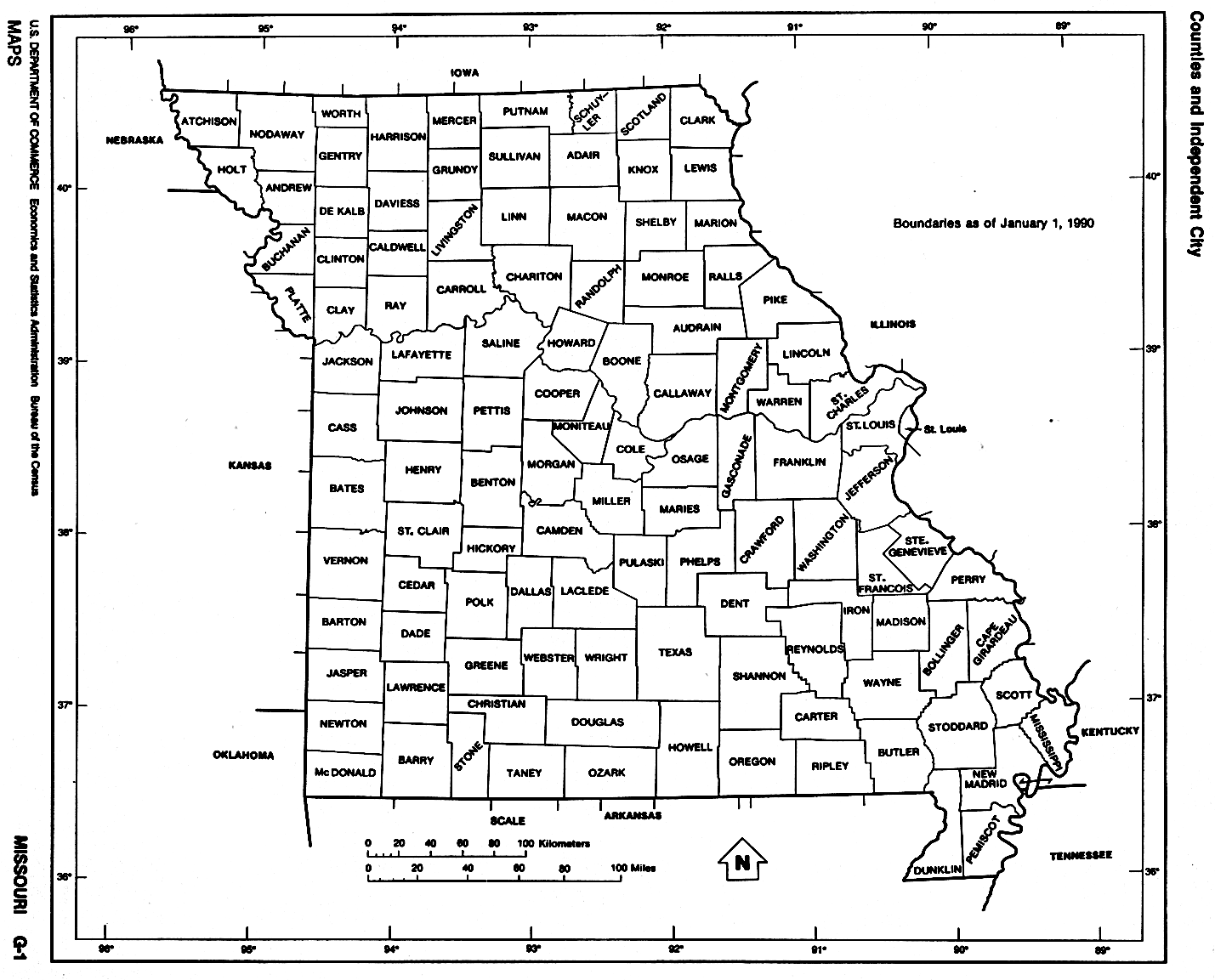
Missouri (outline map) JPEG format (107K) County boundaries and names. U.S. Bureau of the Census, 1990
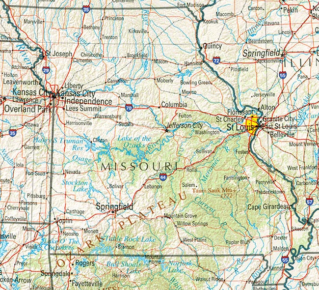
Missouri (reference map) JPEG format (300K) Shaded relief map with state boundaries, forest cover, place names, major highways. Portion of "The National Atlas of the United States of America. General Reference", compiled by U.S. Geological Survey 2001, printed 2002
Missouri (reference map) PDF format (232K) Shaded relief map with state boundaries, forest cover, place names, major highways. Portion of "The National Atlas of the United States of America. General Reference", compiled by U.S. Geological Survey 2001, printed 2002
Missouri - Federal Lands and Indian Reservations PDF format (586K) The National Atlas of the United States of America, U.S. Geological Survey, 2003
City Maps
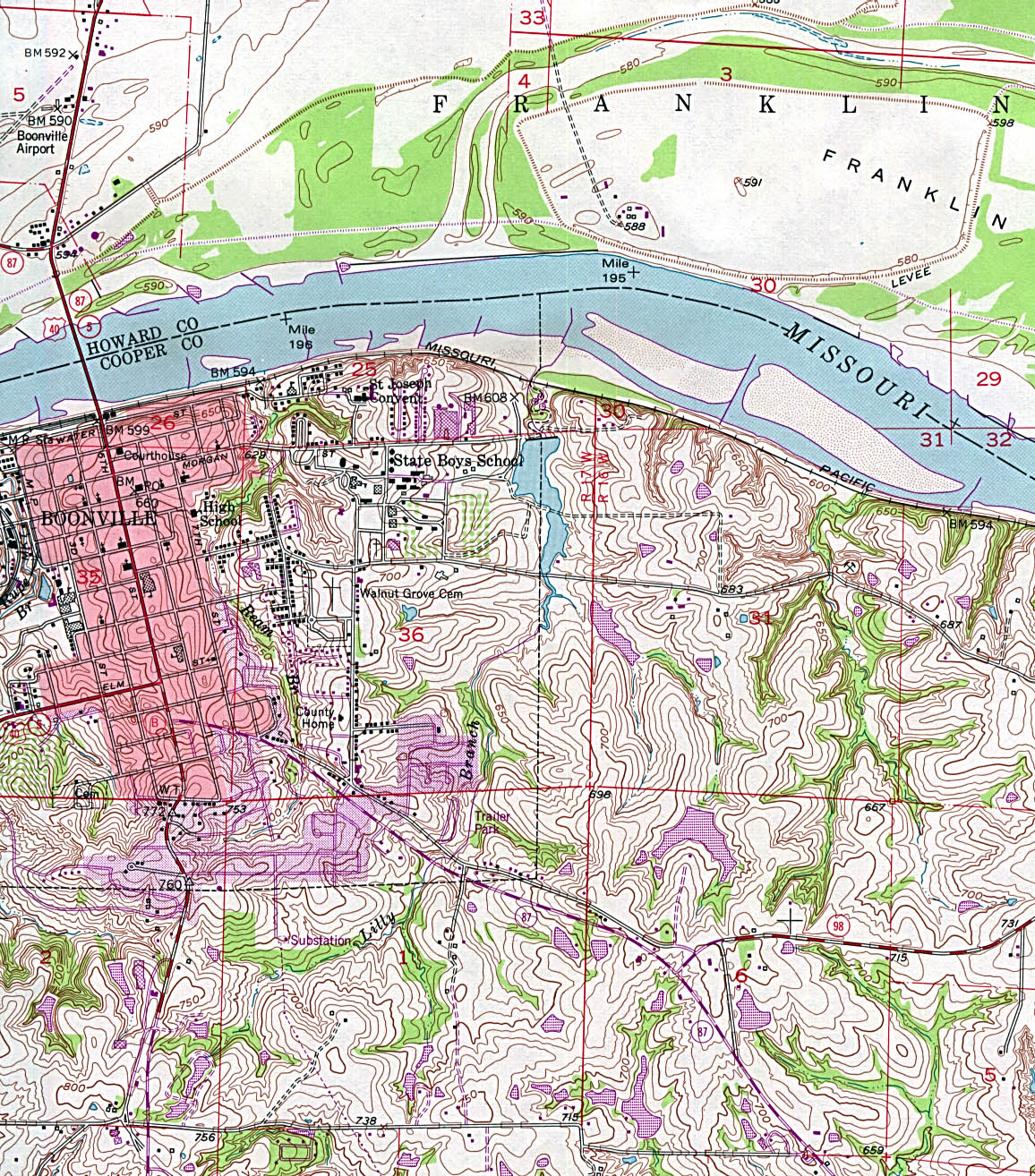
Boonville (topographic) original scale 1:24,000 U.S.G.S. 1952 photorevised 1979 (663K)
Branson (topographic) original scale 1:24,000 U.S.G.S. 1989 (876K)
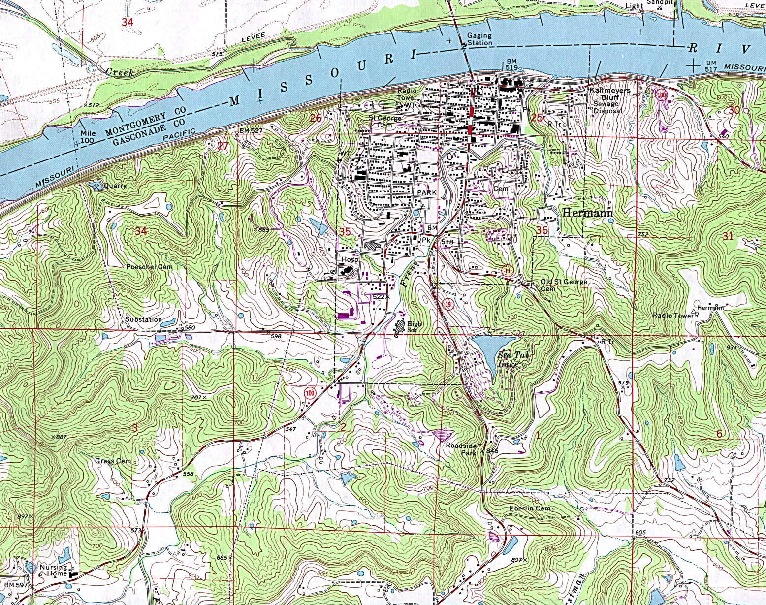
Hermann (topographic) original scale 1:24,000 U.S.G.S. 1974 photorevised 1985 (833K)
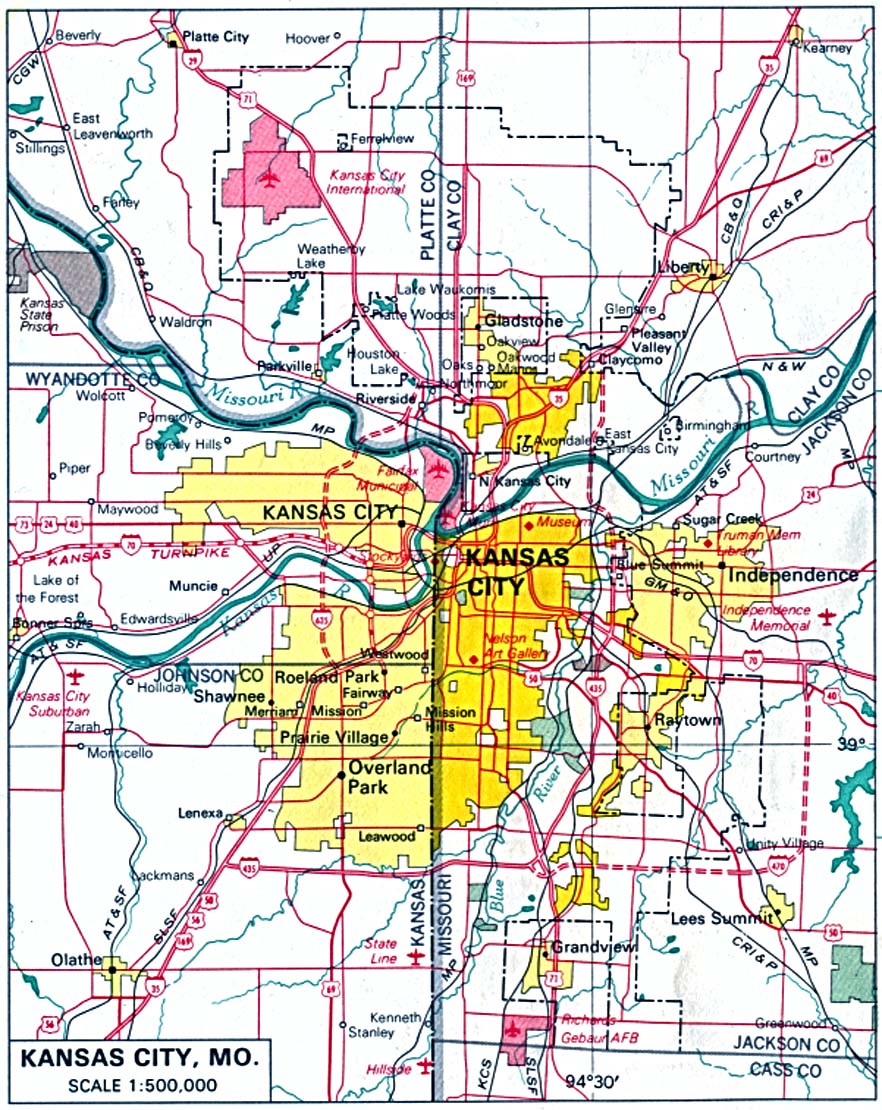
Kansas City (Missouri and Kansas) original scale 1:500,000 U.S. National Atlas 1970 (282K)
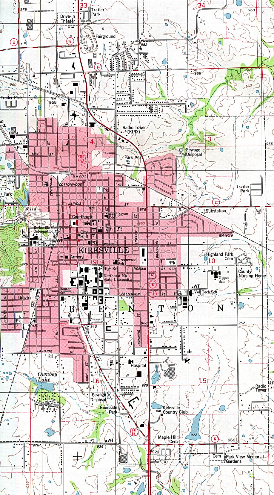
Kirksville (topographic) original scale 1:24,000 U.S.G.S. 1979 (502K)
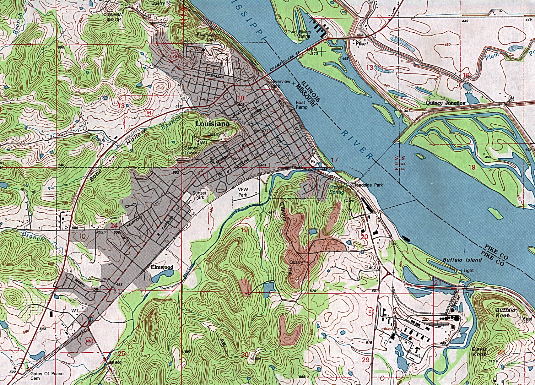
Louisiana (topographic) original scale 1:24,000 U.S.G.S. 1991 (842K)
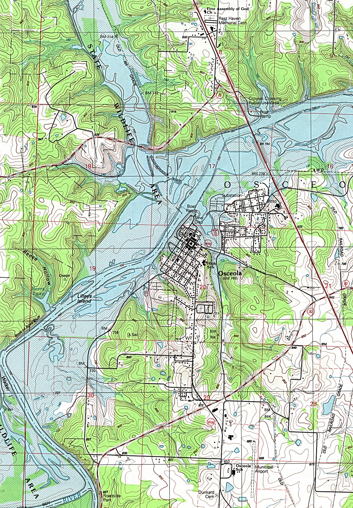
Osceola (topographic) original scale 1:24,000 U.S.G.S. 1991 (935K)
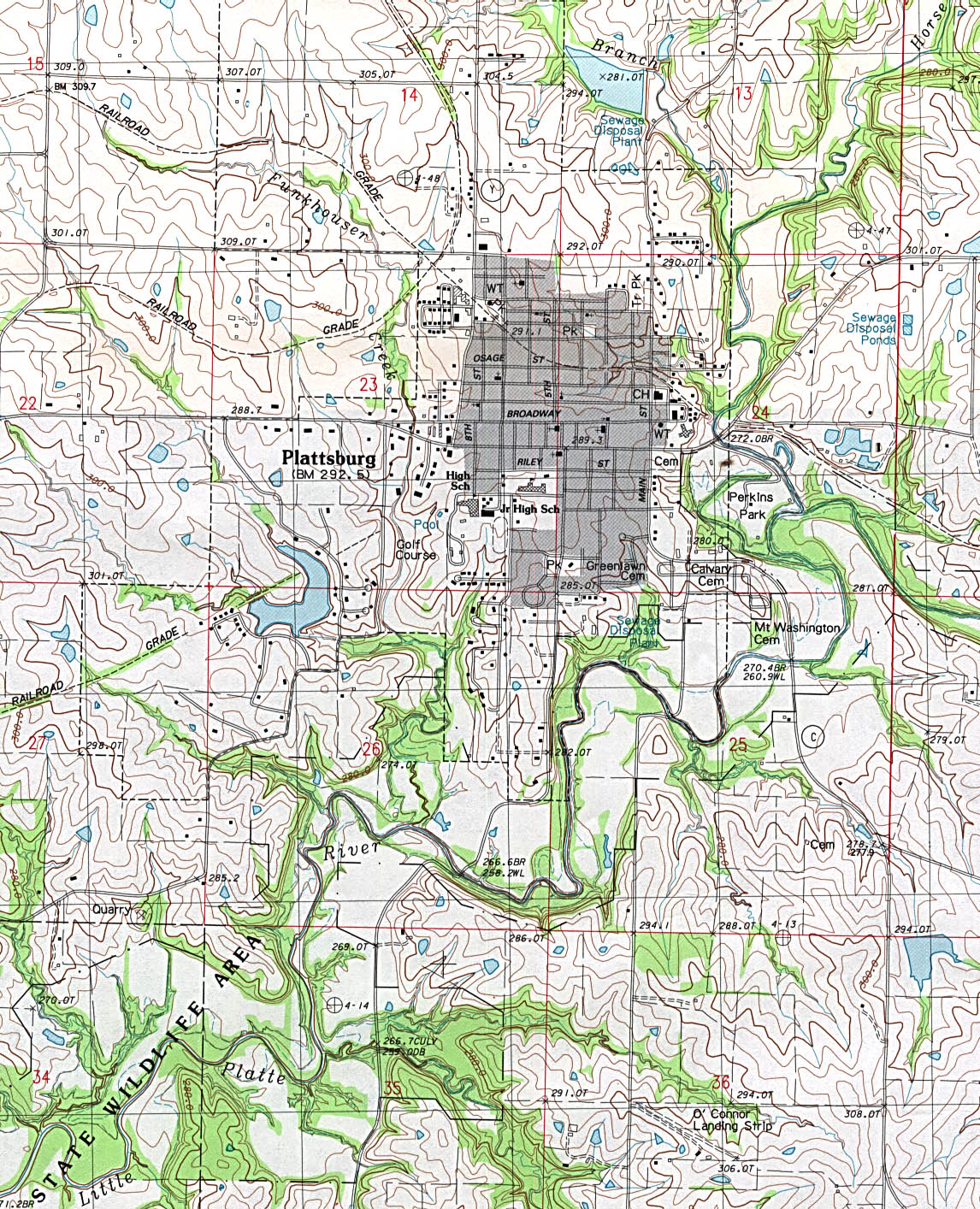
Plattsburg (topographic) original scale 1:24,000 U.S.G.S. provisional edition 1984 (638K)
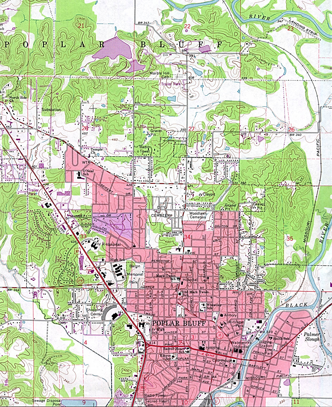
Poplar Bluff (topographic) original scale 1:24,000 U.S.G.S. 1966 photorevised 1979 (748K)
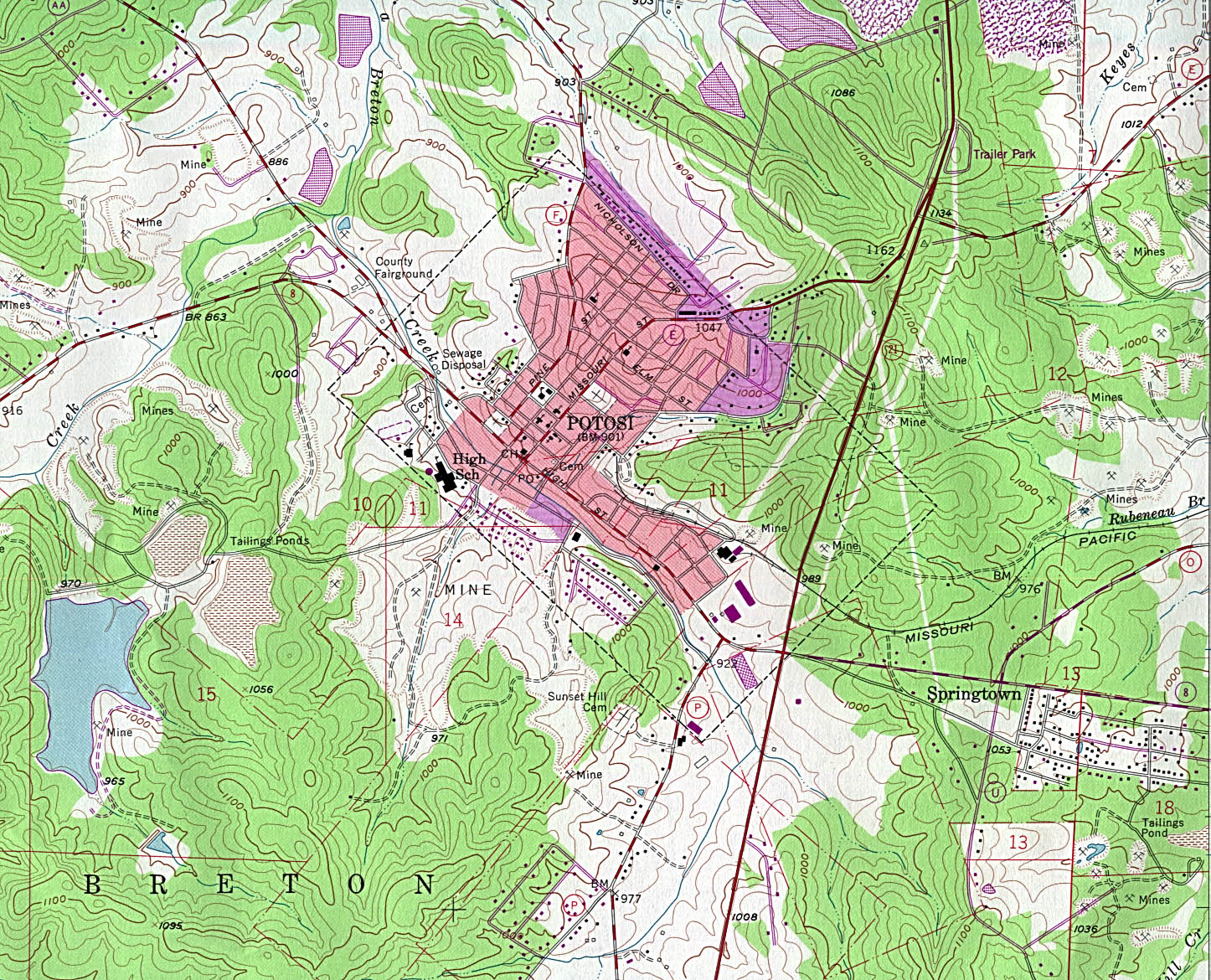
Potosi (topographic) original scale 1:24,000 U.S.G.S. 1958 photorevised 1982 (663K)
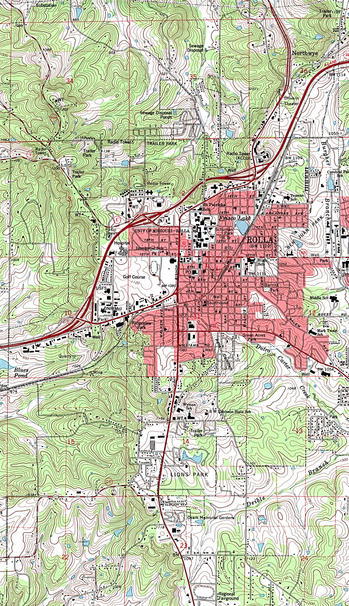
Rolla (topographic) original scale 1:24,000 U.S.G.S. 1992 (1,114K)
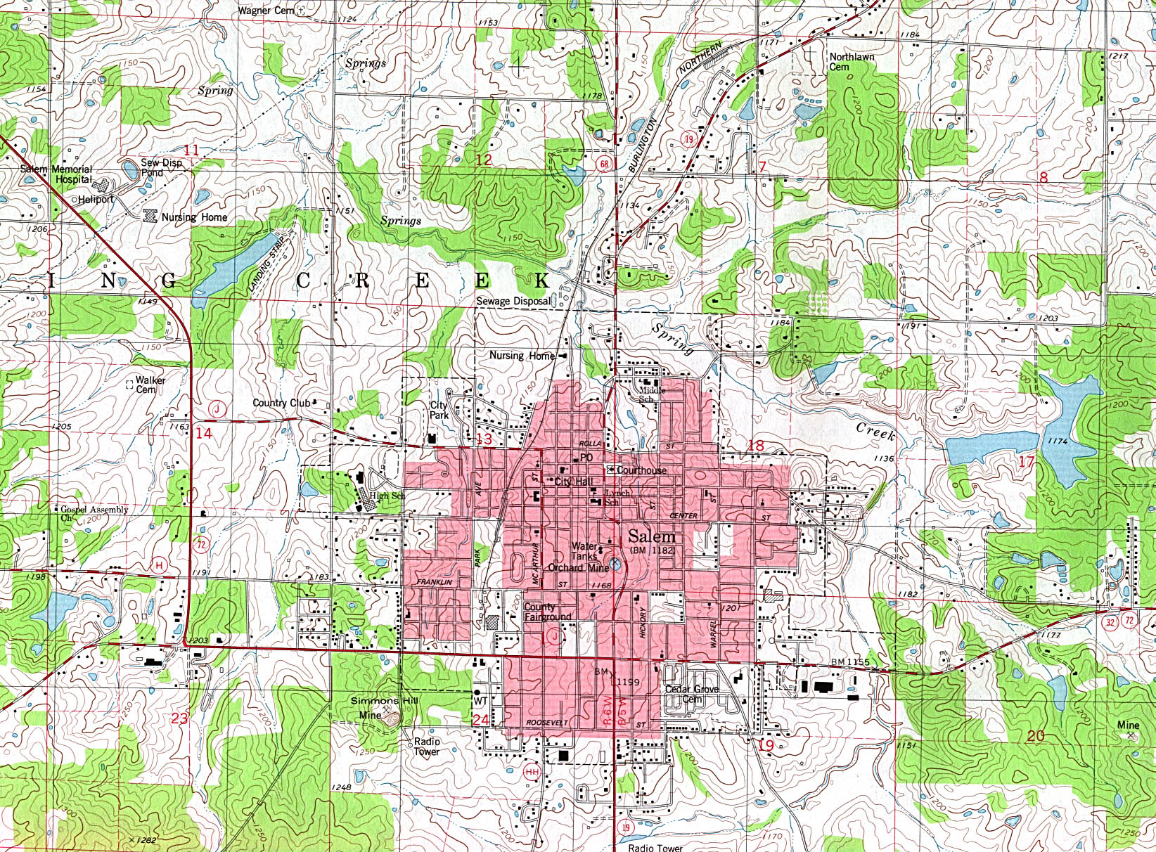
Salem (topographic) original scale 1:24,000 U.S.G.S. 1981 (774K)
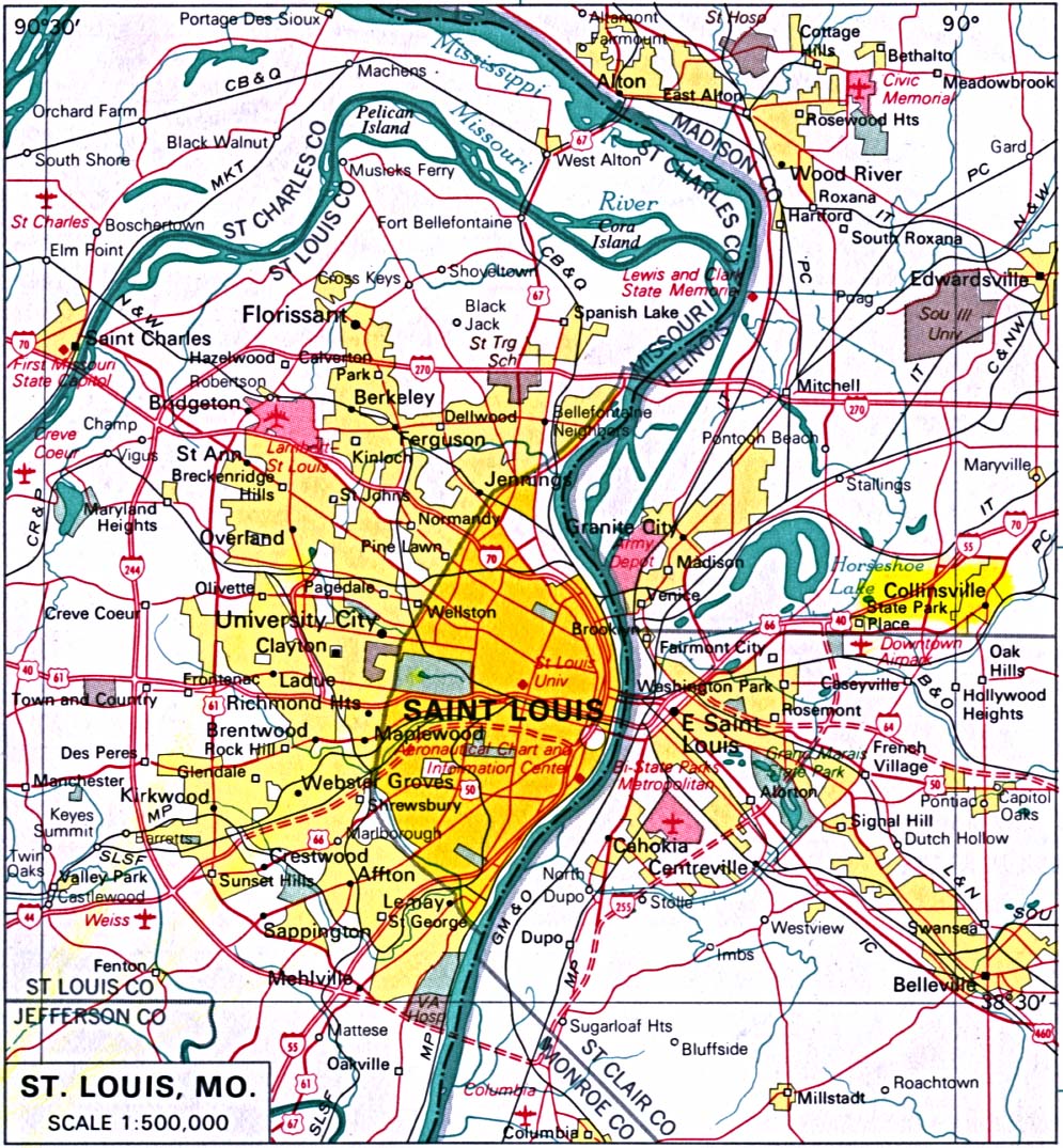
St.Louis original scale 1:500,000 U.S. National Atlas 1970 (377K)
Historical City Maps
Columbia 1920 Automobile Blue Book, 1920, Vol. 5 (123K)
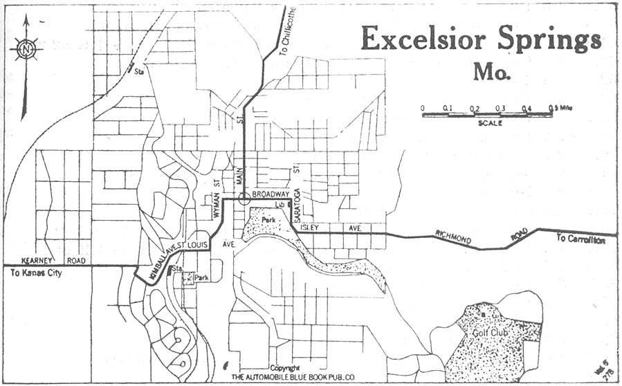
Excelsior Springs 1920 Automobile Blue Book, 1920, Vol. 5 (99K)
Kansas City, Kansas and Missouri 1907 From The New Encyclopedic Atlas and Gazetteer of the World, Edited by Francis J. Reynolds, P.F. Collier & Son, New York, 1917 (139K)
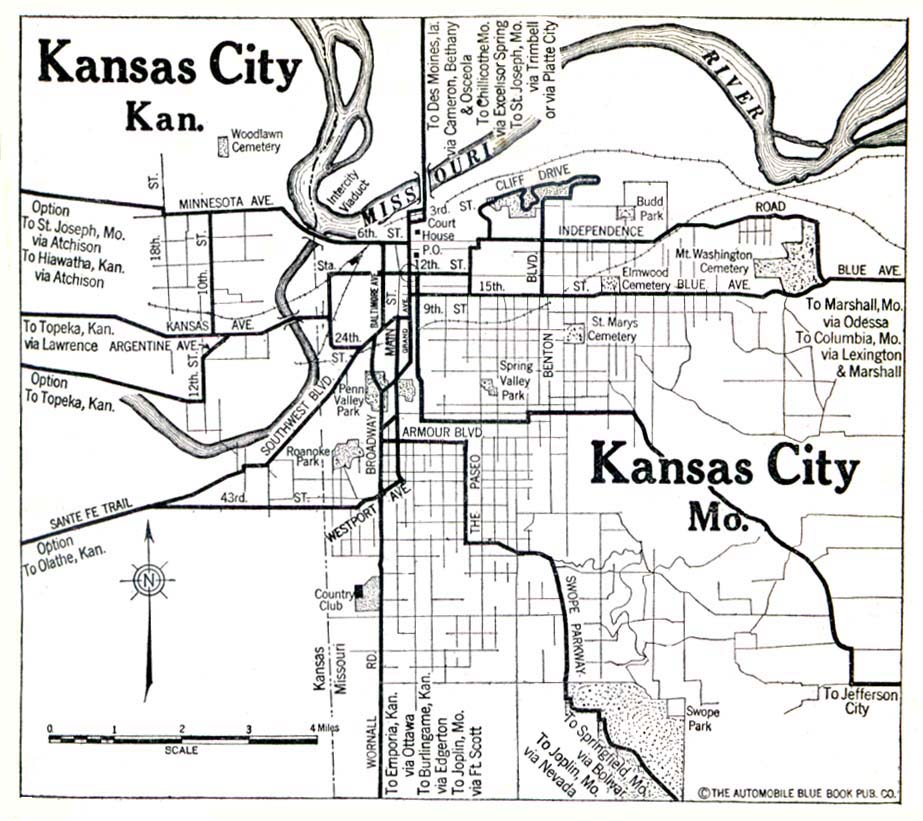
Kansas City, Kansas and Missouri 1920 Automobile Blue Book (139K)
Saint Joseph 1920 Automobile Blue Book (150K)
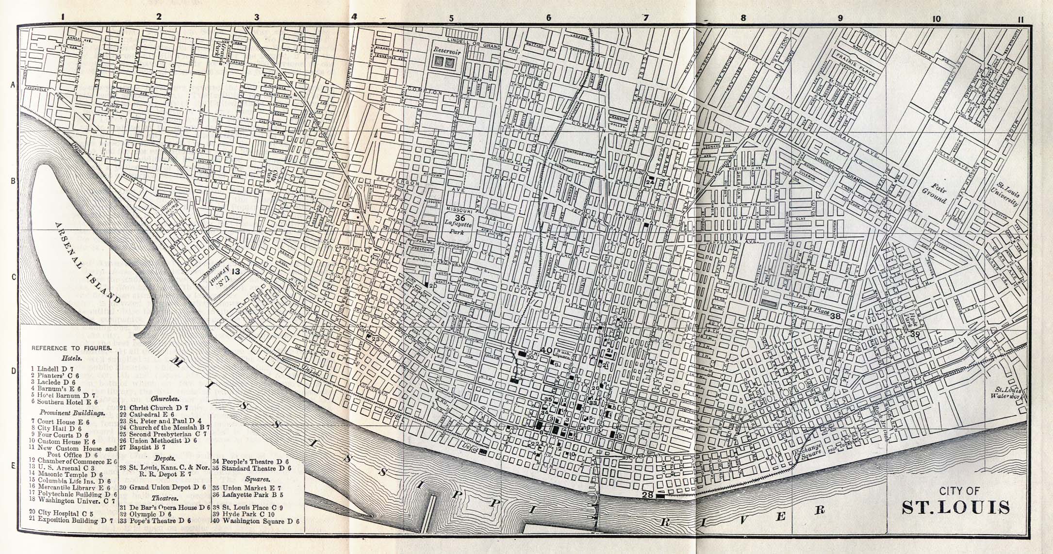
Saint Louis 1885 Appletons' General Guide to the United States and Canada. Part II. Western and Southern States. New York: D. Appleton and Company. 1885 (728K)
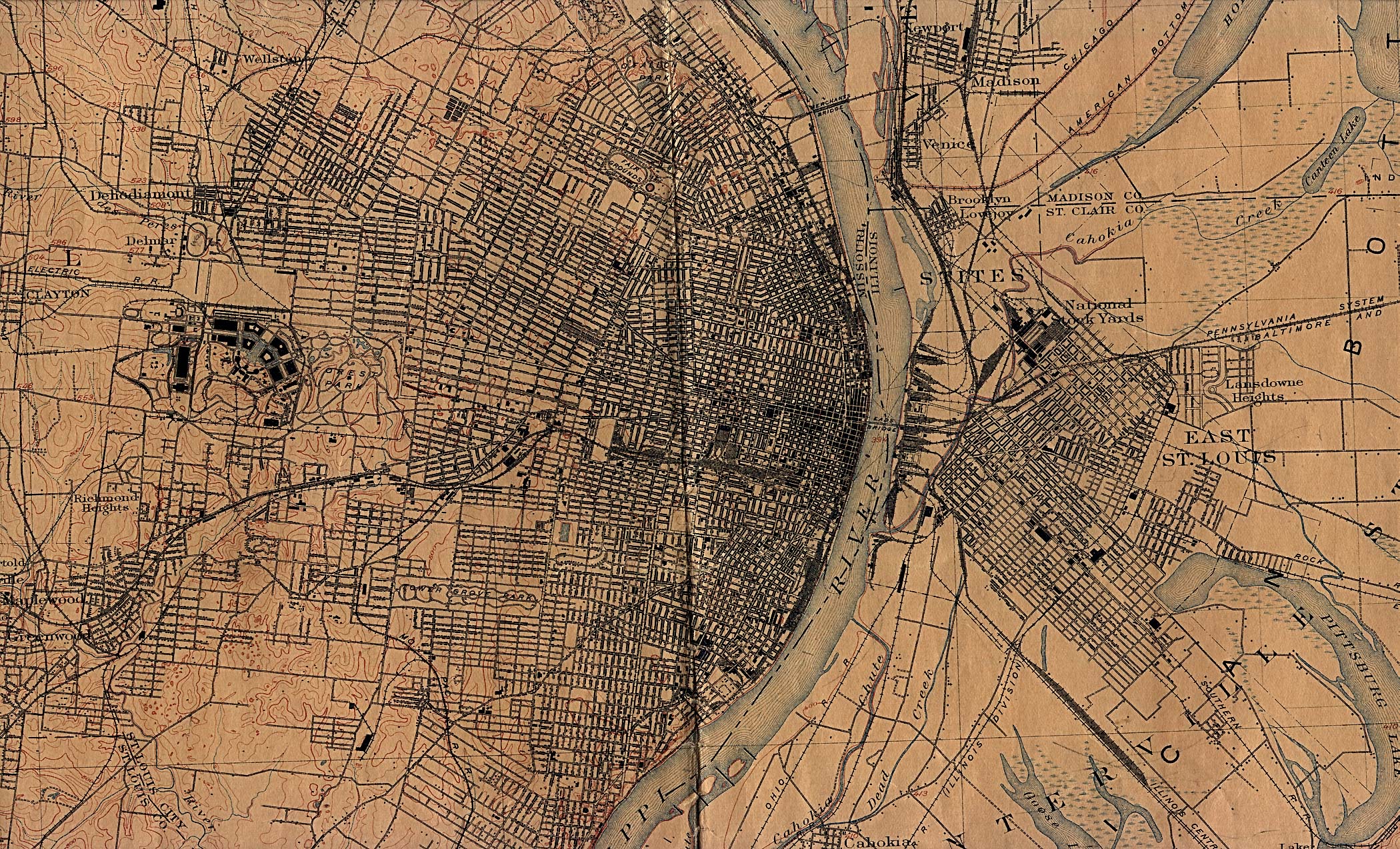
Saint Louis 1912 U.S. Geological Survey (1,241K)
Surveyed in 1903. Edition of April 1904, reprinted Nov. 1912, with corrections.
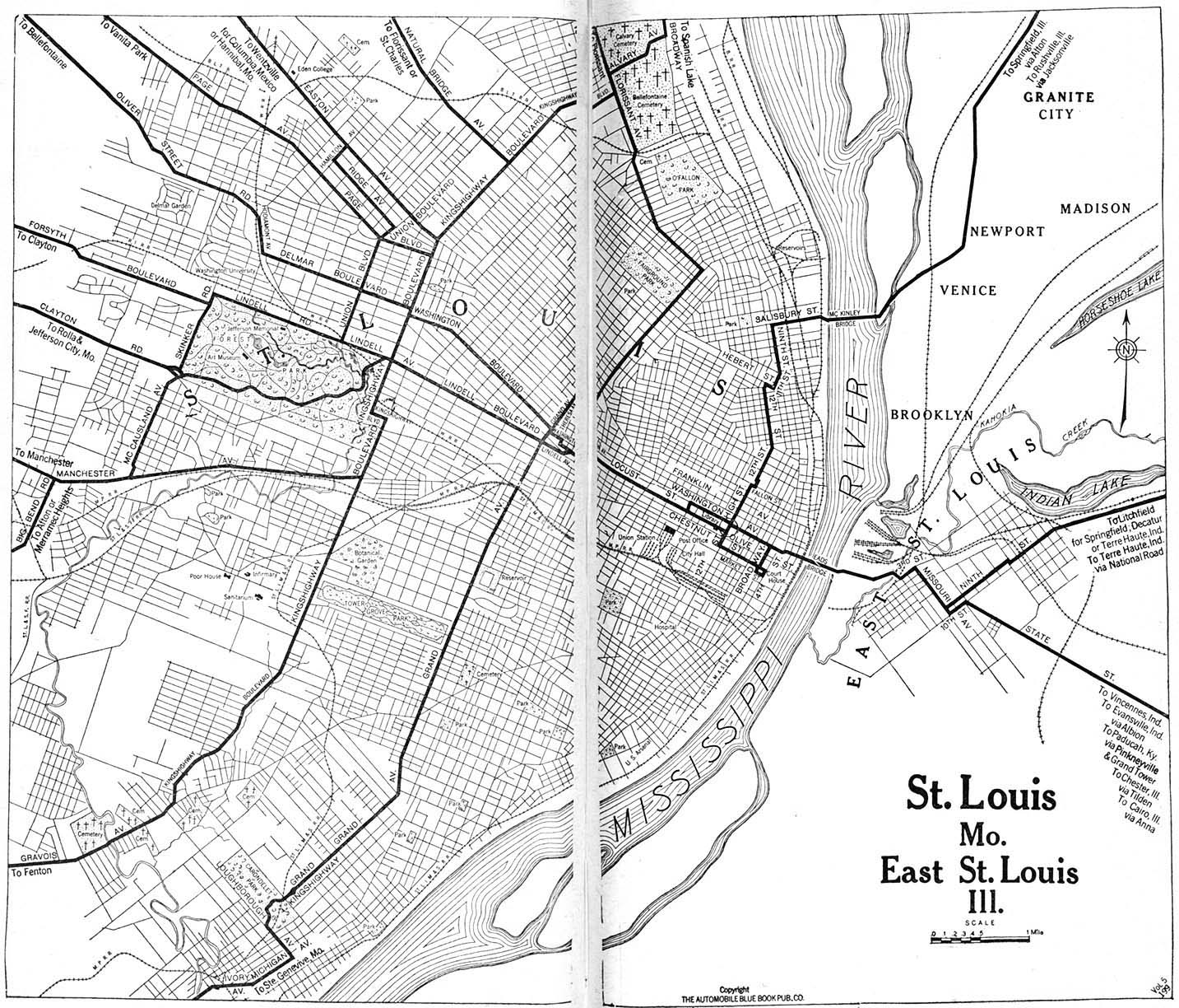
Saint Louis 1920 Automobile Blue Book, 1920, Vol. 7 (493K)
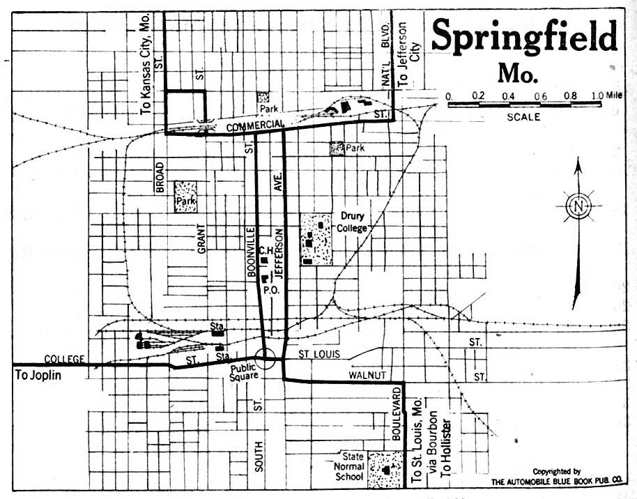
Springfield 1920 Automobile Blue Book, 1920, Vol. 5 (158K)
Maps of National Parks, Monuments, and Historic Sites
The following maps were produced by the U.S. National Park Service unless otherwise noted.
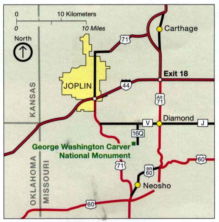
George Washington Carver National Monument (Area Map) 1995 (106K)
George Washington Carver National Monument (Area Map) 1998 (65K) (PDF Format)
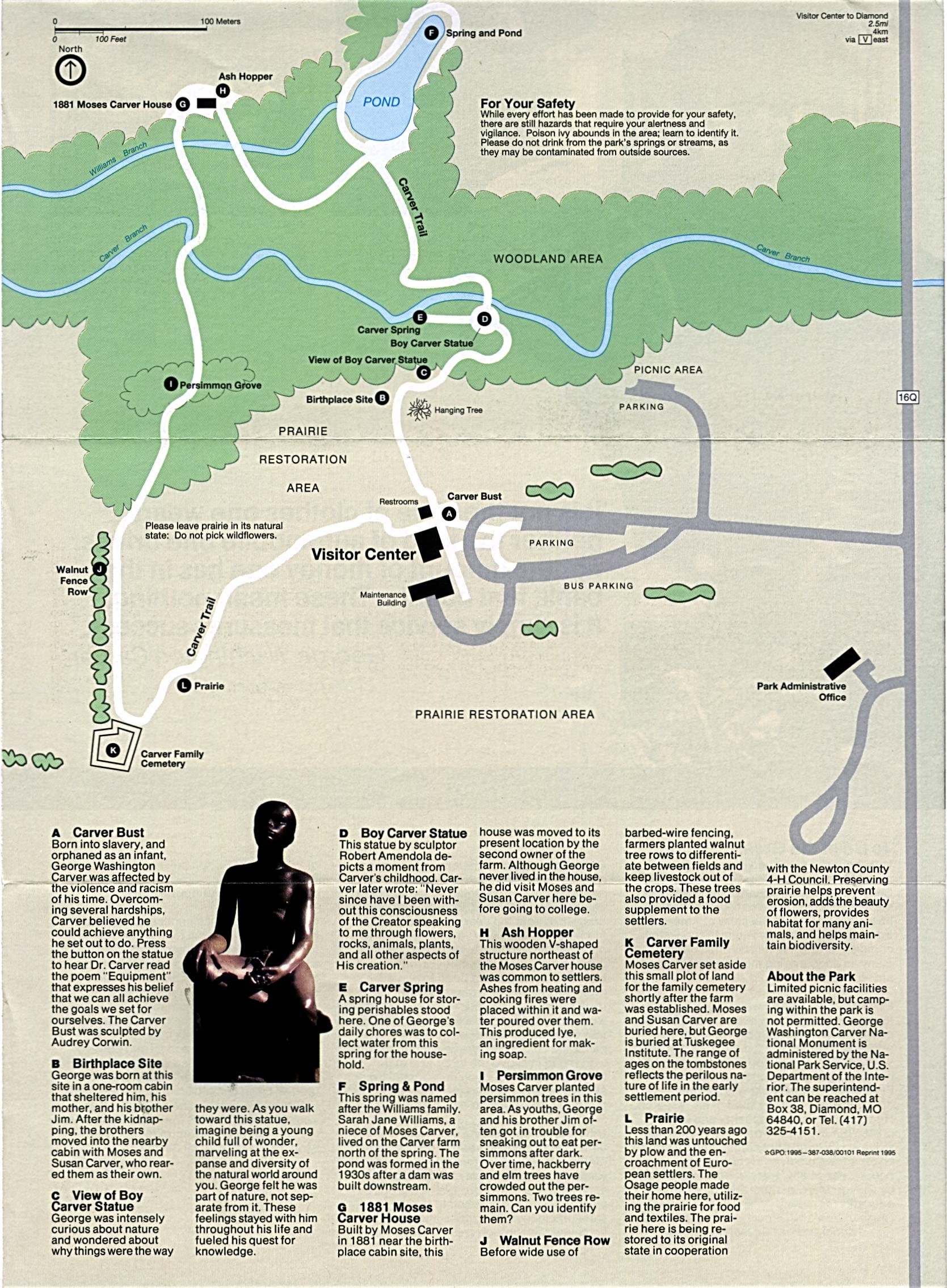
George Washington Carver National Monument (Park Map) 1995 (661K)
George Washington Carver National Monument (Park Map) 1998 (65K) (PDF Format)
Harry S. Truman National Historic Site (Location and Park Maps) 2001 (116K)
Ozark National Scenic River (Park Map) 1999 (323K) (PDF Format)
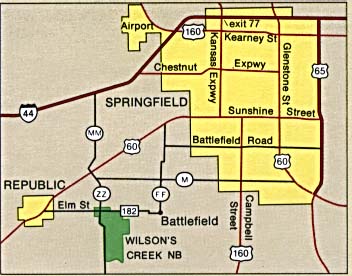
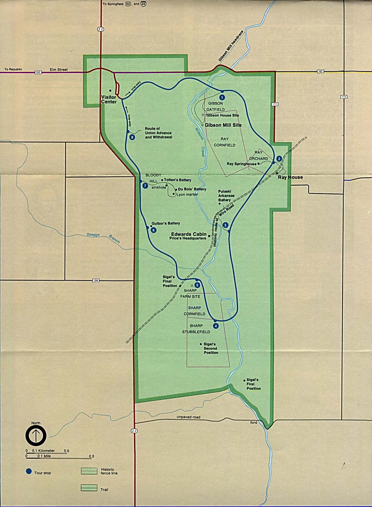
Wilson's Creek National Battlefield (Area Map) (27K)
Wilson's Creek National Battlefield (Park Map) (290K)
Sources: Many of these maps were provided by the University of Texas Library and/or the U.S. Central Intelligence Agency (CIA).
Maps on other websites
Missouri - County Names (Census Bureau)
Missouri - GIS and Maps (Missouri Department of Natural Resources)
Missouri - Interactive Maps (University of Missouri)
Missouri - Maps (Geology.com)
Missouri - Road Map (World Sites Atlas)
Missouri - Satellite Image (Geology.com)
Missouri - Topographic Maps (Libre Map Project)
Missouri - Topographic Maps (University of Missouri)
See Also:
Topographic Maps
ArcGIS Shapefile Map Layers
<-- Free Maps
<-- Free U.S. State Maps
<-- Free World Country Maps
Didn't find what you are looking for? We've been online since 1996 and have created 1000's of pages. Search below and you may find just what you are looking for.
Michael R. Meuser
Data Research & GIS Specialist
MapCruzin.com is an independent firm
specializing in GIS project development and data research.
We created the first U.S. based
interactive toxic chemical facility
maps on the internet in 1996 and we
have been online ever since. Learn more about us and our services.
Have a project in mind? If you have data, GIS project or custom shapefile needs contact Mike.
Contact Us
Report Broken Links
Subscribe for Updates
Sponsors


