Download Free Maps of Hawaii
<-- Free Maps
<-- Free U.S. State Maps
<-- Free World Country Maps
See Also:
Topographic Maps
ArcGIS Shapefile Map Layers
Download these maps of Hawaii for your reports, websites, research, projects, presentations...
Note that maps may not appear on the webpage in their full size and resolution. To save the maps to your computer, right-click on the link.
State Maps
Hawaii original scale 1:7,500,000 From the U.S. National Atlas, 1970 (223K)
Hawaii (outline map) JPEG format (76K) County boundaries and names. U.S. Bureau of the Census, 1990
Hawaii(reference map) JPEG format (168K) Shaded relief map with state boundaries, forest cover, place names, major highways. Portion of "The National Atlas of the United States of America. General Reference", compiled by U.S. Geological Survey 2001, printed 2002
Hawaii (reference map) PDF format (120K) Shaded relief map with state boundaries, forest cover, place names, major highways. Portion of "The National Atlas of the United States of America. General Reference", compiled by U.S. Geological Survey 2001, printed 2002
Hawaii- Federal Lands and Indian Reservations PDF format (564K) The National Atlas of the United States of America, U.S. Geological Survey, 2003
Outlying Islands
Hawaii original scale 1:7,500,000 From the U.S. National Atlas, 1970 (223K)
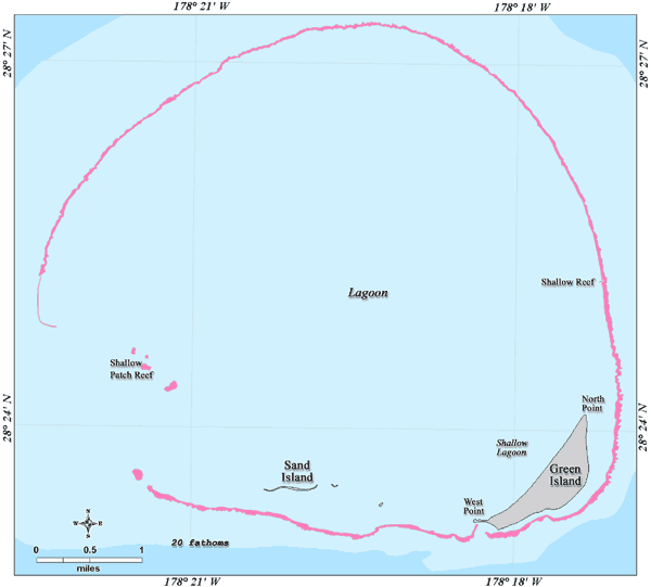
Papahanaumokuakea Marine National Monument from Papahanaumokuakea Marine National Monument Draft Management Plan, 2008 (325K)
Banks Near French Frigate Shoals NOAA/Papahanaumokuakea Marine National Monument 2006 (13K)
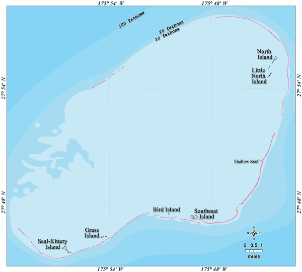
French Frigate Shoals NOAA/Papahanaumokuakea Marine National Monument 2006 (19K)
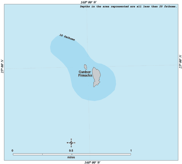
Gardner Pinnacles NOAA/Papahanaumokuakea Marine National Monument 2006 (9K)
Kure Atoll NOAA/Papahanaumokuakea Marine National Monument 2006 (19K)
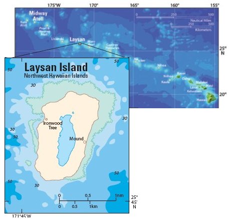
Laysan Island NOAA/Papahanaumokuakea Marine National Monument 2006 (17K)
Laysan Island U.S.G.S. Pacific Island Ecosystems Research Center 2005 (34K)
Lisianski Island NOAA/Papahanaumokuakea Marine National Monument 2006 (16K)
Necker Island NOAA/Papahanaumokuakea Marine National Monument 2006 (12K)
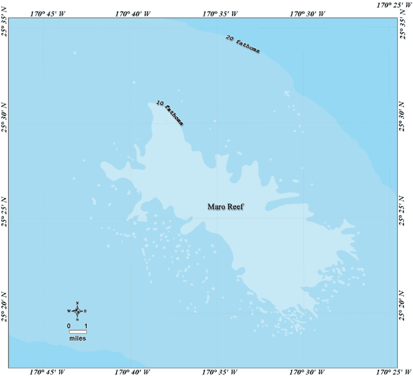
Maro Reef NOAA/Papahanaumokuakea Marine National Monument 2006 (17K)
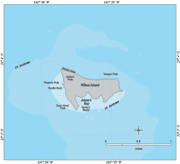
Nihoa Island NOAA/Papahanaumokuakea Marine National Monument 2006 (14K)
Pearl and Hermes Atoll NOAA/Papahanaumokuakea Marine National Monument 2006 (18K)
City Maps
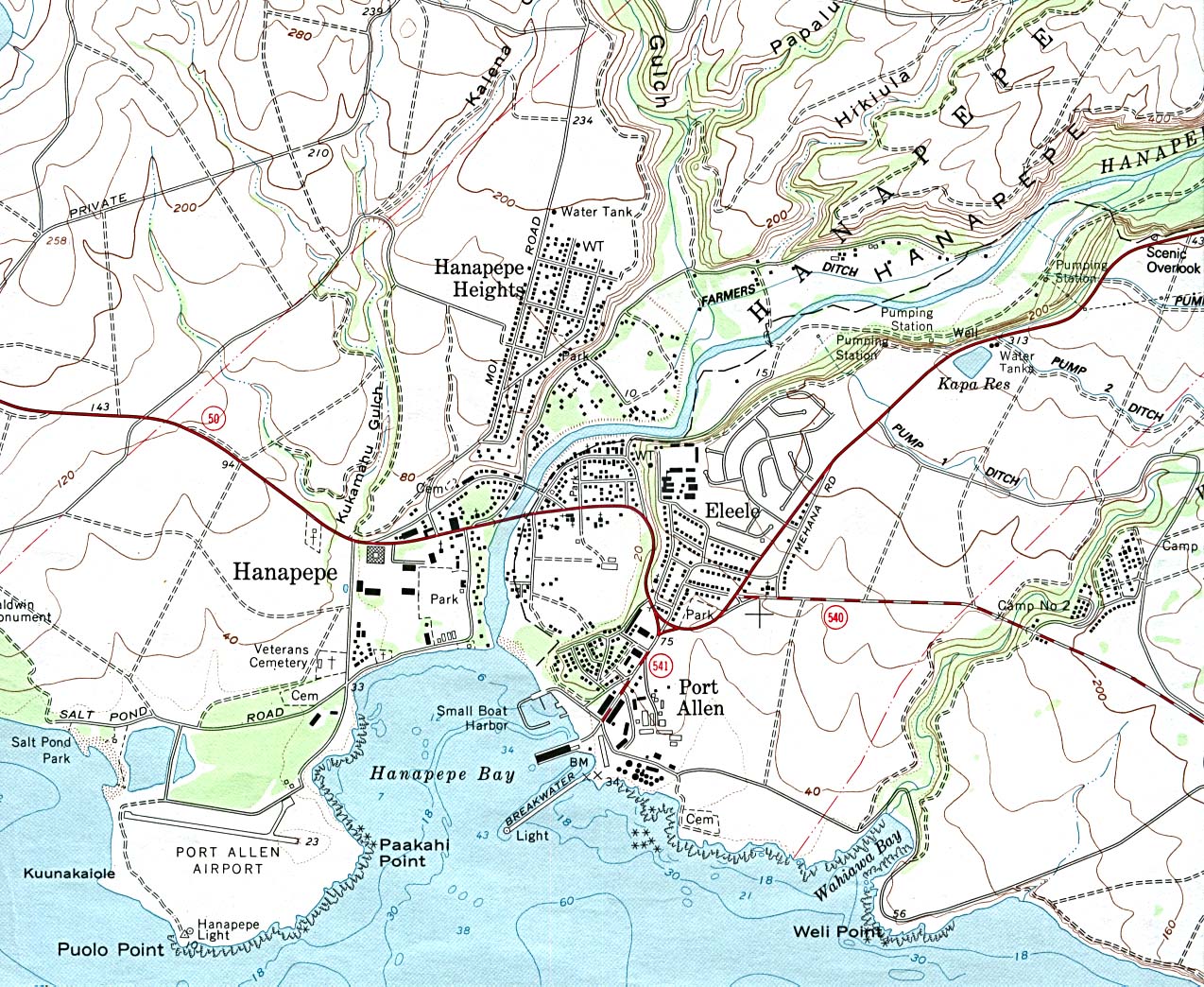
Hanapepe (topographic) original scale 1:24,000 U.S.G.S. 1983 (417K)
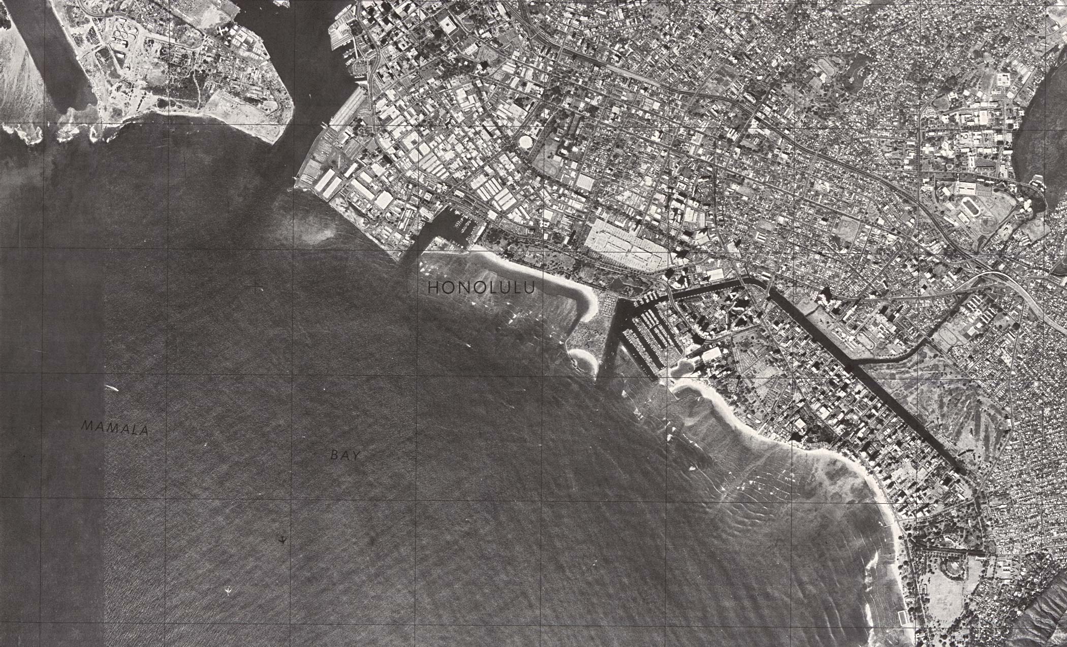
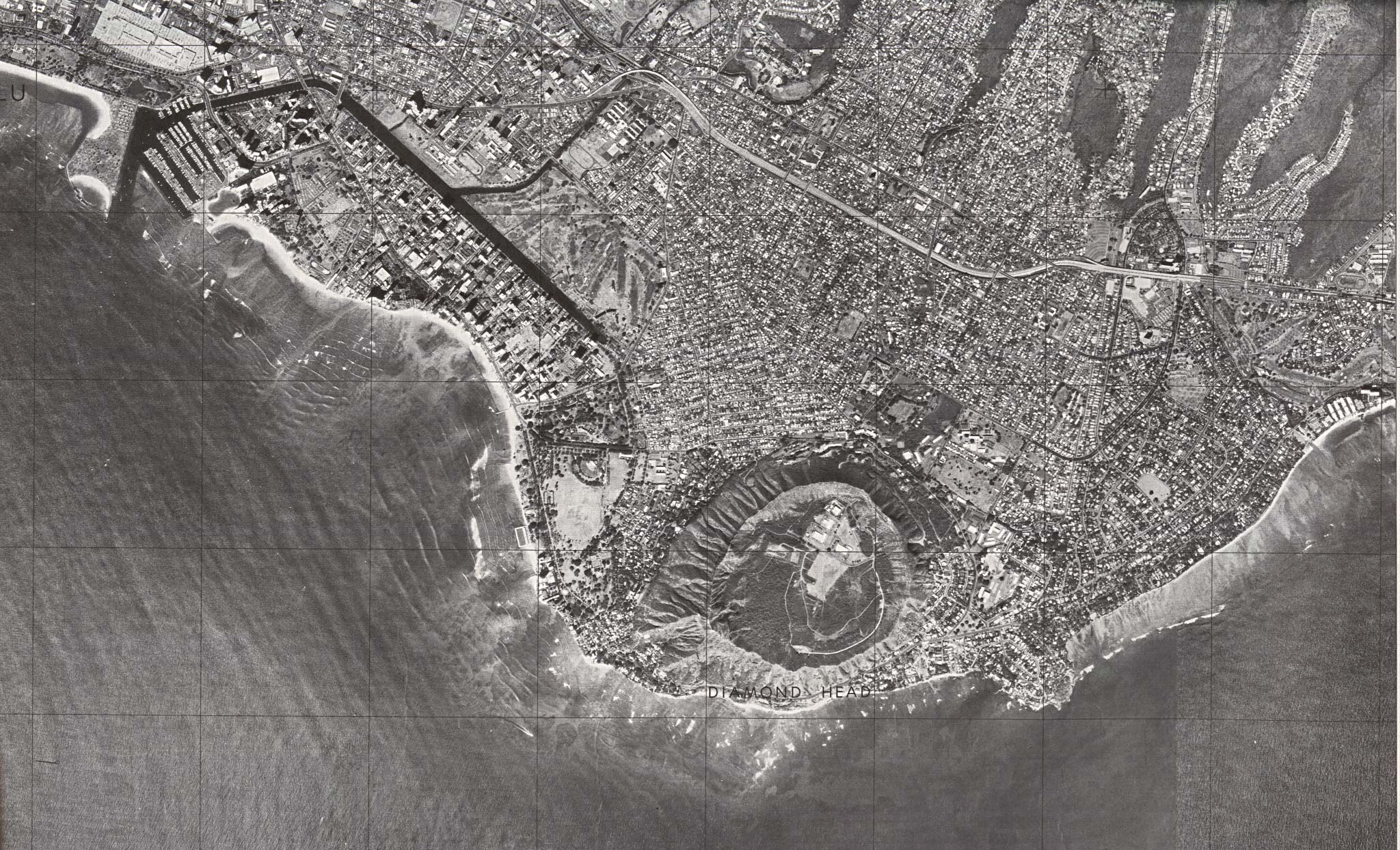
Honolulu Central (orthophoto map) original scale 1:24,000 U.S.G.S.1978, photo taken 1976(746K)
Honolulu Central (topographic) original scale 1:24,000 U.S.G.S. 1953, photorevised 1968, field checked 1969 (972K)
Honolulu - Diamond Head/Waikiki (orthophoto map) original scale 1:24,000 U.S.G.S. 1978, photo taken 1976 (739K)
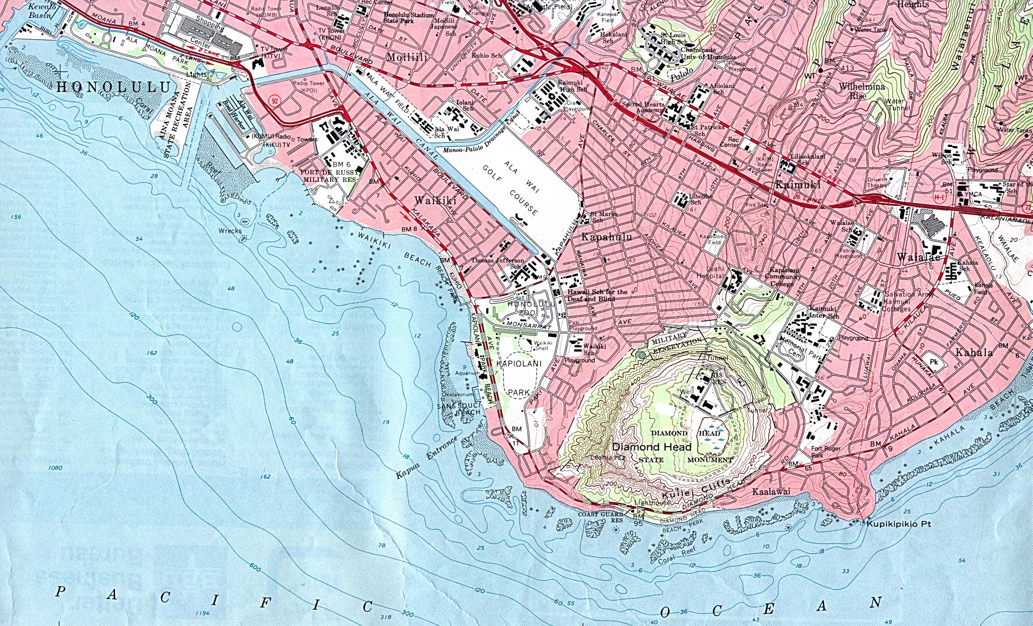
Honolulu - Diamond Head/Waikiki (topographic) original scale 1:24,000 U.S.G.S. 1953, photorevised 1968, field checked 1969 (986K)
Honolulu West (topographic) original scale 1:24,000 U.S.G.S. 1953, photorevised 1968, field checked 1969 (1081K)
Kaneohe (topographic) original scale 1:24,000 U.S.G.S. 1983 (876K)
Makakilo City (topographic) original scale 1:24,000 U.S.G.S. 1983 (578K)
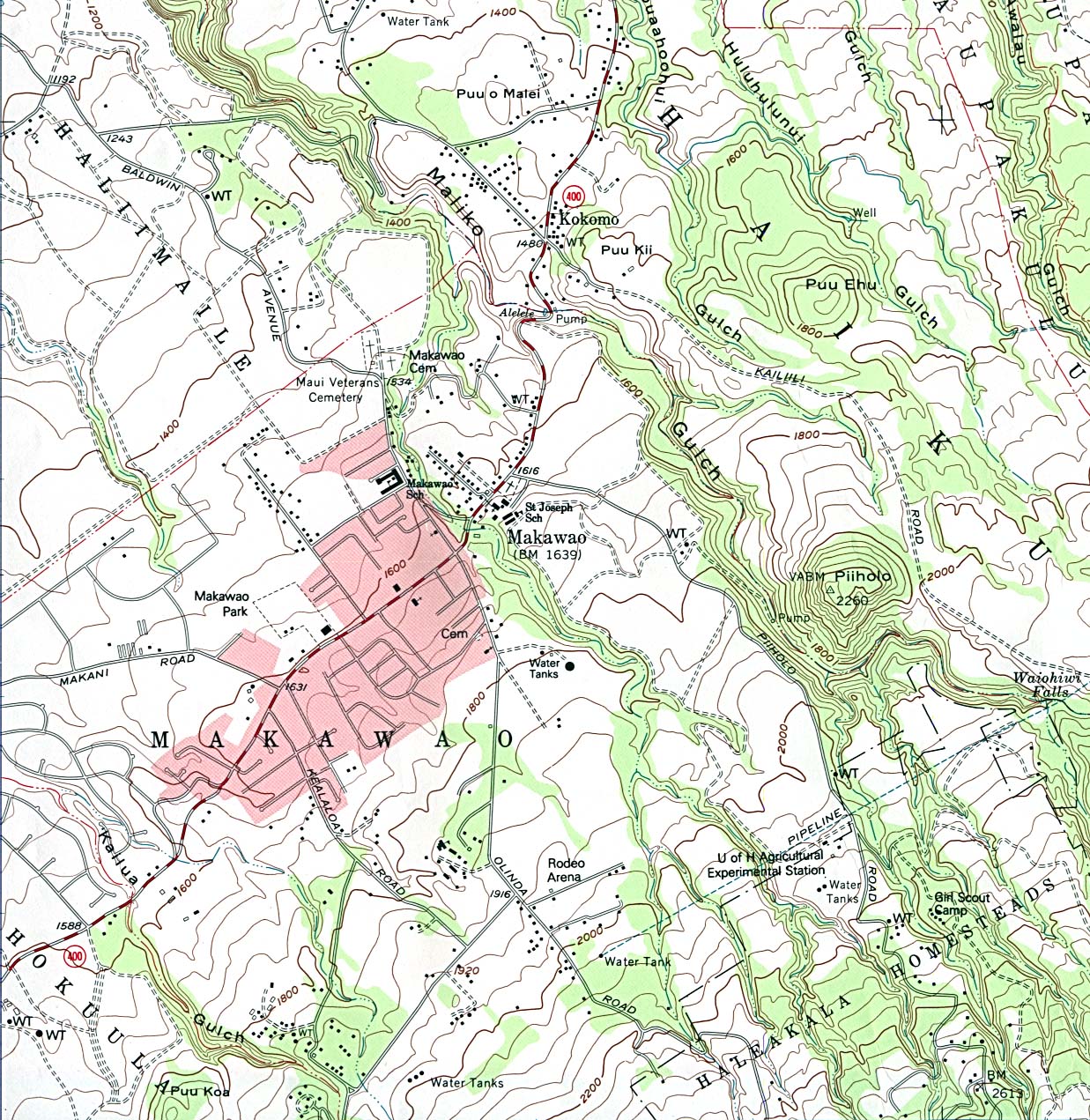
Makawao (topographic) original scale 1:24,000 U.S.G.S. 1983 (527K)
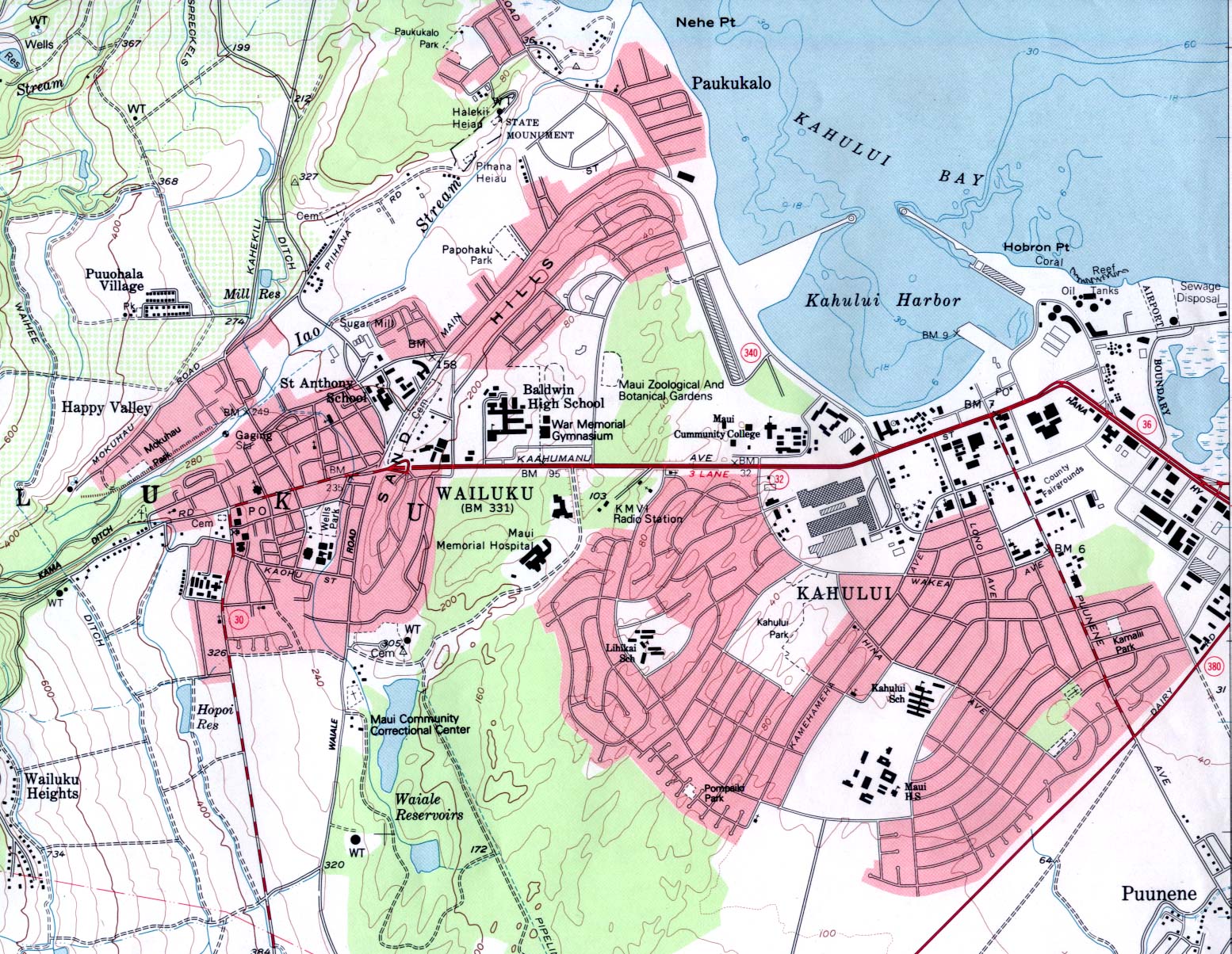
Wailuku (topographic) original scale 1:24,000 U.S.G.S. 1983 (519K)
Historical Maps
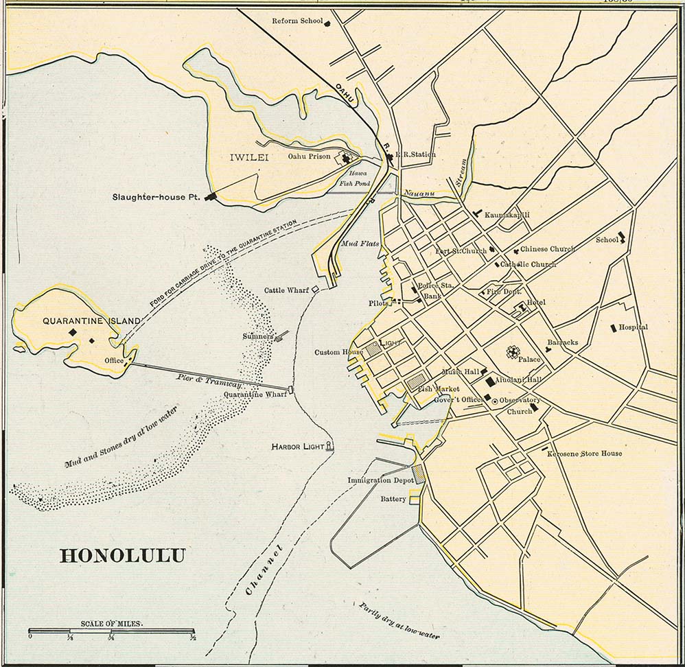
Honolulu from Cram's Modern Atlas, 1901 (175K)
Maps of National Parks, Monuments, and Historic Sites
The following maps were produced by the U.S. National Park Service unless otherwise noted.
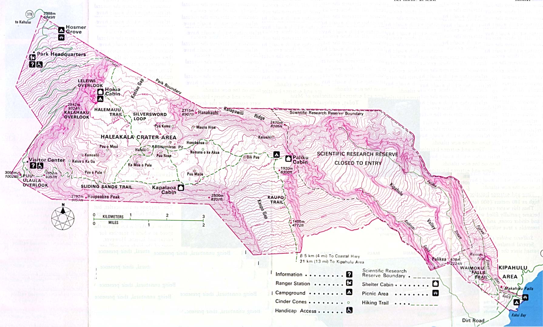
Haleakala National Park (Park Map) 1998 (129K) (PDF Format)
Haleakala National Park (Topographic) 1995 (351K)
Haleakala National Park - Maui Island (Park Map) 1998 (129K) (PDF Format)
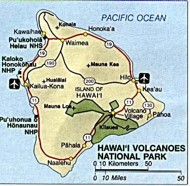
Hawaii Volcanoes National Park (Area Map) (46K)
Hawaii Volcanoes National Park (Park Map) 1999 (387K) (PDF Format)
Kapoho Crater Scale 1:24,000 U.S.G.S. (topographic) 1981 (408K)
Papahanaumokuakea Marine National Monument from Papahanaumokuakea Marine National Monument Draft Management Plan, 2008 (325K)
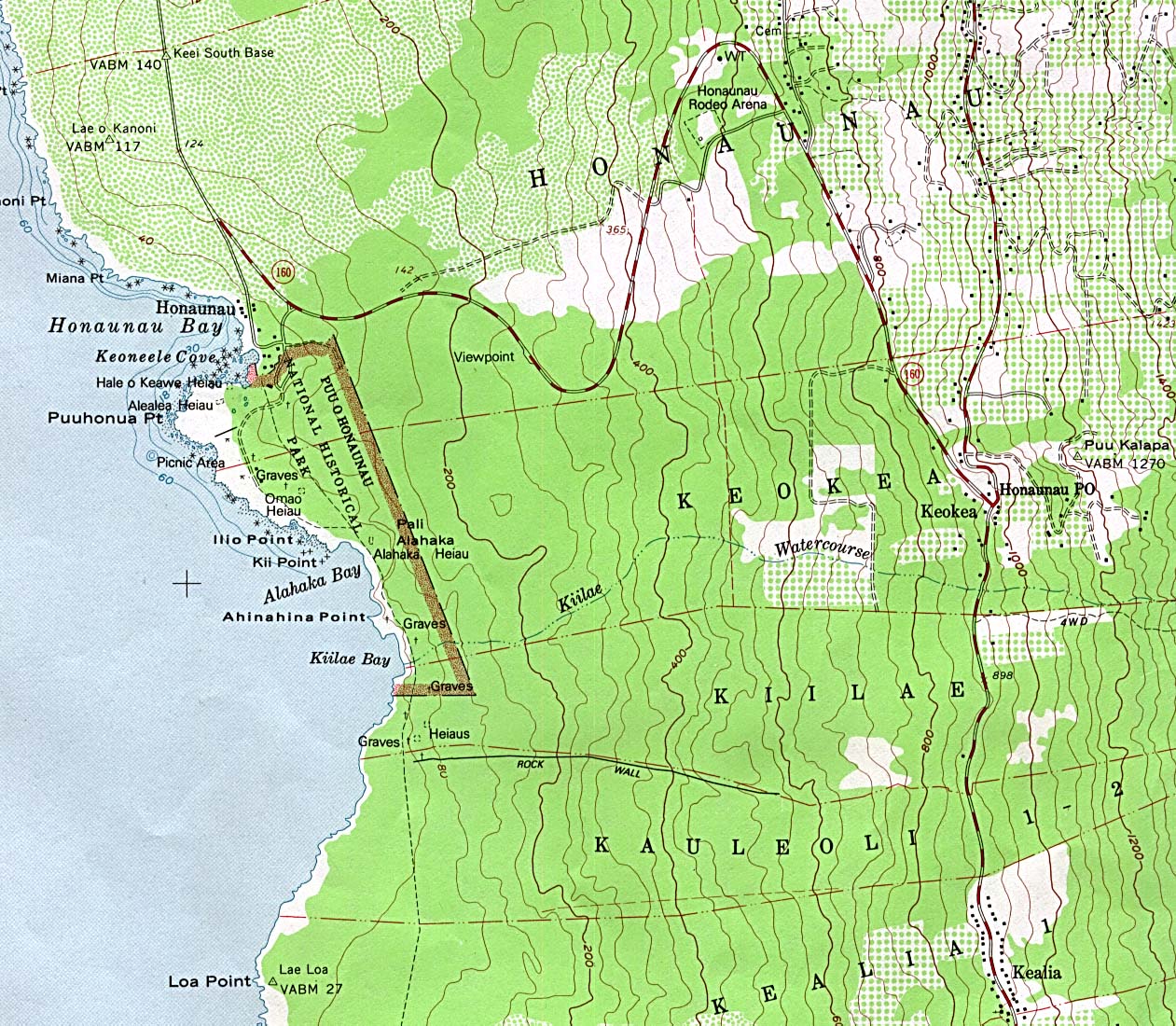
Pu'uhonua Honaunau National Historic Park Scale 1:24,000 U.S.G.S. (topographic) 1982 (434K)
Puukohola Heiau National Historic Site (Park Map) 1999 (65K) (PDF Format)
Sources: Many of these maps were provided by the University of Texas Library and/or the U.S. Central Intelligence Agency (CIA).
Maps on other websites:
Hawaii (Lonely Planet)
Hawaii (World Sites Atlas)
Hawaii - Atlas of Panoramic Aerial Images (William Bowen)
Hawaii - Benthic Habitats Atlas (NOAA)
Hawaii - County Names (Census Bureau)
Hawaii - "Big Island" of Hawaii Map (Best of Hawaii)
Hawaii - GIS Data (Hawaii GIS Clearinghouse/USGS)
Hawaii - GIS Data (State of Hawaii, Office of Planning)
Hawaii - Interactive Maps (CCCarto)
Hawaii - Kauai Map (Best of Hawaii)
Hawaii - Lanai Map (Best of Hawaii)
Hawaii - Maps (Geology.com)
Hawaii - Maps (Hawaii.gov)
Hawaii - Maui Map (Best of Hawaii)
Hawaii - Molokai Map (Best of Hawaii)
Hawaii - Oahu Map (Best of Hawaii)
Hawaii - Satellite Image (Geology.com)
Hawaii - Topographic Maps (Libre Map Project)
See Also:
Topographic Maps
ArcGIS Shapefile Map Layers
<-- Free Maps
<-- Free U.S. State Maps
<-- Free World Country Maps
Didn't find what you are looking for? We've been online since 1996 and have created 1000's of pages. Search below and you may find just what you are looking for.
Michael R. Meuser
Data Research & GIS Specialist
MapCruzin.com is an independent firm
specializing in GIS project development and data research.
We created the first U.S. based
interactive toxic chemical facility
maps on the internet in 1996 and we
have been online ever since. Learn more about us and our services.
Have a project in mind? If you have data, GIS project or custom shapefile needs contact Mike.
Contact Us
Report Broken Links
Subscribe for Updates
Sponsors


