Download Free South Korea Maps
<-- Free Map Downloads
<-- Free World Country Map Downloads
Sponsors
Note that maps may not appear on the webpage in their full size and resolution. To save the maps to your computer, right-click on the link.
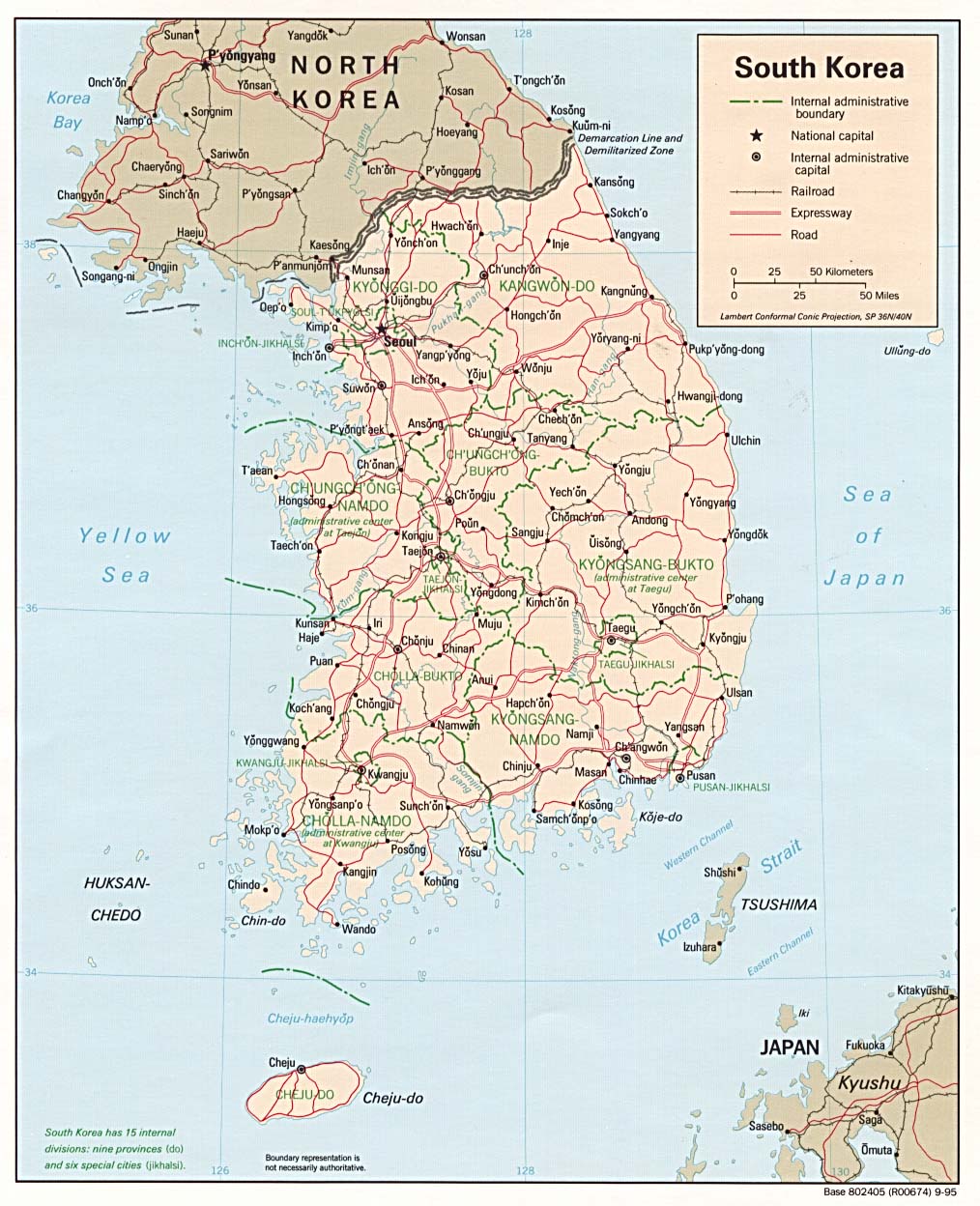
South Korea (Political) 1995 (246K) and
pdf format (275K)
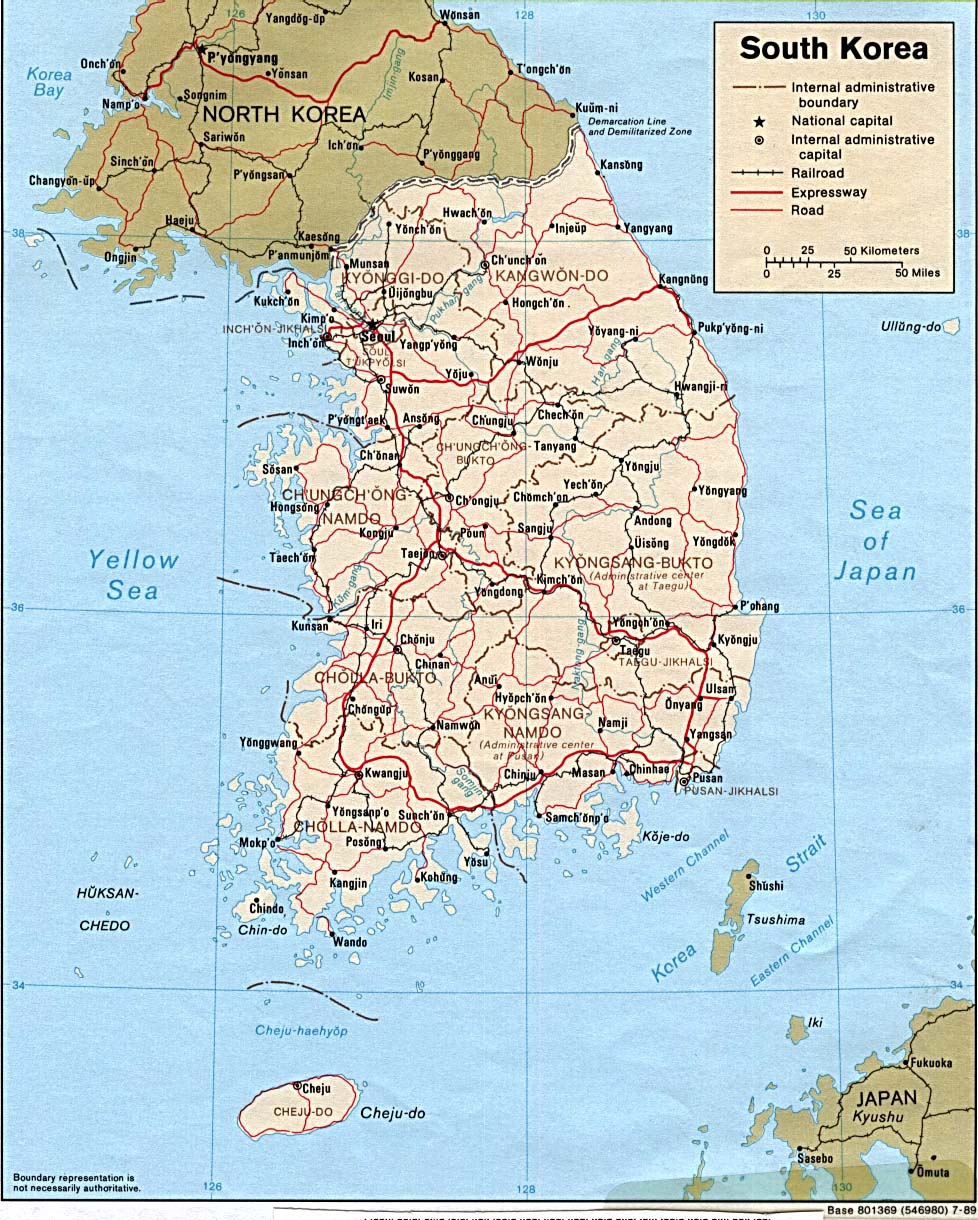
South Korea (Political) 1989 (295K) and
pdf format (306K)
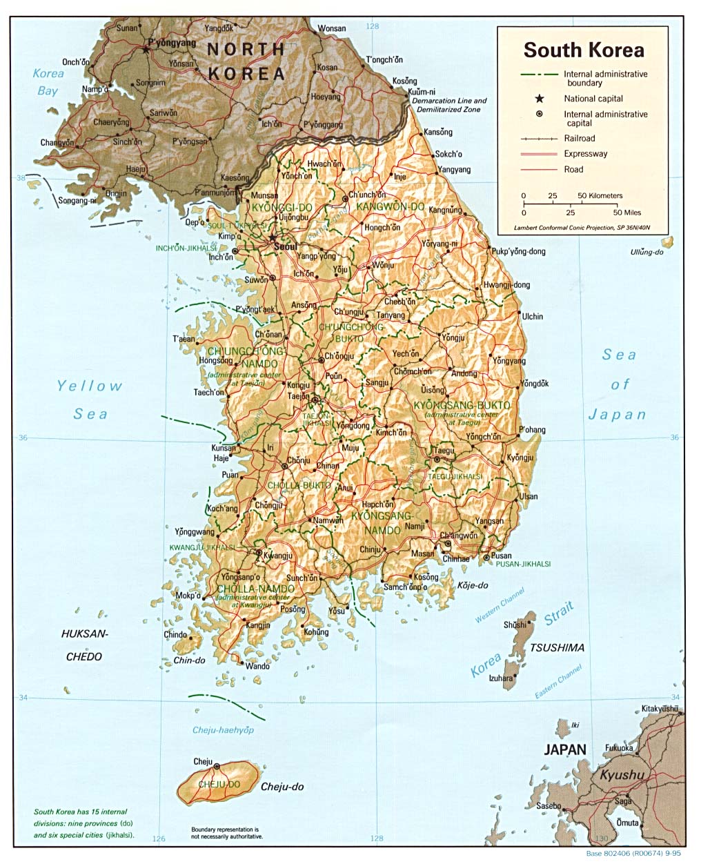
South Korea (Shaded Relief) 1995 (257K) and
pdf format (287K)
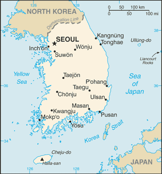
South Korea (Small Map) 2008 (22K)
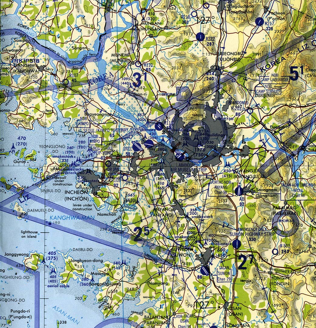
Seoul (tactical pilotage chart) original scale 1:500,000. Portion of Defense Mapping Agency TPC G-10B 1987 (645K) Not for navigational use
Korea [South] - Economic Activity from Map No. 501879 1973 (149K)
Korea [South] - Population from Map No. 501879 1973 (146K)
Korea [South] - Vegetation and Land Utilization from Map No. 501879 1973 (165K)
[Pusan] Fusan 1912 from Northern China, The Valley of the Blue River, Korea. Hachette & Company, 1912. (92K)
[Seoul] Seul and Environs 1912 from Northern China, The Valley of the Blue River, Korea. Hachette & Company, 1912. (251K)
[Seoul to Eui-chu] Se-ul to Eui-chu 1912 from Northern China, The Valley of the Blue River, Korea. Hachette & Company, 1912. (96K)
[Seoul to Pusan] Se-ul to Pu-san 1912 from Northern China, The Valley of the Blue River, Korea. Hachette & Company, 1912. (106K)
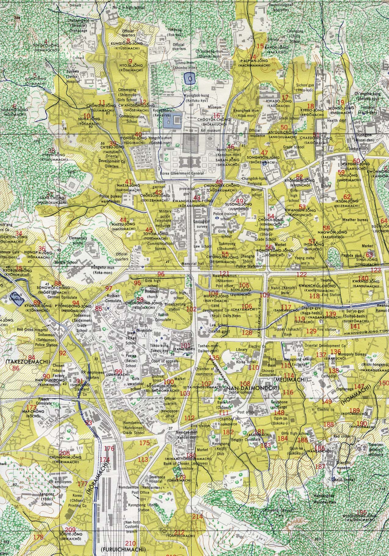
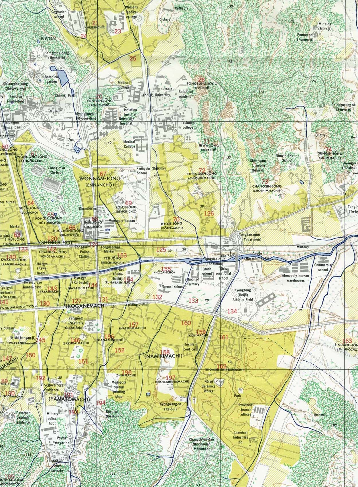
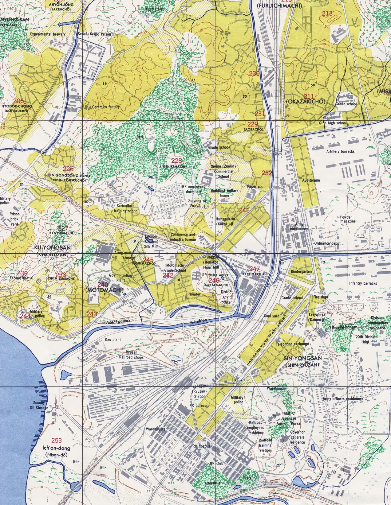
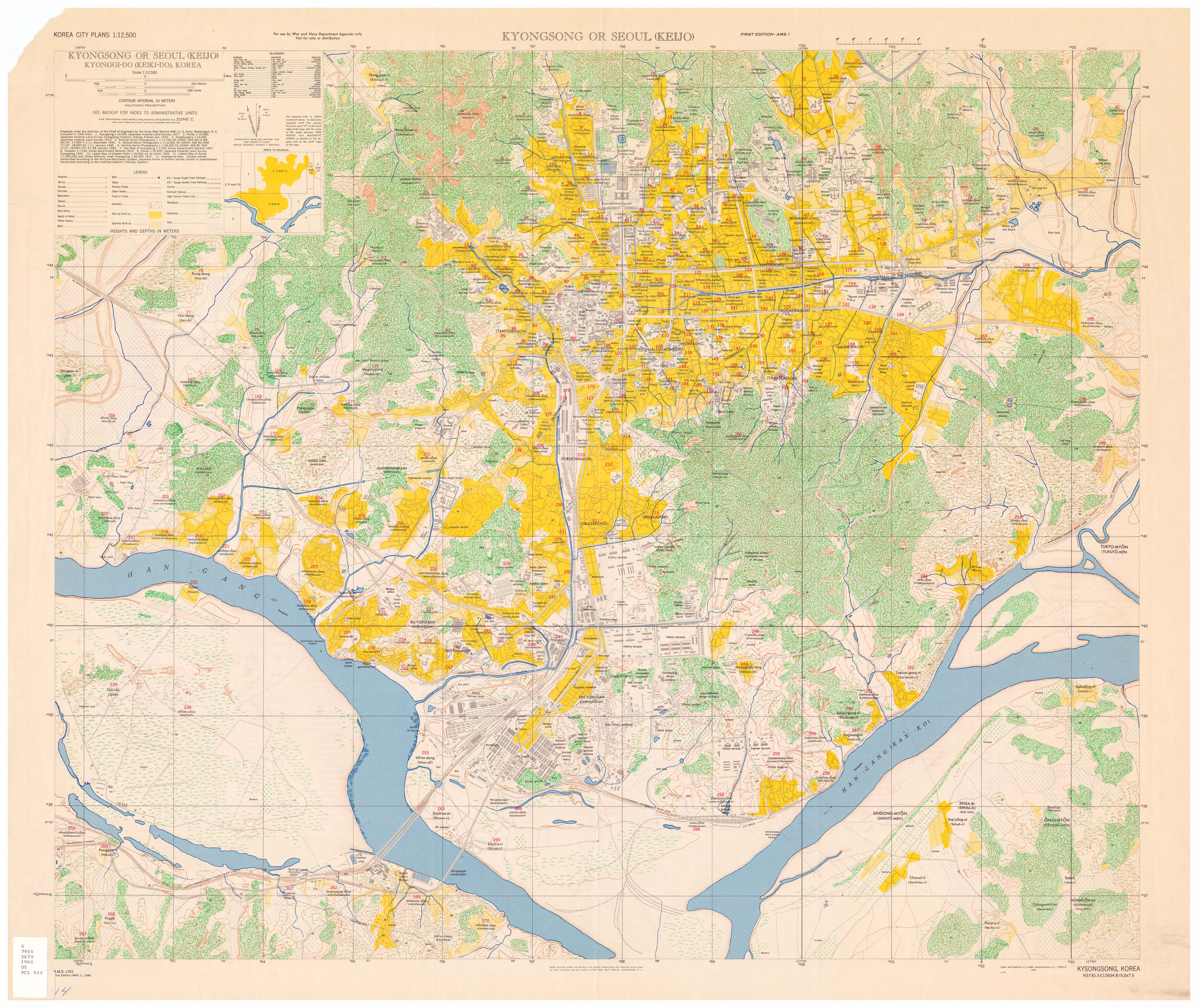
Seoul 1946: Central (628K), East (509K), South (555K), or Entire Map (7.6MB) from "Kyongsong or Seoul (Keijo) Kyonggi-do (Keiki-do), Korea", original scale 1:12,500 U.S. Army Map Service, 1946.
Sources: These maps were provided by the University of Texas Library and/or
the U.S. Central Intelligence Agency (CIA) unless otherwise noted.
Maps on other websites
Korea (AskAsia.org)
Korea, South (Lonely Planet)
Korea, South - Clickable Map (Escortmap.co.kr)
Korea, South - Mineral Industry (USGS) and Map Key
Korea, South - Topographic Maps, AMS Series L751, 1:50,000 (Korean War Project)
<-- Free Map Downloads
<-- Free World Country Map Downloads
Didn't find what you are looking for? We've been online since 1996 and have created 1000's of pages. Search below and you may find just what you are looking for.
Michael R. Meuser
Data Research & GIS Specialist
MapCruzin.com is an independent firm
specializing in GIS project development and data research.
We created the first U.S. based
interactive toxic chemical facility
maps on the internet in 1996 and we
have been online ever since. Learn more about us and our services.
Have a project in mind? If you have data, GIS project or custom shapefile needs contact Mike.
Contact Us
Report Broken Links
Subscribe for Updates
Sponsors


![Korea [South] - Economic Activity](/free-maps-korea/south_korea_econ_1973.jpg)
![Korea [South] - Population](/free-maps-korea/south_korea_pop_1973.jpg)
![Korea [South] - Vegetation and Land Utilization](/free-maps-korea/south_korea_veg_1973.jpg)
![[Pusan] Fusan 1912](/free-maps-korea/fusan_1912.jpg)
![[Seoul] Seul and Environs 1912](/free-maps-korea/se_ul_environs_1912.jpg)
![[Seoul to Eui-chu] Se-ul to Eui-chu 1912](/free-maps-korea/se_ul_to_ei_chu_1912.jpg)
![[Seoul to Pusan] Se-ul to Pu-san 1912](/free-maps-korea/se_ul_to_fu_san_1912.jpg)