Download Free Russia Maps
<-- Free Map Downloads
<-- Free World Country Map Downloads
Sponsors
Note that maps may not appear on the webpage in their full size and resolution. To save the maps to your computer, right-click on the link.
Russia (Small Map) 2008 (38K)
Asia (Reference Map) 2007 (920K) and pdf format (514K)
Europe (Reference Map) 2008 (1 MB) [pdf]
Russia and the Former Soviet Republics Historical Maps
Astrakhan, Russia (Tactical Pilotage Chart) 1991 Portion of U.S. Defense Mapping Agency sheet TPC F-4B, 1:500,000 (854K) Not for navigational use
Baltic States (Political) 1994 (200K)
Baltic States - Major Defense Industry Facilities in the Baltic States from Defense Industries of the Newly Independent States of Eurasia. 1993 (196K)
[Caspian Region] Oil and Gas Infrastructure in the Caspian Sea Region 2001 (2.5 MB)
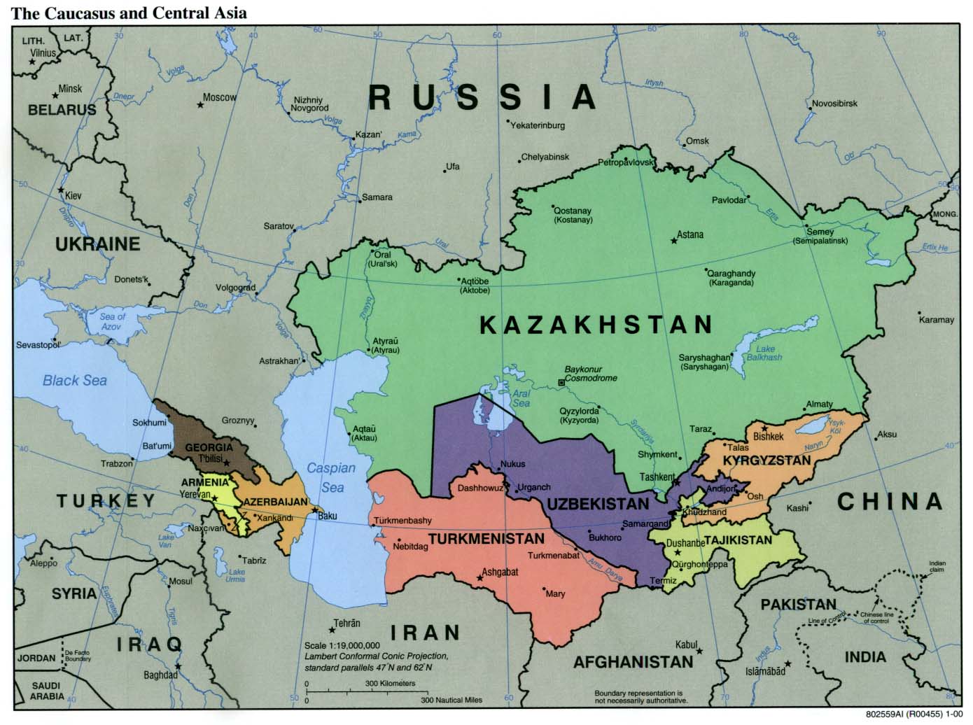
Caucasus and Central Asia (Political) 2003 (255K) and
pdf format (258K)
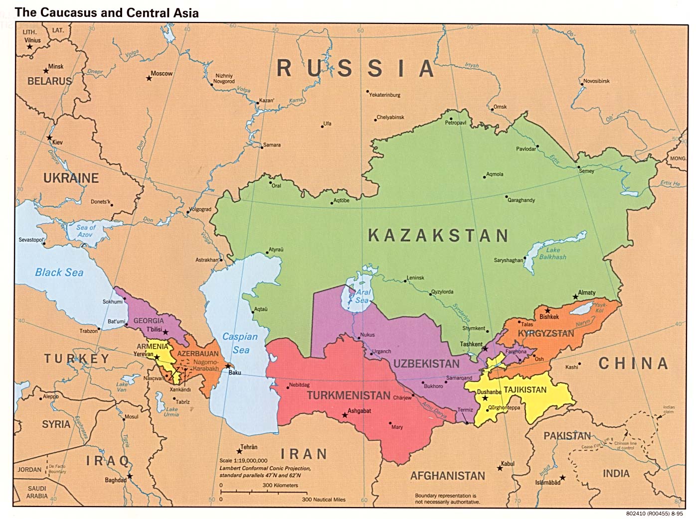
Caucasus and Central Asia (Political) 2000 (171K) and
pdf format (186K)
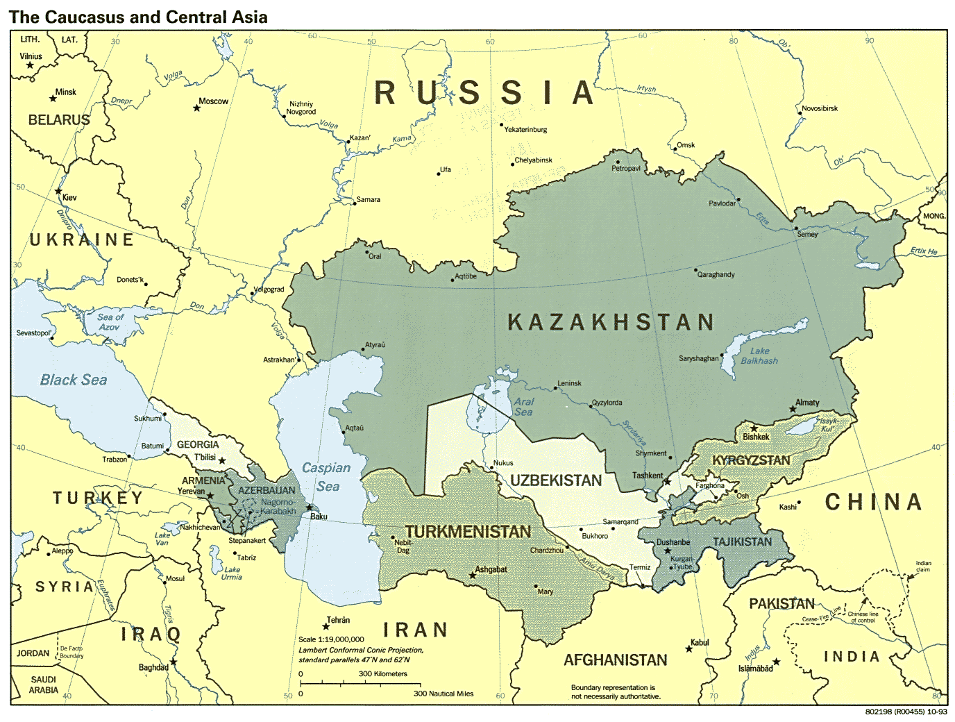
Caucasus and Central Asia (Political) 1995 (231K)
Caucasus and Central Asia (Political) 1993 (223K)
Caucasus Region U.S.Department of State 1994 (1.2MB)
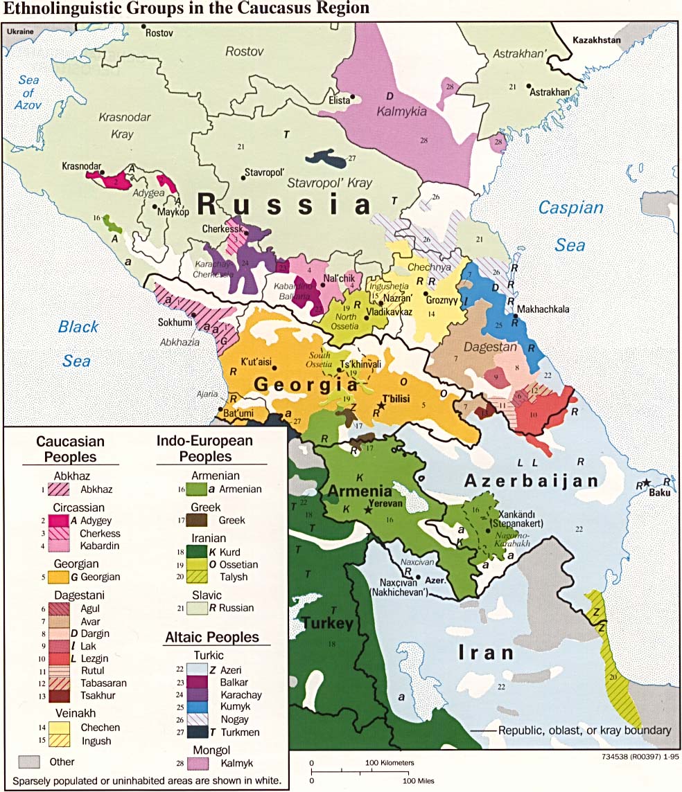
Caucasus Region: Ethnolinguistic Groups 1995 (255K)
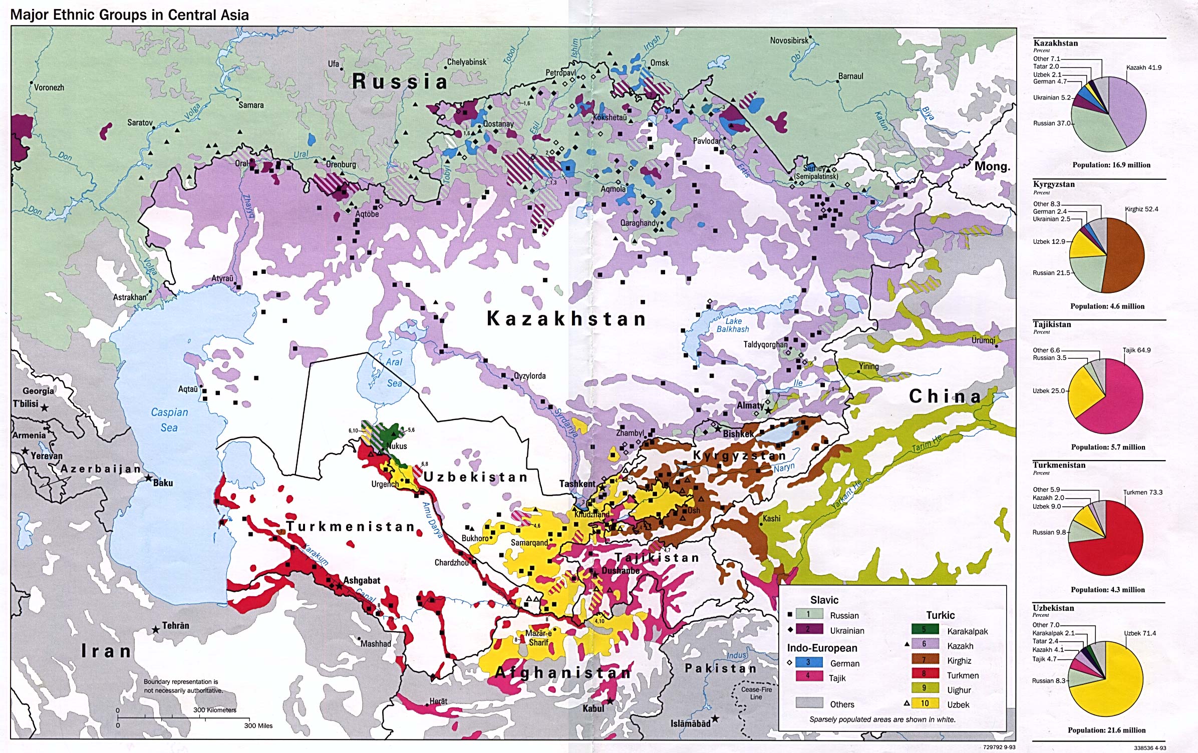
Central Asia (Major Ethnic Groups) 1993 (694K)
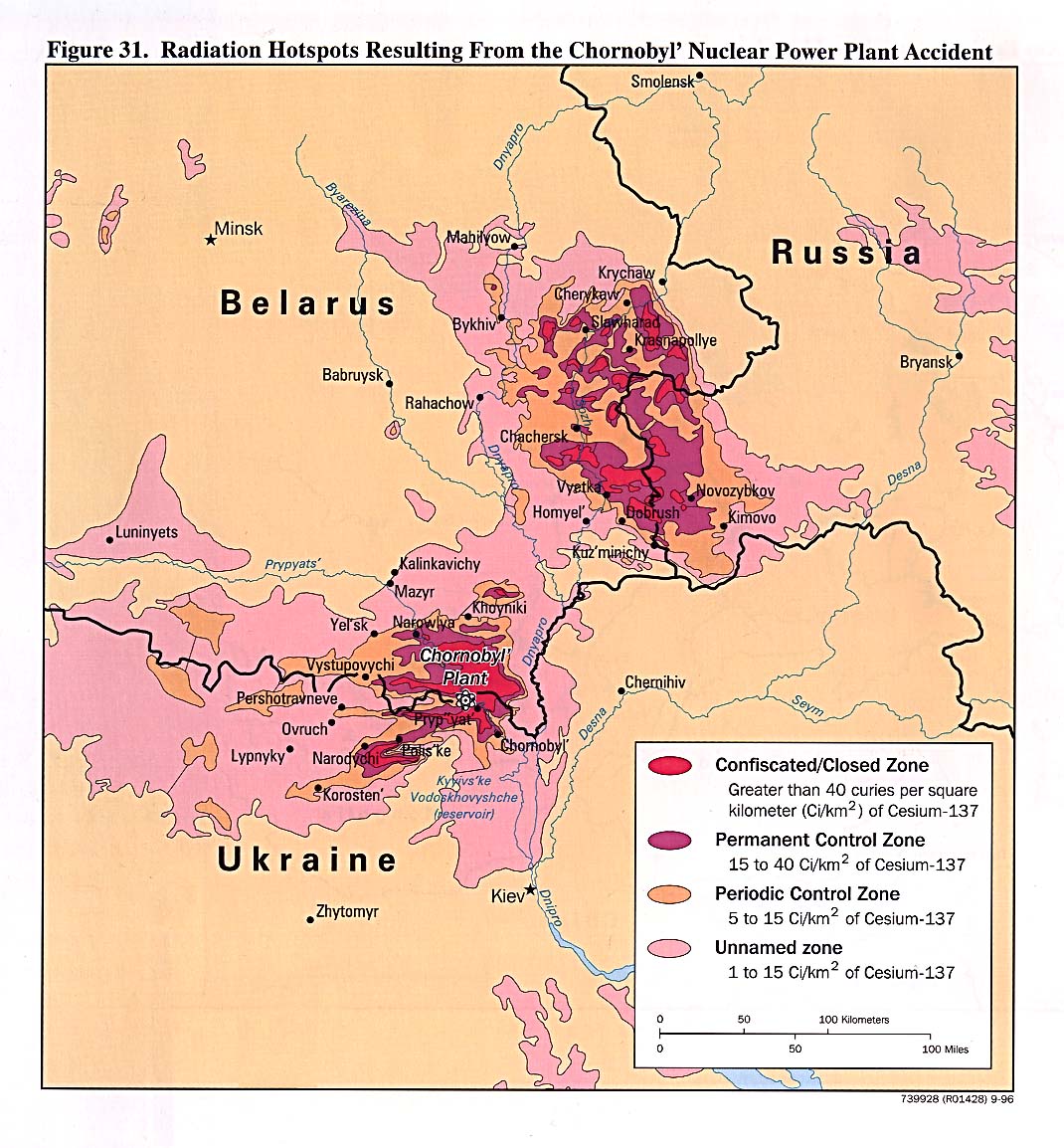
Chernobyl - Radiation Hotspots Resulting From the Chornobyl Nuclear Power Plant Accident from Handbook of International Economic Statistics 1996 (273K)
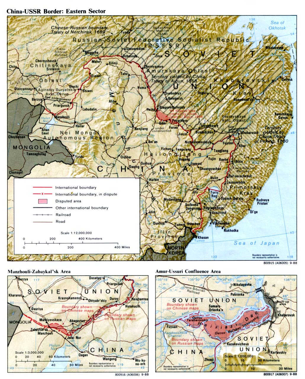
China-USSR Border: Eastern Sector 1988 (452K)
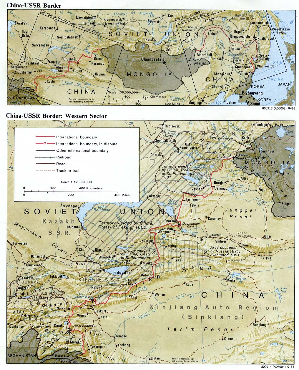
China-USSR Border: Western Sector 1988 (387K)
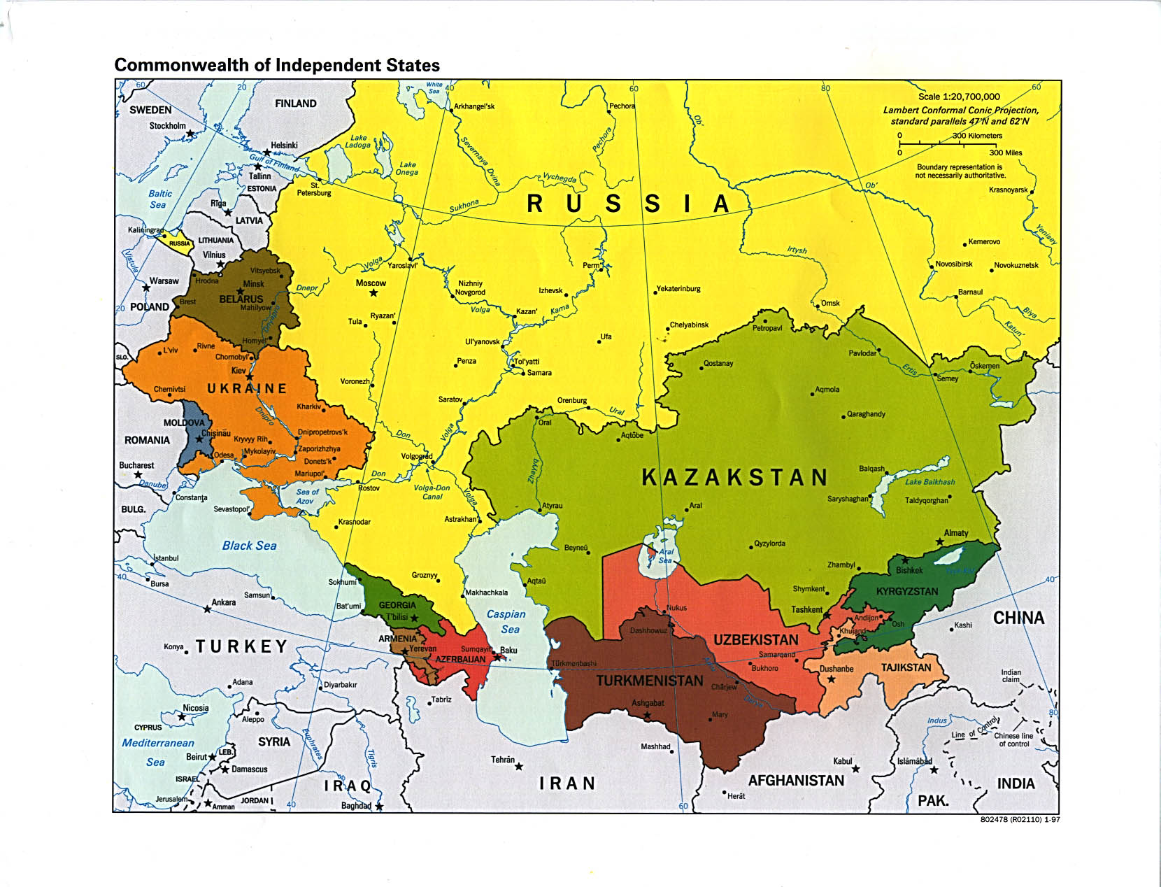
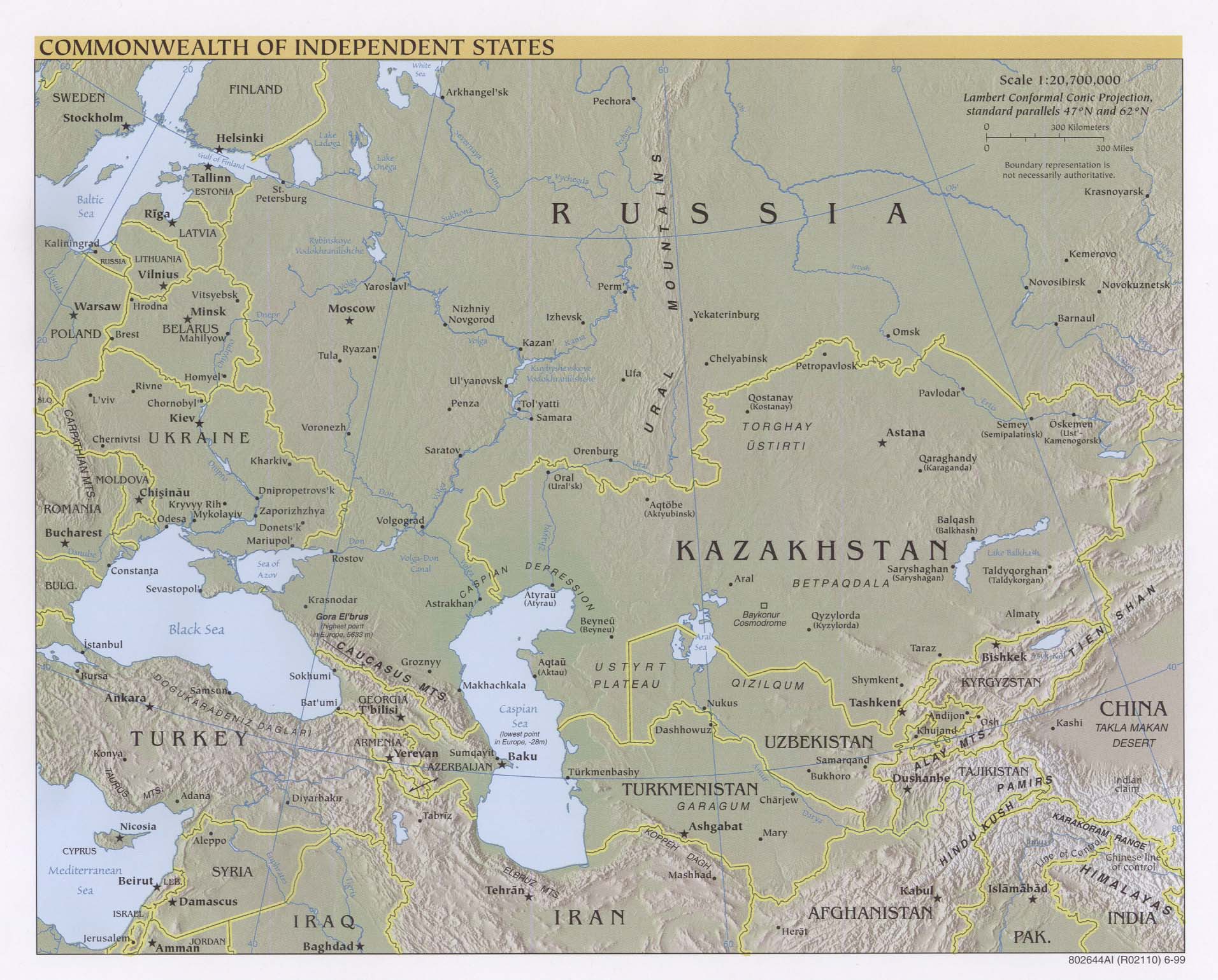
Commonwealth of Independent States (Political) 1997 (374K)
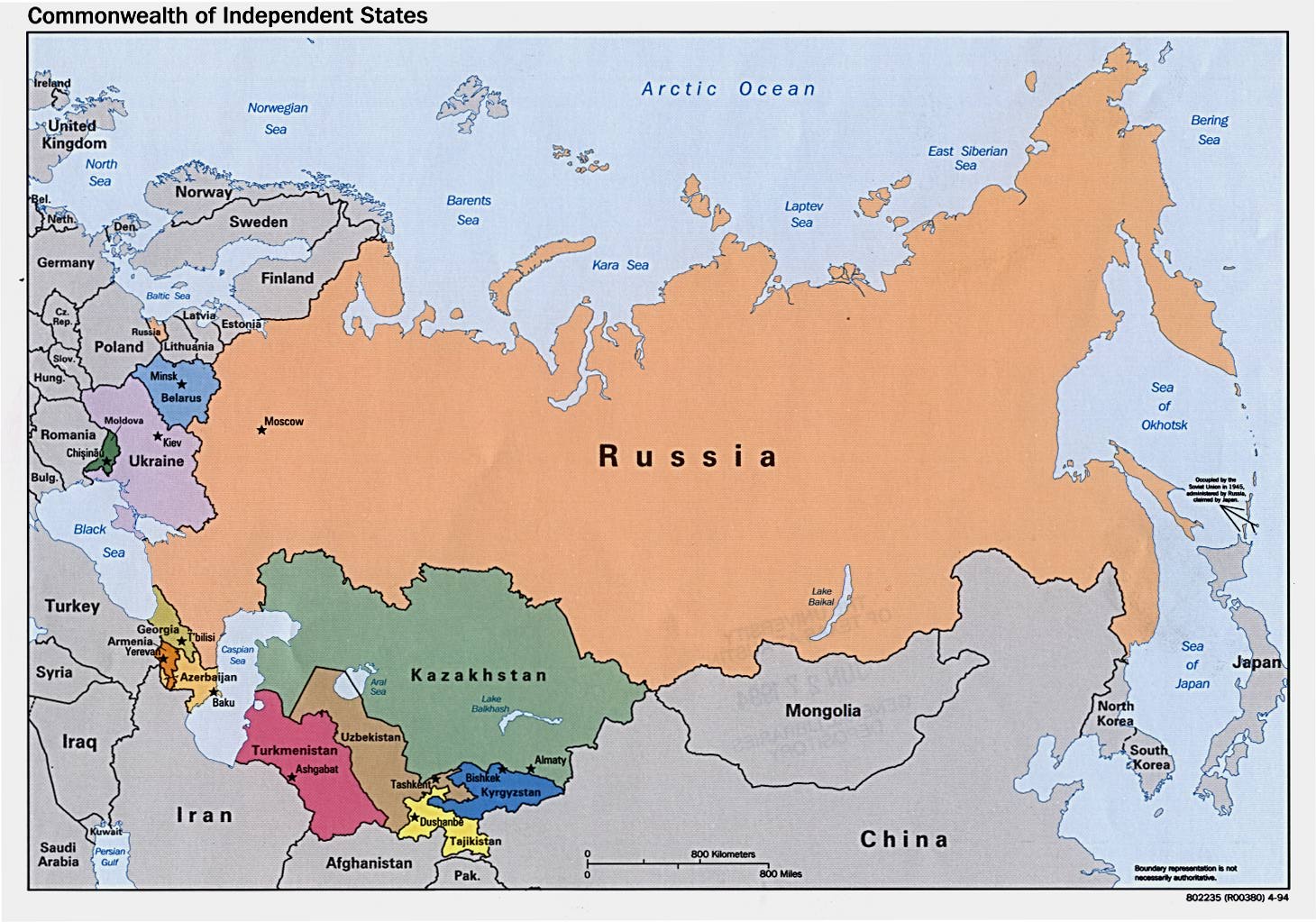
Commonwealth of Independent States (Political) 1994 (226K)
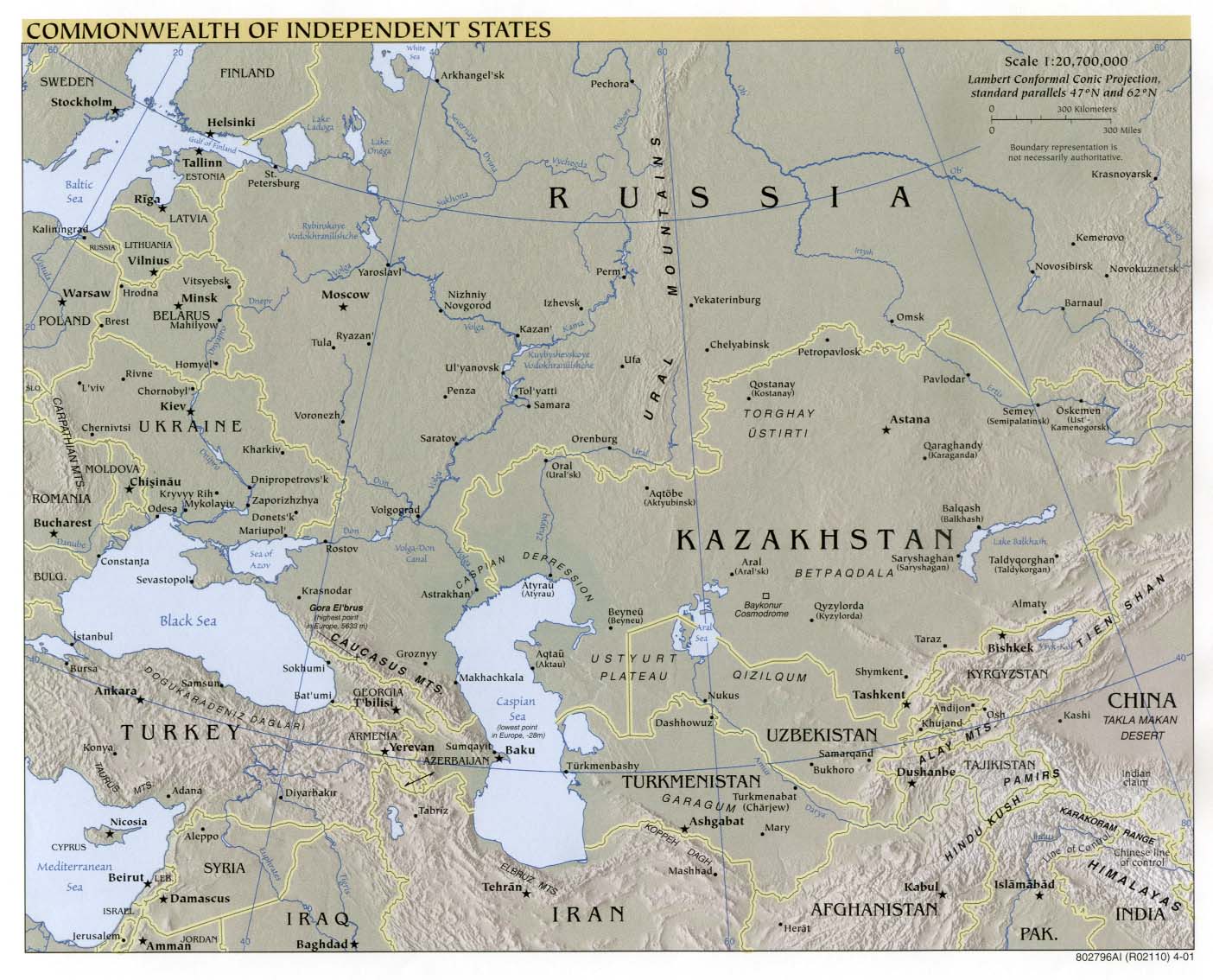
Commonwealth of Independent States (Reference Map) 2001 (246K) and
pdf format (1.2MB)
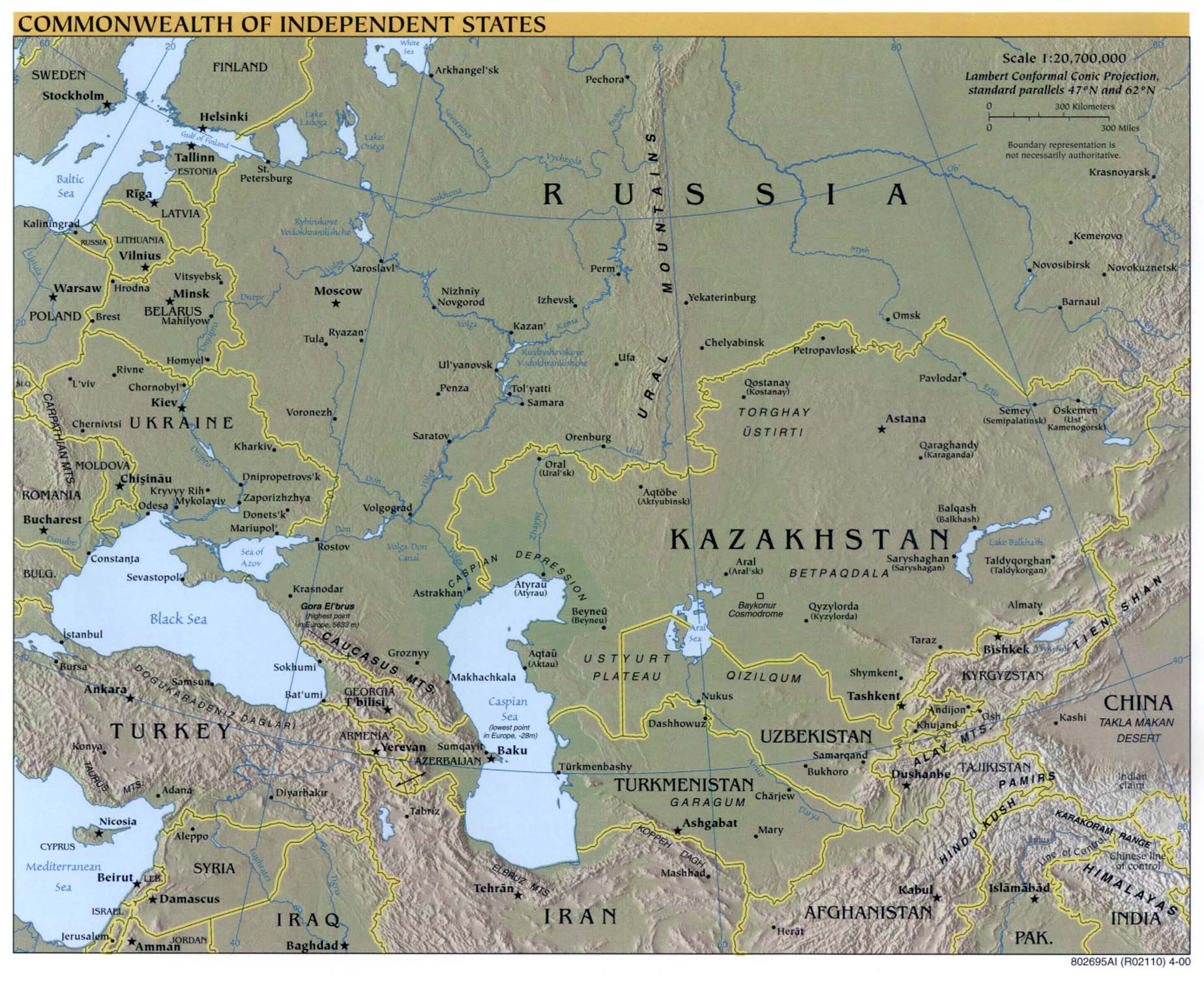
Commonwealth of Independent States (Reference Map) 2000 (352K)
and pdf format (1.7MB)
Commonwealth of Independent States (Reference Map) 1999 (145K) and pdf format (545K)
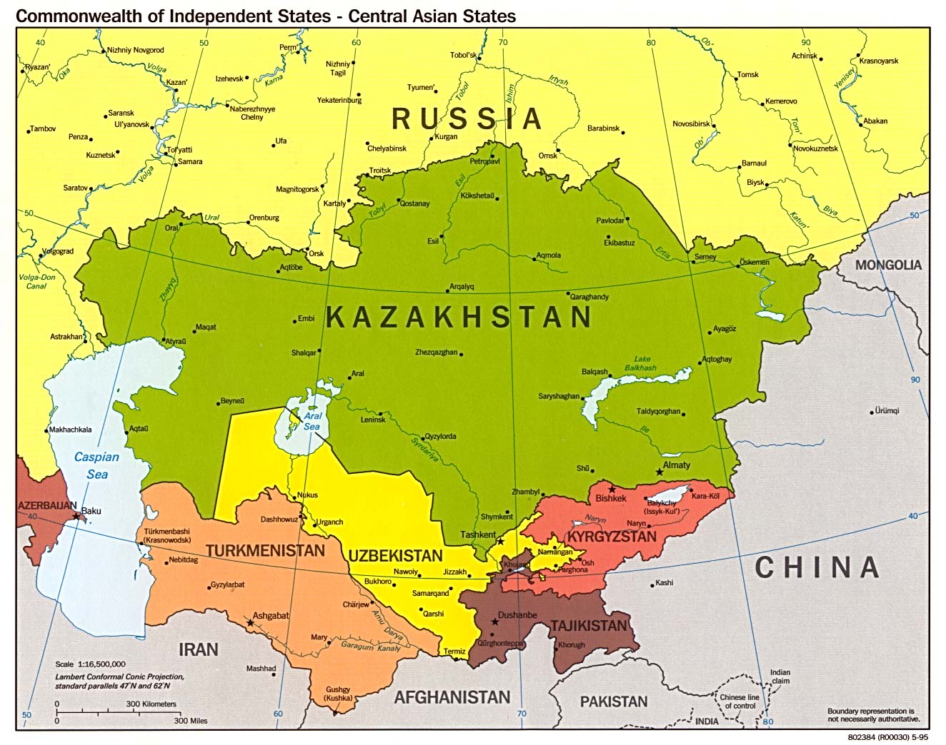
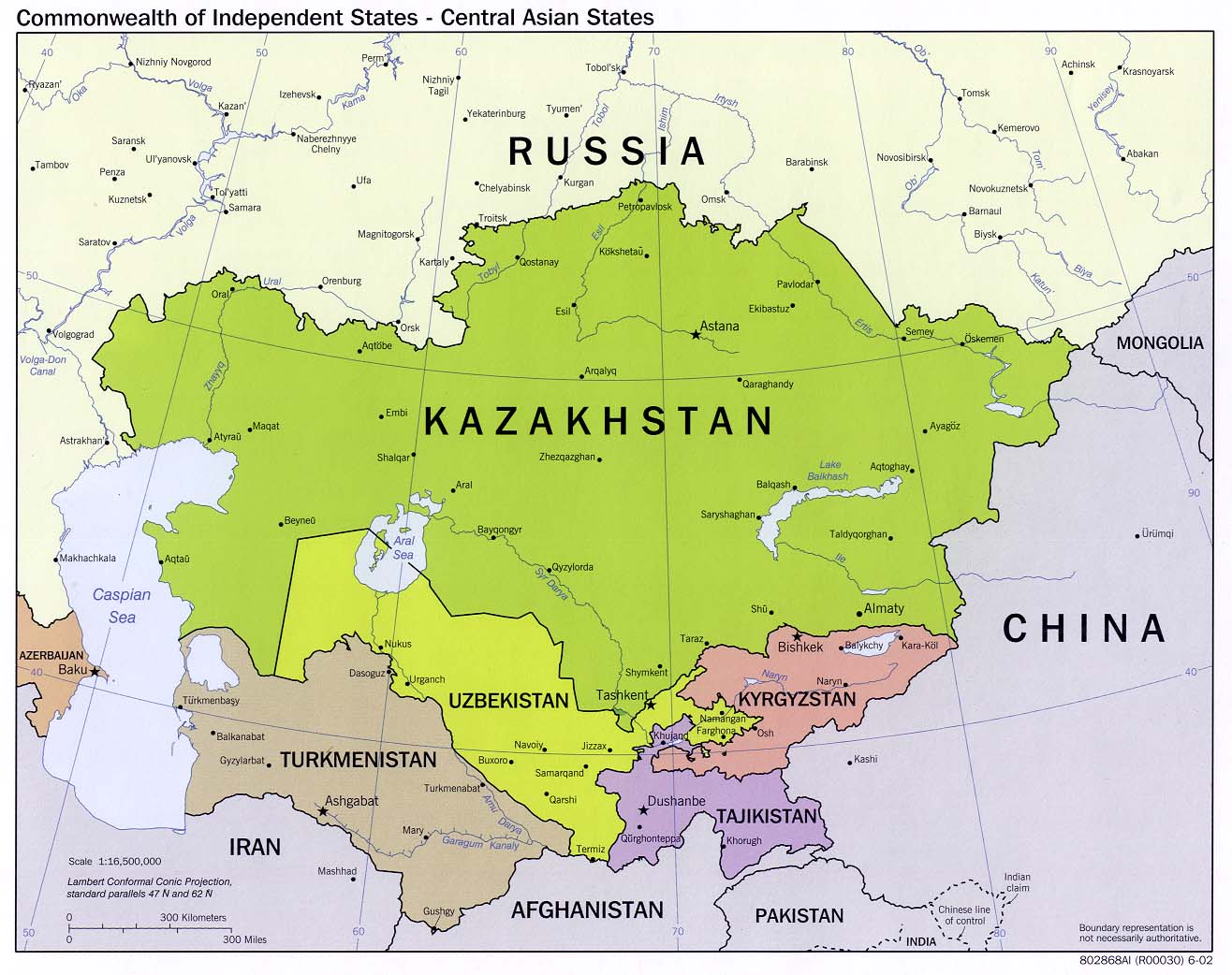
Commonwealth of Independent States - Central Asian States (Political) 1995 (242K)
Commonwealth of Independent States - Central Asian States (Political) 2002 (190K)
Commonwealth of Independent States - Central Asian States (Reference Map) 2002 (190K) and
pdf format (209K)
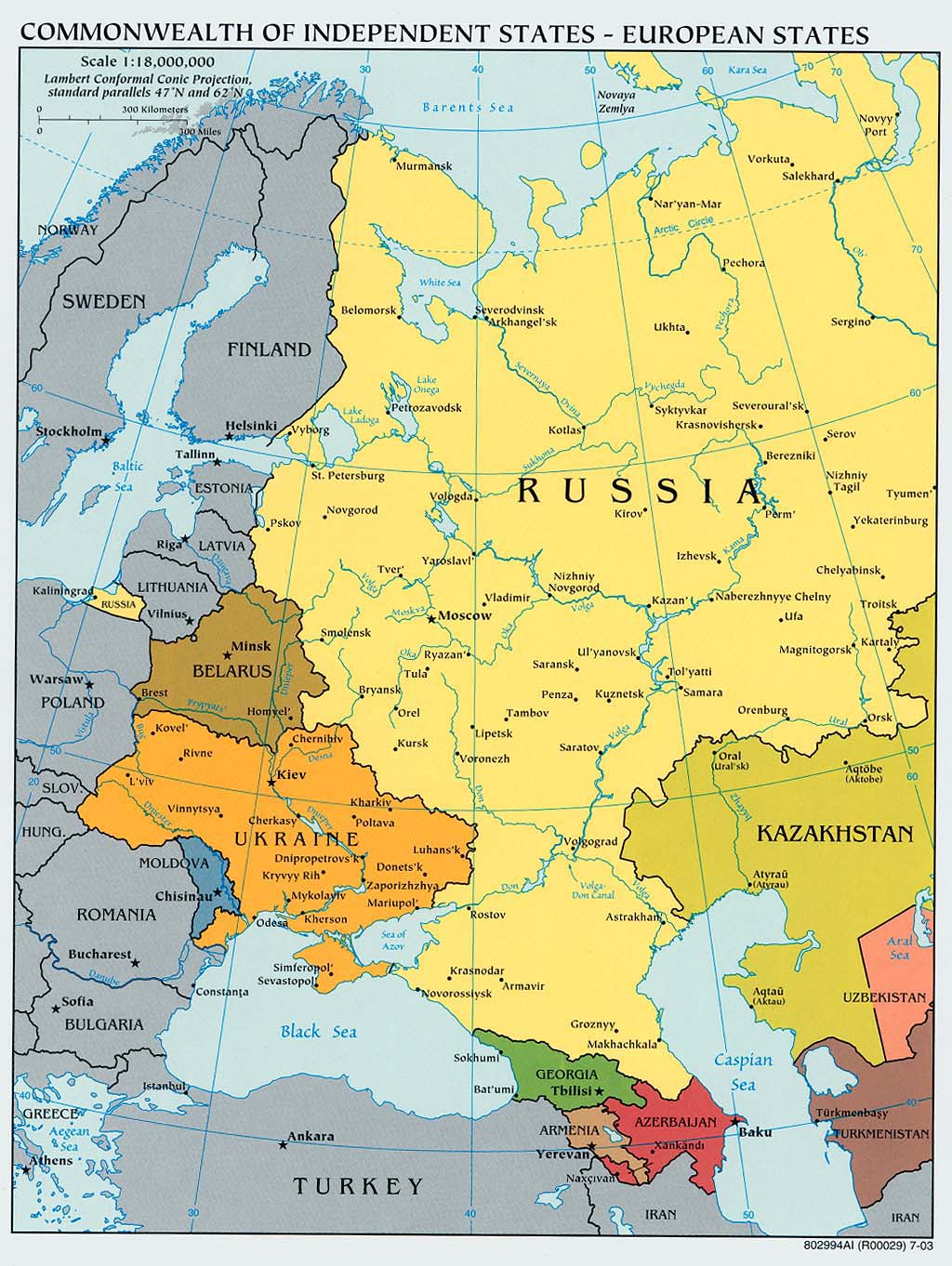
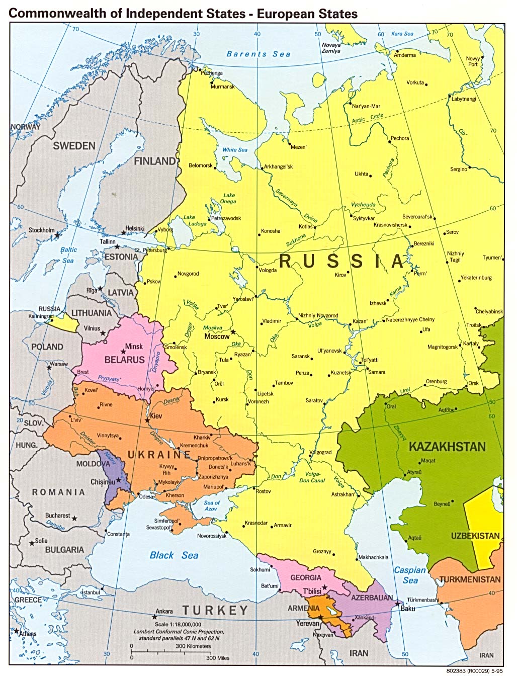
Commonwealth of Independent States - European States
(Political) 2003 (263K) and
pdf format (266K)
Commonwealth of Independent States - European States (Political) 1995 (286K)
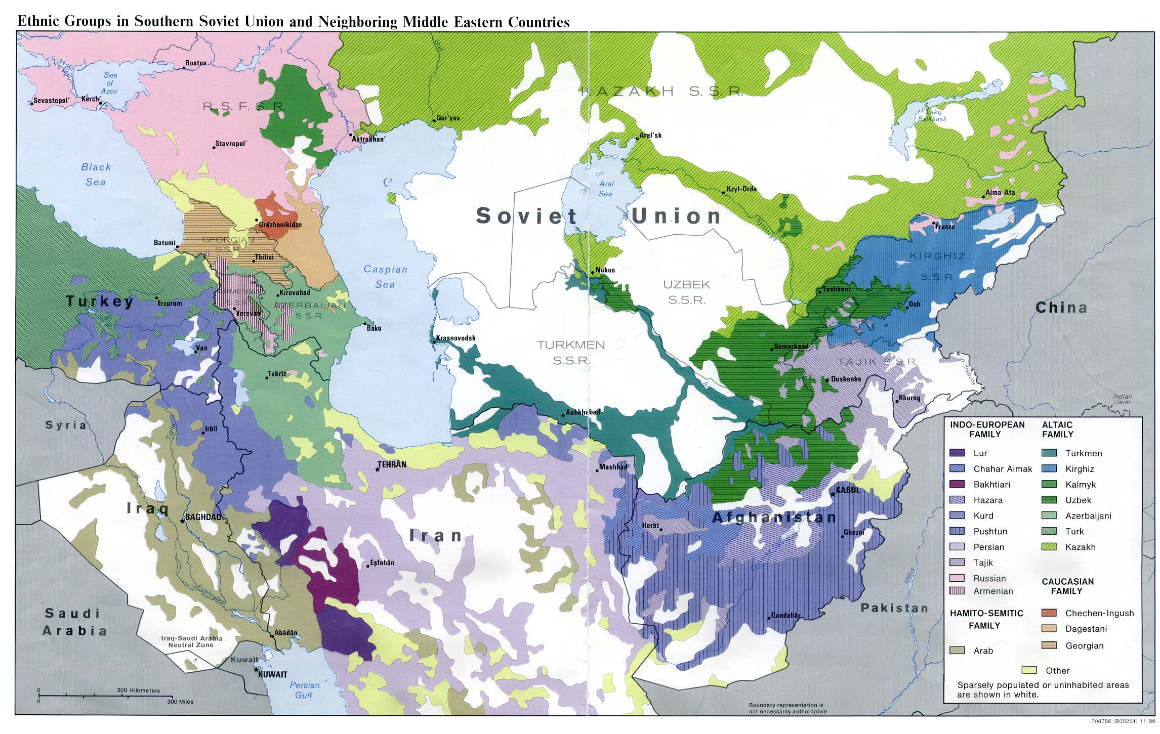
Ethnic Groups in Southern Soviet Union and Neighboring Middle Eastern Countries 1986 (512K)
Ethnic Russians in the Newly Independent States 1994 (417K)
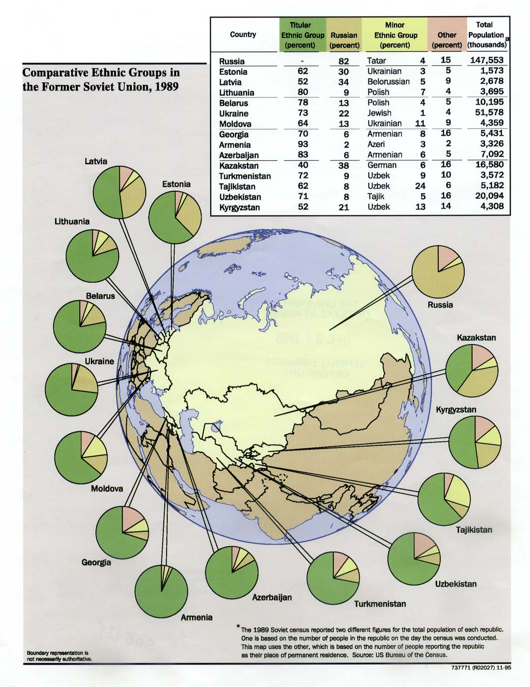
Former Soviet Union: Comparative Ethnic Groups, 1989 1995 (192K)
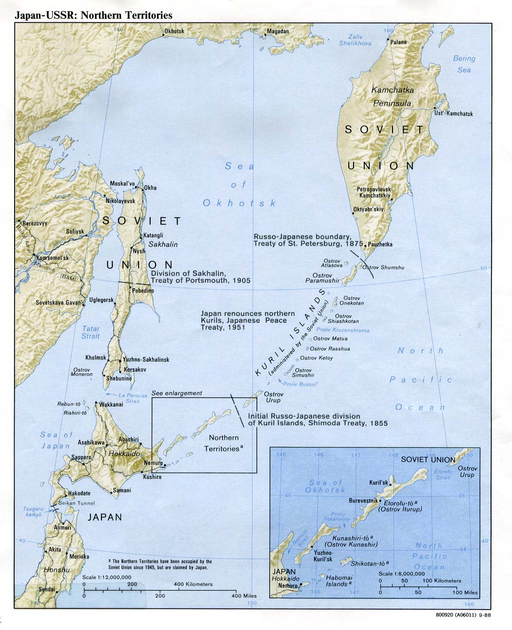
Japan-USSR: Northern Territories (Shaded Relief) 1988 (230K)
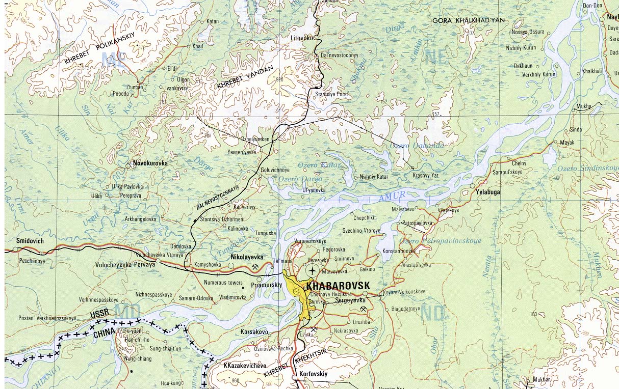
Khabarovsk Area Portion of Khabarovsk sheet. Topographic Map NM 53, Series 1301. Original Scale 1:1,000,000. Printed by U.S. Defense Mapping Agency Topographic Center, 1978 (348K)
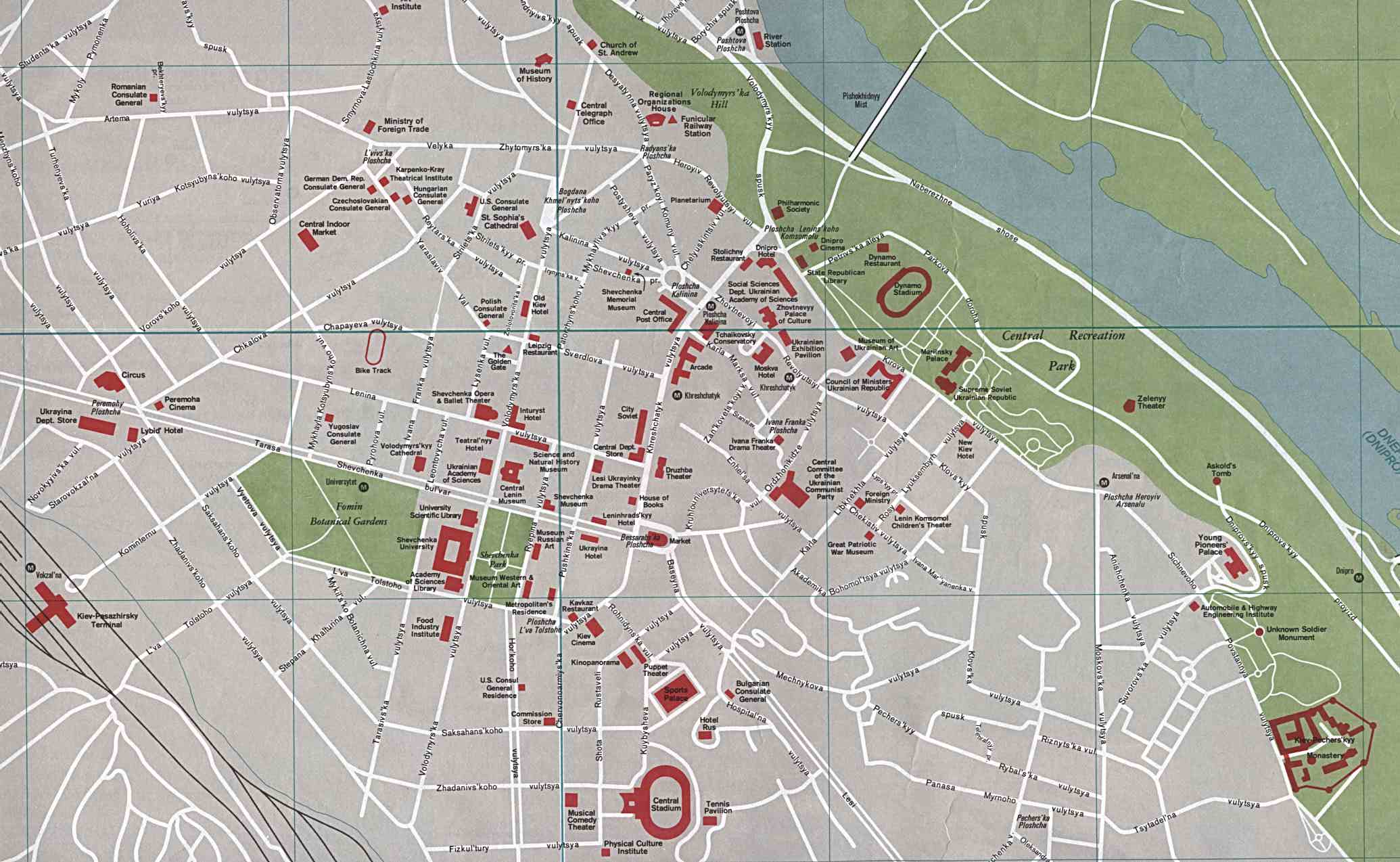
Kiev, Ukraine (223K)
Magadan Area Portion of Magadan sheet. Topographic Map NO 56, Series 1301. Original Scale 1:1,000,000. Printed by U.S. Defense Mapping Agency Topographic Center, 1978 (200K)
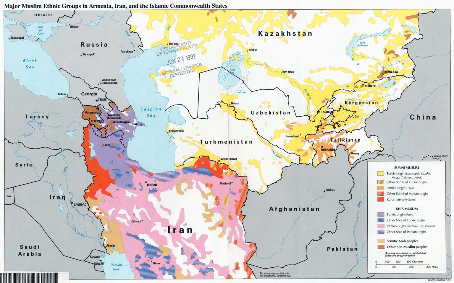
Major Muslim Ethnic Groups in Armenia, Iran, and the Islamic Commonwealth States 1992 (203K)
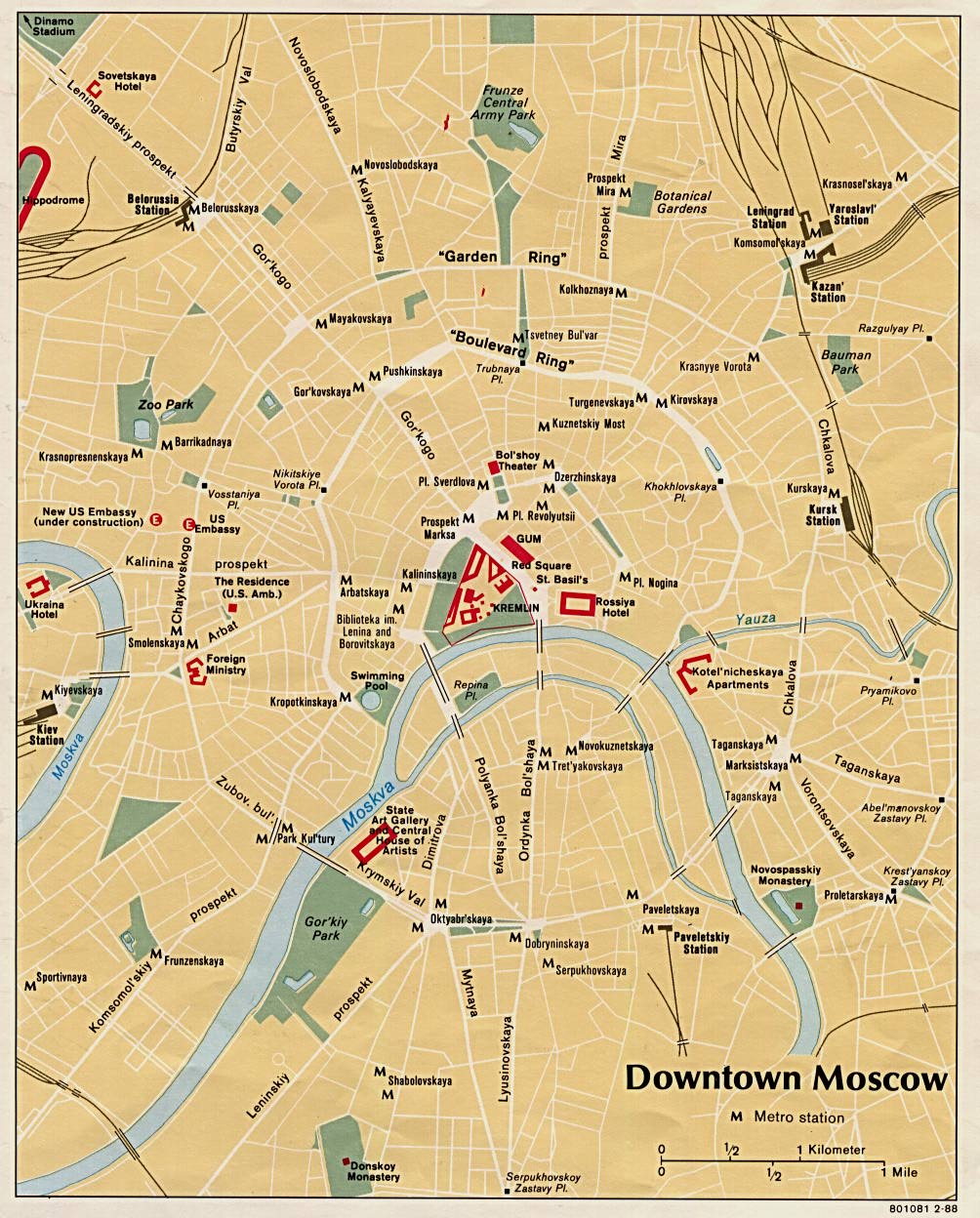
Moscow 1988 (252K)
Moscow 1:35,000 1986 (7.0 MB) and verso Moscow Index 1986 (8.1 MB)
Central Moscow 1:15,000 1986 (6.4 MB)
and verso Central Moscow Index 1986 (5.0 MB)
Moscow Area Portion of Moskva sheet. Topographic Map NN 37, Series 1301. Original Scale 1:1,000,000. Printed by U.S. Defense Mapping Agency Topographic Center, 1978 (296K)
Nagorno-Karabakh (Political) 1993 (272K) and
pdf format (280K)
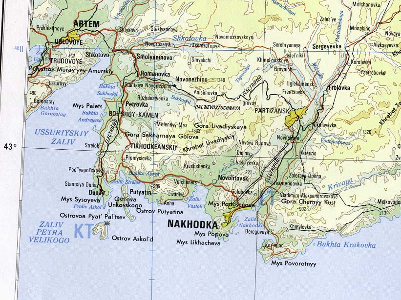
Nakhodka Area Portion of Nakhodka sheet.Topographic Map NK 53, Series 1301. Original Scale 1:1,000,000. Printed by U.S. Defense Mapping Agency Topographic Center, 1978 (188K)
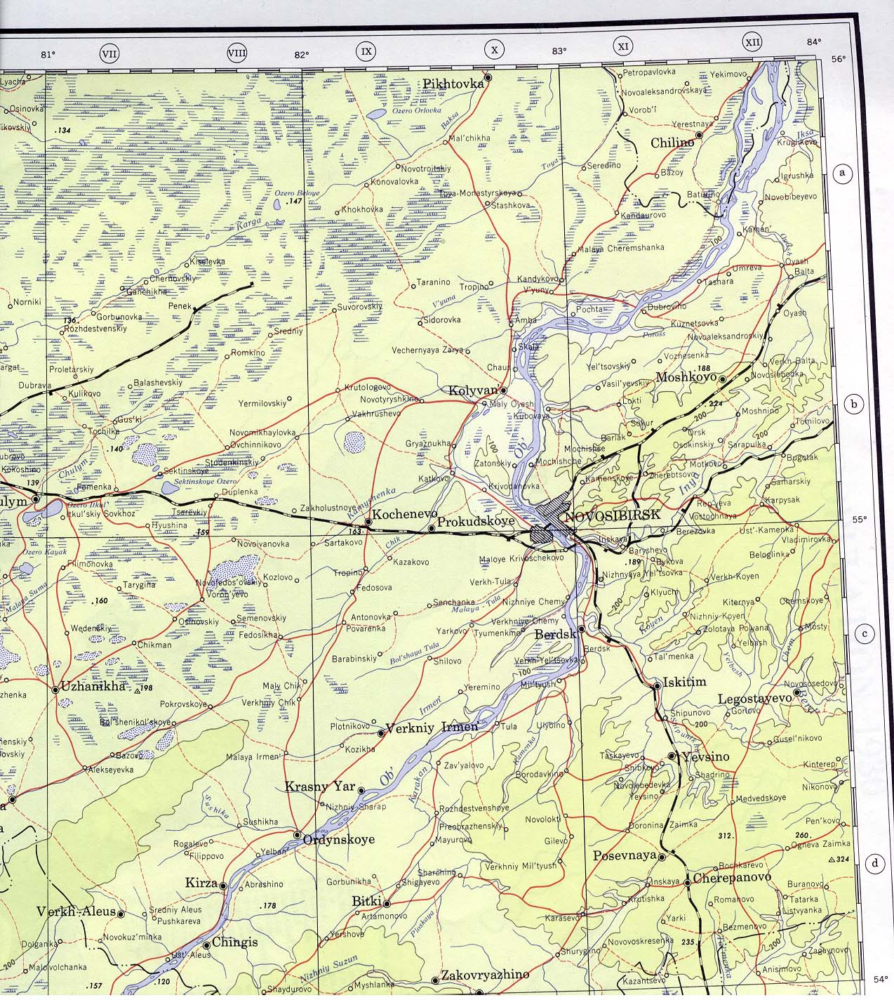
Novosibirsk Area 1960 Portion of Novosibirsk sheet. Topographic Map NN 44, Series 1301. Original Scale 1:1,000,000. Printed by U.S. Army Map Service, Corps of Engineers, 1960 (492K)
Omsk Area Portion of Omsk sheet. Topographic Map NN 43, Series 1301. Original Scale 1:1,000,000. Printed by the U.S. Defense Mapping Agency Hydrographic/Topographic Center, 1979 (496K)
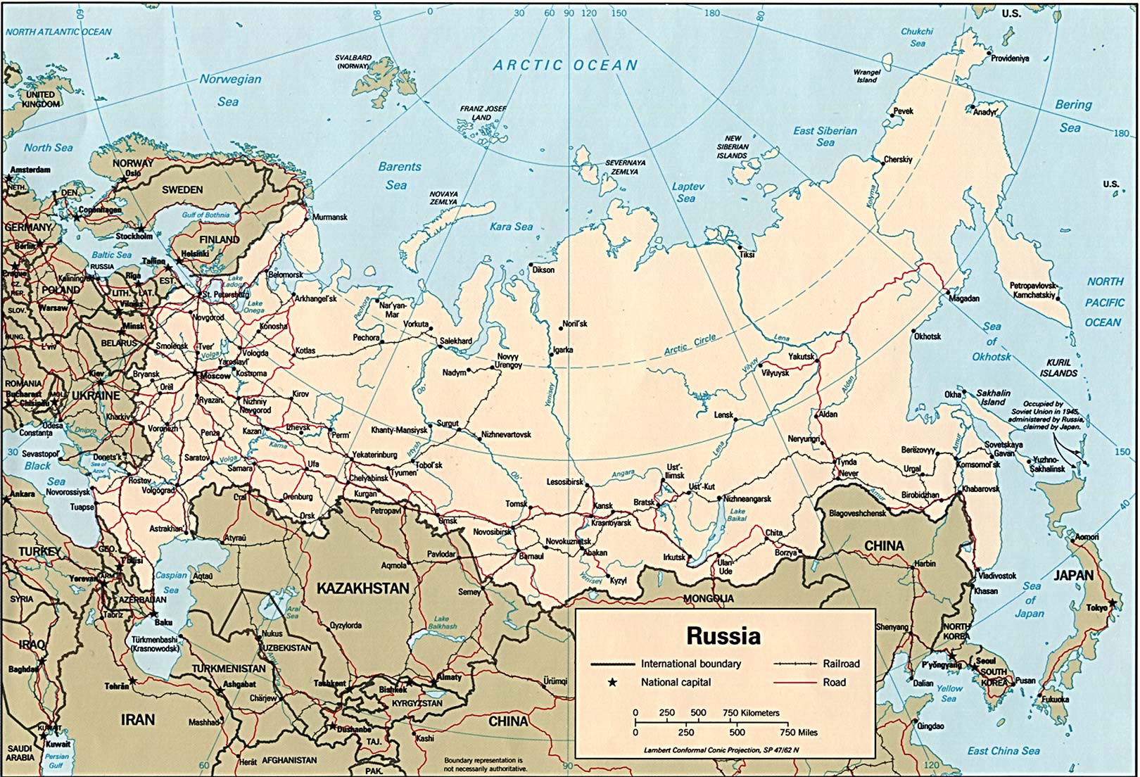
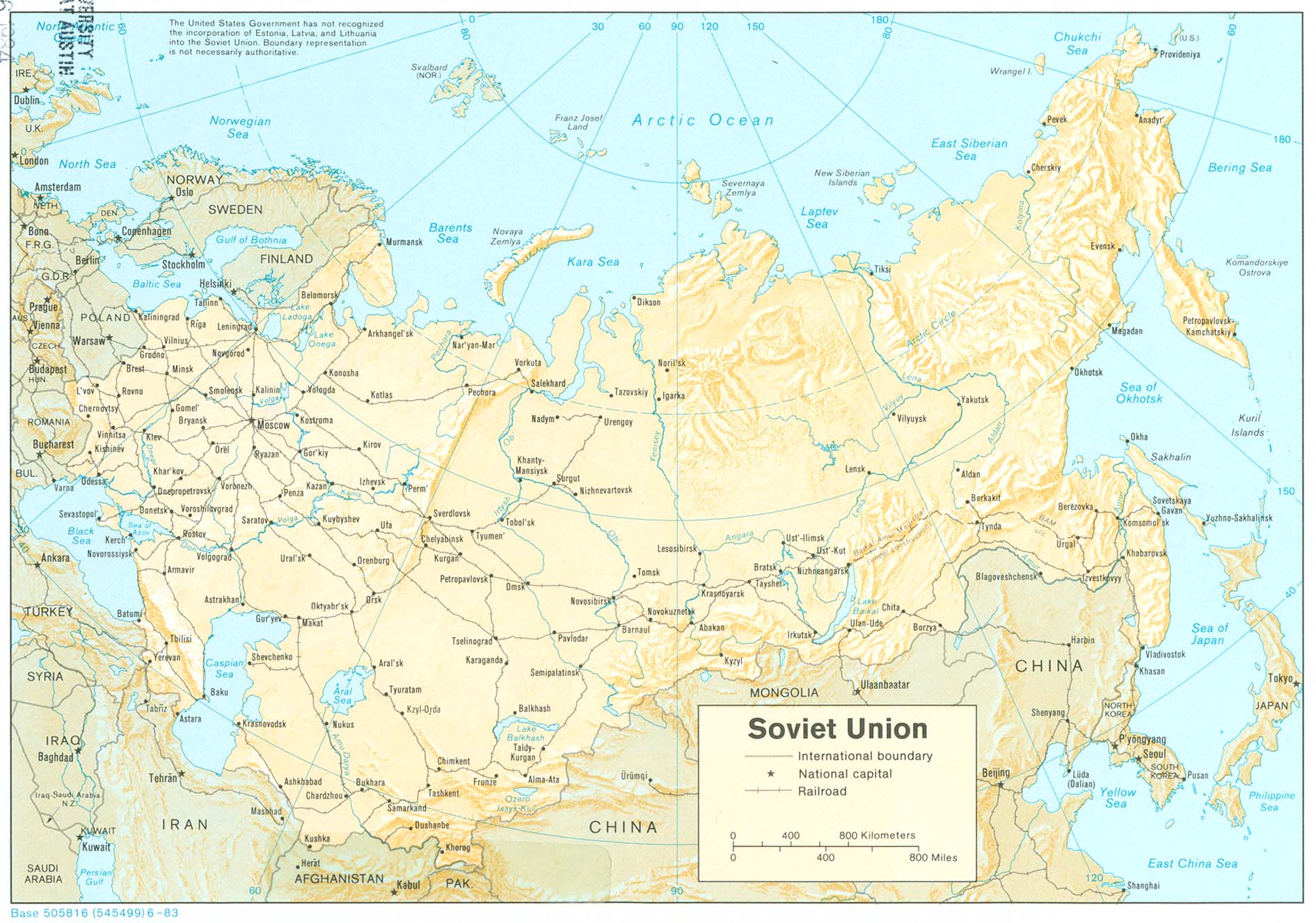
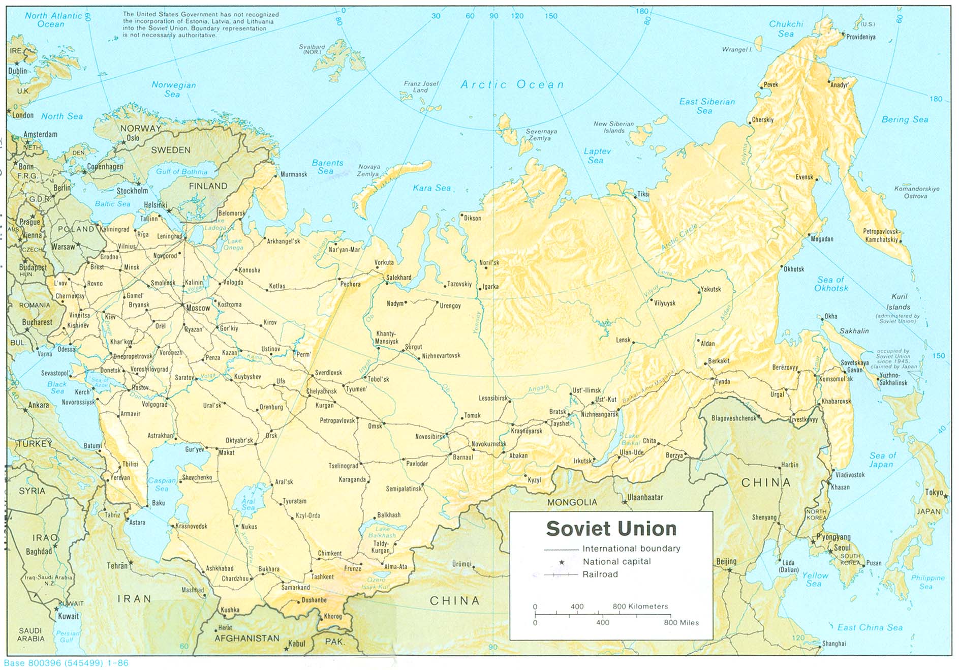
Russia (Political) 1994 (424K) and pdf format (426K)
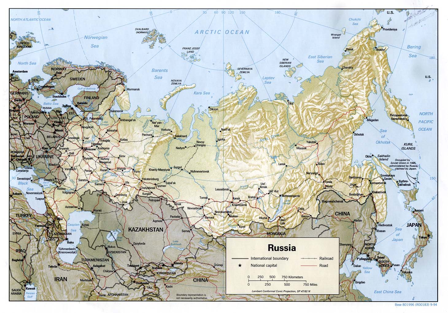
Russia (Shaded Relief) 1994 (321K) and pdf format (331K)
Russia (Small Map) 2008 (32K)
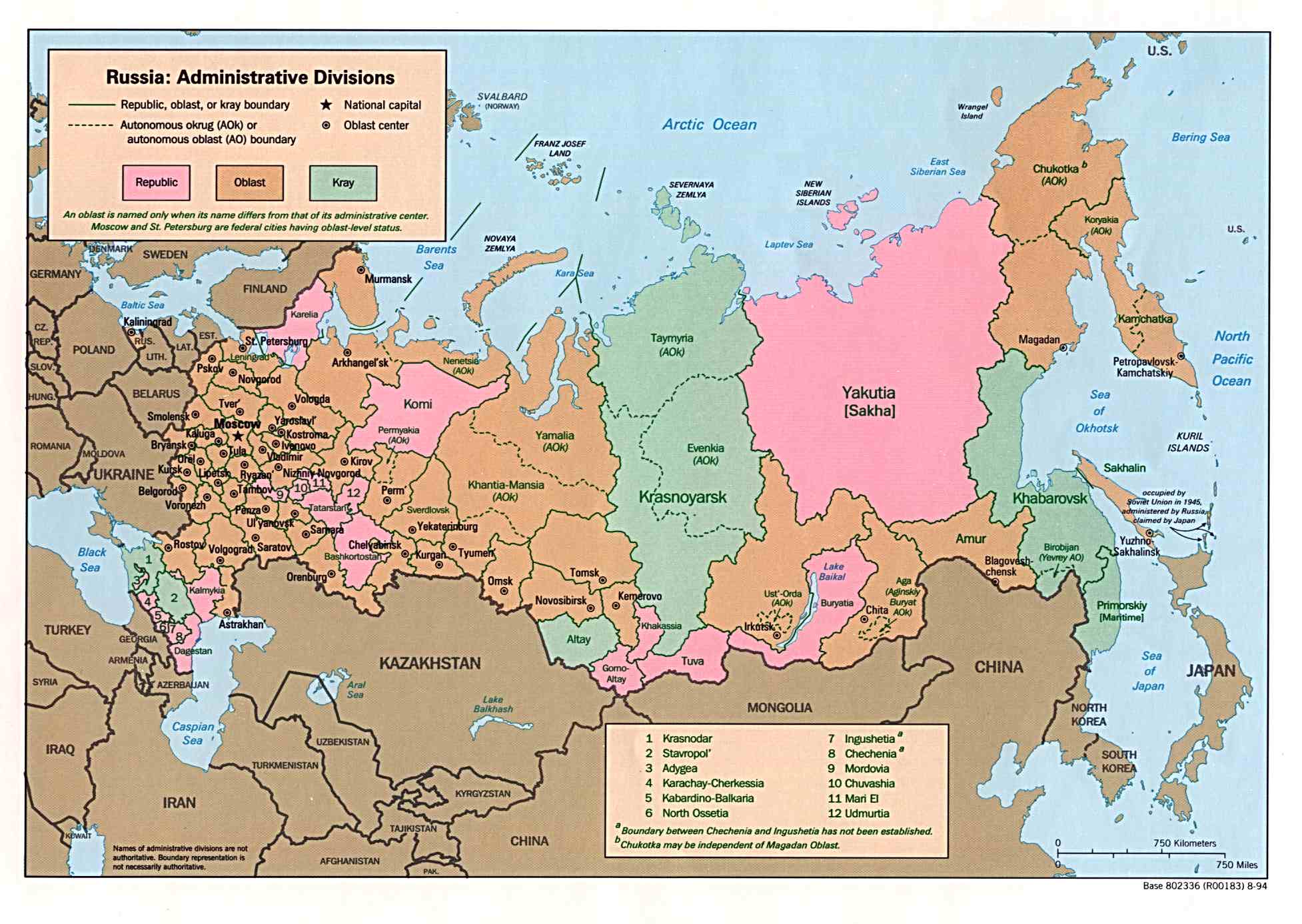
Russia: Administrative Divisions 1994 (225K) and pdf format (228K)
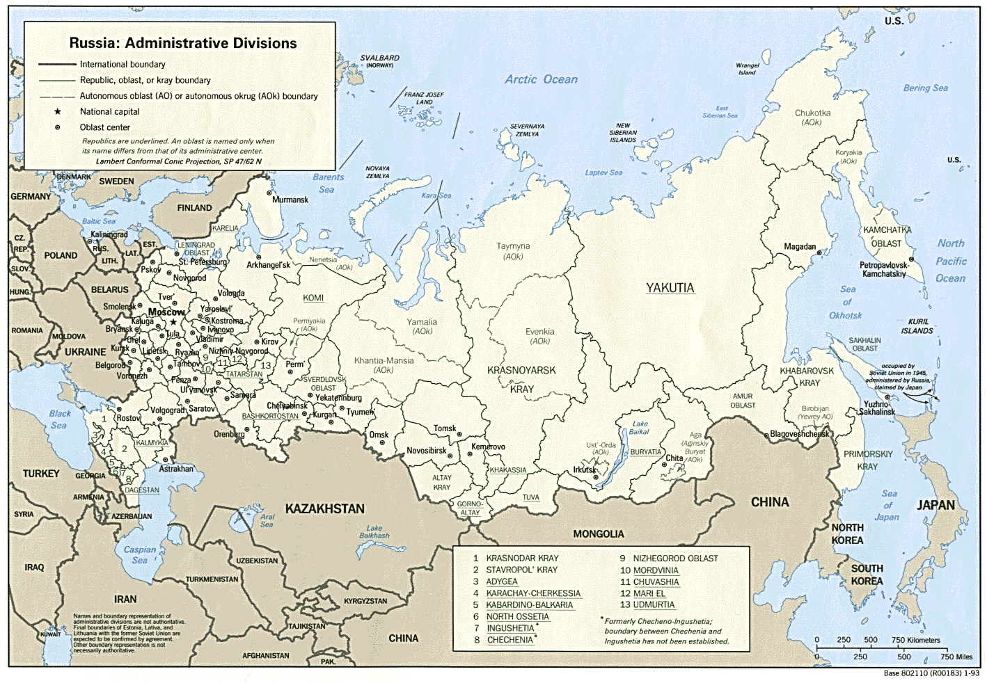
Russia: Administrative Divisions 1993 (317K) and pdf format (333K)
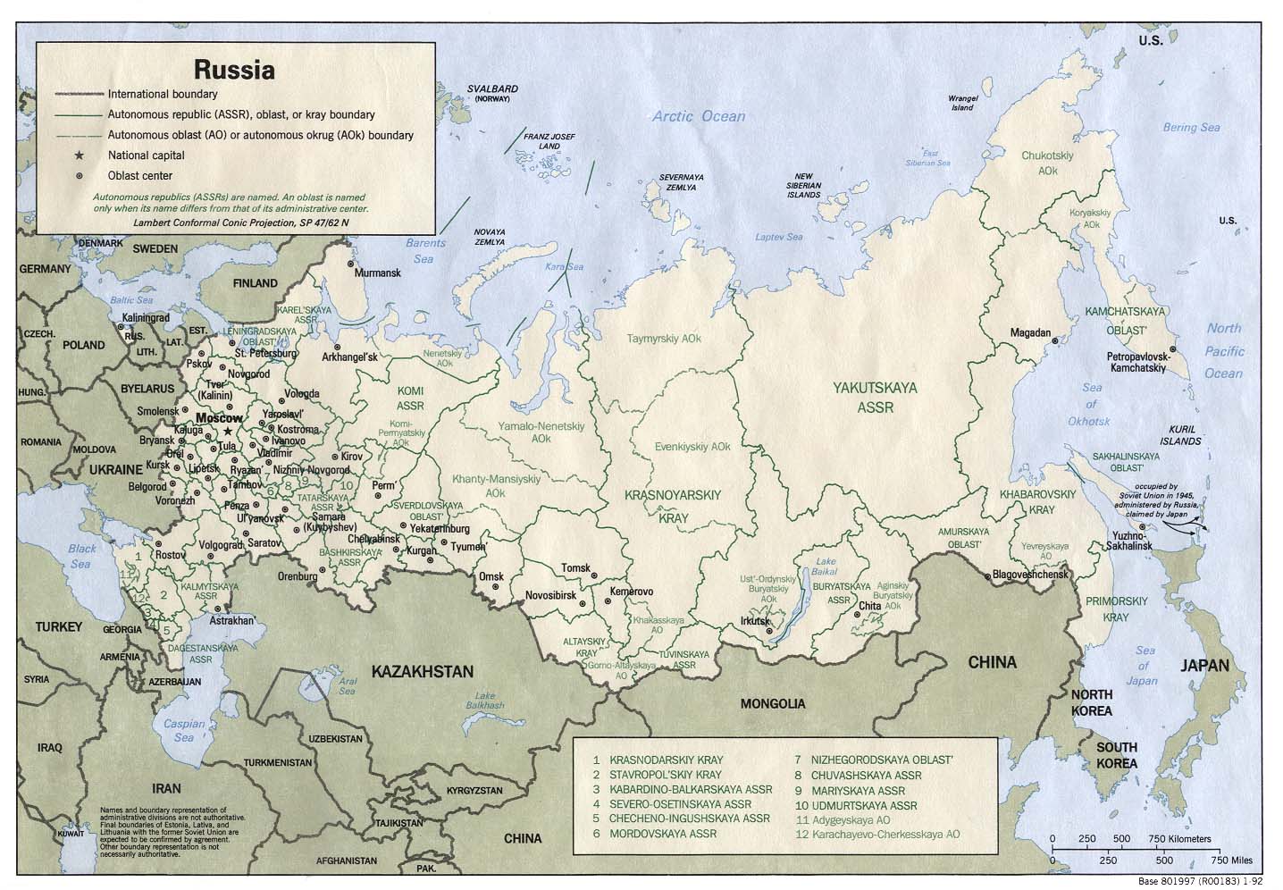
Russia: Administrative Divisions 1992 (101K) and pdf format (234K)
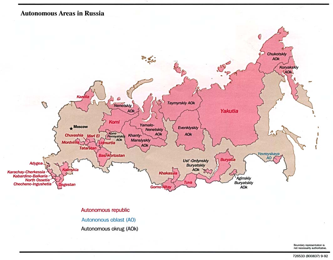
Russia - Autonomous Areas in Russia 1996 (83K)
Russia - Autonomous Areas in Russia 1992 (102K)
Russia - Birth Rate in 1999 U.S. Agency for International Development 2002 (1.1MB) [pdf format]
Russia: Environmental Problem Areas from Handbook of International Economic Statistics 1998 (2.3MB) [pdf format]
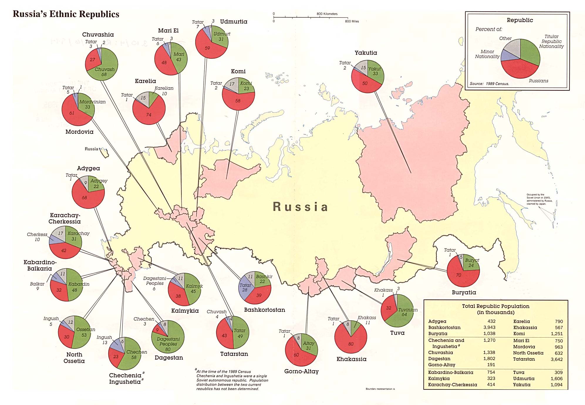
Russia's Ethnic Republics 1994 (312K)
Russia: Ethnic Russians in the Newly Independent States 1994 (417K)
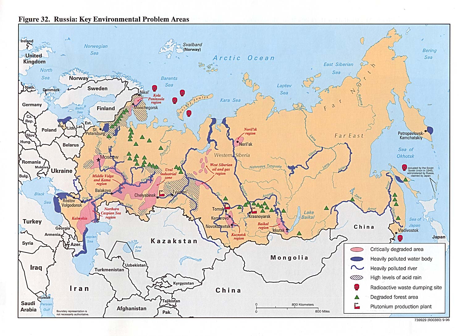
Russia: Key Environmental Problem Areas from Handbook of International Economic Statistics 1996 (351K)
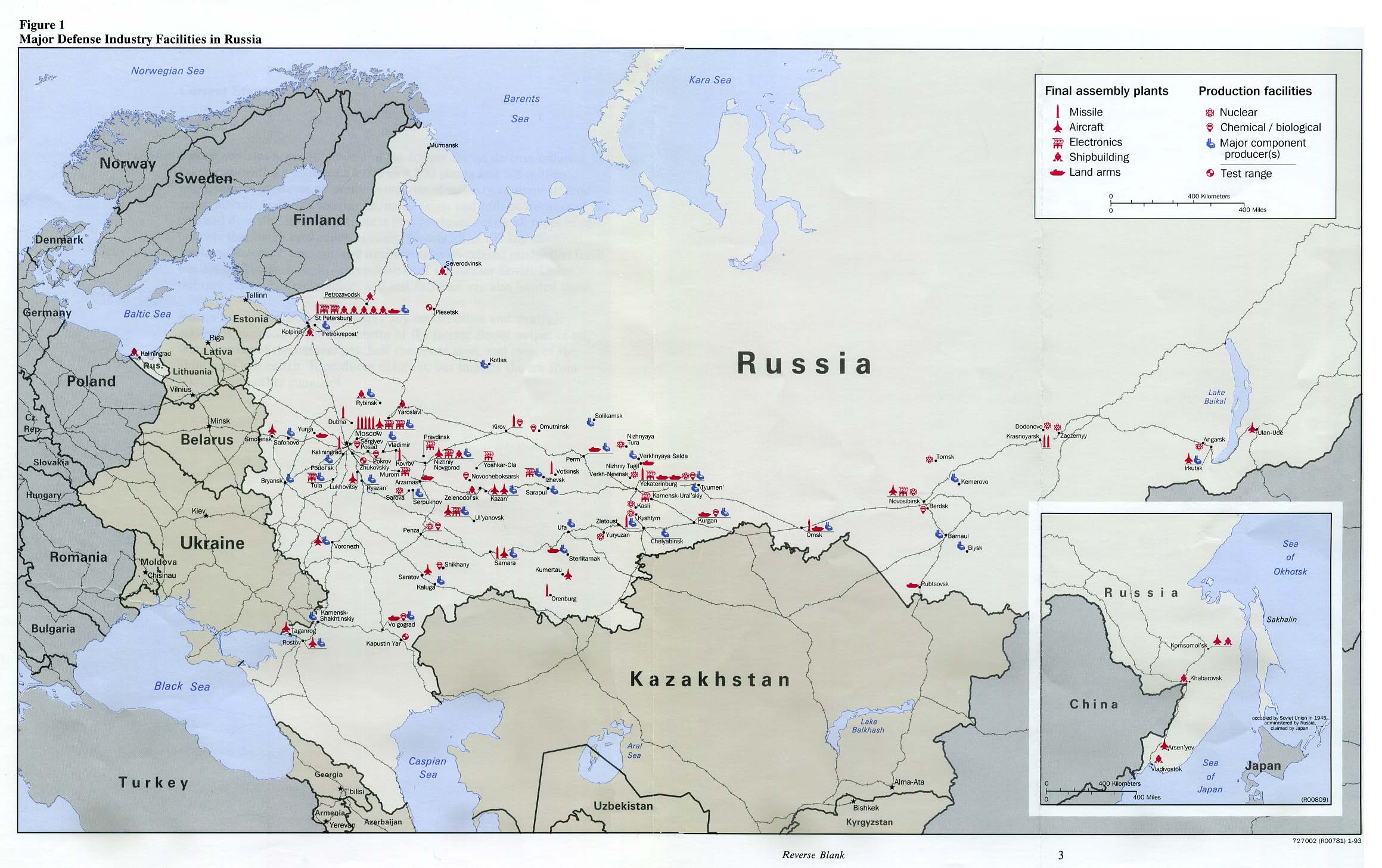
Russia - Major Defense Industry Facilities in Russia from Defense Industries of the Newly Independent States of Eurasia. 1993 (196K)
Russia - Population 2000 U.S. Agency for International Development 2001 (1.1MB) [pdf format]
Russia - Regional Investment Potential U.S. Agency for International Development 2001 (933K) [pdf format]
Russia - Youth (ages 0 to 15) as Percent of Total Population 2000 U.S. Agency for International Development 2002 (1.1MB) [pdf format]
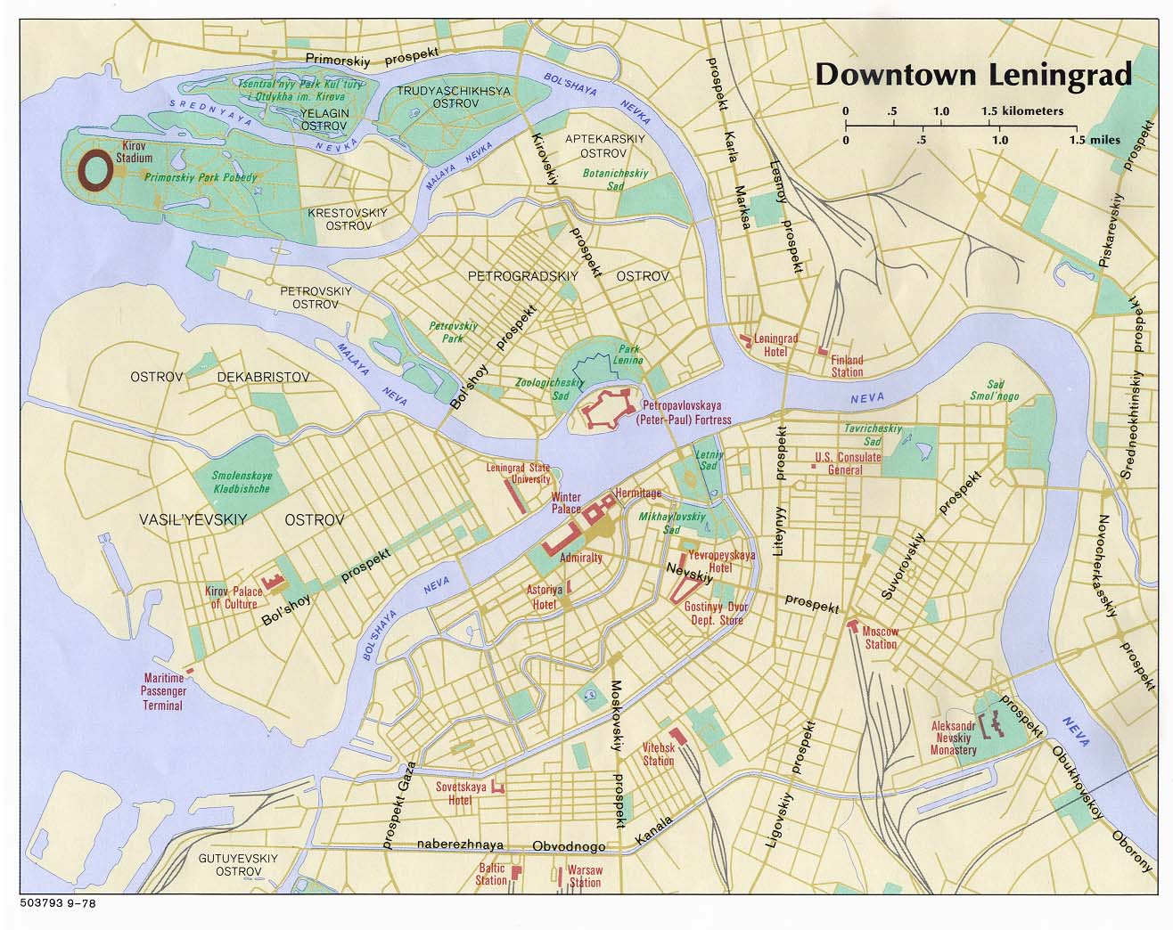
Saint Petersburg (Leningrad), Russia 1978 (224K)
Saint Petersburg and Vicinity (Leningrad), Russia 1978 (153K)
Saint Petersburg (Leningrad) - Central Leningrad 1:15,000 1977 (3.9 MB)
and verso Saint Petersburg (Leningrad) - Central Leningrad Index 1977 (3.9 MB)
Soviet-Designed Nuclear Power Plants from Handbook of International Economic Statistics 1996 (332K)
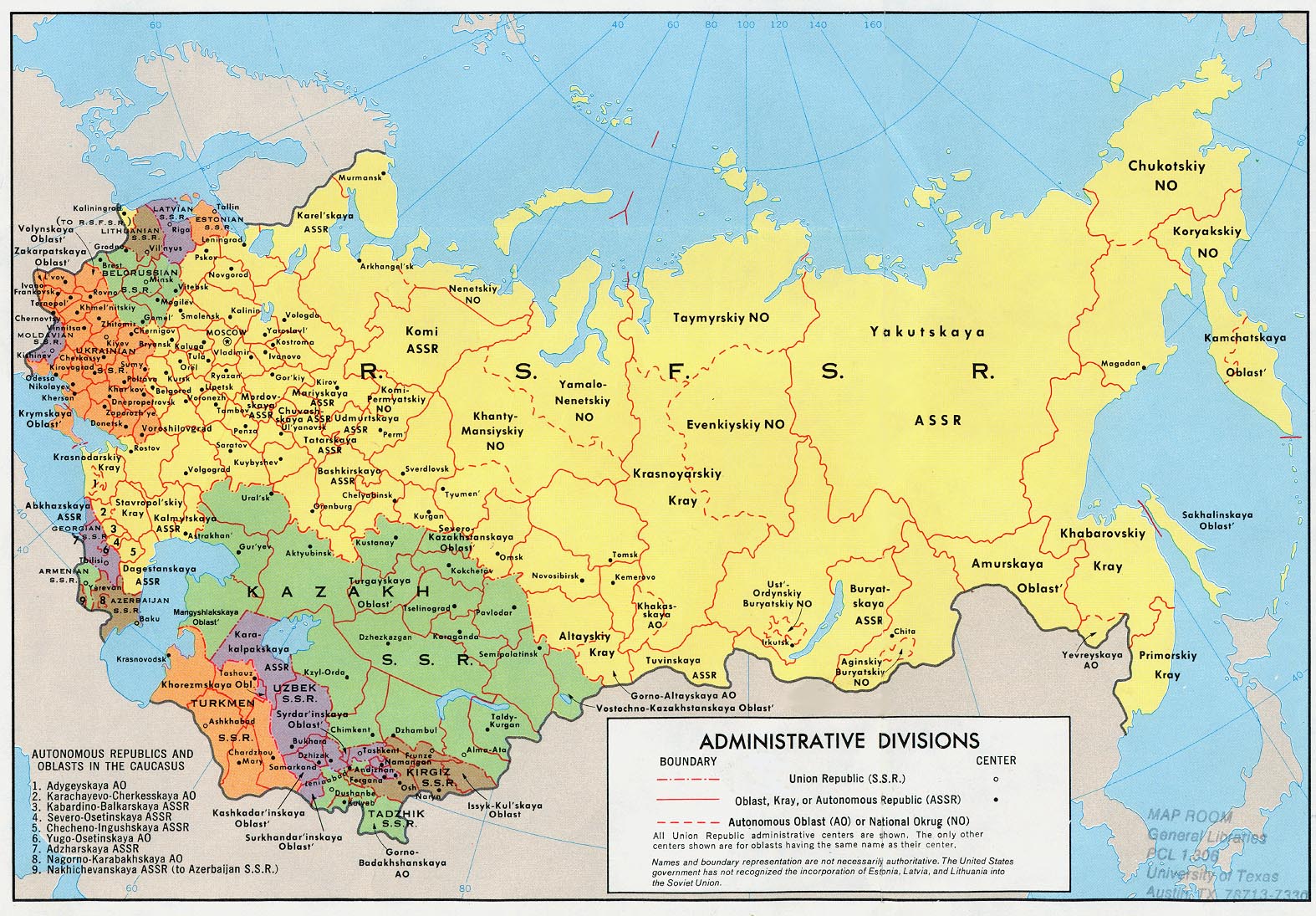
Soviet Union - Administrative Divisions, 1981 1982 (384K) and pdf format (396K)
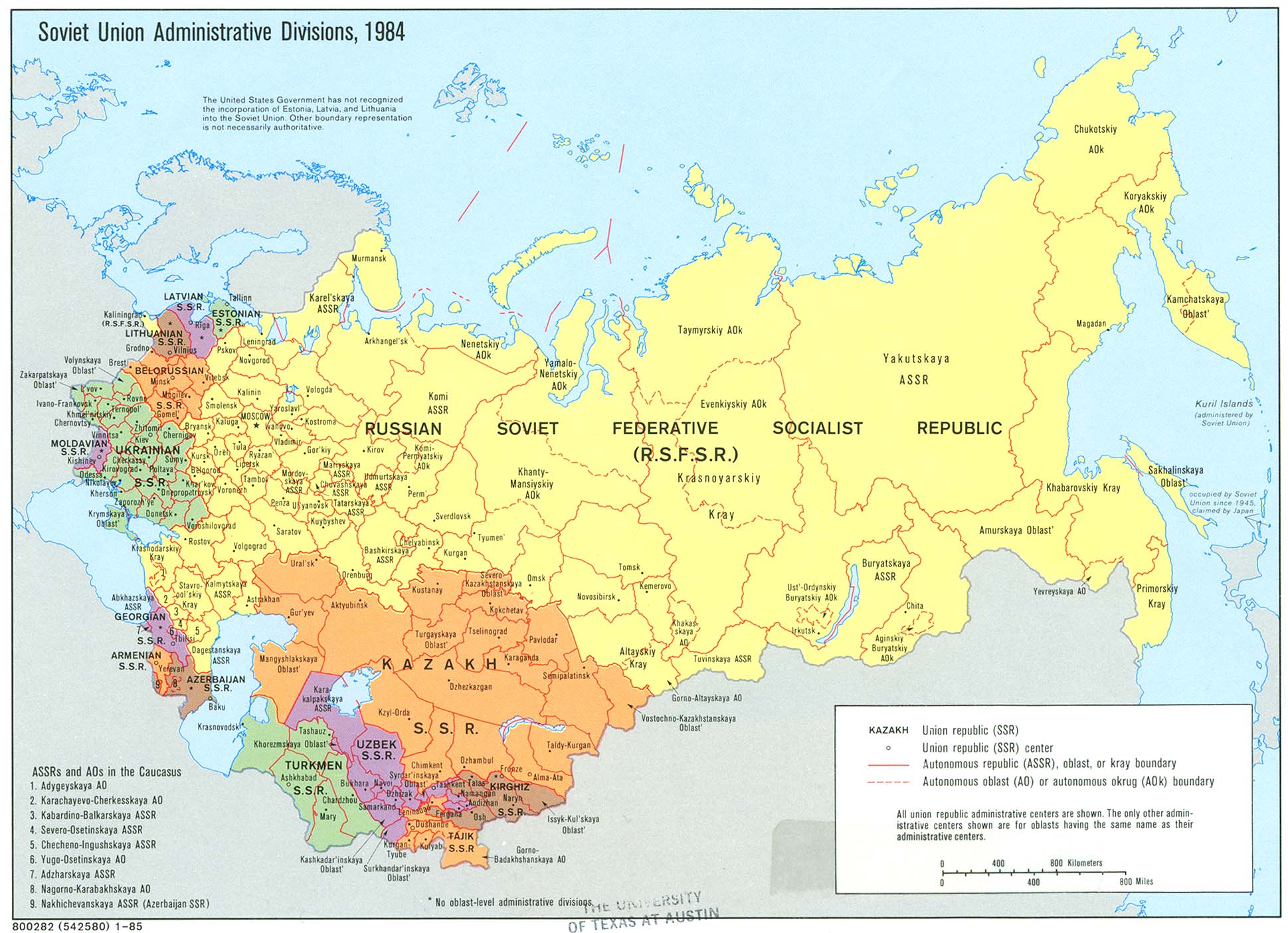
Soviet Union - Administrative Divisions, 1984 1985 (374K) and pdf format (385K)
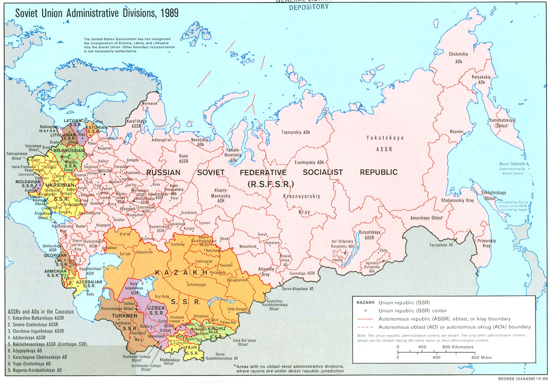
Soviet Union - Administrative Divisions 1989 (422K) and pdf format (425K)
Soviet Union - Administrative Divisions 1974 (470K)
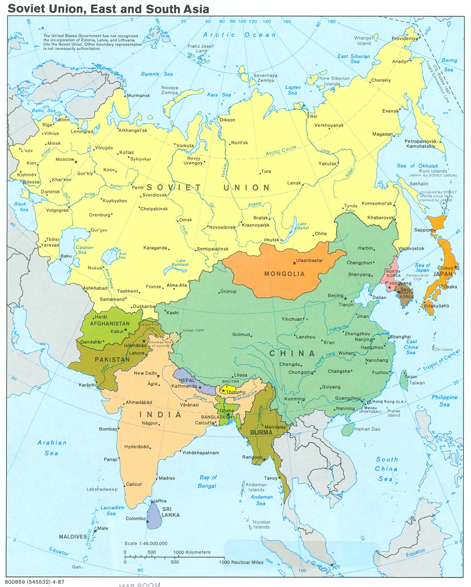
Soviet Union - East and South Asia 1987 (390K) and pdf format (392K)
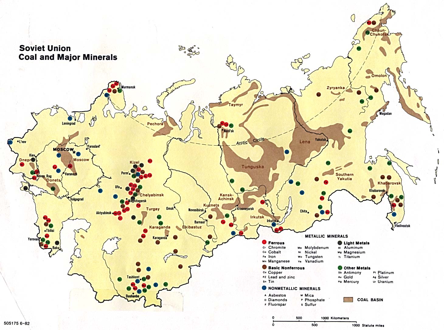
Soviet Union - Coal and Major Minerals 1982 (230K)
Soviet Union - Comparative Ethnic Groups, 1989 1995 (192K)
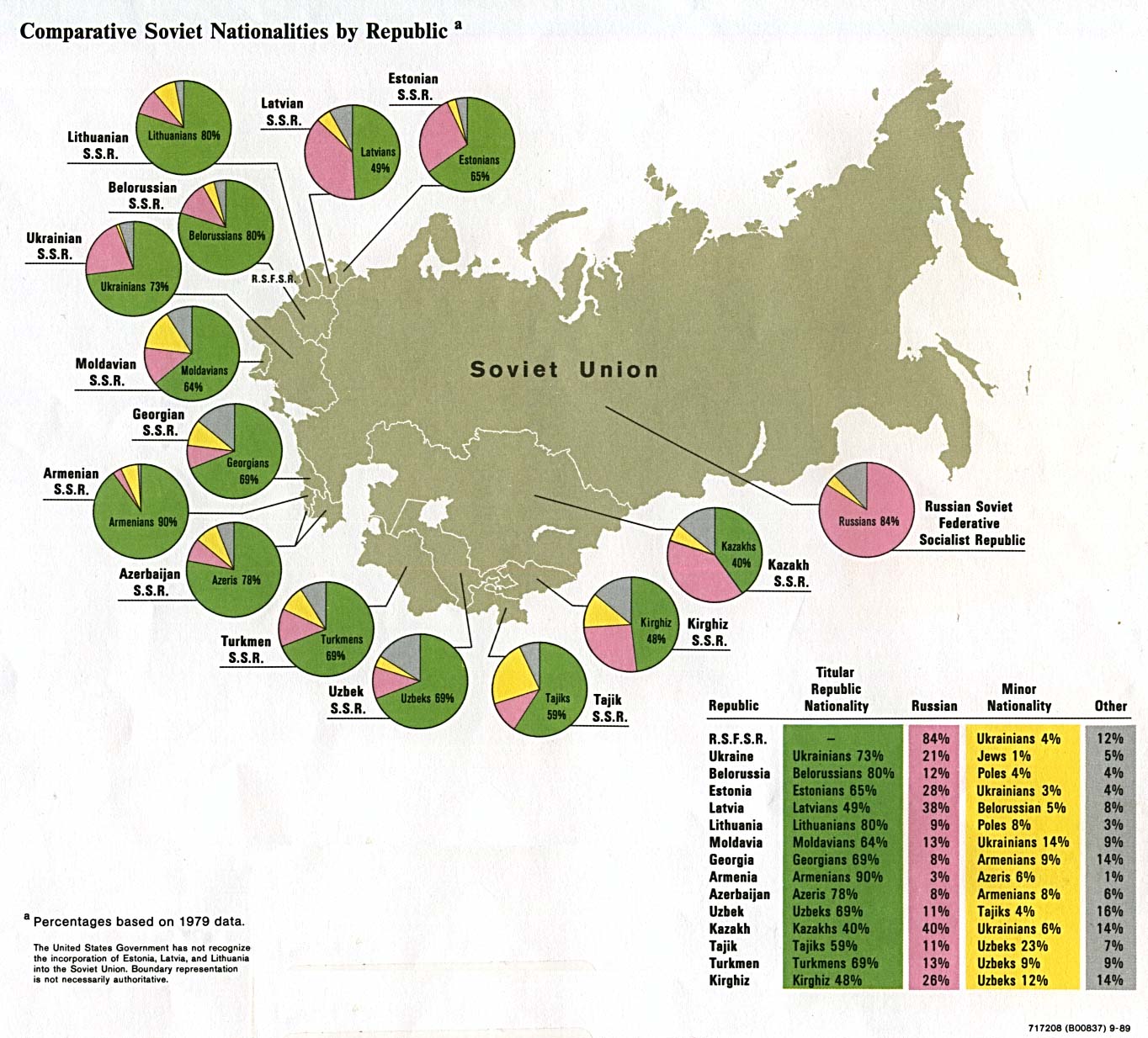
Soviet Union - Comparative Soviet Nationalities by Republic 1989 (249K)
Soviet Union - Shaded Relief 1983 (353K) and pdf format (364K)
Soviet Union - Shaded Relief 1986 (337K) and pdf format (345K)
Soviet Union - East and South Asia 1987 (390K)
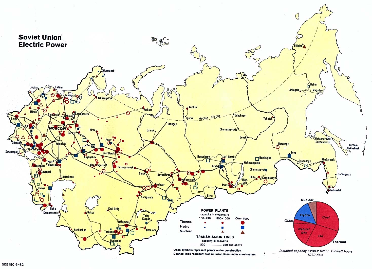
Soviet Union - Electric Power 1982 (235K)
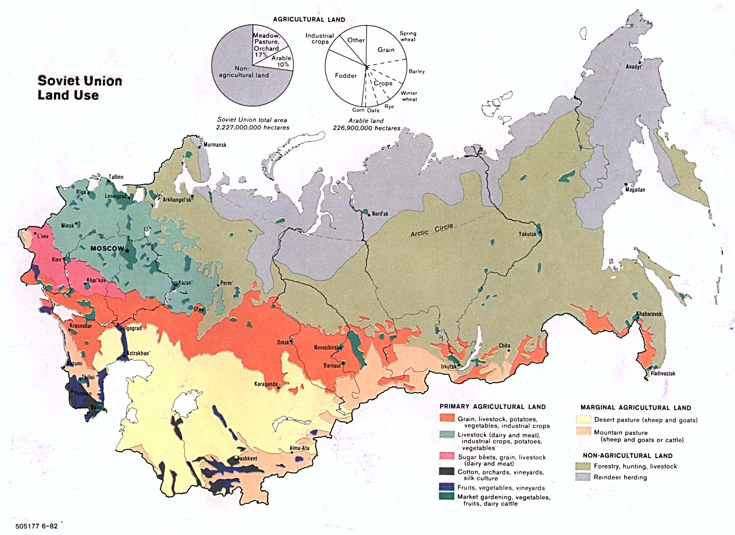
Soviet Union - Land Use 1982 (239K)
Soviet Union - Machine Building and Metal Working 1982 (221K)
Soviet Union - Major Terrain Features 1974 (421K)
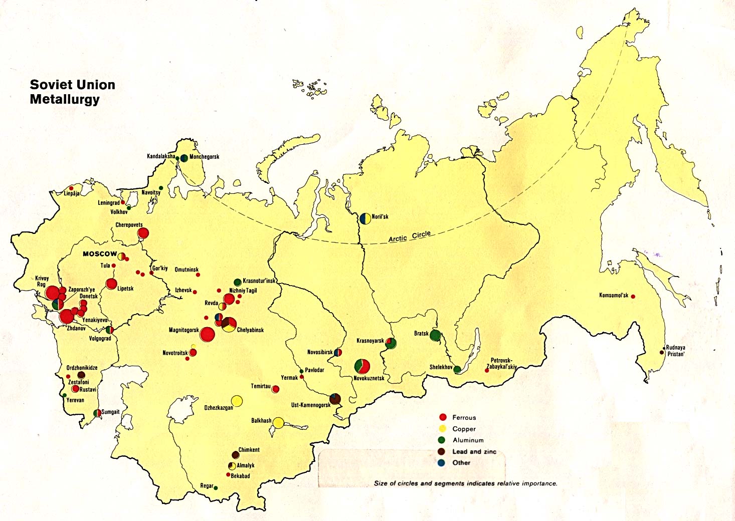
Soviet Union - Metallurgy 1982 (192K)
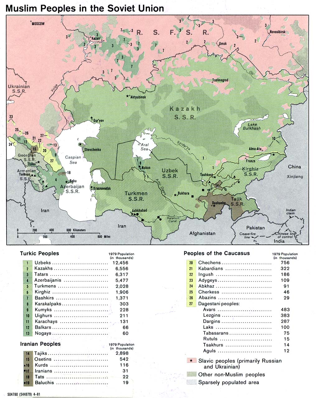
Soviet Union - Muslim Peoples 1981 (257K)
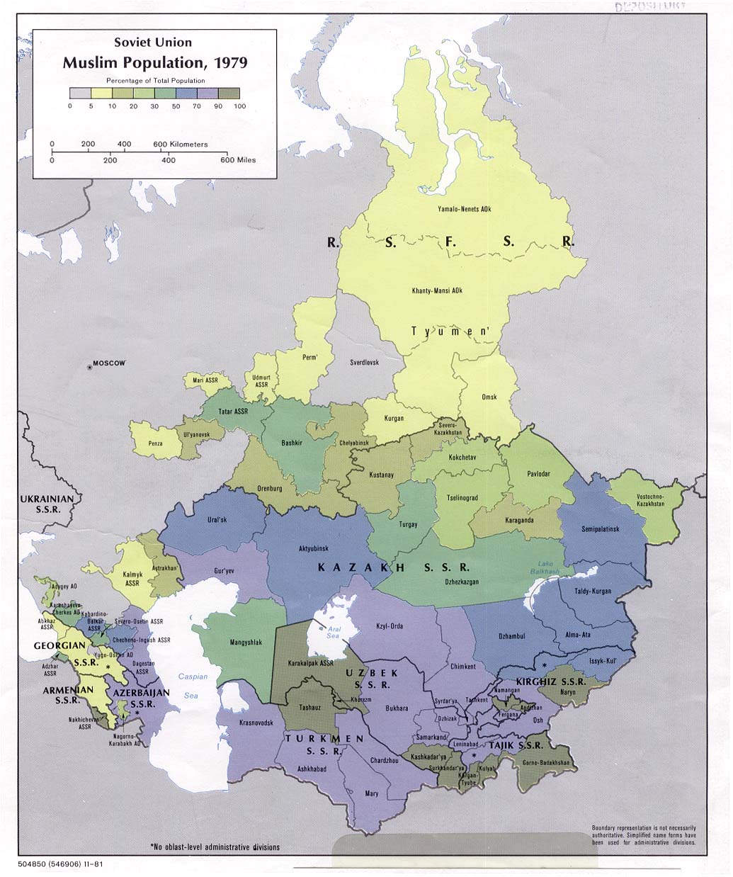
Soviet Union - Muslim Population, 1979 1981 (179K)
Soviet Union - Nationalities 1982 (274K)
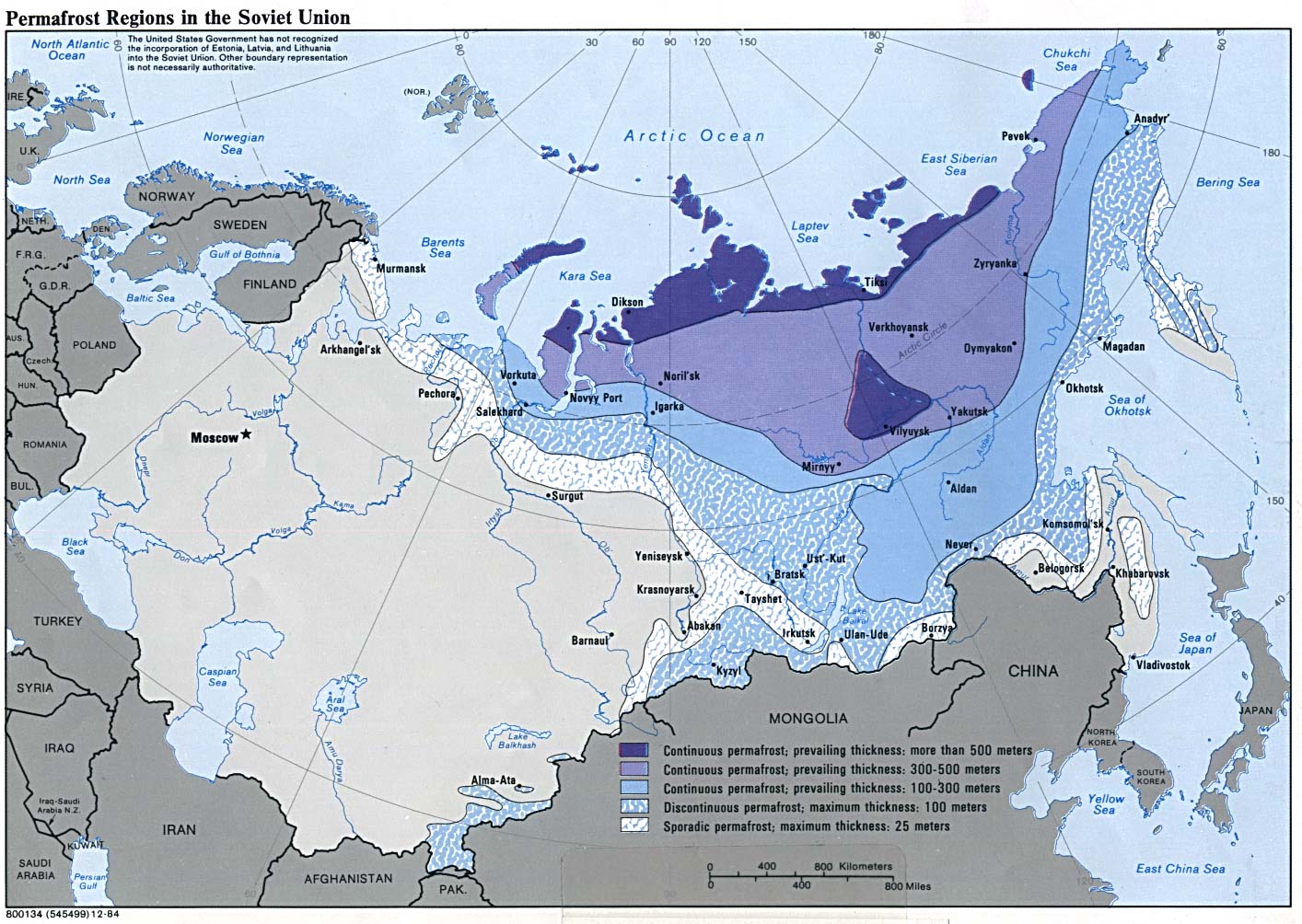
Soviet Union - Permafrost Regions 1984 (274K)
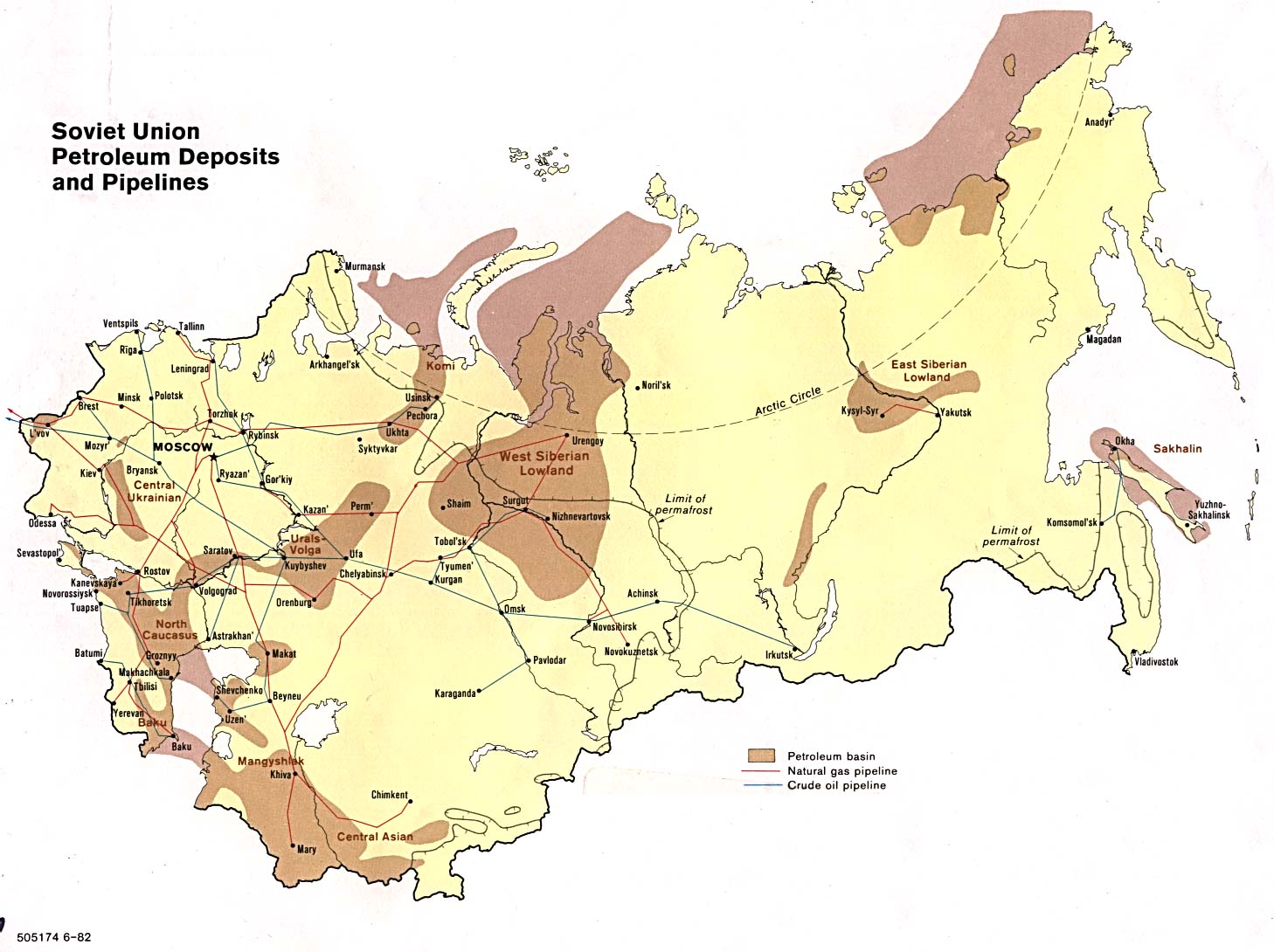
Soviet Union - Petroleum Deposits and Pipelines 1982 (206K)
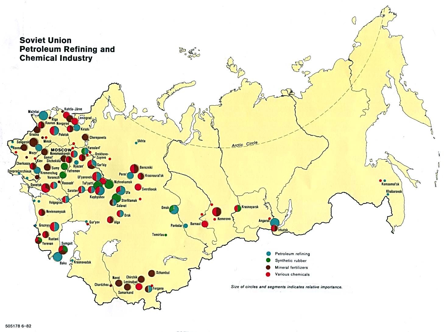
Soviet Union - Petroleum Refining and Chemical Industry 1982 (186K)
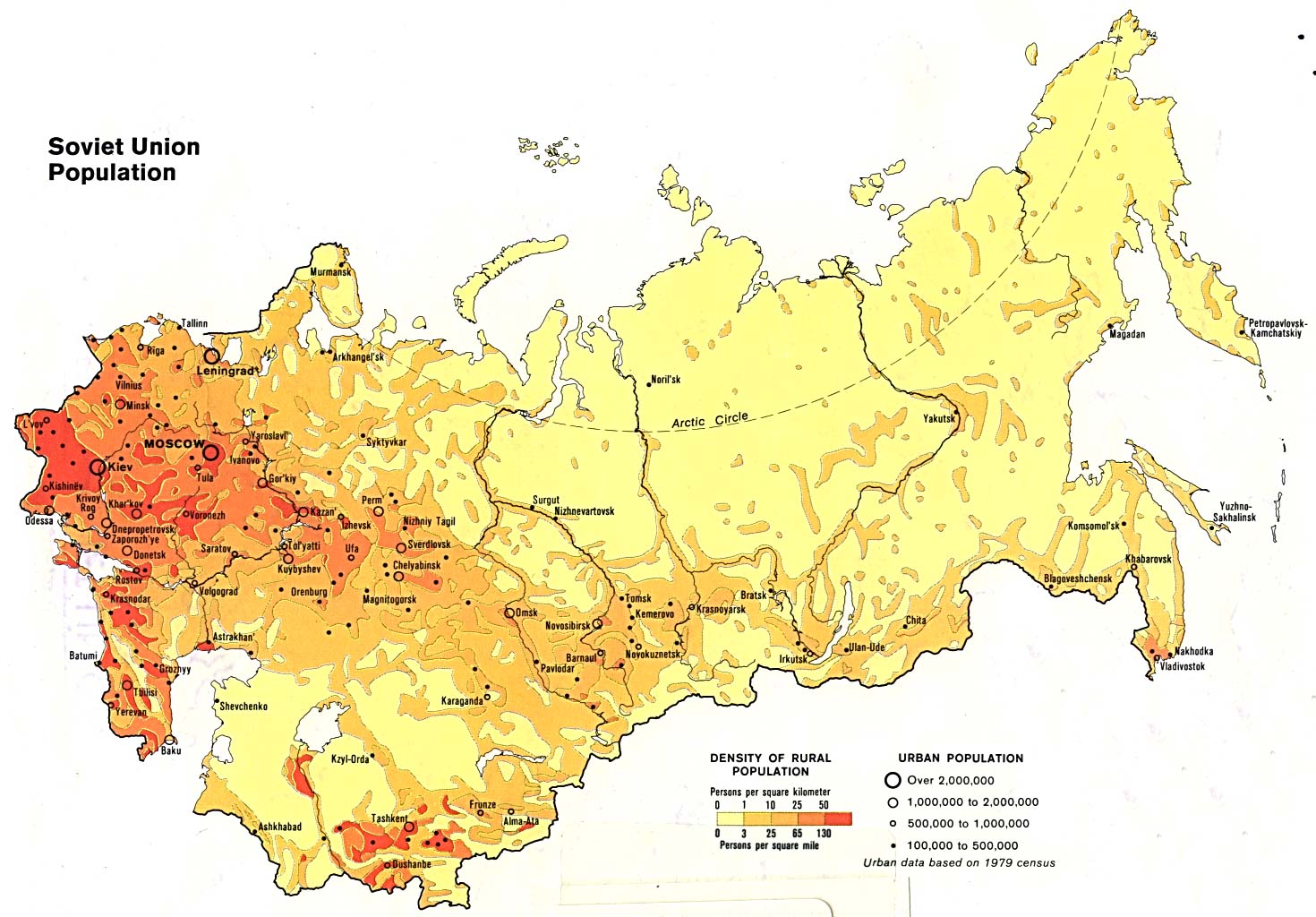
Soviet Union - Population 1982 (244K)
Soviet Union, Western - Economic Regions 1986 (311K)
Wrangel Island - Siberia (tactical pilotage chart) original scale 1:500,000 Portion of Defense Mapping Agency TPC C-8A 1982 (581K) Not for navigational use
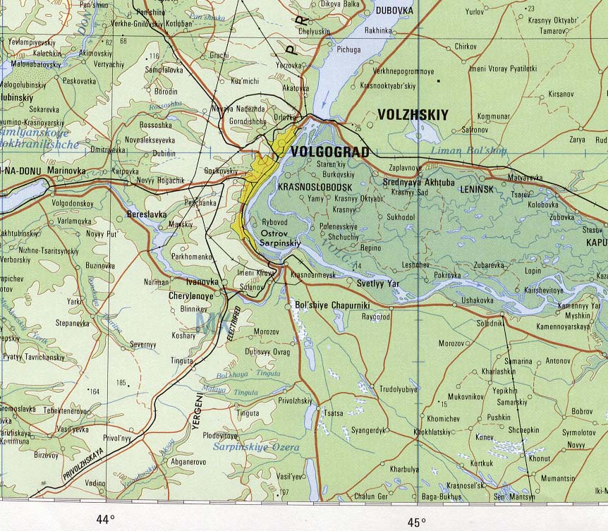
Volgograd Area Portion of Volgograd sheet. Topographic Map NM 38, Series 1301. Original Scale 1:1,000,000. Printed by the U.S. Defense Mapping Agency Hydrographic/Topographic Center, 1979 (232K)
Sources: These maps were provided by the University of Texas Library and/or
the U.S. Central Intelligence Agency (CIA) unless otherwise noted.
Sponsors
Maps on other websites
Russia (GRID-Arendal)
Russia (Lonely Planet)
Russia (United Nations) [PDF]
Russia - Elbrus Region Maps (Elbrus.org)
Russia - European Russia (DK Clip Art)
Russia - Forest Type and Protected Area Distribution (WCMC)
Russia - Gas Pipelines, Russia to Europe (Centre for Eastern Studies)
Russia - Geology, Oil and Gas Fields - Clickable Map (USGS)
Russia - Languages - Russia in Asia (Ethnologue)
Russia - Languages - Northern European Russia (Ethnologue)
Russia - Languages - Southern European Russia (Ethnologue)
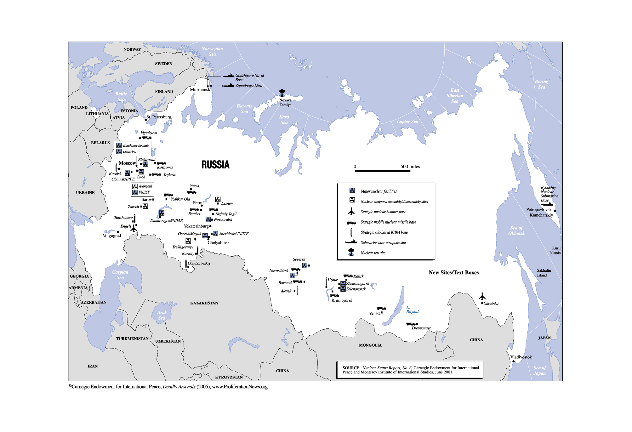
Russia - Military Facilities (Carnegie Endowment)
Russia - Mineral Industry (USGS) and Map Key
Russia - Physical Map (National Geographic)
Russia - Russian Far East Maps
Russia - Siberian Tiger and Amur Leopard Range Map (Tigris)
Russia - Tatarstan - Economic Map (Kazan State University)
Russia - Trans-Siberian Express Map (TEI Tours and Travel)
Russia - Yakutia Administrative Map
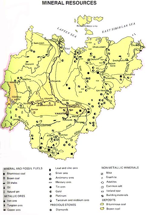
Russia - Yakutia Mineral Resources Map
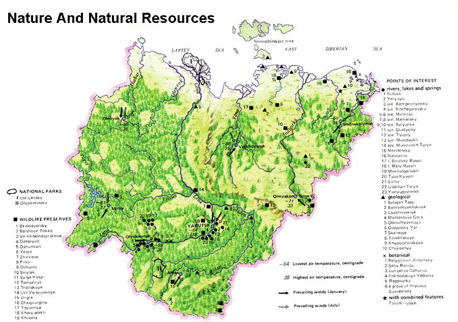
Russia - Yakutia Nature and Natural Resources Map
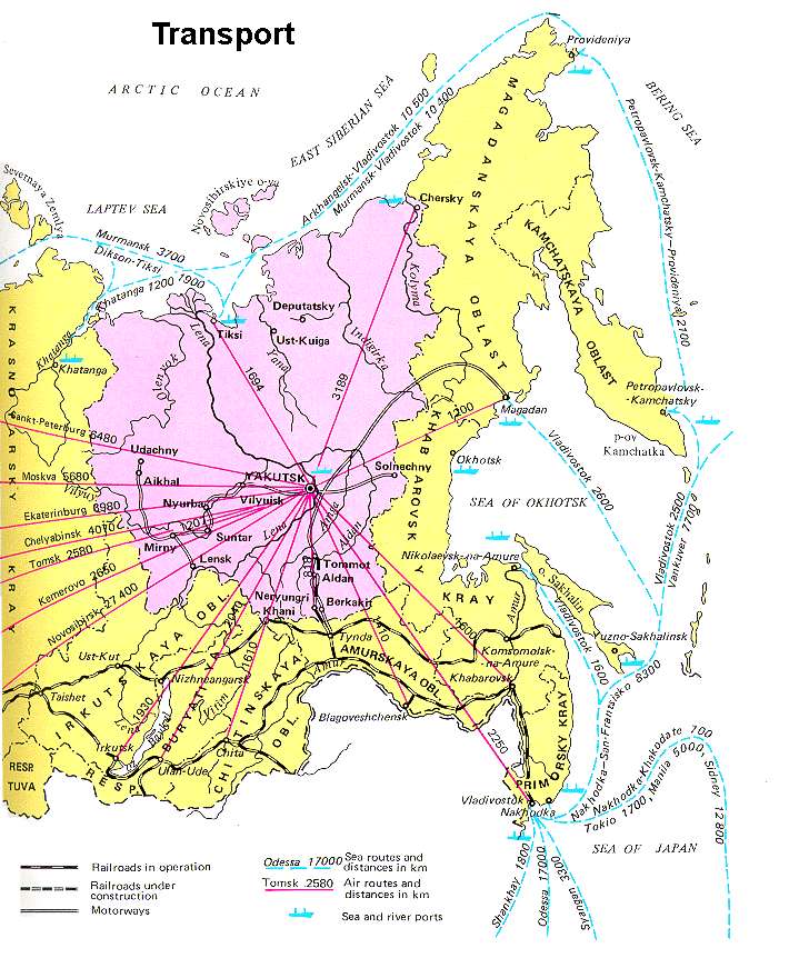
Russia - Yakutia Transport Map
<-- Free Map Downloads
<-- Free World Country Map Downloads
Didn't find what you are looking for? We've been online since 1996 and have created 1000's of pages. Search below and you may find just what you are looking for.
Michael R. Meuser
Data Research & GIS Specialist
MapCruzin.com is an independent firm
specializing in GIS project development and data research.
We created the first U.S. based
interactive toxic chemical facility
maps on the internet in 1996 and we
have been online ever since. Learn more about us and our services.
Have a project in mind? If you have data, GIS project or custom shapefile needs contact Mike.
Contact Us
Report Broken Links
Subscribe for Updates


![[Caspian Region] Oil and Gas Infrastructure in the Caspian Sea Region](/free-maps-russia-soviet/caspian_sea_oil_gas-2001.jpg)