Download Free Poland Maps
<-- Free Map Downloads
<-- Free World Country Map Downloads
Sponsors
Note that maps may not appear on the webpage in their full size and resolution. To save the maps to your computer, right-click on the link.
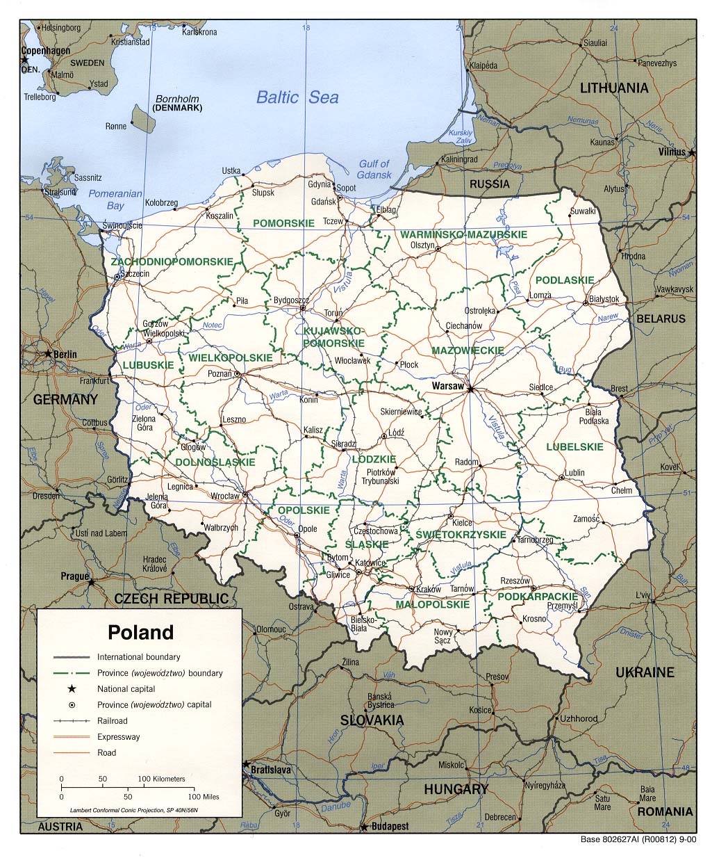
Poland (Political) 2000 (321K) and pdf format (331K)
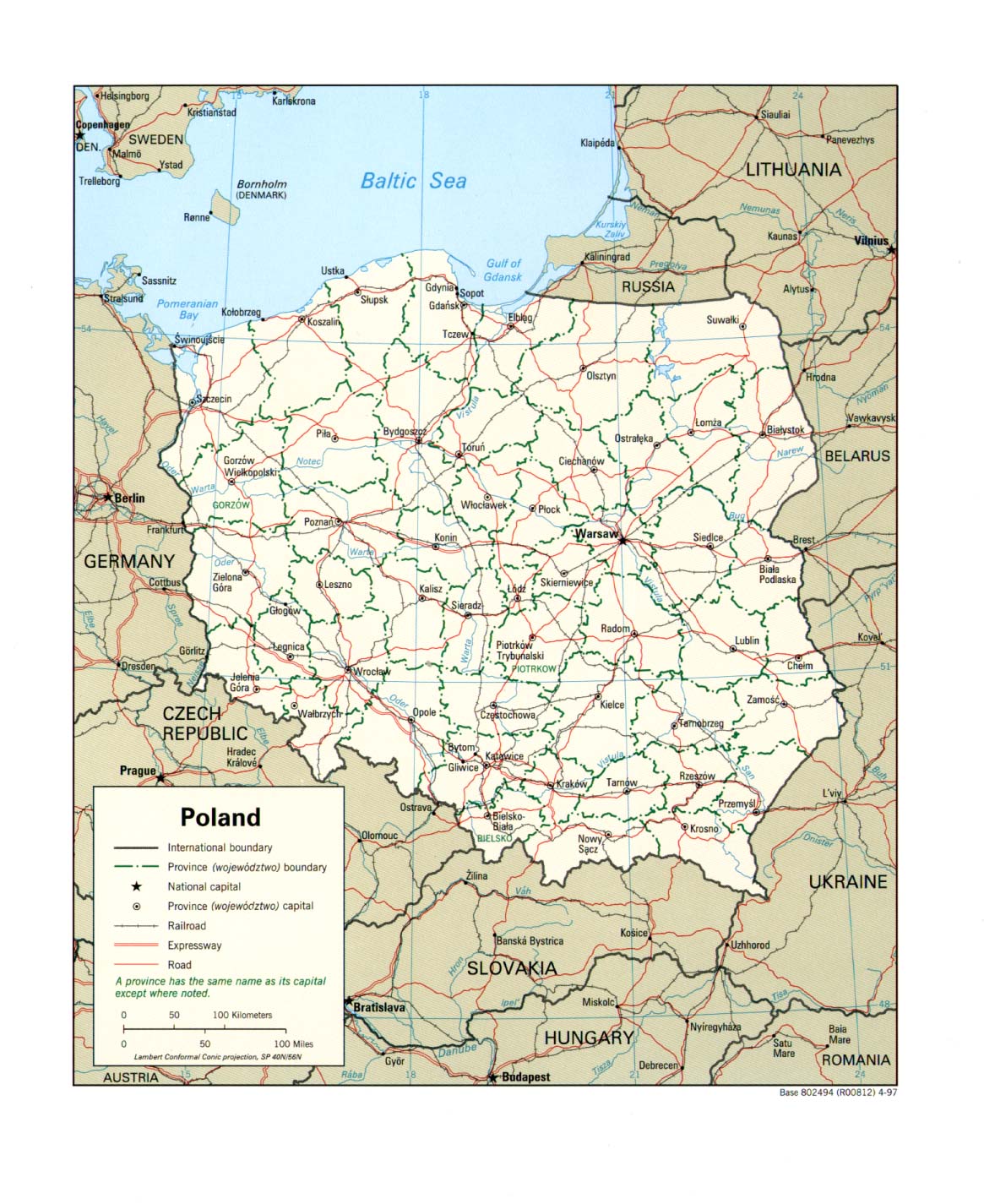
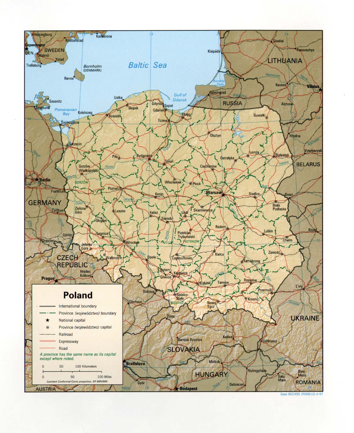
Poland (Political) 1997 (315K) and pdf format (303K)
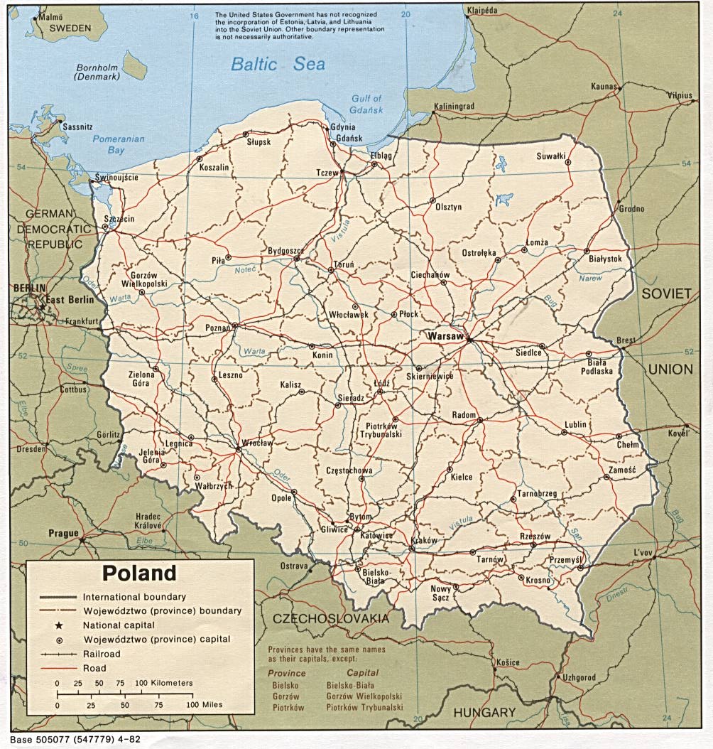
Poland (Political) 1982 (247K) and pdf format (250K)
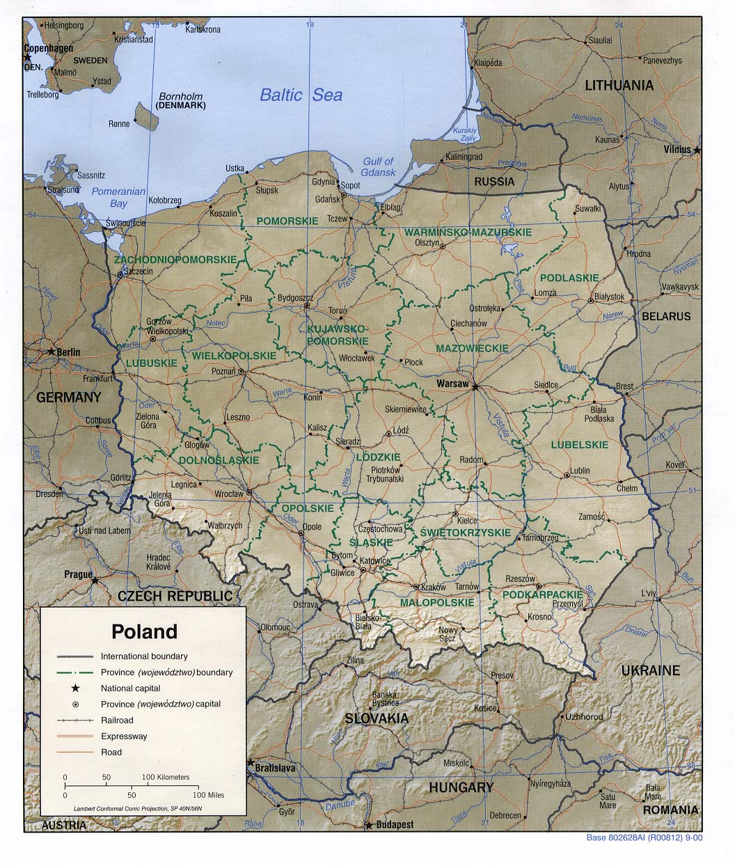
Poland (Shaded Relief) 2000 (285K) and pdf format (329K)
Poland (Shaded Relief) 1997 (306K) and pdf format (294K)
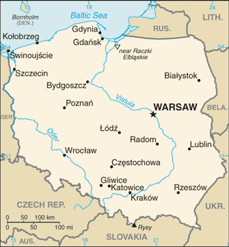
Poland (Small Map) 2008 (14K)
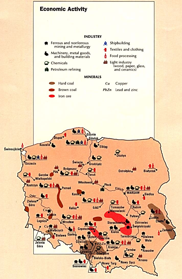
Poland - Economic Activity from the CIA Atlas of Eastern /free-maps-polan 1990 (141K)
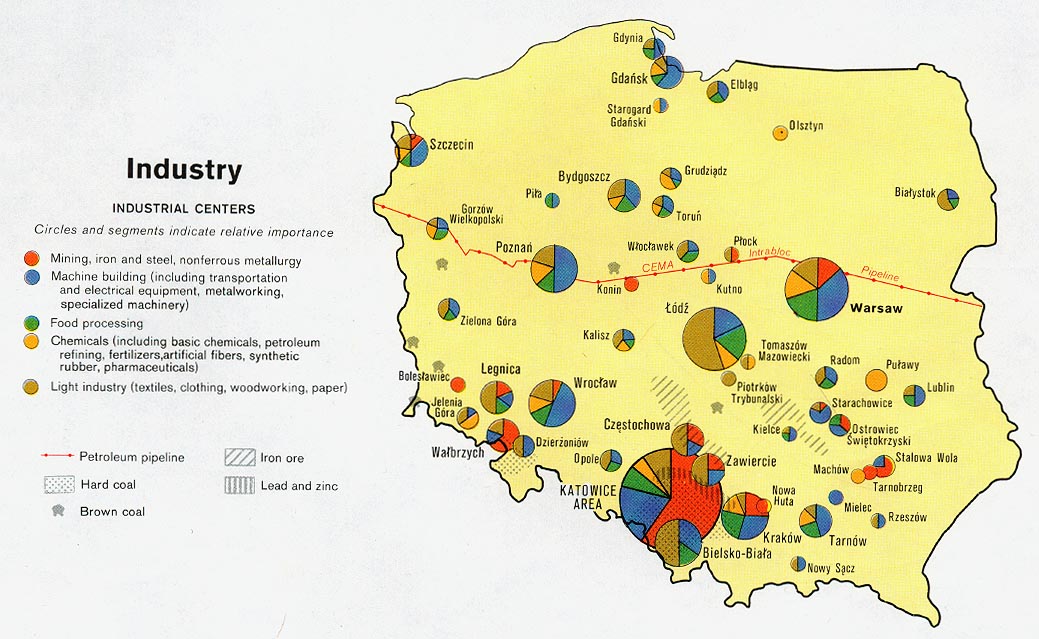
Poland - Industry from Map No. 503478 1977 (160K)
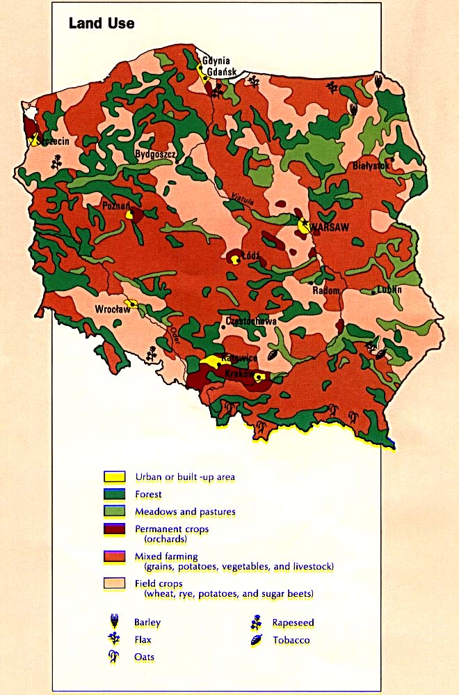
Poland - Land Use from the CIA Atlas of Eastern /free-maps-polan 1990 (138K)
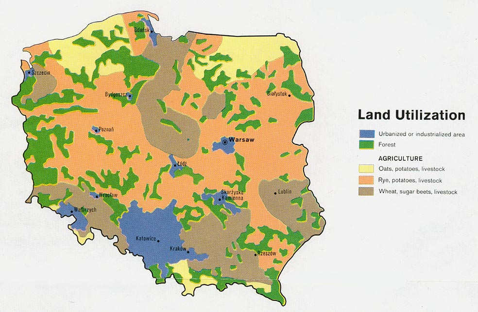
Poland - Land Utilization from Map No. 503478 1977 (166K)
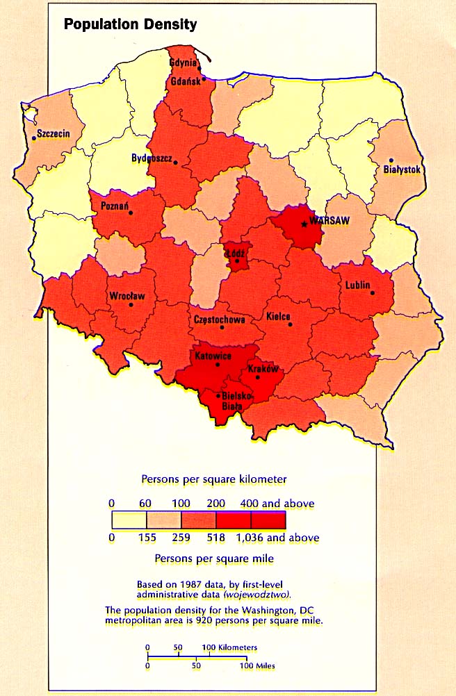
Poland - Population Density from the CIA Atlas of the Eastern /free-maps-polan 1990 (123K)
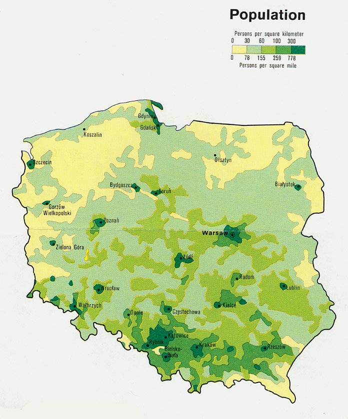
Poland - Population from Map No. 503478 1977 (141K)
Sources: These maps were provided by the University of Texas Library and/or
the U.S. Central Intelligence Agency (CIA) unless otherwise noted.
Maps on other websites
Poland (Eurofresh)
Poland (GRID-Arendal)
Poland (Lonely Planet)
Poland (United Nations) [PDF]
Poland - Interactive Map (Pilot.pl)
Poland - Interactive Topographic Map (IGiPZ Map Server)
<-- Free Map Downloads
<-- Free World Country Map Downloads
Didn't find what you are looking for? We've been online since 1996 and have created 1000's of pages. Search below and you may find just what you are looking for.
Michael R. Meuser
Data Research & GIS Specialist
MapCruzin.com is an independent firm
specializing in GIS project development and data research.
We created the first U.S. based
interactive toxic chemical facility
maps on the internet in 1996 and we
have been online ever since. Learn more about us and our services.
Have a project in mind? If you have data, GIS project or custom shapefile needs contact Mike.
Contact Us
Report Broken Links
Subscribe for Updates
Sponsors


