Download Free Philippines Maps
<-- Free Map Downloads
<-- Free World Country Map Downloads
Sponsors
Note that maps may not appear on the webpage in their full size and resolution. To save the maps to your computer, right-click on the link.
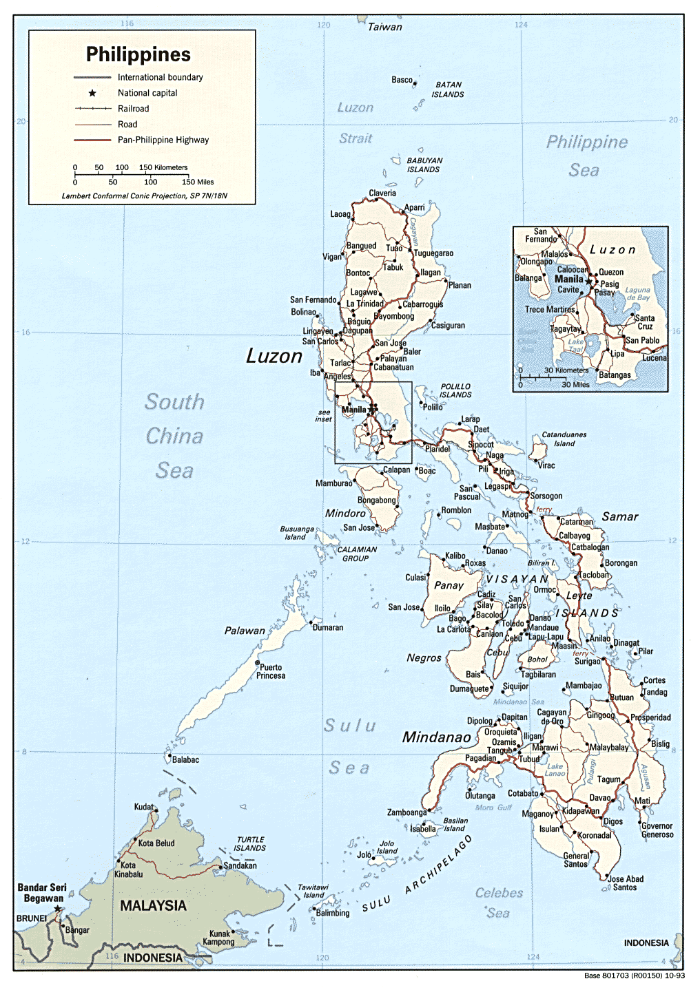
Philippines (Political) 1993 (317K) and
pdf format (332K)
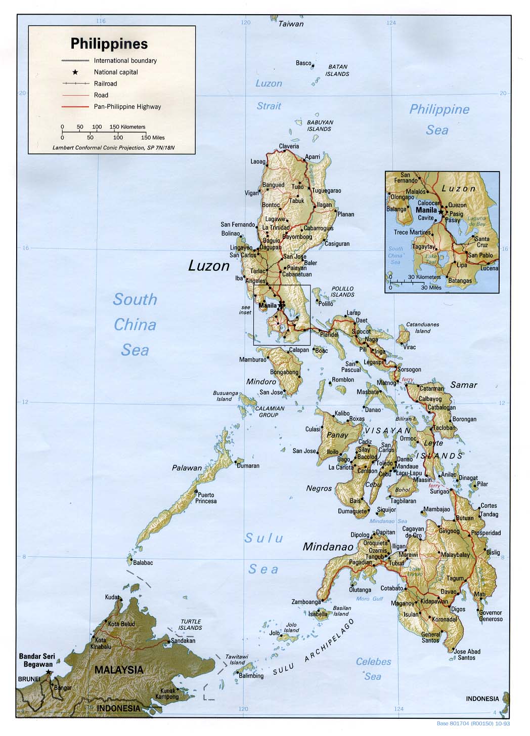
Philippines (Shaded Relief) 1993 (207K) and
pdf format (213K)
Philippines (Small Map) 2008 (23K)
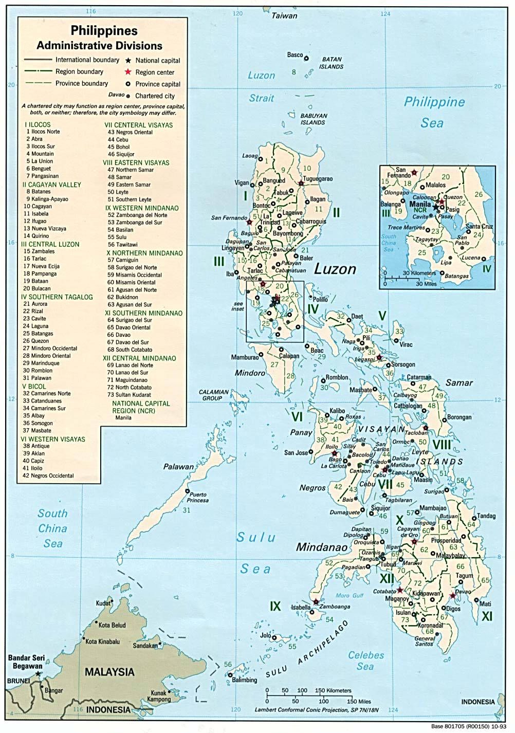
Philippines Administrative Divisions 1993 (298K)
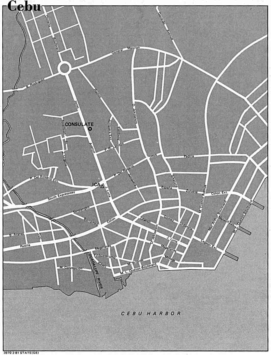
Cebu U.S. Dept. of State 1981 (94K)
Jolo from Philippine Islands Sailing Directions (Enroute) published by the U.S. Defense Mapping Agency 1993 (103K)
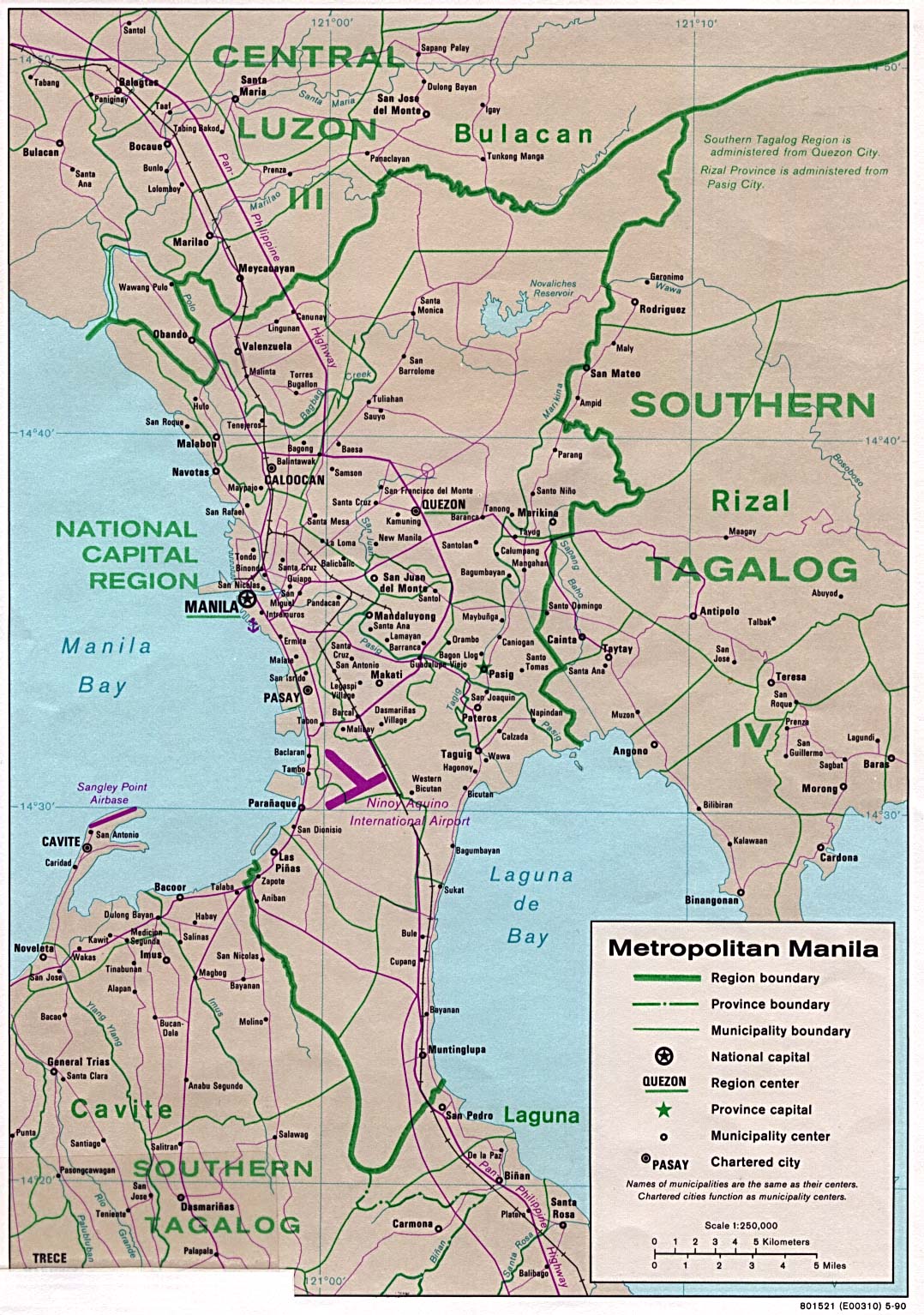
Manila 1990 CIA (383K)
Manila U.S. Dept. of State 1980 (73K)
Basilan Island Original scale 1:500,000 Portion of Defense Mapping Agency TPC L-12A 1984 (157K) Not for navigational use
Jolo Island Original scale 1:500,000 Portion of Defense Mapping Agency TPC L-12A 1984 (166K) Not for navigational use
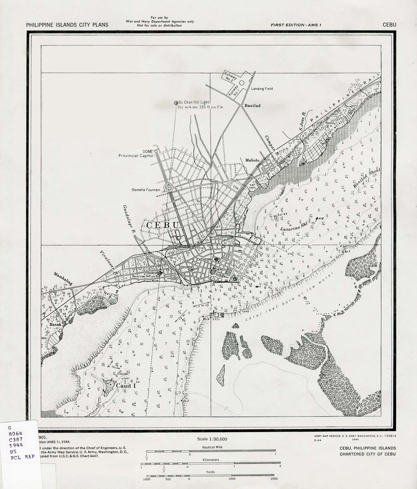
Cebu 1944 (524K) Published by U.S. Army Map Service, 1944.
Lingayen 1944 (175K)
Published by U.S. Army Map Service, 1944.
Manila 1851 (851K) Diccionario Geografico-Estadistico-Historico De Las Islas Filipinas. Madrid 1851.
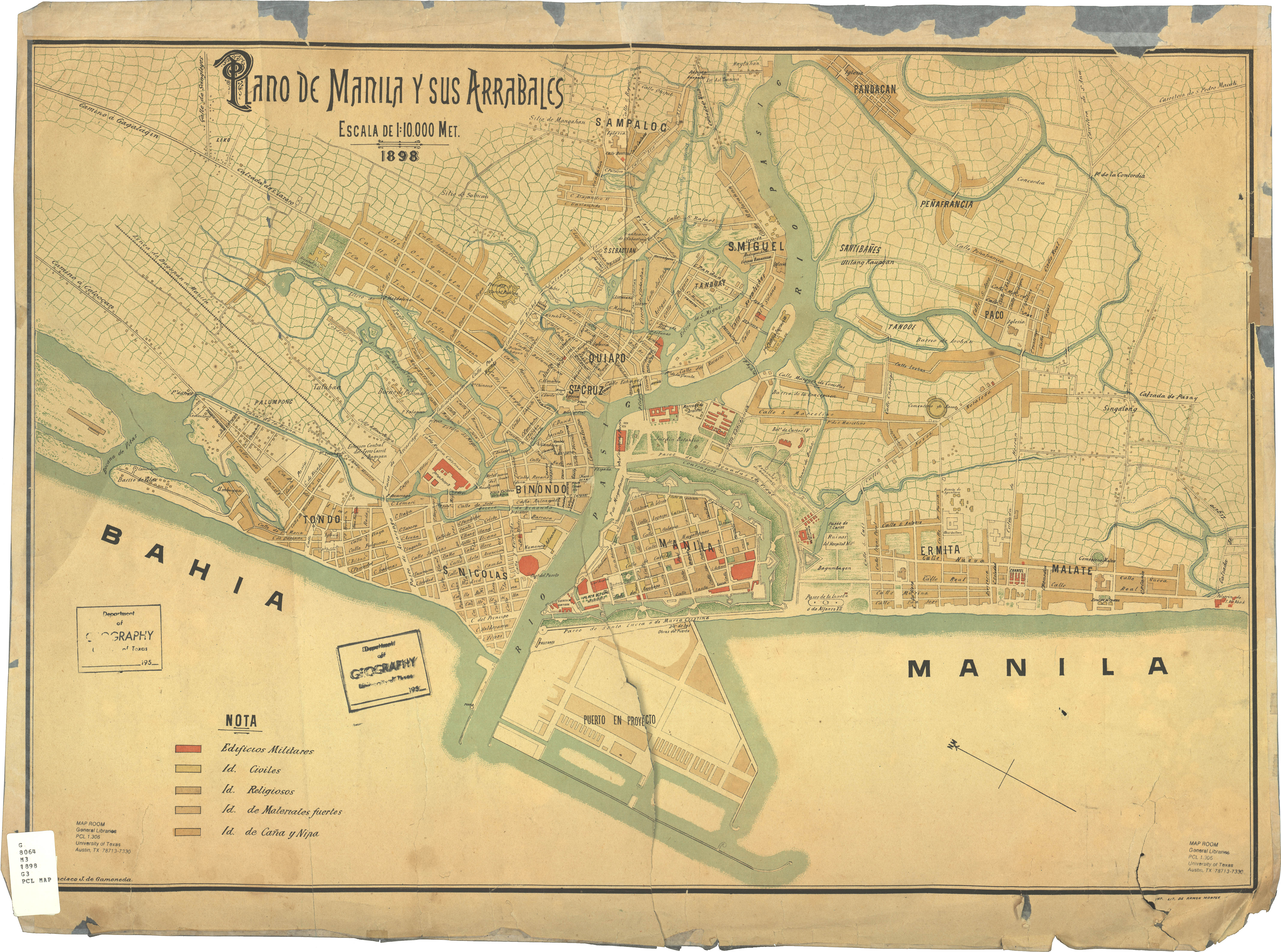
Manila 1898 (3.8MB) Plano de Manila y sus Arrables, Francisco J. de Gamoneda ; imp. lit. de Ramon Montes, original scale 1:10,000, 1898.
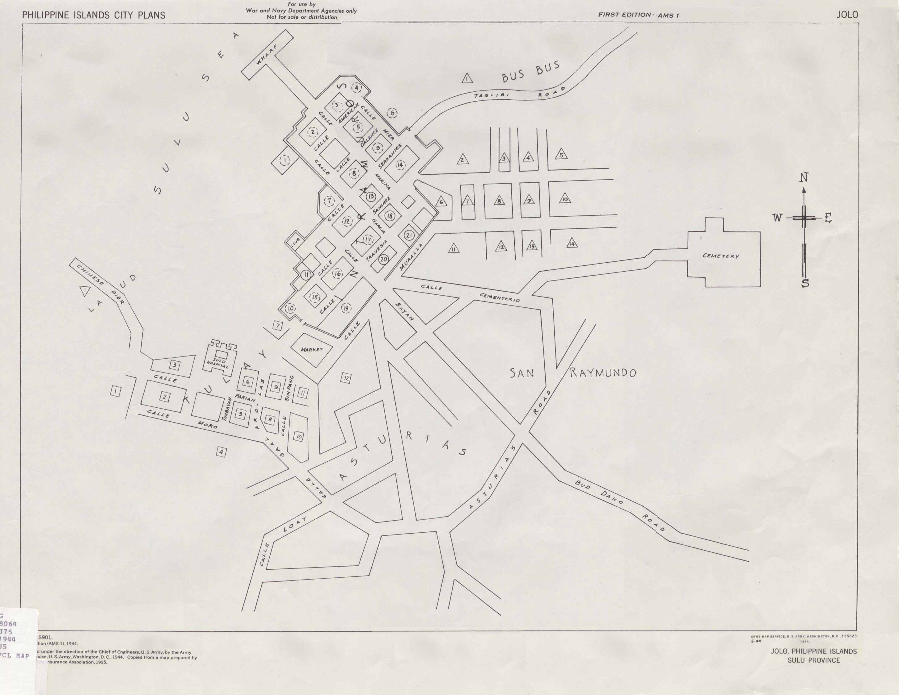
Jolo 1944 (266K) Published by U.S. Army Map Service, 1944.
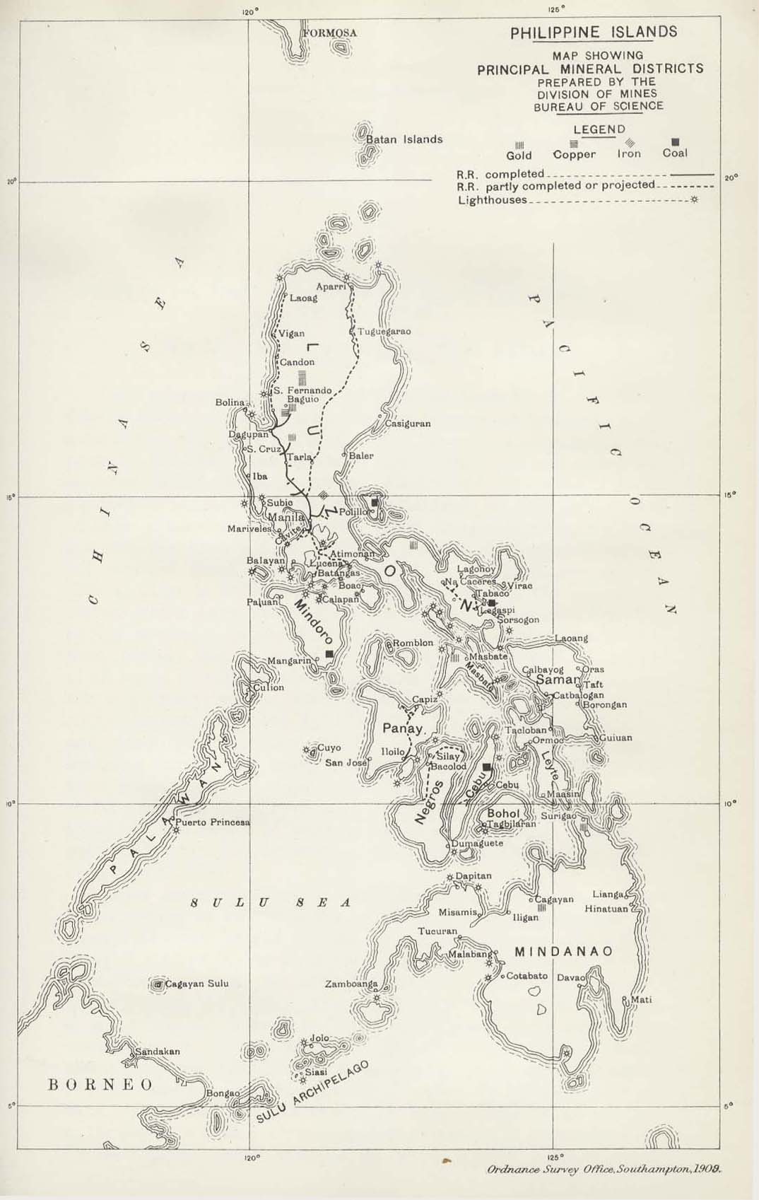
Philippine Islands 1909 (192K) "Philippine Islands Map Showing Principal Mineral Districts" from Diplomatic and Consular Reports; Annual 4369 - 4387, 1908 Vol. 7; edited at the Foreign Office and the Board of Trade. London 1909.
Ports in China, Japan and the Philippines 1860 Part I (335K)
Ports Location Map and Plan of Jedo Bay, [Tokyo/yokohama, Japan] From Mittheilungen aus Justus Perthes' Geographischer Anstalt uber Wichtige Neue Erforschungen auf dem Gesammtgebiete der Geographie von Dr. A. Petermann. Volume 6, 1860.
Ports in China, Japan and the Philippines 1860 Part II (325K)
Plans of Schanghai [Shanghai, China], Iloilo [Philippines], Sual [Port Sual, Philippines], Taiwan [now Tainan, Taiwan], Zamboanga [Philippines], Khiungtscheu [Kiungshan/ch'iung-Shan, China] From Mittheilungen aus Justus Perthes' Geographischer Anstalt uber Wichtige Neue Erforschungen auf dem Gesammtgebiete der Geographie von Dr. A. Petermann. Volume 6, 1860.
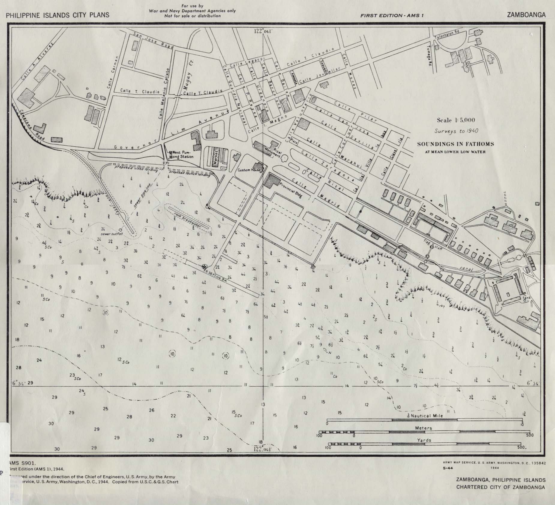
Zamboanga 1944 (297K)
Published by U.S. Army Map Service, 1944.
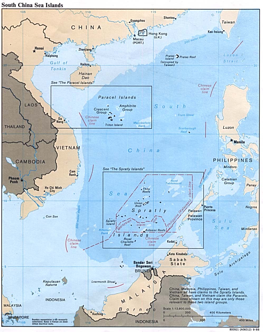
South China Sea 1988 (229K)
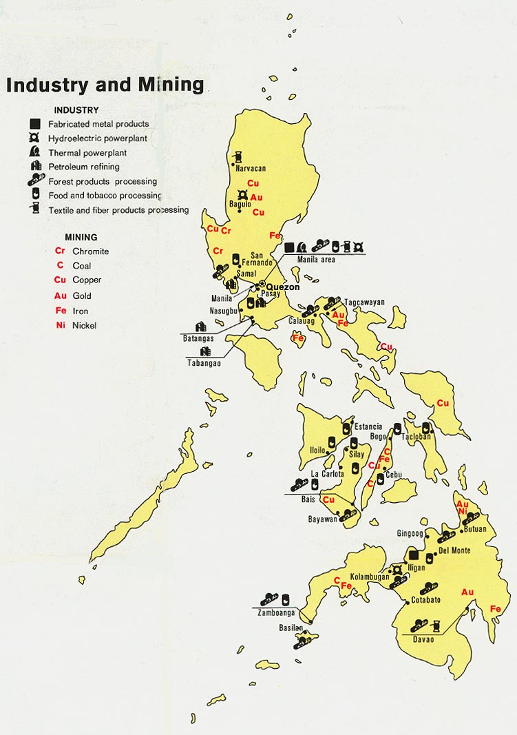
Philippines - Industry and Mining from Map No. 501475 1973 (137K)
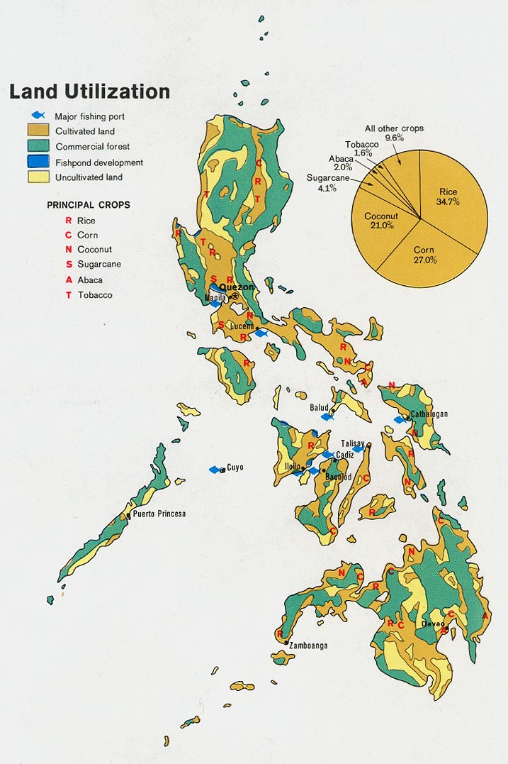
Philippines - Land Utilization from Map No. 501475 1973 (160K)
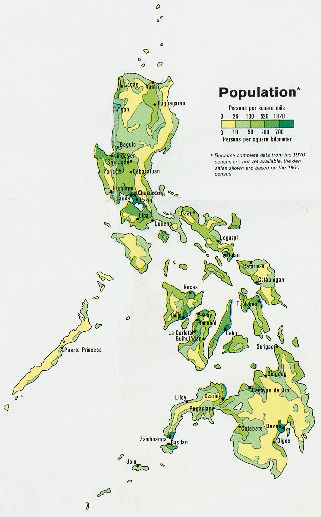
Philippines - Population from Map No. 501475 1973 (140K)
Sources: These maps were provided by the University of Texas Library and/or
the U.S. Central Intelligence Agency (CIA) unless otherwise noted.
Maps on other websites
Philippines (Lonely Planet)
Philippines - Language Maps (Ethnologue)
Philippines - Maps (Peter Loud)
Philippines - Maps (UNOSAT)
<-- Free Map Downloads
<-- Free World Country Map Downloads
Sponsors
Didn't find what you are looking for? We've been online since 1996 and have created 1000's of pages. Search below and you may find just what you are looking for.
Michael R. Meuser
Data Research & GIS Specialist
MapCruzin.com is an independent firm
specializing in GIS project development and data research.
We created the first U.S. based
interactive toxic chemical facility
maps on the internet in 1996 and we
have been online ever since. Learn more about us and our services.
Have a project in mind? If you have data, GIS project or custom shapefile needs contact Mike.
Contact Us
Report Broken Links
Subscribe for Updates


