Download Free Mississippi National Park and Historic Monument Maps
<-- Download Free Maps
<-- Free National Park Maps
Sponsors
Our growing collection of free-to-use national park, monument, historic site, recreation area, battlefield, park trails and visitor information maps from the National Park Service. They are in high resolution PDF or image formats ready for you to view, print and use. Please check back as we add new ones as they become available.
Gulf Islands National Seashore [Mississippi / Alabama / Florida] (Detail and Park Maps) 1999 (387K) (PDF Format)
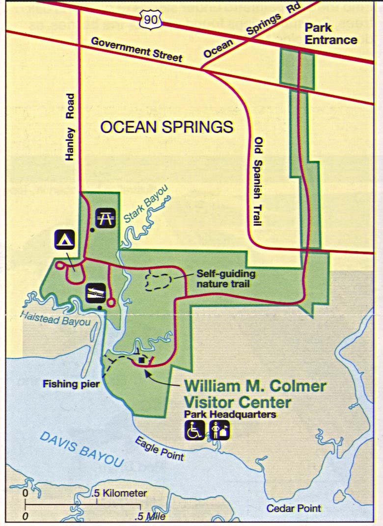
Gulf Islands National Seashore - Davis Bayou (Detail Map) 1994 (195K)
Gulf of Mexico [Mississippi / Alabama / Florida] (Area Features) 1994 (351K)
Mississippi River Valley [Mississippi / Louisiana] (Burial Mounds Map) 1997 (452K) (PDF Format)
Mississippi River Valley [Mississippi / Louisiana] (Plantations Map) 1997 (452K) (PDF Format)
Mississippi River Valley [Southern U.S.] (Route of DeSoto Map) 1997 (65K) (PDF Format)
Sponsors
Natchez Trace Parkway National Scenic Trail [Mississippi, Alabama, and Tennessee] (Area Map) 1999 (65K) (PDF Format)
Natchez Trace Parkway National Scenic Trail [Mississippi, Alabama, and Tennessee] (Park Map) 1999 (516K) (PDF Format)
Natchez Trace Parkway National Scenic Trail [Mississippi, Alabama, and Tennessee] (Natchez to Jackson, Mississippi) 1997 (387K)
Natchez Trace Parkway National Scenic Trail [Mississippi, Alabama, and Tennessee] (Jackson to Dancy, Mississippi) 1997 (323K)
Natchez Trace Parkway National Scenic Trail [Mississippi, Alabama, and Tennessee] (Dancy, Mississippi to Rock Spring, Alabama) 1997 (387K)
Natchez Trace Parkway National Scenic Trail [Mississippi, Alabama, and Tennessee] (Rock Spring, Alabama to Nashville, Tennessee) 1997 (452K)
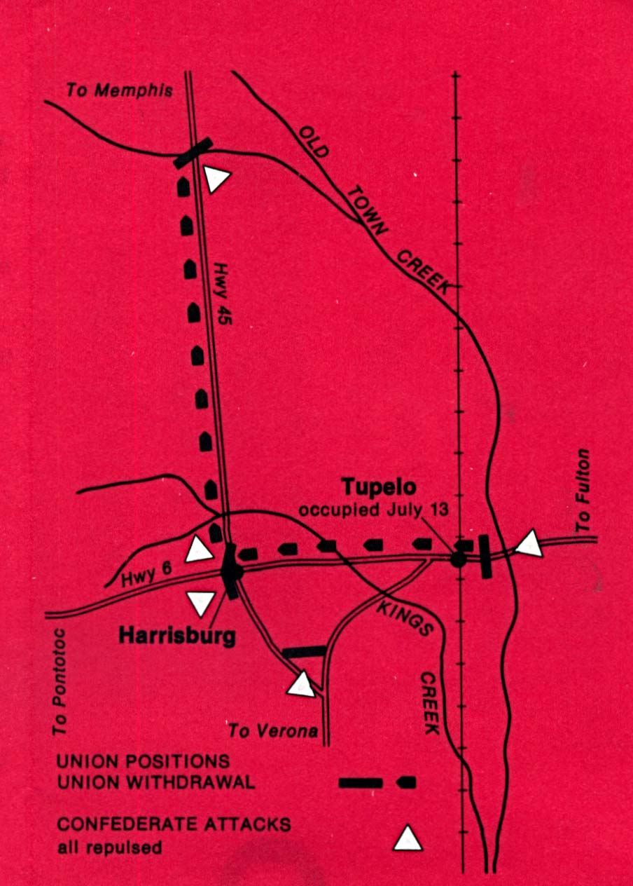
Tupelo National Battlefield (Battle Map) 1995 (126K)
Vicksburg National Military Park (Area Map) 1994 (507K)
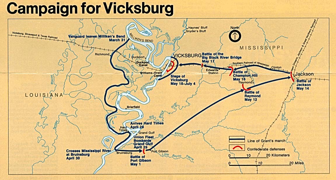
Vicksburg National Military Park (Campaign Map) 1994 (195K)
Vicksburg National Military Park (Campaign Map) 1999 (65K) (PDF Format)
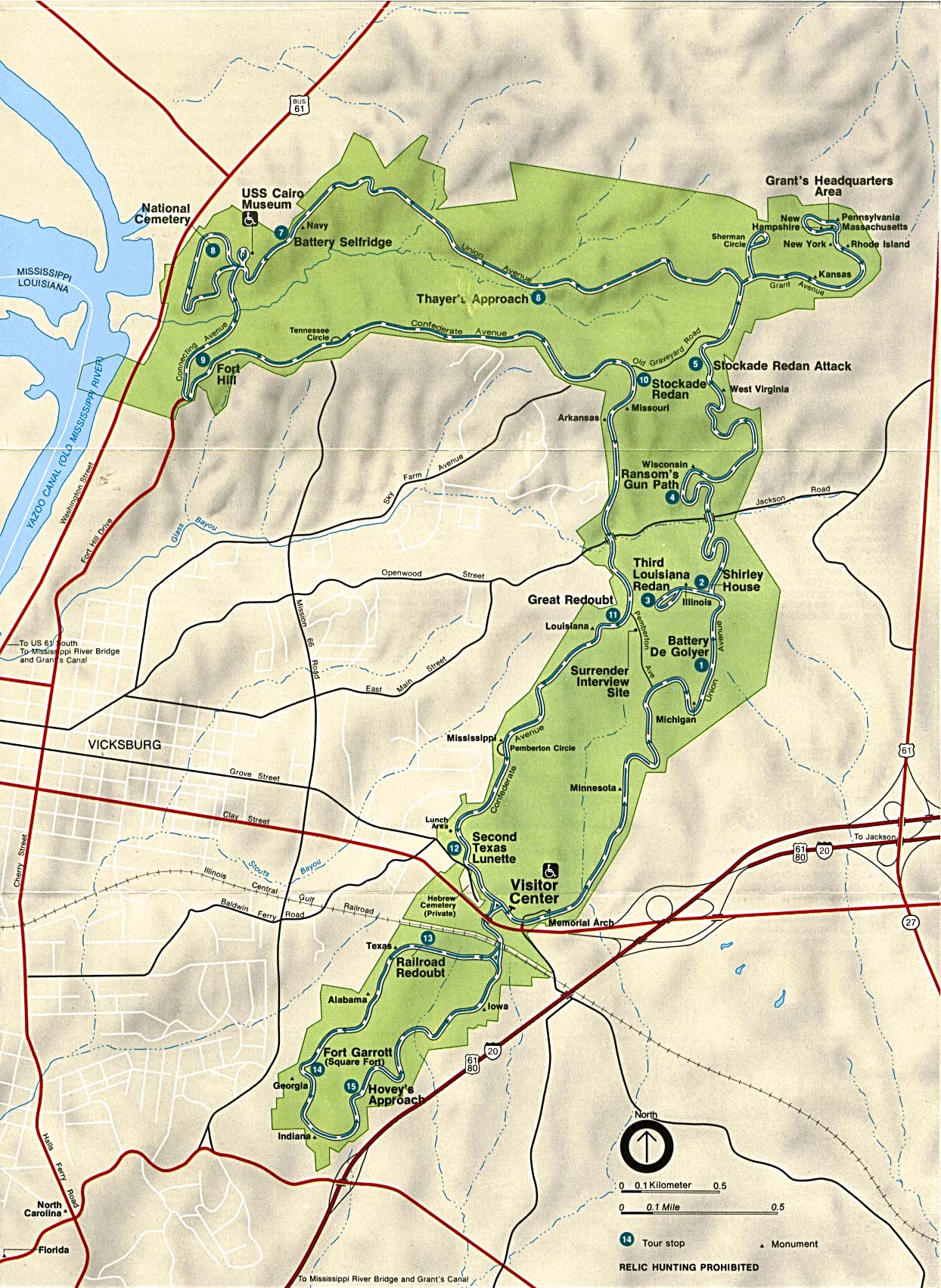
Vicksburg National Military Park (Touring the Battlefield Map) 1999 (194K) (PDF Format)
<-- Download Free Maps
<-- Free National Park Maps
Didn't find what you are looking for? We've been online since 1996 and have created 1000's of pages. Search below and you may find just what you are looking for.
Michael R. Meuser
Data Research & GIS Specialist
MapCruzin.com is an independent firm
specializing in GIS project development and data research.
We created the first U.S. based
interactive toxic chemical facility
maps on the internet in 1996 and we
have been online ever since. Learn more about us and our services.
Have a project in mind? If you have data, GIS project or custom shapefile needs contact Mike.
Contact Us
Report Broken Links
Subscribe for Updates


![Gulf of Mexico [Mississippi / Alabama / Florida]](/download-national-park-maps/gulf94.jpg)
![Natchez Trace Parkway National Scenic Trail [Mississippi, Alabama, and Tennessee]](/download-national-park-maps/traceparkway4_97.jpg)
![Natchez Trace Parkway National Scenic Trail [Mississippi, Alabama, and Tennessee]](/download-national-park-maps/traceparkway3_97.jpg)
![Natchez Trace Parkway National Scenic Trail [Mississippi, Alabama, and Tennessee]](/download-national-park-maps/traceparkway2_97.jpg)
![Natchez Trace Parkway National Scenic Trail [Mississippi, Alabama, and Tennessee]](/download-national-park-maps/traceparkway1_97.jpg)