Download Free Massachusetts National Park and Historic Monument Maps
<-- Download Free Maps
<-- Free National Park Maps
Sponsors
Our growing collection of free-to-use national park, monument, historic site, recreation area, battlefield, park trails and visitor information maps from the National Park Service. They are in high resolution PDF or image formats ready for you to view, print and use. Please check back as we add new ones as they become available.
Blackstone River Valley National Heritage Corridor [Massachusetts / Rhode Island] (Park Map) 1998 (645K) (PDF Format)
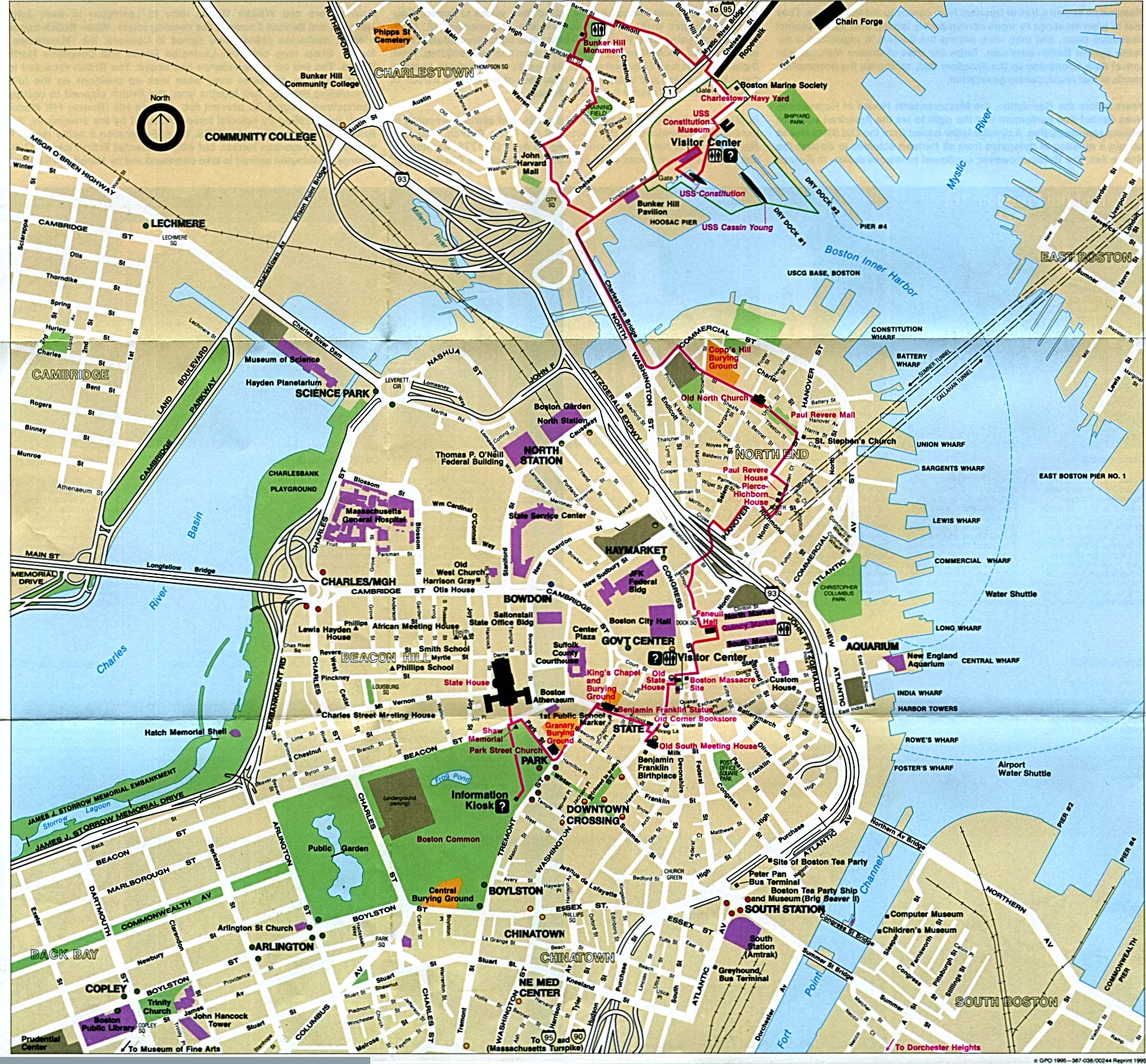
Boston National Historic Park (Historic City Locations Map) 1995 (698K)
Boston National Historic Park (Historic City Locations Map) 1999 (258K) (PDF Format)
Sponsors
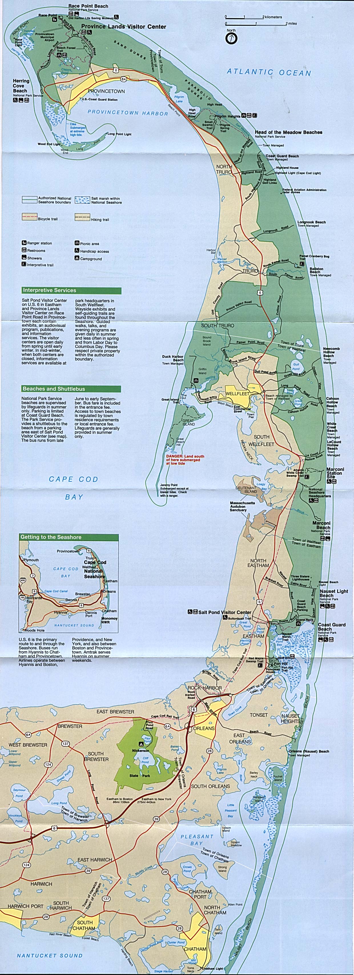
Cape Cod National Seashore (Park Map) 1995 (834K)
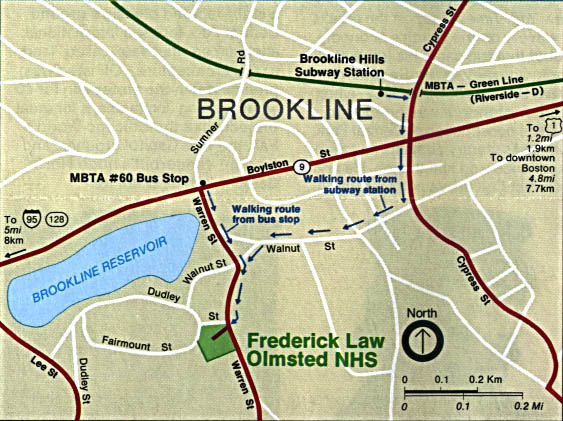
Frederick Law Olmsted National Historic Site (Location Map) 1992 (102K)
Gerry E. Studds Stellwagen Bank National Marine Sanctuary (NOAA) (681K)
<-- Download Free Maps
<-- Free National Park Maps
Didn't find what you are looking for? We've been online since 1996 and have created 1000's of pages. Search below and you may find just what you are looking for.
Michael R. Meuser
Data Research & GIS Specialist
MapCruzin.com is an independent firm
specializing in GIS project development and data research.
We created the first U.S. based
interactive toxic chemical facility
maps on the internet in 1996 and we
have been online ever since. Learn more about us and our services.
Have a project in mind? If you have data, GIS project or custom shapefile needs contact Mike.
Contact Us
Report Broken Links
Subscribe for Updates


