Download Free Kashmir Maps
<-- Free Map Downloads
<-- Free World Country Map Downloads
Sponsors
Note that maps may not appear on the webpage in their full size and resolution. To save the maps to your computer, right-click on the link.
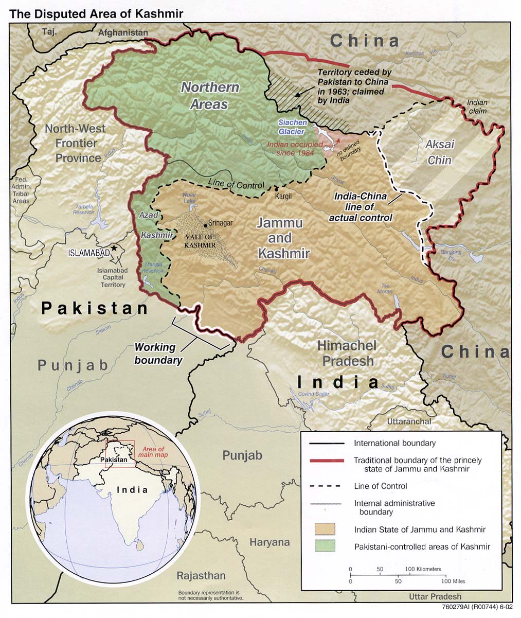
The Disputed Area of Kashmir 2003 (310K) and
pdf format (313K)
The Disputed Area of Kashmir 2002 (350K)
[Kashmir and Northern Areas] Eastern Section (satellite image map) Original scale 1:2,000,000 Portion of "Pakistan: Satellite Image Map", U.S. Geological Survey Map I-2587-A, 1997 (702K)
[Kashmir and Northern Areas] Western Section (satellite image map) Original scale 1:2,000,000 Portion of "Pakistan: Satellite Image Map", U.S. Geological Survey Map I-2587-A, 1997 (1MB)
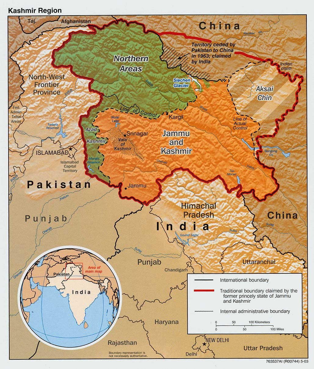
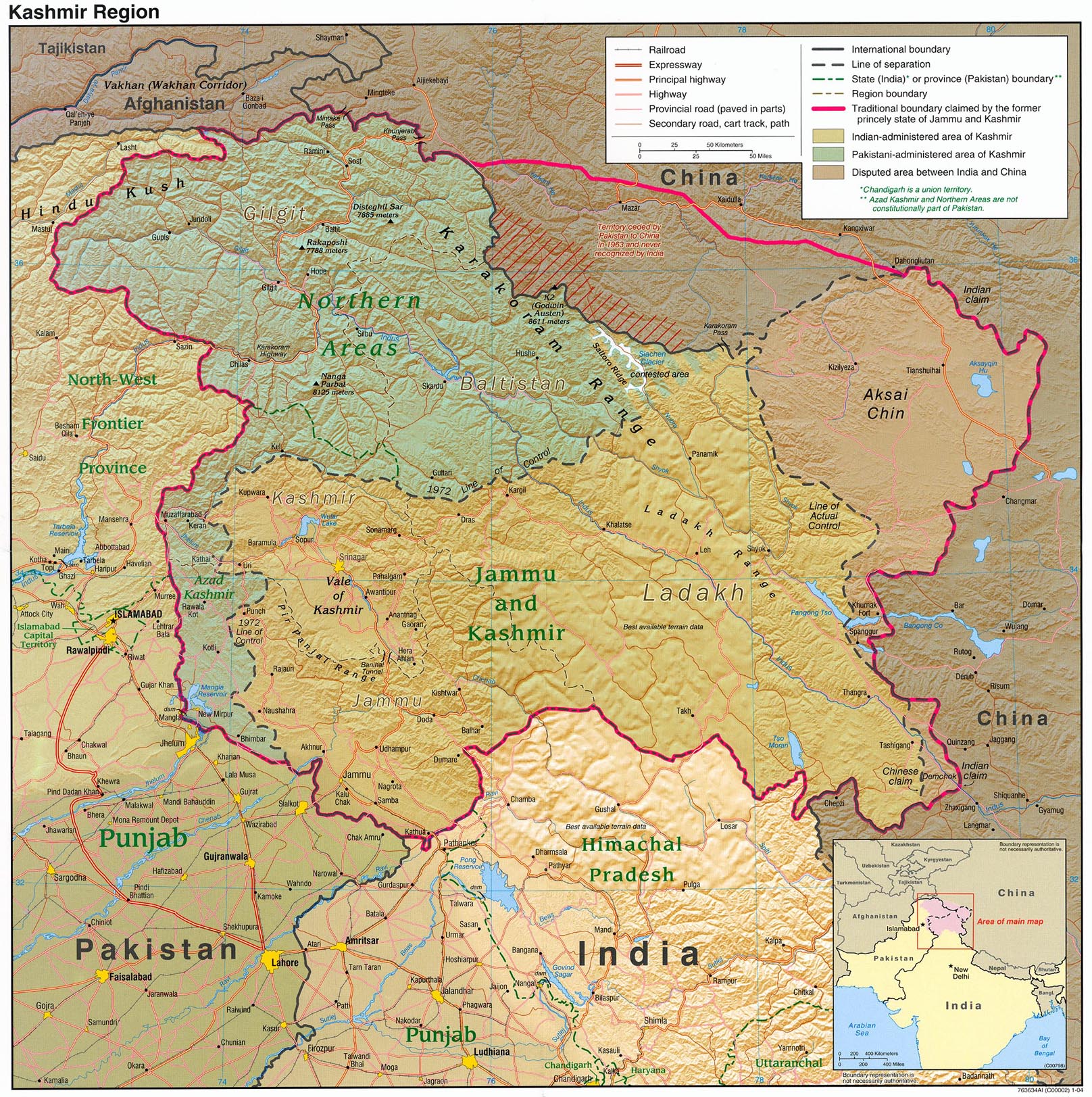
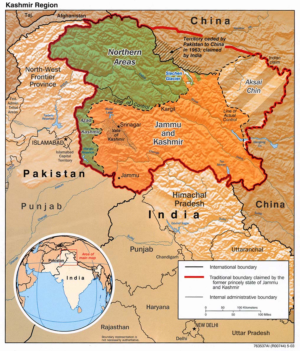
Kashmir Region 2004 (789K) and pdf format (592K)
Kashmir Region 2003 (783K)
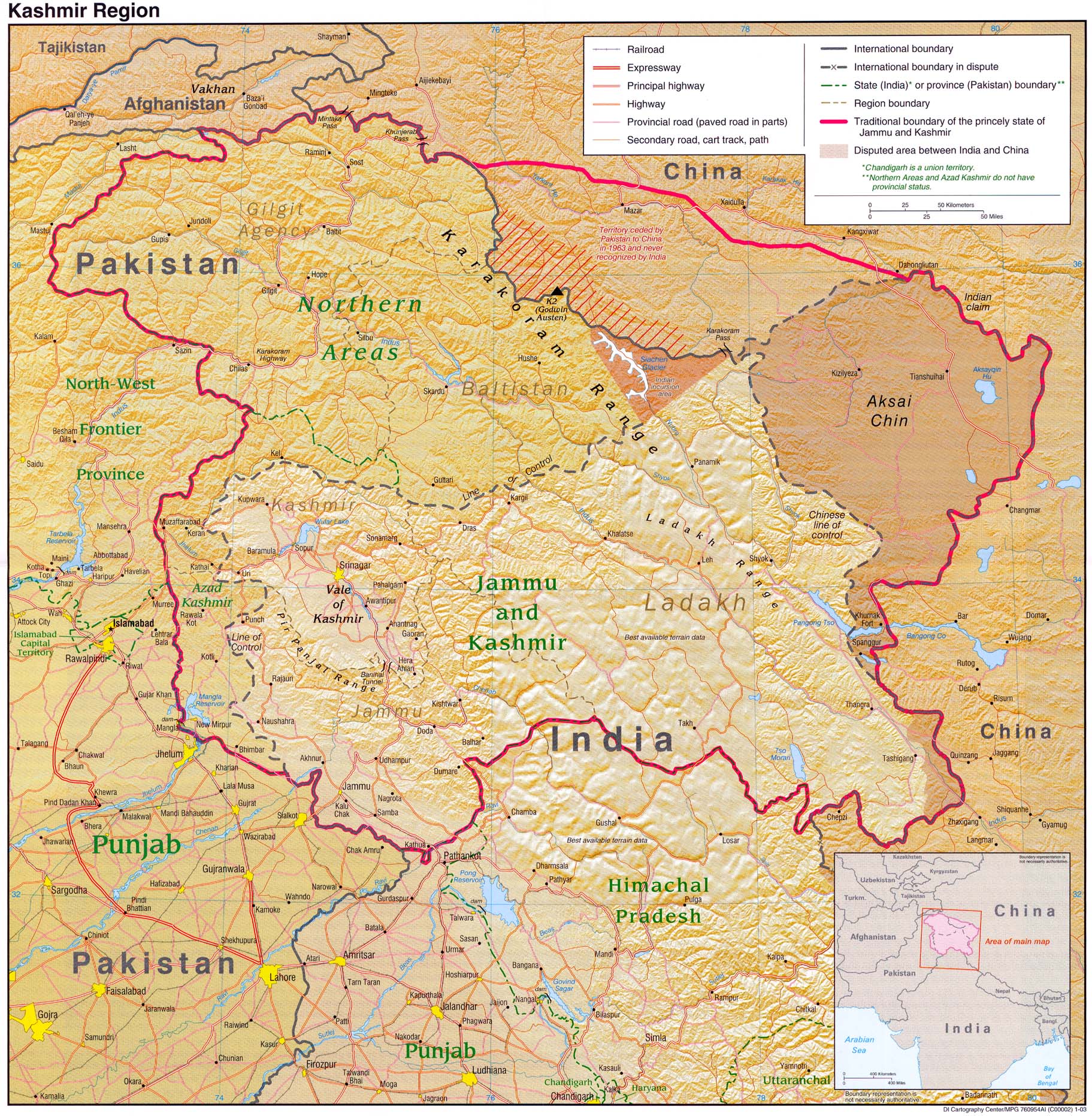
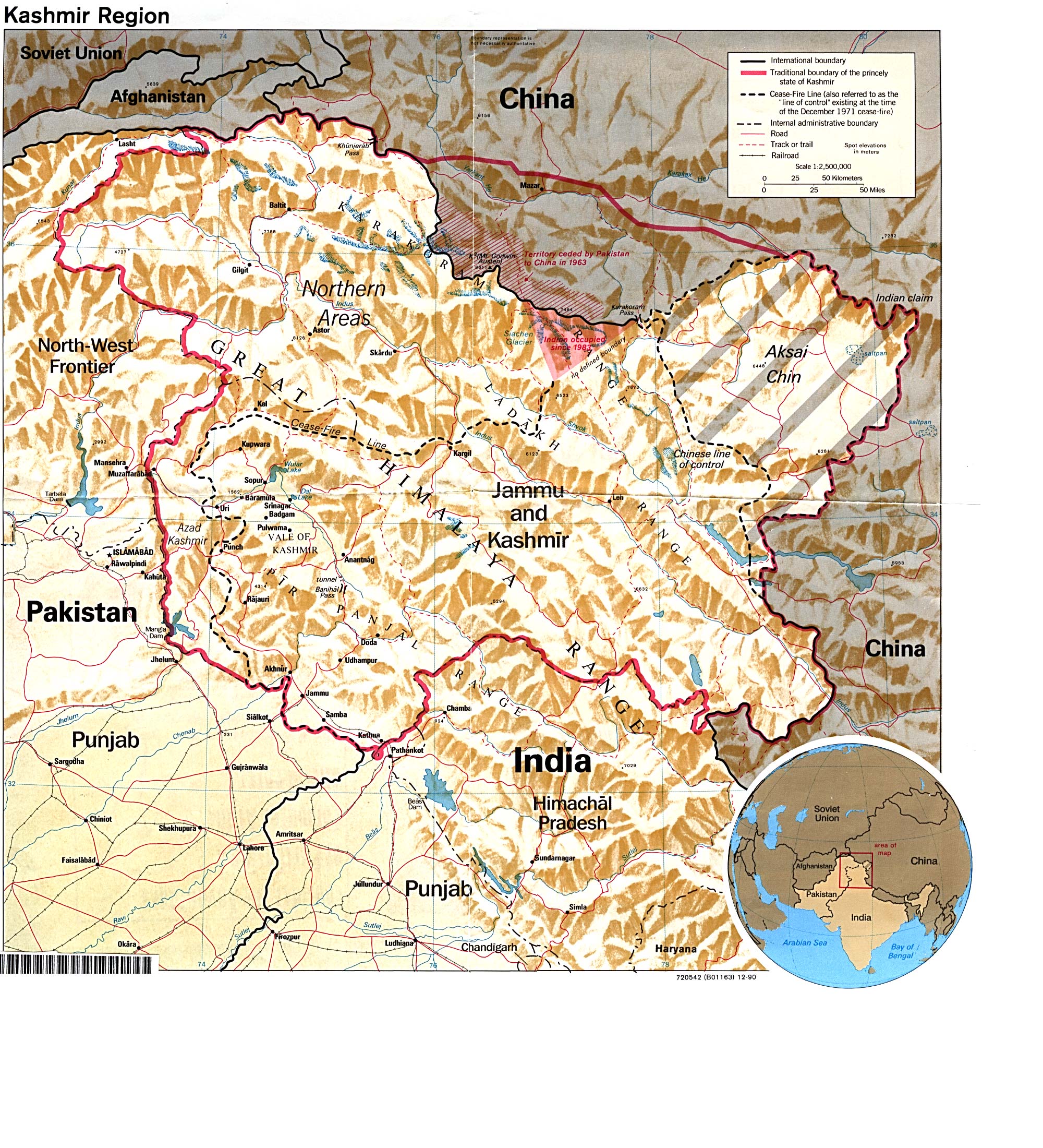
Kashmir Region 1990 (929K)
Kashmir Region (Shaded Relief) 2003 (317K)
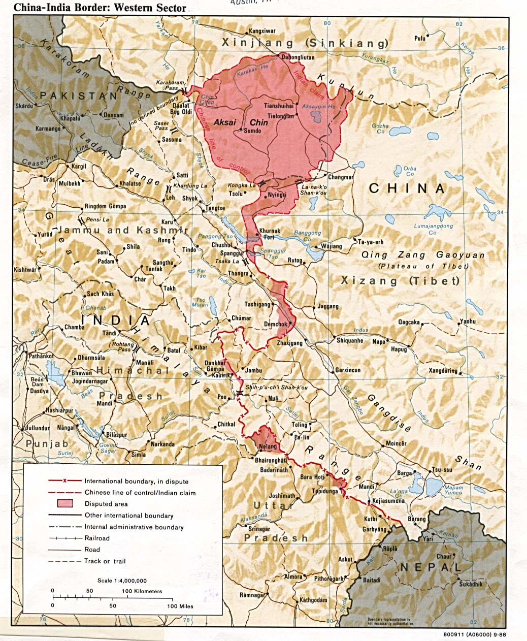
China-India Border: Western Sector 1988 (319K)
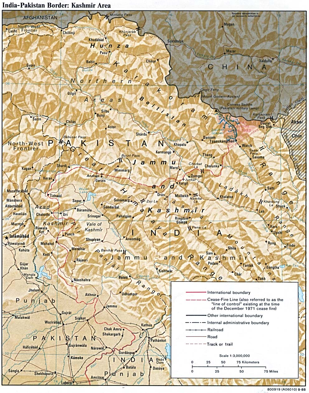
India-Pakistan Border: Kashmir Area 1988 (350K)
Jammu and Kashmir: Ethnic Mix of a Disputed State from Global Trends 2015: A Dialogue About the Future With Nongovernment Experts [page 73], National Intelligence Council, 2000 (173K)
Muzaffarabad Border Region Original scale 1:500,000 Portion of Defense Mapping Agency TPC G-6C 1992 (1.2MB) Not for navigational use
Srinagar Border Region Original scale 1:500,000 Portion of Defense Mapping Agency TPC G-7D 1995 (1.1MB) Not for navigational use
Srinagar to Kargil Original scale 1:500,000 Portion of Defense Mapping Agency TPC G-7D 1995 (1.1MB) Not for navigational use
Leh (topographic map) Original scale 1:250,000 Portion of U.S. Army Map Service Series U502, Sheet NI 43-8, 1955 (217K)
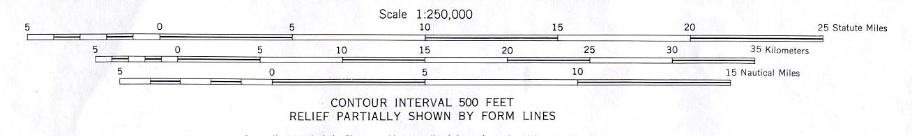
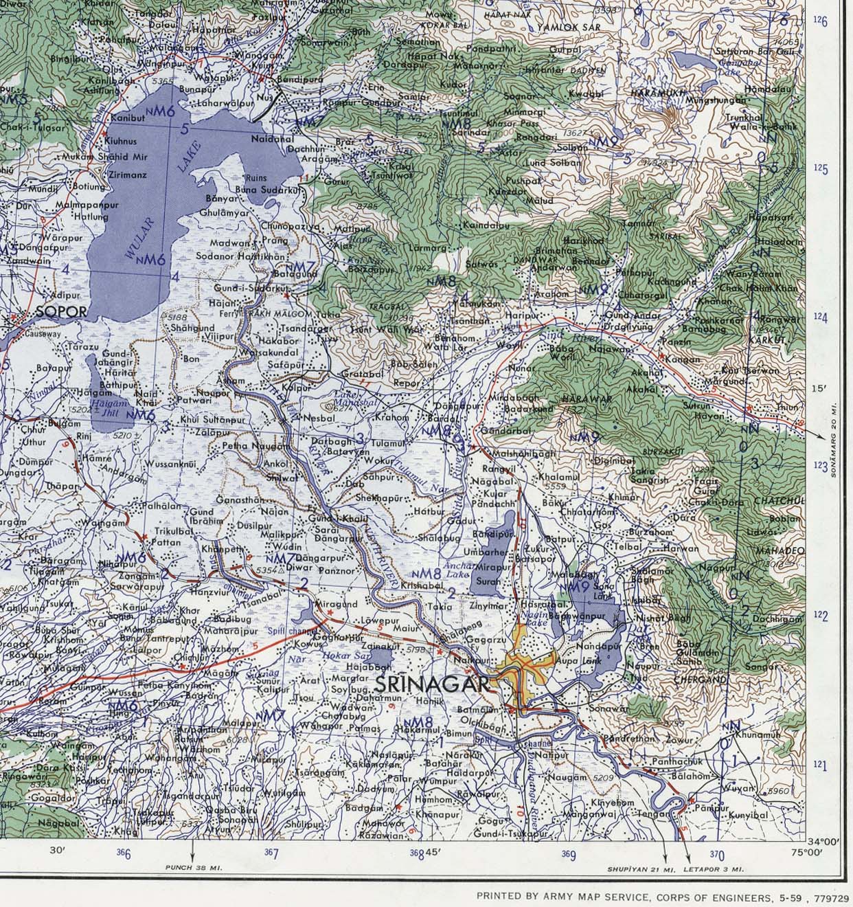
Srinagar Area Portion of sheet NI 43-6 Srinagar. Edition May 1959. Original scale 1:250,000 Compiled in 1954 from Survey of India. Published by the U.S. Army Map Service, July 1959 (520K) Not for navigational use
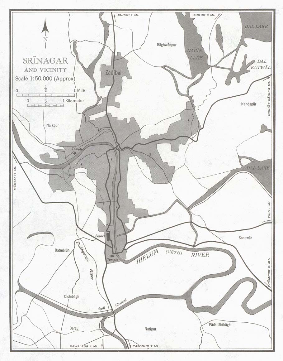
Srinagar and Vicinty (town plan) Portion of sheet NI 43-6 Srinagar. Edition May 1959. Original scale 1:50,000 Compiled in 1954 from Survey of India. Published by the U.S. Army Map Service, July 1959 (146K) Not for navigational use
Sources: These maps were provided by the University of Texas Library and/or
the U.S. Central Intelligence Agency (CIA) unless otherwise noted.
Maps on other websites
Jammu and Kashmir (Embassy of India, Washington, D.C.)
Jammu and Kashmir (United Nations) [PDF]
Jammu and Kashmir Maps (MapsofIndia)
Kashmir (Washington Post)
Kashmir Earthquake - October 8, 2005:
BBC News,
ITC,
ReliefWeb and
RESPOND
Kashmir - Future of Kashmir Maps (BBC News)
Kashmir - Mountain War (Le Monde Diplomatique)
Kashmir - U.N. Military Observer Group in India and Pakistan - UNMOGIP (United Nations) [PDF]
Sponsors
<-- Free Map Downloads
<-- Free World Country Map Downloads
Didn't find what you are looking for? We've been online since 1996 and have created 1000's of pages. Search below and you may find just what you are looking for.
Michael R. Meuser
Data Research & GIS Specialist
MapCruzin.com is an independent firm
specializing in GIS project development and data research.
We created the first U.S. based
interactive toxic chemical facility
maps on the internet in 1996 and we
have been online ever since. Learn more about us and our services.
Have a project in mind? If you have data, GIS project or custom shapefile needs contact Mike.
Contact Us
Report Broken Links
Subscribe for Updates


![[Kashmir and Northern Areas] Eastern Section (satellite image map)](/free-maps-kashmir/kashmir_east_1997.jpg)
![[Kashmir and Northern Areas] Western Section (satellite image map)](/free-maps-kashmir/kashmir_west_1997.jpg)