Download Free Haiti Maps
<-- Free Map Downloads
<-- Free World Country Map Downloads
Sponsors
Note that maps may not appear on the webpage in their full size and resolution. To save the maps to your computer, right-click on the link.
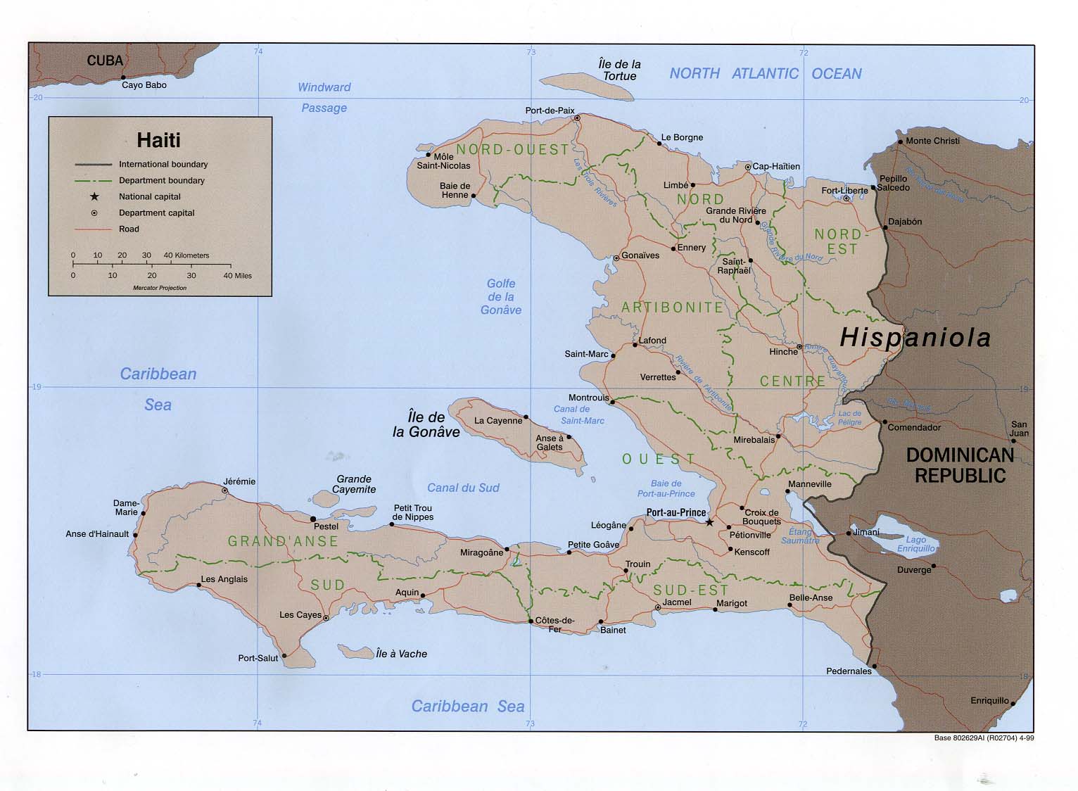
Haiti (Political) 1999 (451K) and
pdf format (331K)
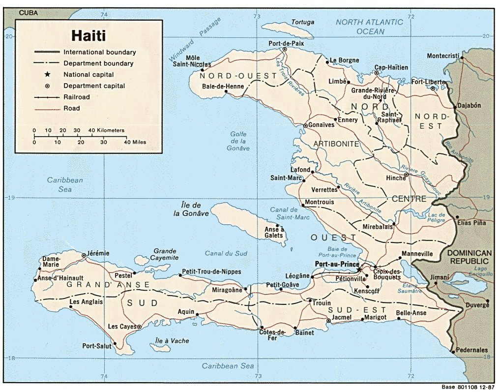
Haiti (Political) 1987 (164K) and pdf format (170K)
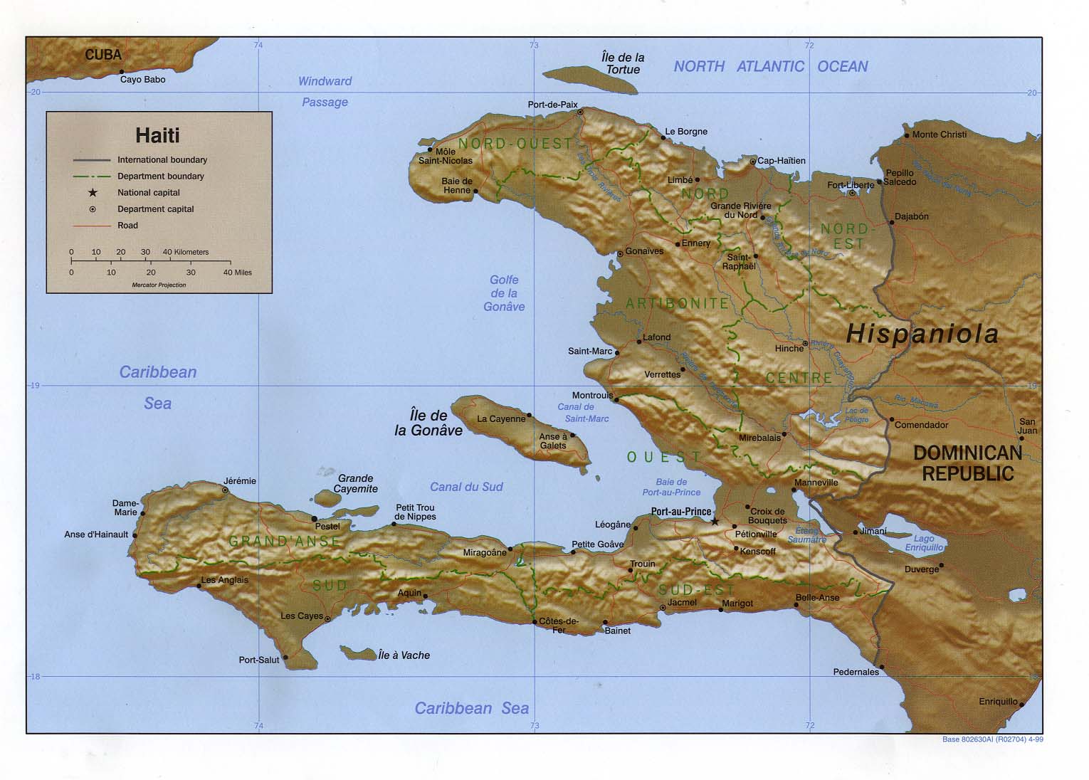
Haiti (Shaded Relief) 1999 (451K) and
pdf format (319K)
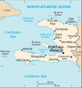
Haiti (Small Map) 2008 (13K)
Aquin original scale 1:10,000, Edition 1-DMA, Series E935, U.S. Defense Mapping Agency, 1988 (4.1MB)
Cap-Haitien original scale 1:12,500, Edition 3-DMA, Series E935. U.S. Defense Mapping Agency, 1994 (5.6MB)
Fort Liberte original scale 1:12,500, Edition 3-DMA, Series E935. U.S. Defense Mapping Agency, 1987 (4.6MB)
Gonaives original scale 1:12,500, Edition 3-DMA, Series E935. U.S. Defense Mapping Agency, 1993 (4.3MB)
Hinche original scale 1:10,000, Edition 1-DMA, Series E935. U.S. Defense Mapping Agency, 1988 (2.6MB)
Jacmel original scale 1:12,500, Edition 2-DMA, Series E935. U.S. Defense Mapping Agency, 1987 (5.2MB)
Jeremie original scale 1:12,500, Edition 2-DMA, Series E935. U.S. Defense Mapping Agency, 1987 (5.4MB)
Petit Goave original scale 1:10,000, Edition 1-DMA, Series E935. U.S. Defense Mapping Agency, 1988 (3.7MB)
Port-au-Prince - Central (orthophoto) 1:12,500 U.S. Army Map Service 1967 (629K)
Port-au-Prince - North (military airport) (orthophoto) 1:12,500 U.S. Army Map Service 1967 (561K)
Port-au-Prince - Mais Gate Airport (orthophoto) 1:12,500 U.S. Army Map Service 1967 (323K)
Port de Paix original scale 1:12,500, Edition 2-DMA, Series E935. U.S. Defense Mapping Agency, 1987 (4.8MB)
Saint-Marc original scale 1:12,500, Edition 2-DMA, Series E935. U.S. Defense Mapping Agency, 1987 (5.1MB)
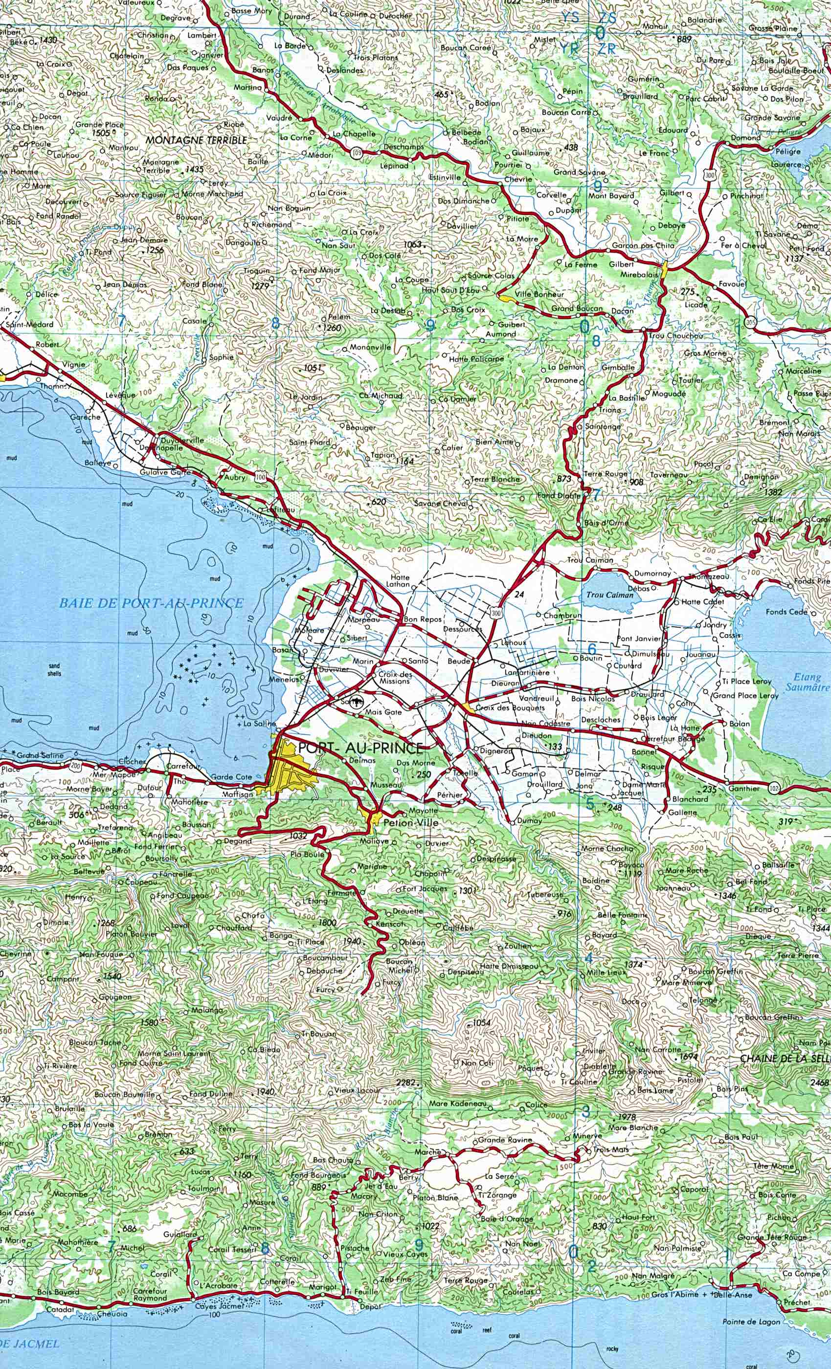
Port-au-Prince (topographic) 1:250,000 U.S.G.S. 1984 (612K)
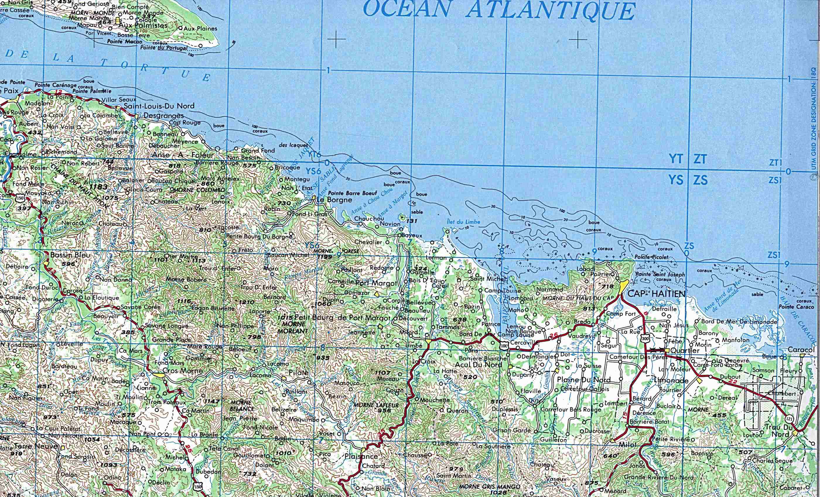
Cap-Haïtien (topographic) 1:250,000 U.S.G.S. 1984 (544K)
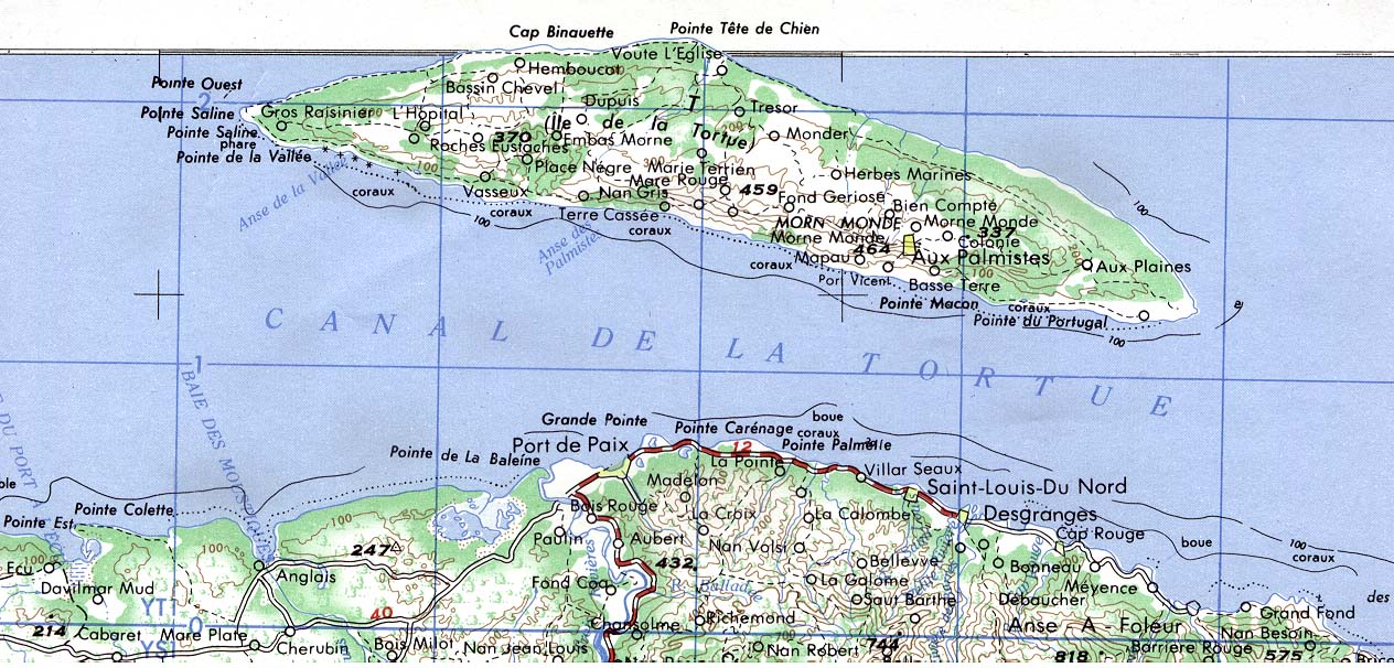
Ile de la Tortue (topographic) 1:250,000 U.S.G.S. 1984 (233K)
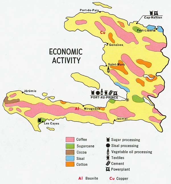
Haiti - Economic Activity from Map No. 77972 1970 (90K)
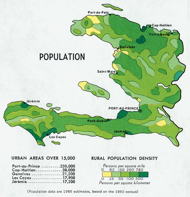
Haiti - Population from Map No. 77972 1970 (96K)
Haiti - Vegetation and Land Use from Map No. 77972 1970 (102K)
Sources: These maps were provided by the University of Texas Library and/or
the U.S. Central Intelligence Agency (CIA) unless otherwise noted.
Sponsors
Maps on other websites
Haiti (Haiti-Business.com)
Haiti (Haiticulture.ch)
Haiti (Lonely Planet)
Haiti (United Nations) [PDF]
Haiti - Maps (ReliefWeb)
Haiti - MINUSTAH Deployment (United Nations) [PDF]
Haiti - Planning Map, March 2004 (ReliefWeb)
<-- Free Map Downloads
<-- Free World Country Map Downloads
Didn't find what you are looking for? We've been online since 1996 and have created 1000's of pages. Search below and you may find just what you are looking for.
Michael R. Meuser
Data Research & GIS Specialist
MapCruzin.com is an independent firm
specializing in GIS project development and data research.
We created the first U.S. based
interactive toxic chemical facility
maps on the internet in 1996 and we
have been online ever since. Learn more about us and our services.
Have a project in mind? If you have data, GIS project or custom shapefile needs contact Mike.
Contact Us
Report Broken Links
Subscribe for Updates


