Free TatukGIS GIS Viewer Program
Excellent Easy to Use GIS Viewer
Sponsors
<-- Free GIS Software & Resources
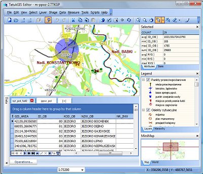
The TatukGIS Editor is a programmable, general purpose desktop GIS mapping and data editing application featuring support for dozens of vector, image, grid, and SQL database formats, on-the-fly map reprojection with nearly 3,000 pre-defined coordinate systems, compatibility with leading database engines, GPS connectivity. For power users with specialized or advanced requirements, a built-in scripting IDE provides the means to customize or extend the product beyond its core features.
TatukGIS Viewer is a free, slimmed down version of the Editor product, without features for creating/editing data and for customization with scripts. The feature list for the Editor and free Viewer products is presented in the Feature Matrix.
Viewing: The Editor and Viewer open most GIS/CAD vector map files, raster maps, aerial images, grid data, and SQL database layers such as Oracle Spatial or PostGIS coverages. Both products can open TatukGIS projects and most ESRI ArcView v.3 or MapInfo Professional projects and projects exported from ESRI ArcGIS/ArcMap using the free Arc2TatukGIS plug-in. Each data type is supported "natively", so there is no need to import data into any internal format. Comprehensive visual layer property and legend controls provide for deep customization of the appearance of each map layer, thematic mapping, layer hierarchies, legend presentation, scale. The Editor and Viewer support advanced query and selection features, including SQL Query Builder.
Sponsors
Coordinate systems: The Editor and Viewer support nearly 3,000 pre-defined map coordinate systems in use around the world (including all the U.S. State Planes), user-defined coordinate systems based on 120 supported projections, automatic layer coordinate system recognition and on-the-fly conversion of vector and raster layers from multiple coordinate systems for display as a single map. The support reflects EPSG codes and OpenGIS WKT coordinate system definitions. The Editor can export map data to any selected coordinate system.
Editing: The Editor contains features to create, edit, save, and import/export GIS map files and import/export attribute data between vector map layers and external databases. The Editor can be used as a conversion tool to translate map layers between supported file types and/or coordinate systems. Special tools include the topology builder/corrector to systematically clear geometry related errors (overlapping polygons, holes between polygons, missed line intersections, dangling nodes, etc.) from vector line or polygon layers.
Scripting: The Editor is a fully scriptable IDE for writing and debugging code. Using Basic or Pascal scripts, the Editor functionality can be enhanced or modified, including full menu redesign, custom dialog boxes, etc., for end-user custom applications. The scripting engine exposes (inside the Editor) the full power of the TatukGIS Developer Kernel, with its hundreds of classes and thousands of methods, to fulfill the requirements of any kind of GIS application. Dozens of example scripts are provided, e.g., to perform Google or Bing maps integration, GPS tracking on a projected map, batch (command line) conversions between coordinate systems, and various tutorial examples. The special features or customizations can be distributed (deployed) to other Editor licensed users just by sharing the scripts.
Sponsors
Databases: The Editor is compatible with leading database engines, e.g., MSSQL Server, MSJET, Oracle, DB2, Interbase, PostgreSQL and most 3rd party SQL database map layer formats, e.g., MSSQL 2008 Spatial, ESRI ArcSDE, ESRI ArcSDE Raster, ESRI Personal Geodatabase, MapInfo SpatialWare, Oracle Spatial/Locator, Oracle GeoRaster, Geomedia SQL Server, PostGIS, OpenGIS Simple Features, etc. The Editor supports live joins of vector map layers to external database tables, as well as data import/export with external databases.
Visit the TatukGIS Website.
<-- Free GIS Software & Resources
See Also:
Free ArcGIS Shapefiles, Free Maps, Google Earth & Maps, Free GPS, Satellite and Aerial, GIS Tutorials.
Didn't find what you are looking for? We've been online since 1996 and have created 1000's of pages. Search below and you may find just what you are looking for.
Michael R. Meuser
Data Research & GIS Specialist
MapCruzin.com is an independent firm
specializing in GIS project development and data research.
We created the first U.S. based
interactive toxic chemical facility
maps on the internet in 1996 and we
have been online ever since. Learn more about us and our services.
Have a project in mind? If you have data, GIS project or custom shapefile needs contact Mike.
Contact Us
Report Broken Links
Subscribe for Updates


