Download Free France Maps
<-- Free Map Downloads
<-- Free World Country Map Downloads
Sponsors
Note that maps may not appear on the webpage in their full size and resolution. To save the maps to your computer, right-click on the link.
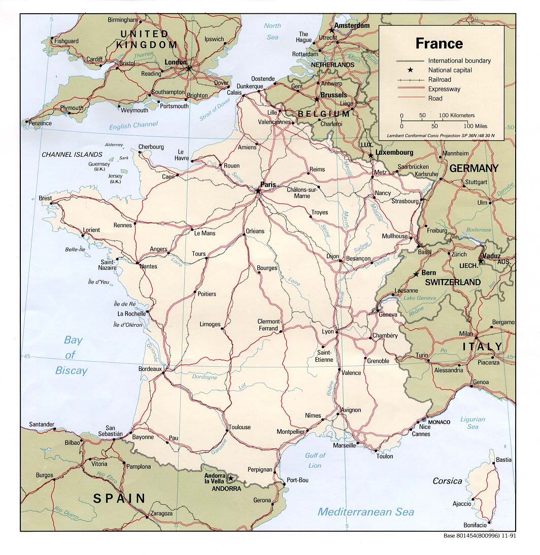
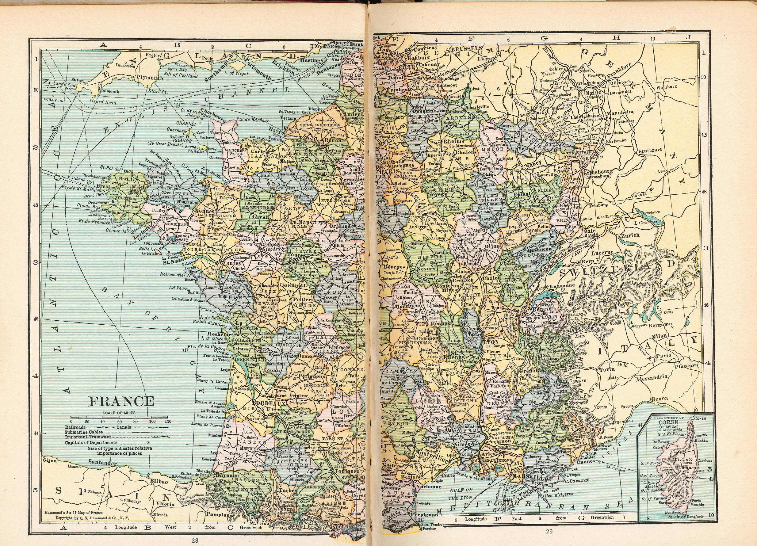
France (Political) 1991 (227K) and
pdf format (264K)
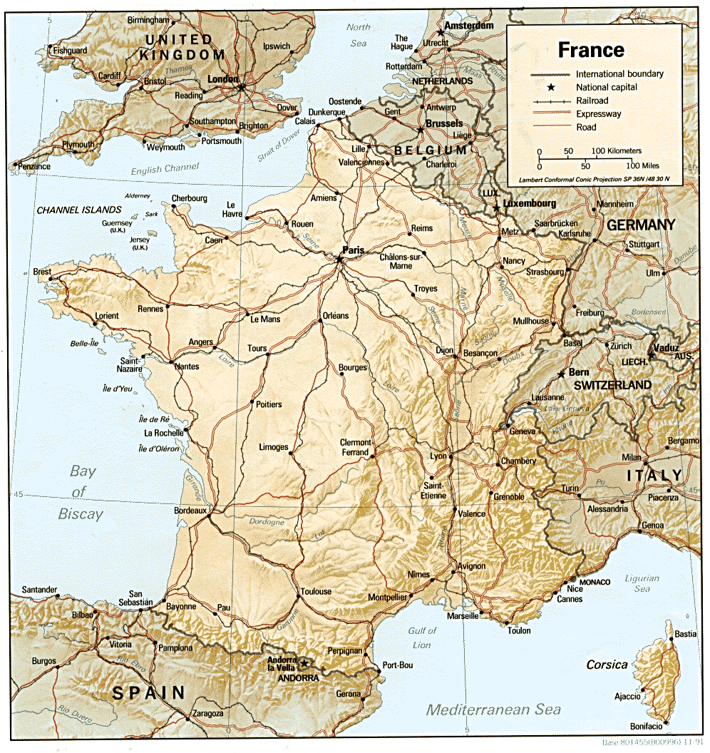
France (Shaded Relief) 1991 (309K) and pdf format (321K)
France (Small Map) 2008 (16K)
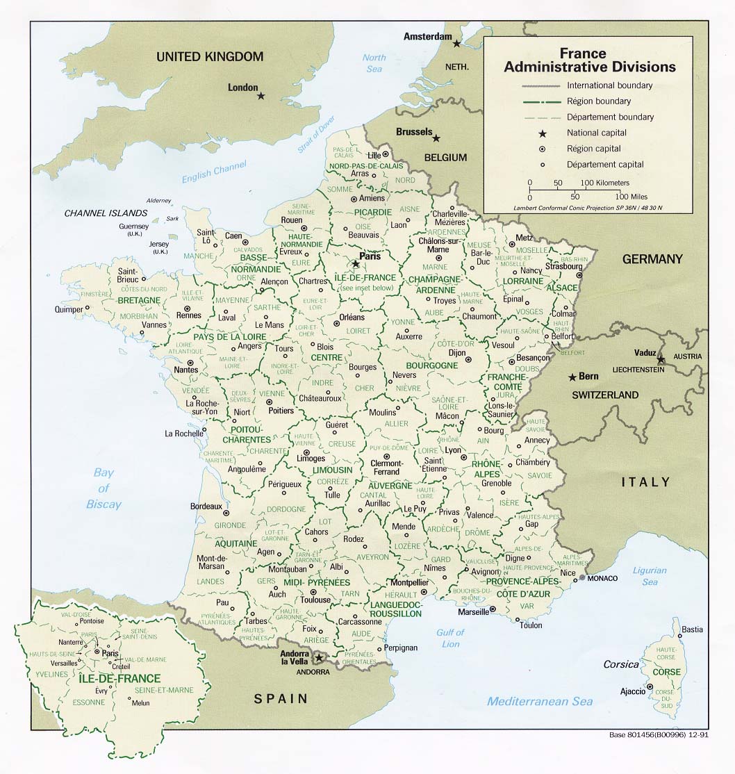
France: Administrative Divisions (Political) 1991 (211K)
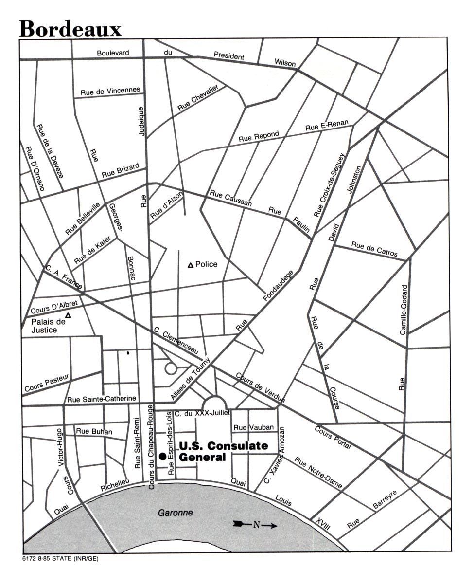
Bordeaux (Note: Consulate Closed 1996) U.S. Dept. of State 1985 (285K)
Marseille U.S. Dept. of State 1993 (258K)
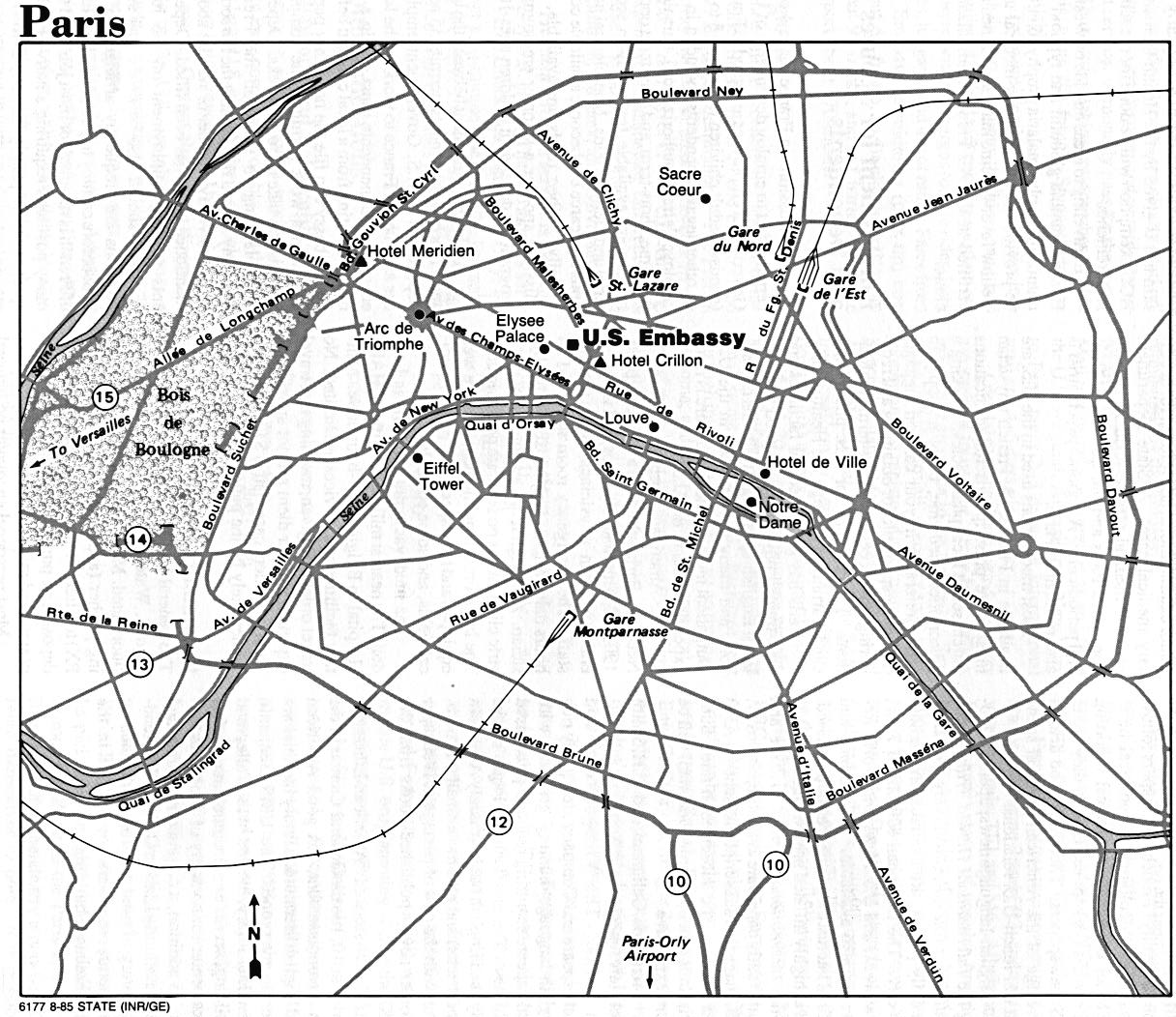
Paris U.S. Dept. of State 1985 (266K)
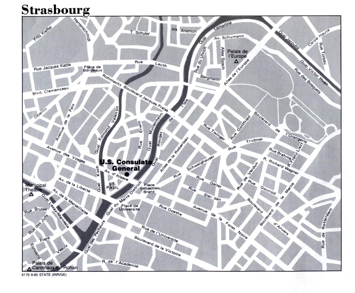
Strasbourg U.S. Dept. of State 1985 (387K)
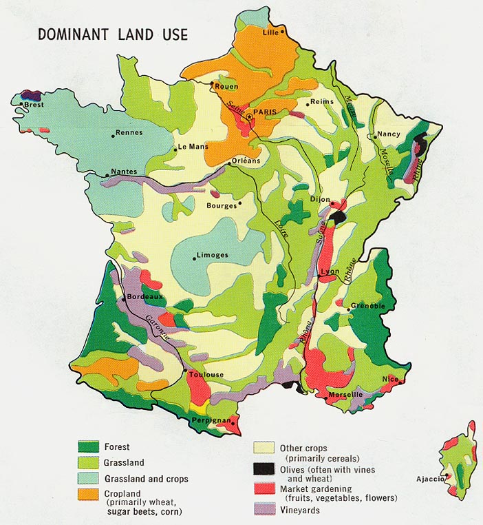
France - Dominant Land Use from Map No. 500197 1972 (155K)
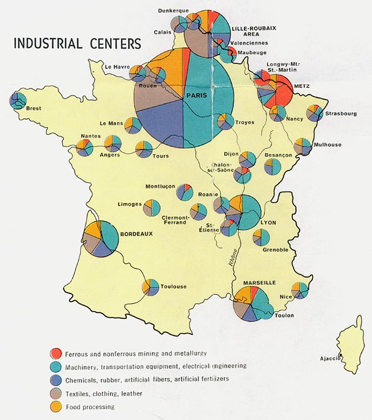
France - Industrial Centers from Map No. 500197 1972 (132K)
France - Population from Map No. 500197 1972 (164K)
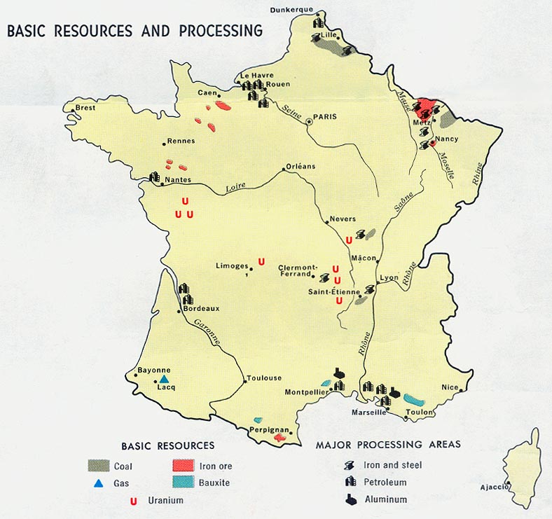
France - Resources and Processing from Map No. 500197 1972 (119K)
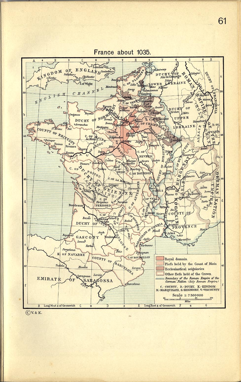
France about 1035
From The Historical Atlas by William R. Shepherd, 1911. (329K)
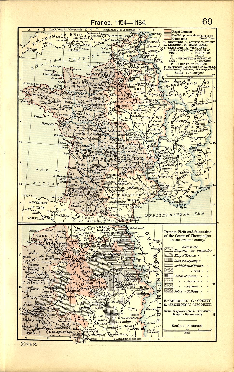
France 1154-1184
From The Historical Atlas by William R. Shepherd, 1911. (497K)
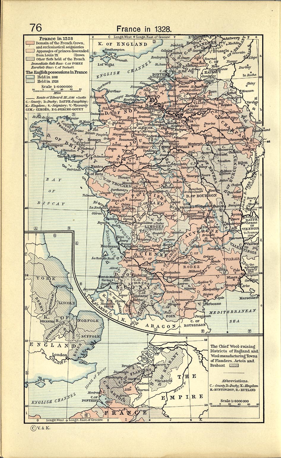
France 1328
From The Historical Atlas by William R. Shepherd, 1911. (446K)
France 1453
From The Historical Atlas by William R. Shepherd, 1911. (344K)
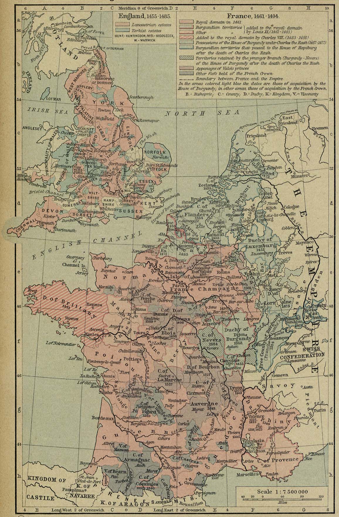
France 1461-1494
From The Historical Atlas by William R. Shepherd, 1926. (373K)
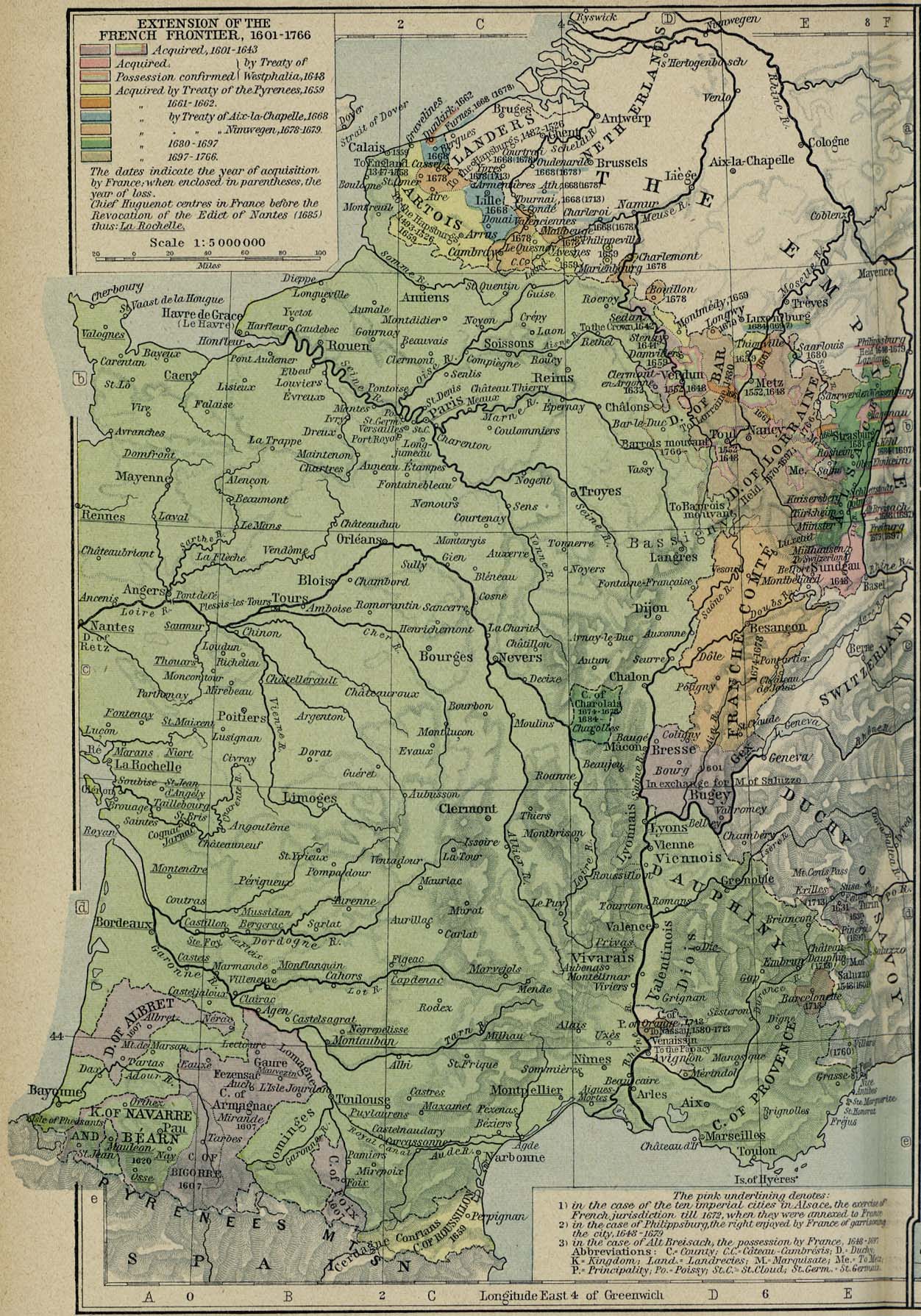
France - Extension of the French Frontier 1601-1766
From The Historical Atlas by William R. Shepherd, 1926. (477K)
France 1789
The Generalities or Intendancies. From The Historical Atlas by William R. Shepherd, 1926. (269K)
France 1789
The "Gouvernements". From The Historical Atlas by William R. Shepherd, 1926. (275K)
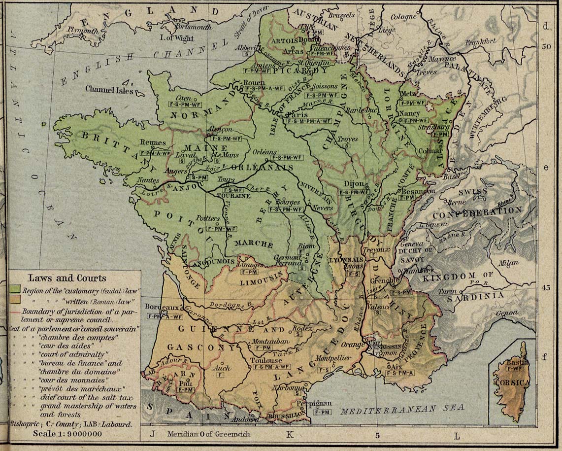
France 1789
Laws and Courts. From The Historical Atlas by William R. Shepherd, 1926. (291K)
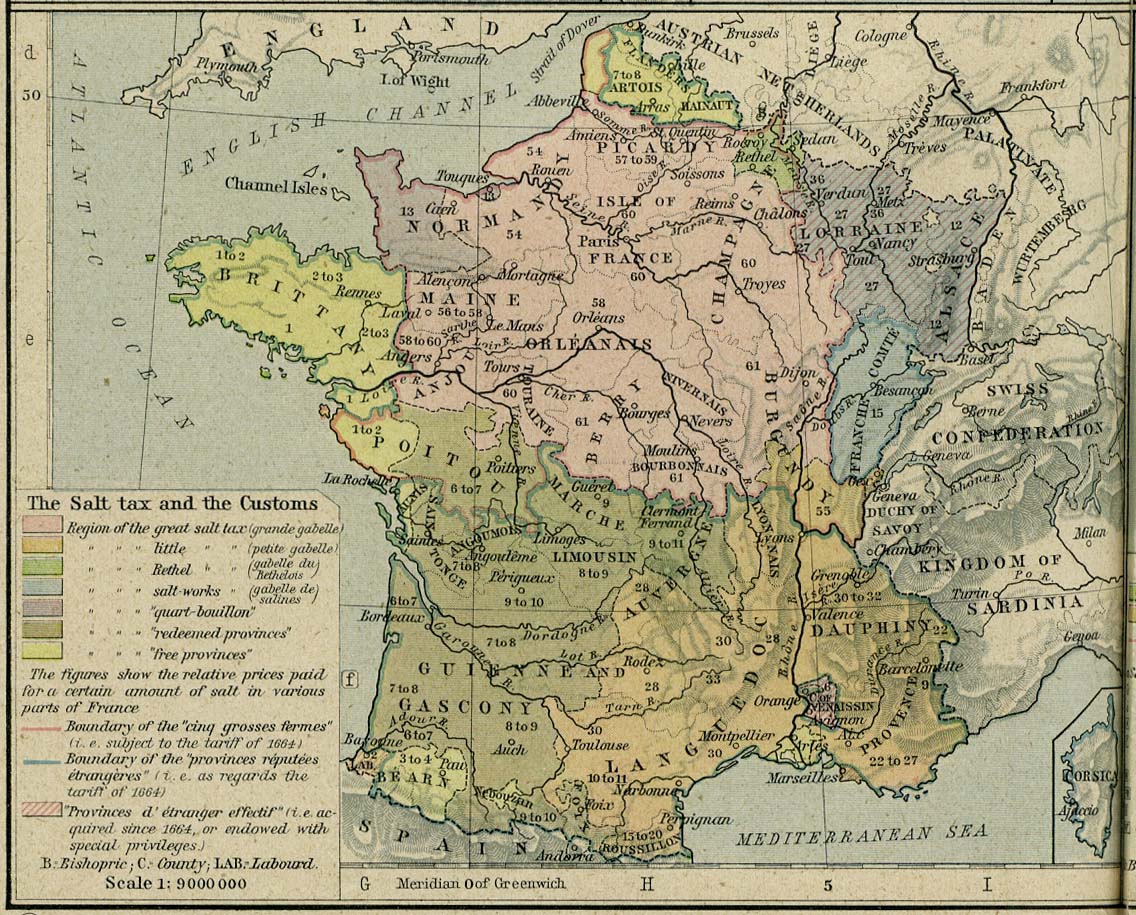
France 1789
The Salt Tax and the Customs. From The Historical Atlas by William R. Shepherd, 1926. (299K)
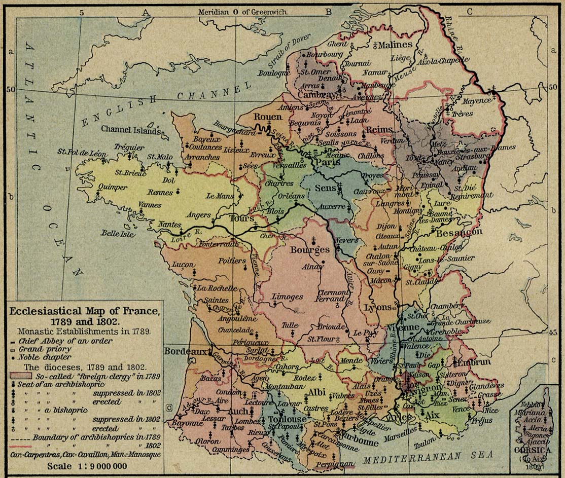
France 1789 and 1802
Ecclesiastical Map of France, 1789 and 1802. From The Historical Atlas by William R. Shepherd, 1926. (292K)
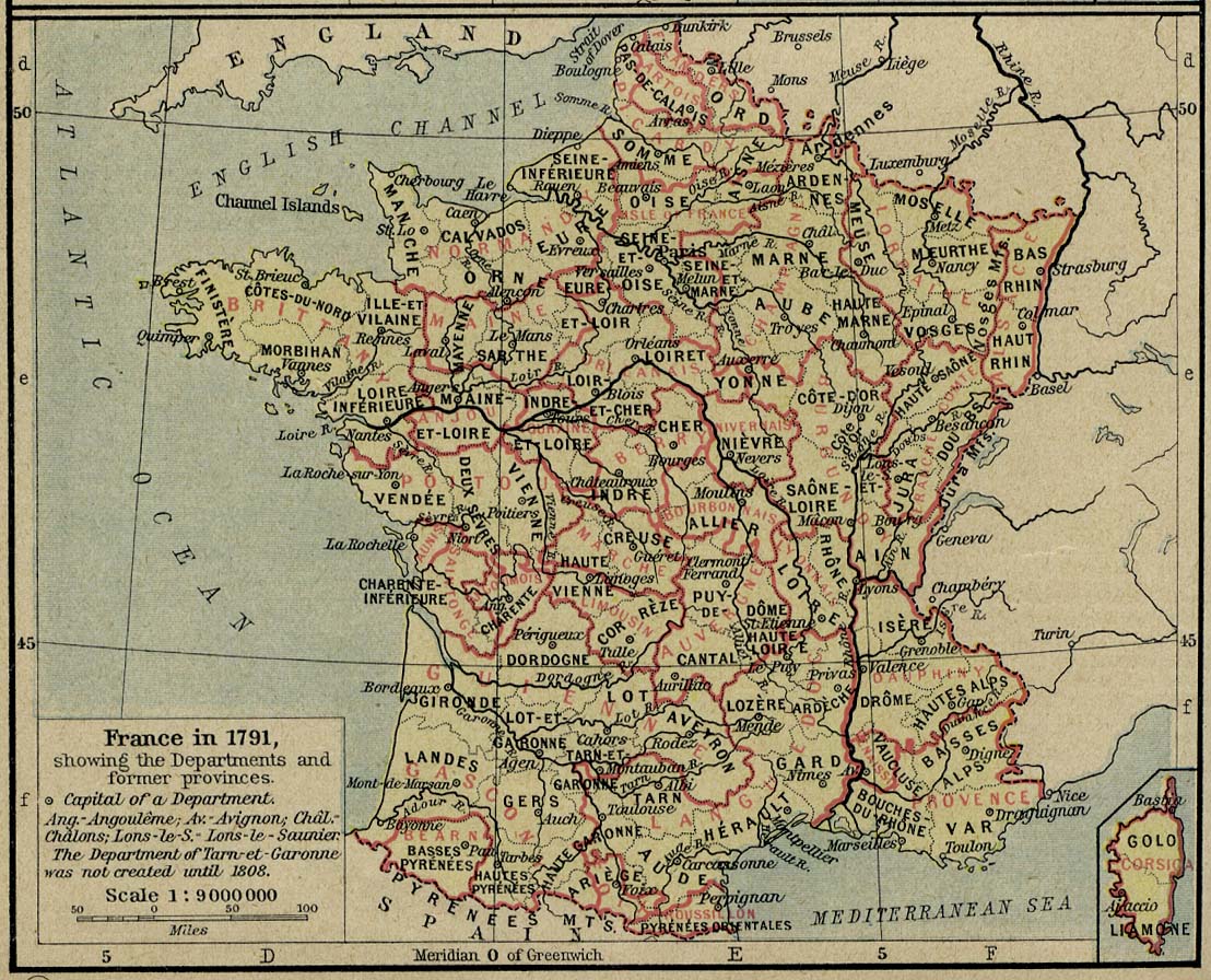
France 1791
From The Historical Atlas by William R. Shepherd, 1926. (301K)
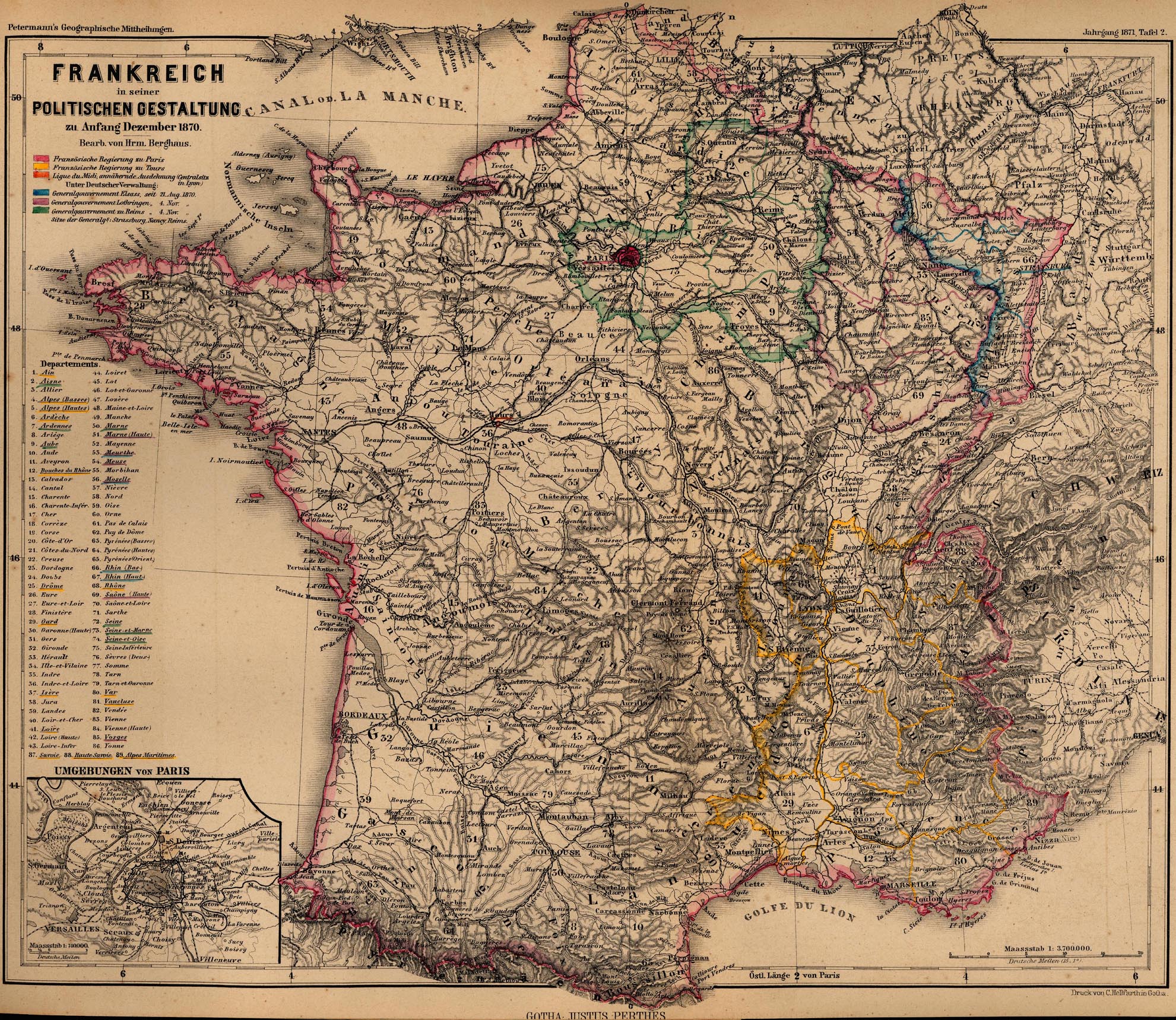
France 1870
"Frankreich in seiner Politischen Gestaltung zu Anfang Dezember 1870" From Mittheilungen aus Justus Perthes' geographischer Anstalt..., by Dr. A Petermann. 1871. (1.1MB)
France 1921
From Putnam's Handy Volume Atlas of the World. Published by G.P. Putnam's Sons, New York and London, 1921. (1.4MB)
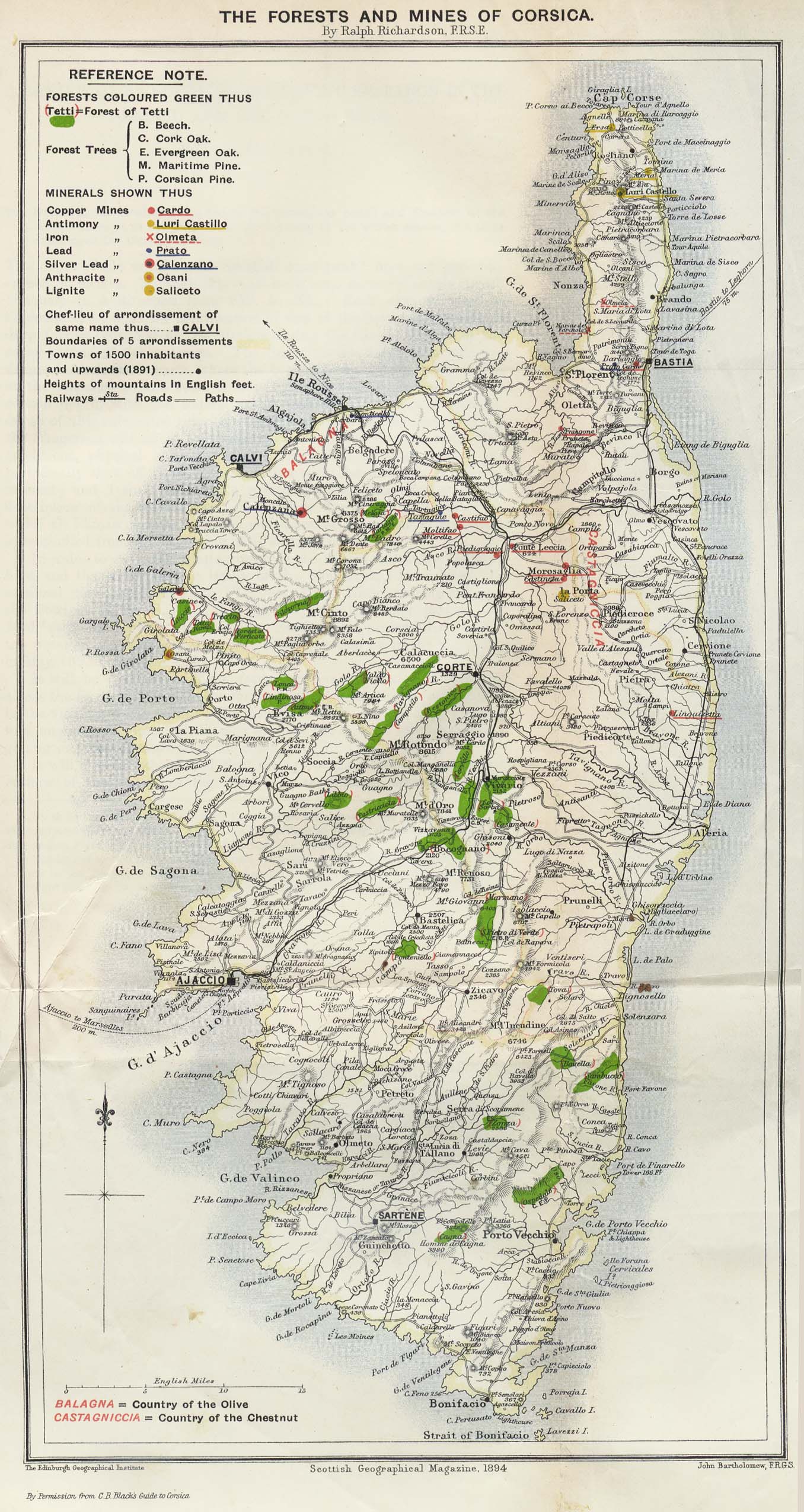
Corsica 1894 from the Scottish Geographical Magazine. Published by the Royal Scottish Geographical Society and edited by James Geikie and W.A. Taylor. Volume X, 1894. (599K)
Paris, Medieval "Mediaeval Paris" From Literary and Historical Atlas of Europe, by J.G. Bartholomew, 1912. (88K)
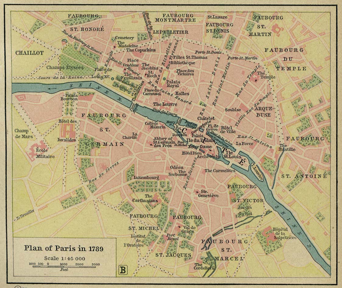
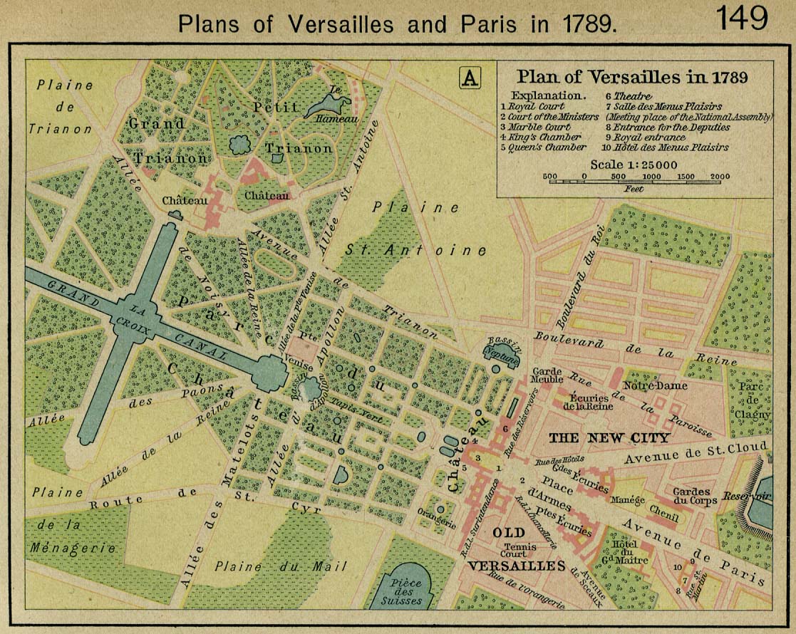
Plans of Paris (251K) and Versailles 1789. From The Historical Atlas by William R. Shepherd, 1926. (262K)
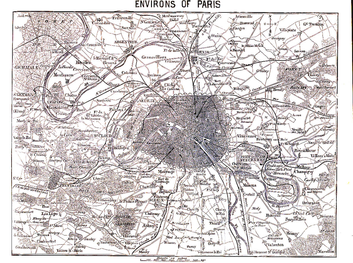
Paris, Environs of 1866 From A Handbook For Visitors To Paris, Second Edition. London: John Murray. 1866. (645K)
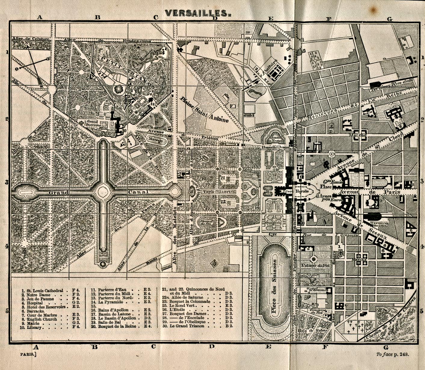
Versailles 1866 From A Handbook For Visitors To Paris, Second Edition. London: John Murray. 1866. (774K)
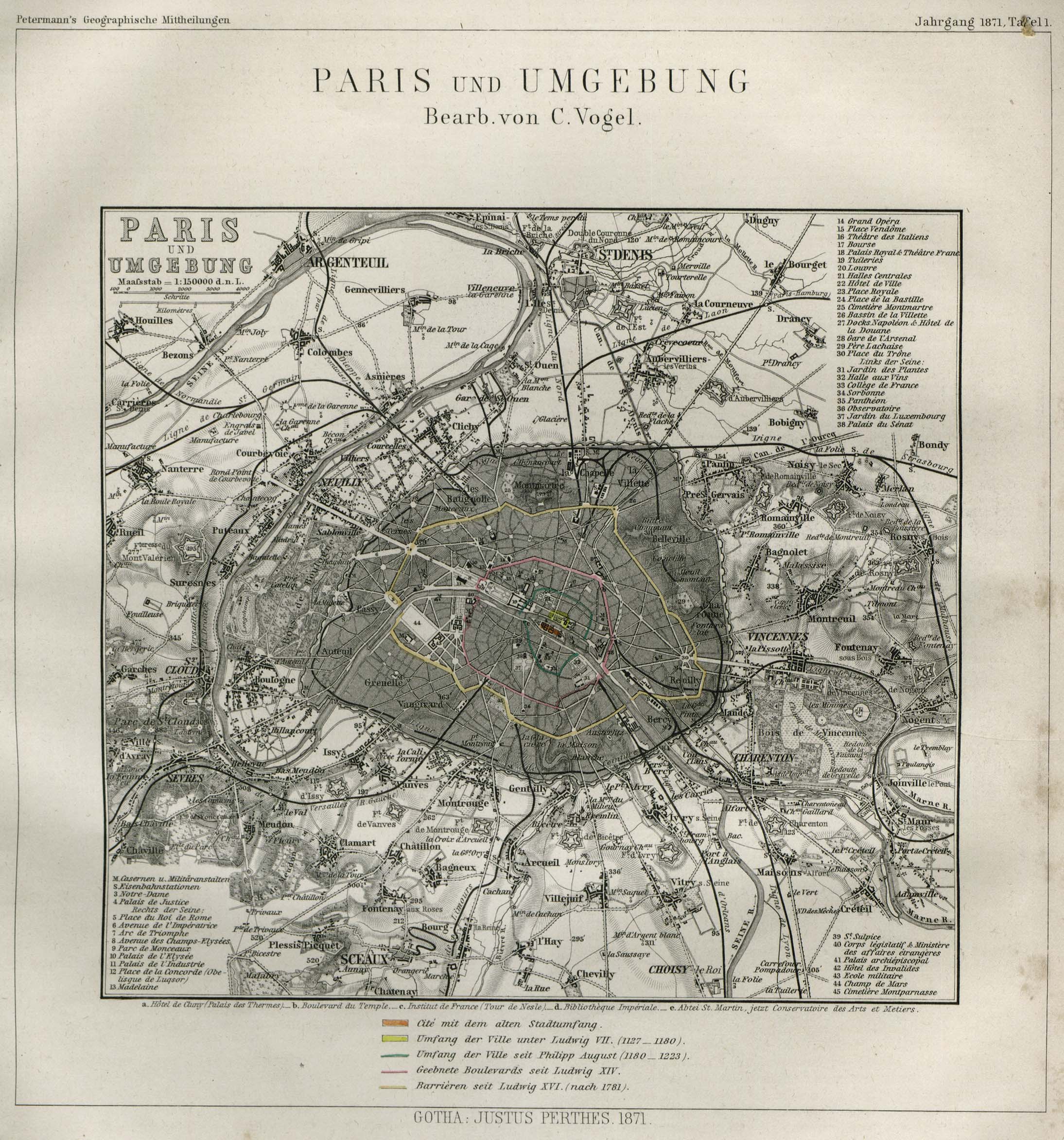
Paris 1871 "Paris und Umgebung" From Mittheilungen aus Justus Perthes' geographischer Anstalt..., by Dr. A Petermann. 1871. (784K)
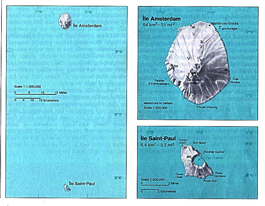
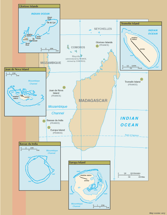
Amsterdam Island and Saint-Paul Island (Indian Ocean) 1976 (141K)
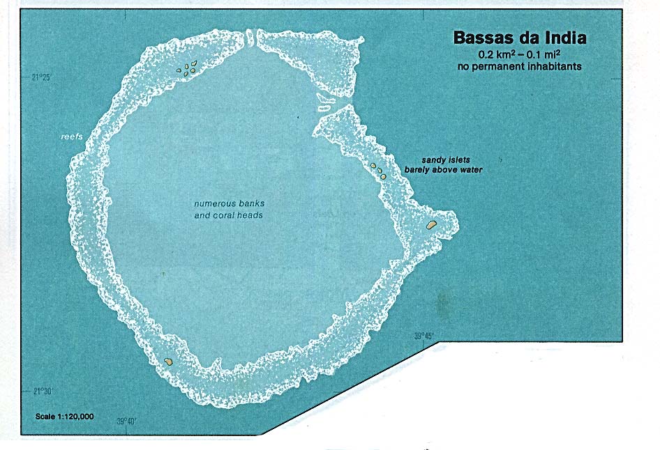
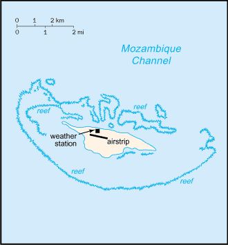
Bassas da India (Indian Ocean) 1976 (116K)
Bassas da India (Indian Ocean) (Small Map) 2006 (6K)
Clipperton Island (Pacific Ocean) (Small Map) 2008 (6K)
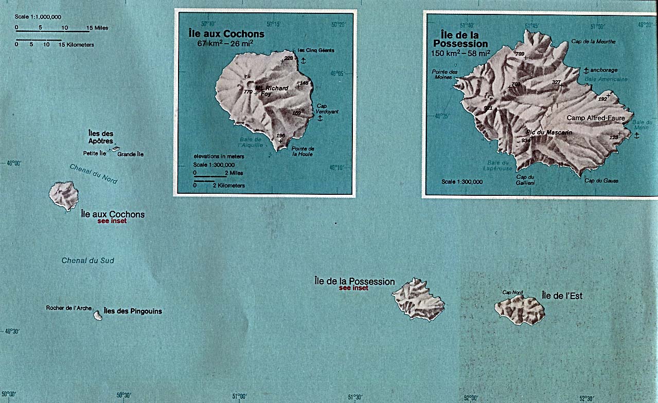
Crozet Islands (Indian Ocean) 1976 (206K)
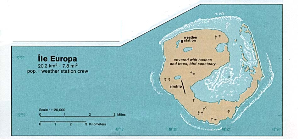
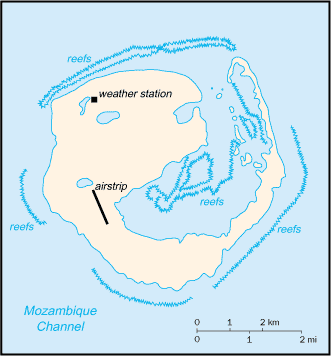
Europa Island (Indian Ocean) 1976 (64K)
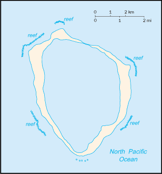
Europa Island (Indian Ocean) (Small Map) 2006 (10K)
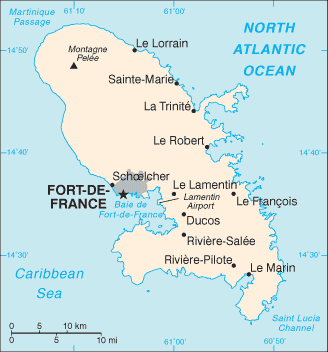
Fort de France, Martinique [City Map] U.S. Dept. of State 1984 (121K)
French Polynesia (Pacific Ocean) (Political) 1989 (190K)
French Polynesia (Pacific Ocean) (Small Map) 2008 (7K)
French Southern and Antarctic Lands (Small Map) 2008 (7K)
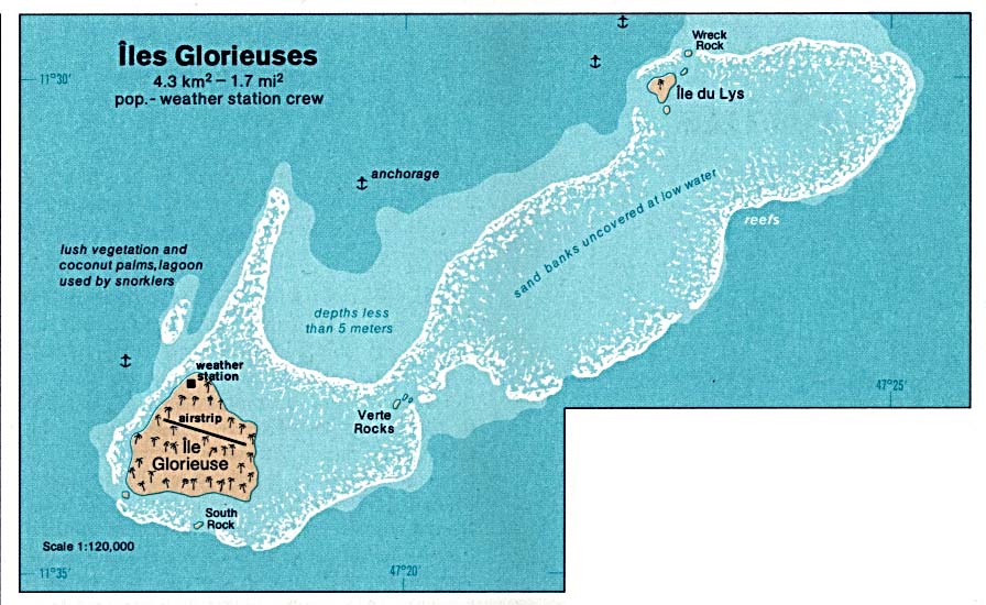
Glorioso Islands - Iles Glorieuses (Indian Ocean) 1976 (103K)
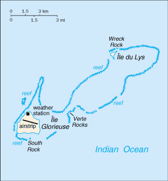
Glorioso Islands - Iles Glorieuses (Indian Ocean) (Small Map) 2006 (7K)
Guadeloupe (Caribbean Sea) (Small Map) 2006 (11K)
Iles Eparses (Indian Ocean) (Small Map) 2007 (35K)
Juan de Nova Island (Indian Ocean) 1976 (80K)
Juan de Nova Island (Indian Ocean) (Small Map) 2006 (7K)
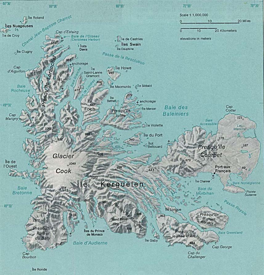
Kerguelen Islands (Indian Ocean) 1976 (171K)
Martinique (Caribbean Sea) (Small Map) 2006 (11K)
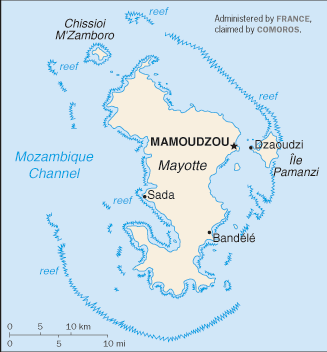
Mayotte (Indian Ocean) (Small Map) 2008 (11K)
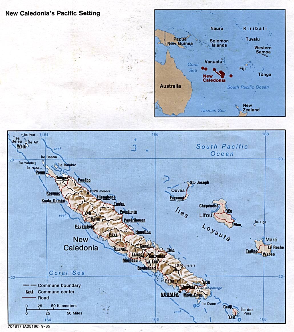
New Caledonia (Pacific Ocean) (Shaded Relief) 1985 (217K)
New Caledonia (Pacific Ocean) (Small Map) 2008 (9K)
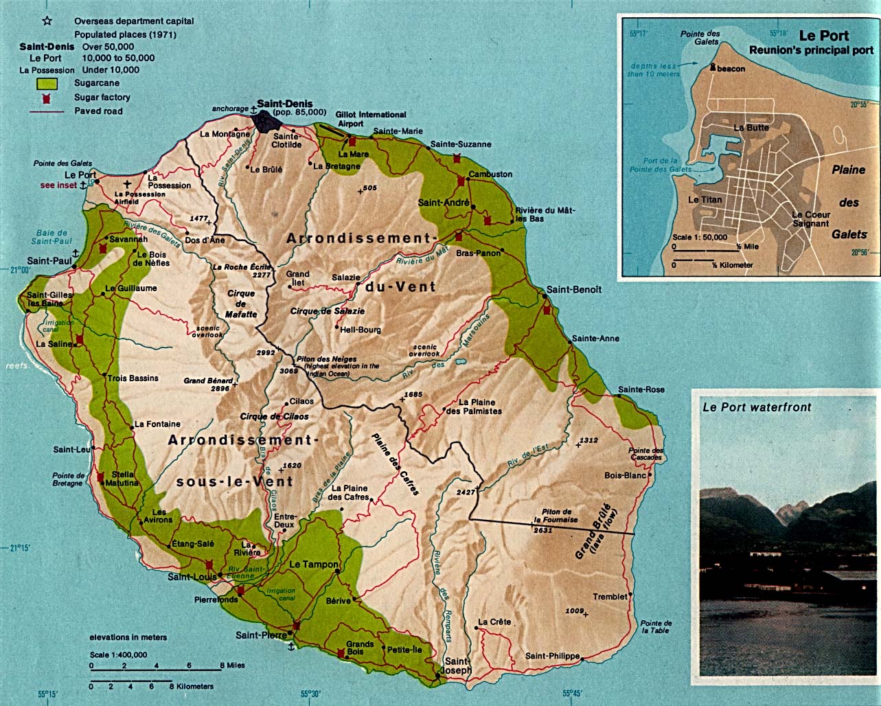
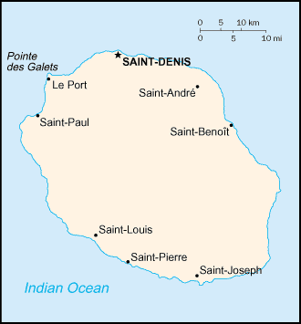
Reunion (Indian Ocean) 1976 (309K)
Reunion (Indian Ocean) (Small Map) 2006 (6K)
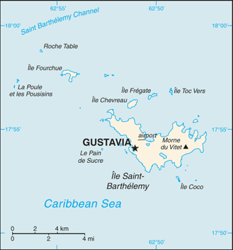
Saint Barthelemy (Caribbean Sea) (Small Map) 2008 (12K)
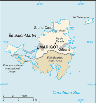
Saint Martin (Caribbean Sea) (Small Map) 2008 (14K)
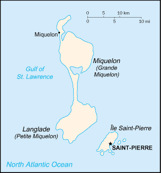
Saint Pierre and Miquelon (North America) (Small Map) 2008 (7K)
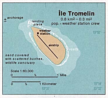
Tromelin Island (Indian Ocean) 1976 (29K)
Tromelin Island (Indian Ocean) (Small Map) 2006 (7K)
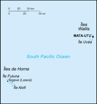
Wallis and Futuna Islands (Pacific Ocean) (Small Map) 2008 (4K)
Sources: These maps were provided by the University of Texas Library and/or
the U.S. Central Intelligence Agency (CIA) unless otherwise noted.
Sponsors
Maps on other websites
France (Lonely Planet)
France (Quid)
France (World Sites Atlas)
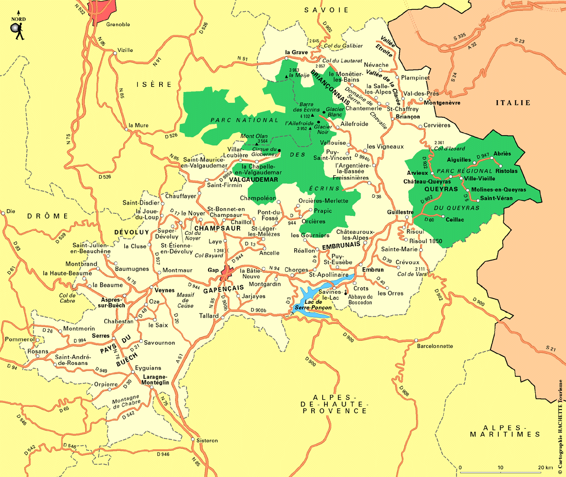
France - Alps (Routard.com)
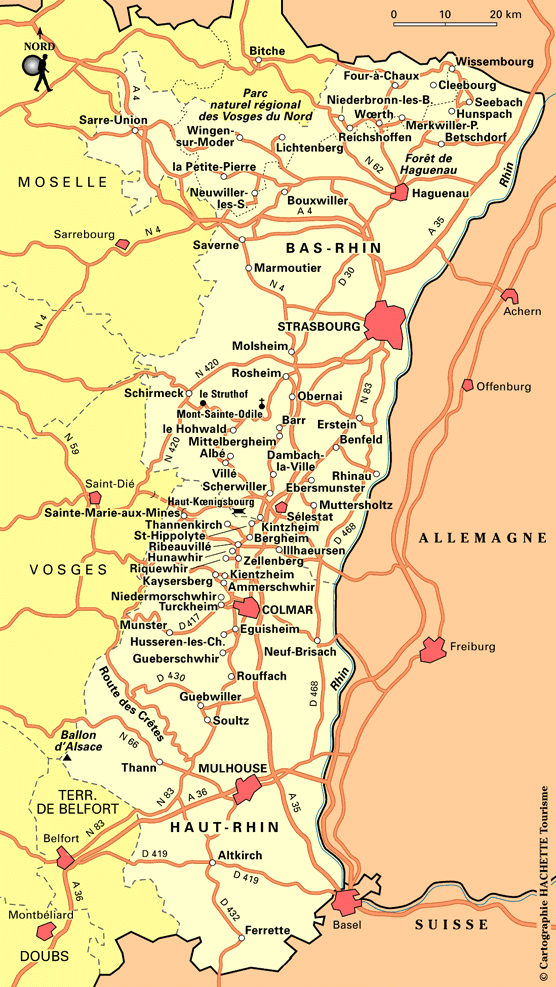
France - Alsace (Routard.com)
France - Departments Maps (Quid)
France - Maps (French Property, Services and Information Ltd.)
France - Interactive Maps/Images [includes French overseas territories] (Geoportail)
France - Railways (Trainspotting B�kkes)
France - Thematic and Electoral Maps (Documentation Française)
France - Wine Maps (Art and Betsy Stratemeyer)
France - Zones Urbaines Sensibles (D�l�gation Interminist�rielle � la Ville)
<-- Free Map Downloads
<-- Free World Country Map Downloads
Didn't find what you are looking for? We've been online since 1996 and have created 1000's of pages. Search below and you may find just what you are looking for.
Michael R. Meuser
Data Research & GIS Specialist
MapCruzin.com is an independent firm
specializing in GIS project development and data research.
We created the first U.S. based
interactive toxic chemical facility
maps on the internet in 1996 and we
have been online ever since. Learn more about us and our services.
Have a project in mind? If you have data, GIS project or custom shapefile needs contact Mike.
Contact Us
Report Broken Links
Subscribe for Updates


![Fort de France, Martinique [City Map]](/free-maps-france/fortdefrance.jpg)