Download Free Ethiopia Maps
<-- Free Map Downloads
<-- Free World Country Map Downloads
Sponsors
Note that maps may not appear on the webpage in their full size and resolution. To save the maps to your computer, right-click on the link.
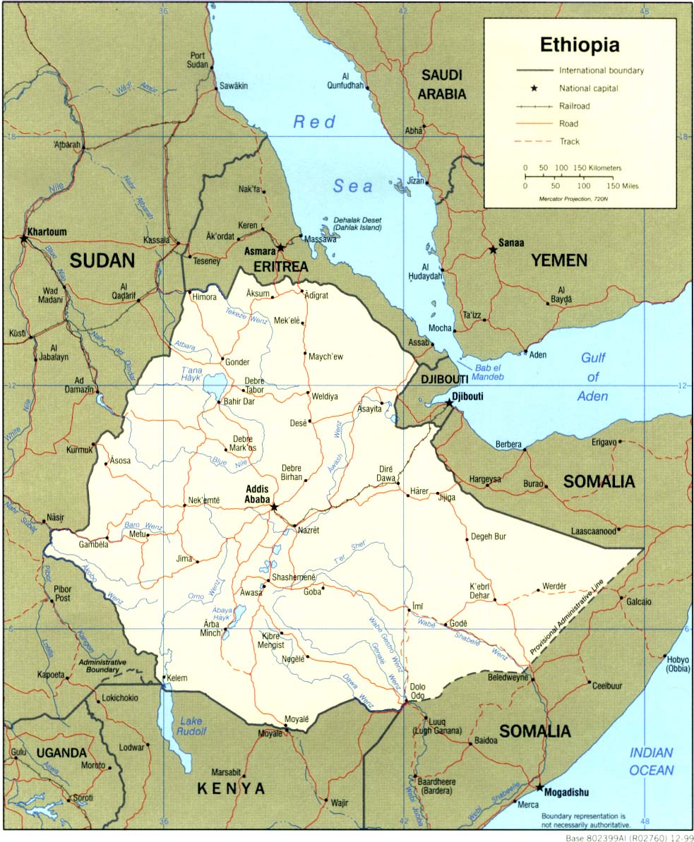
Ethiopia (Political) 1999 (323K) and
pdf format (331K)
Ethiopia (Shaded Relief) 1999 (223K) and
pdf format (247K)
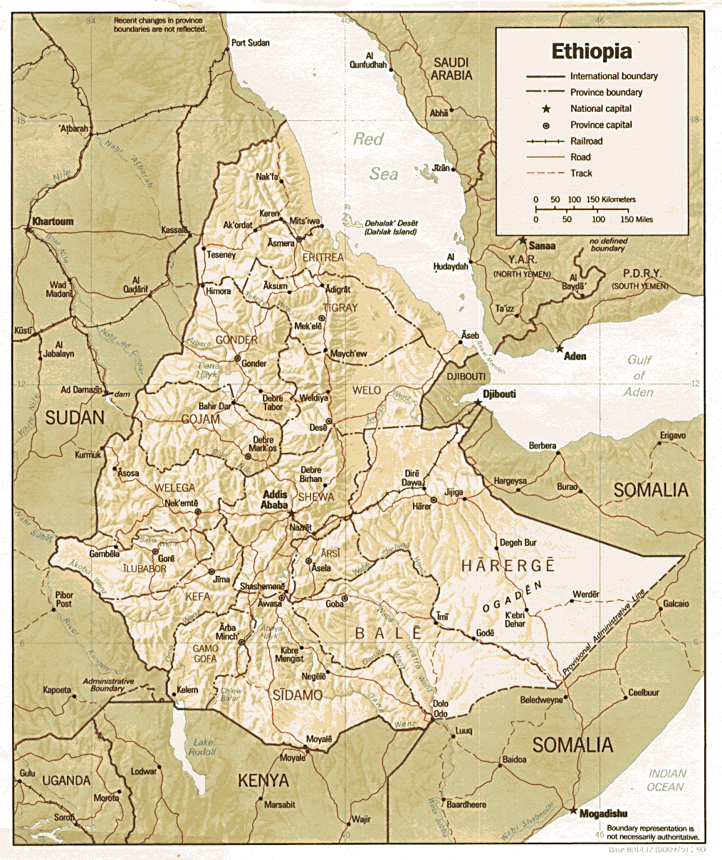
Ethiopia (Shaded Relief) 1990 (317K) and
pdf format (221K)
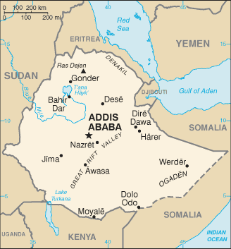
Ethiopia (Small Map) 2008 (15K)
Addis Ababa U.S. Dept. of State 1986 (157K)
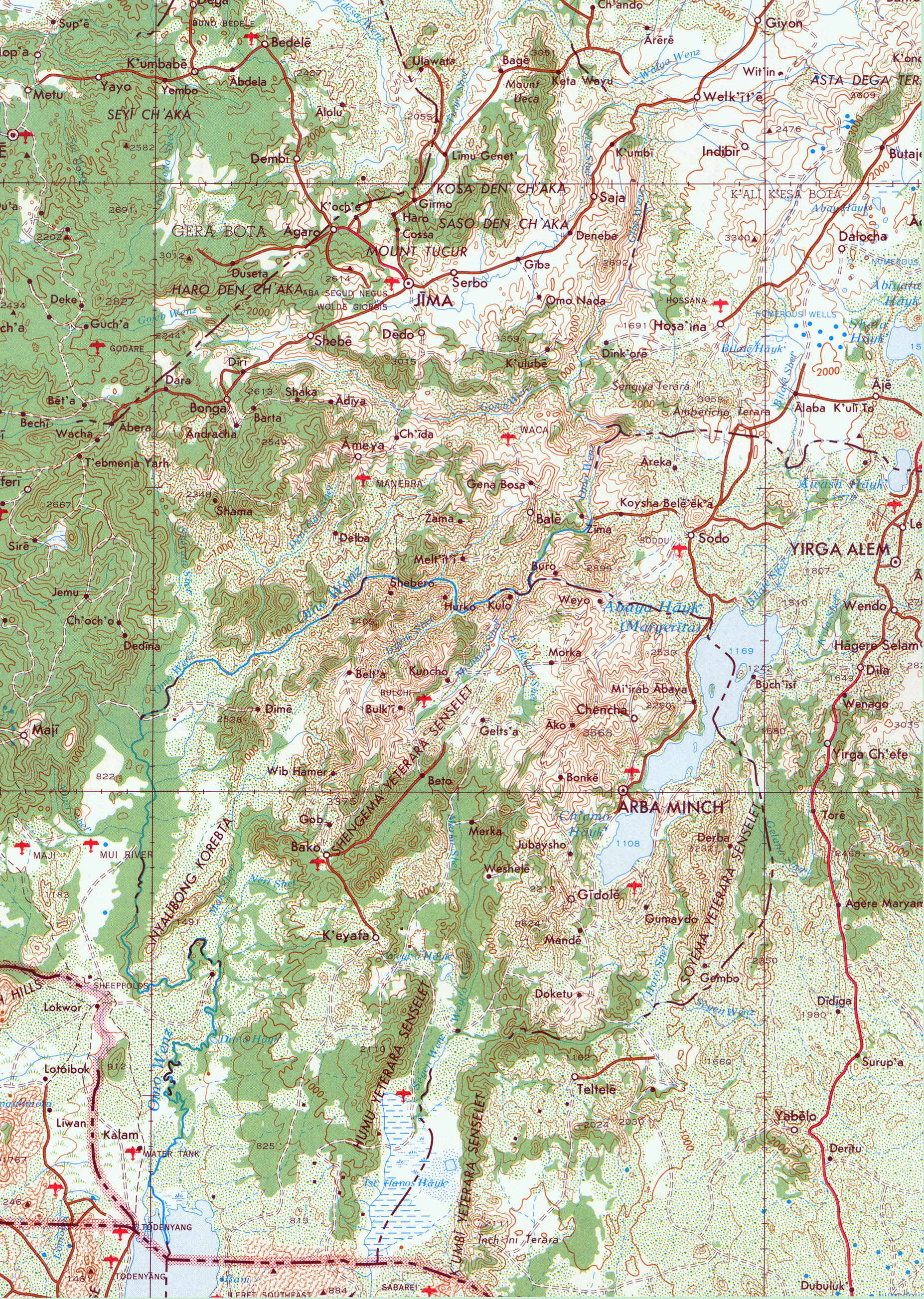
Omo River Region Portion of U.S. Army Map Service Series 2201, Sheet 20, 1980, original scale 1:2,000,000 (2.7MB)
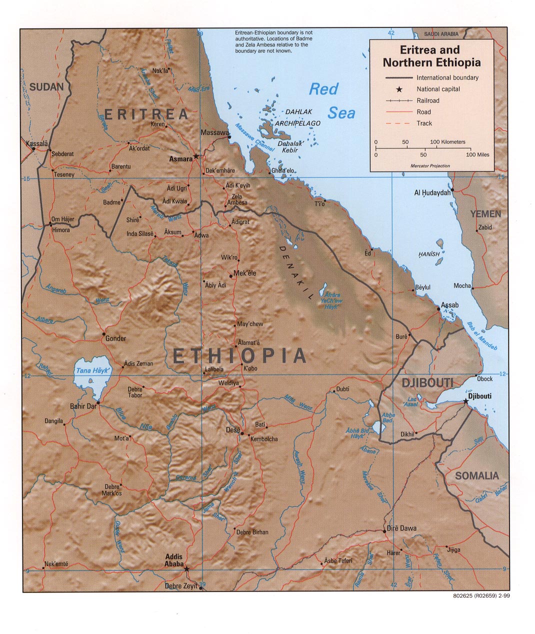
Eritrea and Northern Ethiopia (Shaded Relief) 2000 (185K)
Eritrea and Northern Ethiopia (Shaded Relief) 1999 (321K)
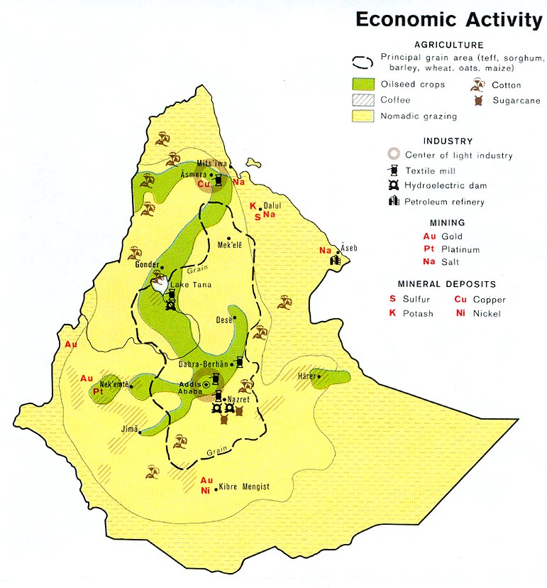
Ethiopia - Economic Activity from Map No. 503188 1976 (138K)
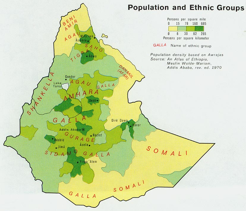
Ethiopia - Population from Map No. 503188 1976 (127K)
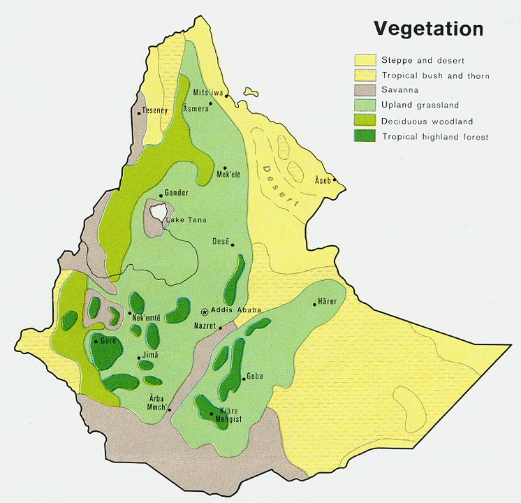
Ethiopia - Vegetation from Map No. 503188 1976 (121K)
Sources: These maps were provided by the University of Texas Library and/or
the U.S. Central Intelligence Agency (CIA) unless otherwise noted.
Maps on other websites
Ethiopia (UniMaps)
Ethiopia - Maps (ReliefWeb)
Ethiopia - Oromia [Anti-Government Web Site] (Oromo Liberation Front)
Ethiopia - Regions (UN OCHA Ethiopia)
<-- Free Map Downloads
<-- Free World Country Map Downloads
Didn't find what you are looking for? We've been online since 1996 and have created 1000's of pages. Search below and you may find just what you are looking for.
Michael R. Meuser
Data Research & GIS Specialist
MapCruzin.com is an independent firm
specializing in GIS project development and data research.
We created the first U.S. based
interactive toxic chemical facility
maps on the internet in 1996 and we
have been online ever since. Learn more about us and our services.
Have a project in mind? If you have data, GIS project or custom shapefile needs contact Mike.
Contact Us
Report Broken Links
Subscribe for Updates
Sponsors


