Download Free East Timor Maps
<-- Free Map Downloads
<-- Free World Country Map Downloads
Sponsors
Note that maps may not appear on the webpage in their full size and resolution. To save the maps to your computer, right-click on the link.
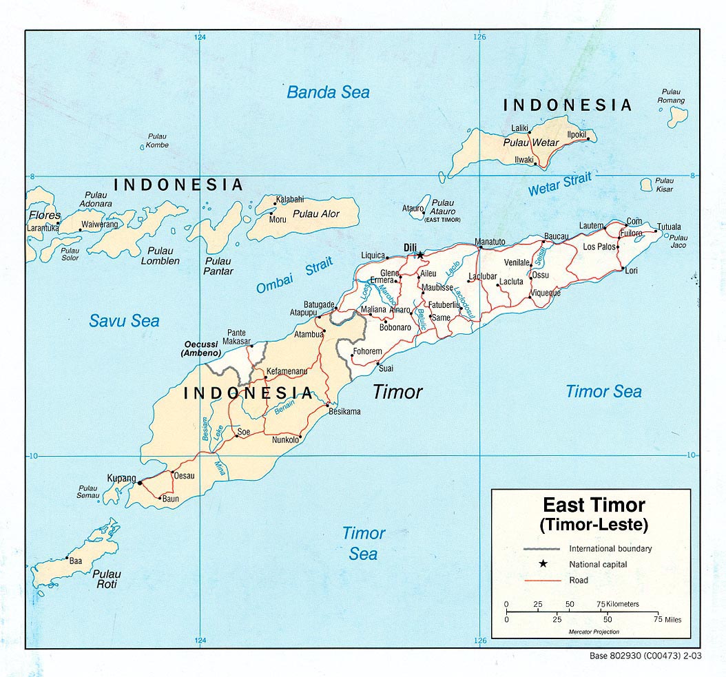
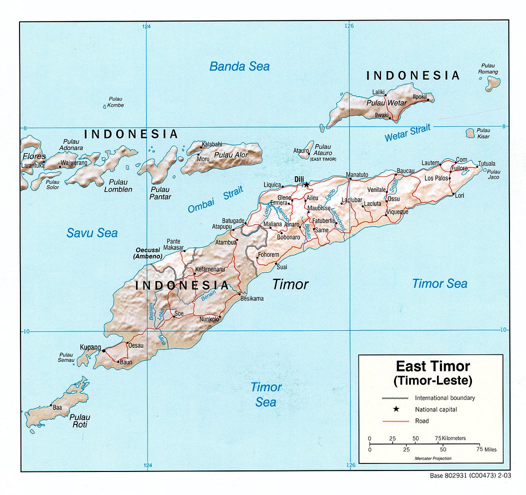
East Timor (Political) U.S. Central Intelligence Agency 2003 (225K) pdf format (228K)
[Dili] Dilly 1943 (553K) and map key (103k) and map scale (24K) Portion of "Dilly, Lesser Sunda Islands", U.S. Army Map Service T551, Second Edition, 1943. Original scale 1:250,000.
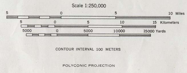
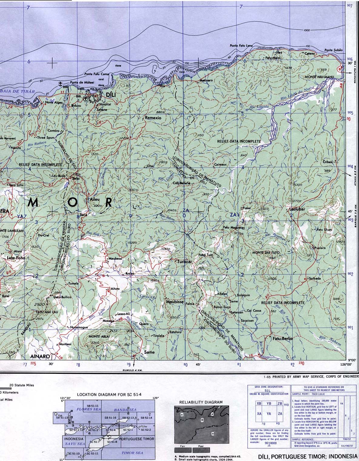
Dili Area 1965 (415K) and map scale (47K) Portion of "Dili, Portuguese Timor; Indonesia", U.S. Army Map Service, Series T503, Sheet SC 51-4, 1965. Original scale 1:250,000.
Central Timor [OMEGA Nautical Chart] 1979 (351K)
Portion of "Timor and Adjacent Islands", Sheet 73004, U.S. Defense Mapping Agency, 1979. From Netherlands Government Surveys to 1927. "Natural Scale 1:500,000 at the Equator." Soundings in fathoms. Not for navigational use
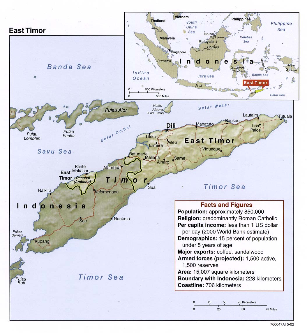
East Timor (Shaded Relief) U.S. Central Intelligence Agency 2002 (182K) and pdf format (189K)
Timor-Leste (Small Map) U.S. Central Intelligence Agency 2008 (5K)
East Timor (Shaded Relief) U.S. Central Intelligence Agency 2003 (231K) and pdf format (234K)
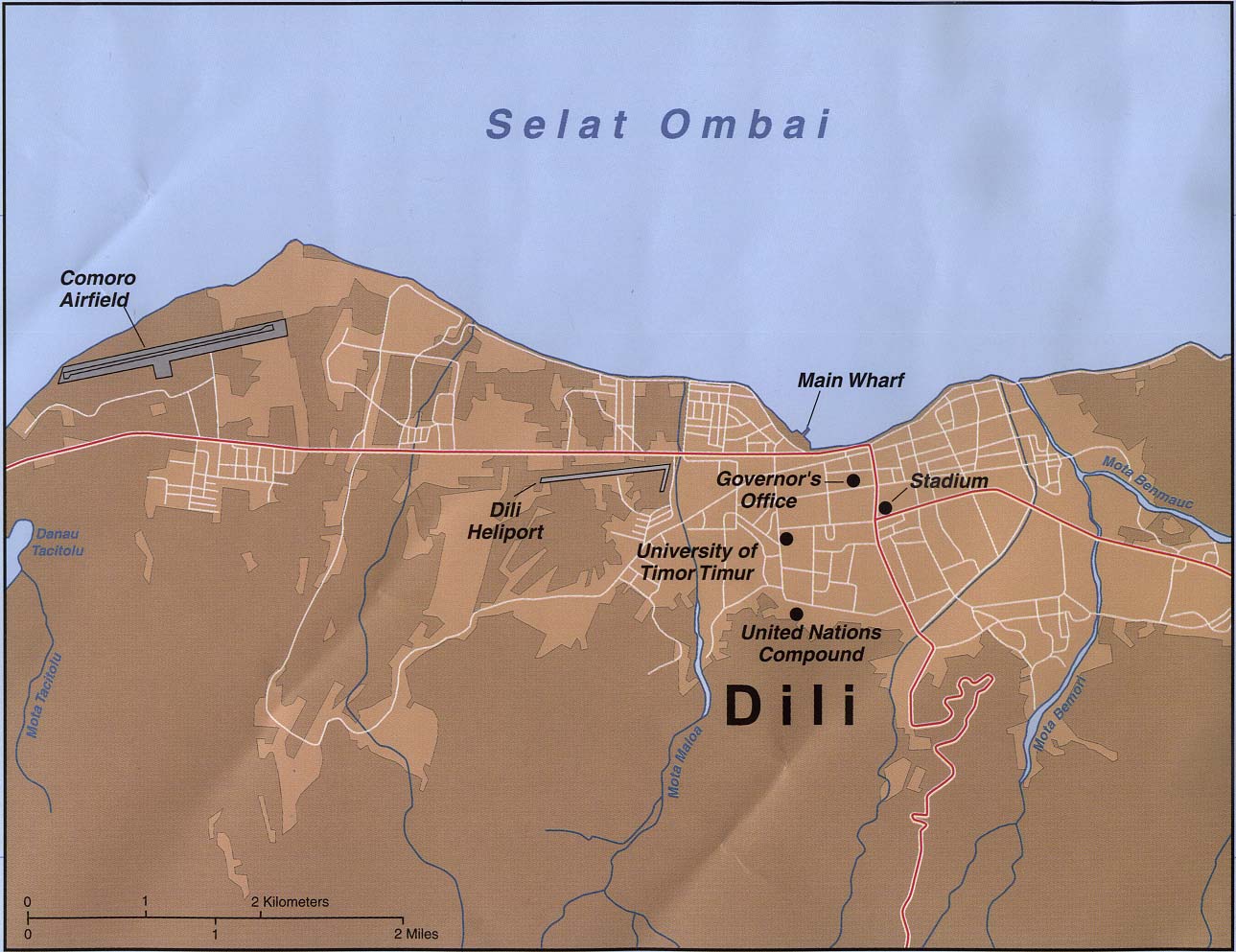
Dili U.S. Central Intelligence Agency 1999 (181K)
Timor - Eastern and Central (Operational Navigation Chart) Portion of Defense Mapping Agency ONC N-13, 1989, original scale 1:1,000,000. (304K) Not for navigational use
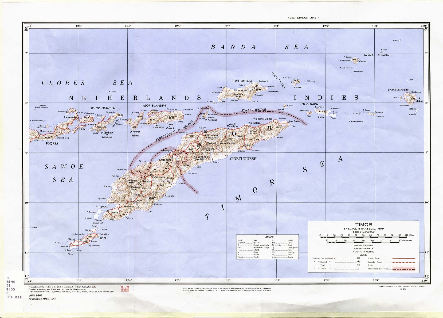
Timor 1943 (286K) Portion of "Timor Special Strategic Map" U.S. Army Map Service, AMS 9101, 1943 [May 1955 printing]. Original scale 1:2,000,000.
Sources: These maps were provided by the University of Texas Library and/or
the U.S. Central Intelligence Agency (CIA) unless otherwise noted.
Maps on other websites
East and West Timor - Refugees (UNHCR) [PDF]
East Timor (ETAN/US)
East Timor (National Geographic)
East Timor (United Nations) [PDF]
East Timor - Location Map (timorNet)
Timor (Peter Loud)
<-- Free Map Downloads
<-- Free World Country Map Downloads
Sponsors
Didn't find what you are looking for? We've been online since 1996 and have created 1000's of pages. Search below and you may find just what you are looking for.
Michael R. Meuser
Data Research & GIS Specialist
MapCruzin.com is an independent firm
specializing in GIS project development and data research.
We created the first U.S. based
interactive toxic chemical facility
maps on the internet in 1996 and we
have been online ever since. Learn more about us and our services.
Have a project in mind? If you have data, GIS project or custom shapefile needs contact Mike.
Contact Us
Report Broken Links
Subscribe for Updates


![[Dili] Dilly 1943](/free-maps-east-timor/dili_1943.jpg)
![Central Timor [OMEGA Nautical Chart] 1979](/free-maps-east-timor/timor_nautical_1979.jpg)