Download Free North Carolina National Park and Historic Monument Maps
Sponsors
<-- Download Free Maps
<-- Free National Park Maps
Blue Ridge Parkway [North Carolina / Virginia] (Park Map) 1998 (968K) (PDF Format)
Blue Ridge Parkway - Northern Section [North Carolina / Virginia] (Park Map) 1995 (901K)
Blue Ridge Parkway - Southern Section [North Carolina / Virginia] (Park Map) 1995 (764K)
Cape Hatteras National Seashore (Area Map) 1993 (347K)
Cape Hatteras National Seashore (Park Map) 1998 (1.8MB) (PDF Format)
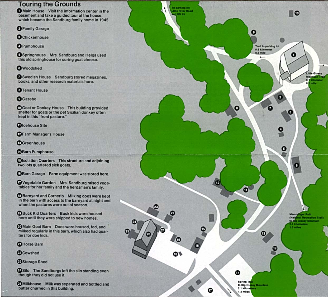
Carl Sandburg Home National Historic Site (Schematic Map) 1997 (323K) (PDF Format)
Sponsors
Carl Sandburg Home National Historic Site (Schematic Tour Map) 1996 (194K)
Guilford Courthouse National Military Park (Regional Map) (46K)
Guilford Courthouse National Military Park (Park Map) (165K)
Guilford Courthouse National Military Park (Park Map) (65K) (PDF Format)
Moores Creek National Battlefield (Area Map) (53K)
Moores Creek National Battlefield (Area Map) 1997 (65K) (PDF Format)
Moores Creek National Battlefield (Park Map) (80K)
Moores Creek National Battlefield (Park Map) 1997 (65K) (PDF Format)
Wright Brothers National Memorial (Site Illustration) 1995 (351K)
Sponsors
<-- Download Free Maps
<-- Free National Park Maps
Didn't find what you are looking for? We've been online since 1996 and have created 1000's of pages. Search below and you may find just what you are looking for.
Michael R. Meuser
Data Research & GIS Specialist
MapCruzin.com is an independent firm
specializing in GIS project development and data research.
We created the first U.S. based
interactive toxic chemical facility
maps on the internet in 1996 and we
have been online ever since. Learn more about us and our services.
Have a project in mind? If you have data, GIS project or custom shapefile needs contact Mike.
Contact Us
Report Broken Links
Subscribe for Updates


![Blue Ridge Parkway - Northern Section [North Carolina / Virginia]](/download-national-park-maps/blue_n95.jpg)
![Blue Ridge Parkway - Southern Section [North Carolina / Virginia]](/download-national-park-maps/blue_s95.jpg)