Download Free Pennsylvania Maps
<-- Free Maps
<-- Free U.S. State Maps
<-- Free World Country Maps
See Also:
Topographic Maps
ArcGIS Shapefile Map Layers
Download or link to these maps for your reports, websites, research, projects, presentations...
Note that maps may not appear on the webpage in their full size and resolution. To save the maps to your computer, right-click on the link.
State Maps
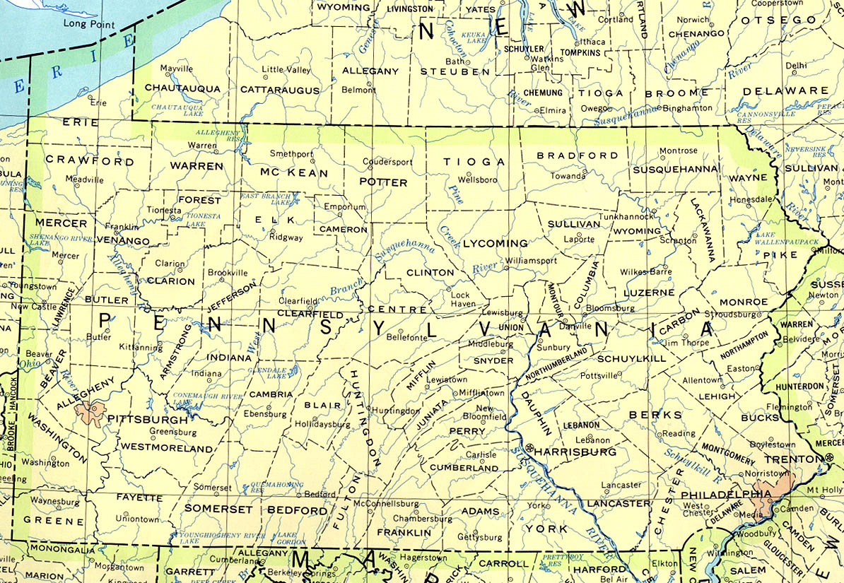
Pennsylvania (base map) JPEG format (408K) County boundaries and names, county seats, rivers. Original scale 1:2,500,000 U.S. Geological Survey, 1972 limited update 1990
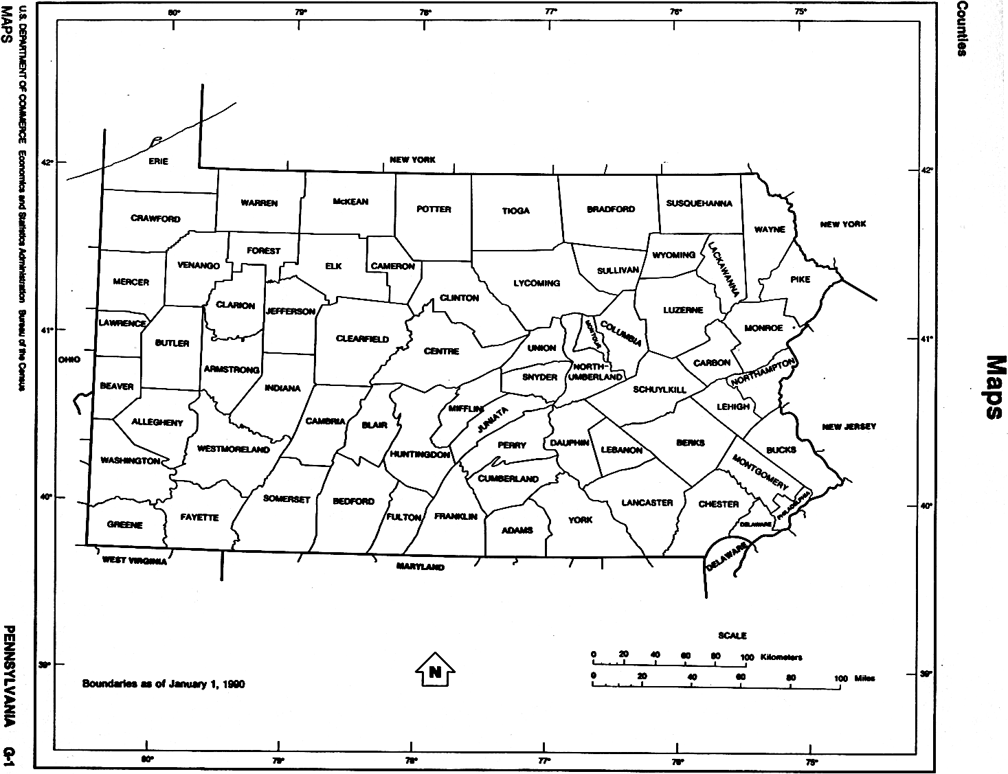
Pennsylvania (outline map) JPEG format (83K) County boundaries and names. U.S. Bureau of the Census, 1990
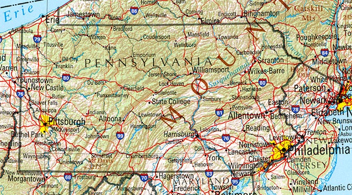
Pennsylvania (reference map) JPEG format (201K) Shaded relief map with state boundaries, forest cover, place names, major highways. Portion of "The National Atlas of the United States of America. General Reference", compiled by U.S. Geological Survey 2001, printed 2002
Pennsylvania (reference map) PDF format (204K) Shaded relief map with state boundaries, forest cover, place names, major highways. Portion of "The National Atlas of the United States of America. General Reference", compiled by U.S. Geological Survey 2001, printed 2002
Pennsylvania - Federal Lands and Indian Reservations PDF format (500K) The National Atlas of the United States of America, U.S. Geological Survey, 2003
City Maps
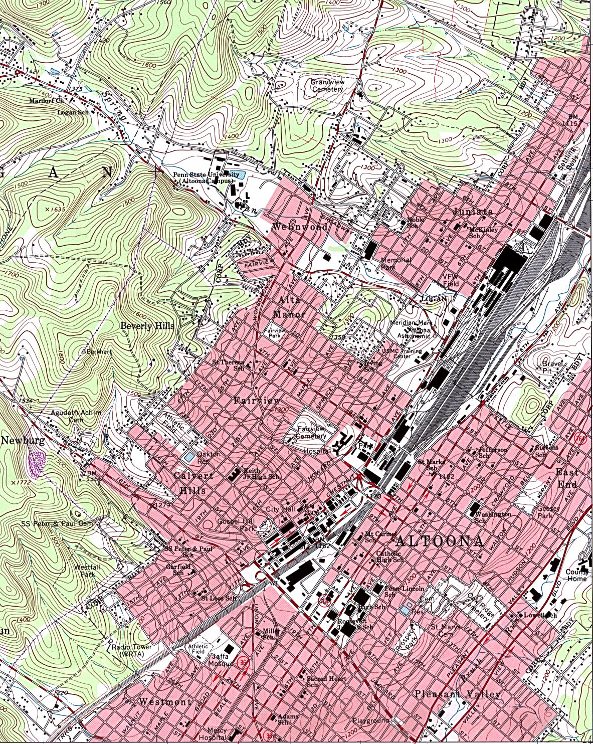
Altoona (topographic) original scale 1:24,000 U.S.G.S. 1963, revised 1993 (884K)
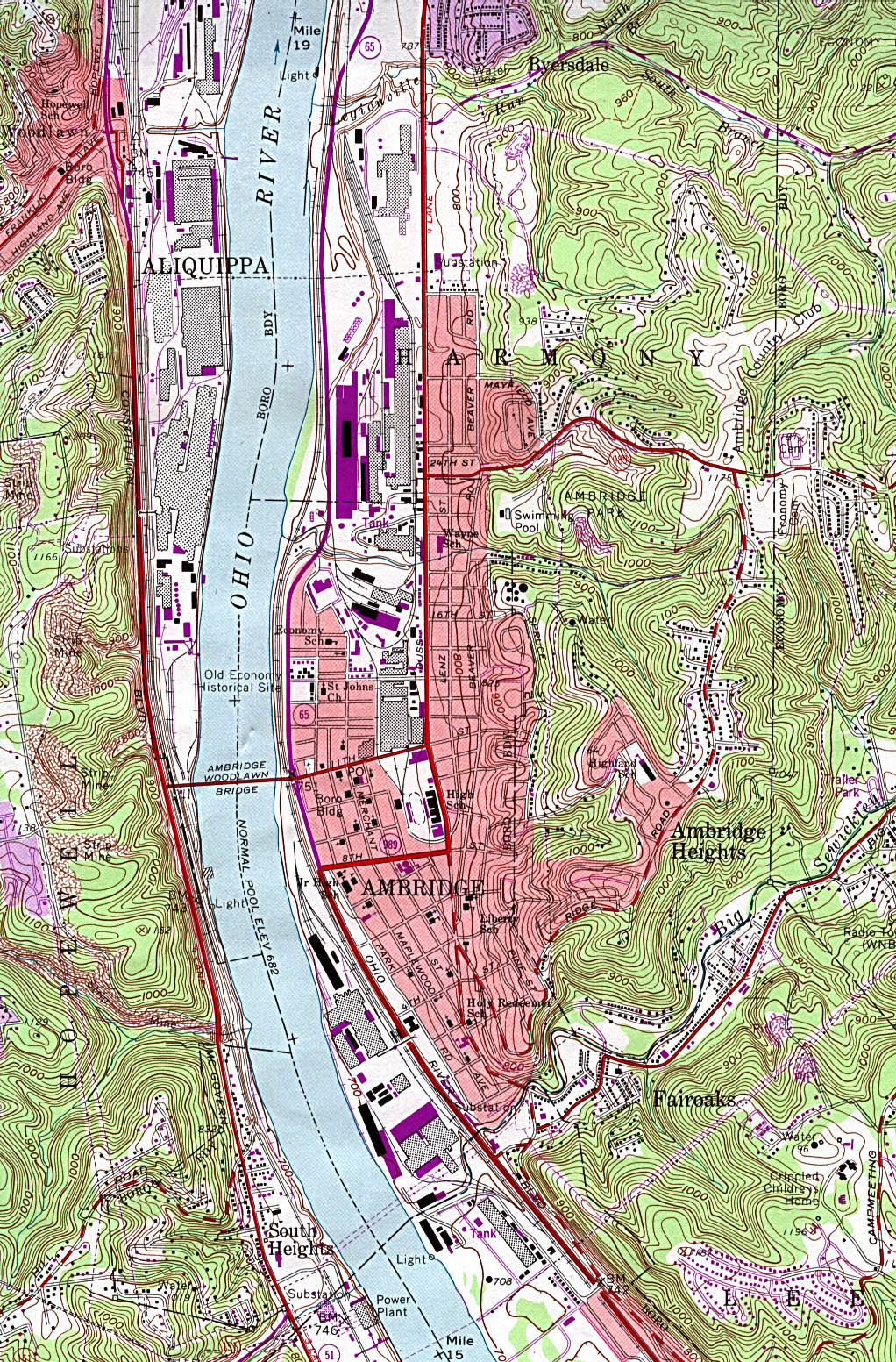
Ambridge (topographic) original scale 1:24,000 U.S.G.S. 1960, photorevised 1990 (808K)
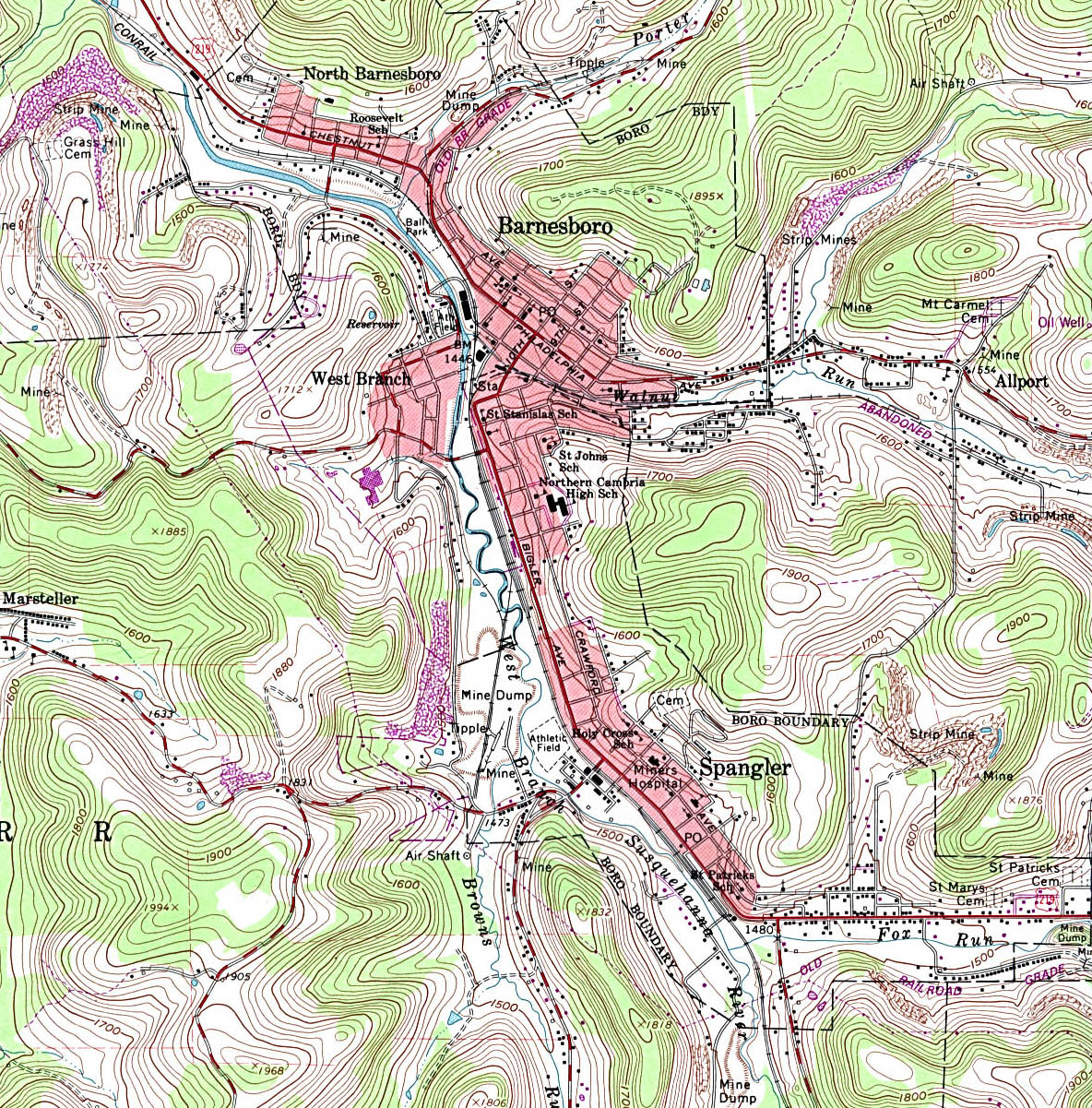
Barnesboro (topographic) original scale 1:24,000 U.S.G.S. 1961, photorevised 1981, photoinspected 1984 (740K)
Blairsville (topographic) original scale 1:24,000 U.S.G.S. 1964, photorevised 1981 (434K)
Chambersburg (topographic) original scale 1:24,000 U.S.G.S. 1990 (842K)
Coatesville (topographic) original scale 1:24,000 U.S.G.S. 1953, revised 1992 (876K)
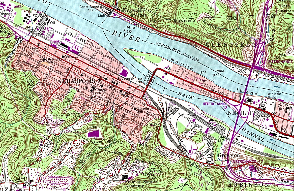
Coraopolis (topographic) original scale 1:24,000 U.S.G.S. 1960, photorevised 1990 (544K)
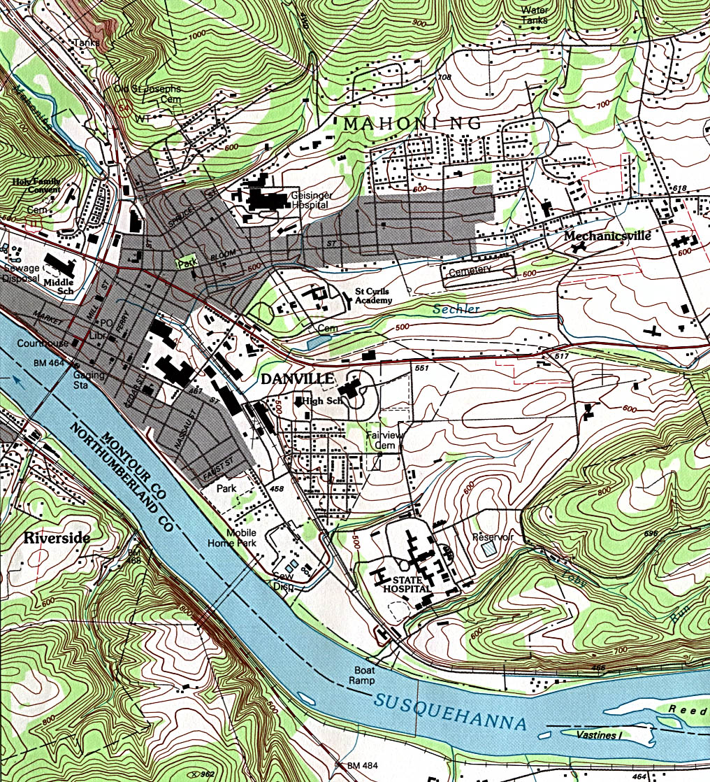
Danville (topographic) original scale 1:24,000 U.S.G.S. 1994 (595K)
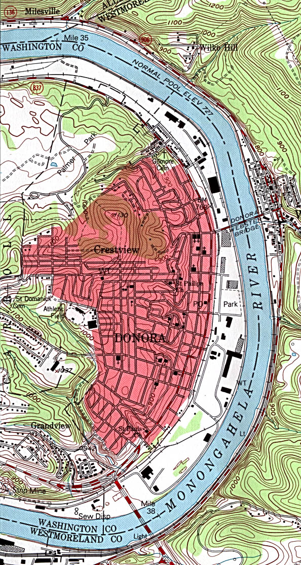
Donora (topographic) original scale 1:24,000 U.S.G.S. 1993 (366K)
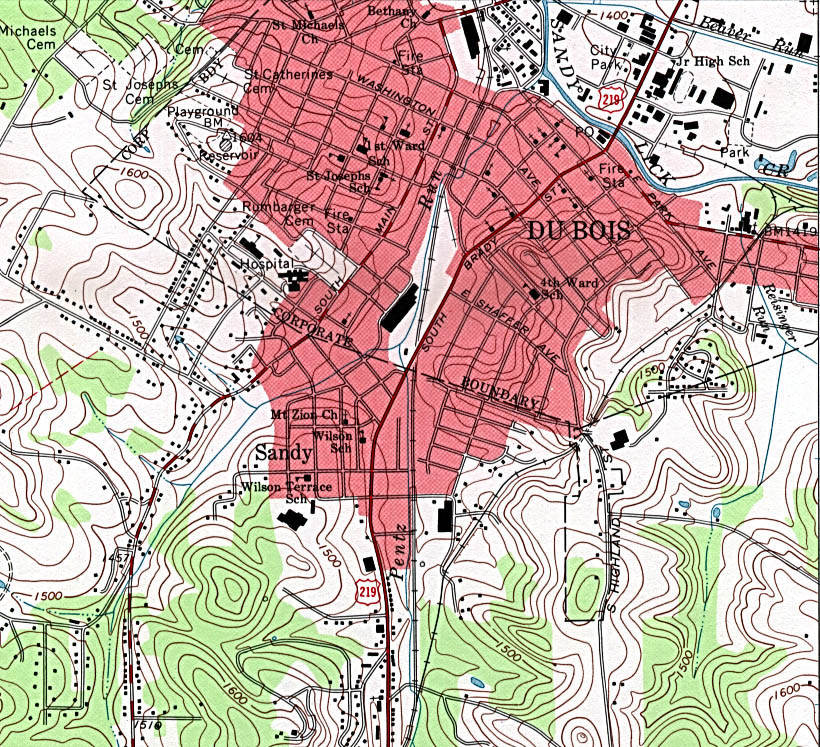
Du Bois (topographic) original scale 1:24,000 U.S.G.S. 1966, revised 1994 (332K)
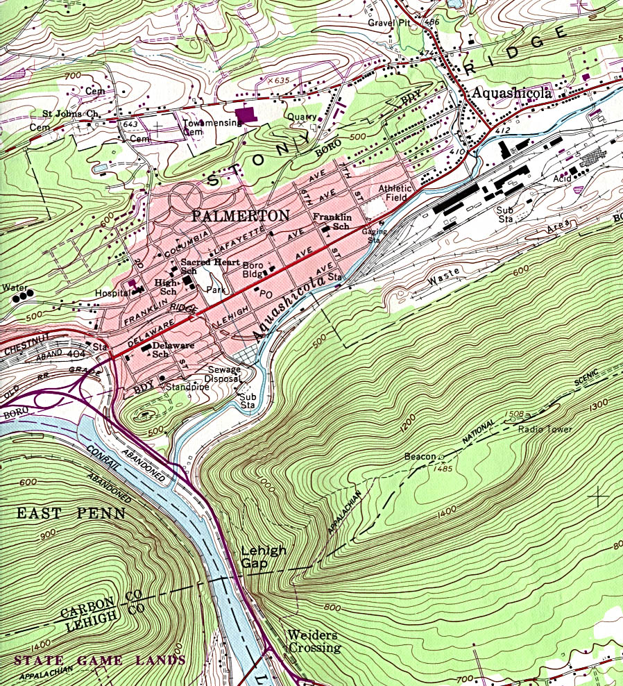
Palmerton (topographic) original scale 1:24,000 U.S.G.S. 1960, photorevised 1984 (485K)
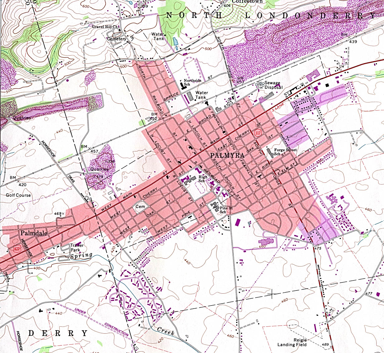
Palmyra (topographic) original scale 1:24,000 U.S.G.S. 1969, photorevised 1990 (536K)
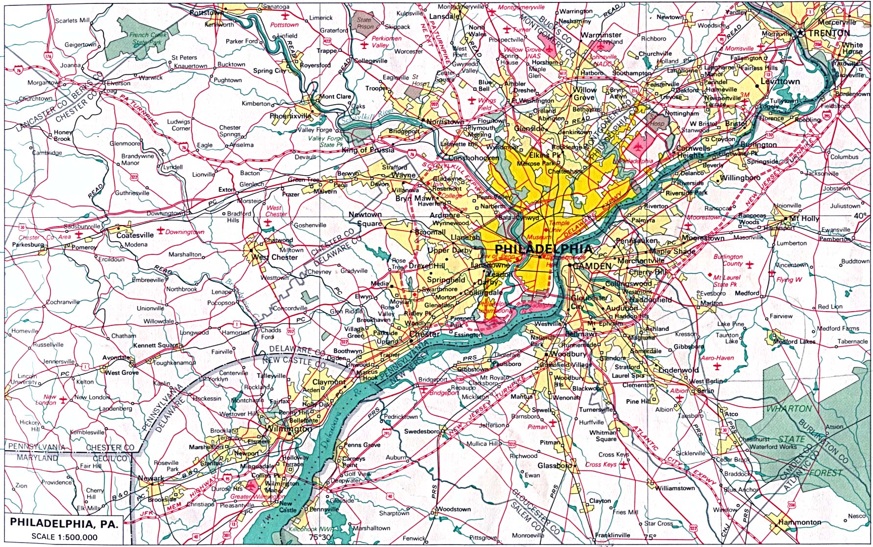
Philadelphia original scale 1:500,000 U.S. National Atlas 1970 (514K)
Philadelphia [Downtown] (topographic) original scale 1:24,000 U.S.G.S. 1967, revised 1994 (1.1MB)
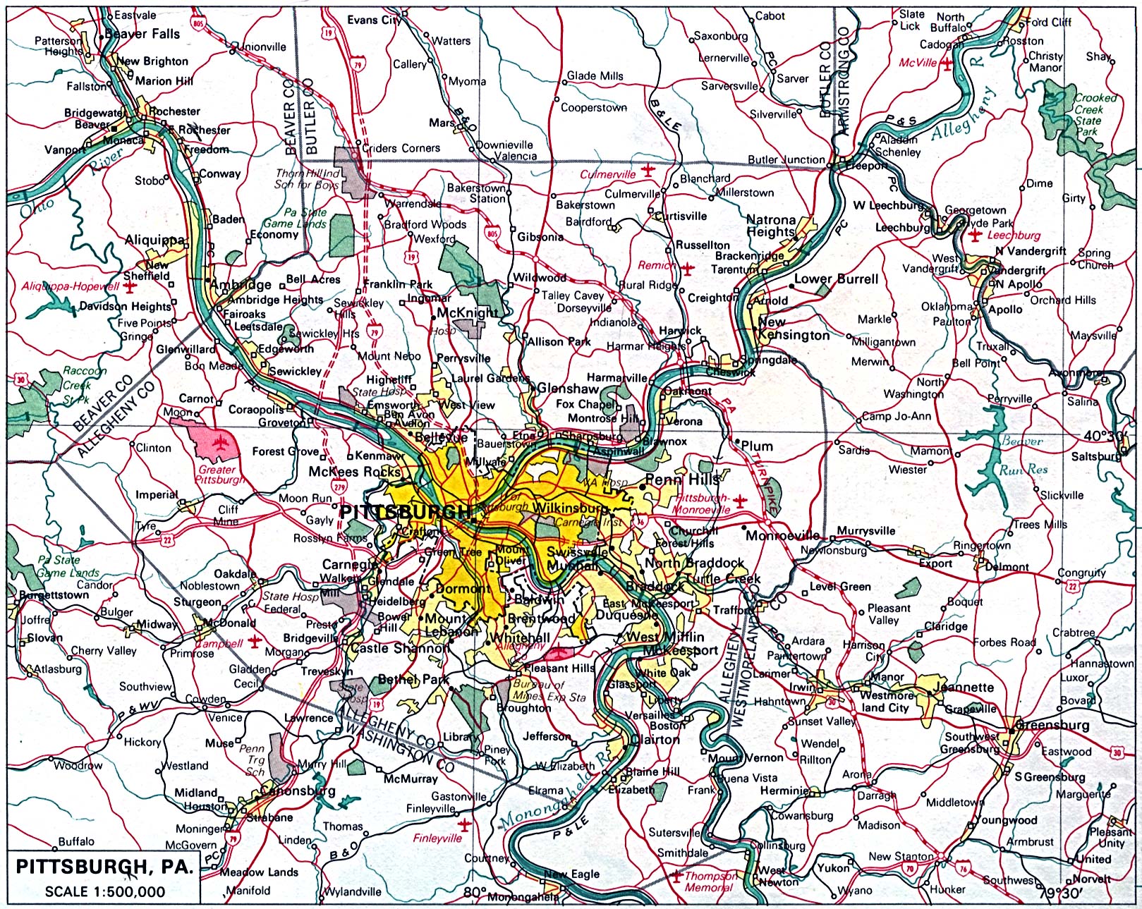
Pittsburgh original scale 1:500,000 U.S. National Atlas 1970 (747K)
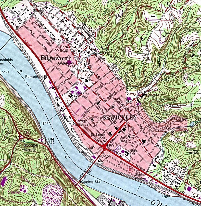
Sewickley (topographic) original scale 1:24,000 U.S.G.S. 1960, photorevised 1990 (391K)
Spring City - Royersford (topographic) original scale 1:24,000 U.S.G.S. 1955, photorevised 1983 (519K)
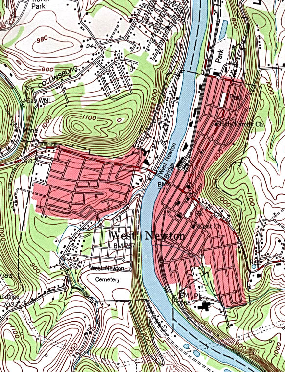
West Newton (topographic) original scale 1:24,000 U.S.G.S. 1993 (246K)
Historical City Maps
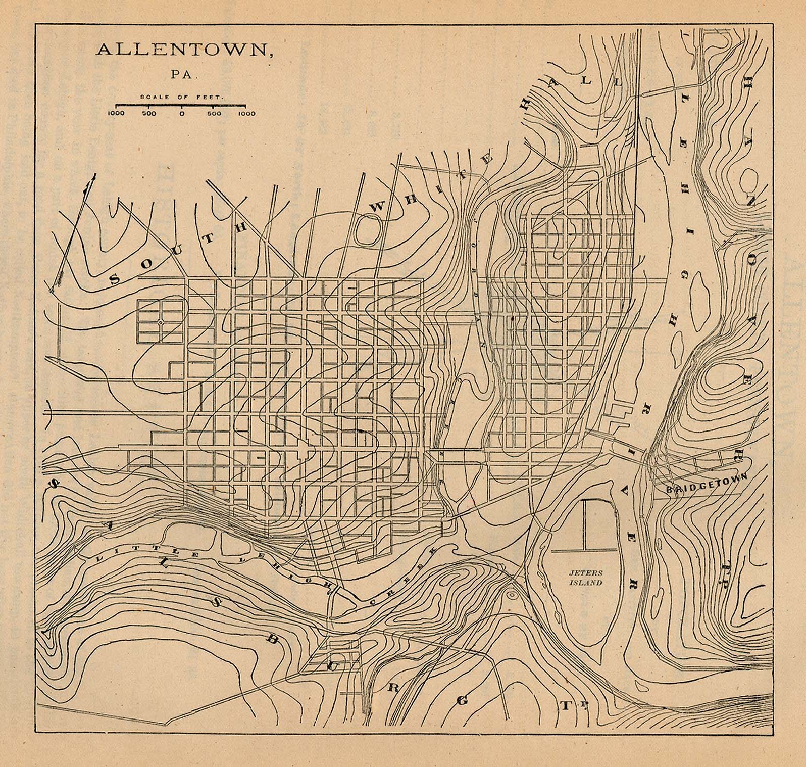
Allentown 1880 From Report on the Social Statistics of Cities, Compiled by George E. Waring, Jr., United States. Census Office, Part I, 1886. (459K)
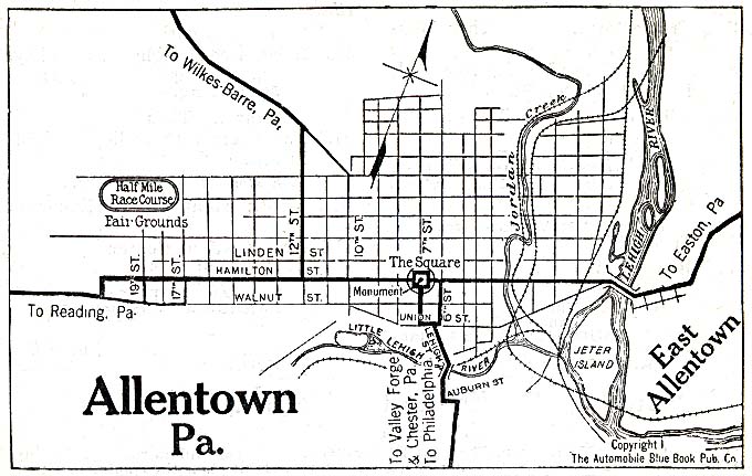
Allentown 1920 Automobile Blue Book (117K)
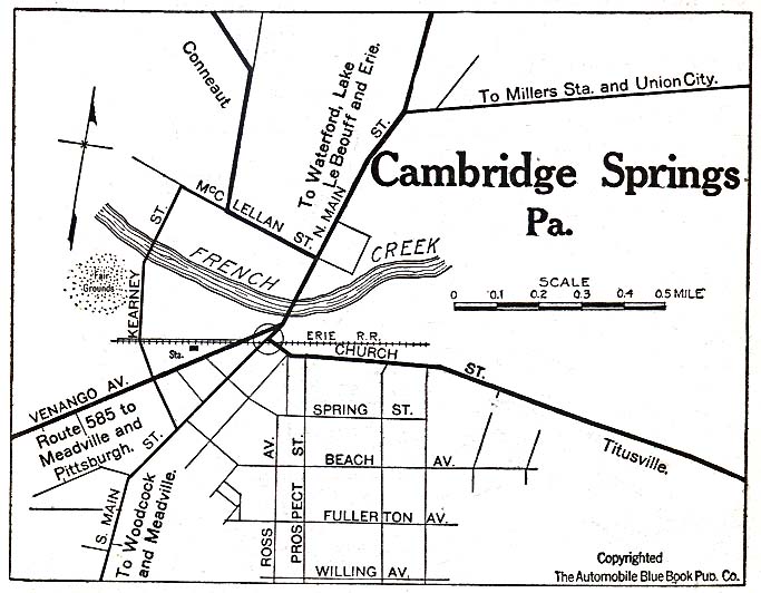
Cambridge Springs 1920 Automobile Blue Book (117K)
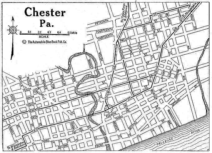
Chester 1920 Automobile Blue Book (176K)
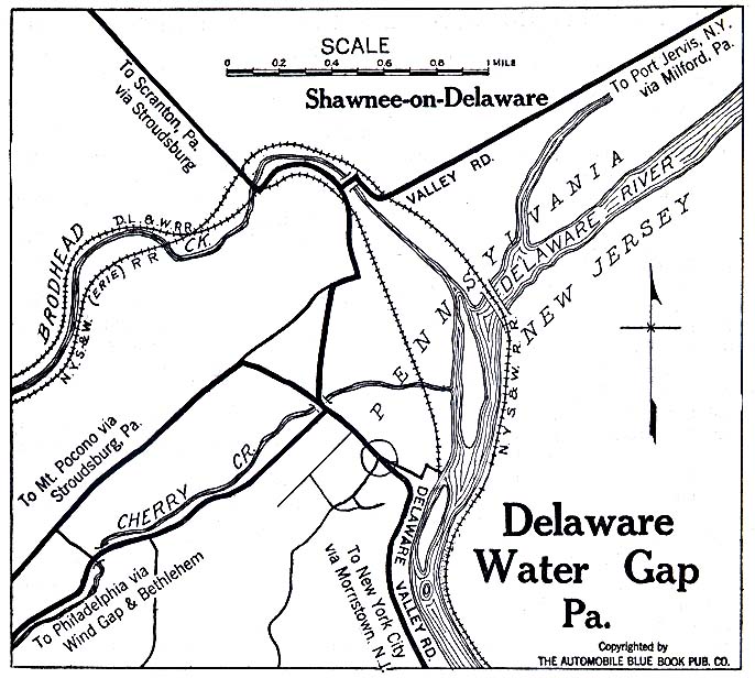
Delaware Water Gap 1920 Automobile Blue Book (137K)
Eagles Mere 1920 Automobile Blue Book (137K)
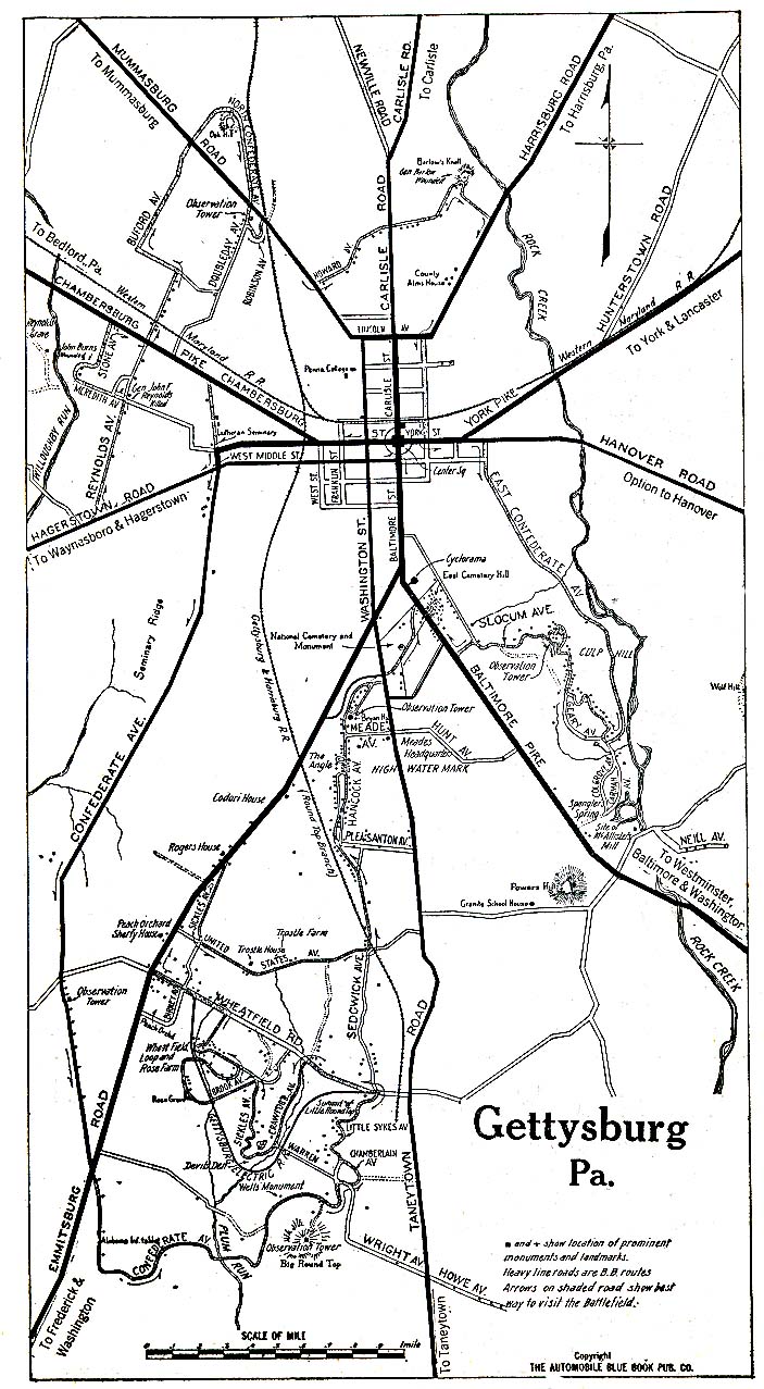
Gettysburg 1920 Automobile Blue Book (273K)
Lancaster 1920 Automobile Blue Book (156K)
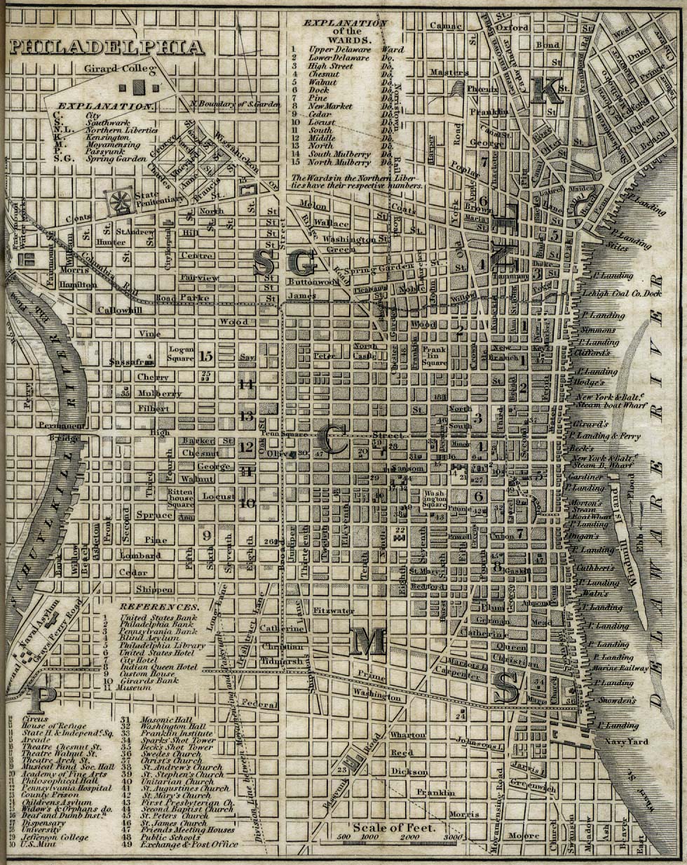
Philadelphia 1842 "Philadelphia" from Tanner, H.S. The American Traveller; or Guide Through the United States. Eighth Edition. New York, 1842. (341K)
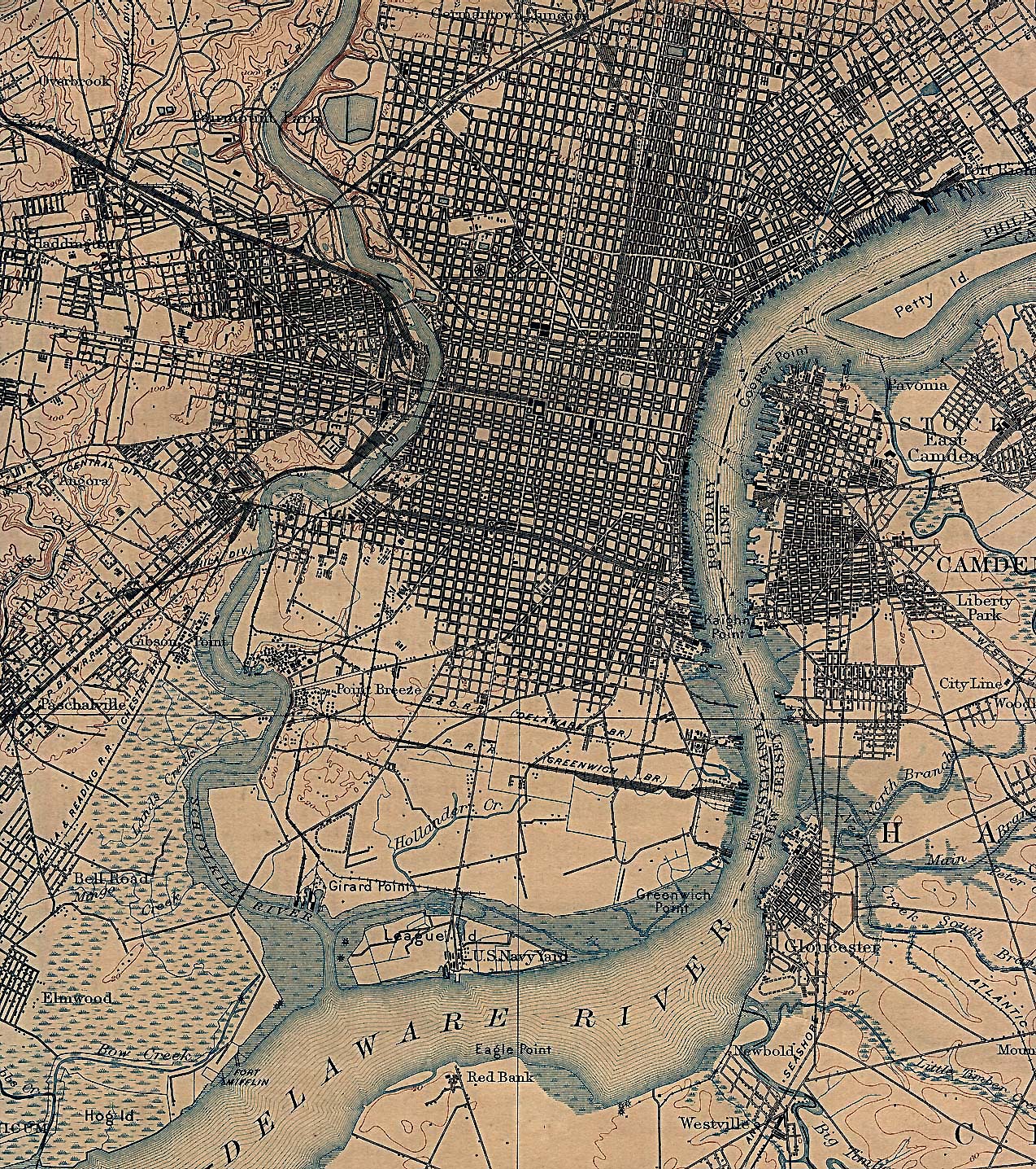
Philadelphia 1898 U.S. Geological Survey (1,029K)
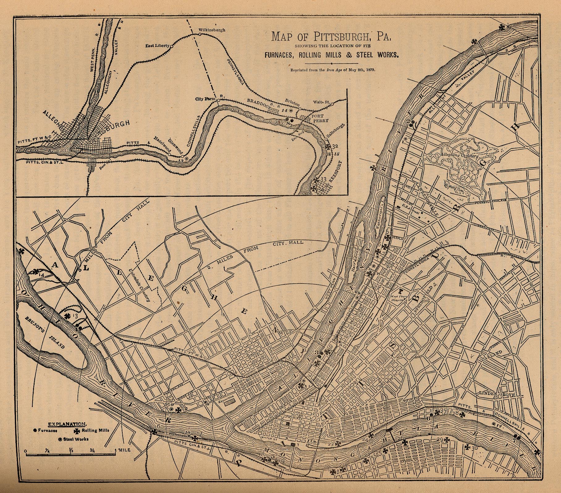
Pittsburgh 1879 "Map of Pittsburgh, Pa. Showing the Location of its Furnaces, Rolling Mills and Steel Works. Reprinted from the Iron Age of May 8th, 1879." From Report on the Social Statistics of Cities, Compiled by George E. Waring, Jr., United States. Census Office, Part II, 1887. (433K)
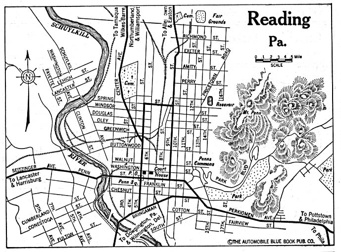
Reading 1920 Automobile Blue Book (156K)
Scranton 1920 Automobile Blue Book (176K)
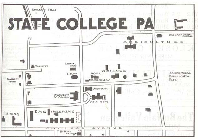
State College 1920 Automobile Blue Book 1920, Volume 3 (56K)
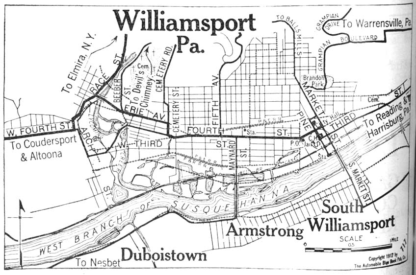
Williamsport 1917 Automobile Blue Book 1917, Vol. 3 (140K)
Maps of National Parks, Monuments, and Historic Sites
The following maps were produced by the U.S. National Park Service unless otherwise noted.
Allegheny Portage Railroad National Historic Site (Park Map) 1997 (65K) (PDF Format)
Delaware Water Gap National Recreation Area [Pennsylvania / New Jersey] (Park Map) 1998 (516K) (PDF Format)
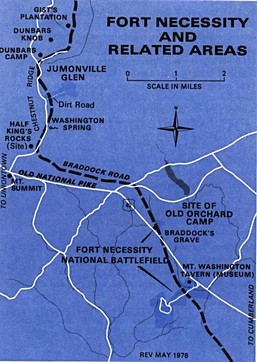
Fort Necessity National Battlefield (Area Map) 1976 (85K)
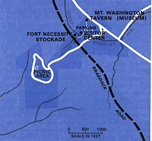
Fort Necessity National Battlefield (Park Map) 1976 (46K)
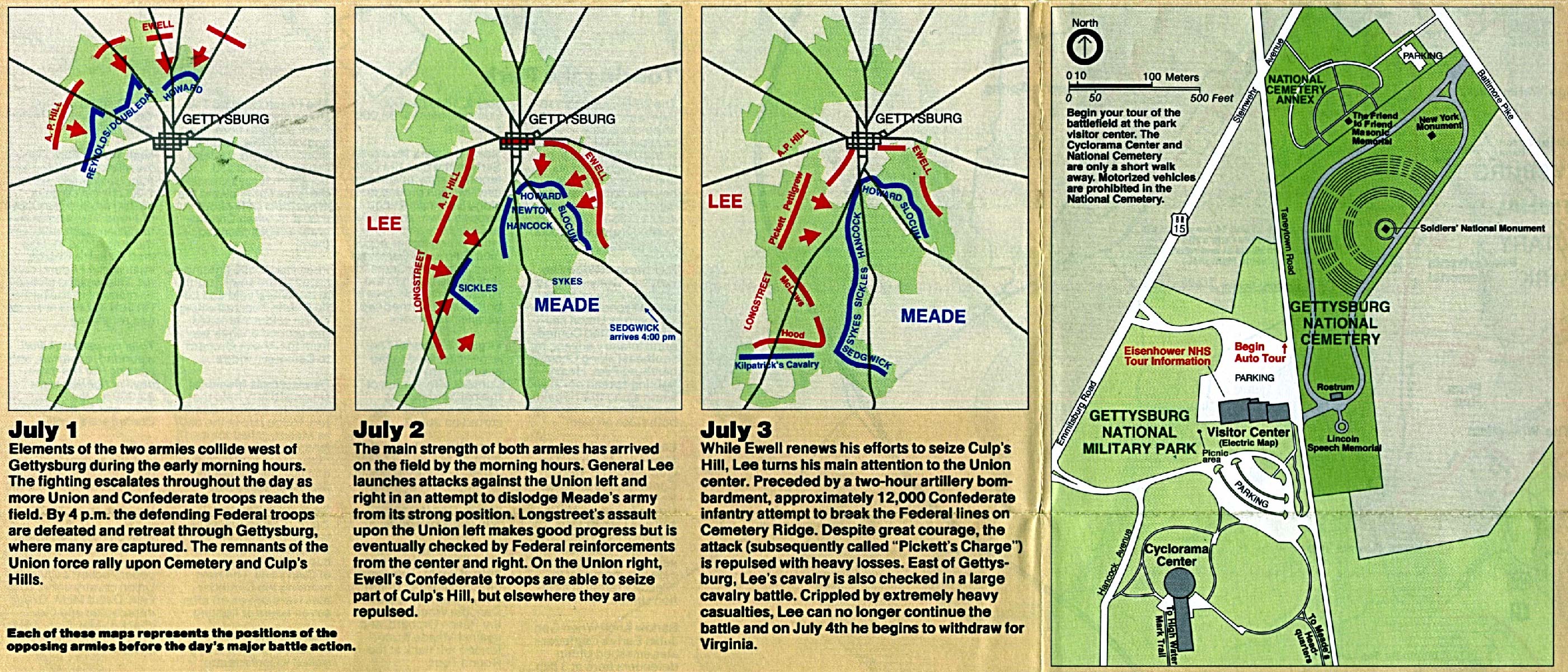
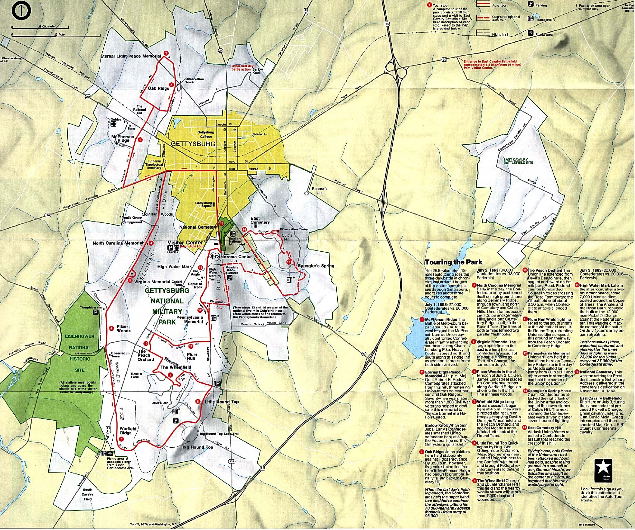
Gettysburg National Military Park (Battle Maps with Park Map) 1995 (970K)
Gettysburg National Military Park (Battle Map of July 1,1863) 1998 (65K) (PDF Format)
Gettysburg National Military Park (Battle Map of July 2,1863) 1998 (65K) (PDF Format)
Gettysburg National Military Park (Battle Map of July 3,1863) 1998 (65K) (PDF Format)
Gettysburg National Military Park (Park Map) (148K)
Gettysburg National Military Park (Park Map) 1998 (323K) (PDF Format)
Gettysburg National Military Park (Park Map / Shaded Relief) 1995 (995K)
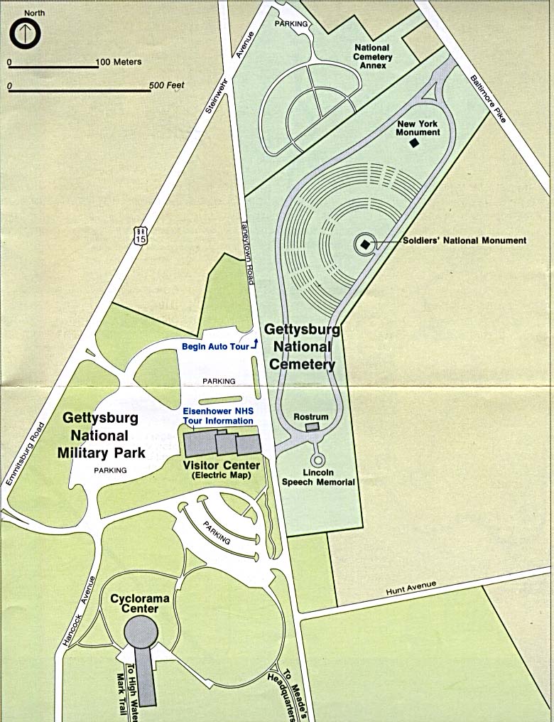
Gettysburg National Military Park - Visitor Center and National Cemetery (Detail Map) (65K) (PDF Format)
Hopewell Furnace National Historic Site (Location Map) 2006 (249K)
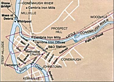
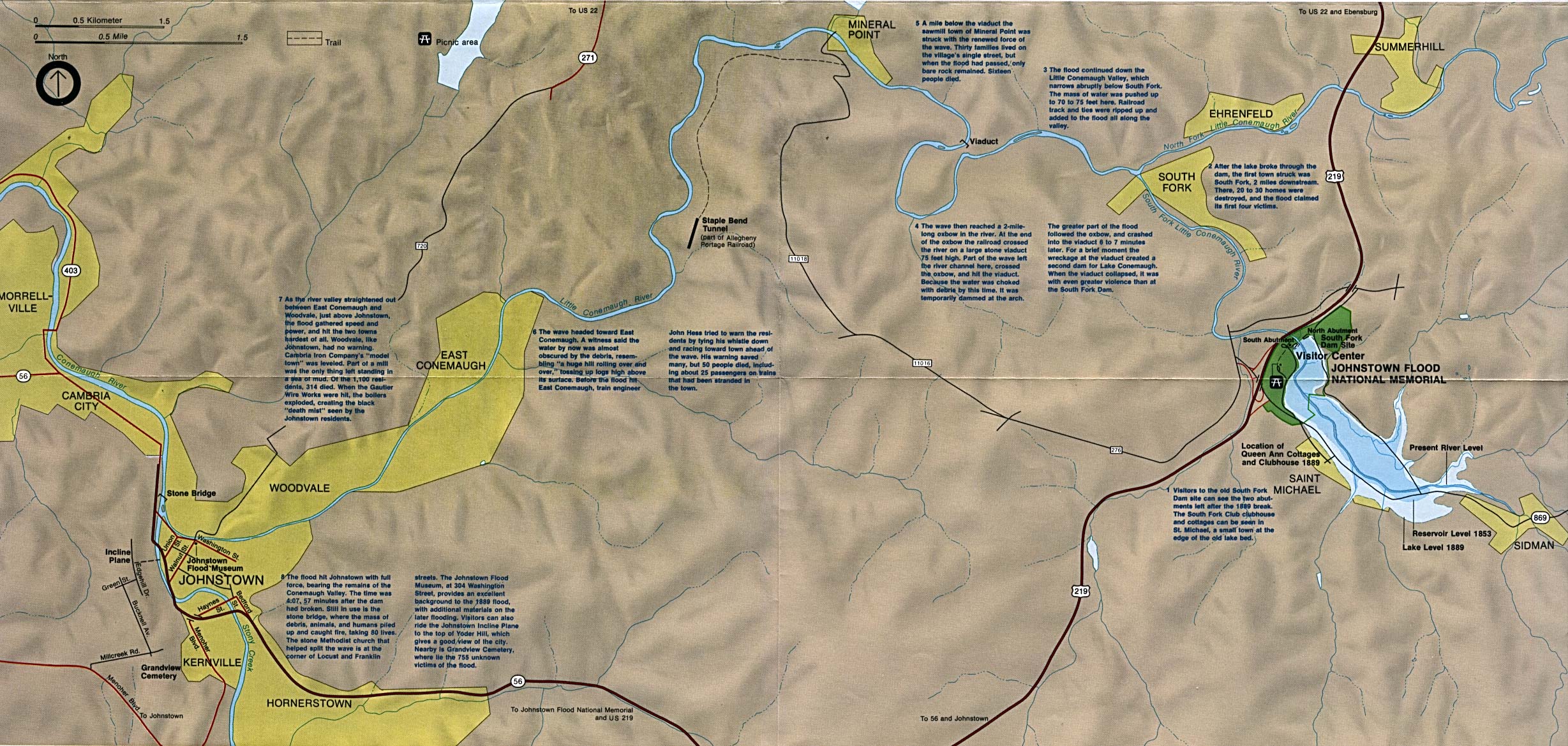
Johnstown Flood National Memorial (Flood Path Map) (32K)
Johnstown Flood National Memorial (Location Map) (586K)
Upper Delaware Scenic & Recreation River [Pennsylvania / New York] (Area Map) 1998 (65K) (PDF Format)
Upper Delaware Scenic & Recreation River [Pennsylvania / New York] (Park Map) 1998 (710K) (PDF Format)
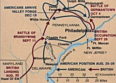
Valley Forge National Historical Park (Battle Map) (31K)
Valley Forge National Historical Park (Battle Map) 1997 (65K) (PDF Format)
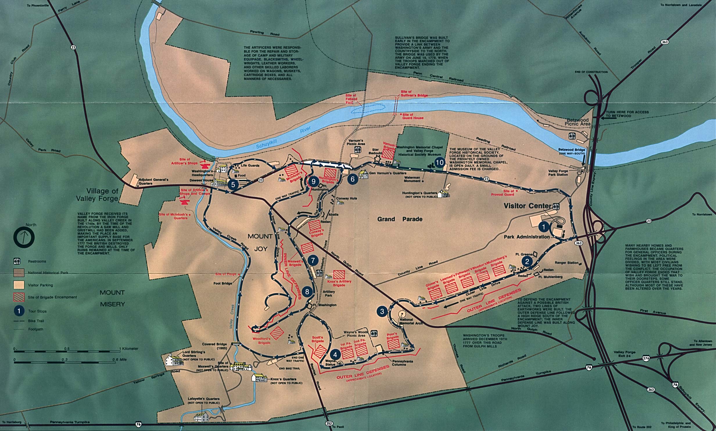
Valley Forge National Historical Park (Park Map) (625K)
Valley Forge National Historical Park (Park Map) 1997 (129K) (PDF Format)
See Also:
Topographic Maps
ArcGIS Shapefile Map Layers
<-- Free Maps
<-- Free U.S. State Maps
<-- Free World Country Maps
Didn't find what you are looking for? We've been online since 1996 and have created 1000's of pages. Search below and you may find just what you are looking for.
Michael R. Meuser
Data Research & GIS Specialist
MapCruzin.com is an independent firm
specializing in GIS project development and data research.
We created the first U.S. based
interactive toxic chemical facility
maps on the internet in 1996 and we
have been online ever since. Learn more about us and our services.
Have a project in mind? If you have data, GIS project or custom shapefile needs contact Mike.
Contact Us
Report Broken Links
Subscribe for Updates


![Philadelphia [Downtown] (topographic)](/free-state-maps/states/pennsylvania/philadelphia_pa_94.jpg)