Download Free Massachusetts Maps
<-- Free Maps
<-- Free U.S. State Maps
<-- Free World Country Maps
See Also:
Topographic Maps
ArcGIS Shapefile Map Layers
Download or link to these maps for your reports, websites, research, projects, presentations...
Note that maps may not appear on the webpage in their full size and resolution. To save the maps to your computer, right-click on the link.
State and Regional Maps
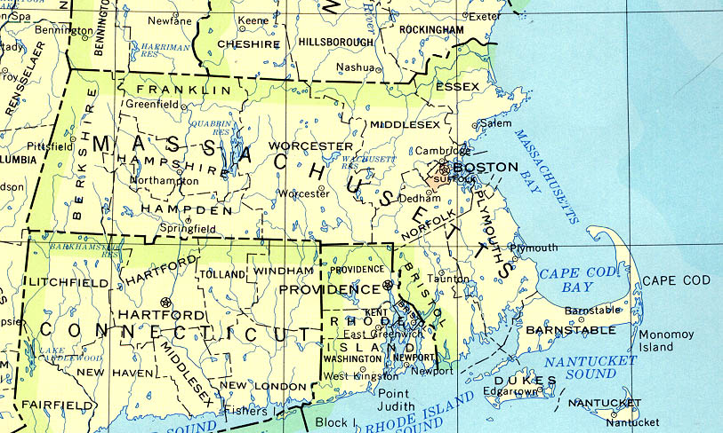
Massachusetts (base map) JPEG format (196K) County boundaries and names, county seats, rivers. Original scale 1:2,500,000 U.S. Geological Survey, 1972 limited update 1990
Massachusetts (outline map) JPEG format (59K) County boundaries and names. U.S. Bureau of the Census, 1990
Massachusetts - Federal Lands and Indian Reservations PDF format (499K) The National Atlas of the United States of America, U.S. Geological Survey, 2003
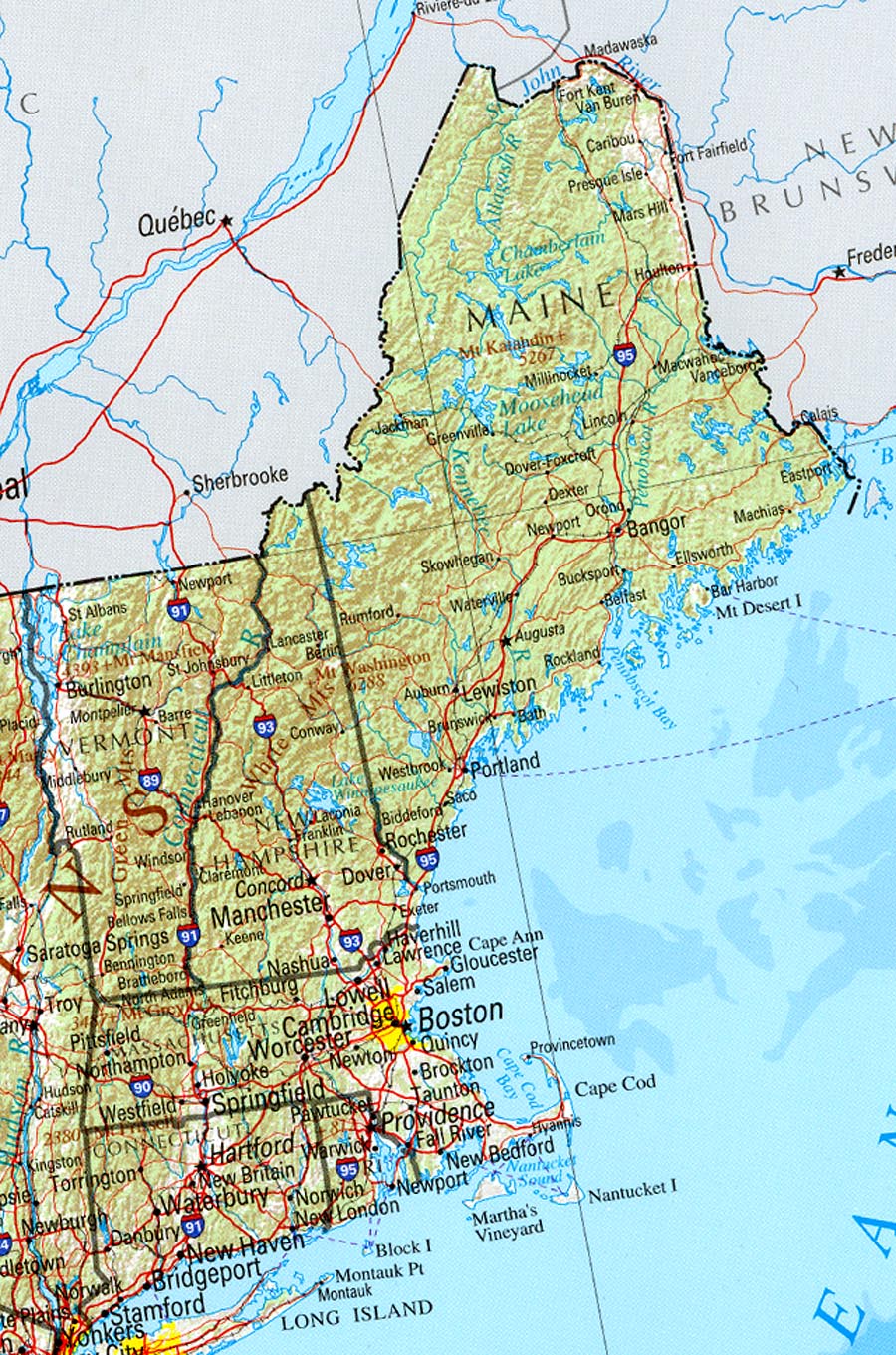
New England (reference map) JPEG format (385K) Shaded relief map with state boundaries, forest cover, place names, major highways. Portion of "The National Atlas of the United States of America. General Reference", compiled by U.S. Geological Survey 2001, printed 2002
New England (reference map) PDF format (388K) Shaded relief map with state boundaries, forest cover, place names, major highways. Portion of "The National Atlas of the United States of America. General Reference", compiled by U.S. Geological Survey 2001, printed 2002
City Maps
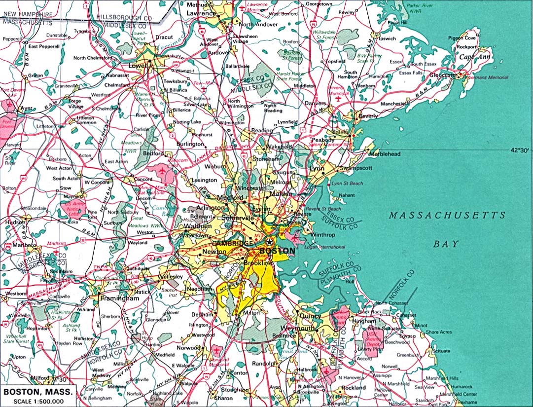
Boston original scale 1:500,000 U.S. National Atlas 1970 (308K)
Historical City Maps
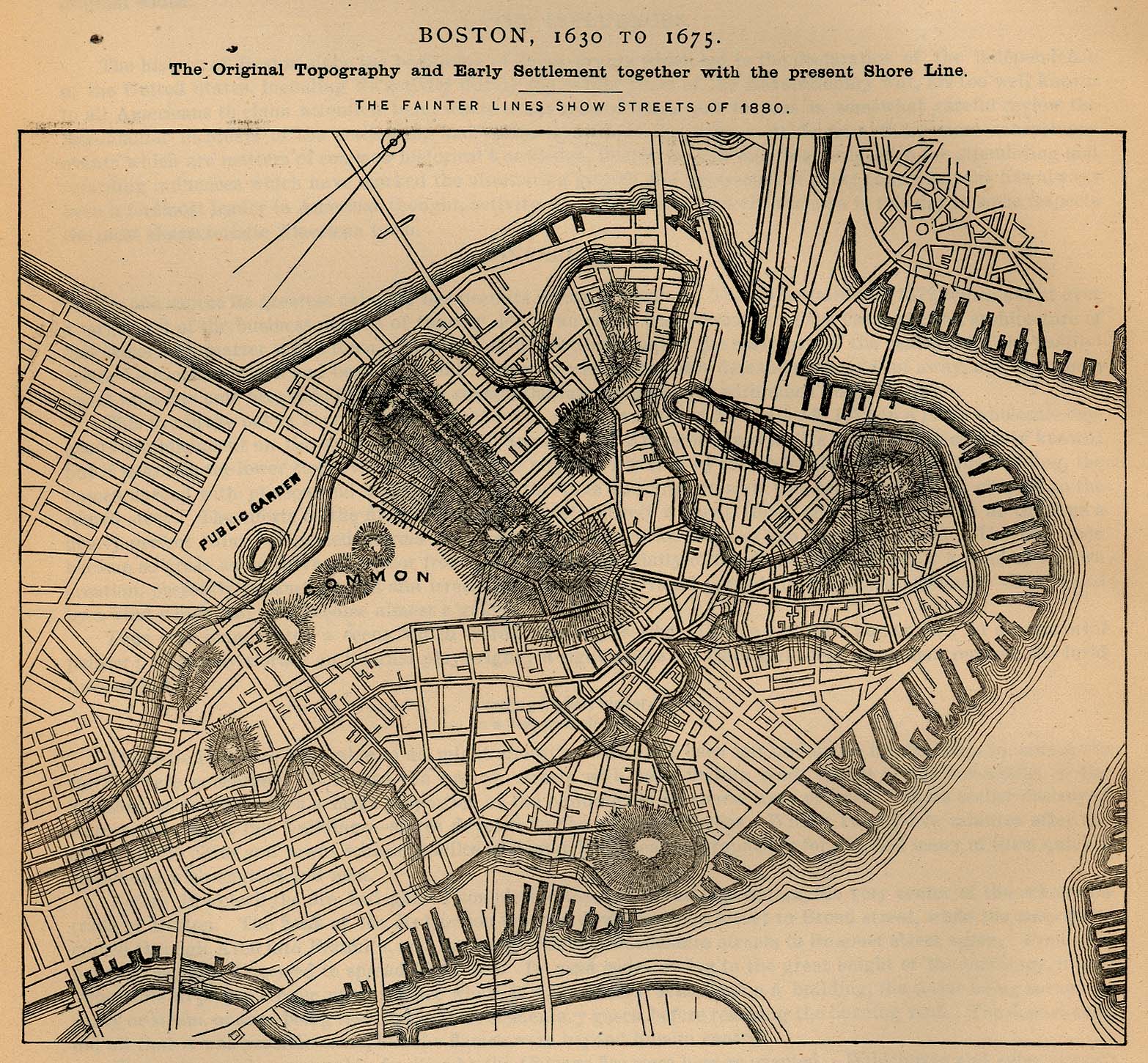
Boston 1630-1675 "Boston, 1630 to 1675. The Original Topography and Early Settlement together with the present Shore Line" "The fainter lines show streets of 1880." From Report on the Social Statistics of Cities, Compiled by George E. Waring, Jr., United States. Census Office, Part I, 1886. (648K)
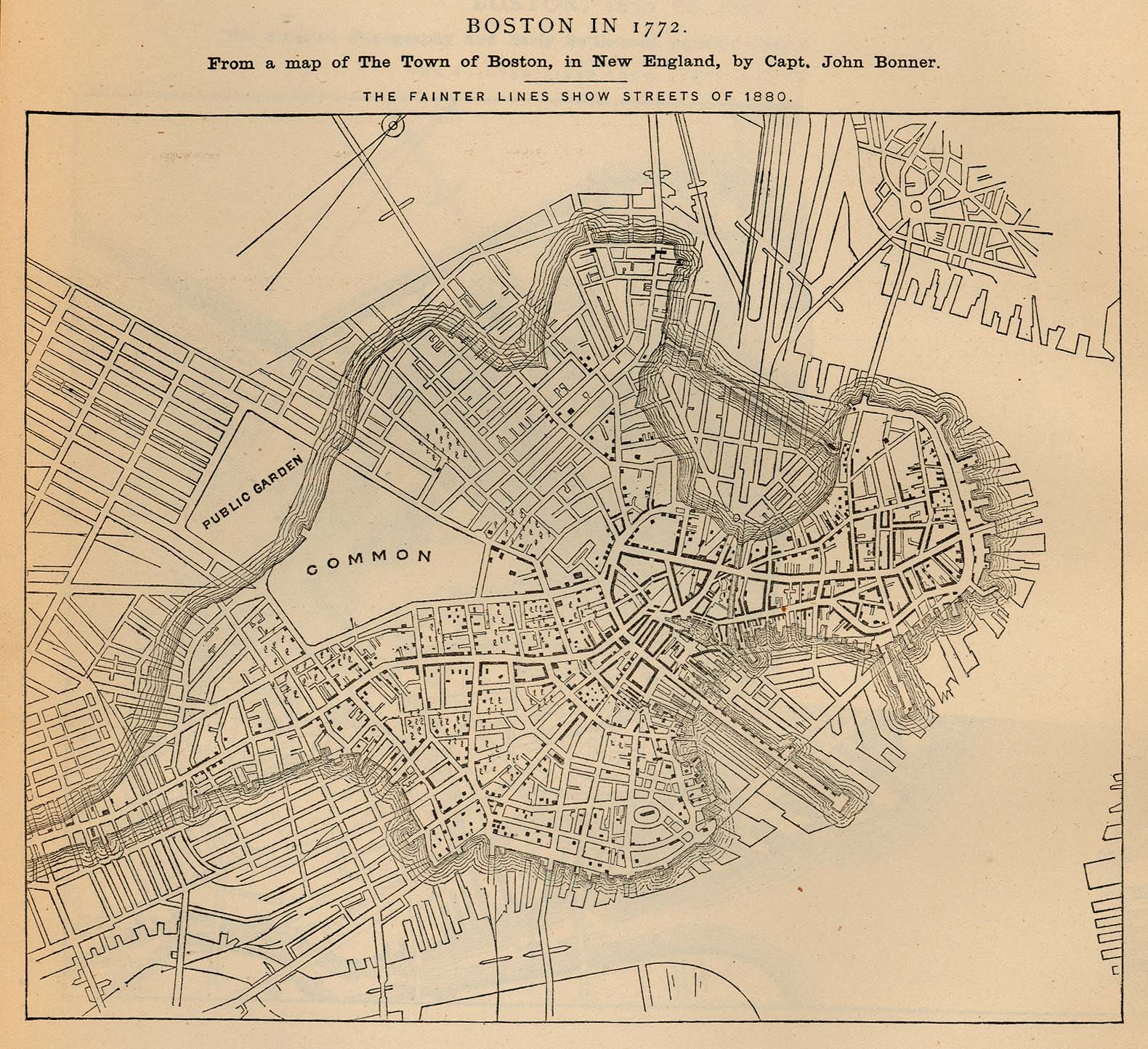
Boston 1772 "Boston in 1772. From a map of The Town of Boston, in New England, by Capt. John Bonner" "The fainter lines show streets of 1880." From Report on the Social Statistics of Cities, Compiled by George E. Waring, Jr., United States. Census Office, Part I, 1886. (491K)
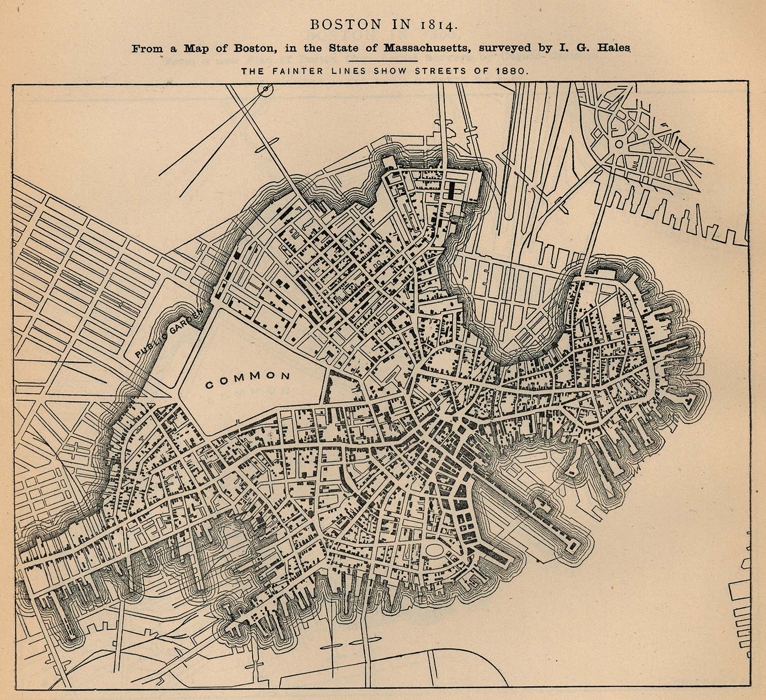
Boston 1814 "Boston in 1814. From a map of Boston, in the State of Massachusetts, Surveyed by I.G. Hales" "The fainter lines show streets of 1880." From Report on the Social Statistics of Cities, Compiled by George E. Waring, Jr., United States. Census Office, Part I, 1886. (574K)
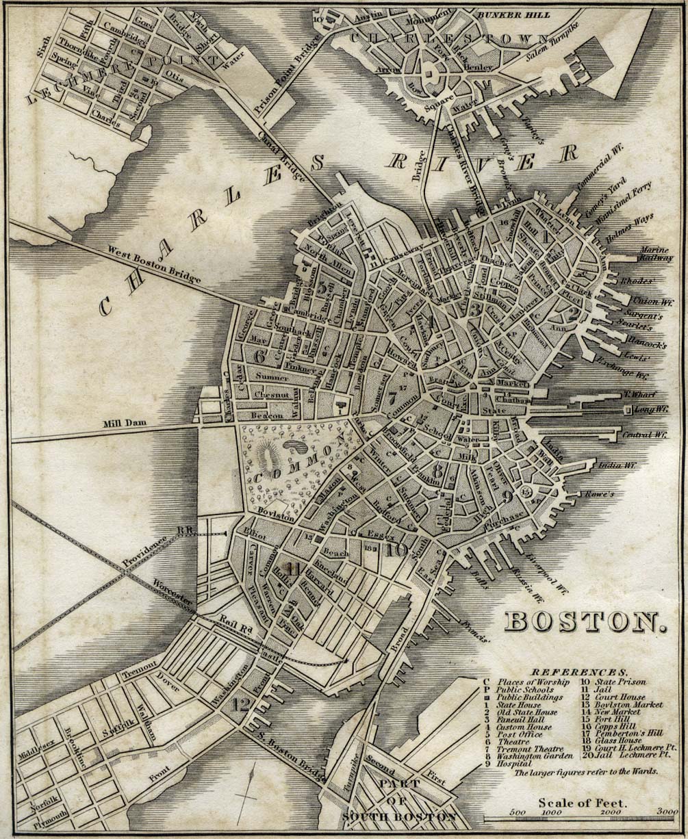
Boston 1842 "Boston" from Tanner, H.S. The American Traveller; or Guide Through the United States. Eighth Edition. New York, 1842. (341K)
Boston 1880 - All Ground Occupied by Buildings
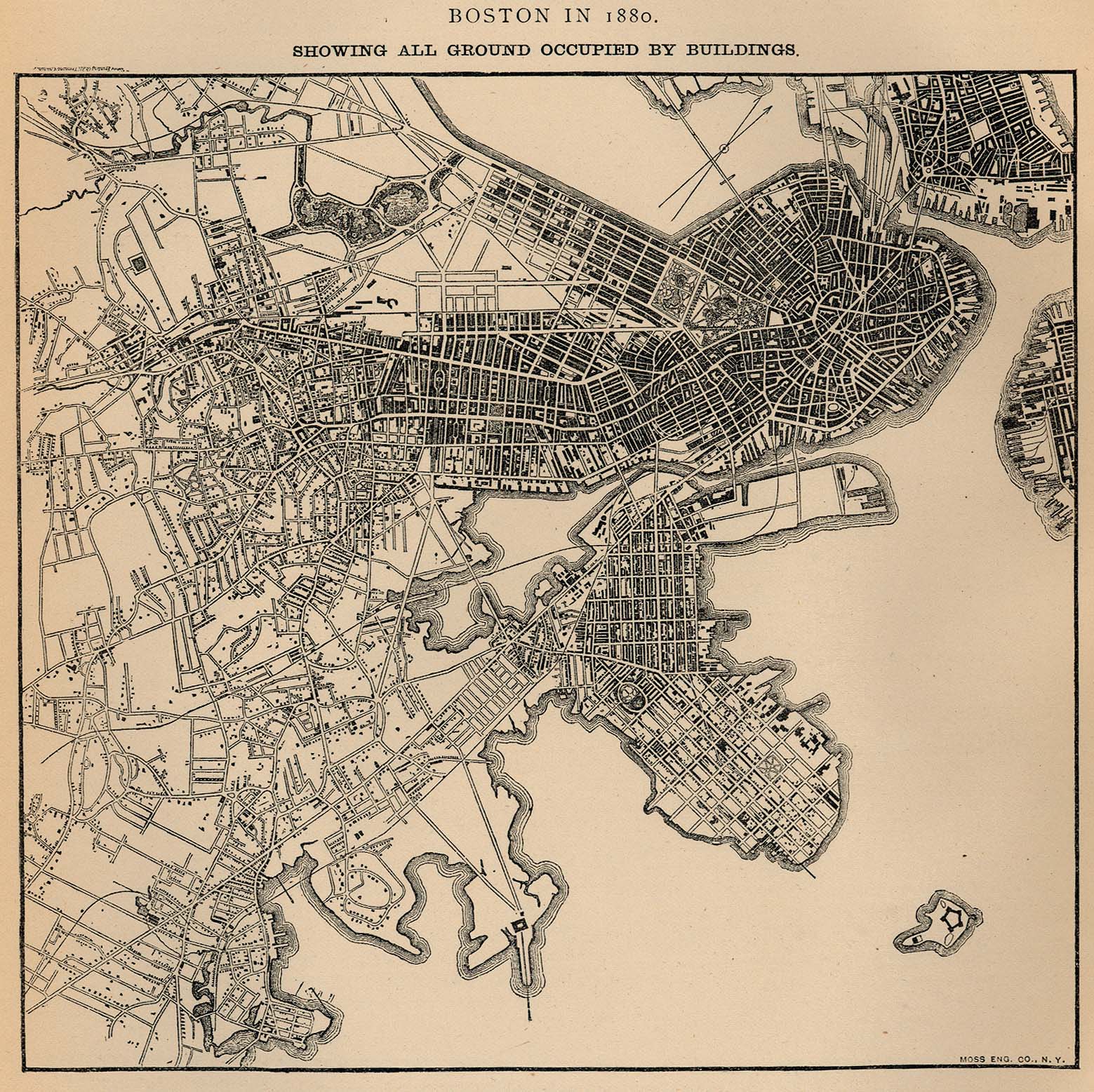
"Boston in 1880. Showing All Ground Occupied by Buildings." From Report on the Social Statistics of Cities, Compiled by George E. Waring, Jr., United States. Census Office, Part I, 1886. (611K)
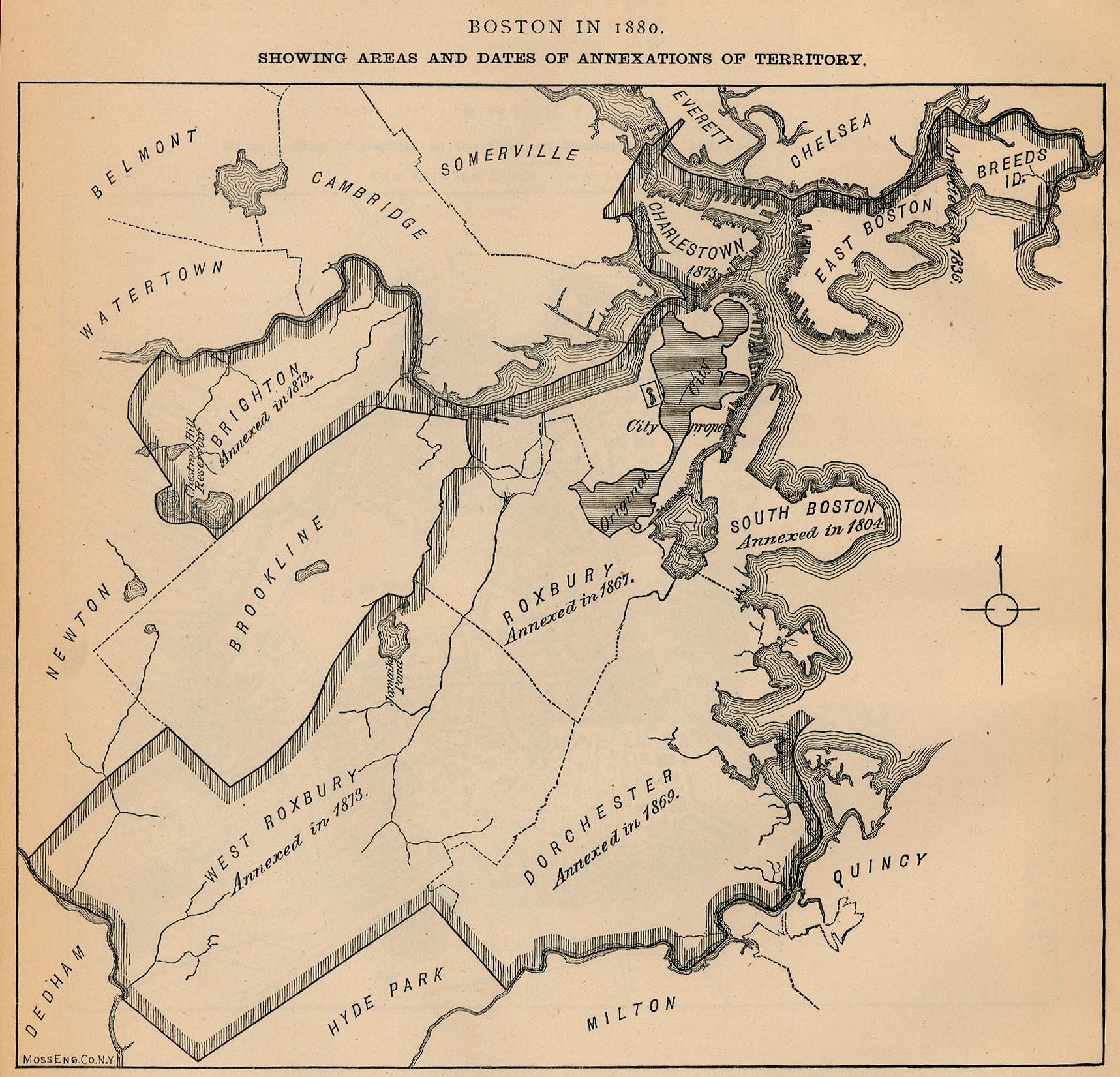
Boston 1880 - Areas and Dates of Annexations of Territory
"Boston in 1880. Showing Areas and Dates of Annexations of Territory." From Report on the Social Statistics of Cities, Compiled by George E. Waring, Jr., United States. Census Office, Part I, 1886. (429K)
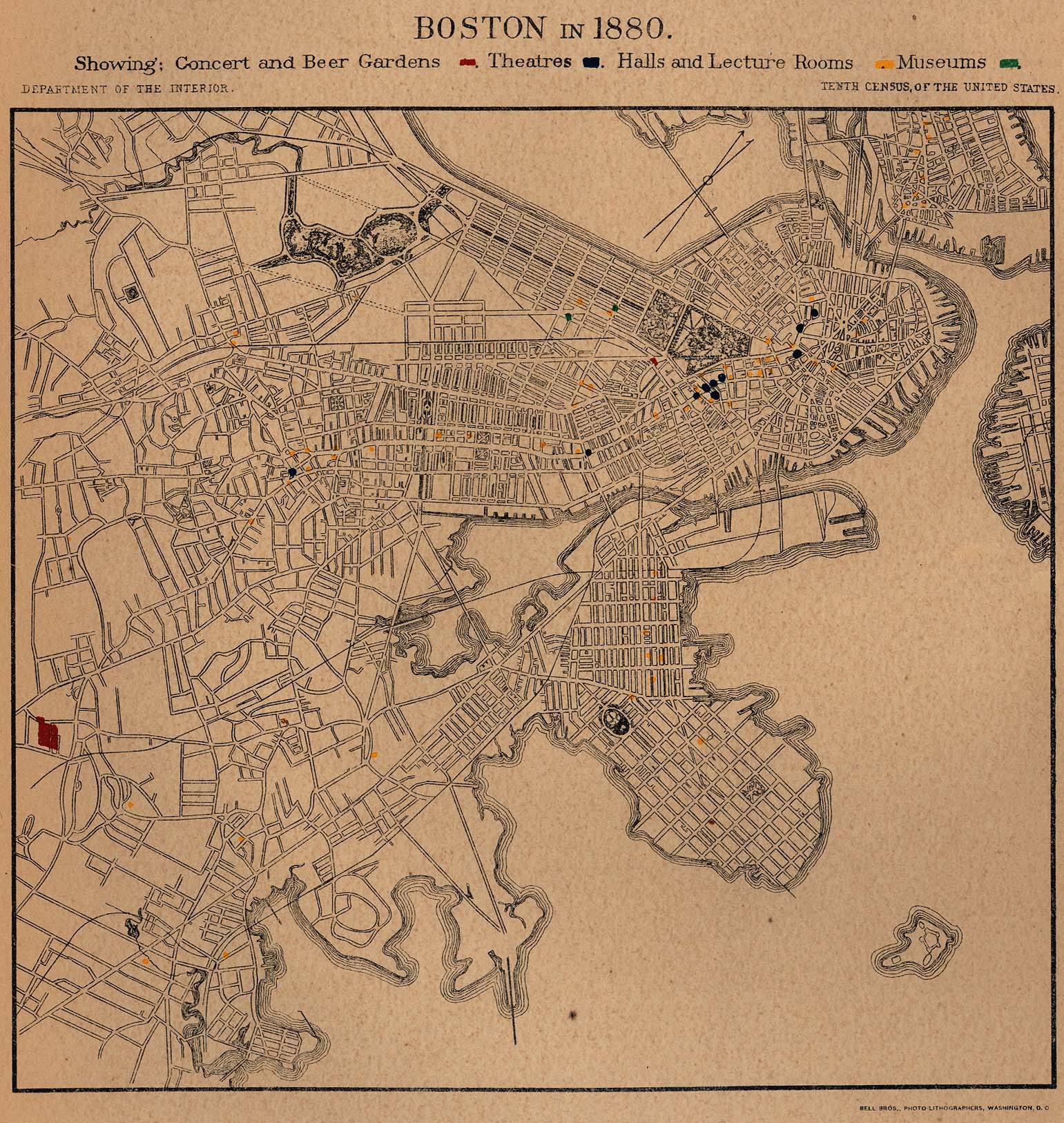
Boston 1880 - Concert and Beer Gardens, Theatres, Halls and Lecture Rooms, Museums
"Boston in 1880. Showing Concert and Beer Gardens, Theatres, Halls and Lecture Rooms, Museums." From Report on the Social Statistics of Cities, Compiled by George E. Waring, Jr., United States. Census Office, Part I, 1886. (618K)
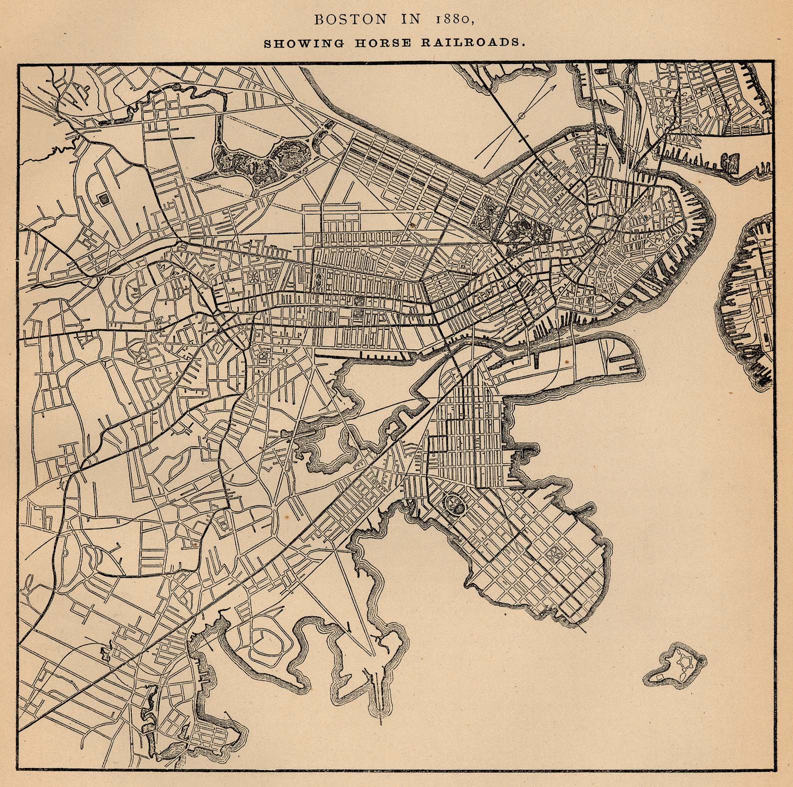
Boston 1880 - Horse Railroads
"Boston in 1880. Showing Horse Railroads." From Report on the Social Statistics of Cities, Compiled by George E. Waring, Jr., United States. Census Office, Part I, 1886. (661K)
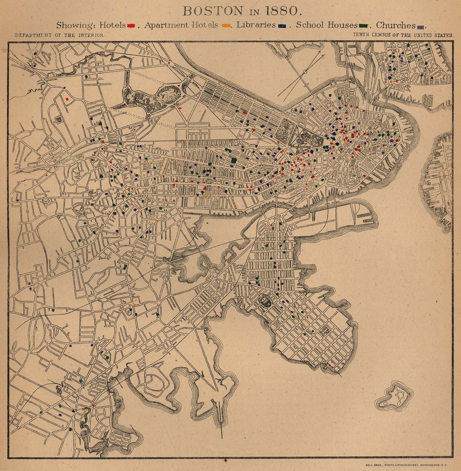
Boston 1880 - Hotels, Apartment Hotels, Libraries, School Houses, Churches
"Boston in 1880. Showing: Hotels, Apartment Hotels, Libraries, School Houses, Churches." From Report on the Social Statistics of Cities, Compiled by George E. Waring, Jr., United States. Census Office, Part I, 1886. (575K)
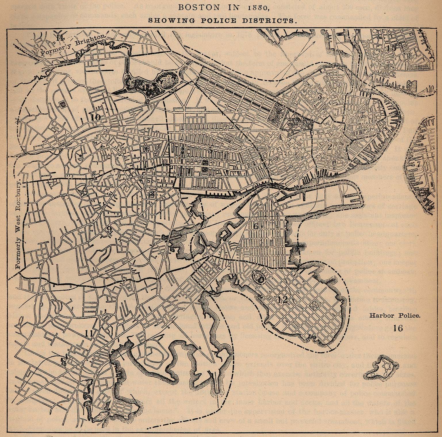
Boston 1880 - Police Districts
"Boston in 1880. Showing Police Districts." From Report on the Social Statistics of Cities, Compiled by George E. Waring, Jr., United States. Census Office, Part I, 1886. (683K)
Boston 1880 - Societies-Secret and Benefit, Hospitals, Asylums and Homes
"Boston in 1880. Showing Societies-Secret and Benefit, Hospitals, Asylums and Homes." From Report on the Social Statistics of Cities, Compiled by George E. Waring, Jr., United States. Census Office, Part I, 1886. (609K)
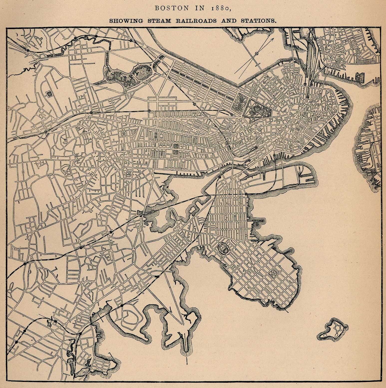
Boston 1880 - Steam Railroads and Stations
"Boston in 1880. Showing Steam Railroads and Stations." From Report on the Social Statistics of Cities, Compiled by George E. Waring, Jr., United States. Census Office, Part I, 1886. (655K)
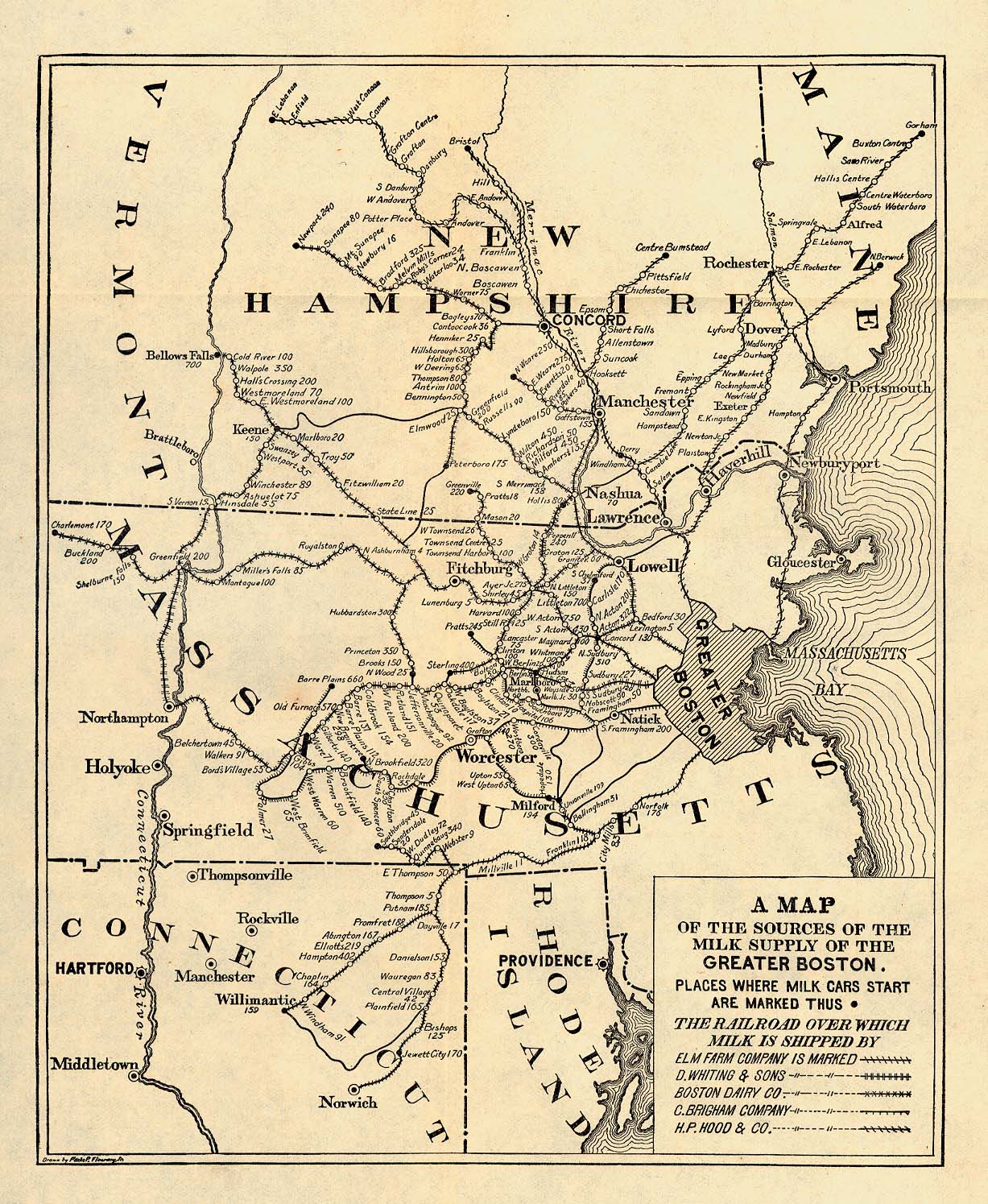
Boston 1901
"A Map of the Sources of the Milk Supply of the Greater Boston." From Report of the Industrial Commission on the Distribution of Farm Products. Volume VI of the Commission's Reports. House of Representatives, 1901. (663K)
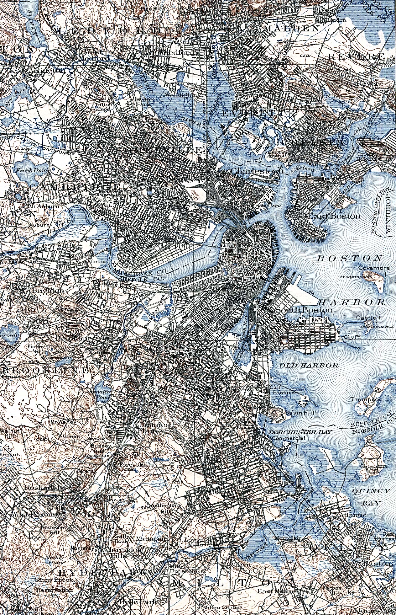
Boston 1903 U.S. Geological Survey (1,624K)
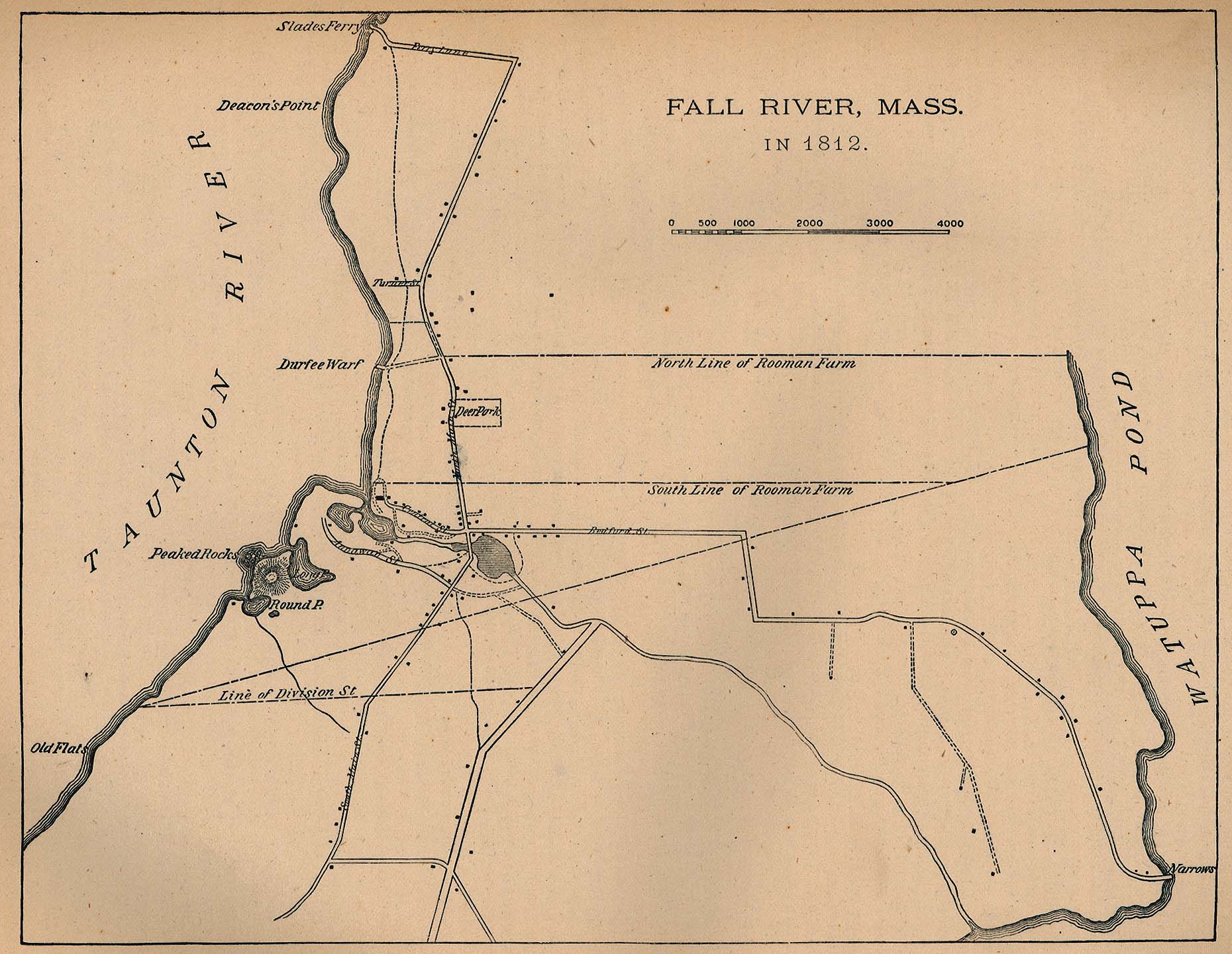
Fall River 1812 From Report on the Social Statistics of Cities, Compiled by George E. Waring, Jr., United States. Census Office, Part II, 1887. (323K)
Maps of National Parks, Monuments, and Historic Sites
The following maps were produced by the U.S. National Park Service unless otherwise noted.
Blackstone River Valley National Heritage Corridor [Massachusetts / Rhode Island] (Park Map) 1998 (645K) (PDF Format)
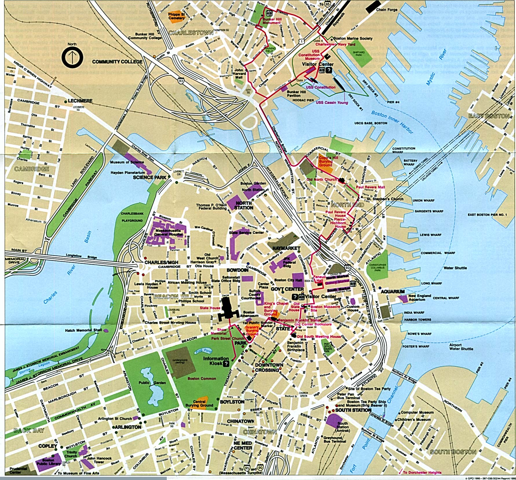
Boston National Historic Park (Historic City Locations Map) 1995 (698K)
Boston National Historic Park (Historic City Locations Map) 1999 (258K) (PDF Format)
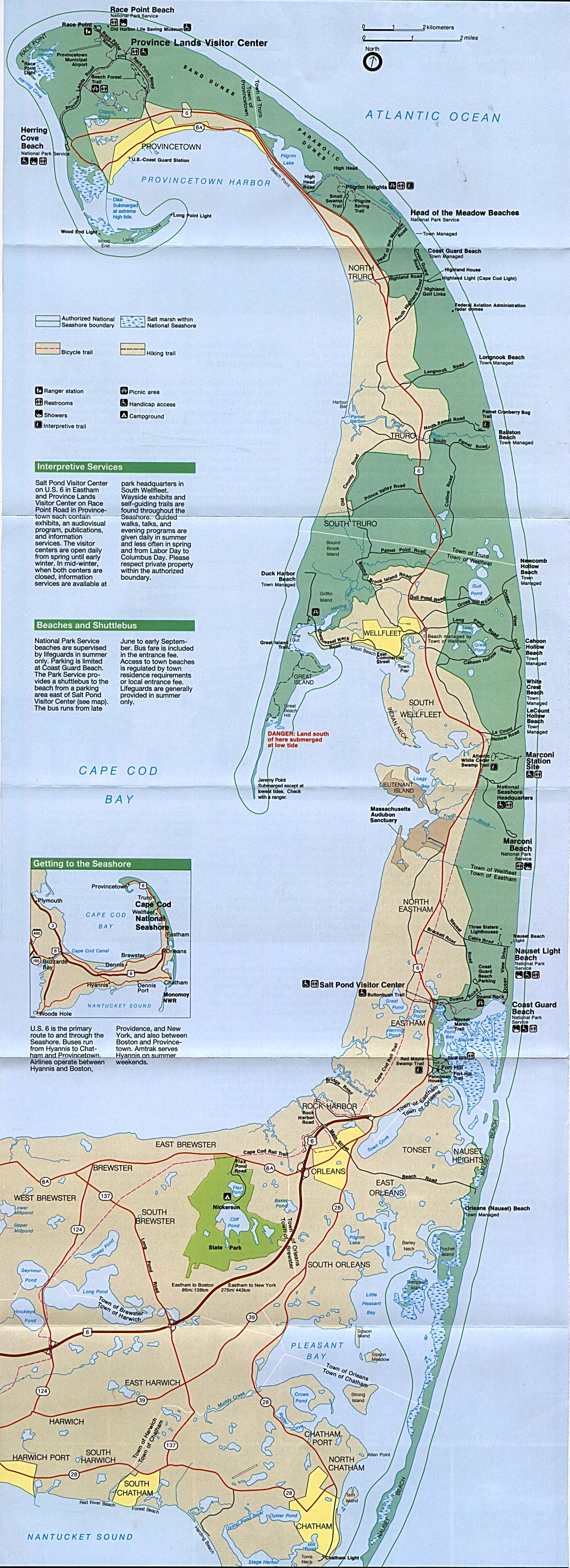
Cape Cod National Seashore (Park Map) 1995 (834K)
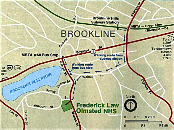
Frederick Law Olmsted National Historic Site (Location Map) 1992 (102K)
Gerry E. Studds Stellwagen Bank National Marine Sanctuary (NOAA) (681K)
Sources: Many of these maps were provided by the University of Texas Library and/or the U.S. Central Intelligence Agency (CIA).
Maps on other websites
Massachusetts (Information Please)
Massachusetts - County Names (Census Bureau)
Massachusetts - GIS Data (Mass.gov)
Massachusetts - Maps (Geology.com)
Massachusetts - Road Map (World Sites Atlas)
Massachusetts - Satellite Image (Geology.com)
Massachusetts - Topographic Maps (Libre Map Project)
Massachusetts - Topographic Maps (Mass.gov)
See Also:
Topographic Maps
ArcGIS Shapefile Map Layers
<-- Free Maps
<-- Free U.S. State Maps
<-- Free World Country Maps
Didn't find what you are looking for? We've been online since 1996 and have created 1000's of pages. Search below and you may find just what you are looking for.
Michael R. Meuser
Data Research & GIS Specialist
MapCruzin.com is an independent firm
specializing in GIS project development and data research.
We created the first U.S. based
interactive toxic chemical facility
maps on the internet in 1996 and we
have been online ever since. Learn more about us and our services.
Have a project in mind? If you have data, GIS project or custom shapefile needs contact Mike.
Contact Us
Report Broken Links
Subscribe for Updates
Sponsors


