Download Free Maryland Maps
<-- Free Maps
<-- Free U.S. State Maps
<-- Free World Country Maps
See Also:
Topographic Maps
ArcGIS Shapefile Map Layers
Download or link to these maps for your reports, websites, research, projects, presentations...
Note that maps may not appear on the webpage in their full size and resolution. To save the maps to your computer, right-click on the link.
State Maps
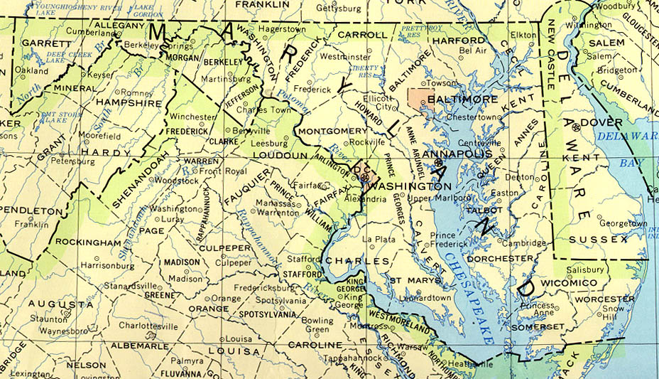
Maryland (base map) JPEG format (247K) County boundaries and names, county seats, rivers. Original scale 1:2,500,000 U.S. Geological Survey, 1972 limited update 1990
Maryland (outline map) JPEG format (77K) County boundaries and names. U.S. Bureau of the Census, 1990
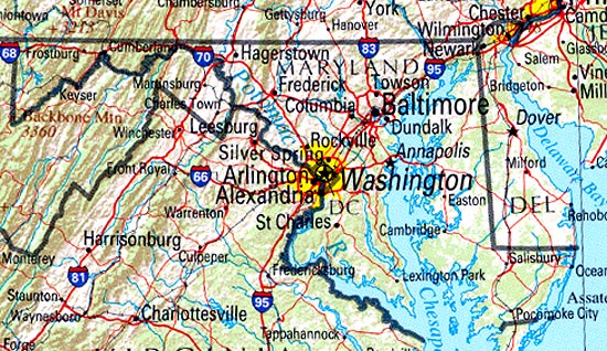
Maryland (reference map) JPEG format (196K) Shaded relief map with state boundaries, forest cover, place names, major highways. Portion of "The National Atlas of the United States of America. General Reference", compiled by U.S. Geological Survey 2001, printed 2002
Maryland (reference map) PDF format (144K) Shaded relief map with state boundaries, forest cover, place names, major highways. Portion of "The National Atlas of the United States of America. General Reference", compiled by U.S. Geological Survey 2001, printed 2002
Maryland - Federal Lands and Indian Reservations PDF format (517K) The National Atlas of the United States of America, U.S. Geological Survey, 2003
City Maps
Baltimore original scale 1:500,000 U.S.National Atlas 1970 (665K)
Detailed Maps
Camp David (Camp 3) (topographic) original scale 1:24,000 Portion of U.S.G.S. Blue Ridge Summit Md. 1953, photorevised 1971 (321K)
Historical Maps
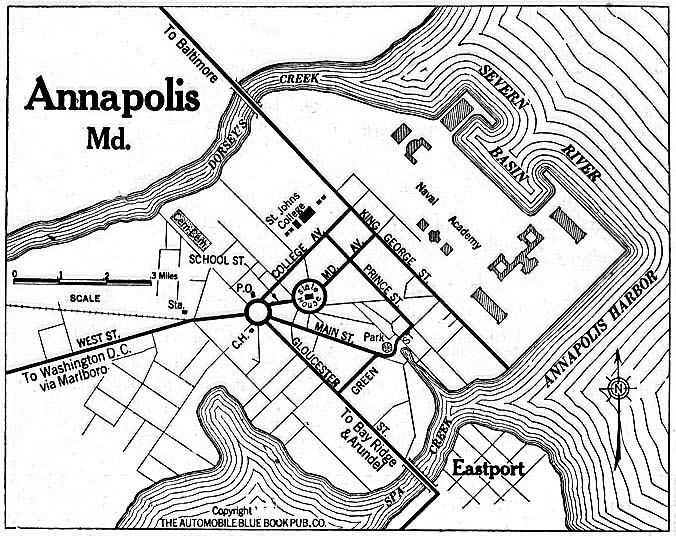
Annapolis 1920 Automobile Blue Book (156K)
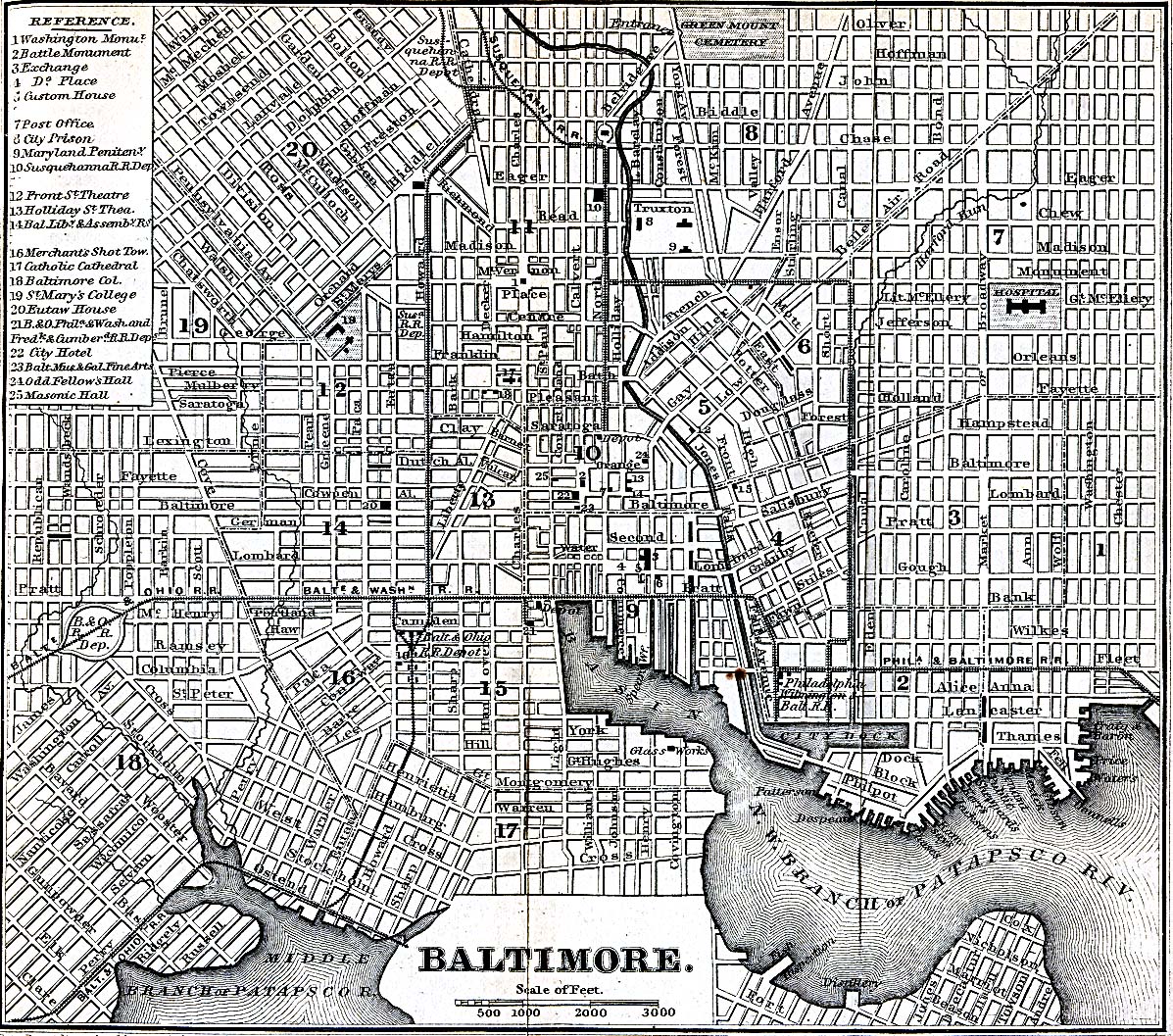
Baltimore, Maryland 1848 Appletons' Hand-Book of American Travel. New York: D. Appleton and Company, 1869 (723K)
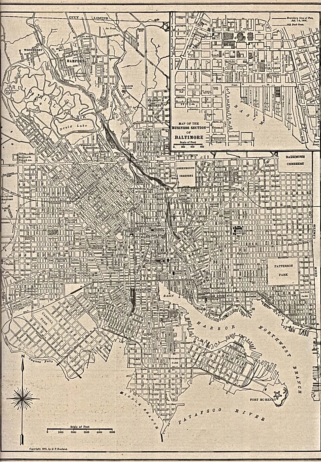
Baltimore 1905 The New Encyclopedic Atlas and Gazetteer of the World. New York: P.F. Collier & Son. 1917 (968K)
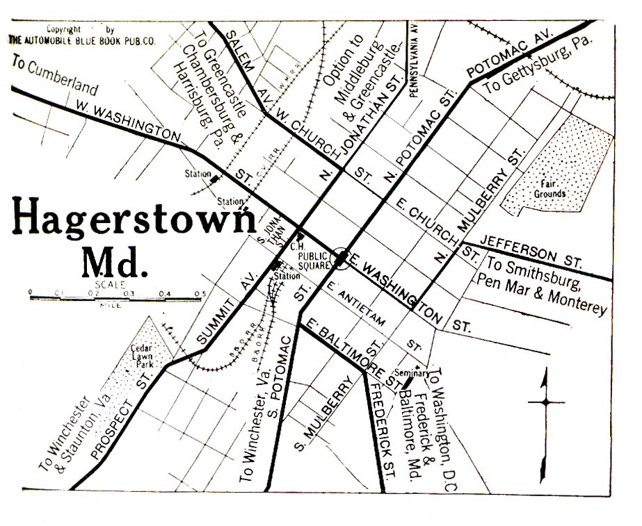
Hagerstown 1920 Automobile Blue Book (323K)
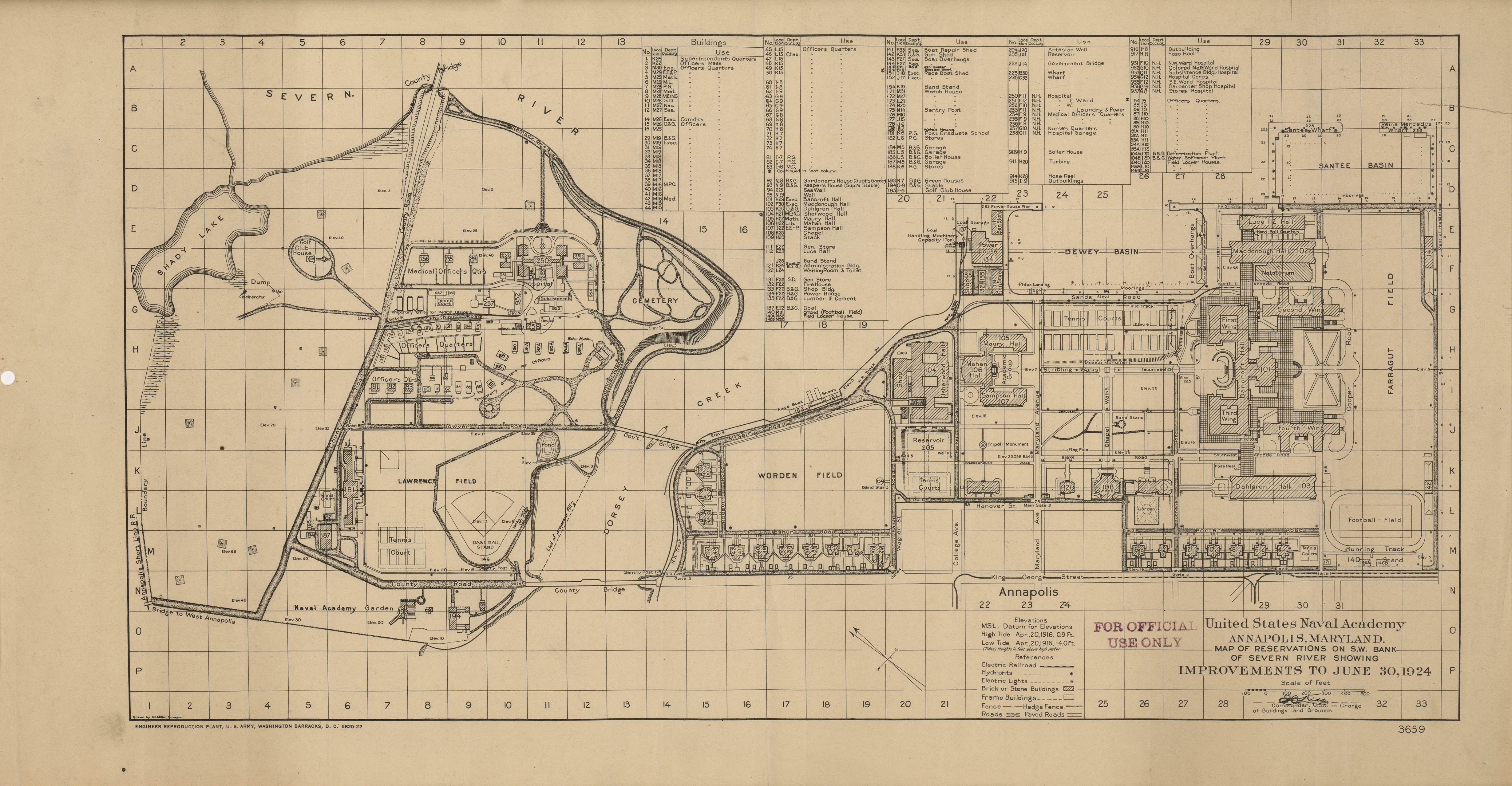
U.S. Naval Academy 1924 (1.7 MB)
"United States Naval Academy, Annapolis, Maryland, Map of Reservations on S.W. Bank of Severn River
showing Improvements to June, 1924"
Maps of National Parks, Monuments, and Historic Sites
The following maps were produced by the U.S. National Park Service unless otherwise noted.
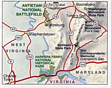
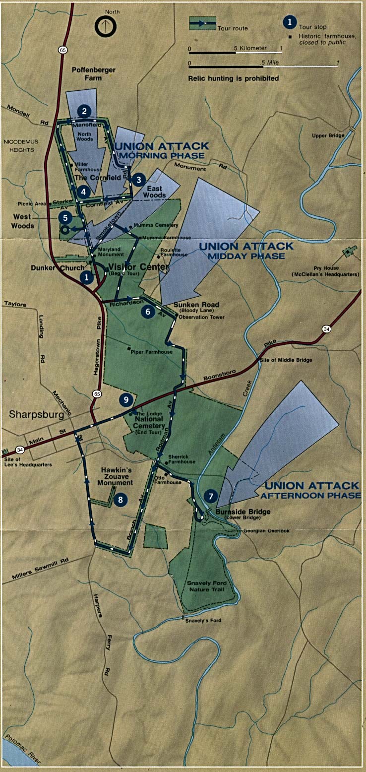
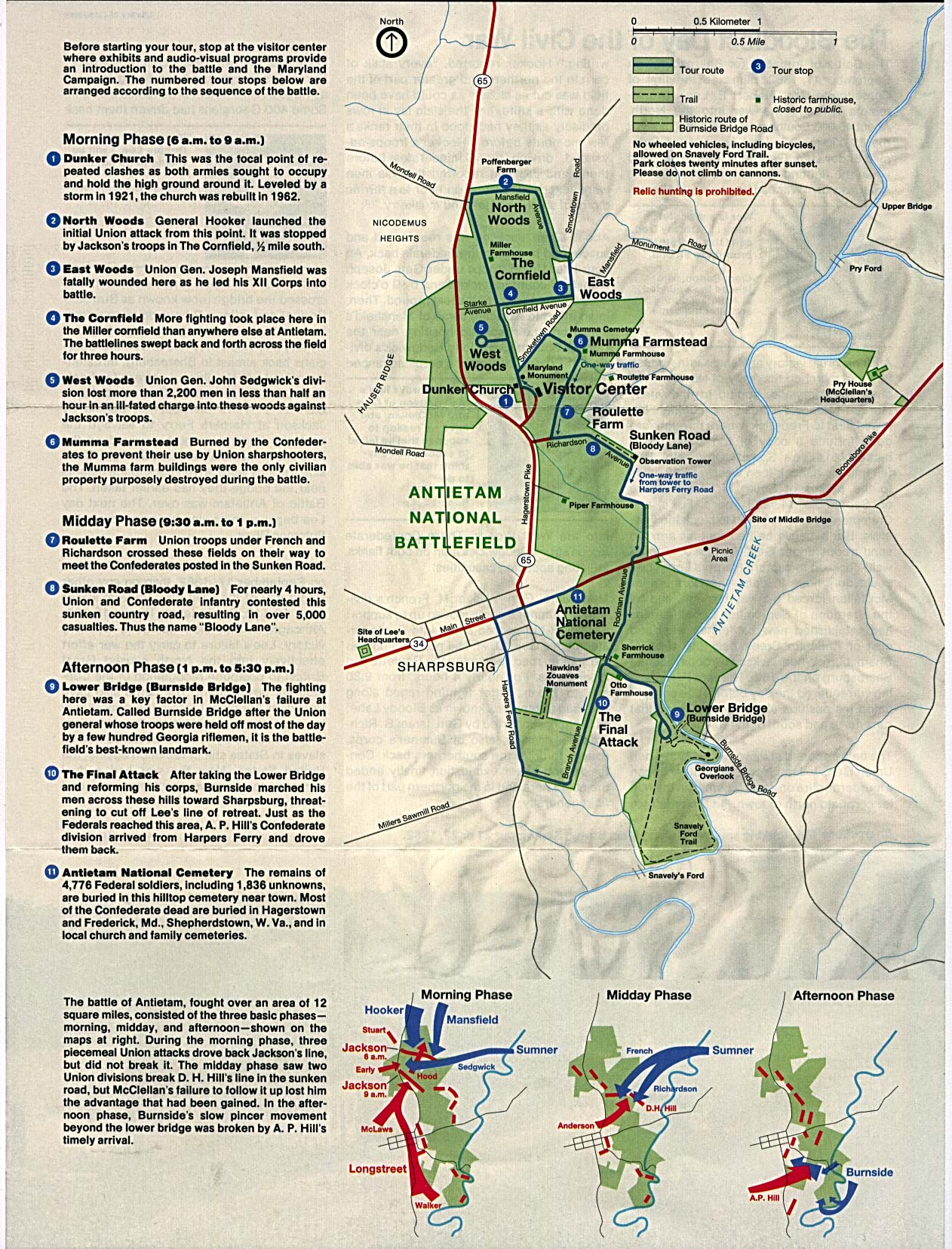
Antietam National Battlefield (Area Map) 1995 (37K)
Antietam National Battlefield (Area Map) 1995 (65K) (PDF Format)
Antietam National Battlefield (Battle Map) (236K)
Antietam National Battlefield (Battle Map) 1995 (65K) (PDF Format)
Antietam National Battlefield (Park Map) 1995 (129K) (PDF Format)
Antietam National Battlefield (Park Map with Battle Maps) 1995 (554K)
Assateague Island National Seashore (Park Map) 1995 (384K)
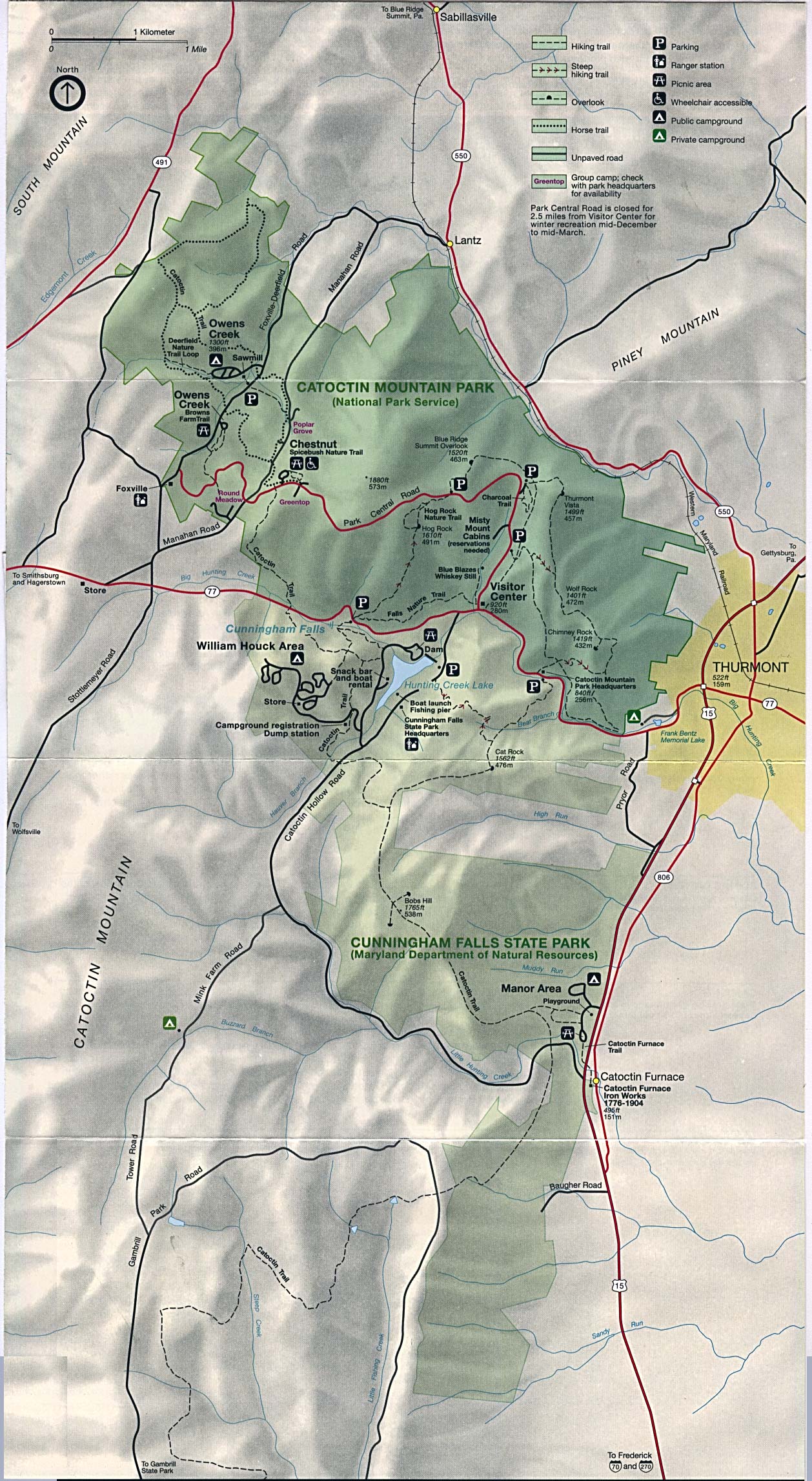
Catoctin Mountain Park (Park Map) 1995 (588K)
Catoctin Mountain Park (Park Map) 1997 (194K) (PDF Format)
Chesapeake and Ohio Canal National Historic Park [Maryland / Washington, DC / West Virginia] (Area Map) 1996 (273K)
Chesapeake and Ohio Canal National Historic Park [Maryland / Washington, DC / West Virginia] (Detail Map) 1999 (258) (PDF Format)
Chesapeake and Ohio Canal National Historic Park [Maryland / Washington, DC / West Virginia] (Park Map) 1996 (936K)
George Washington Memorial Parkway [Maryland / Virginia / Washington D.C.] (Park Map) 1998 (258K) (PDF Format)
Glen Echo Park (Area Map) 1997 (65K) (PDF Format)
Glen Echo Park (Park Map) 1997 (1.1MB) (PDF Format)
Greenbelt Park (Park Map) 1997 (129K) (PDF Format)
Hampton National Historic Site (Park Map) 1997 (65K) (PDF Format)
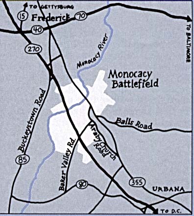
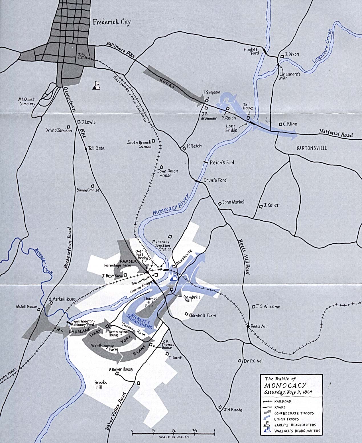
Monocacy National Battlefield (Area Map) (43K)
Monocacy National Battlefield (Battle Map) (345K)
Sources: Many of these maps were provided by the University of Texas Library and/or the U.S. Central Intelligence Agency (CIA).
Maps on other websites
Maryland - County Comparative Maps (Maryland Dept. of Business and Economic Development)
Maryland - County Names (Census Bureau)
Maryland - Maps (Geology.com)
Maryland - Road Map (World Sites Atlas)
Maryland - Satellite Image (Geology.com)
Maryland - Topographic Maps (Libre Map Project)
Maryland - Topographic Maps (Radford University)
See Also:
Topographic Maps
ArcGIS Shapefile Map Layers
<-- Free Maps
<-- Free U.S. State Maps
<-- Free World Country Maps
Didn't find what you are looking for? We've been online since 1996 and have created 1000's of pages. Search below and you may find just what you are looking for.
Michael R. Meuser
Data Research & GIS Specialist
MapCruzin.com is an independent firm
specializing in GIS project development and data research.
We created the first U.S. based
interactive toxic chemical facility
maps on the internet in 1996 and we
have been online ever since. Learn more about us and our services.
Have a project in mind? If you have data, GIS project or custom shapefile needs contact Mike.
Contact Us
Report Broken Links
Subscribe for Updates
Sponsors


![Chesapeake and Ohio Canal National Historic Park [Maryland / Washington, DC / West Virginia]](/free-state-maps/states/maryland/ches_loc96.jpg)
![Chesapeake and Ohio Canal National Historic Park [Maryland / Washington, DC / West Virginia]](/free-state-maps/states/maryland/ches_96.jpg)