Download Free Maps of Colorado
<-- Free Maps
<-- Free U.S. State Maps
<-- Free World Country Maps
See Also:
Topographic Maps
ArcGIS Shapefile Map Layers
Download these maps of Colorado for your reports, websites, research, projects, presentations...
Note that maps may not appear on the webpage in their full size and resolution. To save the maps to your computer, right-click on the link.
State Maps
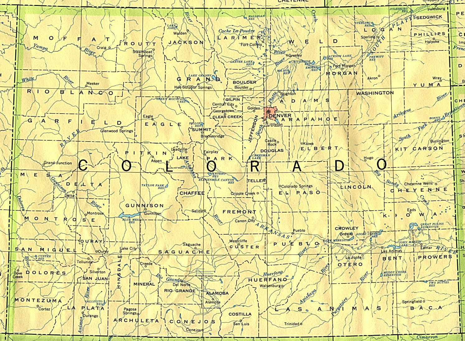
Colorado (base map) JPEG format (519K) County boundaries and names, county seats, rivers. Original scale 1:2,500,000 U.S. Geological Survey, 1972 limited update 1990
Colorado (outline map) JPEG format (90K) County boundaries and names. U.S. Bureau of the Census, 1990
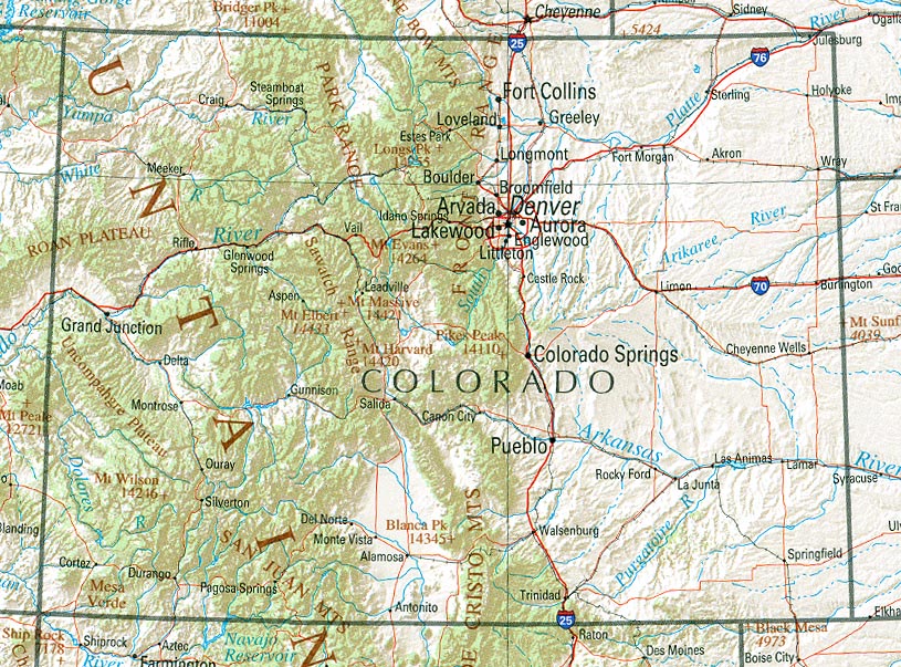
Colorado (reference map) JPEG format (265K) Shaded relief map with state boundaries, forest cover, place names, major highways. Portion of "The National Atlas of the United States of America. General Reference", compiled by U.S. Geological Survey 2001, printed 2002
Colorado (reference map) PDF format (268K) Shaded relief map with state boundaries, forest cover, place names, major highways. Portion of "The National Atlas of the United States of America. General Reference", compiled by U.S. Geological Survey 2001, printed 2002
Colorado - Federal Lands and Indian Reservations PDF format (1MB) The National Atlas of the United States of America, U.S. Geological Survey, 2003
City Maps
Aspen (topographic) original scale 1:24,000 U.S.G.S. 1987 (340K)
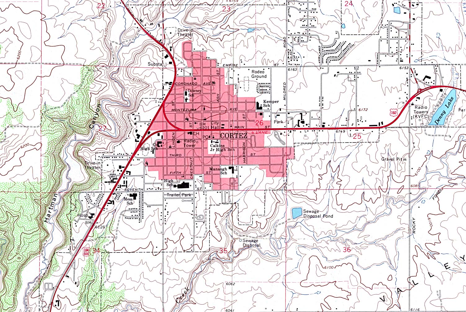
Cortez (topographic) original scale 1:24,000 U.S.G.S. 1965 (476K)
Denver original scale 1:500,000 U.S. National Atlas 1970 (303K)
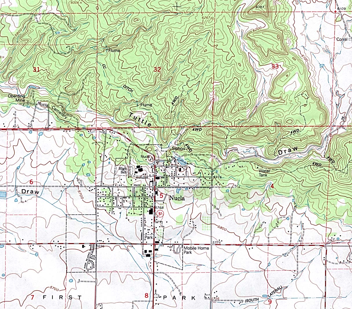
Nucla (topographic) original scale 1:24,000 U.S.G.S. 1994 (468K)
Historical City Maps
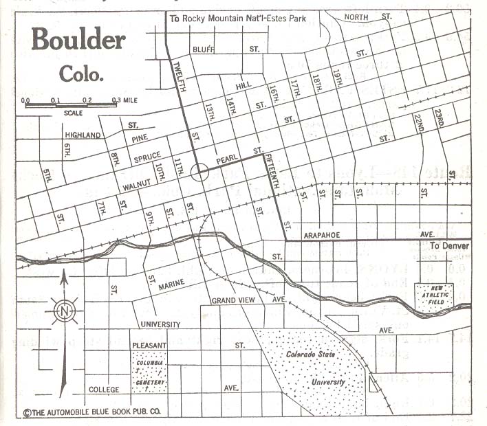
Boulder 1920 Automobile Blue Book 1920, Vol. 7 (258K)
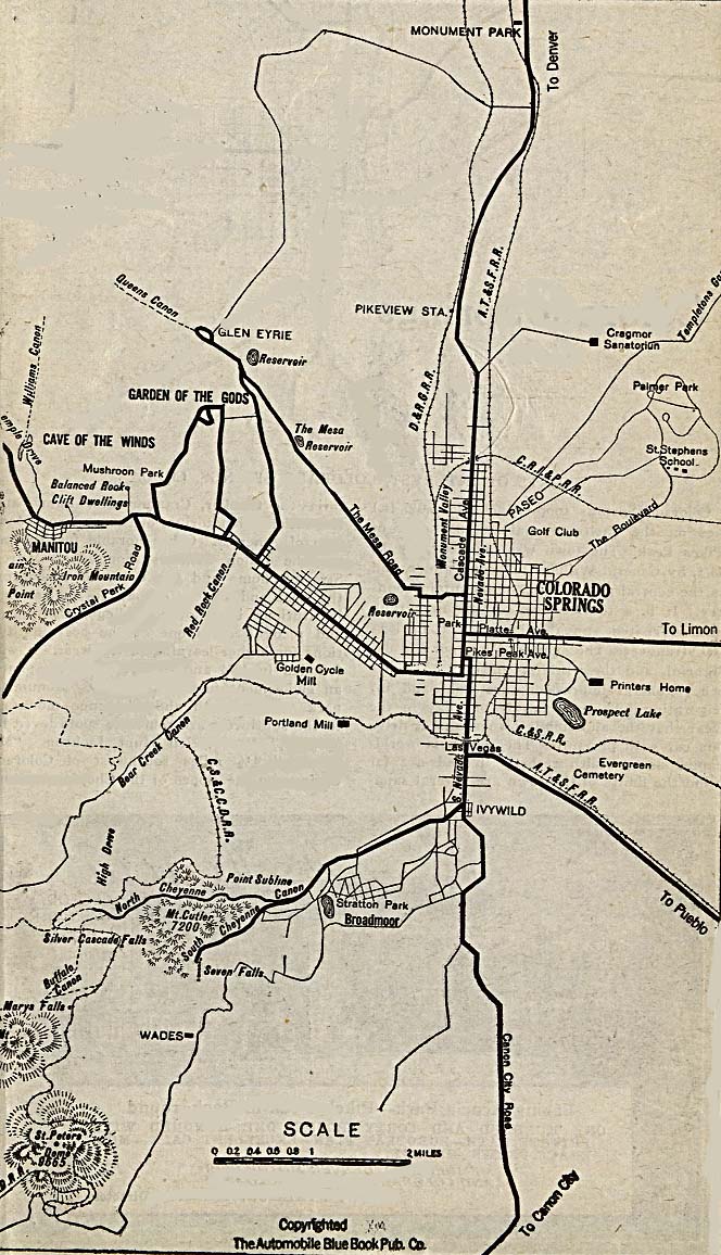
Colorado Springs 1920 Automobile Blue Book, 1920, Vol. 7 (221K)
Denver 1917 Automobile Blue Book, 1917, Vol. 8 (90K)
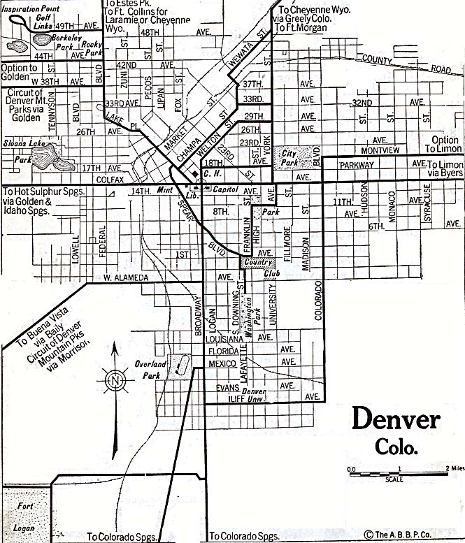
Denver 1920 Automobile Blue Book, 1920, Vol. 7 (179K)
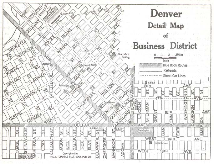
Denver - Business District 1920 Automobile Blue Book, 1920, Vol. 7 (90K)
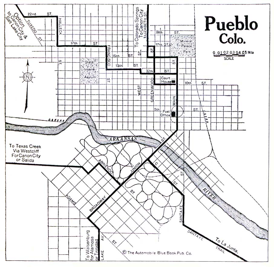
Pueblo 1920 Automobile Blue Book, 1920, Vol. 7 (176K)
Maps of National Parks, Monuments, and Historic Sites
The following maps were produced by the U.S. National Park Service unless otherwise noted.
Bent's Old Fort National Historic Site (Area Map) 1994 (327K)
Bent's Old Fort National Historic Site (Area Map) 1995 (65K) (PDF Format)
Bent's Old Fort National Historic Site (Floor Plan) 1995 (65K) (PDF Format)
Bent's Old Fort National Historic Site (Schematic and Floor Plan) 1994 (241K)
Black Canyon of the Gunnison National Park (Area Map) 1995 (129K) (PDF Format)
Black Canyon of the Gunnison National Park (Park Map) 1996 (323K) (PDF Format)
Black Canyon of the Gunnison National Park (Profile Map) 1996 (65K) (PDF Format)
Black Canyon of the Gunnison National Park (Area Map) 1995 (129K) (PDF Format)
Black Canyon of the Gunnison National Park (Park Map) 1996 (323K) (PDF Format)
Black Canyon of the Gunnison National Park (Profile Map) 1996 (65K) (PDF Format)
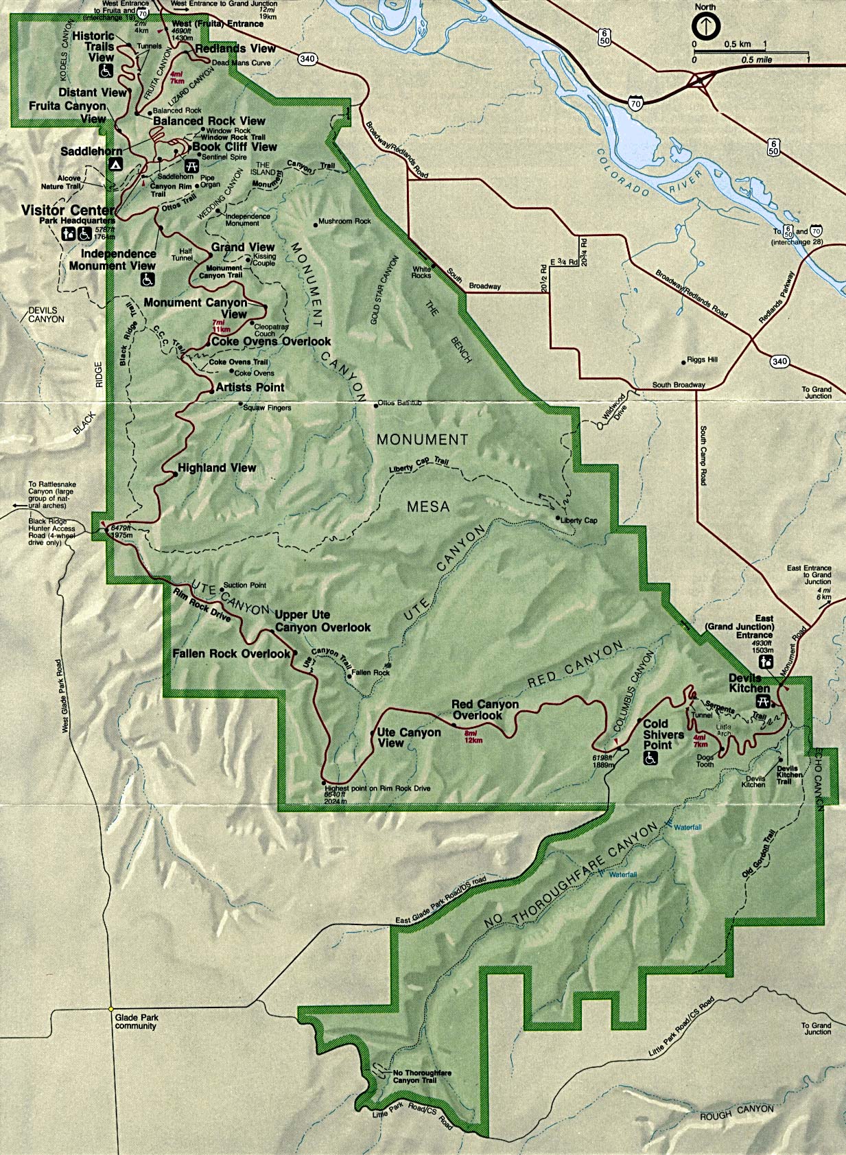
Colorado National Monument (Park Map) 1994 (546K)
Dinosaur National Monument [Colorado / Utah] (Area Map) 1999 (65K) (PDF Format)
Dinosaur National Monument [Colorado / Utah] (Park Map) 1999 (258K) (PDF Format)
Florissant Fossil Beds National Monument (Park Map) 1999 (65K) (PDF Format)
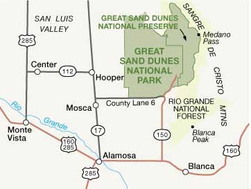
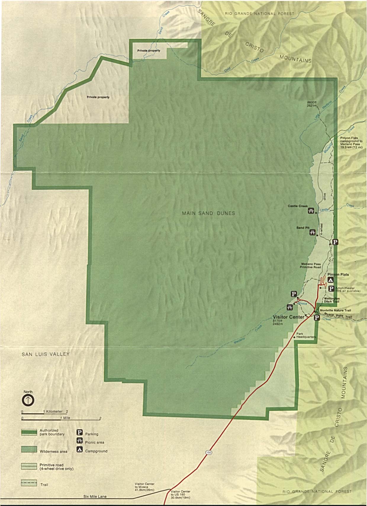
Great Sand Dunes National Park and Preserve (Park Map / Shaded Relief) 2007 (416K)
Great Sand Dunes National Park and Preserve (Area Map) 2007 (15K)
Older maps of Great Sand Dunes:
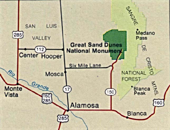
Great Sand Dunes National Monument (Area Map) 1994 (77K)
Great Sand Dunes National Monument (Area Map) 1999 (65K) (PDF Format)
Great Sand Dunes National Monument (Park Map / Shaded Relief) 1994 (254K)
Great Sand Dunes National Monument (Park Map) 1999 (65K) (PDF Format)
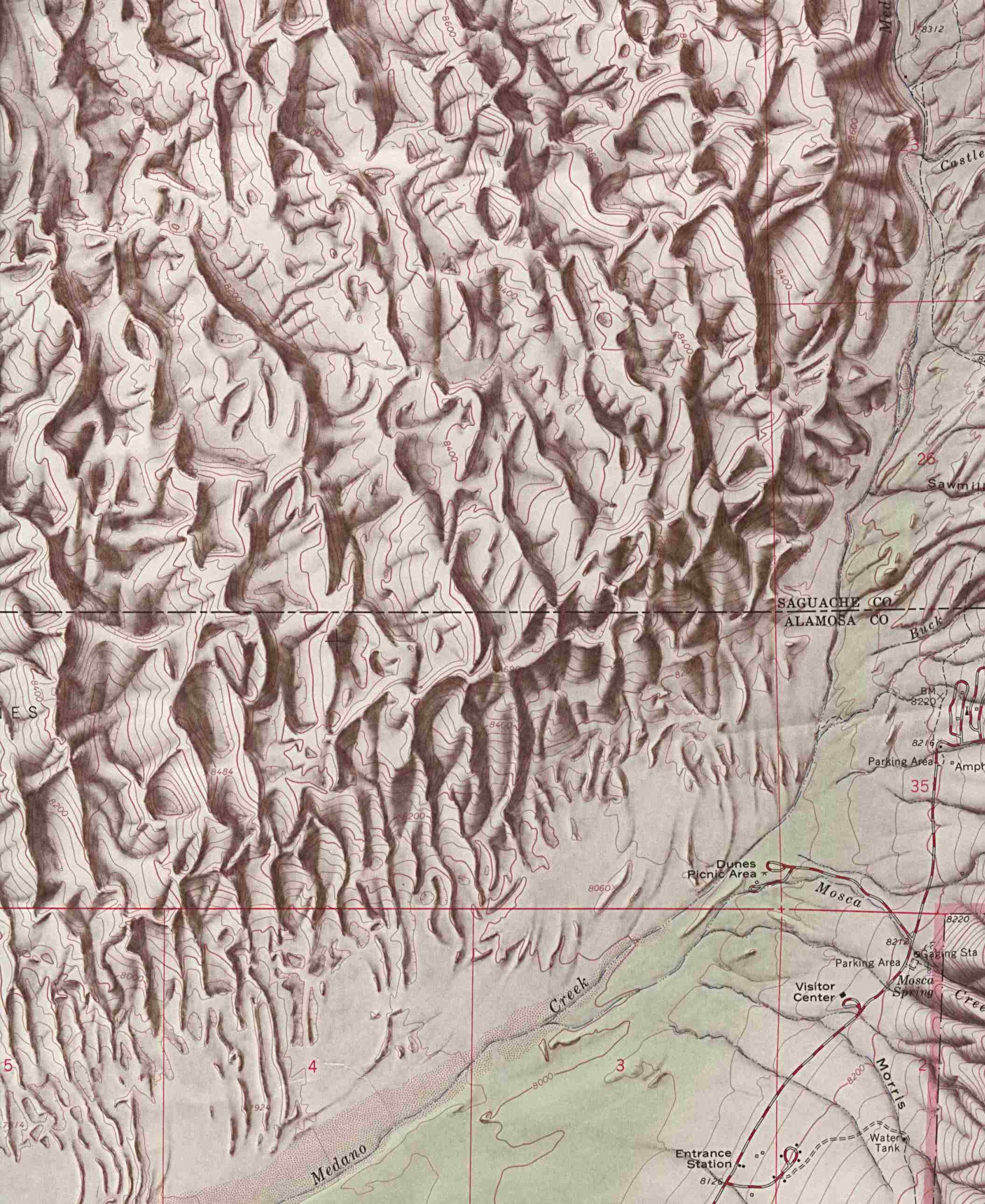
Great Sand Dunes National Monument (Shaded Relief Map) 1:24,000 U.S.G.S. 1967 (349K)
Hovenweep National Monument (Park Map) 1998 (194K) (PDF Format)
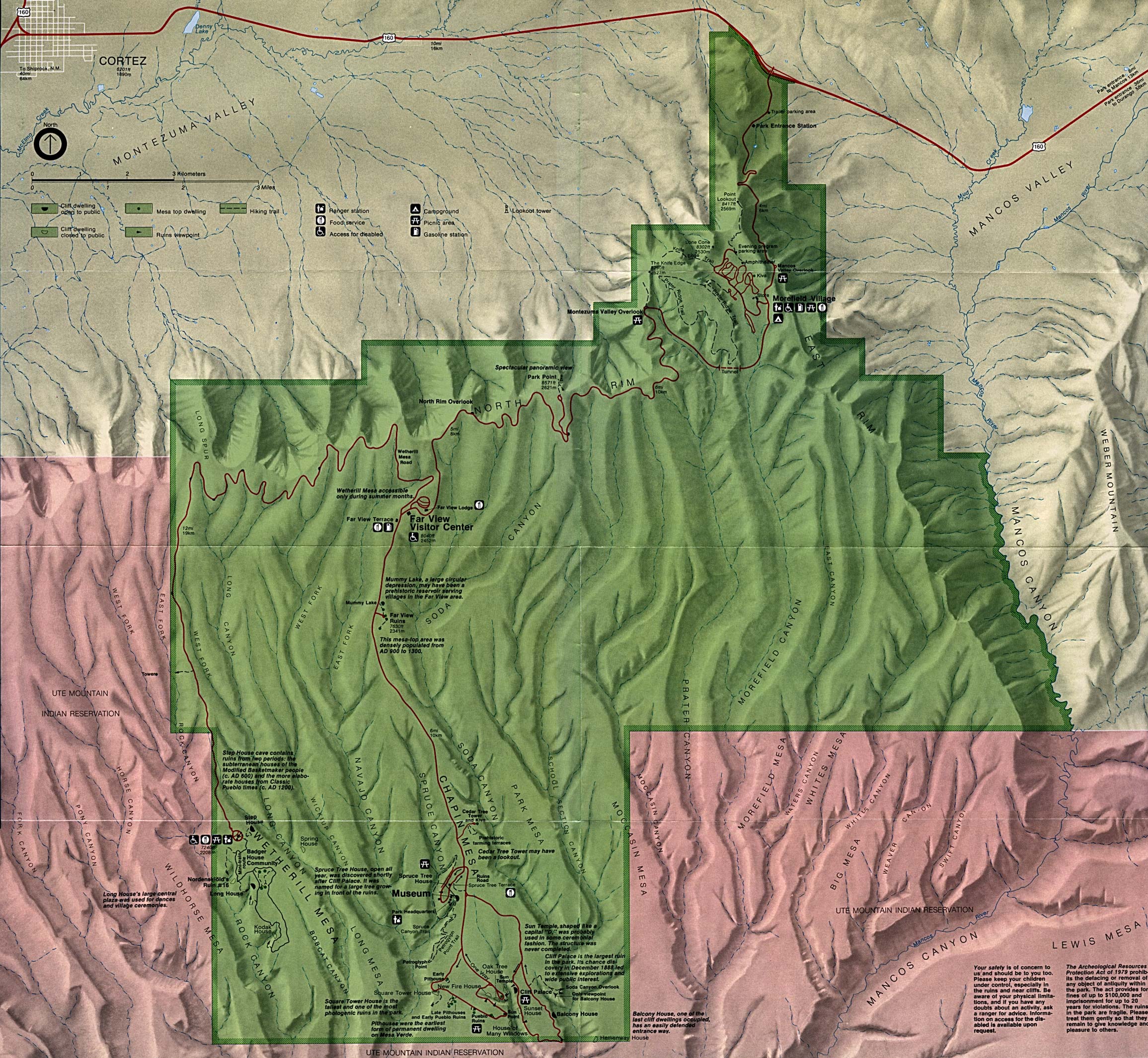
Mesa Verde National Park (Park Map) (1MB)
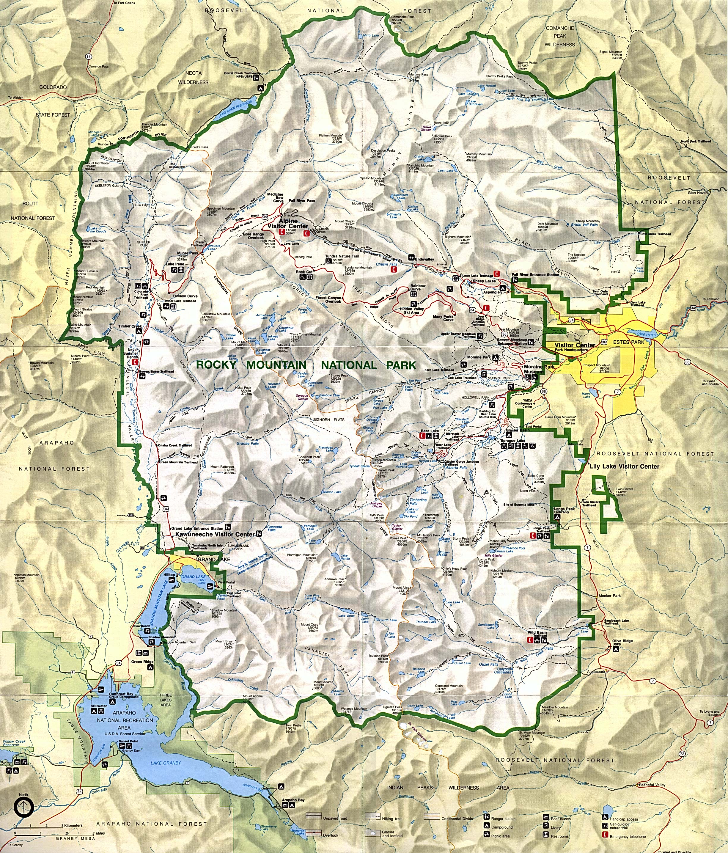
Rocky Mountain National Park (Park Map) (1MB)
Rocky Mountain National Park (Park Map) 1999 (710K) (PDF Format)
Sources: Many of these maps were provided by the University of Texas Library and/or the U.S. Central Intelligence Agency (CIA).
Maps on other websites:
Colorado - Atlas of Colorado (UNC Department of Geography)
Colorado - County Names (Census Bureau)
Colorado - Maps (Geology.com)
Colorado - Road Map (World Sites Atlas)
Colorado - Satellite Image (Geology.com)
Colorado - Shaded Relief (Purdue University)
Colorado - Topographic Maps (Libre Map Project)
See Also:
Topographic Maps
ArcGIS Shapefile Map Layers
<-- Free Maps
<-- Free U.S. State Maps
<-- Free World Country Maps
Didn't find what you are looking for? We've been online since 1996 and have created 1000's of pages. Search below and you may find just what you are looking for.
Michael R. Meuser
Data Research & GIS Specialist
MapCruzin.com is an independent firm
specializing in GIS project development and data research.
We created the first U.S. based
interactive toxic chemical facility
maps on the internet in 1996 and we
have been online ever since. Learn more about us and our services.
Have a project in mind? If you have data, GIS project or custom shapefile needs contact Mike.
Contact Us
Report Broken Links
Subscribe for Updates
Sponsors


