Download Free Maps of Arizona
<-- Free Maps
<-- Free U.S. State Maps
<-- Free World Country Maps
See Also:
Topographic Maps
ArcGIS Shapefile Map Layers
Download or link to these maps for your reports, websites, research, projects, presentations...
Note that maps may not appear on the webpage in their full size and resolution. To save the maps to your computer, right-click on the link.
State Maps
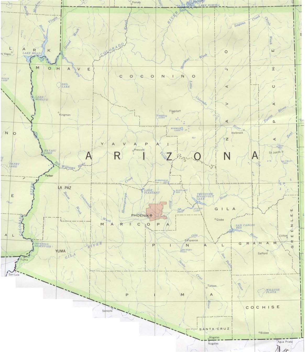
Arizona (base map) JPEG format (175K) County boundaries and names, county seats, rivers. Original scale 1:2,500,000 U.S. Geological Survey, 1972 limited update 1990
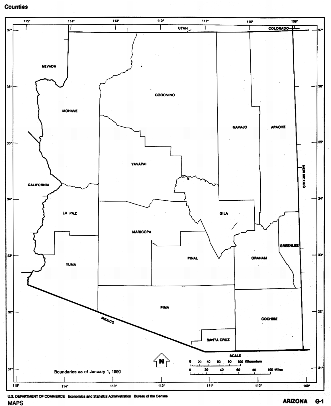
Arizona (outline map) JPEG format (174K) County boundaries and names. U.S. Bureau of the Census, 1990
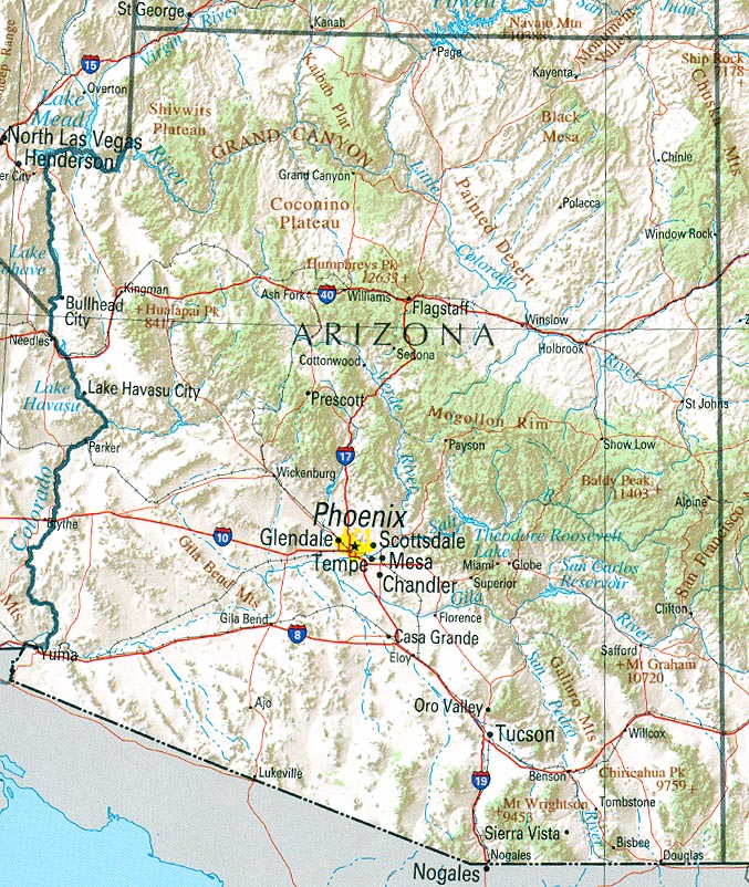
Arizona (reference map) JPEG format (283K) Shaded relief map with state boundaries, forest cover, place names, major highways. Portion of "The National Atlas of the United States of America. General Reference", compiled by U.S. Geological Survey 2001, printed 2002
Arizona (reference map) PDF format (285K) Shaded relief map with state boundaries, forest cover, place names, major highways. Portion of "The National Atlas of the United States of America. General Reference", compiled by U.S. Geological Survey 2001, printed 2002
Arizona - Federal Lands and Indian Reservations PDF format (1.1MB) The National Atlas of the United States of America, U.S. Geological Survey, 2003
City Maps
Safford (topographic) 1:24,000 U.S.G.S. 1985 (218K)
Historical City Maps
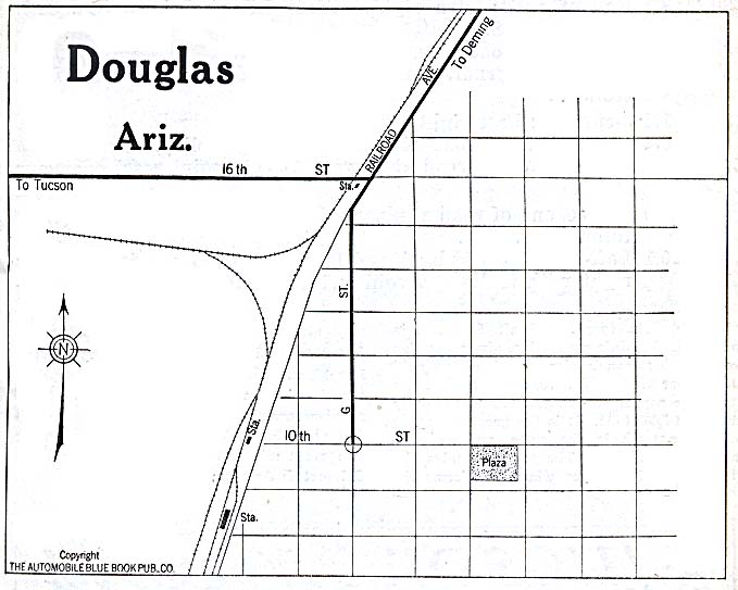
Douglas 1920 Automobile Blue Book (78K)
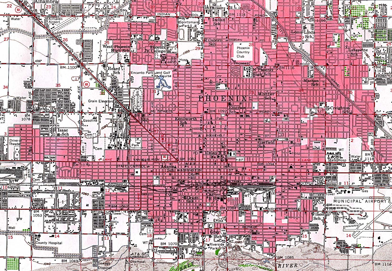
Phoenix 1952 Original Scale 1:62,500 U.S. Geological Survey 1952 (839K)
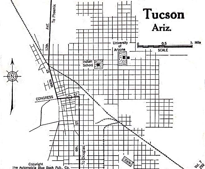
Tucson 1920 Automobile Blue Book (117K)
Maps of National Parks, Monuments, and Historic Sites
The following maps were produced by the U.S. National Park Service unless otherwise noted.
Canyon de Chelly National Monument (Park Map) 1997 (323K) (PDF Format)
Chiricahua National Monument (Area Map) 1999 (65K) (PDF Format)
Chiricahua National Monument (Park Map) 1999 (129K) (PDF Format)
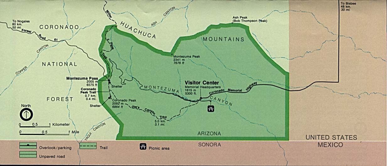
Coronado National Memorial (Area Map) (100K)
Coronado National Memorial [Southwest United States] (Historic Route Map) (135K)
Coronado National Memorial (Park Map) 1997 (65K) (PDF Format)
Fort Bowie National Historic Site (Area Map) 1995 (65K) (PDF Format)
Fort Bowie National Historic Site (Park Map) 1995 (65K) (PDF Format)
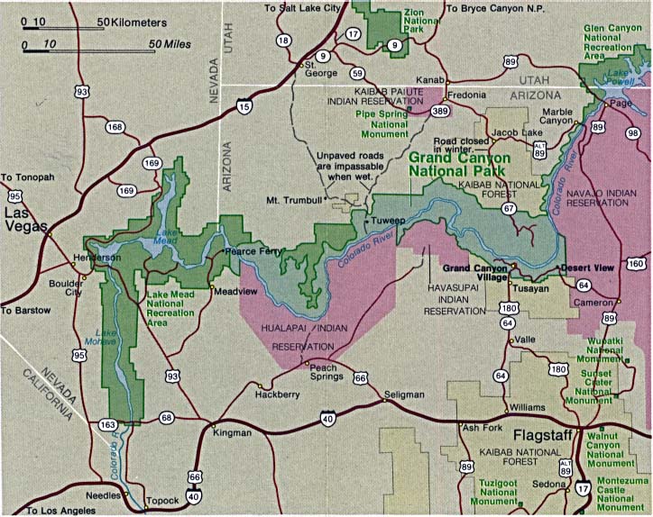
Glen Canyon National Recreation Area [Arizona / Utah] (Park Map / Shaded Relief) 1995 (1.8MB)
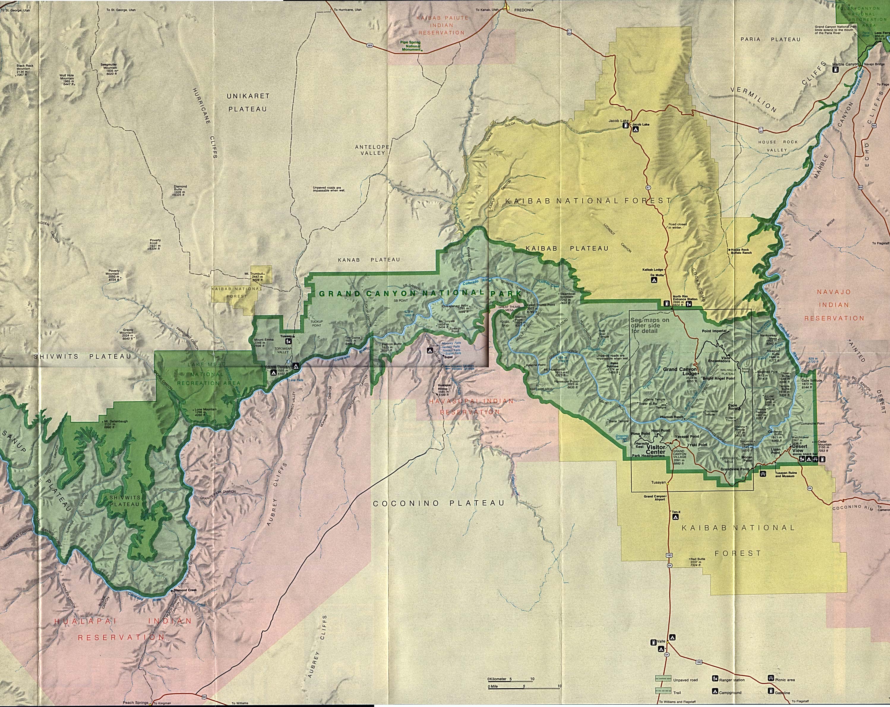
Grand Canyon National Park (Area Map) (113K)
Grand Canyon National Park (Park Map) 1997 (194K) (PDF Format)
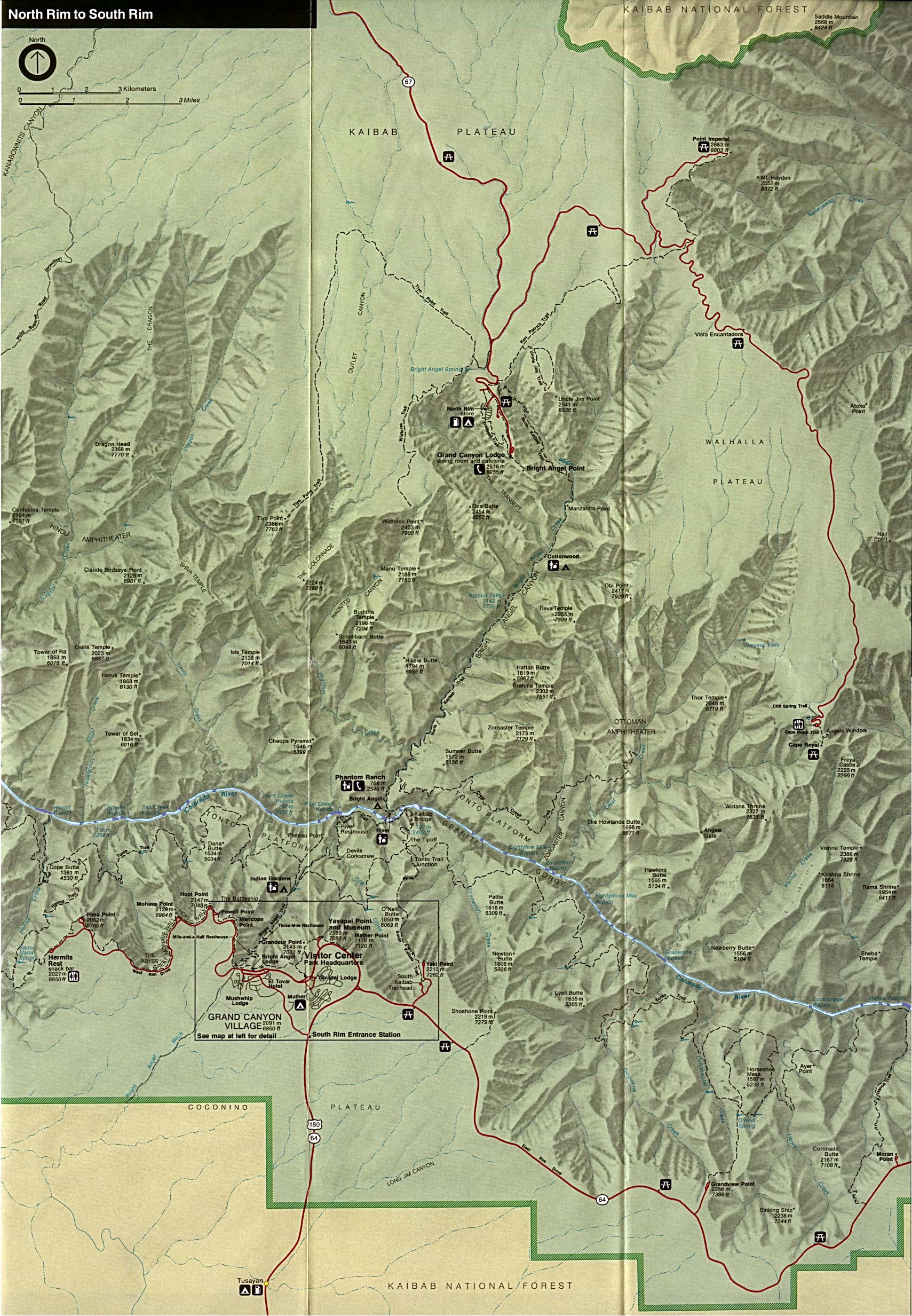
Grand Canyon National Park (Shaded Relief Map) 1:62:500 U.S.G.S. (519K)
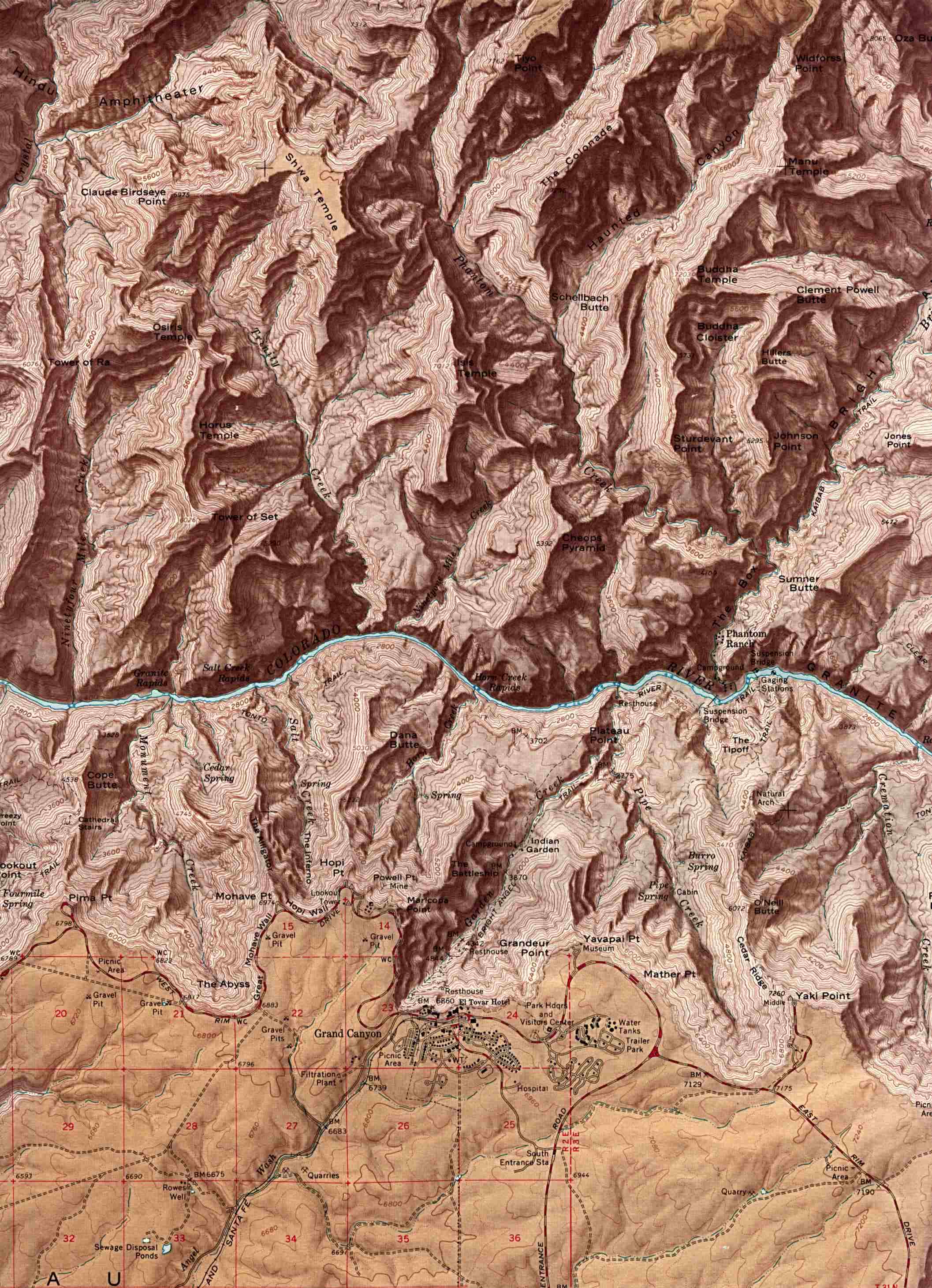
Grand Canyon National Park - Eastern Area (Shaded Relief Map) (886K)
Grand Canyon National Park - Western Area (Shaded Relief Map) (1MB)
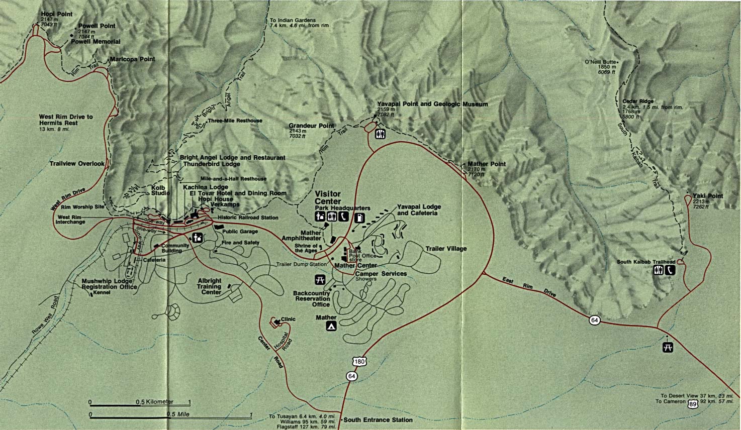
Grand Canyon National Park - Grand Canyon Village (Detail Map) (281K)
Grand Canyon National Park - Phantom Ranch Topographic Map USGS 2009 (13.6 MB) (PDF)
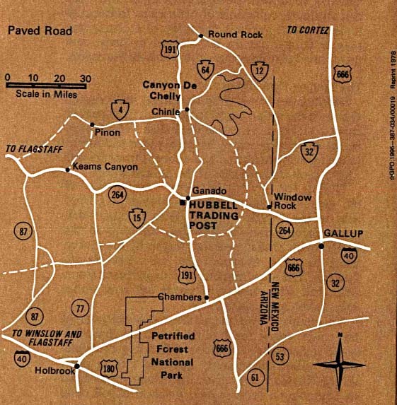
Hubbell Trading Post National Historic Site (Area Map) 1995 (111K)
Hubbell Trading Post National Historic Site (Park Map) 1997 (65K) (PDF Format)
Organ Pipe Cactus National Monument (Campsite Map) 1999 (65K) (PDF Format)
Organ Pipe Cactus National Monument (Park Map) 1999 (129K) (PDF Format)
Petrified Forest National Park (Area Map) (16K)
Petrified Forest National Park (Park Map) (485K)
Petrified Forest National Park (Park Map) 1999 (129K) (PDF Format)
Pipe Spring National Monument (Tour Map) 1999 (65K) (PDF Format)
Rainbow Bridge National Monument (Park Map) 1997 (258K) (PDF Format)
Saguaro National Park (Area Map) 1997 (65K) (PDF Format)
Saguaro National Park (East: Rincon Mountain District) (Park Map) 1996 (425K)
Saguaro National Park (East: Rincon Mountain District) (Park Map) 1997 (65K) (PDF Format)
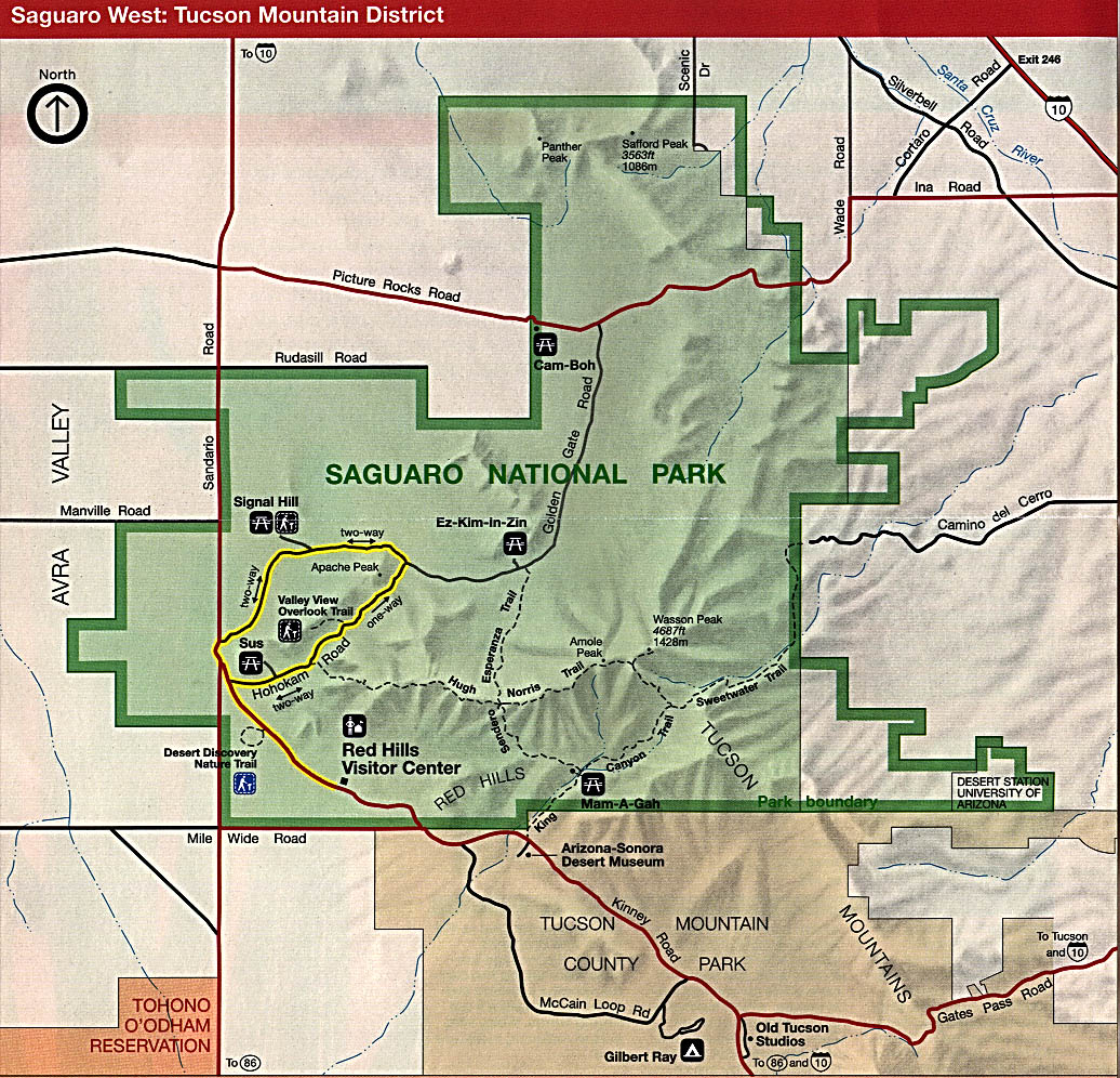
Saguaro National Park (West: Tucson Mountain District) (Park Map) 1996 (349K)
Saguaro National Park (West: Tucson Mountain District) (Park Map) 1997 (65K) (PDF Format)
Wupatki National Monument (Park Map) 1998 (65K) (PDF Format)
Sources: Many of these maps were provided by the University of Texas Library and/or the U.S. Central Intelligence Agency (CIA).
Maps on other websites:
Arizona - Arizona Electronic Atlas (University of Arizona)
Arizona - Arizona Trail Map (Arizona Trail Association)
Arizona - Atlas of Panoramic Aerial Images (William Bowen)
Arizona - County Names (Census Bureau)
Arizona - Grand Canyon (Desert Maps) [PDF format]
Arizona - Maps (Geology.com)
Arizona - Maps (Netstate)
Arizona - Mexico Border Maps (Humane Borders)
Arizona - National Park Maps (Desert Maps)
Arizona - Road Map (World Sites Atlas)
Arizona - Satellite Image (Geology.com)
Arizona - Shaded Relief (Purdue University)
Arizona - Topographic Maps (Arizona Regional Image Archive)
Arizona - Topographic Maps (Libre Map Project)
Arizona - Tribal and Federal Lands (EPA) [PDF format]
See Also:
Topographic Maps
ArcGIS Shapefile Map Layers
<-- Free Maps
<-- Free U.S. State Maps
<-- Free World Country Maps
Didn't find what you are looking for? We've been online since 1996 and have created 1000's of pages. Search below and you may find just what you are looking for.
Michael R. Meuser
Data Research & GIS Specialist
MapCruzin.com is an independent firm
specializing in GIS project development and data research.
We created the first U.S. based
interactive toxic chemical facility
maps on the internet in 1996 and we
have been online ever since. Learn more about us and our services.
Have a project in mind? If you have data, GIS project or custom shapefile needs contact Mike.
Contact Us
Report Broken Links
Subscribe for Updates
Sponsors


![Coronado National Memorial [Southwest United States]](/free-state-maps/states/arizona/coronado_expedition.jpg)
![Glen Canyon National Recreation Area [Arizona / Utah]](/free-state-maps/states/arizona/glen95.jpg)