Download Free Maps of Alaska
<-- Free Maps
<-- Free U.S. State Maps
<-- Free World Country Maps
See Also:
Topographic Maps
ArcGIS Shapefile Map Layers
Download or link to these maps for your reports, websites, research, projects, presentations...
Note that maps may not appear on the webpage in their full size and resolution. To save the maps to your computer, right-click on the link.
State Maps
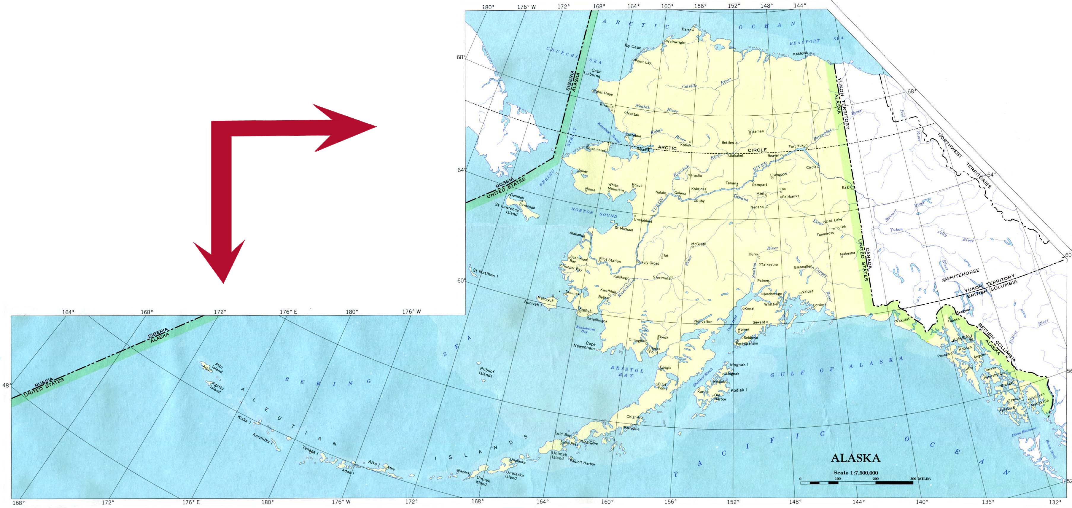
Alaska (base map) JPEG format (478K) County boundaries and names, county seats, rivers. Original scale 1:2,500,000 U.S. Geological Survey, 1972 limited update 1990
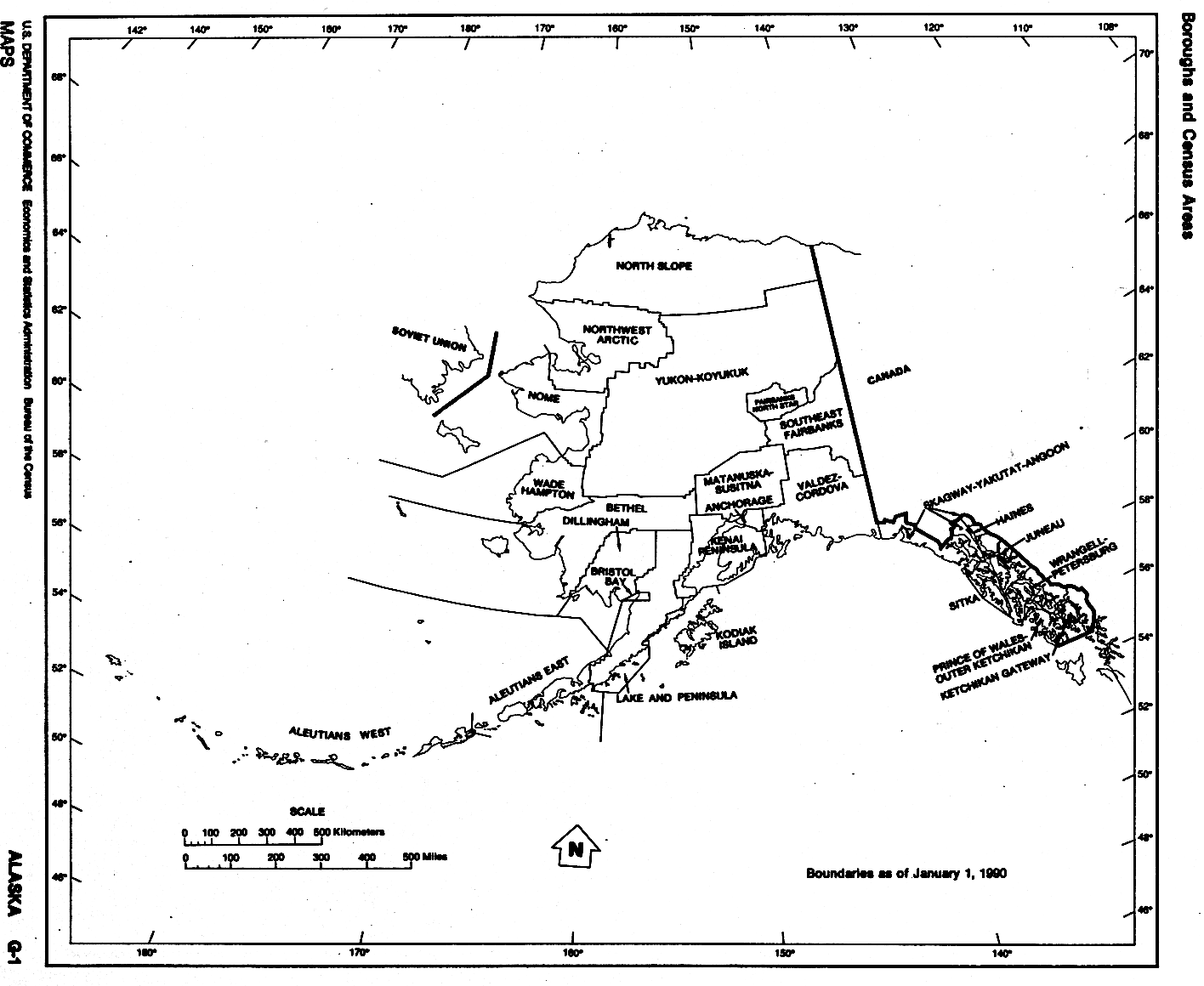
Alaska (outline map) County boundaries and names. U.S. Bureau of the Census, 1990
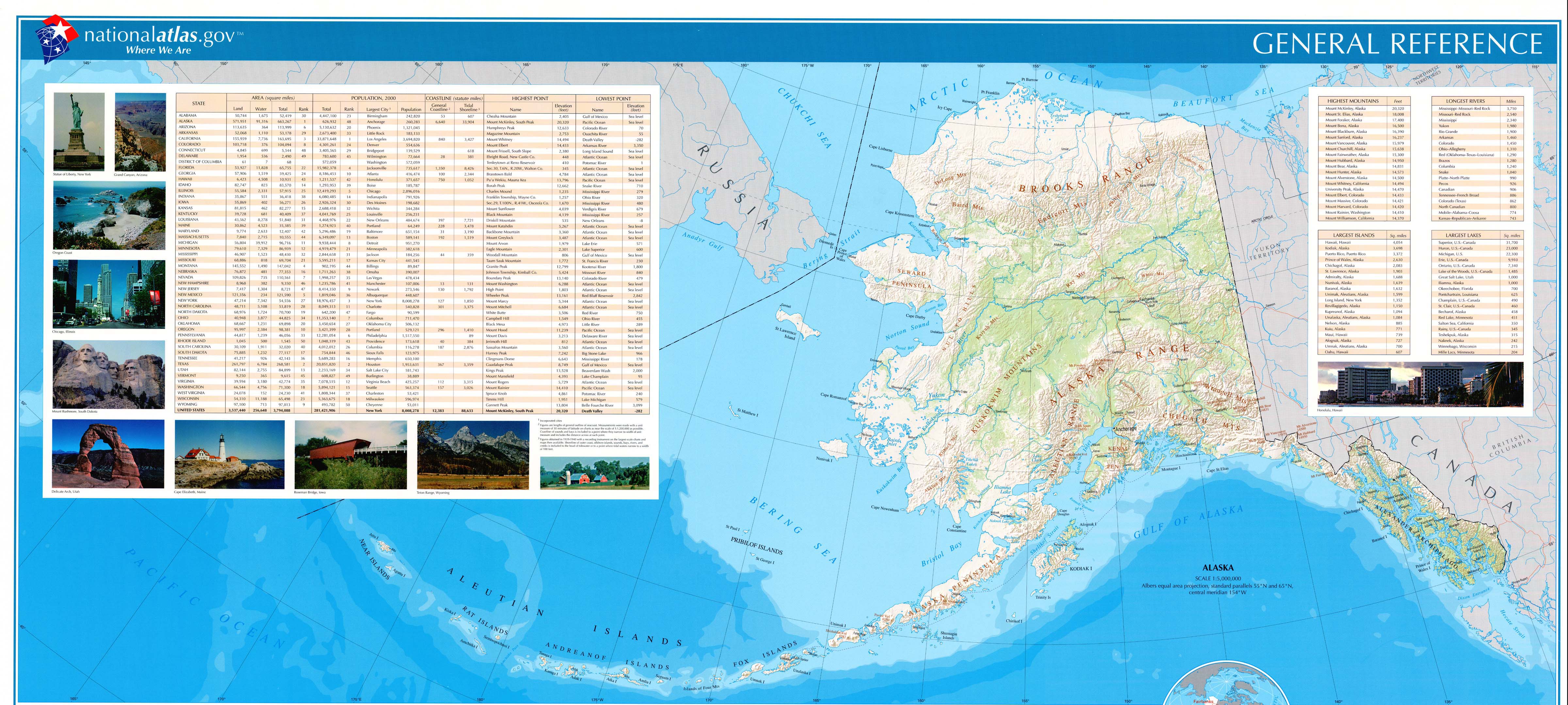
Alaska (reference map) JPEG format (1.2MB) Shaded relief map with state boundaries, forest cover, place names, major highways. Portion of "The National Atlas of the United States of America. General Reference", compiled by U.S. Geological Survey 2001, printed 2002
Alaska - Federal Lands and Indian Reservations PDF format (10MB) The National Atlas of the United States of America, U.S. Geological Survey, 2003
Alaska - National Highway System PDF format (1.2 MB) U.S. Department of Transportation, Federal Highway Administration, 2005
City Maps
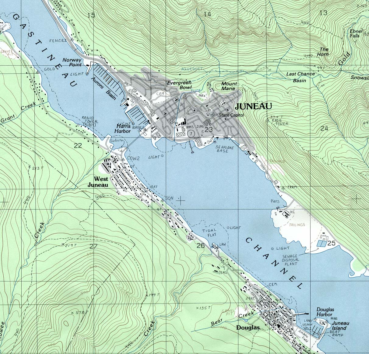
Juneau (topographic) original scale 1:24,000 U.S.G.S. 1986 (468K)
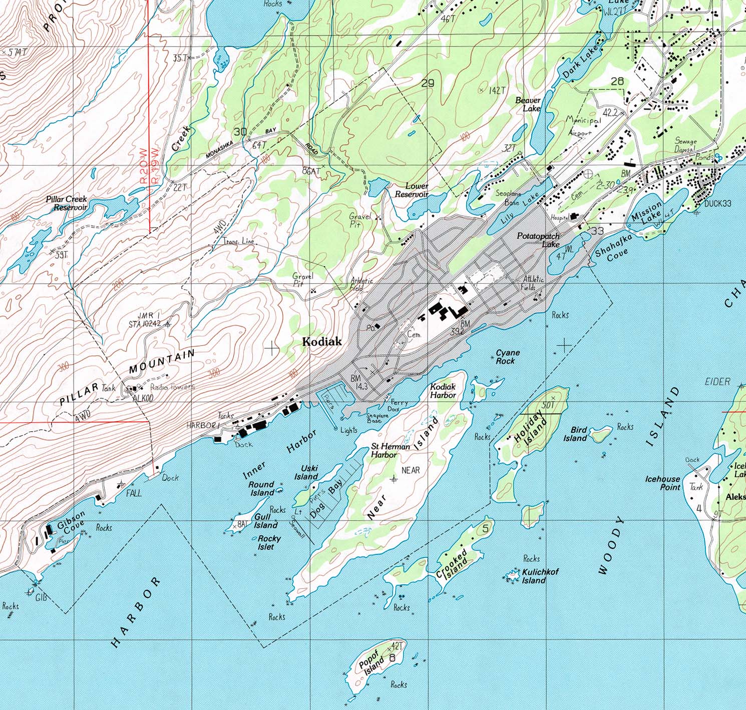
Kodiak (topographic) original scale 1:25,000 U.S.G.S. 1988 (444K)
Historical Maps
Alaska Territory 1915 (679K)
"Map of the Territory of Alaska" From General Information Regarding the Territory of Alaska, Department of the Interior, Office of the Secretary. January 1916.
The map shows locations of Army, Navy and commercial radio stations, telegraph offices and lines, railroads and post-offices.
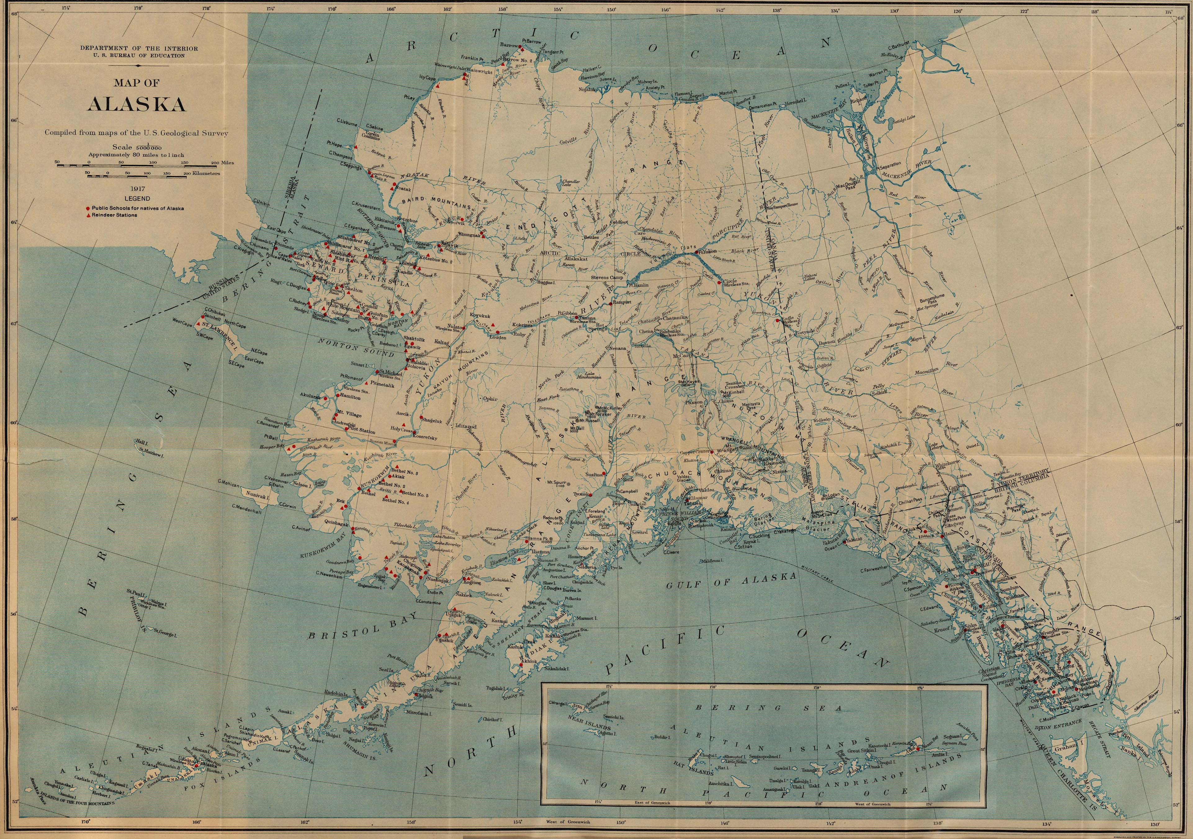
Alaska 1917 (1,806K)
"Map of Alaska" from Work of the Bureau of Education for the Natives of Alaska, 1916-17, Department of the Interior. U.S. Bureau of Education Bulletin, 1918, No. 5.
The map shows locations of public schools for natives of Alaska and reindeer stations.
Maps of National Parks, Monuments, and Historic Sites
The following maps were produced by the U.S. National Park Service unless otherwise noted.
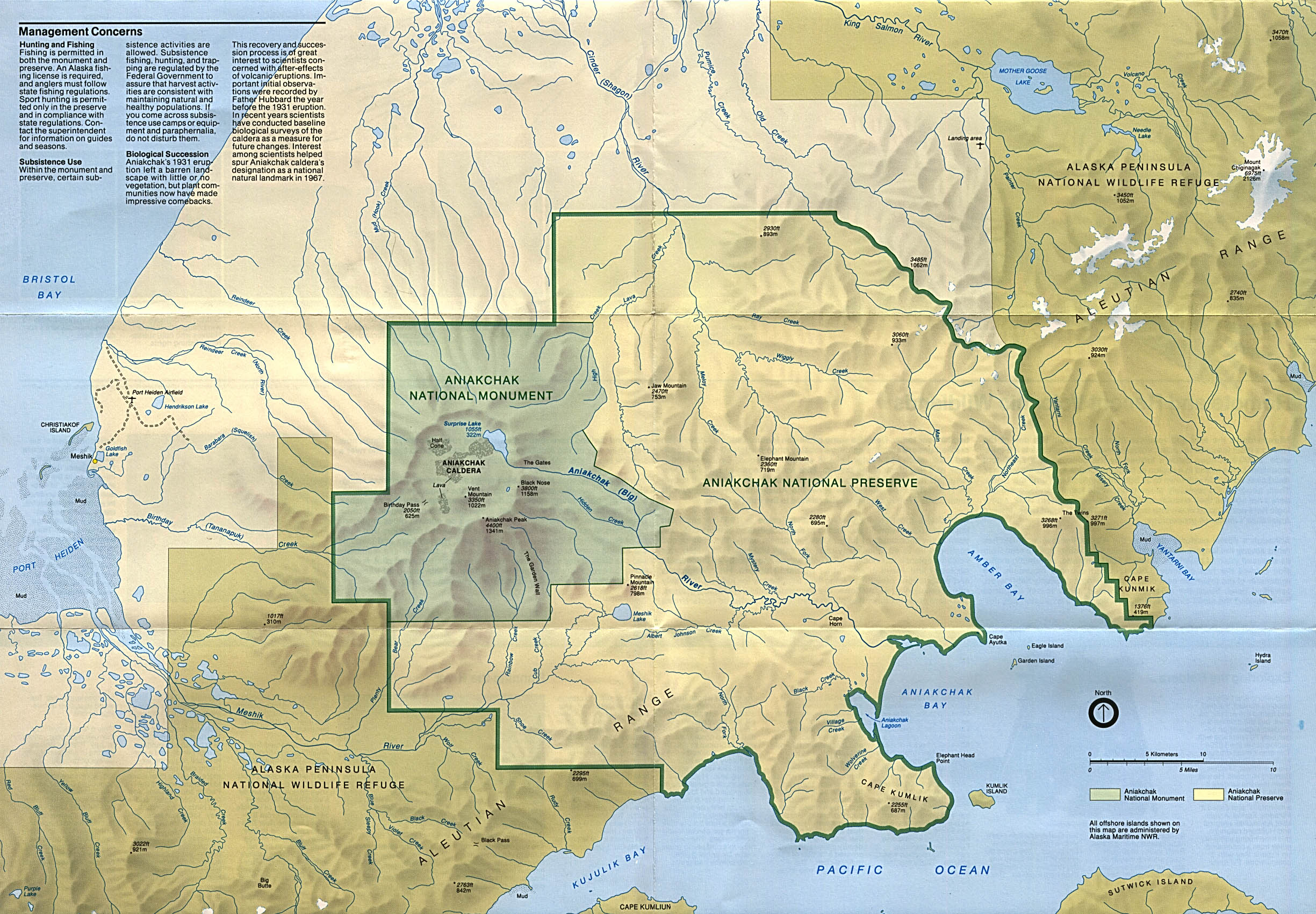
Aniakchak National Monument and Preserve (Park Map) 1993 (901K)
Bering Land Bridge National Preserve (Park Map) 1995 (854K)
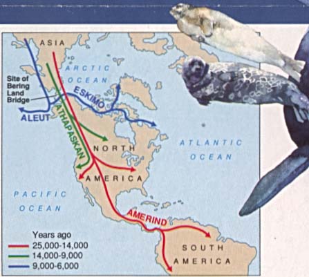
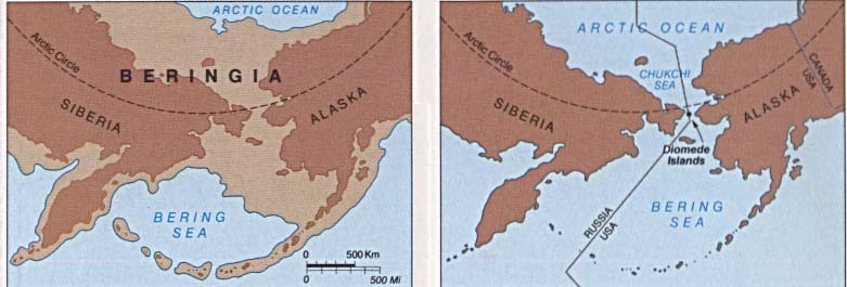
Bering Land Bridge National Preserve (First Americans: Migration Routes Map) 1995 (31K)
Bering Land Bridge National Preserve (Beringia: Historical Glaciation Map) 1995 (37K)
Cape Krusenstern National Monument (Park Map) (1MB)
Cape Krusenstern National Monument (Location Map) (26KB)
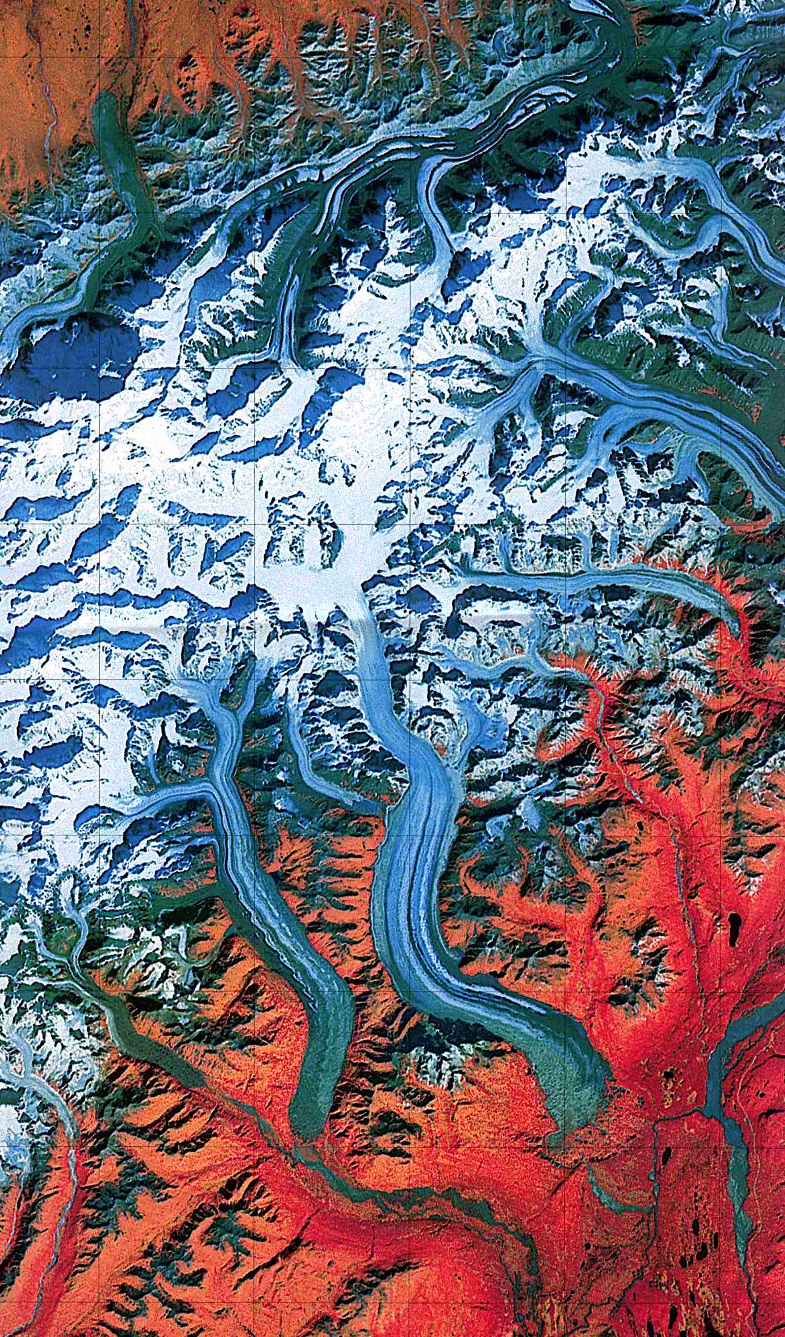
Denali National Park and Preserve (Landsat Image) 1:250,000 U.S.G.S. 1984 (459K)
Denali National Park and Preserve (Park Map) 1998 (839K) (PDF Format)
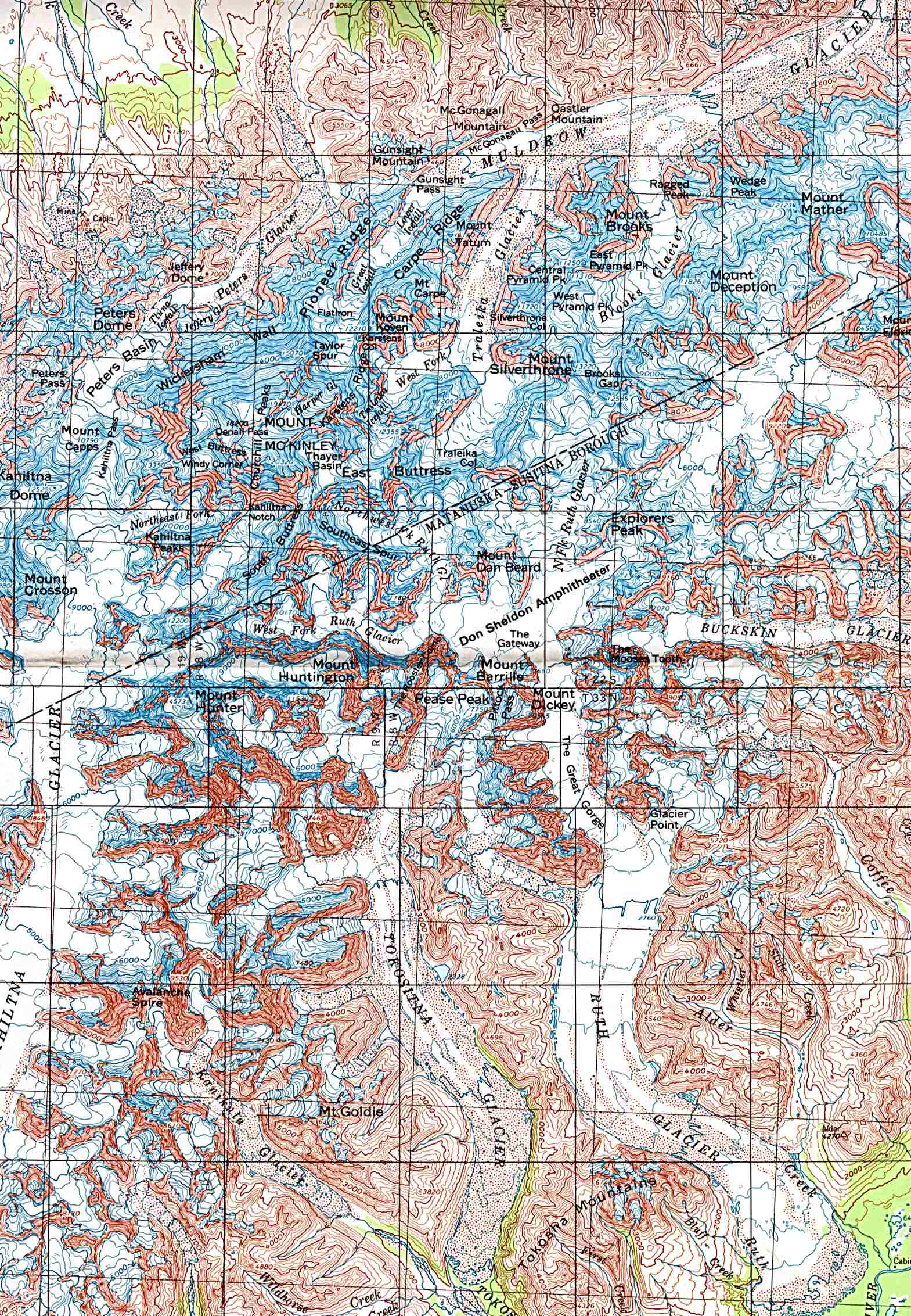
Denali National Park and Preserve - Mount McKinley (Shaded Relief Map) 1:250,000 U.S.G.S. 1984 (612K)
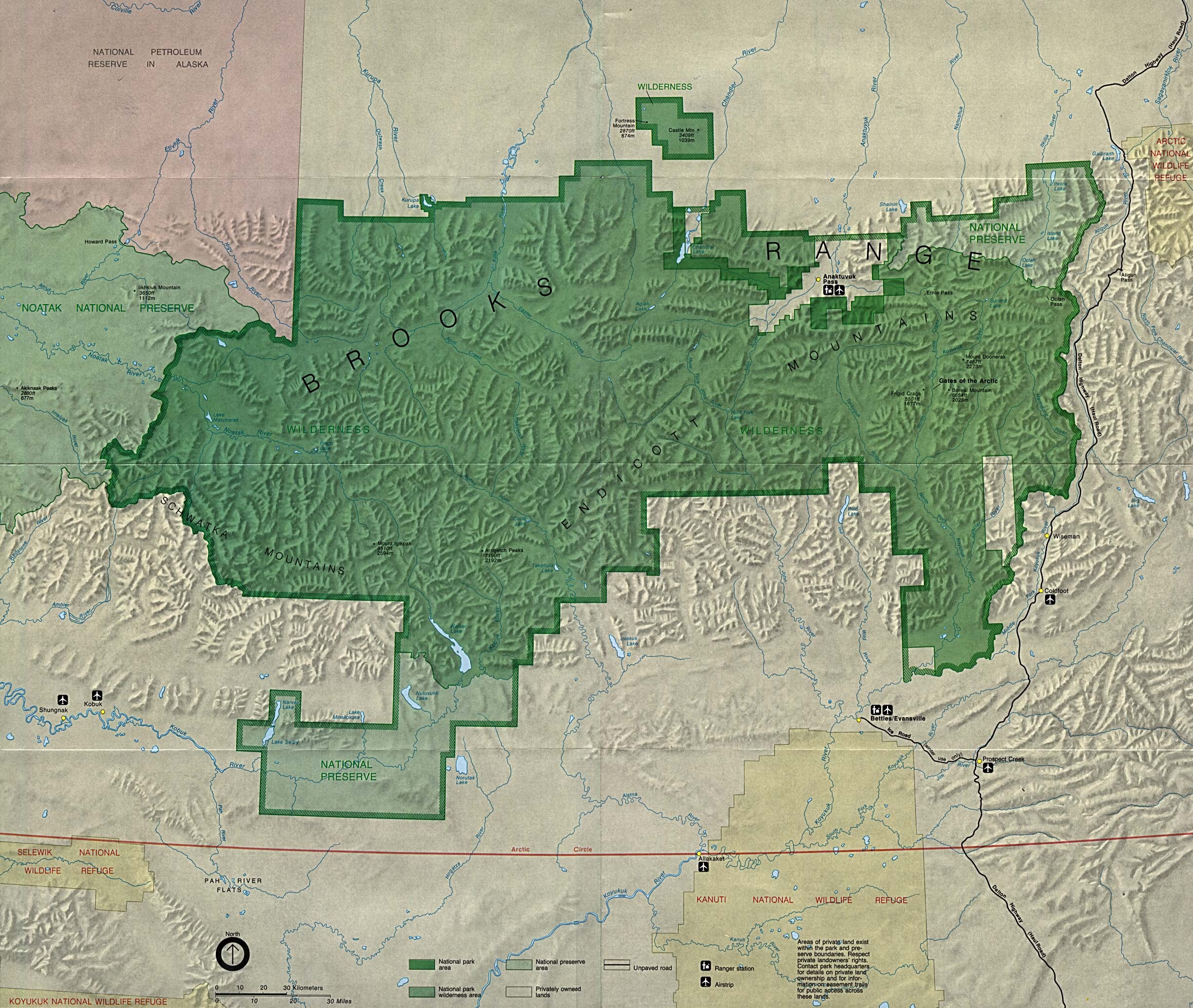
Gates of the Arctic National Park and Preserve in Brooks Range (Park Map) (323K) (PDF Format)
Gates of the Arctic National Park and Preserve in Brooks Range - Preserve Area (Detail Map) (1MB)
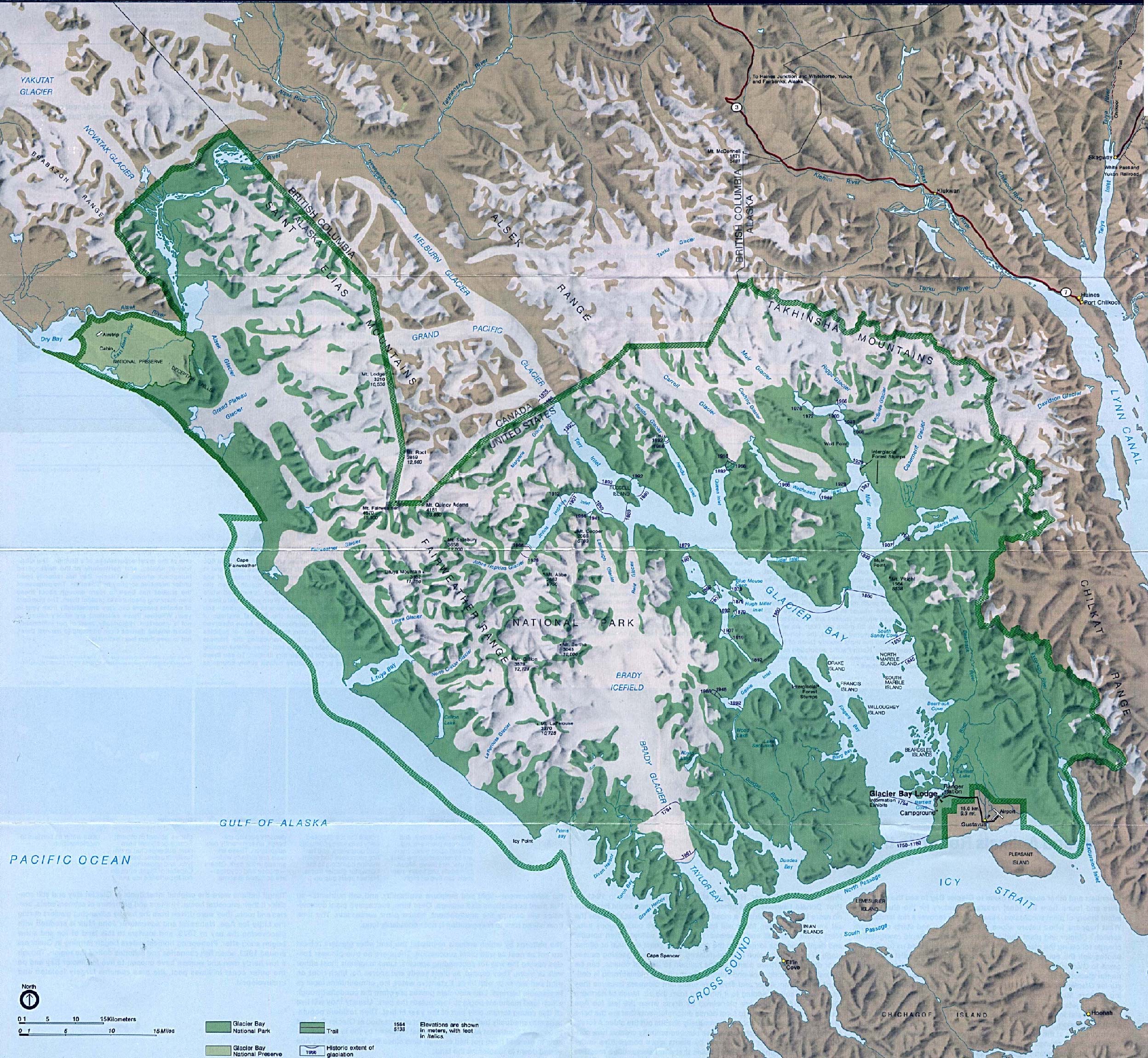
Glacier Bay National Park (Park Map / Shaded Relief) 1994 (1.1MB)
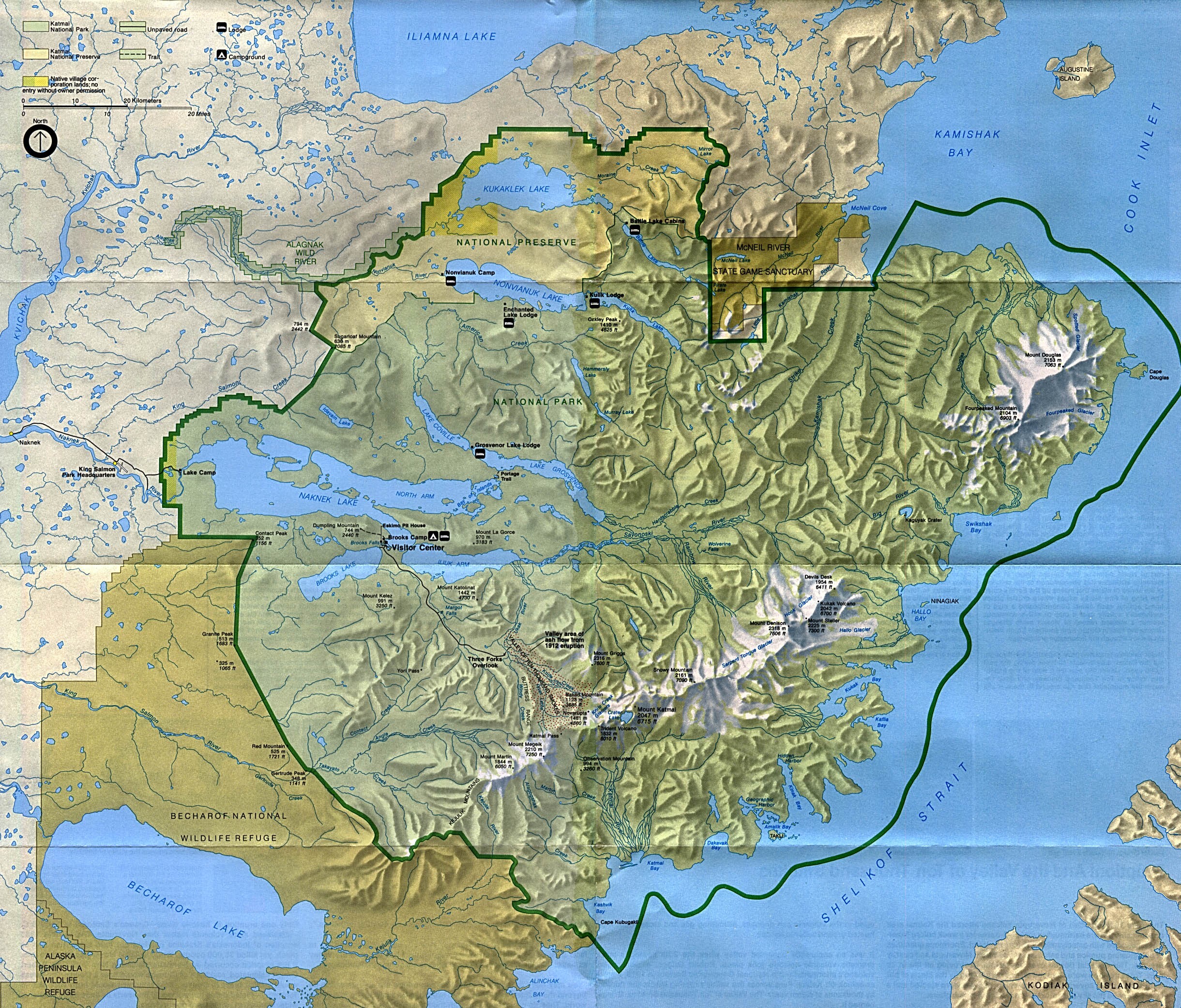
Katmai National Park and Preserve (Park Map) 1994 (1.2MB)
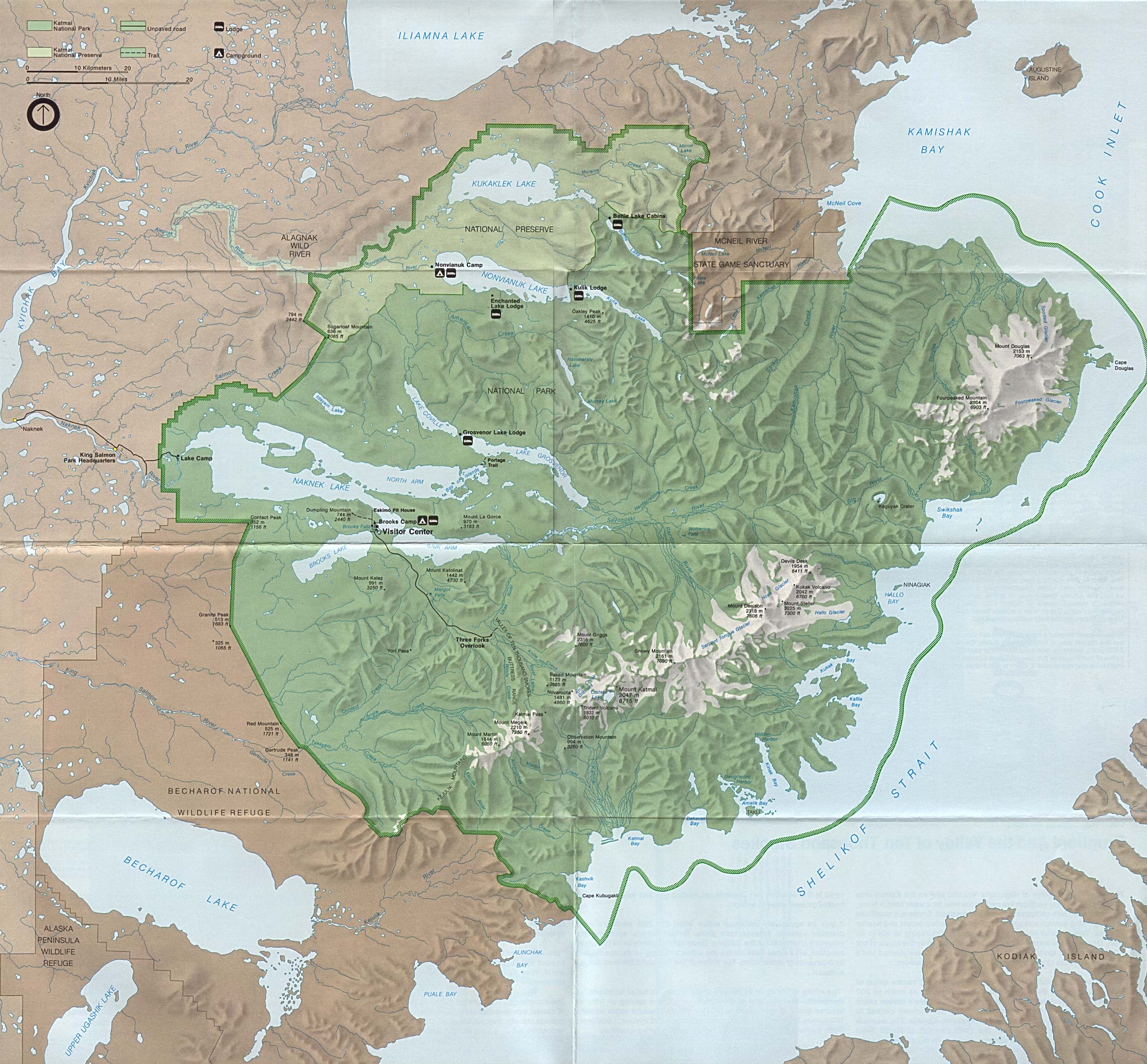
Katmai National Park and Preserve (Park Map) 1988 (748K)
Kenai Fjords National Park (Glacier Map) 1999 (65K) (PDF Format)
Kenai Fjords National Park (Park Map) 1999 (968K) (PDF Format)
Klondike Gold Rush National Historical Park (Skagway Map) 1999 (65K) (PDF Format)
Kobuk Valley National Park (Park Map) (1MB)
Kobuk Valley National Park (Location Map) (26KB)
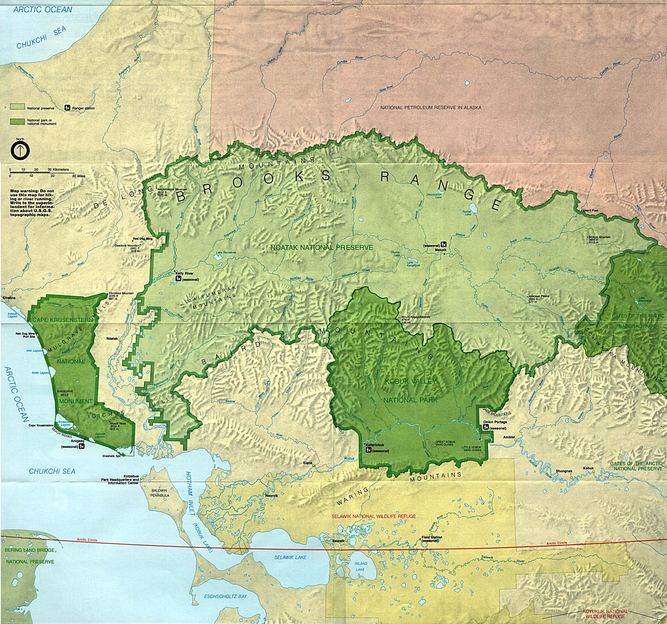
Noatak National Preserve (Park Map) (1MB)
Noatak National Preserve (Location Map) (26KB)
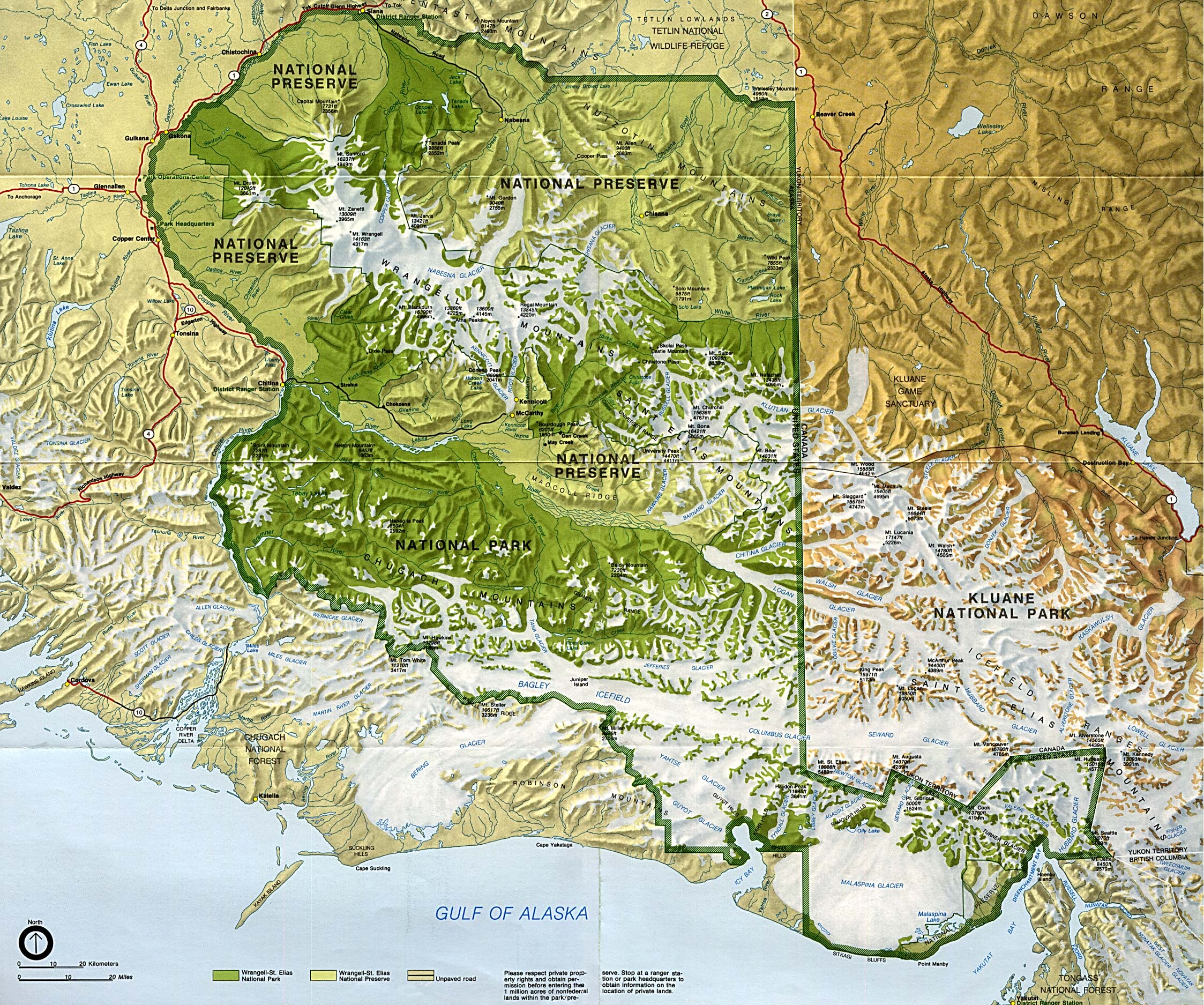
Wrangell-St. Elias National Park and Preserve (Park Map) (1M)
Yukon - Charley Rivers National Preserve (Park Map) 1998 (323K) (PDF Format)
Sources: Many of these maps were provided by the University of Texas Library and/or the U.S. Central Intelligence Agency (CIA).
Maps on other websites:
Alaska (Lonely Planet)
Alaska (World Sites Atlas)
Alaska - Alaska Airlines Route Map
Alaska - Atlas of Panoramic Aerial Images (William Bowen)
Alaska - County Names (Census Bureau)
Alaska - Earthquake Maps (AEIC)
Alaska - Environmental Maps (Inforain)
Alaska - Geospatial Data Clearinghouse (State of Alaska)
Alaska - Highway Map (TravelAlaska)
Alaska - Maps (Alaska Department of Natural Resources)
Alaska - Maps (Alaska Information Services)
Alaska - Maps (Geology.com)
Alaska - Panoramic Aerial Images Atlas (William Bowen)
Alaska Railroad Route Map (Alaska Railroad)
Alaska - Satellite Image (Geology.com)
Alaska - Topographic Maps (Alaska Geospatial Data Clearinghouse)
Alaska - Topographic Maps (Libre Map Project)
Alaska - Volcano Maps
See Also:
Topographic Maps
ArcGIS Shapefile Map Layers
<-- Free Maps
<-- Free U.S. State Maps
<-- Free World Country Maps
Didn't find what you are looking for? We've been online since 1996 and have created 1000's of pages. Search below and you may find just what you are looking for.
Michael R. Meuser
Data Research & GIS Specialist
MapCruzin.com is an independent firm
specializing in GIS project development and data research.
We created the first U.S. based
interactive toxic chemical facility
maps on the internet in 1996 and we
have been online ever since. Learn more about us and our services.
Have a project in mind? If you have data, GIS project or custom shapefile needs contact Mike.
Contact Us
Report Broken Links
Subscribe for Updates
Sponsors


