Download Free United Kingdom Maps
<-- Free Map Downloads
<-- Free World Country Map Downloads
Note that maps may not appear on the webpage in their full size and resolution. To save the maps to your computer, right-click on the link.
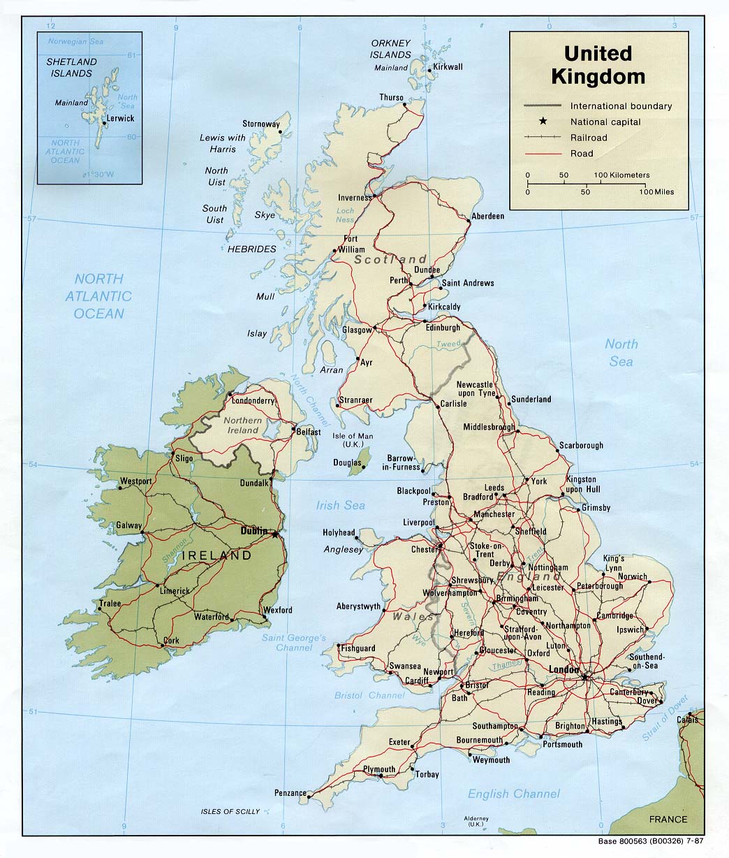
United Kingdom (Political) 1987 (229K) and
pdf format (241K)
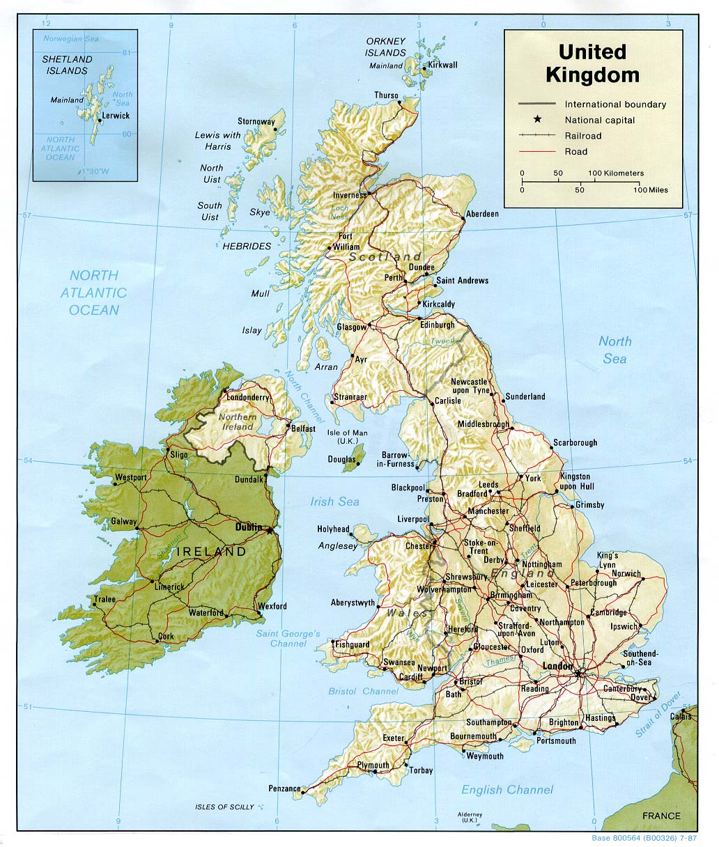
United Kingdom (Shaded Relief) 1987 (268K) and
pdf format (274K)
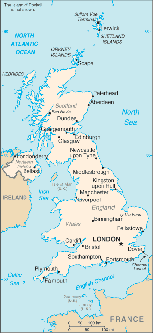
United Kingdom (Small Map) 2008 (23K)
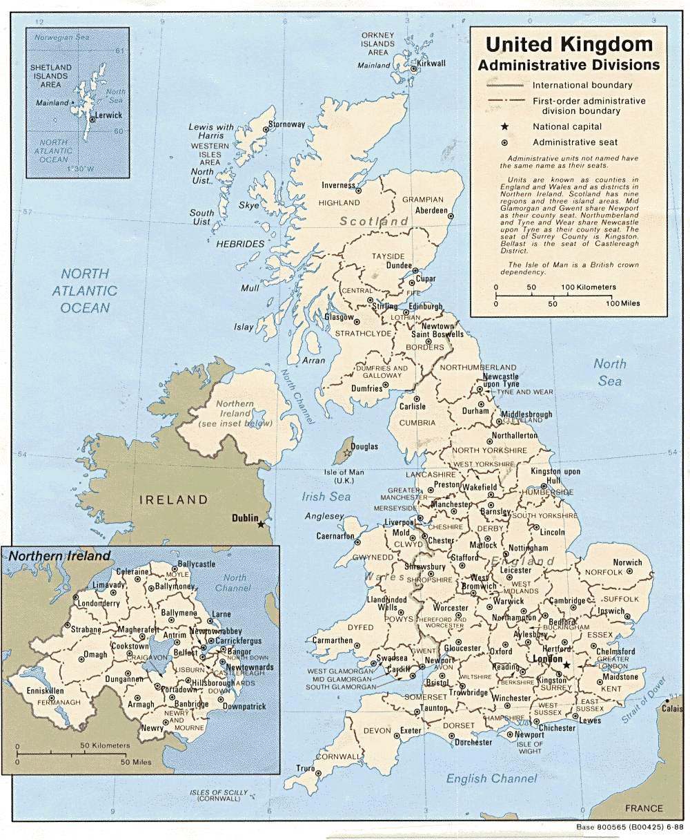
United Kingdom: Admininistrative Divisions 1988 (317K) and pdf format (325K)
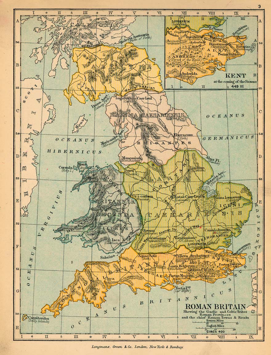
Roman Britain Circa 400 (307K)
From "The Public Schools Historical Atlas" by Charles Colbeck, 1905.
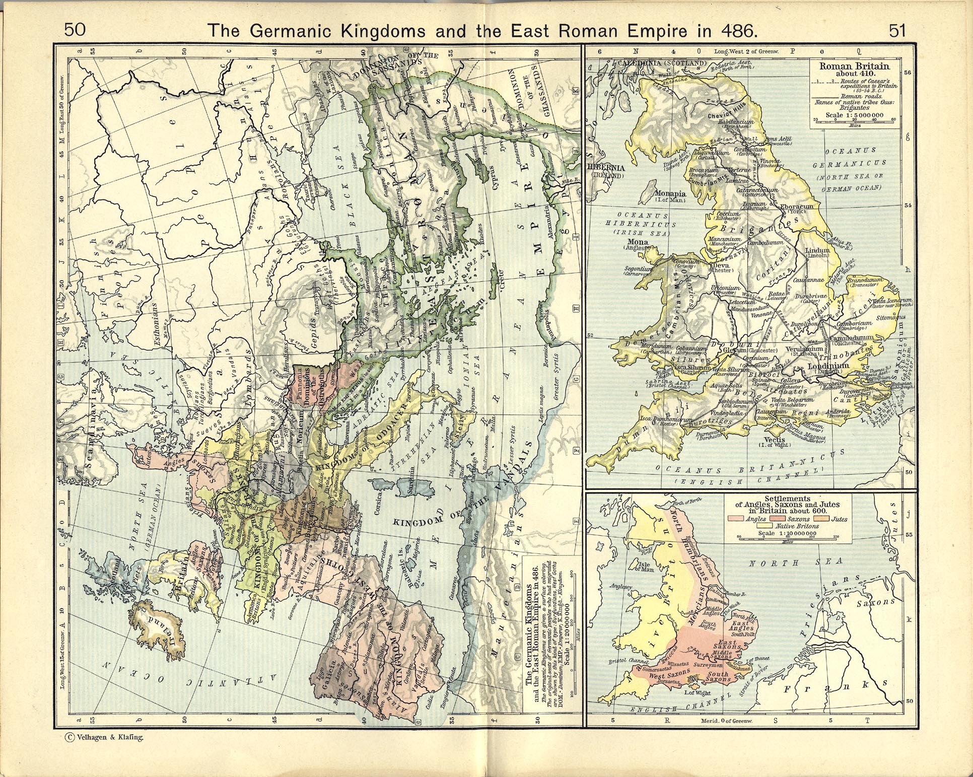
Roman Britain About 410 (770K)
From The Historical Atlas by William R. Shepherd, 1911.
Settlements of Angles, Saxons and Jutes in Britain about 600 (770K) From The Historical Atlas by William R. Shepherd, 1911.
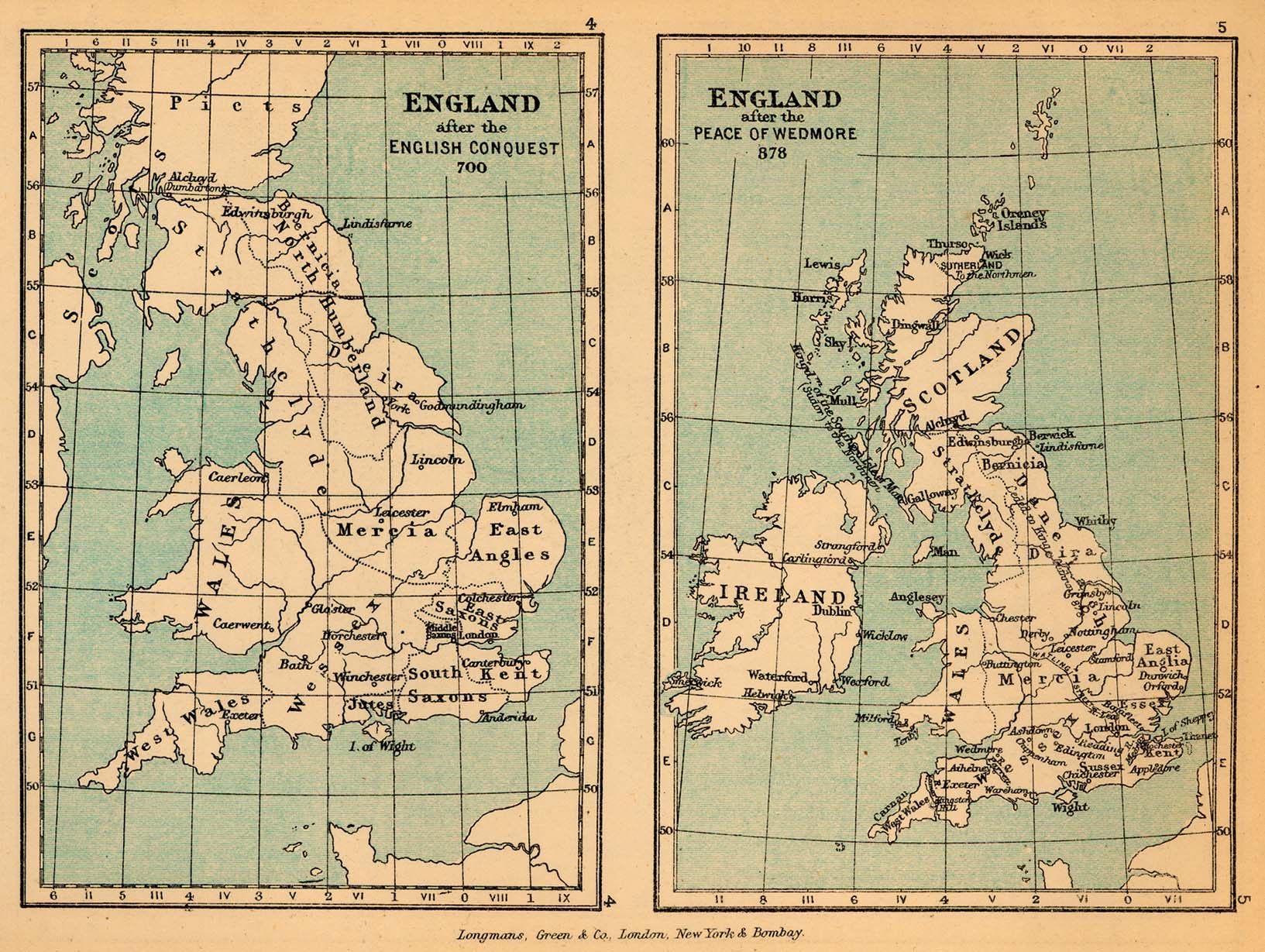
England in 700 and 878 (409K)
From "The Public Schools Historical Atlas" by Charles Colbeck, 1905.
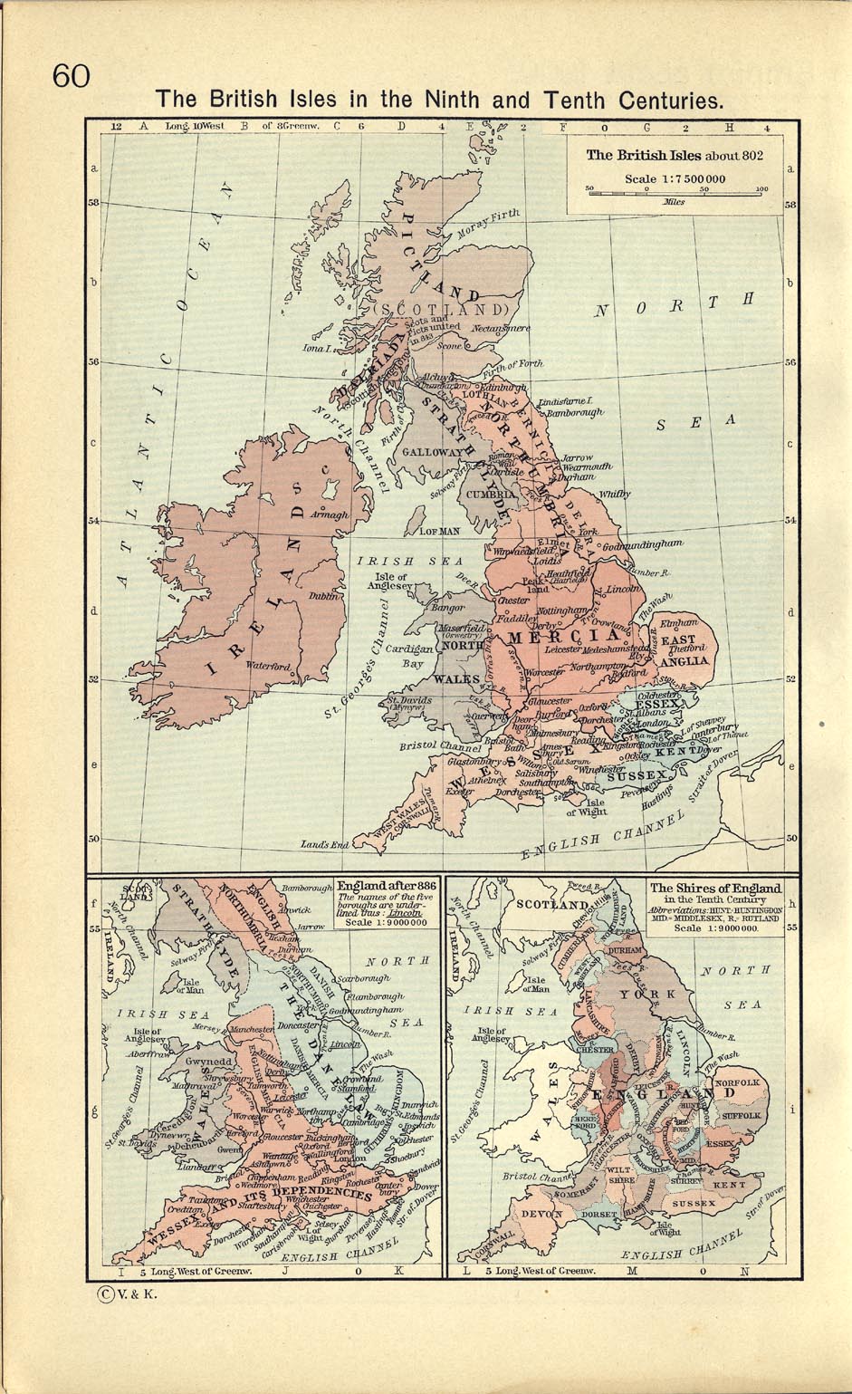
The British Isles about 802 (332K)
From The Historical Atlas by William R. Shepherd, 1911.
England after 886 (332K)
From The Historical Atlas by William R. Shepherd, 1911.
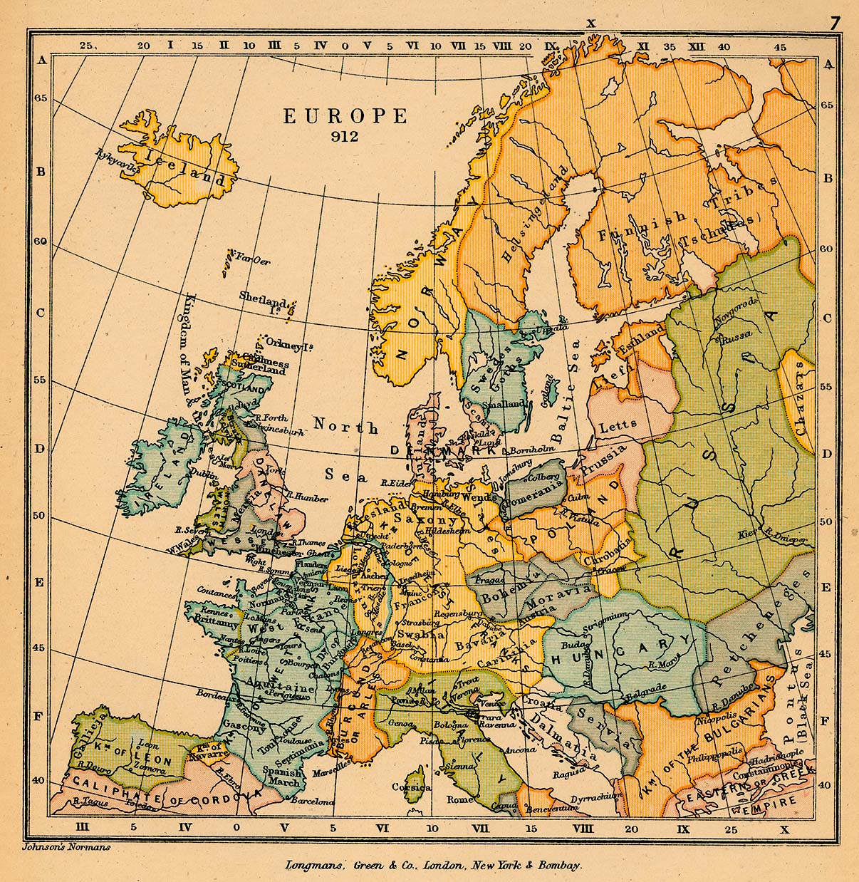
Europe in 912 (529K)
From "The Public Schools Historical Atlas" by Charles Colbeck, 1905.
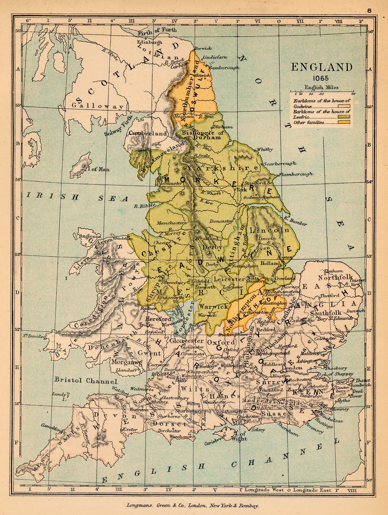
England in 1065 (513K)
From "The Public Schools Historical Atlas" by Charles Colbeck, 1905.
The Shires of England in the Tenth Century (332K)
The Shires of England in the Tenth Century. From The Historical Atlas by William R. Shepherd, 1911.
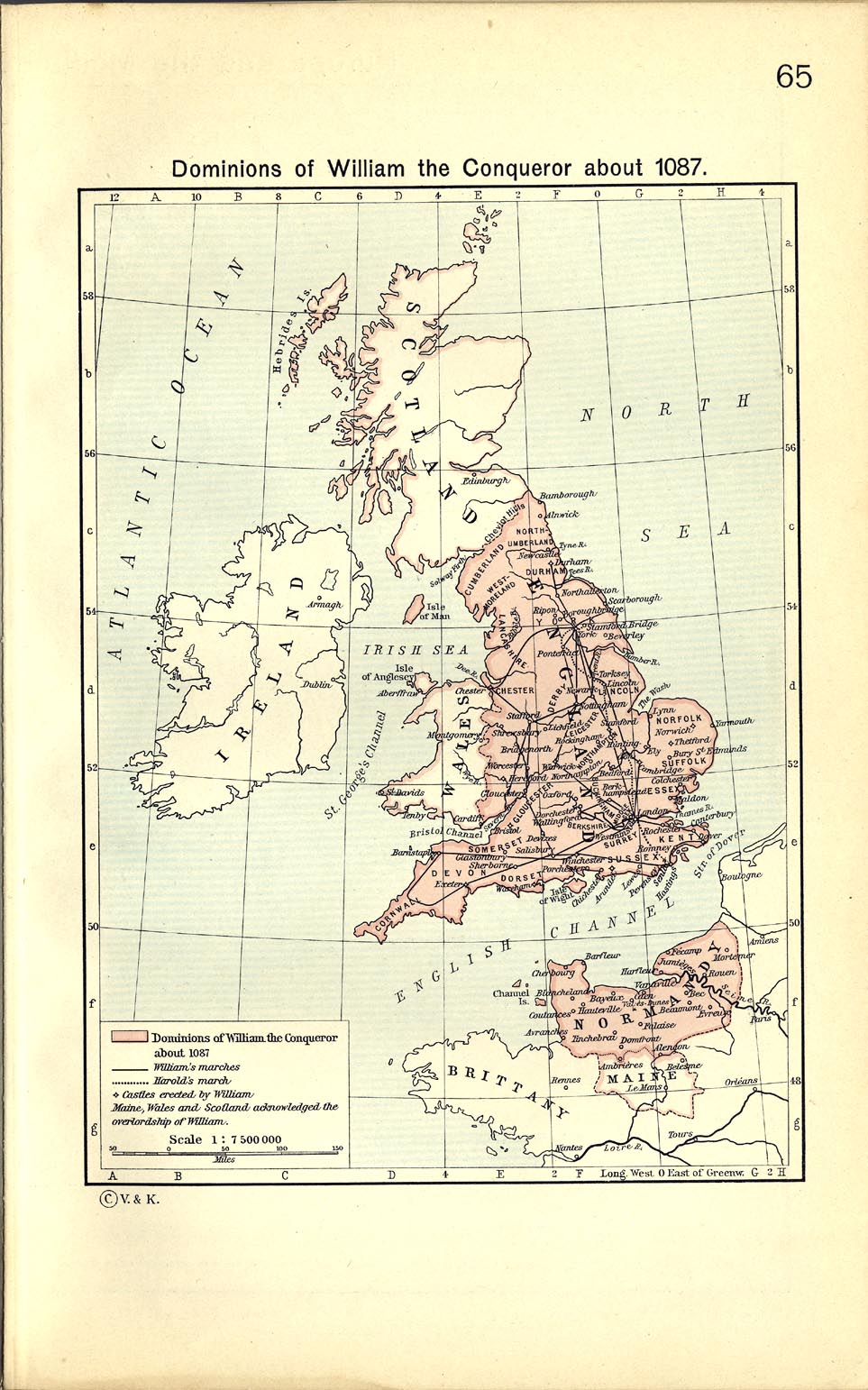
Dominions of William the Conqueror about 1087 (273K)
From The Historical Atlas by William R. Shepherd, 1911.
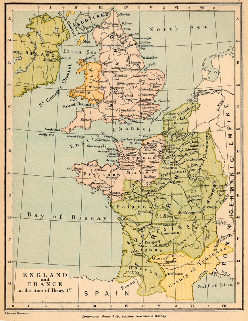
England and France in the time of Henry I (257K)
From "The Public Schools Historical Atlas" by Charles Colbeck, 1905.
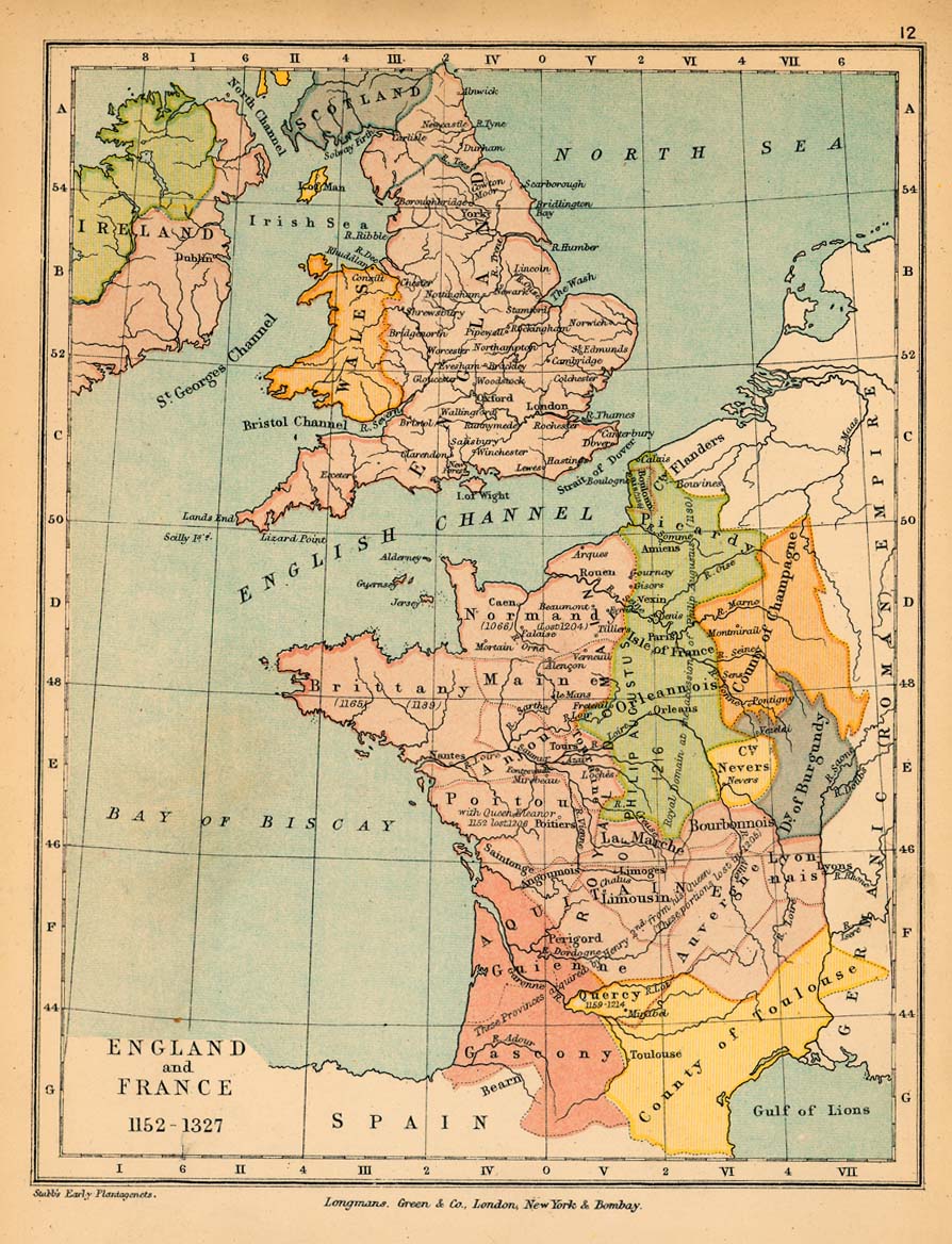
England and France, 1152-1327 (264K)
From "The Public Schools Historical Atlas" by Charles Colbeck, 1905.
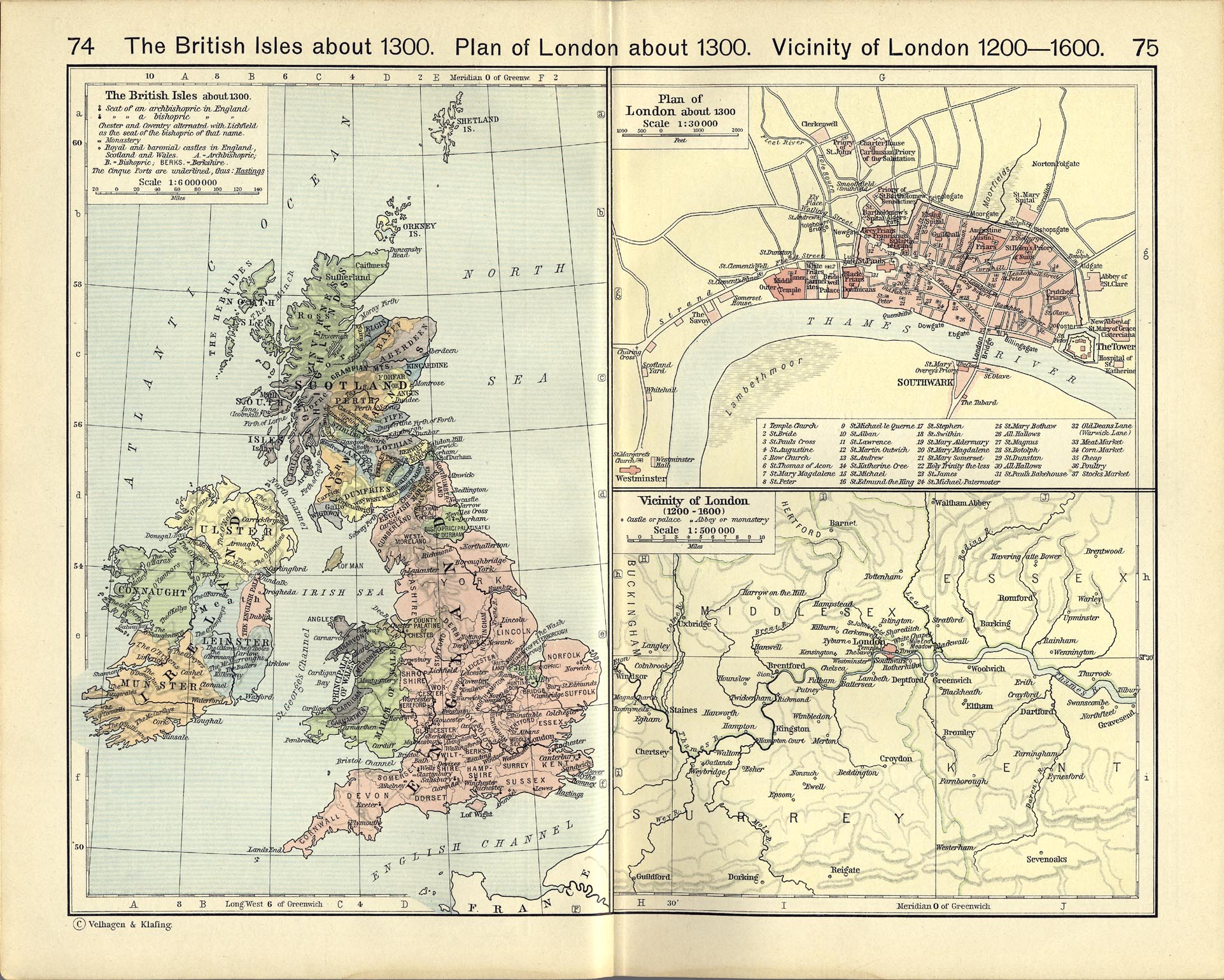
Vicinity of London, 1200-1600 (687K)
From The Historical Atlas by William R. Shepherd, 1911.
The British Isles about 1300 (687K)
From The Historical Atlas by William R. Shepherd, 1911.
Plan of London about 1300 (687K)
From The Historical Atlas by William R. Shepherd, 1911.
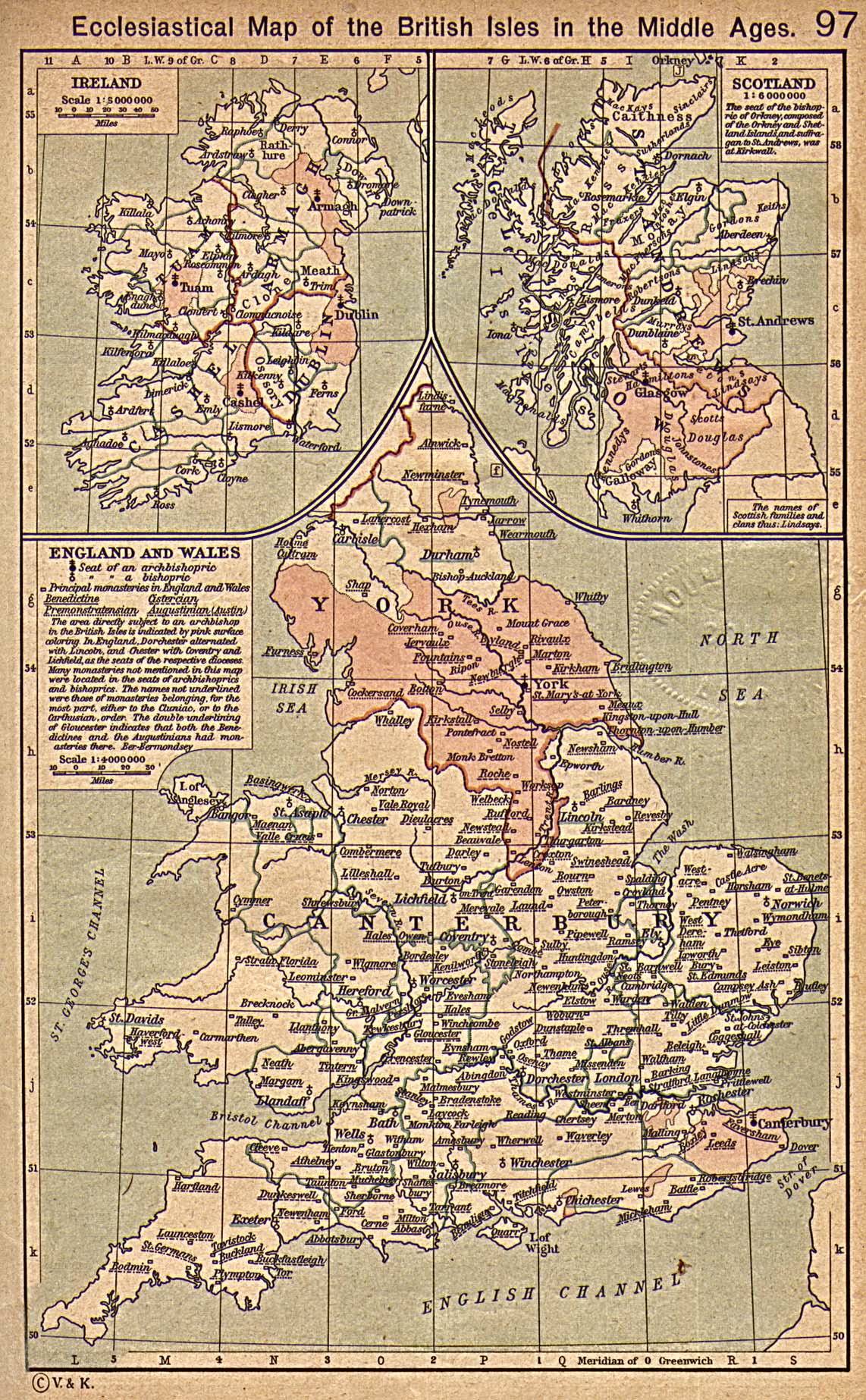
British Isles Ecclesiastical Map (645K)
Ecclesiastical Map of the British Isles in the Middle Ages. From The Historical Atlas by William R. Shepherd, 1923.
England during the Wars of the Roses [1445-1485] (246K)
From "The Public Schools Historical Atlas" by Charles Colbeck, 1905.
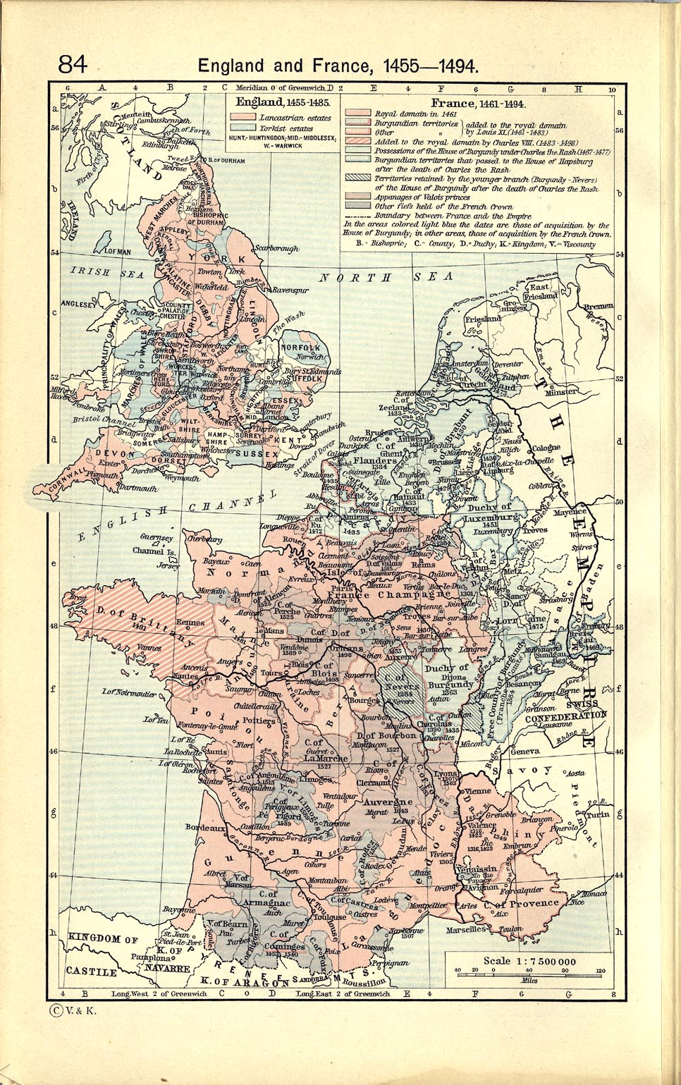
England and France, 1455-1494 (440K)
From The Historical Atlas by William R. Shepherd, 1911.
England and Wales under the Tudors [1485-1603] (877K)
From "The Cambridge Modern History Atlas", 1912.
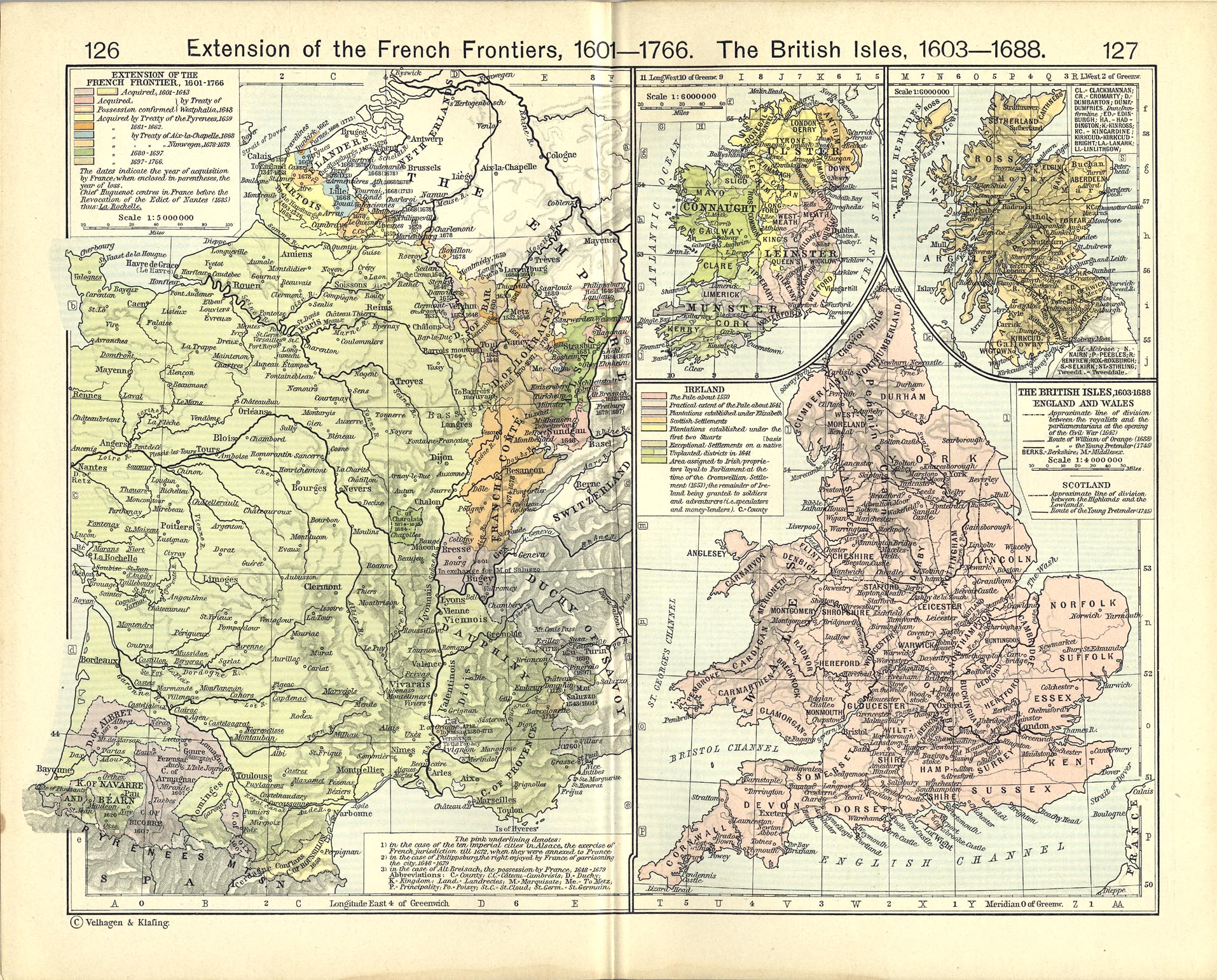
The British Isles, 1603-1688 (904K)
From The Historical Atlas by William R. Shepherd, 1911.
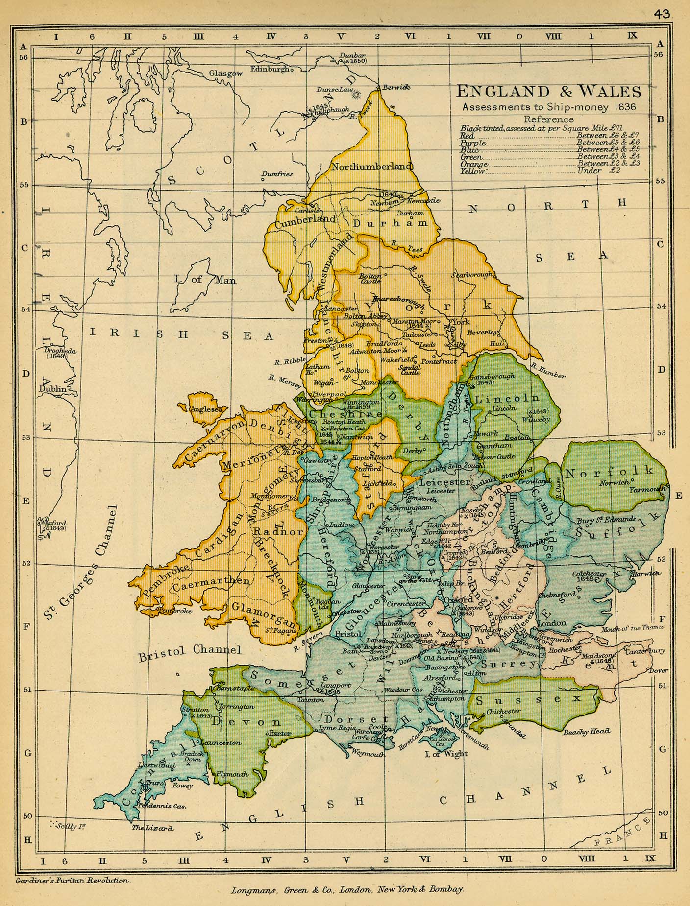
England and Wales. Assessments to Ship-money, 1636 (514K)
From "The Public Schools Historical Atlas" by Charles Colbeck, 1905.
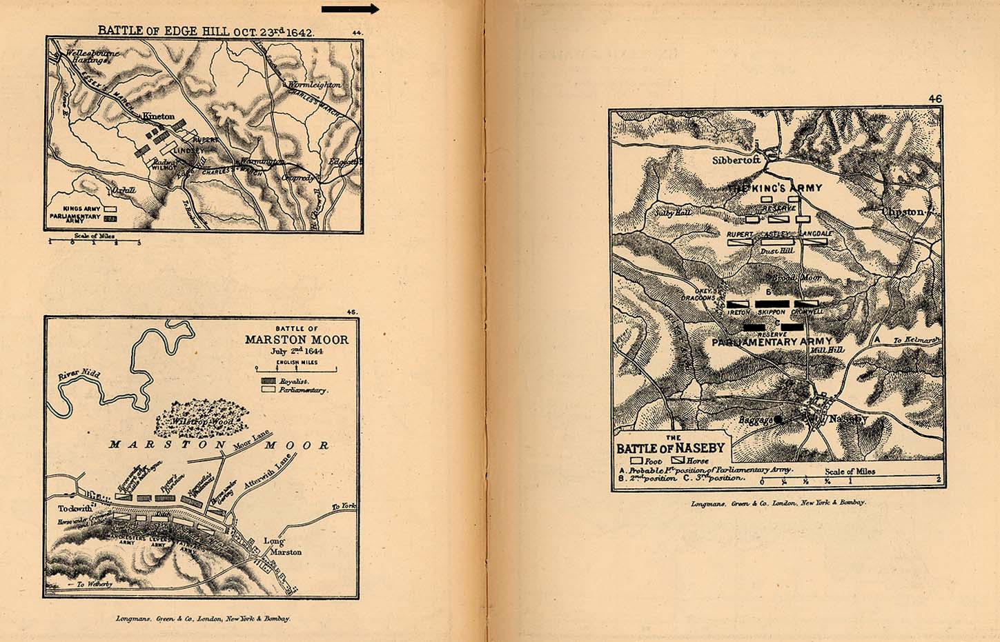
Battles of Edge Hill, Marston Moor, Naseby (254K)
From "The Public Schools Historical Atlas" by Charles Colbeck, 1905.
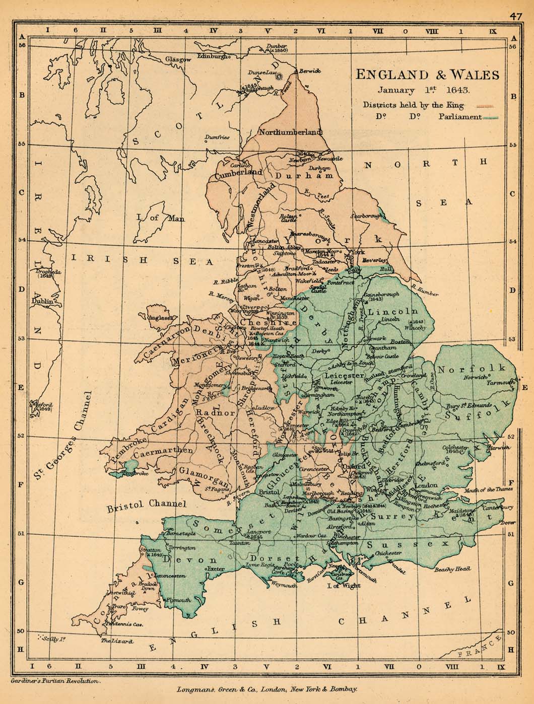
England and Wales, January 1, 1643 (254K)
From "The Public Schools Historical Atlas" by Charles Colbeck, 1905.
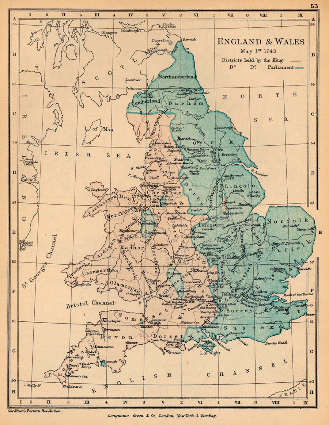
England and Wales, May 1, 1643 (254K)
From "The Public Schools Historical Atlas" by Charles Colbeck, 1905.
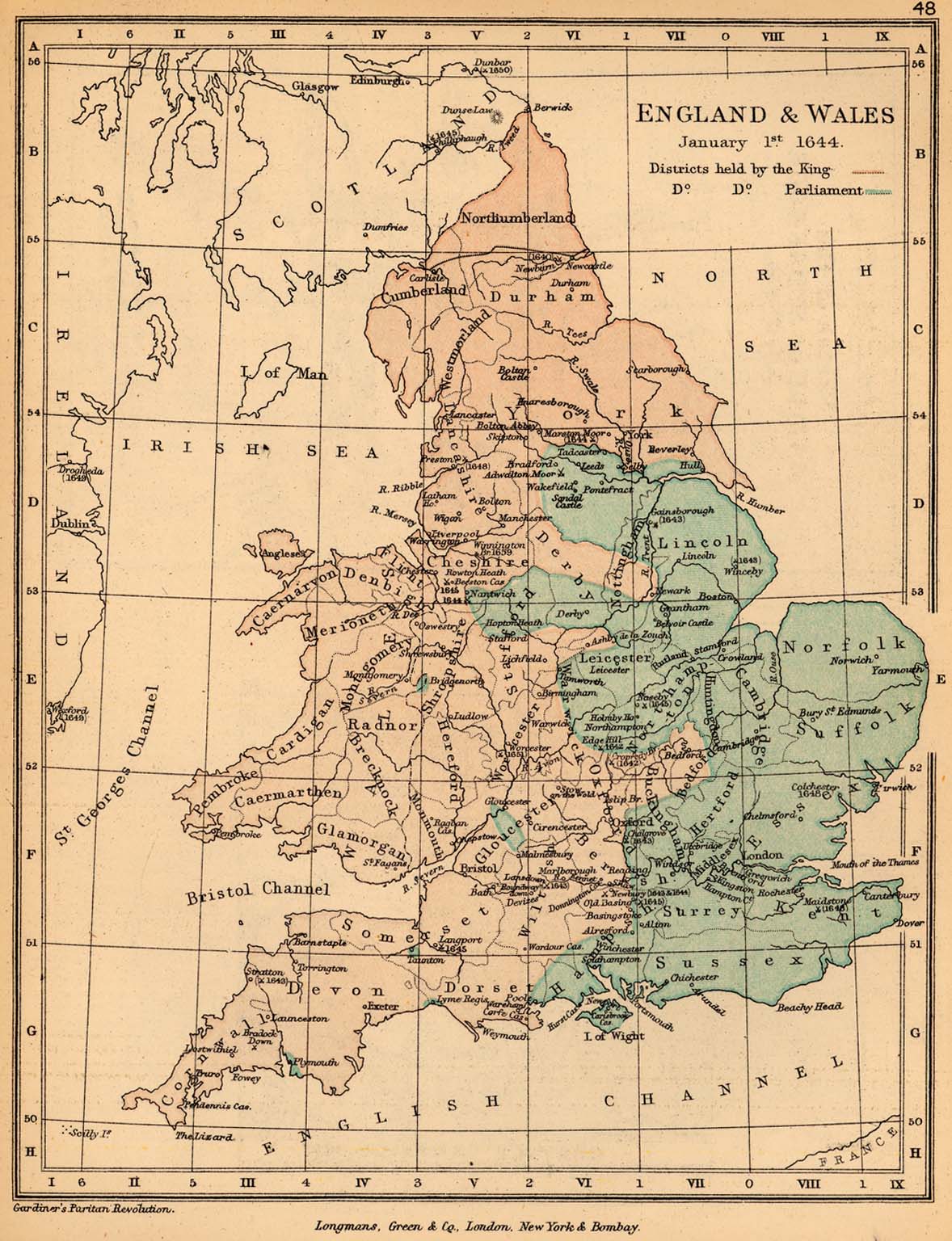
England and Wales, January 1, 1644 (328K)
From "The Public Schools Historical Atlas" by Charles Colbeck, 1905.
England and Wales after the Campaigns of 1644 (426K)
From "The Cambridge Modern History Atlas", 1912.
England and Wales: The Civil War [1642-1651] (1006K)
From "The Cambridge Modern History Atlas", 1912.
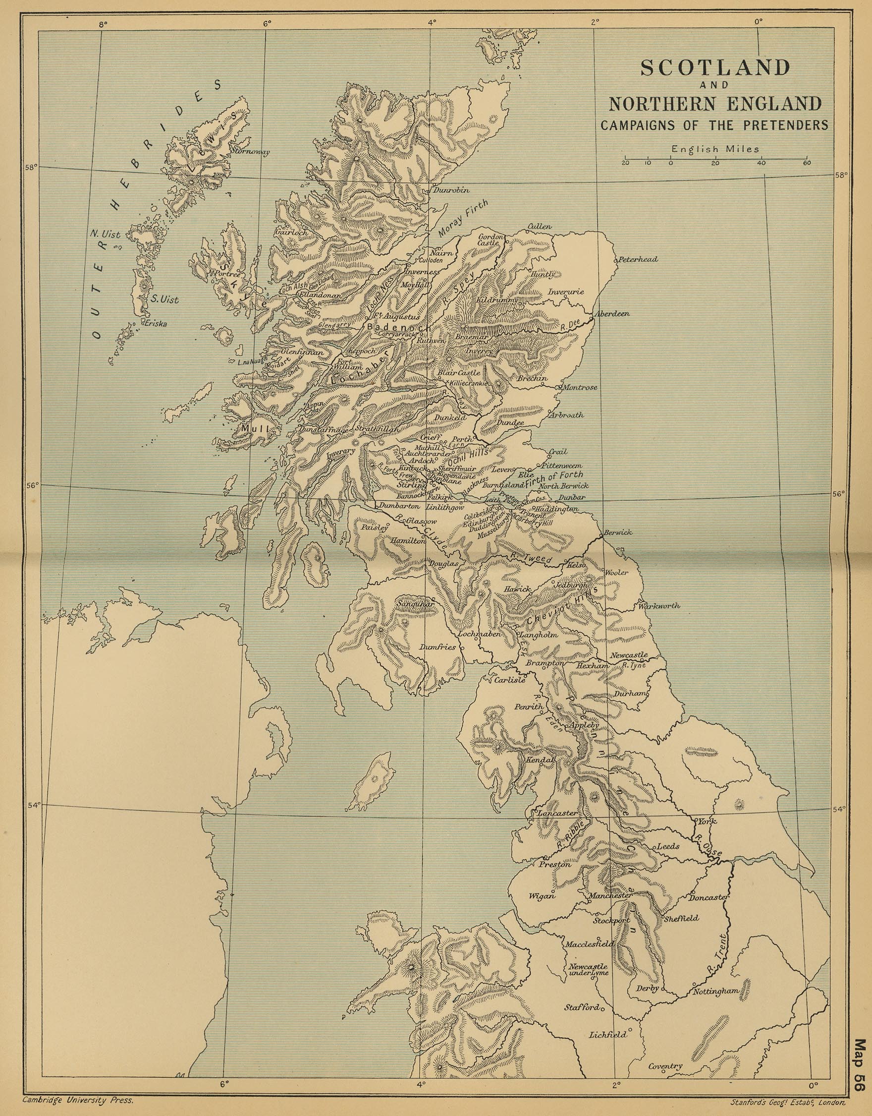
Scotland and Northern England: Campaigns of the Pretenders (847K)
From "The Cambridge Modern History Atlas", 1912.
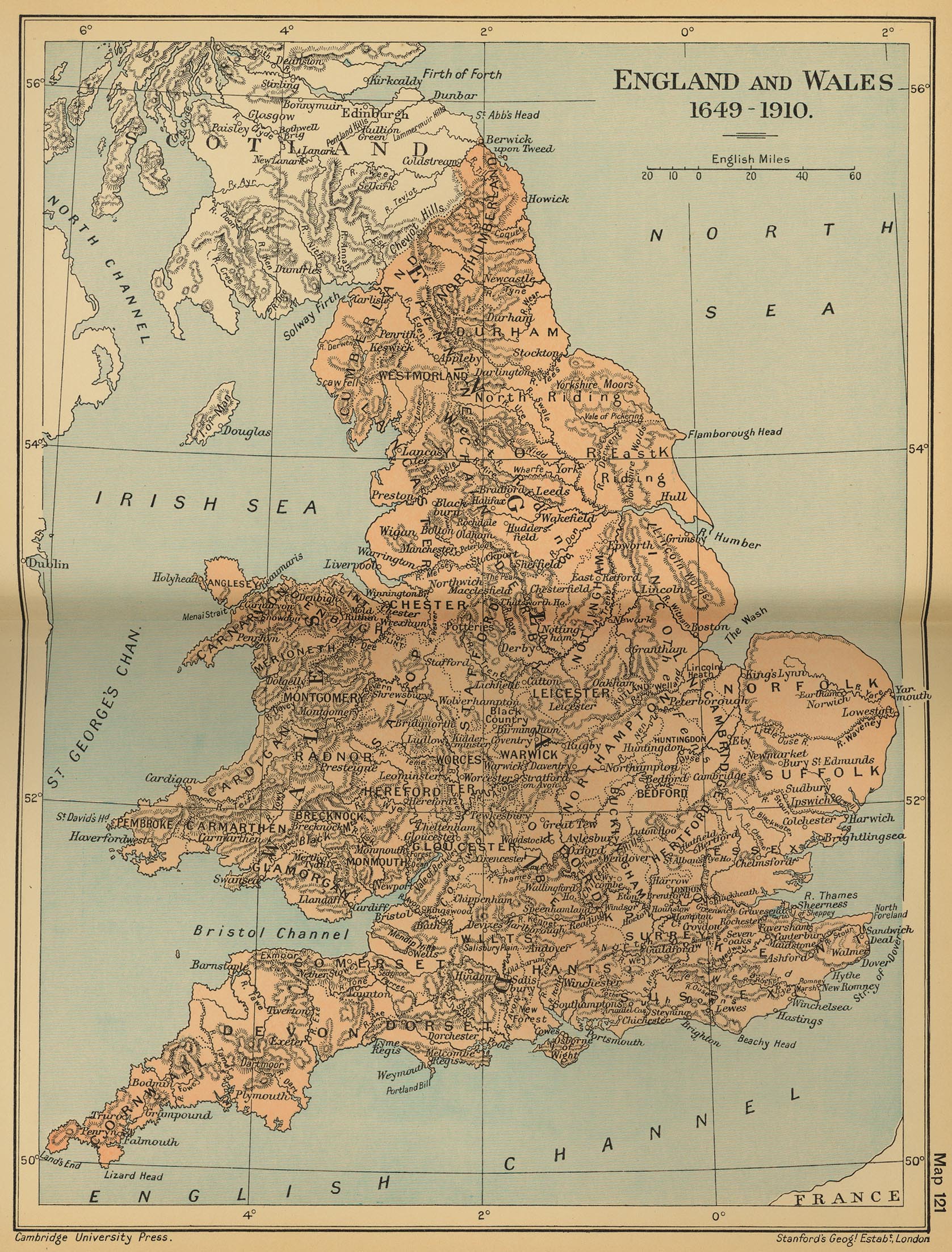
England and Wales 1649-1910 (932K)
From "The Cambridge Modern History Atlas", 1912.
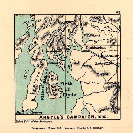
Argyle's Campaign, 1685 (102K)
From "The Public Schools Historical Atlas" by Charles Colbeck, 1905.
Sedgemoor [1685] (98K)
From "The Public Schools Historical Atlas" by Charles Colbeck, 1905.
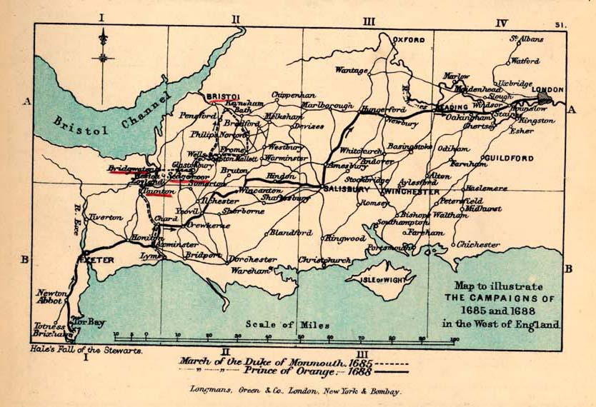
South-West England, to illustrate the Campaign of 1685-1688 (131K)
From "The Public Schools Historical Atlas" by Charles Colbeck, 1905.
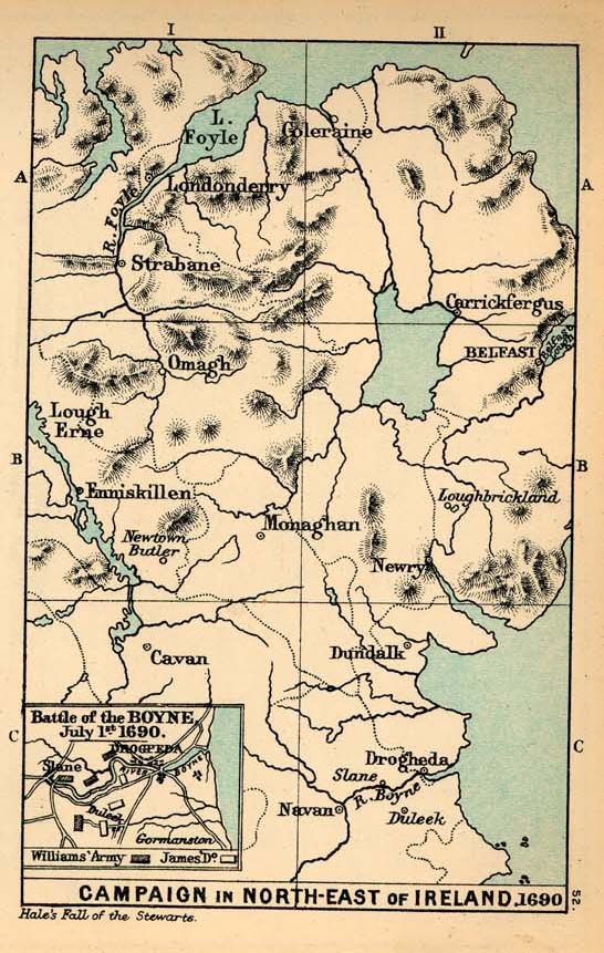
Campaign in the North-East of Ireland and Battle of the Boyne, 1690 (157K)
From "The Public Schools Historical Atlas" by Charles Colbeck, 1905.
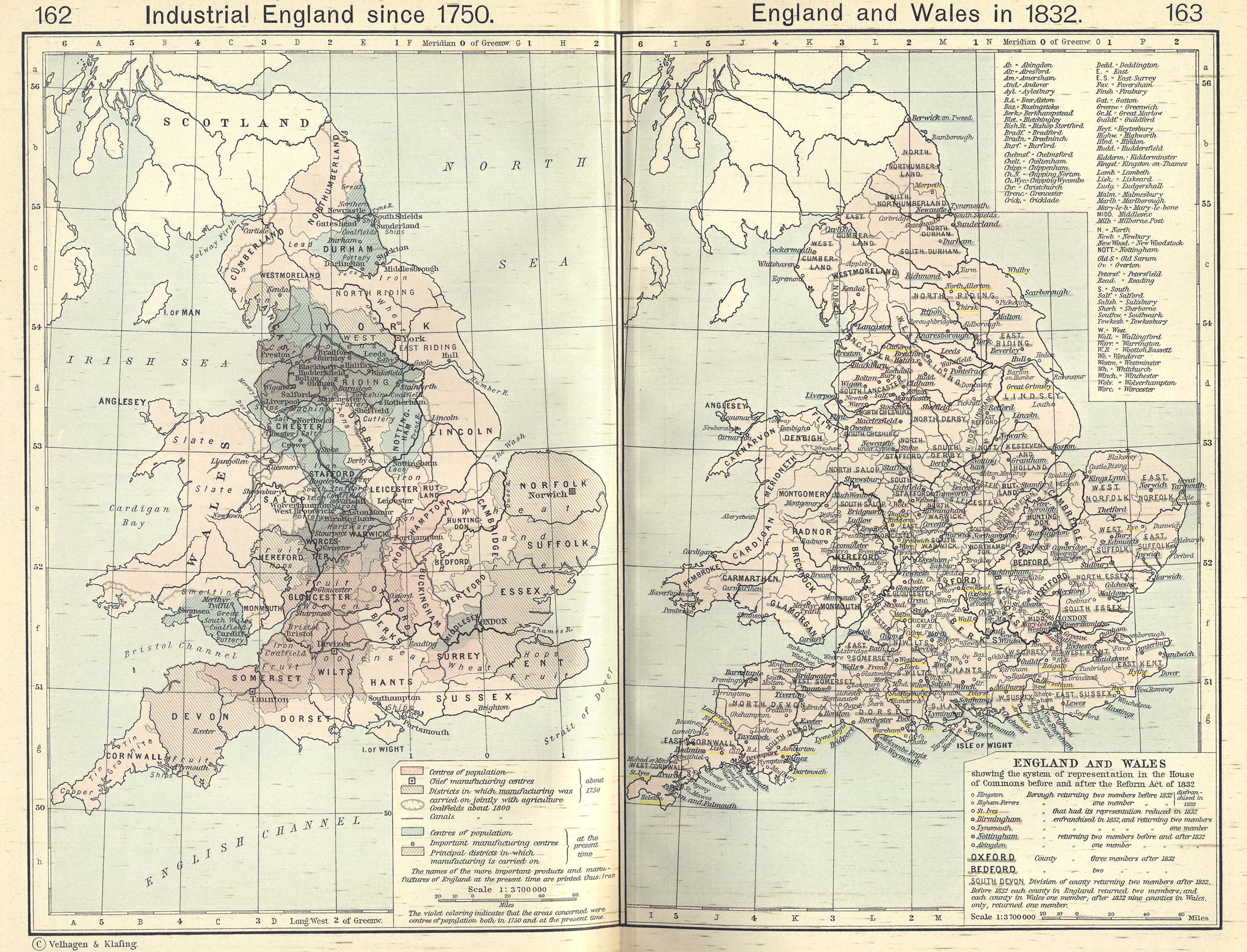
Industrial England since 1750 (1.01MB)
From The Historical Atlas by William R. Shepherd, 1911.
England and Wales in 1832/Industrial England since 1750 (1.10MB)
From The Historical Atlas by William R. Shepherd, 1911.
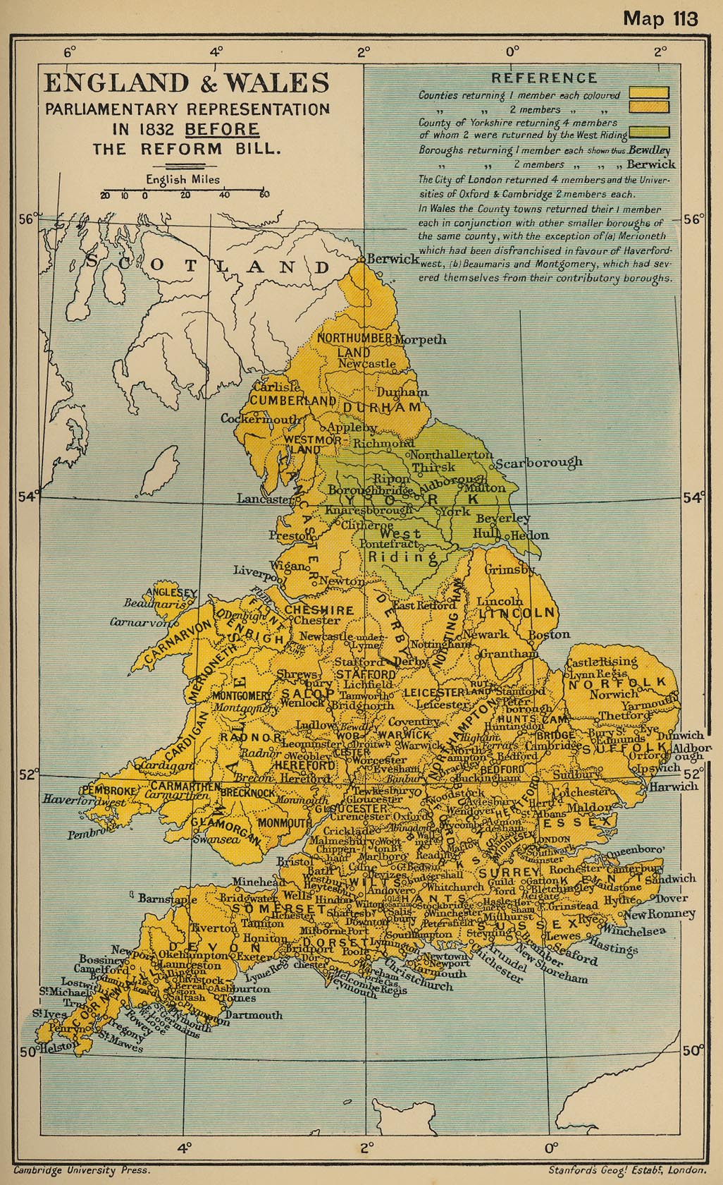
England and Wales: Parliamentary Representation in 1832 Before the Reform Bill (519K)
From "The Cambridge Modern History Atlas", 1912.
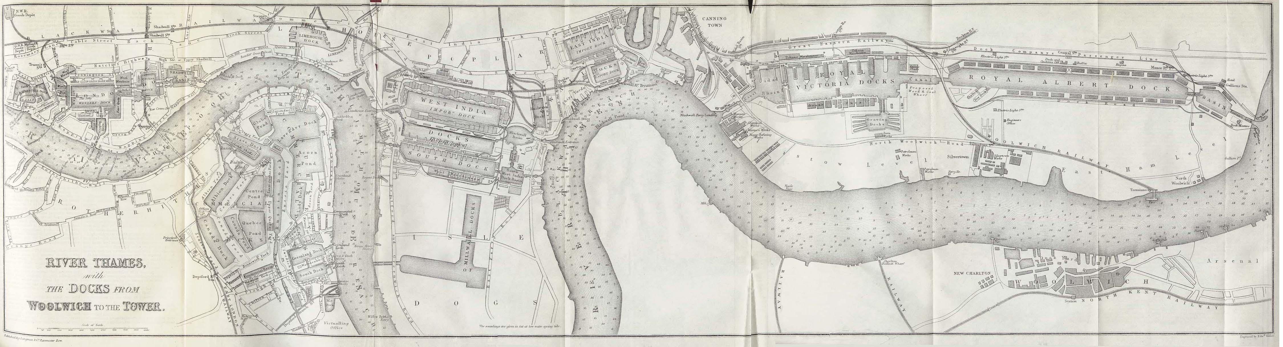
London - Thames River 1882 (982K)
"River Thames with the Docks from Woolwich to the Tower" from A Dictionary Practical, Theoretical, and Historical of Commerce and Commercial Navigation by J.R. M'Culloch. Longmans, Green and Co. London, 1882.
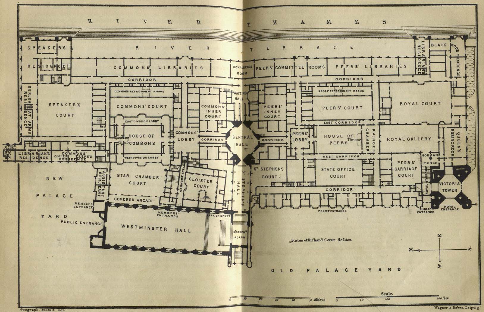
London - Houses of Parliment 1894 (225K)
"Old Palace Yard" from Baedeker, Karl. Baedeker's London and Its Environs. Ninth Revised Edition. Leipsic, 1894.
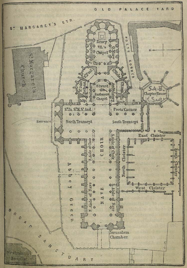
London - Westminster Abbey 1894 (341K)
"Westminster Abbey" from Baedeker, Karl. Baedeker's London and Its Environs. Ninth Revised Edition. Leipsic, 1894.
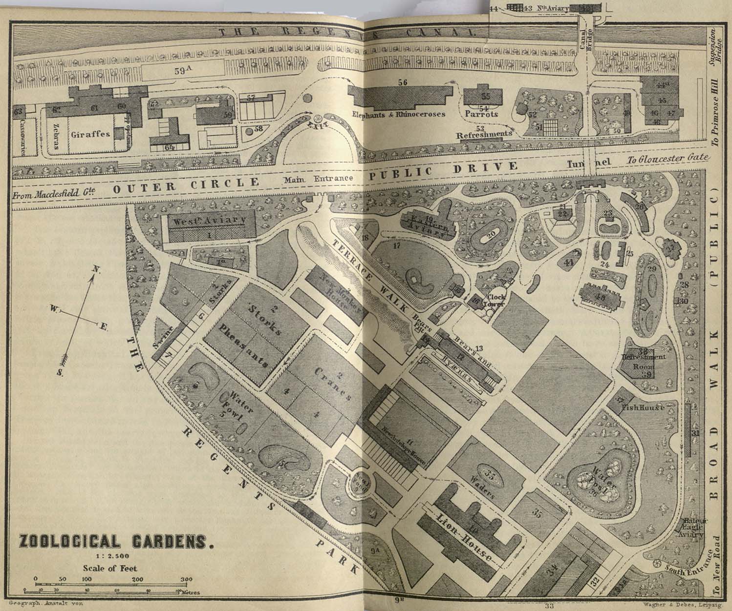
London - Zoological Gardens 1894 (309K)
"Zoological Gardens" from Baedeker, Karl. Baedeker's London and Its Environs. Ninth Revised Edition. Leipsic, 1894.
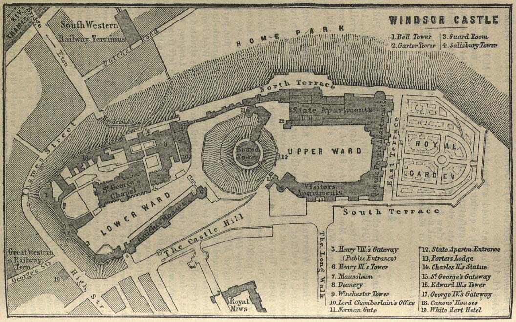
London Area - Windsor Castle 1894 (203K)
"Windsor Castle" from Baedeker, Karl. Baedeker's London and Its Environs. Ninth Revised Edition. Leipsic, 1894.
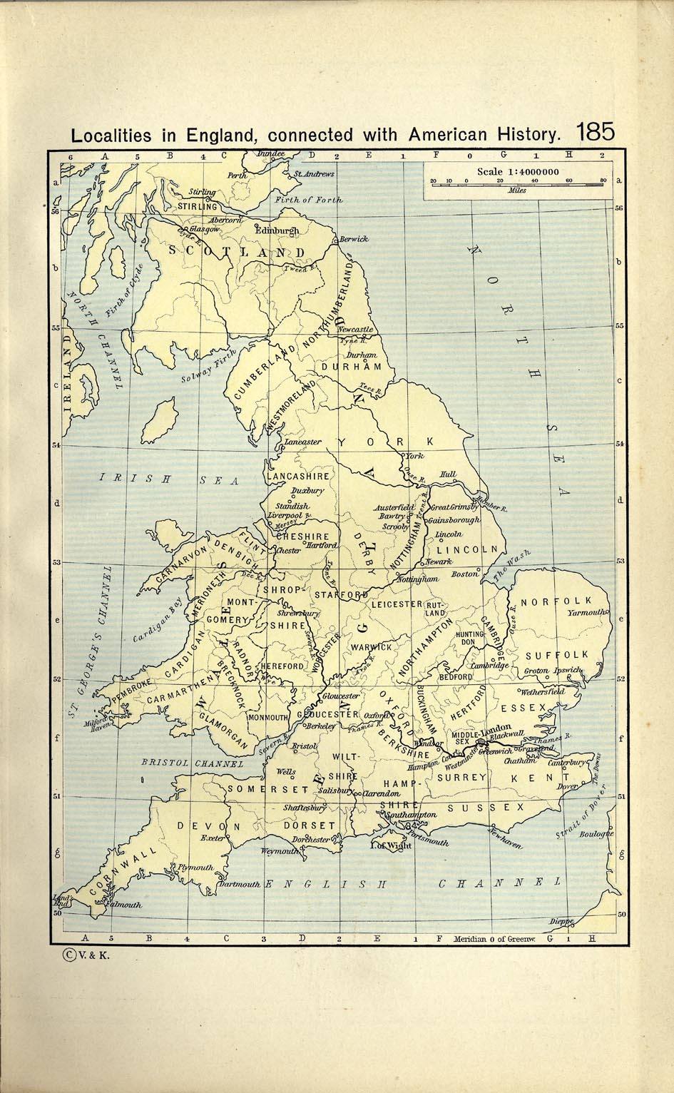
Localities in England connected with American History (296K)
From The Historical Atlas by William R. Shepherd, 1911.
Sources: These maps were provided by the University of Texas Library and/or
the U.S. Central Intelligence Agency (CIA) unless otherwise noted.
Maps on other websites
United Kingdom - Get a Map Online (Ordnance Survey) [PDF]
United Kingdom - Immigration Maps (BBC)
United Kingdom - Interactive Atlas (Google Maps UK)
United Kingdom - Mineral Industry (USGS) and Map Key
United Kingdom - Place Names Gazetteer, with maps (Ordnance Survey MapZone)
United Kingdom - Route Planner (Automobile Association)
United Kingdom (Merriam-Webster)
United Kingdom - Election Maps, May 2005 (BBC News)
United Kingdom - Election Maps, May 2005 (Guardian Unlimited)
United Kingdom - Electoral Geography (Ordnance Survey)
United Kingdom - Immigration Maps (BBC)
United Kingdom - Megalith Map - Clickable (megalithic.co.uk)
United Kingdom - Mineral Industry (USGS) and Map Key
United Kingdom - Old Maps (Old-maps.co.uk)
United Kingdom - Railways (Trainspotting B�kkes)
United Kingdom - Route Planner (Automobile Association)
United Kingdom - Searchable Road Map of England, Scotland and Wales (UK Street Map)
<-- Free Map Downloads
<-- Free World Country Map Downloads
Didn't find what you are looking for? We've been online since 1996 and have created 1000's of pages. Search below and you may find just what you are looking for.
Michael R. Meuser
Data Research & GIS Specialist
MapCruzin.com is an independent firm
specializing in GIS project development and data research.
We created the first U.S. based
interactive toxic chemical facility
maps on the internet in 1996 and we
have been online ever since. Learn more about us and our services.
Have a project in mind? If you have data, GIS project or custom shapefile needs contact Mike.
Contact Us
Report Broken Links
Subscribe for Updates


![England during the Wars of the Roses [1445-1485]](/free-maps-united-kingdom/england_wars_of_the_roses.jpg)
![England and Wales under the Tudors [1485-1603]](/free-maps-united-kingdom/england_wales_tudor_1485.jpg)
![England and Wales: The Civil War [1642-1651]](/free-maps-united-kingdom/england_wales_civil_war_large.jpg)
![Sedgemoor [1685]](/free-maps-united-kingdom/battle_of_sedgemoor_1685.jpg)