Download Free Florida National Park and Historic Monument Maps
Sponsors
<-- Download Free Maps
<-- Free National Park Maps
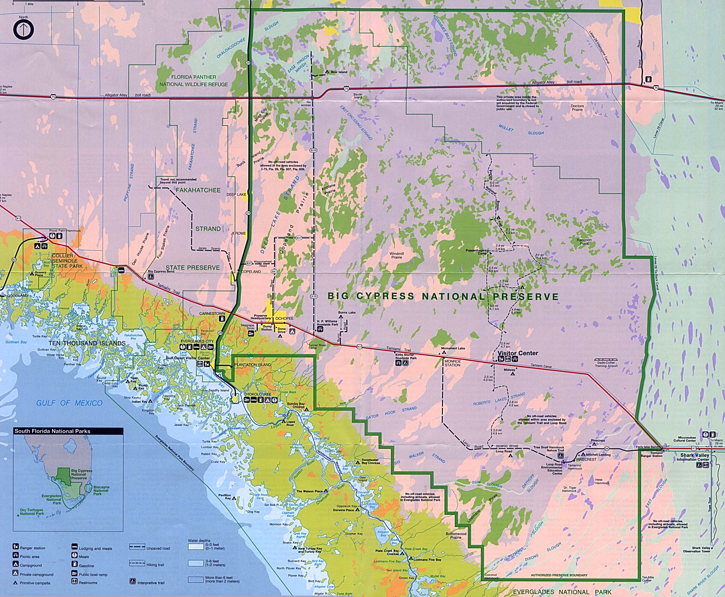
Big Cypress National Preserve (Park Map) 1995 (958K)
Big Cypress National Preserve (Park Map) 1997 (774K) (PDF Format)
Big Cypress National Preserve (Schematic) 1995 (276K)
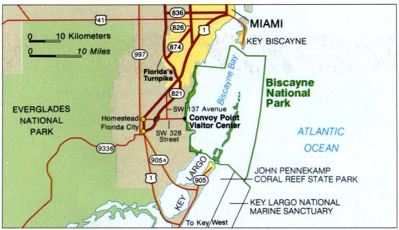
Biscayne National Park (Area Map) 1995 (40K)
Biscayne National Park (Area Map) 1997 (65K) (PDF Format)
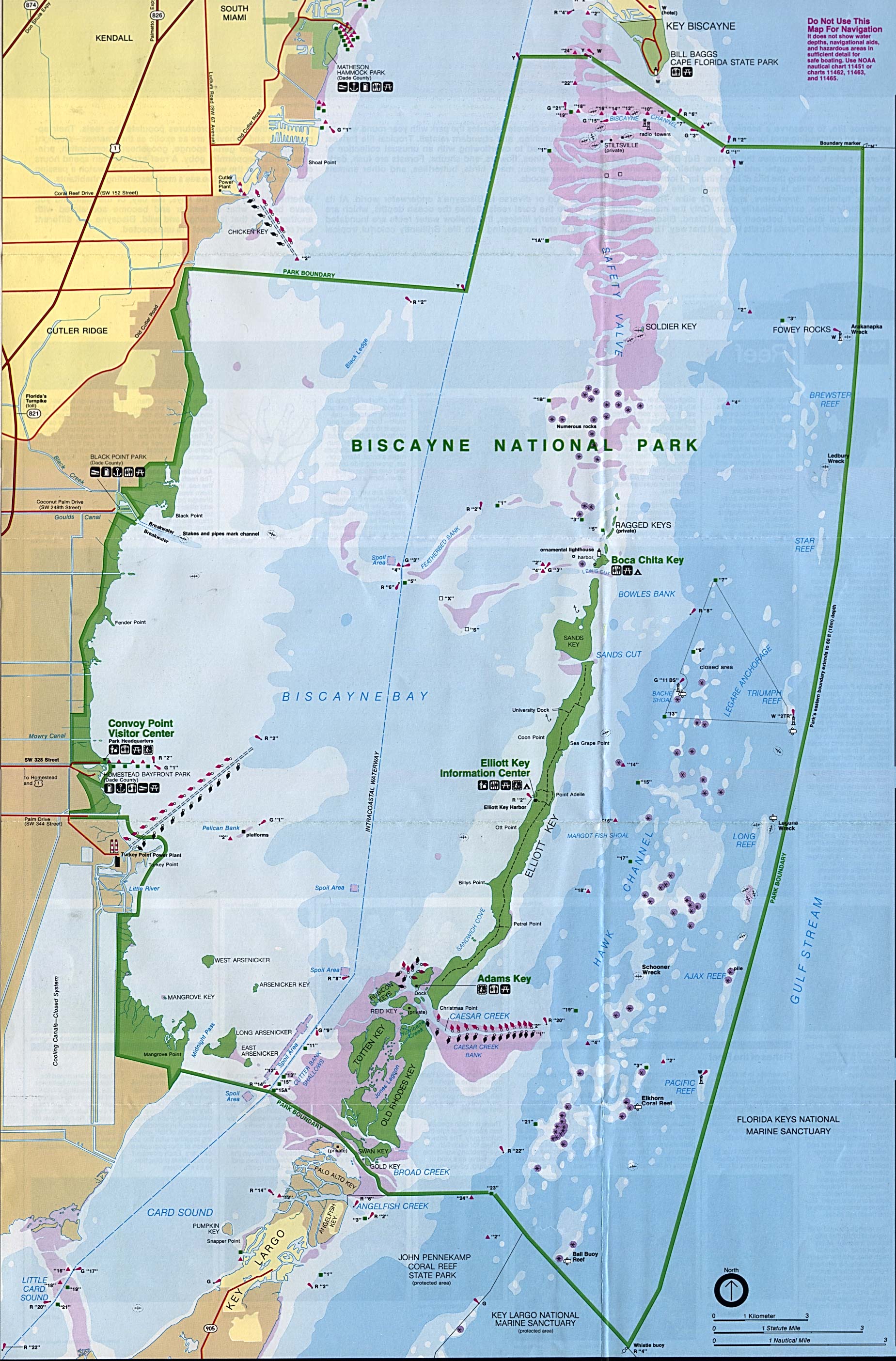
Biscayne National Park (Park Map) 1995 (762K)
Biscayne National Park (Park Map) 1997 (516K) (PDF Format)
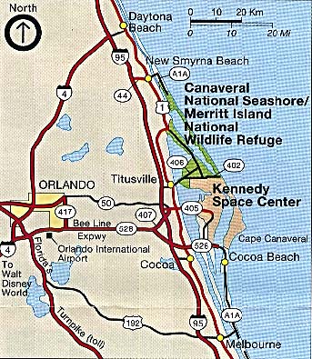
Canaveral and Merritt Island National Seashore (Area Map) 1993 (85K)
Sponsors
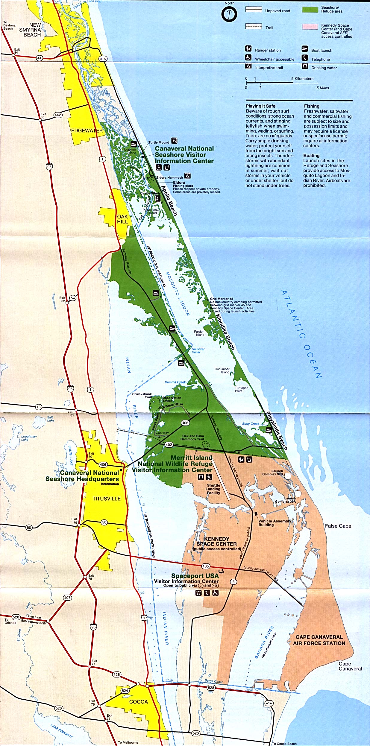
Canaveral and Merritt Island National Seashore (Park Map) 1993 (612K)
Canaveral and Merritt Island National Seashore (Park Map) 1997 (65K) (PDF Format)
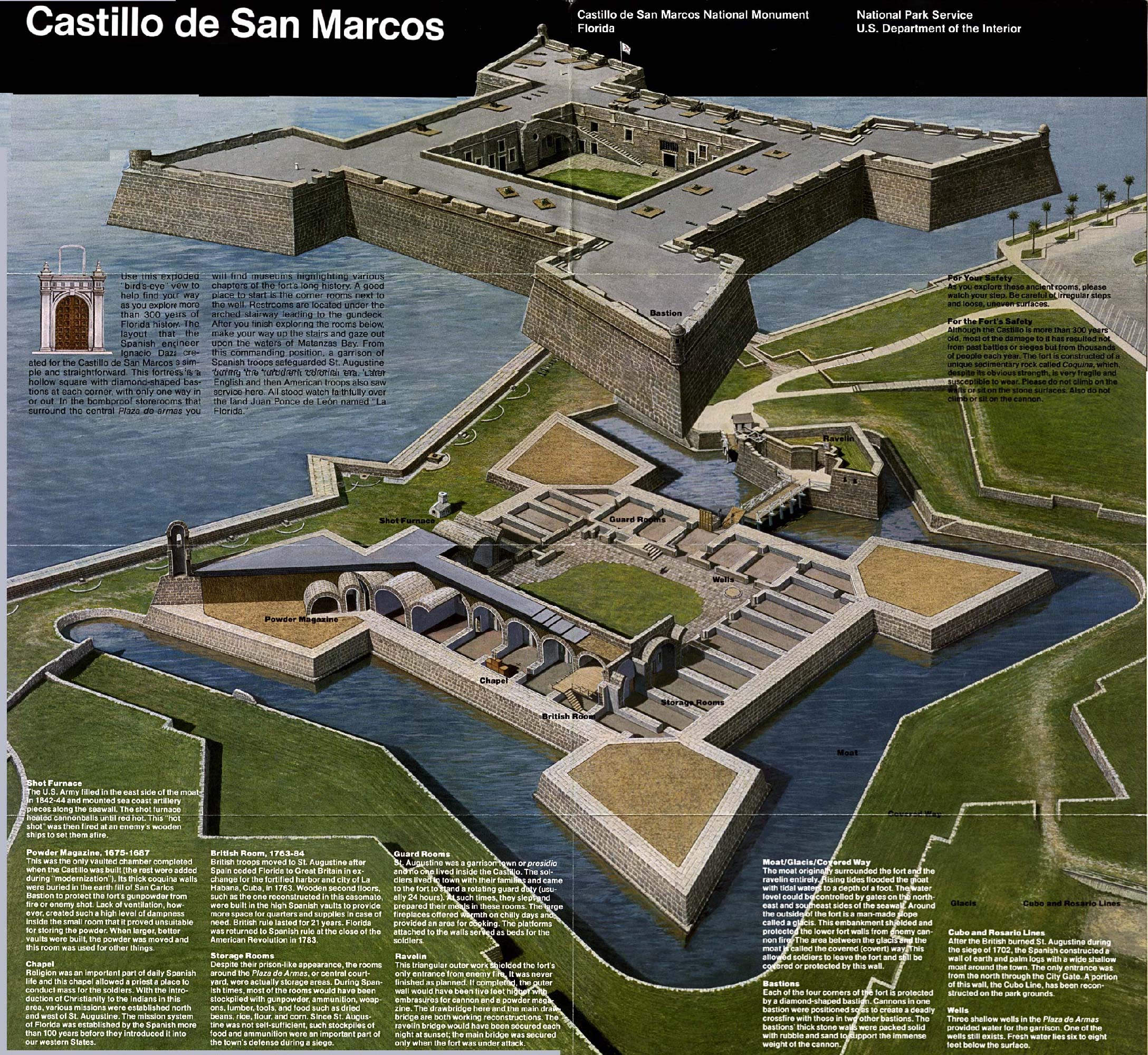
Castillo de San Marcos National Monument (Schematic Map) 1995 (1MB)
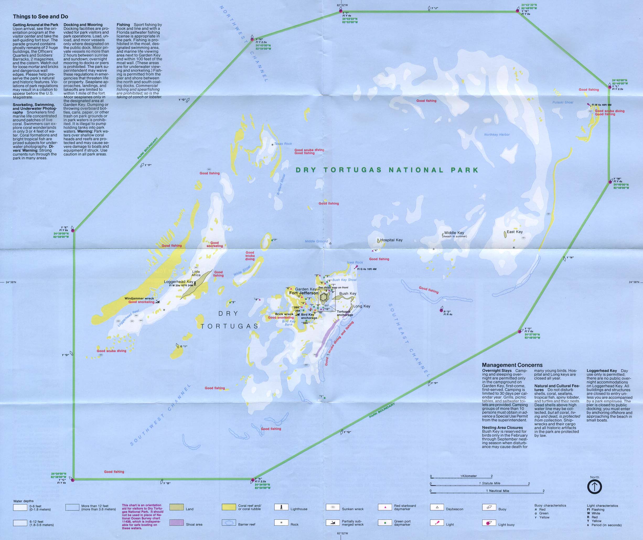
Dry Tortugas National Park (Park Map) 1994 (516K)
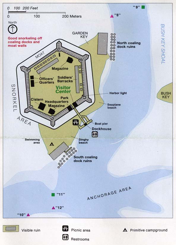
Dry Tortugas National Park - Fort Jefferson (Detail Map) 1994 (194K)
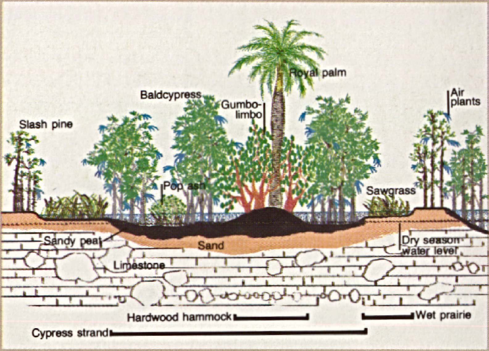
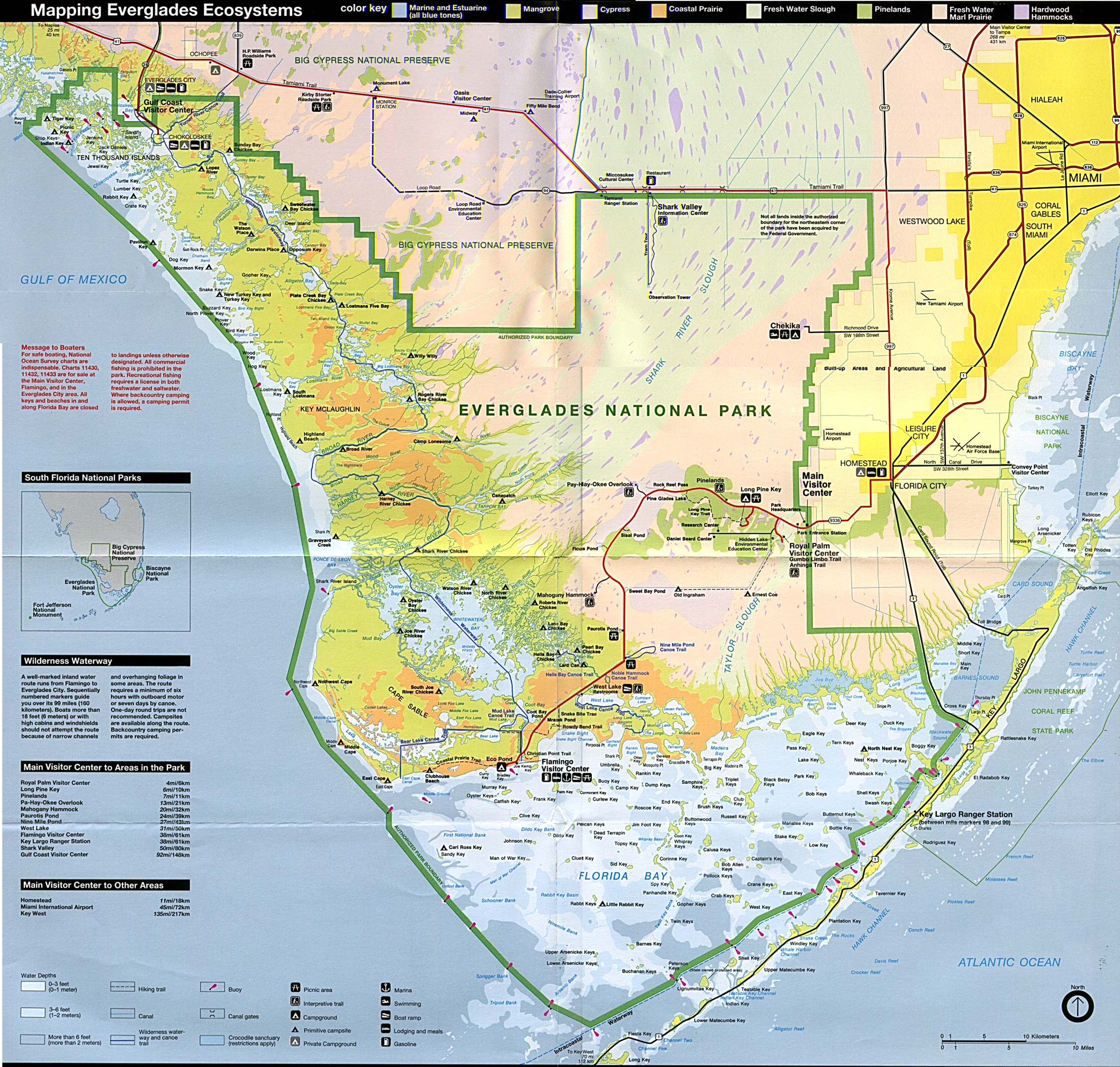
Everglades National Park (Park Ecosystems Map) (947K)
Everglades National Park (Park Map) (1.7MB) (PDF Format)
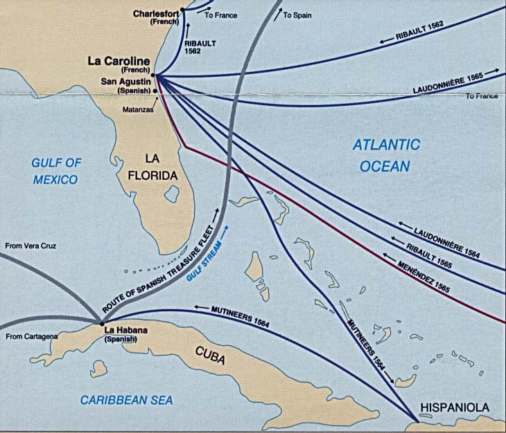
Fort Caroline National Memorial (Historic Routes Map) (91K)
Fort Caroline National Memorial (Park Map) 1998 (65K) (PDF Format)
Fort Matanzas National Monument (Park Map) (1999) (65K) (PDF Format)
Fort Matanzas National Monument - Matanzas Inlet (Detail Map) (1999) (258K) (PDF Format)
Gulf Islands National Seashore [Mississippi / Alabama / Florida] (Detail and Park Maps) 1999 (387K) (PDF Format)
Gulf of Mexico [Mississippi / Alabama / Florida] (Area Features) 1994 (351K)
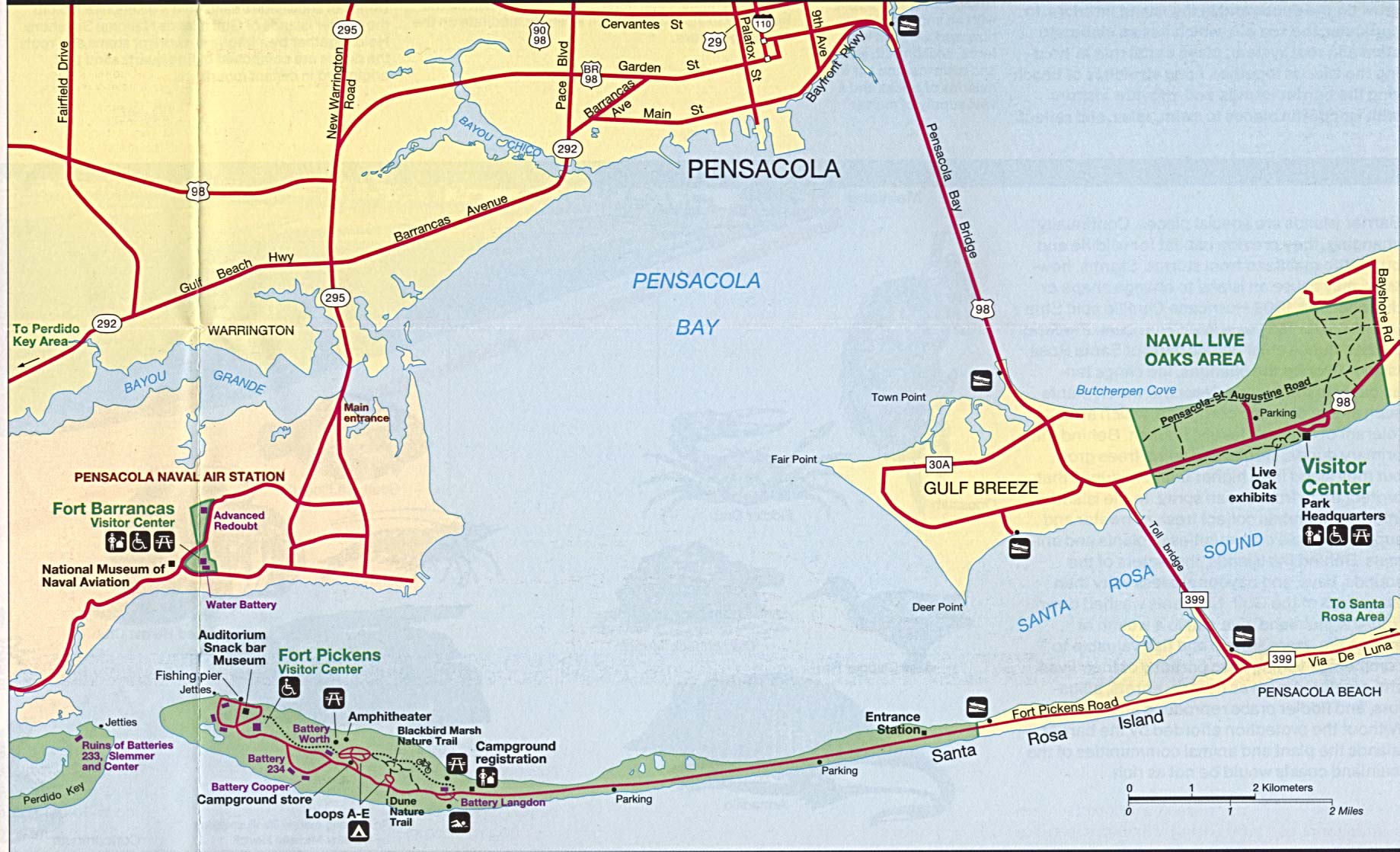
Pensacola Bay (Area Features) 1994 (332K)
This is a growing collection of free-to-use national park, monument, historic site, recreation area, battlefield, park trails and visitor information maps from the National Park Service. They are in high resolution PDF or image formats ready for you to view, print and use. Please check back as we add new ones as they become available.
<-- Download Free Maps
<-- Free National Park Maps
Didn't find what you are looking for? We've been online since 1996 and have created 1000's of pages. Search below and you may find just what you are looking for.
Michael R. Meuser
Data Research & GIS Specialist
MapCruzin.com is an independent firm
specializing in GIS project development and data research.
We created the first U.S. based
interactive toxic chemical facility
maps on the internet in 1996 and we
have been online ever since. Learn more about us and our services.
Have a project in mind? If you have data, GIS project or custom shapefile needs contact Mike.
Contact Us
Report Broken Links
Subscribe for Updates
Sponsors


![Gulf of Mexico [Mississippi / Alabama / Florida]](/download-national-park-maps/gulf94.jpg)