Download Free Colorado National Park and Historic Monument Maps
Sponsors
<-- Download Free Maps
<-- Free National Park Maps
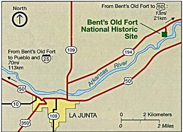
Bent's Old Fort National Historic Site (Area Map) 1994 (327K)
Bent's Old Fort National Historic Site (Area Map) 1995 (65K) (PDF Format)
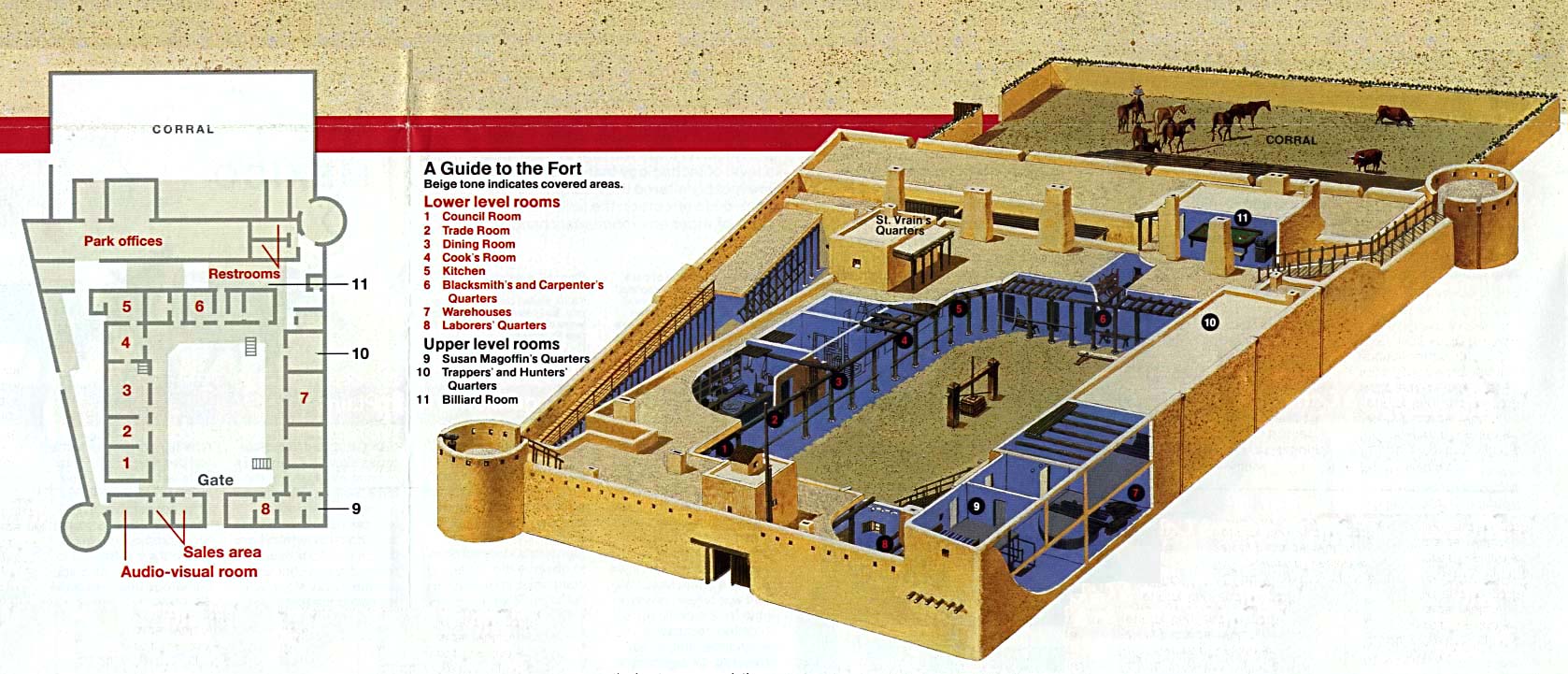
Bent's Old Fort National Historic Site (Floor Plan) 1995 (65K) (PDF Format)
Bent's Old Fort National Historic Site (Schematic and Floor Plan) 1994 (241K)
Black Canyon of the Gunnison National Park (Area Map) 1995 (129K) (PDF Format)
Sponsors
Black Canyon of the Gunnison National Park (Park Map) 1996 (323K) (PDF Format)
Black Canyon of the Gunnison National Park (Profile Map) 1996 (65K) (PDF Format)
Black Canyon of the Gunnison National Park (Area Map) 1995 (129K) (PDF Format)
Black Canyon of the Gunnison National Park (Park Map) 1996 (323K) (PDF Format)
Black Canyon of the Gunnison National Park (Profile Map) 1996 (65K) (PDF Format)
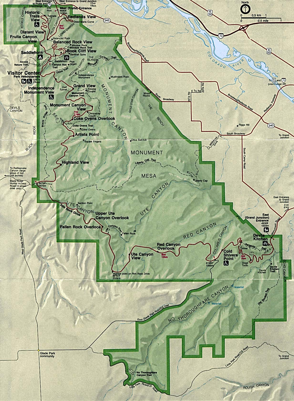
Colorado National Monument (Park Map) 1994 (546K)
Dinosaur National Monument [Colorado / Utah] (Area Map) 1999 (65K) (PDF Format)
Dinosaur National Monument [Colorado / Utah] (Park Map) 1999 (258K) (PDF Format)
Florissant Fossil Beds National Monument (Park Map) 1999 (65K) (PDF Format)
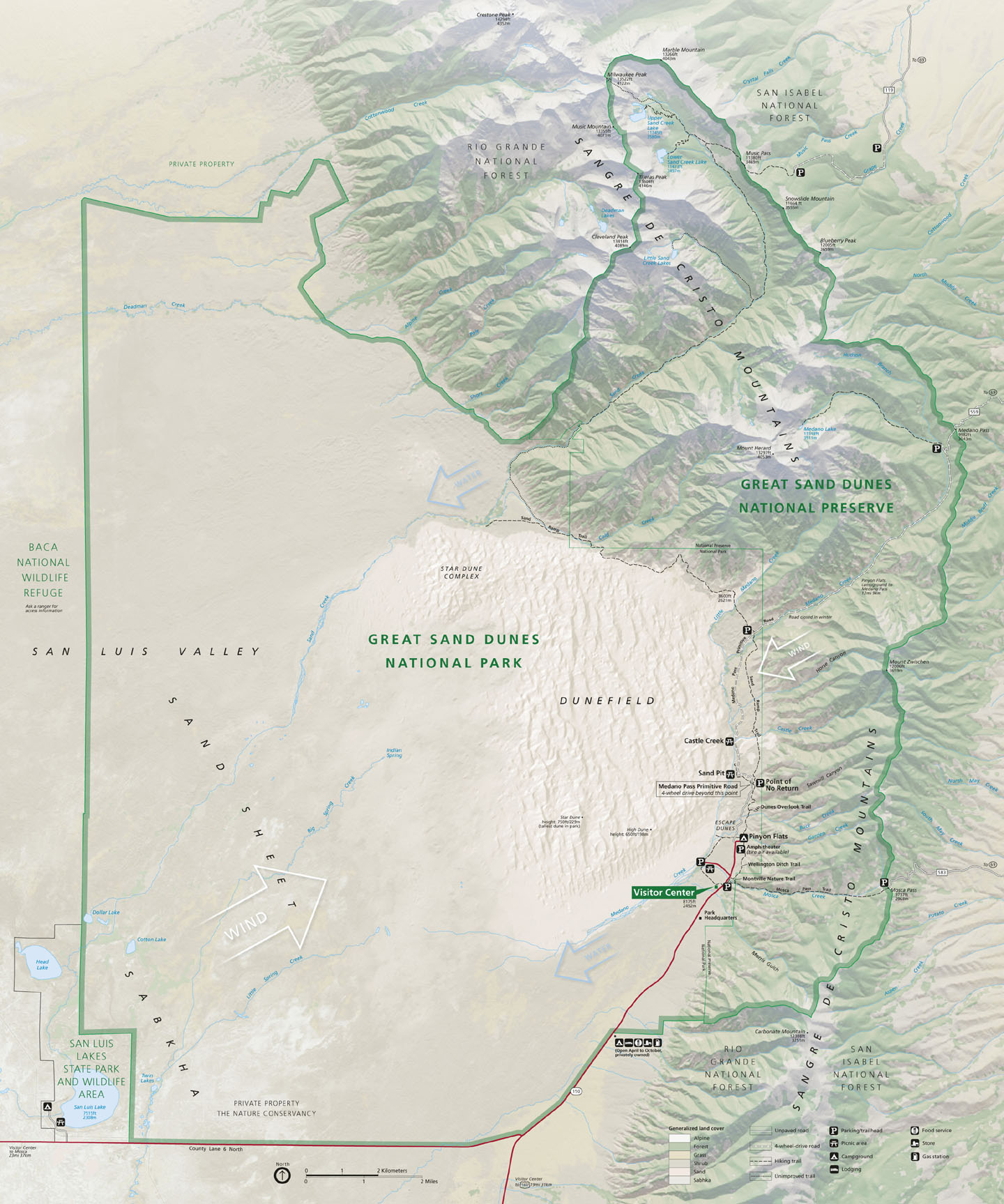
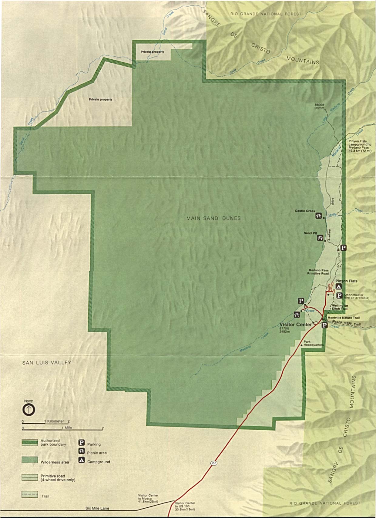
Great Sand Dunes National Park and Preserve (Park Map / Shaded Relief) 2007 (416K)
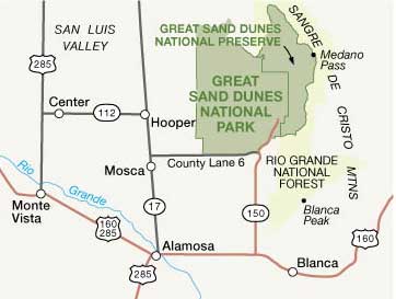
Great Sand Dunes National Park and Preserve (Area Map) 2007 (15K)
Older maps of Great Sand Dunes:
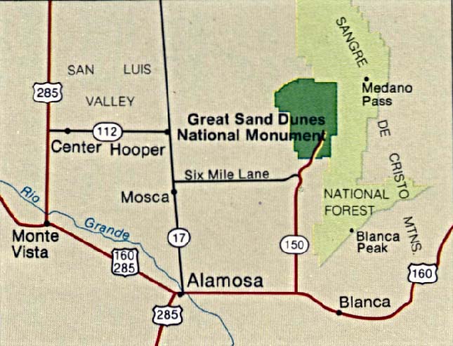
Great Sand Dunes National Monument (Area Map) 1994 (77K)
Great Sand Dunes National Monument (Area Map) 1999 (65K) (PDF Format)
Great Sand Dunes National Monument (Park Map / Shaded Relief) 1994 (254K)
Great Sand Dunes National Monument (Park Map) 1999 (65K) (PDF Format)
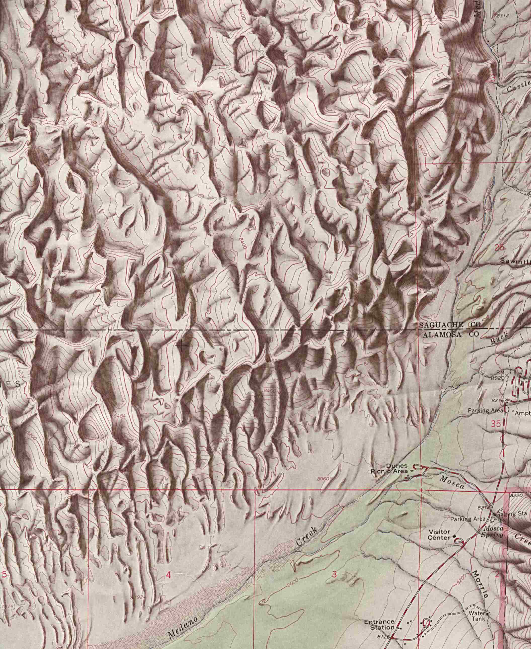
Great Sand Dunes National Monument (Shaded Relief Map) 1:24,000 U.S.G.S. 1967 (349K)
Hovenweep National Monument (Park Map) 1998 (194K) (PDF Format)
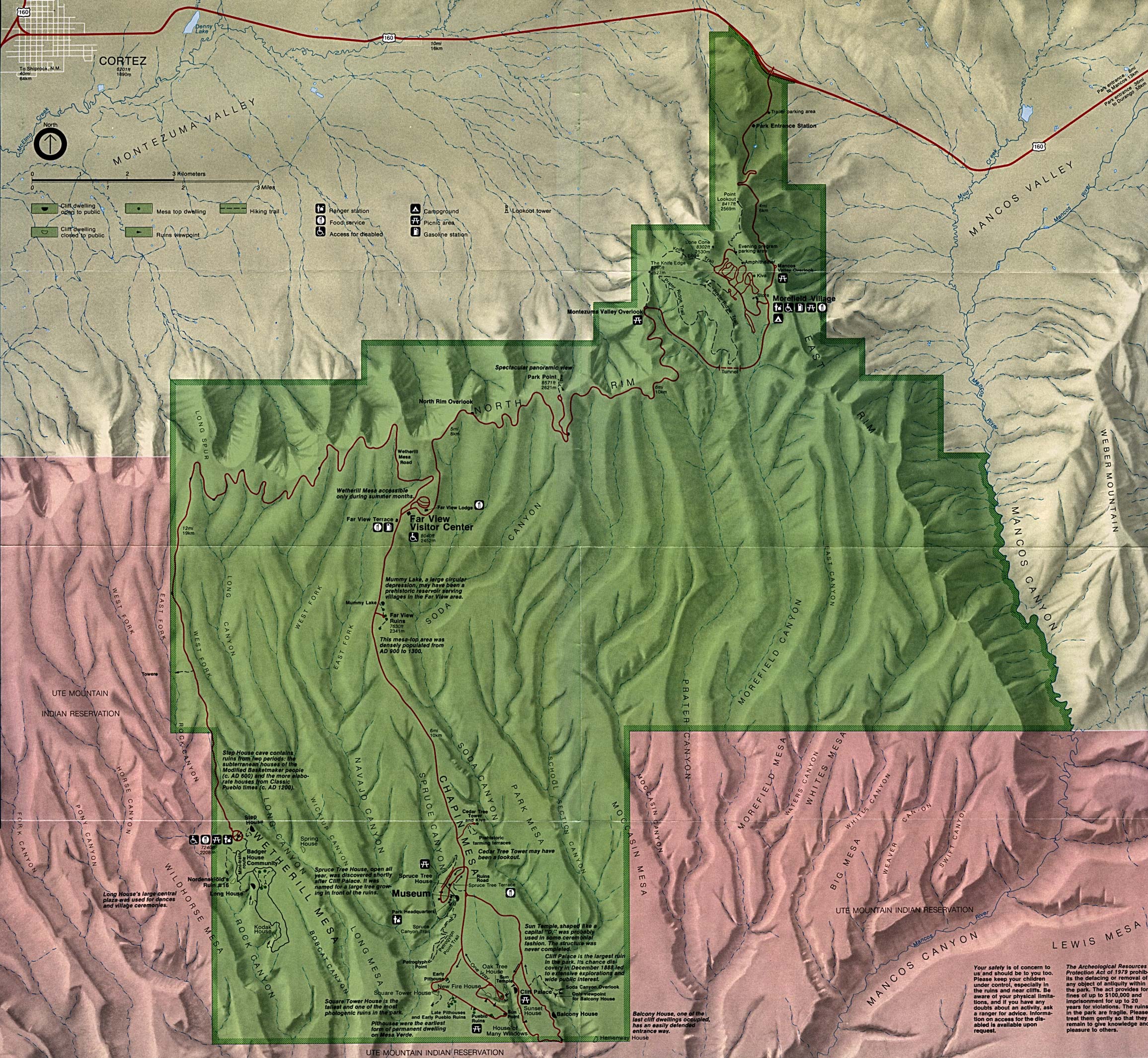
Mesa Verde National Park (Park Map) (1MB)
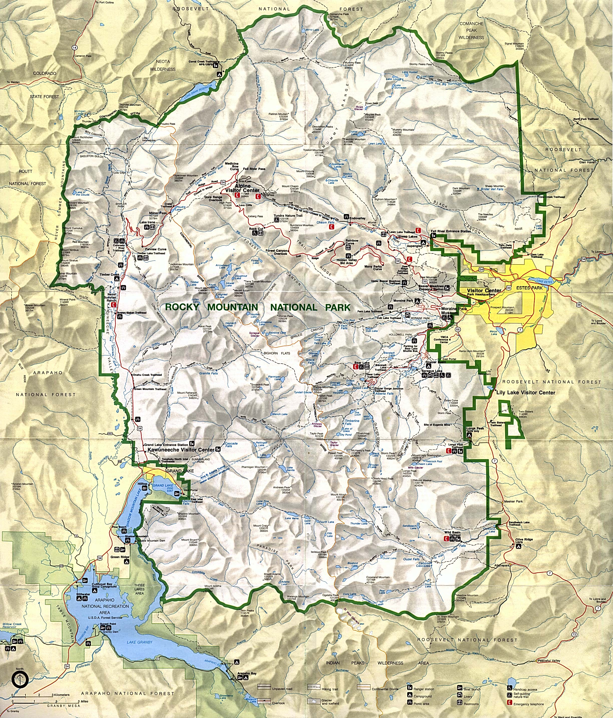
Rocky Mountain National Park (Park Map) (1MB)
Rocky Mountain National Park (Park Map) 1999 (710K) (PDF Format)
This is a growing collection of free-to-use national park, monument, historic site, recreation area, battlefield, park trails and visitor information maps from the National Park Service. They are in high resolution PDF or image formats ready for you to view, print and use. Please check back as we add new ones as they become available.
<-- Download Free Maps
<-- Free National Park Maps
Didn't find what you are looking for? We've been online since 1996 and have created 1000's of pages. Search below and you may find just what you are looking for.
Michael R. Meuser
Data Research & GIS Specialist
MapCruzin.com is an independent firm
specializing in GIS project development and data research.
We created the first U.S. based
interactive toxic chemical facility
maps on the internet in 1996 and we
have been online ever since. Learn more about us and our services.
Have a project in mind? If you have data, GIS project or custom shapefile needs contact Mike.
Contact Us
Report Broken Links
Subscribe for Updates
Sponsors


