Download Free California National Park and Historic Monument Maps
Sponsors
<-- Download Free Maps
<-- Free National Park Maps
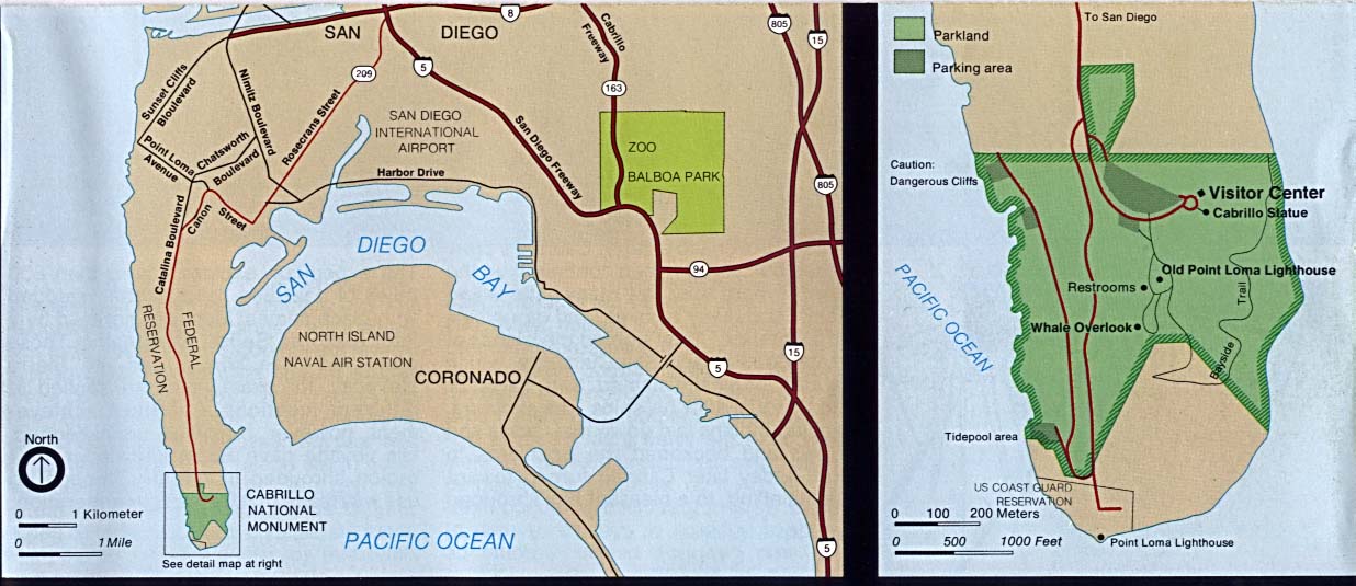
Cabrillo National Monument (Area Map) 1995 (124K)
Cabrillo National Monument (Area Map) 1997 (129K) (PDF Format)
Cabrillo National Monument (Park Map) 1997 (129K) (PDF Format)
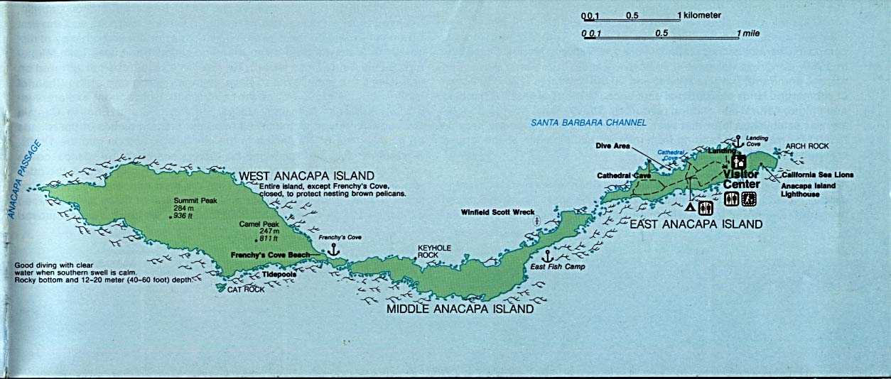
Channel Islands National Park - Anacapa Island (Detail Map) (107K)
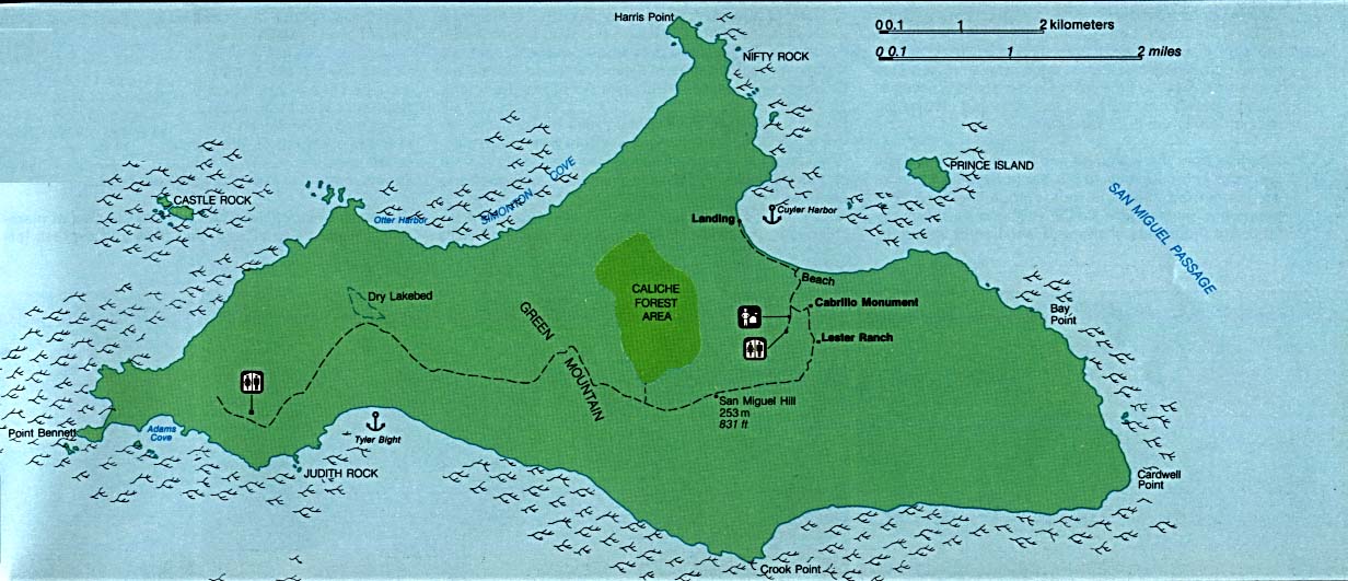
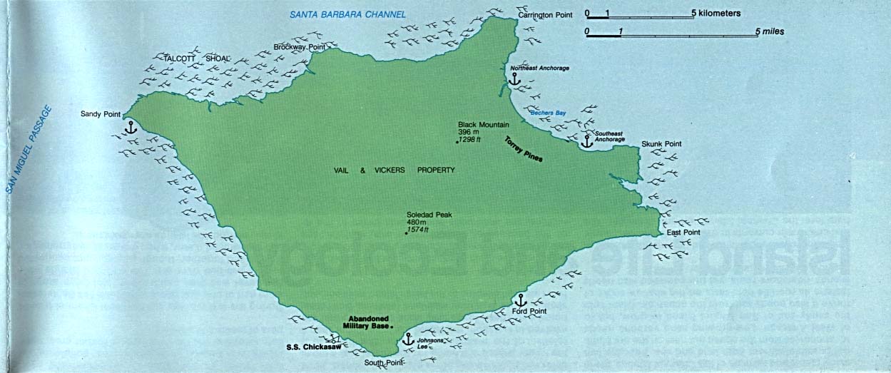
Channel Islands National Park - San Miguel Island (Detail Map) (119K)
Sponsors
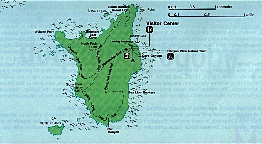
Channel Islands National Park - Santa Barbara Island (Detail Map) (80K)
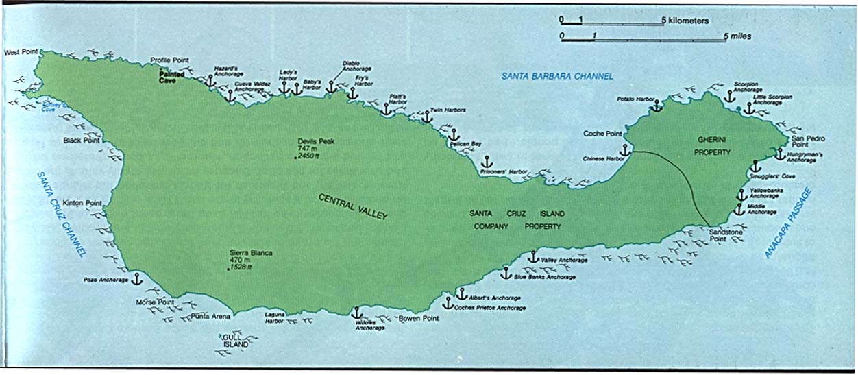
Channel Islands National Park - Santa Cruz Island (Detail Map) (96K)
Channel Islands National Park - Santa Rosa Island (Detail Map) (89K)
Death Valley National Park [California / Nevada] (Shaded Relief Map) 1:250,000 U.S.G.S. 1977 (791K)
Death Valley National Park [California / Nevada] (Park Map) 1997 (836K) (PDF Format)
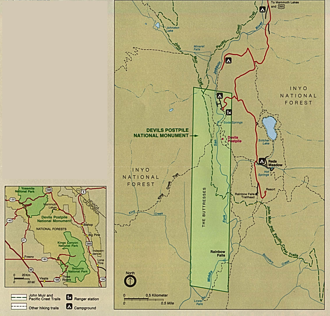
Devils Postpile National Monument (Area Map) 1997 (65K) (PDF Format)
Devils Postpile National Monument (Park Map) 1997 (65K) (PDF Format)
Devils Postpile National Monument (Park and Area Maps) 1993 (289K)
Fort Point National Historic Site (Range Map) (1999) (65K) (PDF Format)
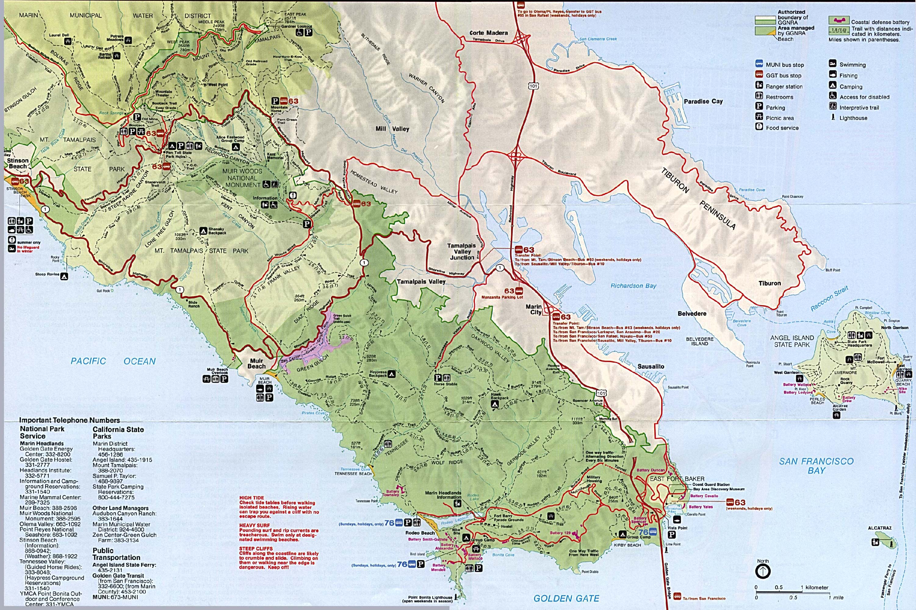
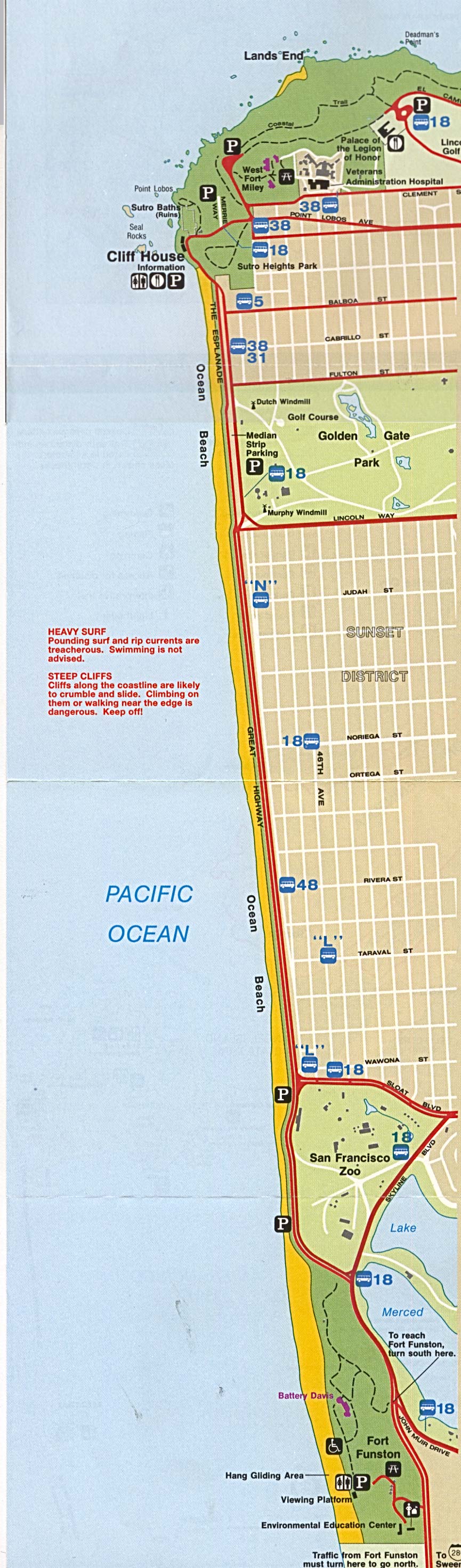
Golden Gate National Recreation Area (Park Map / Shaded Relief) 1995 (1.1MB)
Golden Gate National Recreation Area - Northern (Park Map) 1995 (705K)
Golden Gate National Recreation Area - Southern (Park Map) 1995 (411K)
Imperial Sand Dunes Recreation Area (Park Map) [Bureau of Land Management] 2007 (156K) (PDF Format)
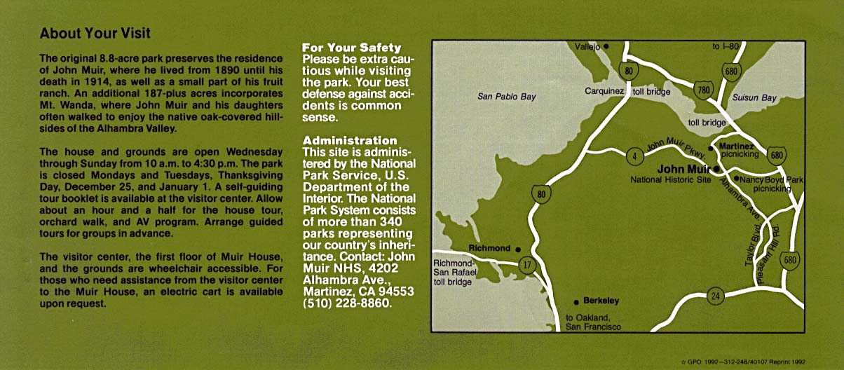
John Muir National Historic Site (Area Map) 1992 (137K)
Joshua Tree National Park (Park Map) 1997 (258K) (PDF Format)
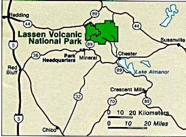
Lassen Volcanic National Park (Area Map) (36K)
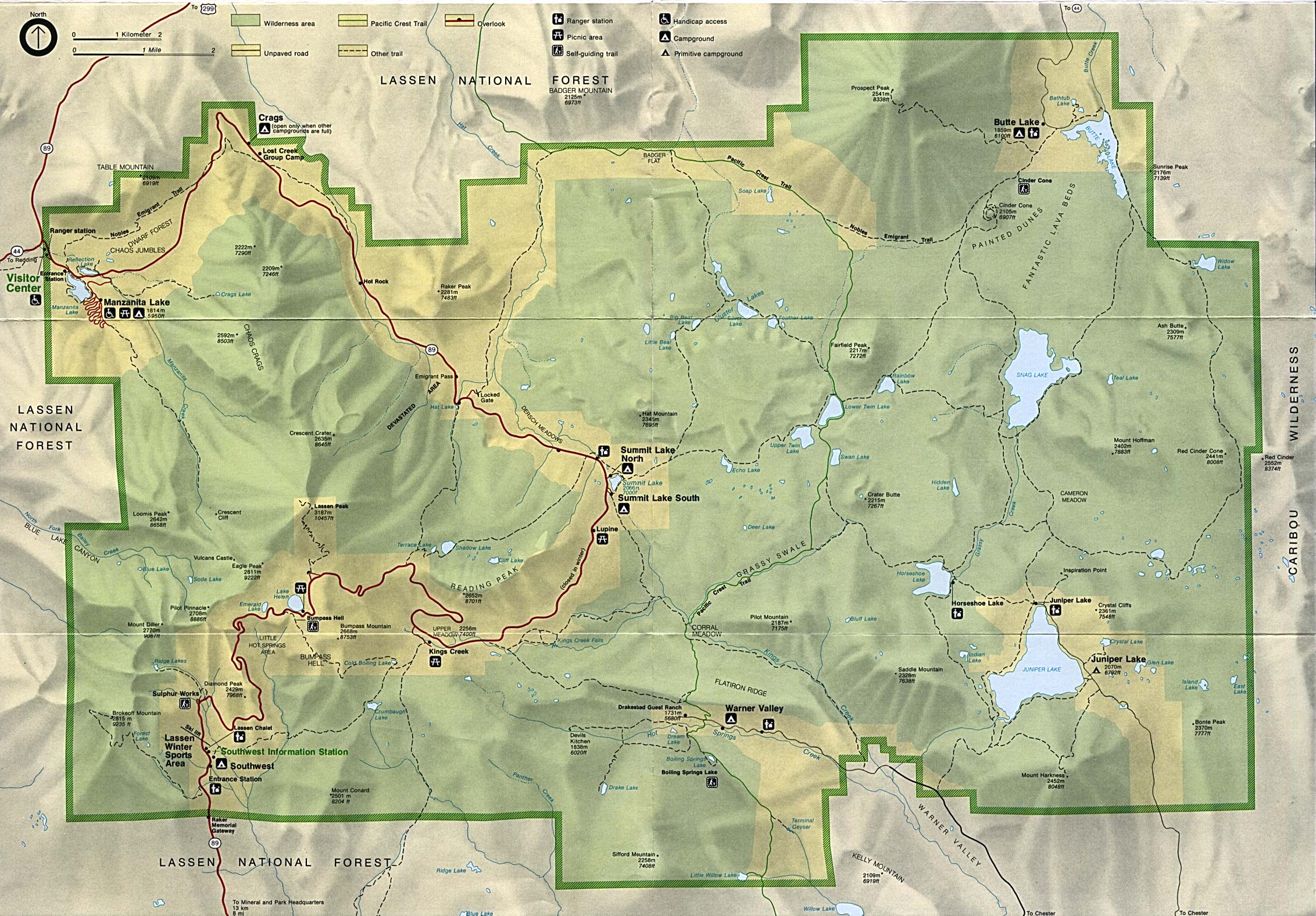
Lassen Volcanic National Park (Park Map) (740K)
Lassen Volcanic National Park (Park Map) 1999 (323K) (PDF Format)
Lava Beds National Monument (Area Map) 1995 (65K) (PDF Format)
Pinnacles National Monument (Park Map) 1999 (194K) (PDF Format)
Point Reyes National Seashore (Park Map) 1997 (516K) (PDF Format)
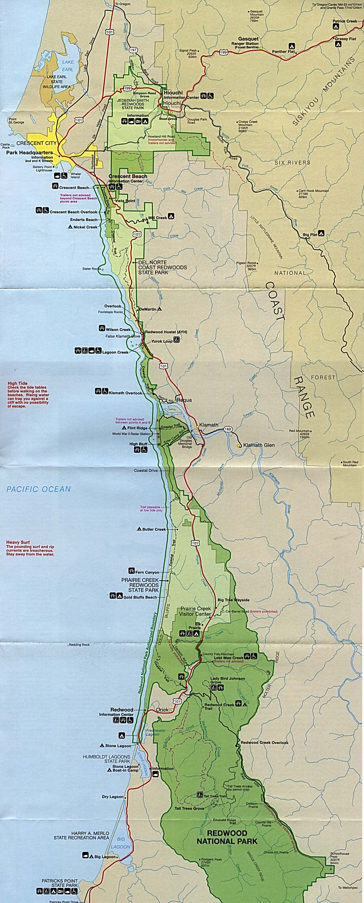
Redwood National Park (Park Map) (687K)
Redwood National Park (Park Map) 1999 (323K) (PDF Format)
Redwood National Park (Perspective Map of Redwood Range) 1997 (323K) (PDF Format)
Redwood National Park (Prehistoric Worldwide Redwood Distribution Map) 1997 (65K) (PDF Format)
Redwood National Park (Redwood Area Tribes Map) 1997 (65K) (PDF Format)
Sequoia and Kings Canyon National Park (Detail Map) 1998 (232K) (PDF Format)
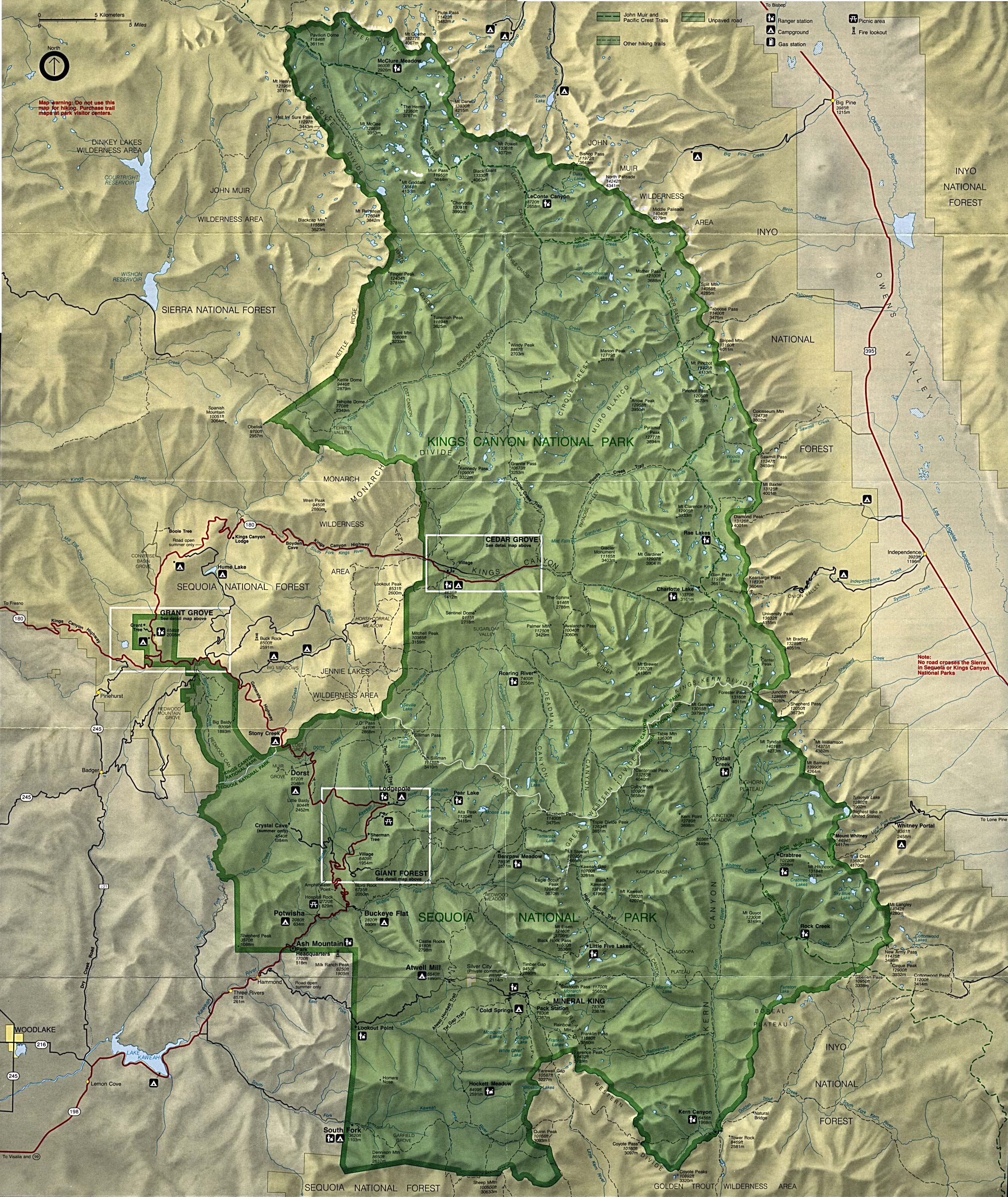
Sequoia and Kings Canyon National Park (Park Map) (1.5MB)
Sequoia and Kings Canyon National Park (Park Map) 1998 (839K) (PDF Format)
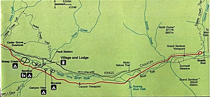
Sequoia and Kings Canyon National Park - Cedar Grove Area (Detail Map) (83K)
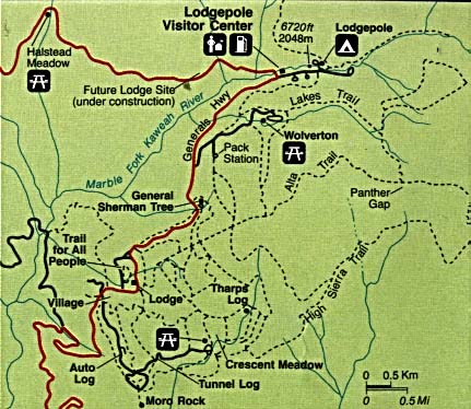
Sequoia and Kings Canyon National Park - Lodgepole Area (Detail Map) (55K)
Whiskeytown National Recreation Area (Area Map) 1999 (65K) (PDF Format)
Whiskeytown National Recreation Area (Park Map) 1999 (323K) (PDF Format)
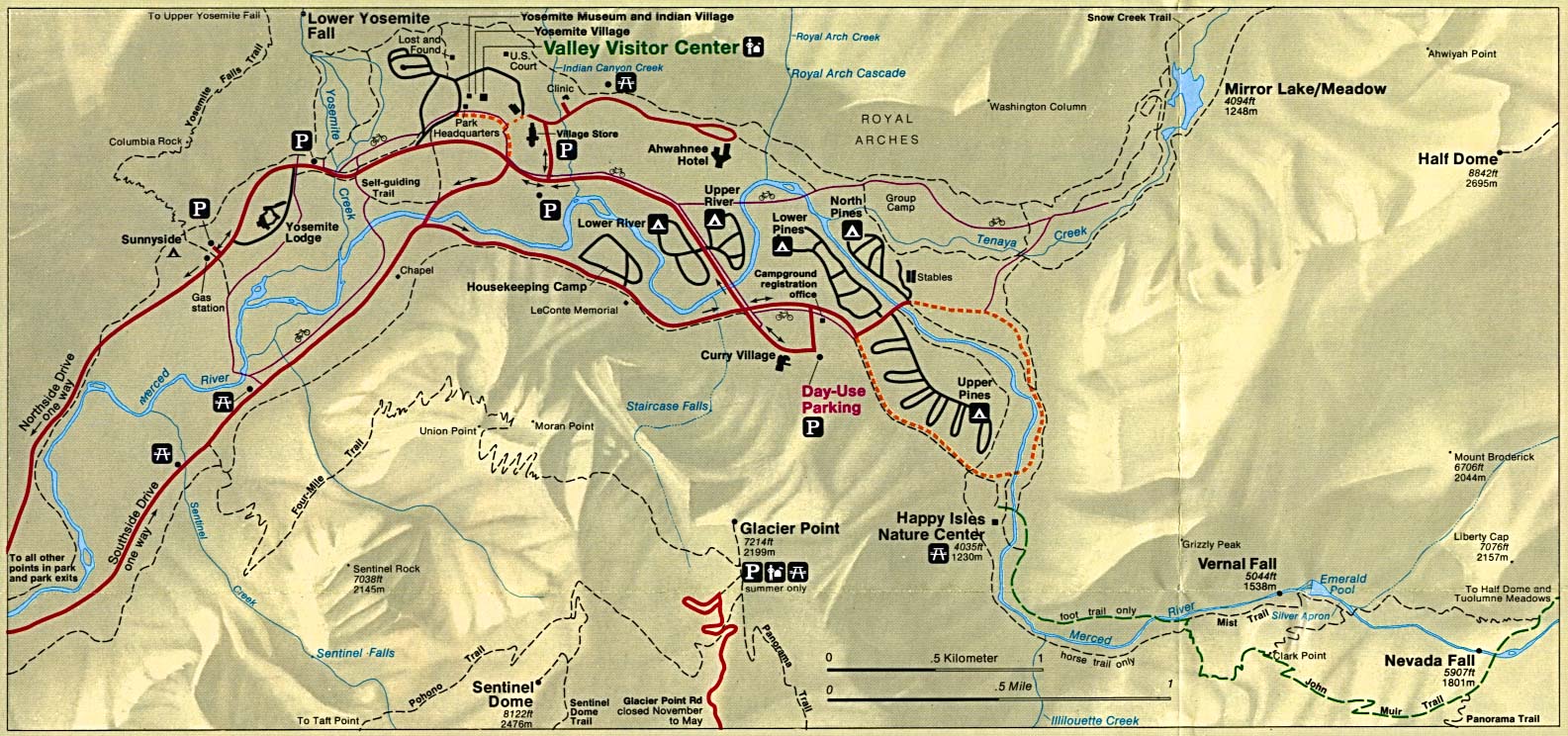
Yosemite National Park (Detail Map) 1994 (312K)
Yosemite National Park (Detail Map) 1998 (129K) (PDF Format)
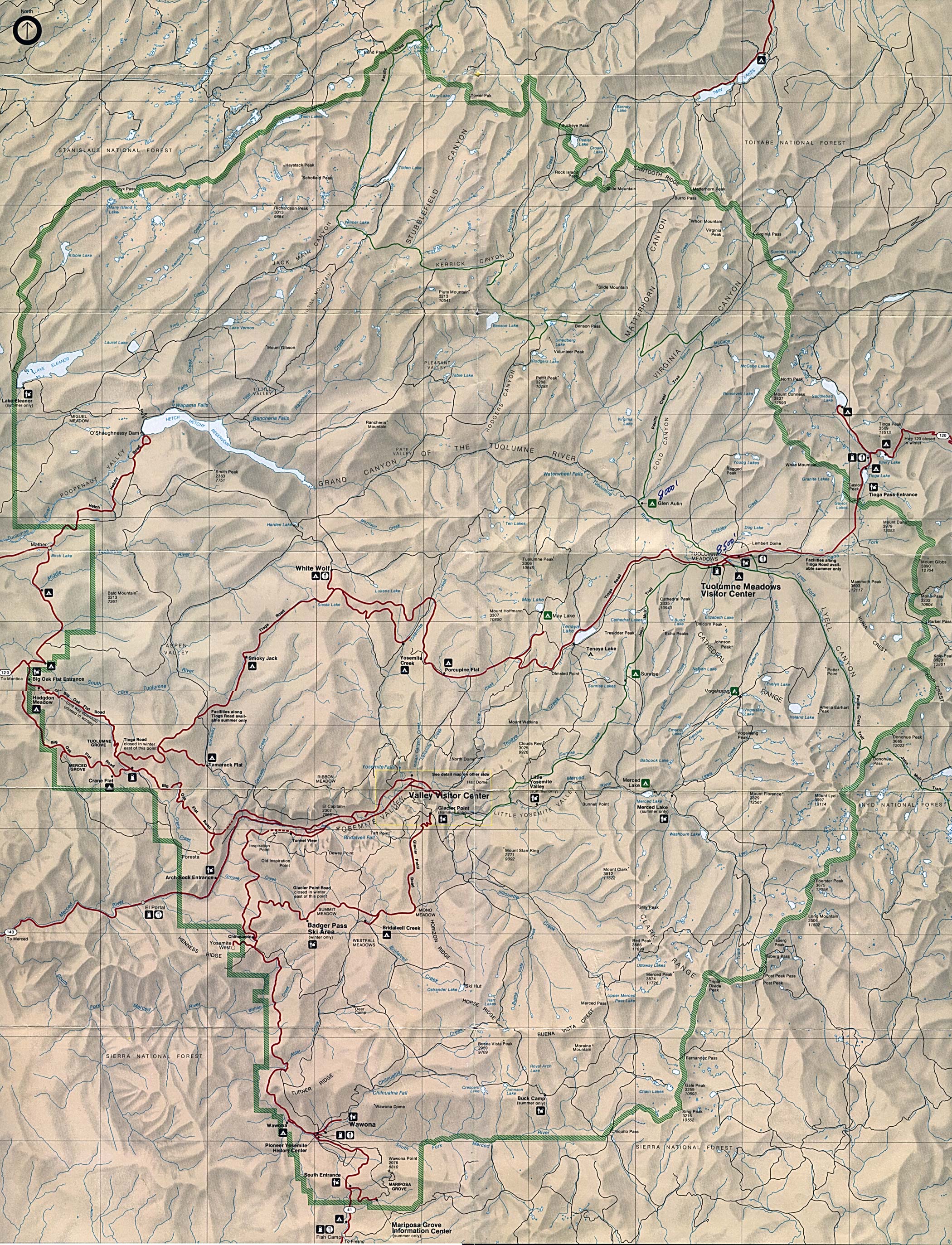
Yosemite National Park (Park Map) (1MB)
Yosemite National Park (Park Map) 1998 (1MB) (PDF Format)
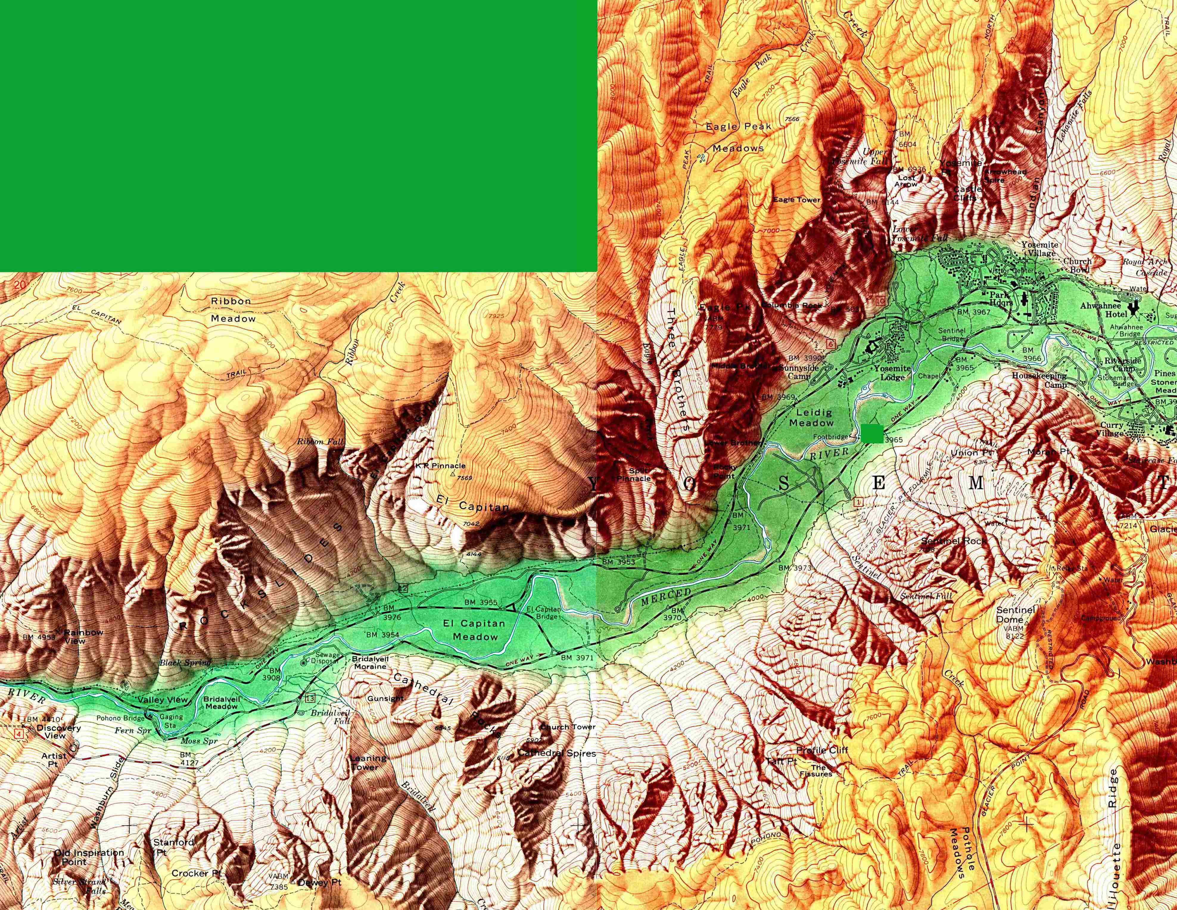
Yosemite National Park - Yosemite Valley (Shaded Relief Map) 1:24,000, U.S. Geological Survey, 1958 (1MB)
This is a growing collection of free-to-use national park, monument, historic site, recreation area, battlefield, park trails and visitor information maps from the National Park Service. They are in high resolution PDF or image formats ready for you to view, print and use. Please check back as we add new ones as they become available.
<-- Download Free Maps
<-- Free National Park Maps
Didn't find what you are looking for? We've been online since 1996 and have created 1000's of pages. Search below and you may find just what you are looking for.
Michael R. Meuser
Data Research & GIS Specialist
MapCruzin.com is an independent firm
specializing in GIS project development and data research.
We created the first U.S. based
interactive toxic chemical facility
maps on the internet in 1996 and we
have been online ever since. Learn more about us and our services.
Have a project in mind? If you have data, GIS project or custom shapefile needs contact Mike.
Contact Us
Report Broken Links
Subscribe for Updates
Sponsors


![Death Valley National Park [California / Nevada]](/download-national-park-maps/death_valley.jpg)