Download Free Arizona National Park and Historic Monument Maps
<-- Download Free Maps
<-- Free National Park Maps
Sponsors
Canyon de Chelly National Monument (Park Map) 1997 (323K) (PDF Format)
Chiricahua National Monument (Area Map) 1999 (65K) (PDF Format)
Chiricahua National Monument (Park Map) 1999 (129K) (PDF Format)
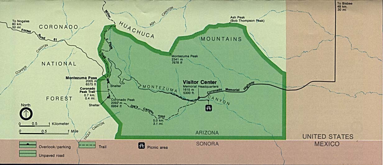
Coronado National Memorial (Area Map) (100K)
Coronado National Memorial [Southwest United States] (Historic Route Map) (135K)
Coronado National Memorial (Park Map) 1997 (65K) (PDF Format)
Fort Bowie National Historic Site (Area Map) 1995 (65K) (PDF Format)
Fort Bowie National Historic Site (Park Map) 1995 (65K) (PDF Format)
Glen Canyon National Recreation Area [Arizona / Utah] (Park Map / Shaded Relief) 1995 (1.8MB)
Sponsors
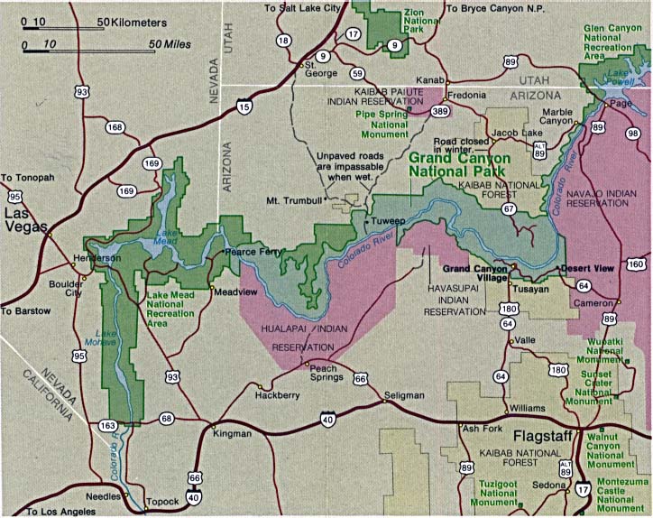
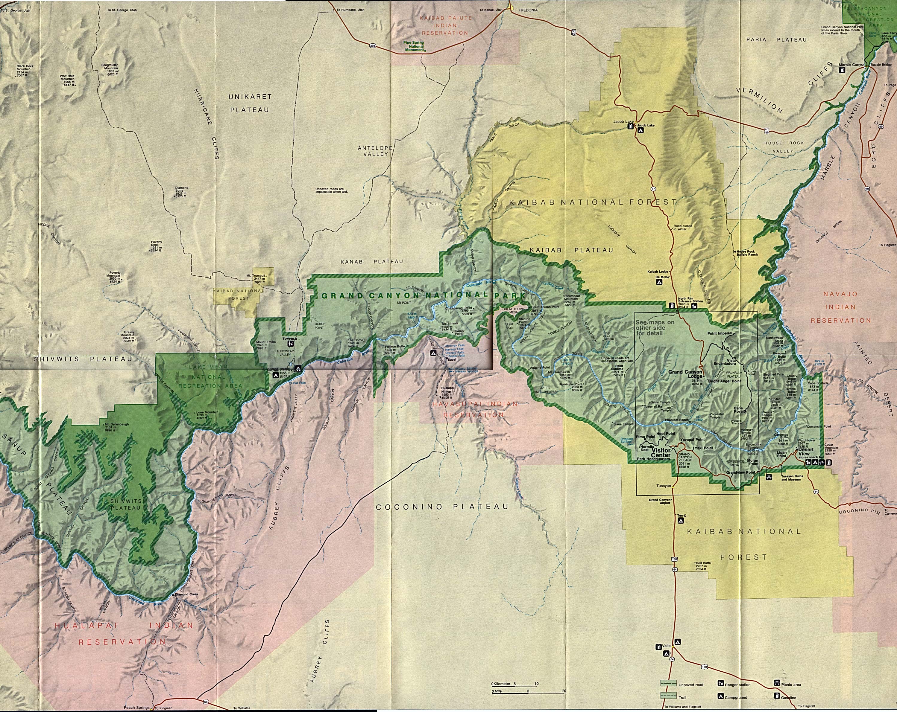
Grand Canyon National Park (Area Map) (113K)
Grand Canyon National Park (Park Map) 1997 (194K) (PDF Format)
Grand Canyon National Park (Shaded Relief Map) 1:62:500 U.S.G.S. (519K)
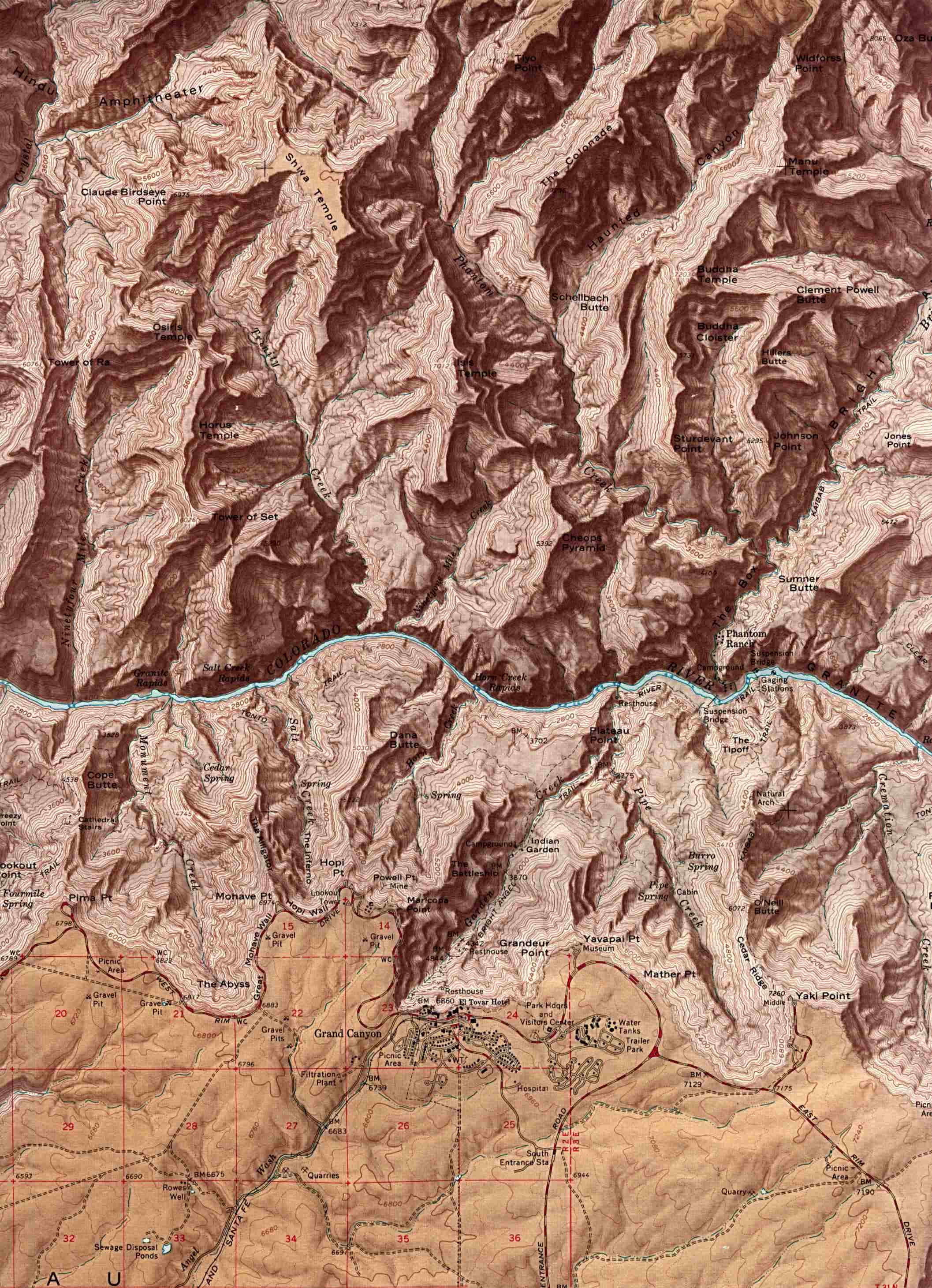
Grand Canyon National Park - Eastern Area (Shaded Relief Map) (886K)
Grand Canyon National Park - Western Area (Shaded Relief Map) (1MB)
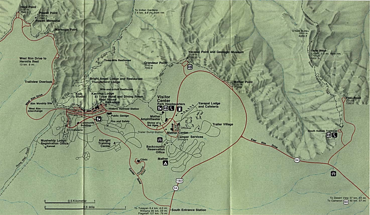
Grand Canyon National Park - Grand Canyon Village (Detail Map) (281K)
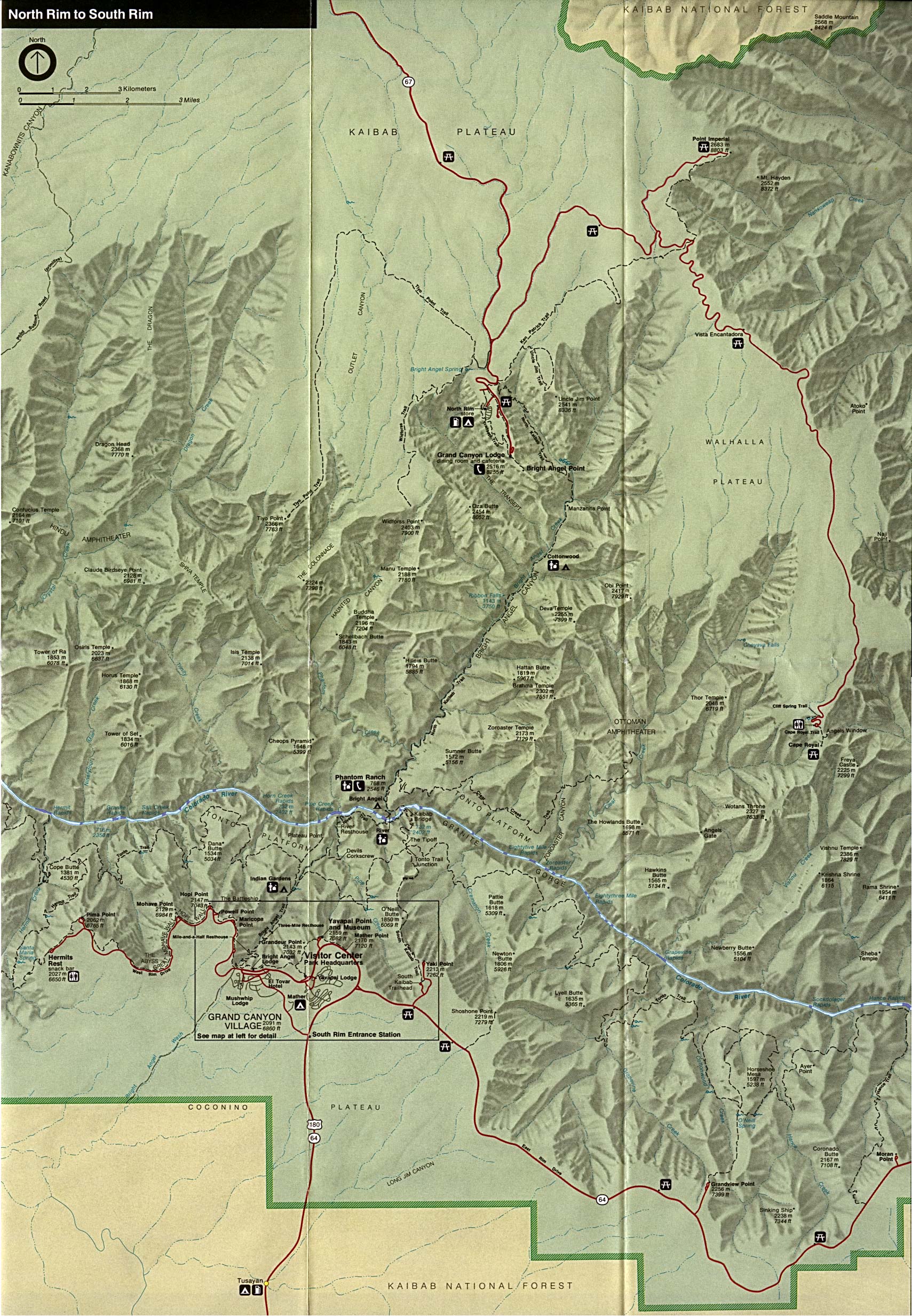
Grand Canyon National Park - Phantom Ranch Topographic Map USGS 2009 (13.6 MB) (PDF)
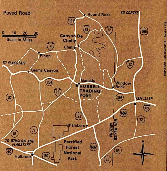
Hubbell Trading Post National Historic Site (Area Map) 1995 (111K)
Hubbell Trading Post National Historic Site (Park Map) 1997 (65K) (PDF Format)
Organ Pipe Cactus National Monument (Campsite Map) 1999 (65K) (PDF Format)
Organ Pipe Cactus National Monument (Park Map) 1999 (129K) (PDF Format)
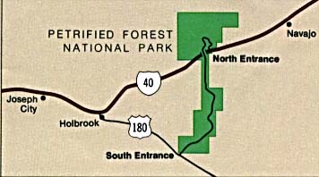
Petrified Forest National Park (Area Map) (16K)
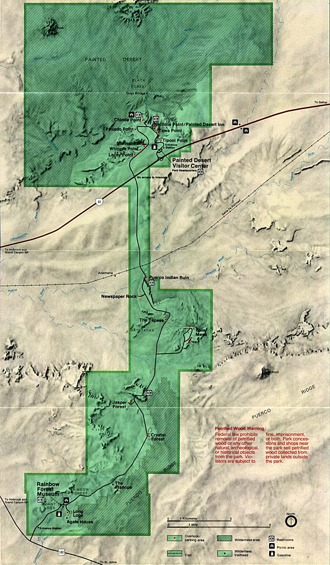
Petrified Forest National Park (Park Map) (485K)
Petrified Forest National Park (Park Map) 1999 (129K) (PDF Format)
Pipe Spring National Monument (Tour Map) 1999 (65K) (PDF Format)
Rainbow Bridge National Monument (Park Map) 1997 (258K) (PDF Format)
Saguaro National Park (Area Map) 1997 (65K) (PDF Format)
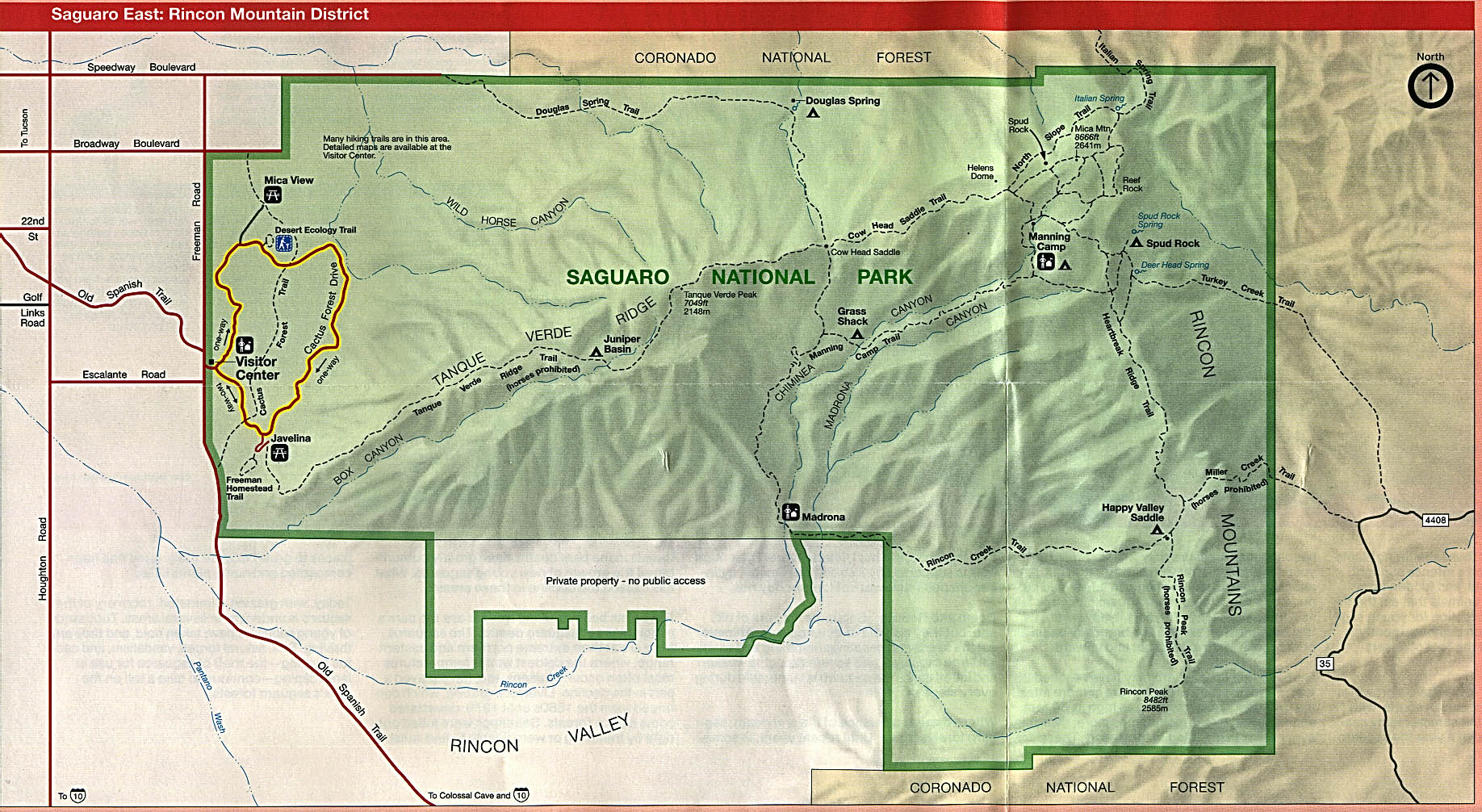
Saguaro National Park (East: Rincon Mountain District) (Park Map) 1996 (425K)
Saguaro National Park (East: Rincon Mountain District) (Park Map) 1997 (65K) (PDF Format)
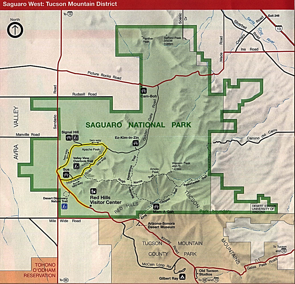
Saguaro National Park (West: Tucson Mountain District) (Park Map) 1996 (349K)
Saguaro National Park (West: Tucson Mountain District) (Park Map) 1997 (65K) (PDF Format)
Wupatki National Monument (Park Map) 1998 (65K) (PDF Format)
This is a growing collection of free-to-use national park, monument, historic site, recreation area, battlefield, park trails and visitor information maps from the National Park Service. They are in high resolution PDF or image formats ready for you to view, print and use. Please check back as we add new ones as they become available.
<-- Download Free Maps
<-- Free National Park Maps
Didn't find what you are looking for? We've been online since 1996 and have created 1000's of pages. Search below and you may find just what you are looking for.
Michael R. Meuser
Data Research & GIS Specialist
MapCruzin.com is an independent firm
specializing in GIS project development and data research.
We created the first U.S. based
interactive toxic chemical facility
maps on the internet in 1996 and we
have been online ever since. Learn more about us and our services.
Have a project in mind? If you have data, GIS project or custom shapefile needs contact Mike.
Contact Us
Report Broken Links
Subscribe for Updates
Sponsors


![Coronado National Memorial [Southwest United States]](/download-national-park-maps/coronado_expedition.jpg)
![Glen Canyon National Recreation Area [Arizona / Utah]](/download-national-park-maps/glen95.jpg)