Download Free Alaska National Park and Historic Monument Maps
<-- Download Free Maps
<-- Free National Park Maps
Sponsors
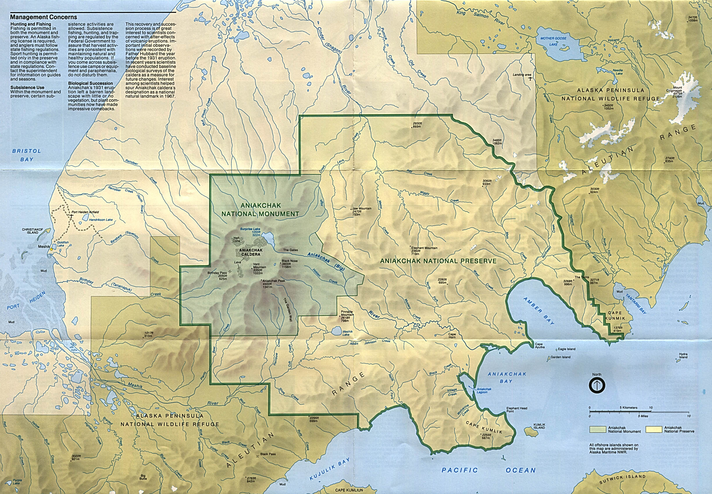
Aniakchak National Monument and Preserve (Park Map) 1993 (901K)
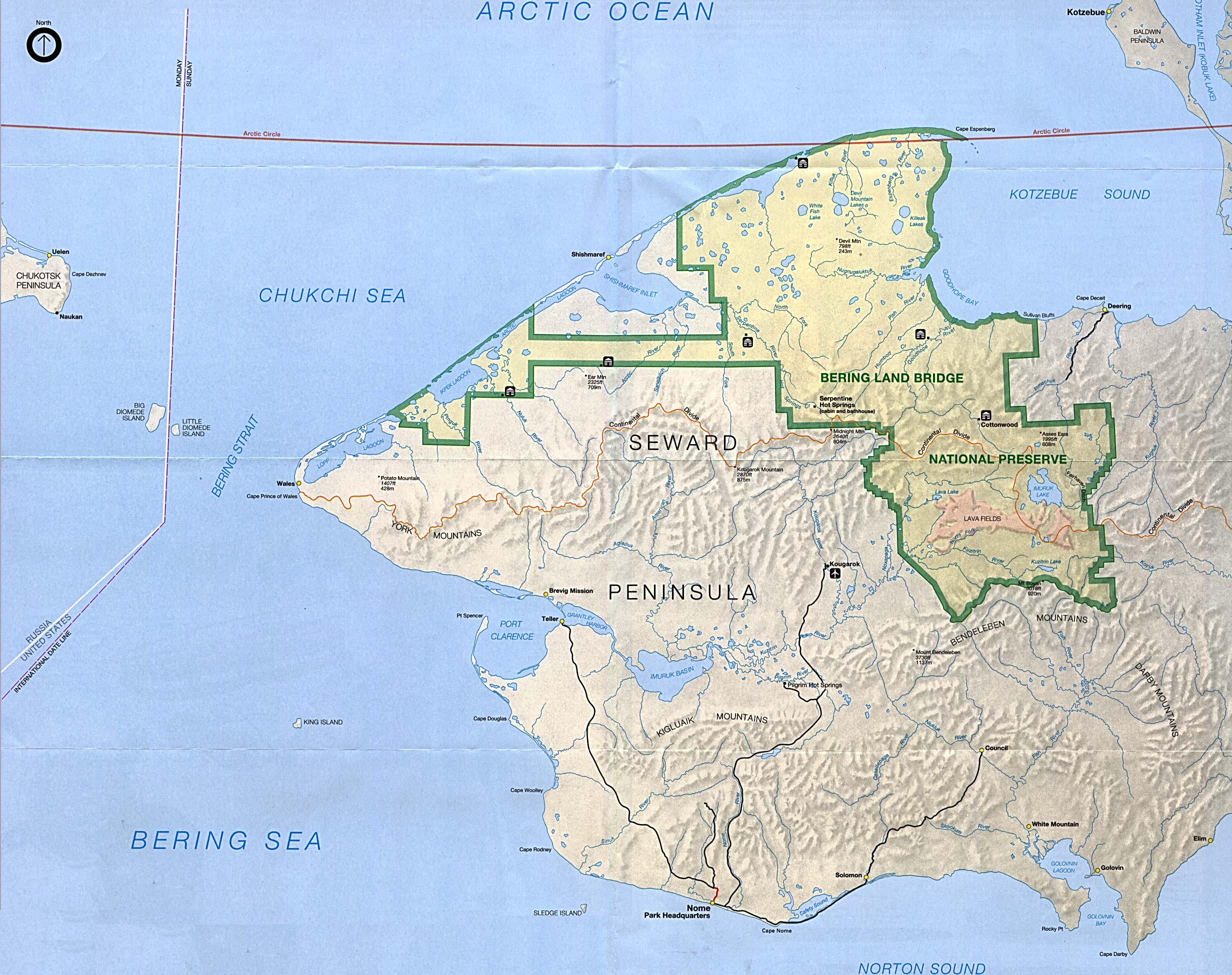
Bering Land Bridge National Preserve (Park Map) 1995 (854K)
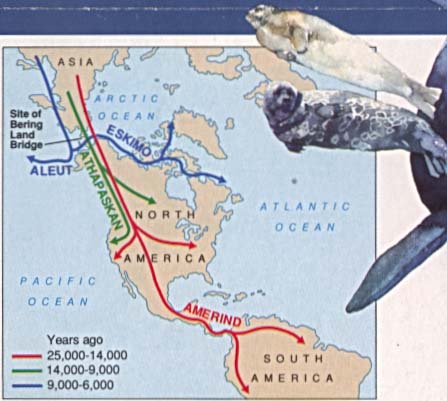
Bering Land Bridge National Preserve (First Americans: Migration Routes Map) 1995 (31K)
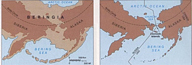
Bering Land Bridge National Preserve (Beringia: Historical Glaciation Map) 1995 (37K)
Cape Krusenstern National Monument (Park Map) (1MB)
Cape Krusenstern National Monument (Location Map) (26KB)
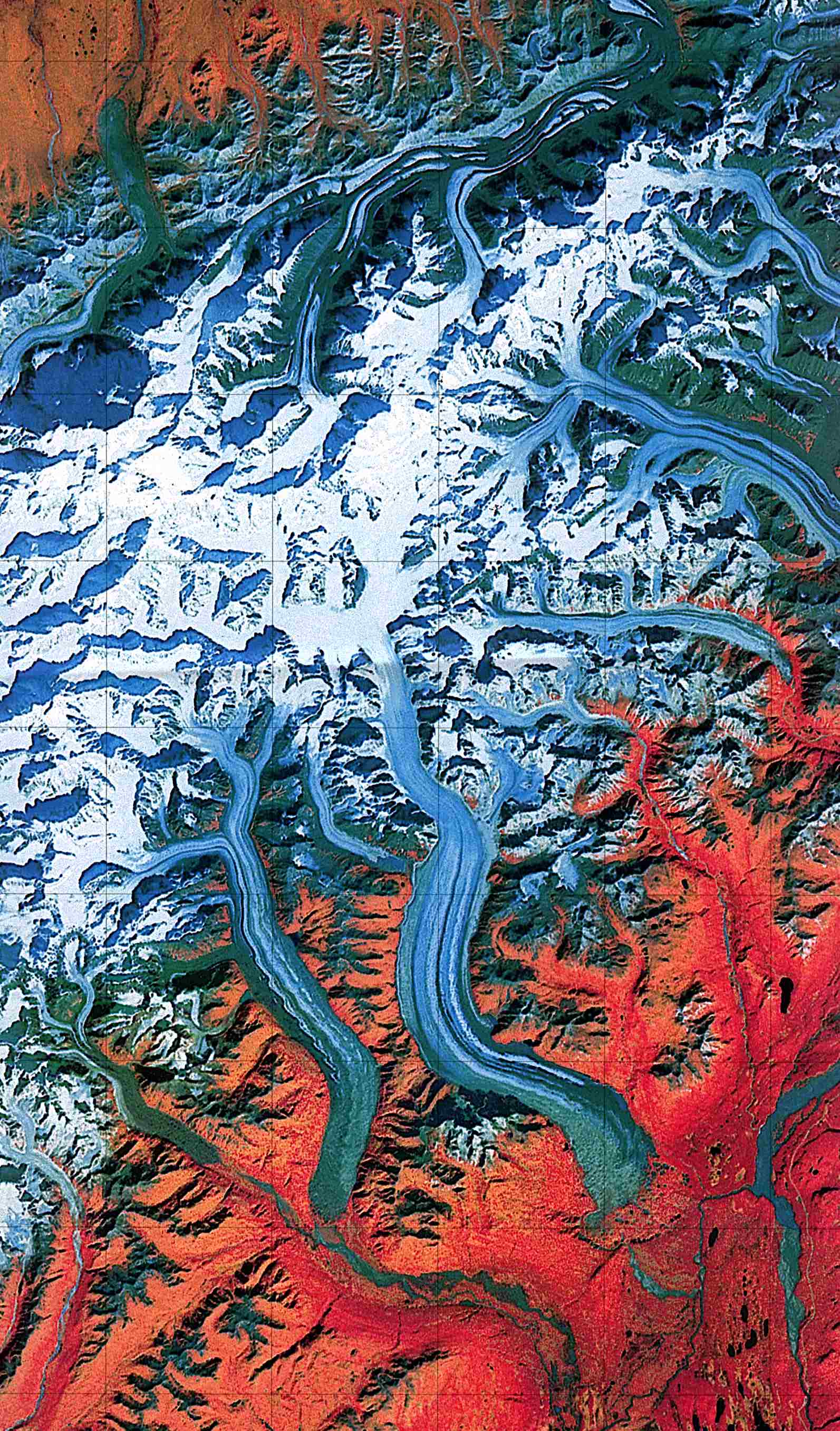
Denali National Park and Preserve (Landsat Image) 1:250,000 U.S.G.S. 1984 (459K)
Denali National Park and Preserve (Park Map) 1998 (839K) (PDF Format)
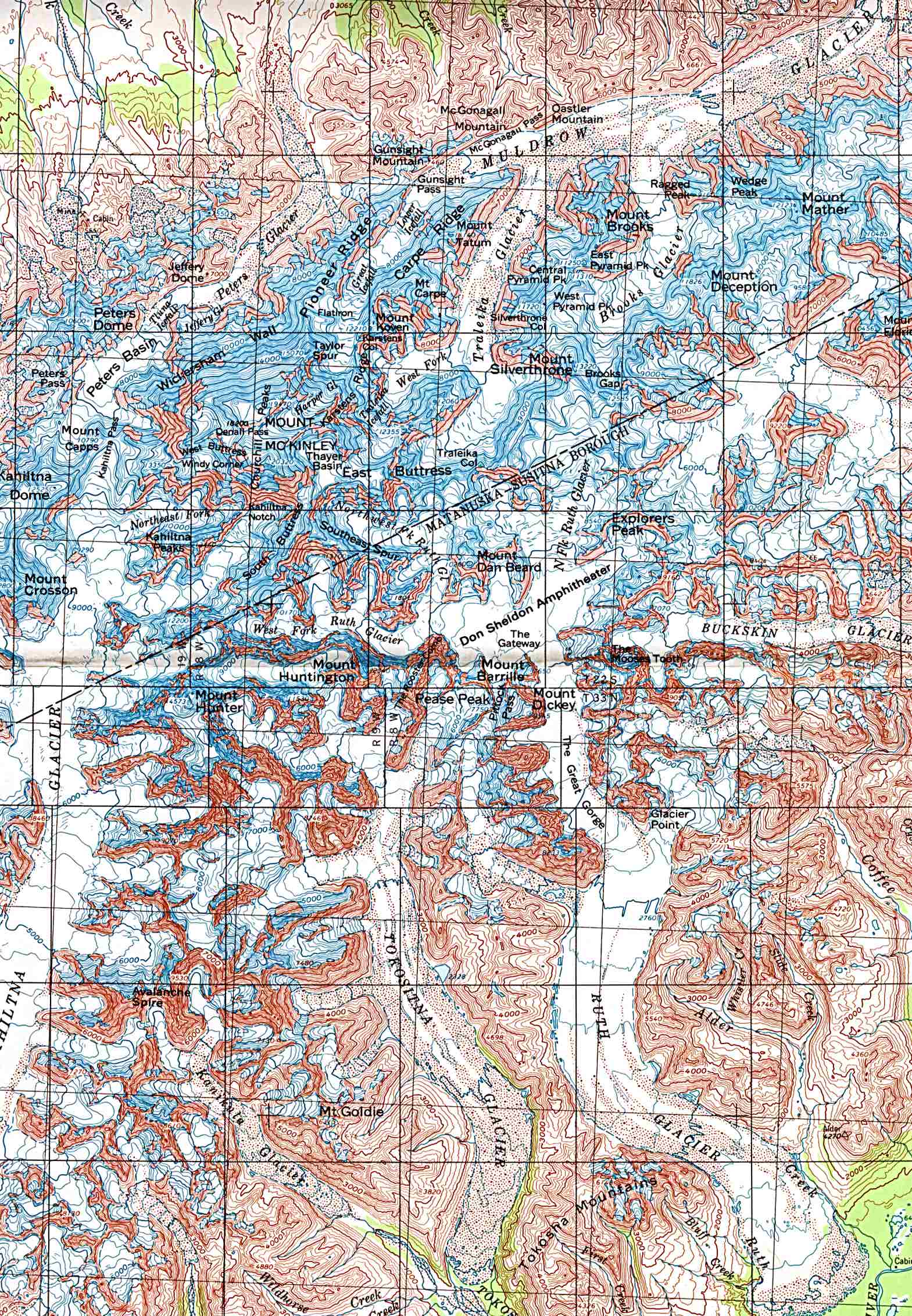
Denali National Park and Preserve - Mount McKinley (Shaded Relief Map) 1:250,000 U.S.G.S. 1984 (612K)
Sponsors
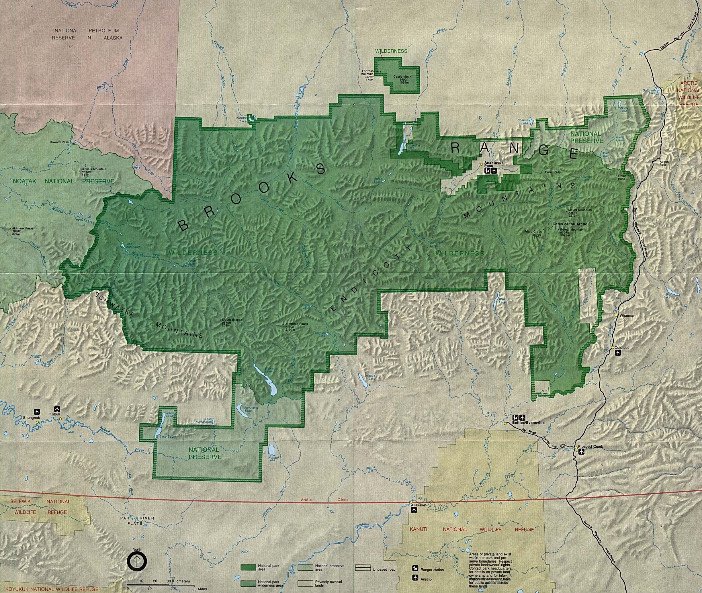
Gates of the Arctic National Park and Preserve in Brooks Range (Park Map) (323K) (PDF Format)
Gates of the Arctic National Park and Preserve in Brooks Range - Preserve Area (Detail Map) (1MB)
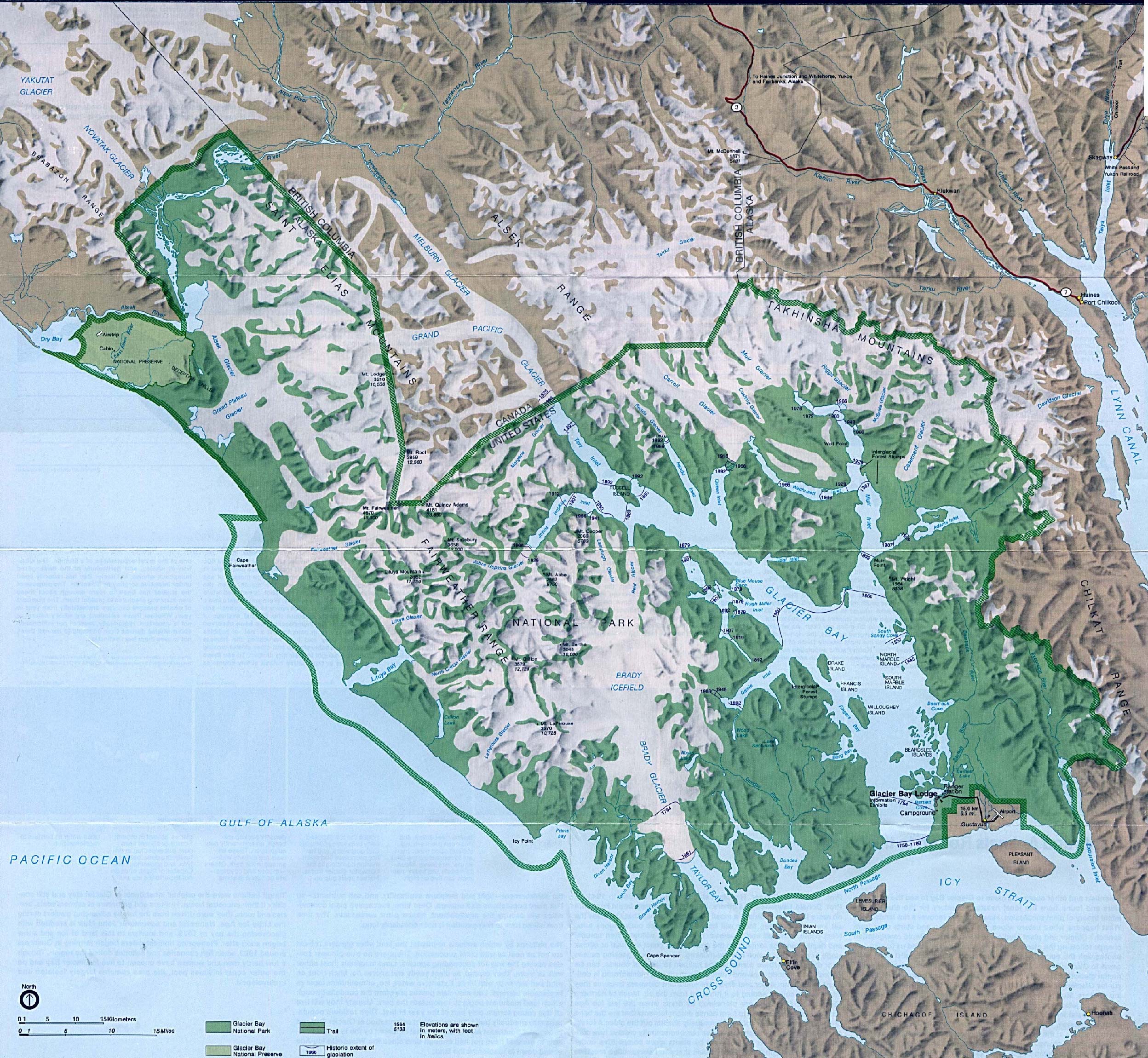
Glacier Bay National Park (Park Map / Shaded Relief) 1994 (1.1MB)
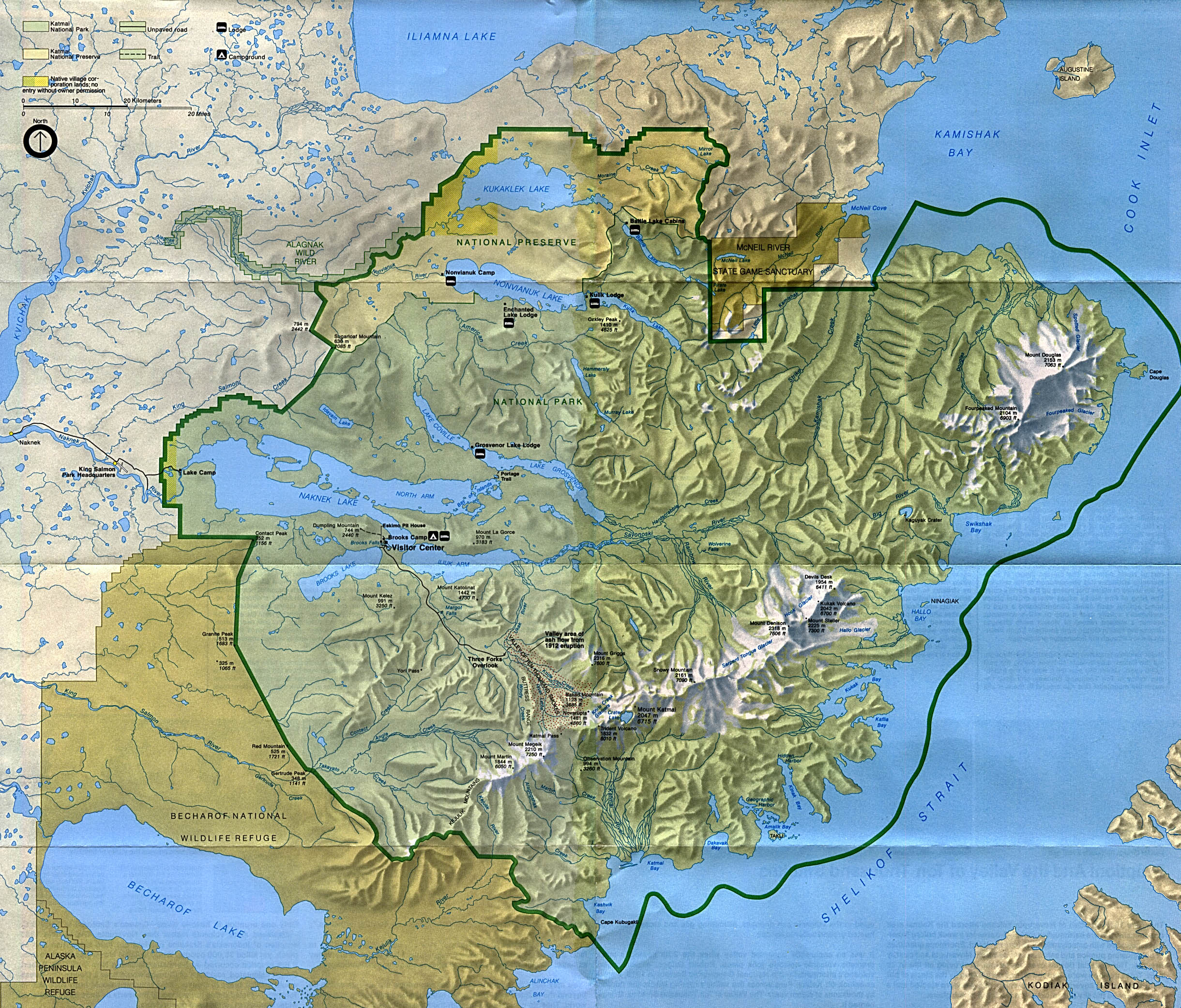
Katmai National Park and Preserve (Park Map) 1994 (1.2MB)
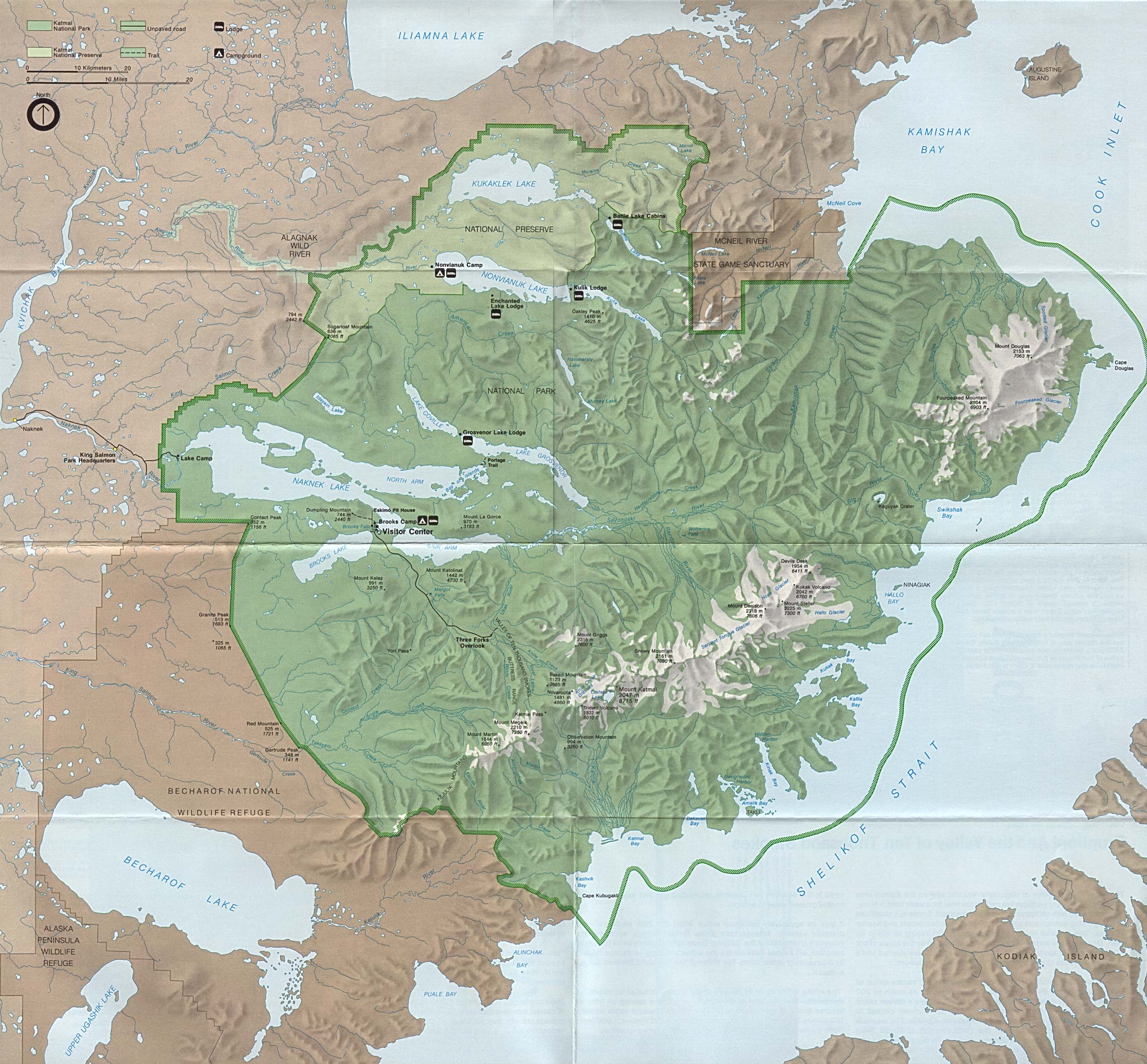
Katmai National Park and Preserve (Park Map) 1988 (748K)
Kenai Fjords National Park (Glacier Map) 1999 (65K) (PDF Format)
Kenai Fjords National Park (Park Map) 1999 (968K) (PDF Format)
Klondike Gold Rush National Historical Park (Skagway Map) 1999 (65K) (PDF Format)
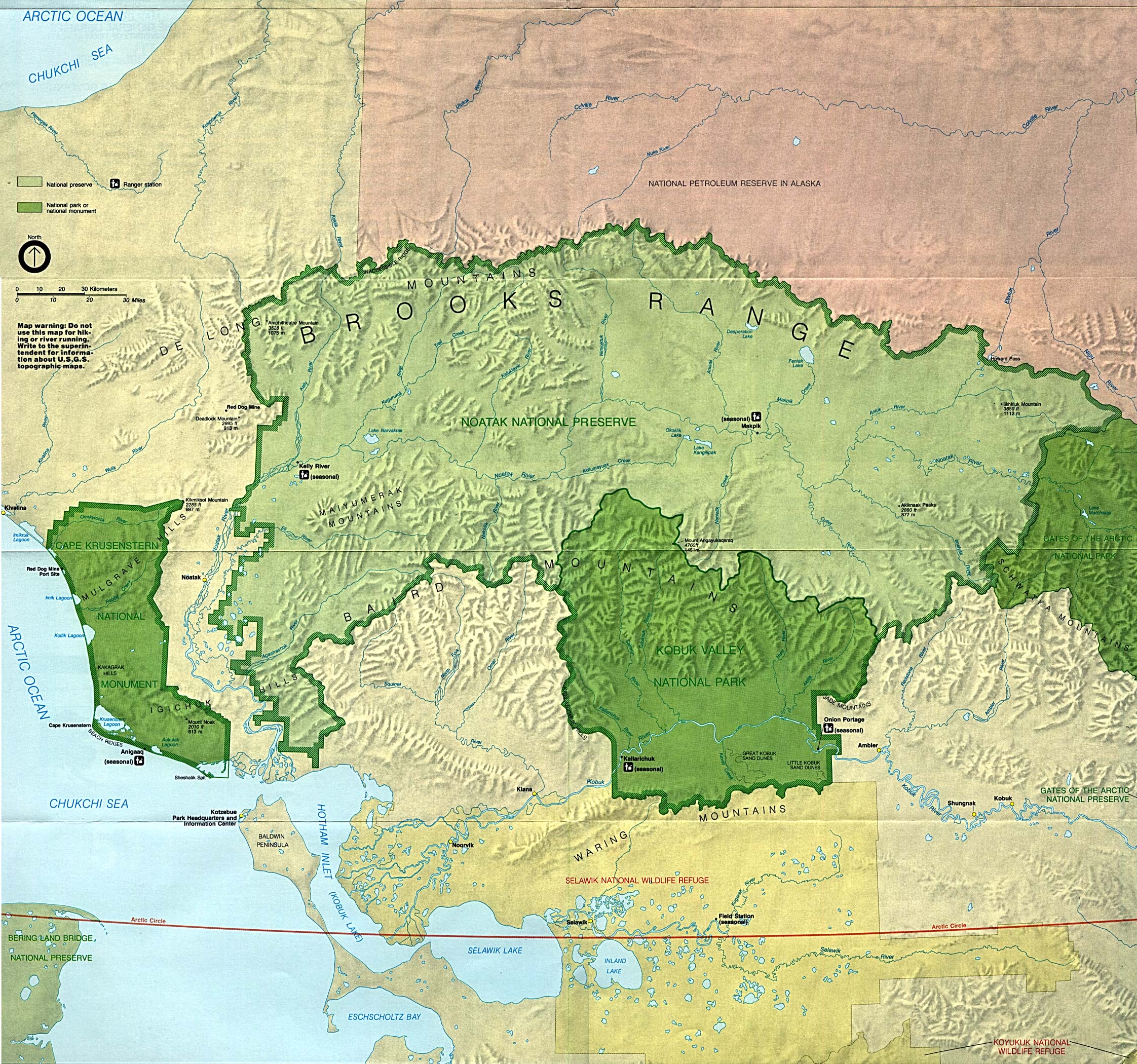
Kobuk Valley National Park (Park Map) (1MB)
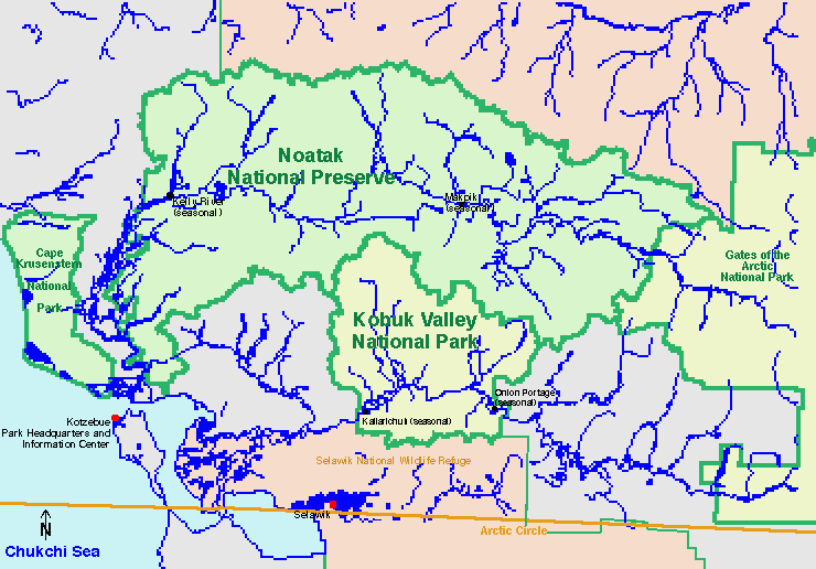
Kobuk Valley National Park (Location Map) (26KB)
Sponsors
Noatak National Preserve (Park Map) (1MB)
Noatak National Preserve (Location Map) (26KB)
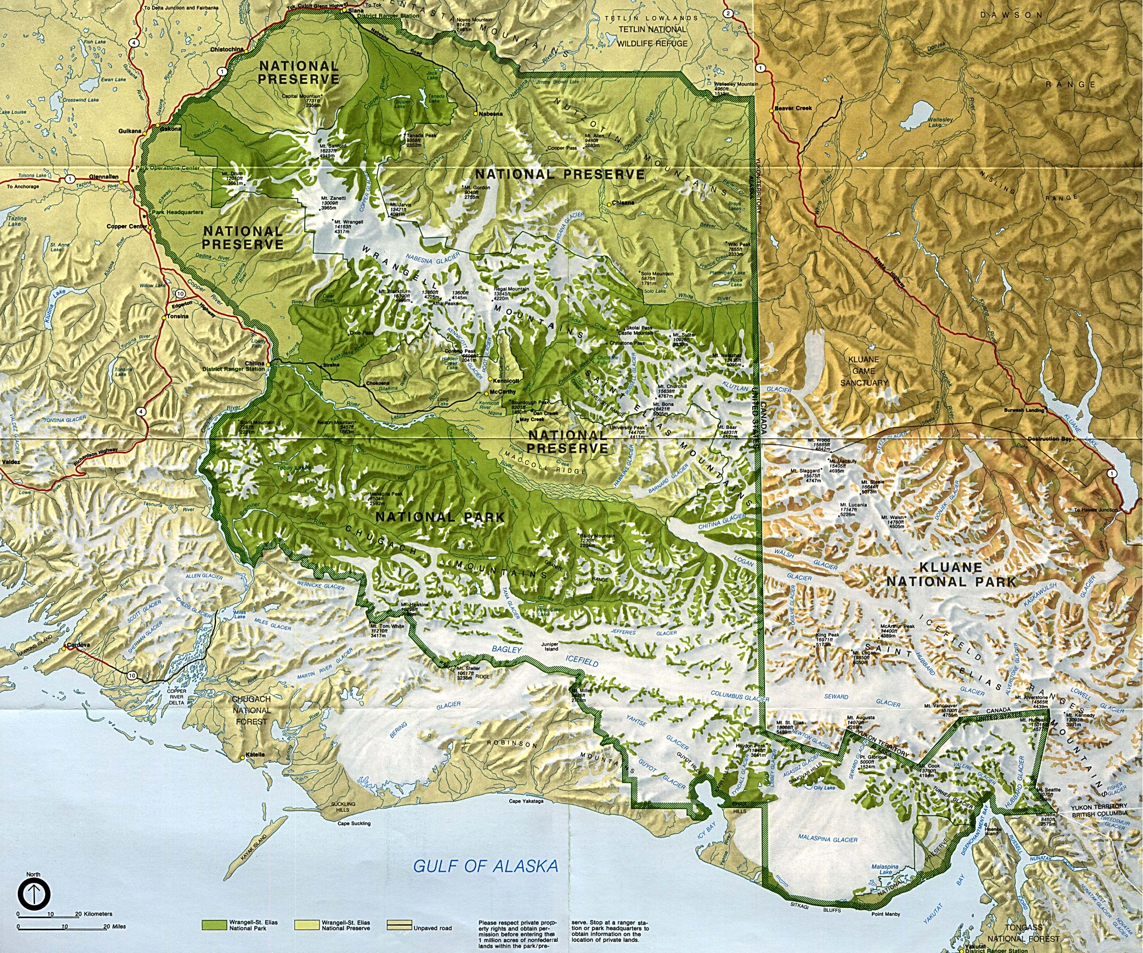
Wrangell-St. Elias National Park and Preserve (Park Map) (1M)
Yukon - Charley Rivers National Preserve (Park Map) 1998 (323K) (PDF Format)
This is a growing collection of free-to-use national park, monument, historic site, recreation area, battlefield, park trails and visitor information maps from the National Park Service. They are in high resolution PDF or image formats ready for you to view, print and use. Please check back as we add new ones as they become available.
<-- Download Free Maps
<-- Free National Park Maps
Didn't find what you are looking for? We've been online since 1996 and have created 1000's of pages. Search below and you may find just what you are looking for.
Michael R. Meuser
Data Research & GIS Specialist
MapCruzin.com is an independent firm
specializing in GIS project development and data research.
We created the first U.S. based
interactive toxic chemical facility
maps on the internet in 1996 and we
have been online ever since. Learn more about us and our services.
Have a project in mind? If you have data, GIS project or custom shapefile needs contact Mike.
Contact Us
Report Broken Links
Subscribe for Updates


