GIS Shapefile Store - for Beginners & Experienced GIS Users Alike. Geographic Names Information System, Nuclear Facilities, Zip Code Boundaries, School Districts, Indian & Federal Lands, Climate Change, Tornadoes, Dams - Create digital GIS maps in minutes.
[This information was originally produced by Beverly Skinner, wildlife biologist at Innoko
National Wildlife Refuge (in west central Alaska), for radio broadcast on Public Radio stations
throughout Alaska.]
The hot topic of conversation among residents of Interior Alaska this time of year is whether or
not it is going to flood. Checking the river level becomes a daily occupance for most of us.
Everyone has their own opinions about the significance of the ice's thickness, the level of the
water in the fall, what were the effects of the cold spells, the warm spells, or the lack of snow during
the past winter. We guess what day breakup will occur and we try to second guess how much
we really need to do to prepare for the unpredictable flood water.
Many people in the lower 48 feel they have solved the problem of this annual flooding cycle.
Over the years, dams have been built, and rivers have been straightened and channelized. These
improvements have allowed people to use the landscape from river bank to river bank. Cities
and towns have grown up on land across which flood waters once flowed. Yearly
small floods over these broad flat lands have been replaced by 10 year, 100 year, and 500 year
disastrous floods. Along with these alterations to the natural flow of spring flood waters have
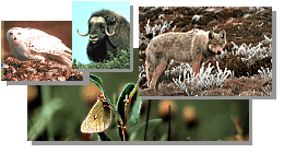
been the changes in fish and wildlife habitat. Irreplaceable river bottom wetlands are no longer
available as fish nurseries. Large game animals also lose out.
Here in Interior Alaska we have yet to try and change our interior rivers. Instead, whole
communities have moved to new sites in response to changes in the rivers' flooding. Maybe we
have a sixth sense about the importance of our rivers and just can't bring ourselves to straighten
or dam them. Civilize interior Alaska's rivers and we will lose our two most important
subsistence food items - salmon and moose. Salmon will no longer be able to return to their
spawning areas to breed. Moose will lose their critical winter habitat - the willow-covered
gravel bars along rivers - which
allow them to survive the long cold winters. The willow bars are maintained by the floods.
Without the floods each year, willow areas will quickly follow the rules of succession and will
turn into birch, cottonwood and white spruce. Over time, the lumber producing birch,
cottonwood and white spruce areas will turn into black spruce trees and muskeg. We would lose
much more. Aquatic animals such as the beaver, most waterfowl, and many others too
numerous to mention would all disappear.
For Alaska Naturally and the Innoko NWR, this is Beverly Skinner. Although the thought of
never having to worry about another spring flood has its merits, Interior Alaskans need to learn
from mistakes made in other parts of the country. By altering our rivers, we lose what is most
important to us - our forests, fish and wildlife. I hope to be able to visit with my neighbors to
speculate on the year's breakup down by the Kuskokwim for many years to come.
Note: This is the MapCruzin.com archive of the FWS Arctic National Wildlife Refuge website. In December, 2001 FWS took this website offline, making it unavailable to the public. It includes 90 plus pages of information and many maps. As of 2006 the important information contained in this, the original "unsanitized" version of the FWS website, has yet to return to the internet, so we will continue to maintain it here as a permanent archive to help inform activists and concerned citizens. If you find any broken links, please report them to me at [email protected] and I will attempt to make the repairs. January, 2008 update - A small part of the original information that was present in 2001 has made it back into the current ANWR website. There is also an archive that contains a small amount of the original information, but it is not readily available from the main website.
Click here to visit our homepage. Click here for NRDC's message about ANWR from Robert Redford.
U.S. Fish and Wildlife Service. 2001. Potential impacts of proposed oil and gas
development on the Arctic Refuge�s
coastal plain: Historical overview and
issues of concern. Web page of the Arctic National
Wildlife Refuge,
Fairbanks, Alaska.
17 January 2001. http://arctic.fws.gov/issues1.html
Archived by MapCruzin.com. Visit us at mapcruzin.com.
MapCruzin.com is an independent firm
specializing in the publication of
educational and research resources.
We created the first U.S. based
interactive toxic chemical facility
maps on the internet in 1996 and we
have been online ever since. Learn more about us and view some of our projects and services.


 January 29, 2008: